TONotL – Part 1 – Bruce Trail Niagara

Duration – about 25 hours of walking over 3 days

Length – about 98 km total, including about 93 km on the trail itself and another 5 km or so getting to/from the trail when I left it each day and rejoined it the next.

Height – according to my fitness tracker, I climbed the equivalent of about 550 flights of stairs over the 3 days – that’s probably around 2000 m of climbing so hey guess what, I did over 20% of Mount Everest!

Weather – first full week of autumn, cloudy with rain on Day 1, then sunny and breezy on Days 2-3; warm temps for early autumn – mid-20’s mostly

Route: About 35k on Day 1, from Niagara-on-the-Lake to Queenston Heights via the Niagara River Recreational Trail. Then along the Niagara Section of the Bruce Trail, starting from the famous cairn marking the start of the trail at Queenston Heights, and continuing along it to Glendale Avenue in Thorold to complete Day 1. About 33k on Day 2, rejoining the trail at Glendale and following it through Short Hills Provincial Park, Rockaway Conservation Area, and Louth Conservation Area to exit the trail on Glen Road near Jordan. Finally, about 24.5k on Day 3, rejoining the trail and following it through Balls Falls Conservation Area, Cave Springs Conservation Area, Mountainview Conservation Area, and 30 Mile Creek Conservation Area to exit the trail at Ridge Road near Grimsby.

In earlier posts, I’ve talked about my bucket list of walks, which includes the walk between Toronto and Niagara-on-the-Lake. I wanted to do this because I reckoned it was a good intro to long distance walking – it’s in my own backyard, I could cover part of the Bruce Trail, and I could learn from it to decide how to approach other bucket list walks, such as the Camino de Santiago.

I didn’t know what to expect, or even if I could finish it. I knew it would be hard, at least for me, as a somewhat overweight, moderately in-shape, mid-50’s guy. I wasn’t going to push myself to the breaking point, but I did want to see how far I could go.

But to find out I had to do it, and that meant starting with the Bruce Trail. My wife and I drove down to Niagara-on-the-Lake on a Sunday, the last official day of summer. We had a lovely evening, enjoying a great meal with some very good local wines, and a gentle stroll about town.

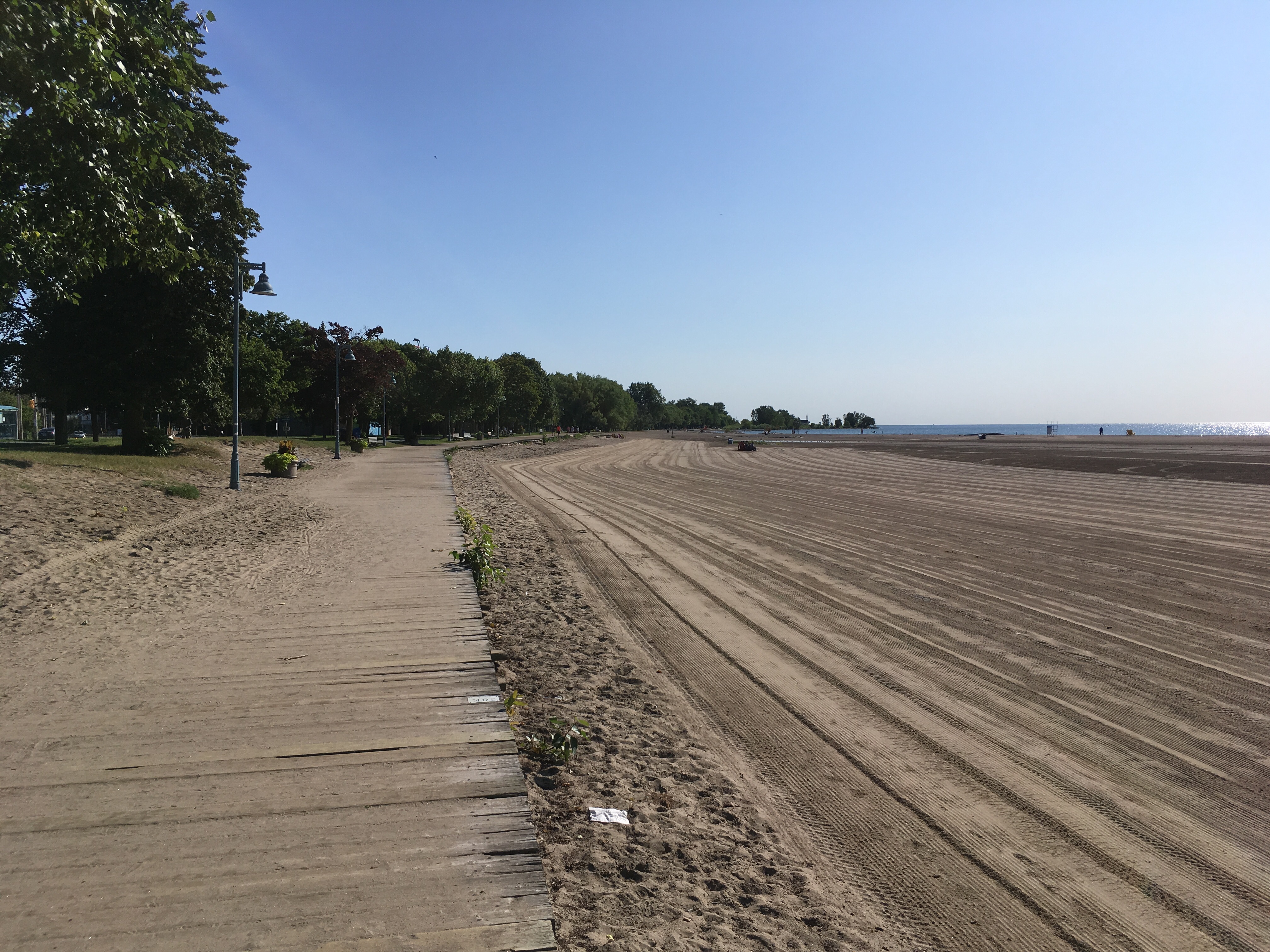
Leaving on Monday morning, I wanted to start at Fort George, because then I could finish in Toronto at Fort York and that appealed to the history buff in me. Besides, my family, the Bradt’s, emigrated from Europe in the 1640’s to then New Amsterdam / now upper New York state, and from there moved to the Niagara region as United Empire Loyalists in the 1790’s, where distant relatives served in the Canadian Militia units attached to the British Army (Butler’s Rangers) during the War of 1812 when Forts George and York played important roles. Basically, from way, way back I have roots in the area.

There was some rain that morning, but I had been keyed up to start, so I was ready to leave as soon as I woke up. I put the rain cover on my pack, clicked together my walking poles, and headed off down the Niagara River Recreational Trail.

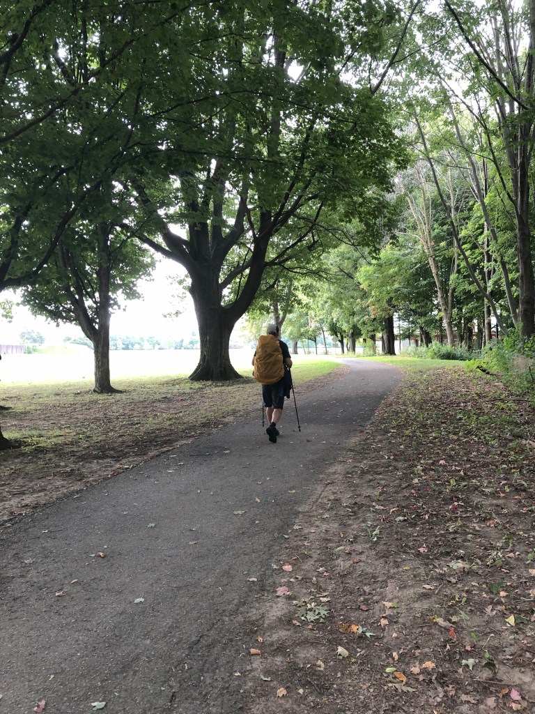
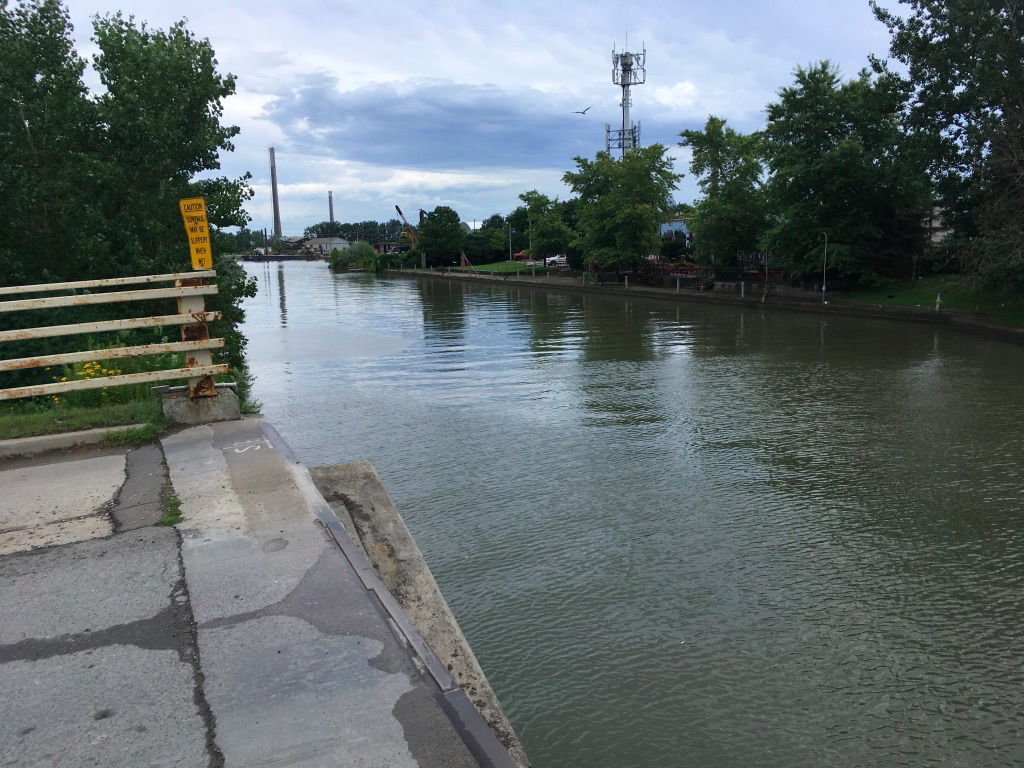
The Niagara River Rec Trail is a great little walk in its own right. It follows the river quite closely so you get great views over the gorge, and it’s lined by wineries, orchards, and fruit stands. My wife and I have walked part of it a few times when we’ve been in Niagara-on-the-Lake and having stopped at various wineries to sample and buy, we return later with the car to pick up our trophies.

On this day, of course, my focus was ahead of me. I kept looking down the road where the Niagara Escarpment loomed larger and higher as I got closer. I knew that it’s about 100m high in most places, but it seemed higher because it just jumps up from flat ground.

As I walked, I was constantly jolted by something that seemed appropriate given my start at Fort George – the constant banging and thumping of air cannons. It was harvest time in the fruit basket of Ontario, and every orchard, vineyard, and field seemed to have at least one of these cannons firing away to scare off birds. The almost military cannonade called to mind the sound track from films of World War 1, and the rumble of the guns would accompany me all the way to Grimsby after I’d left the Bruce.

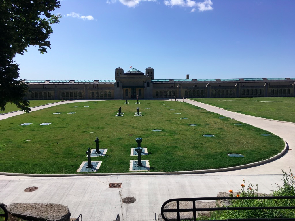
Coming into Queenston, the Recreational Trail takes you up into the Queenston Heights park. It also takes you past the Sir Isaac Brock Monument – a reminder of the historical importance of the area to what eventually became Canada.

After a quick look at the monument, I turned and saw that over the river, a number of turkey vultures and hawks were circling in the breeze, just a few meters from the roadway – I stood there mesmerized for several minutes, though they moved so fast it was hard to get a good photo.

From there, it was time to climb some more and find the cairn that marks the official start of the Bruce Trail.

Looking opposite the cairn, I could see a line of trees marching across the park, each marked with the white painted blaze that I would follow for the next 3 days.

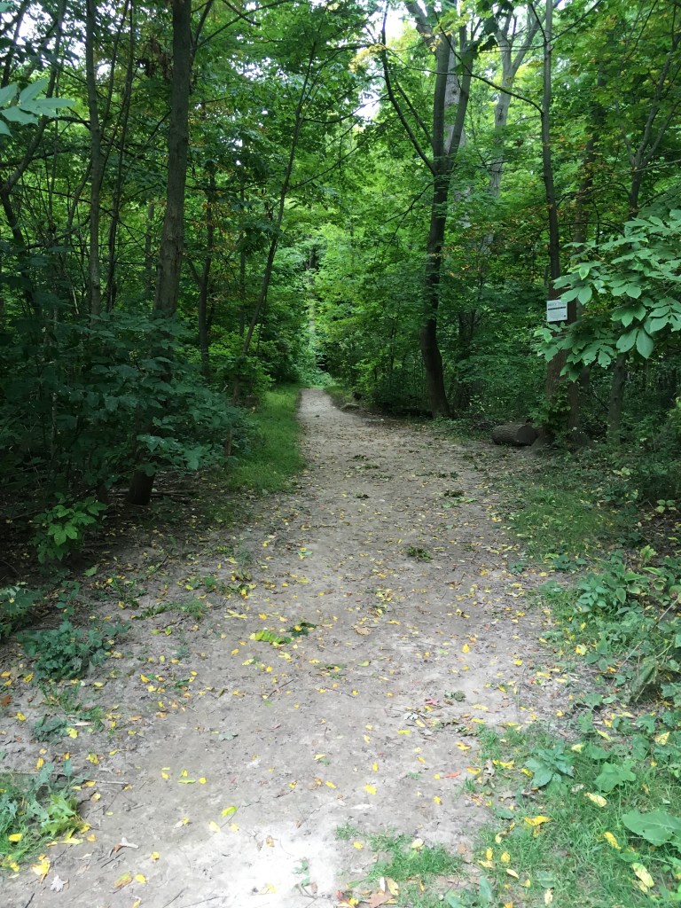
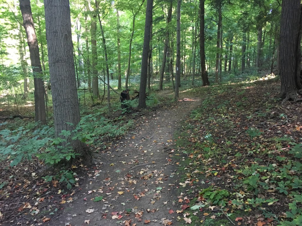
After a quick break to fill water bottles and have a bite, I set off on the Trail. It was a weird feeling. I had been anticipating a rugged trail and yet as you cross Queenston Heights Park following the markers, you’re walking on mowed grass with very little that looks like a trail. Gradually you get closer to a line of trees with no apparent opening, though one eventually appears. The Trail looks easy here, but I would learn that it’s a deceptive entry.

Not long after I joined the Trail, the looming grey skies opened up and the rain stayed with me for another hour or so. Soon I was skidding on mud and blessing my walking poles as I descended the escarpment, in some places very steeply, and then climbed back up again; dipping down gullies and scrambling back out; up and down, up and down, all on muddy ground and broken rock.

way steeper than it looks

I kept looking for a place to take a break, but another lesson of the Trail is that there are few places to stretch your legs unless you want to get wet. I eventually found a downed tree that served the purpose, at the cost of a soaked seat to my shorts.

The first 20 km of Trail takes some interesting twists. At one point, coming out of the Woodend Conservation Area, I followed the Trail across the Royal Niagara Golf Course where I ran into a guy searching for his ball and we shared a hello. In another section, I crossed a meadow along a narrow grassy path that was littered with snails – I tried to avoid stepping on them but couldn’t help crunching my way for several hundred meters, feeling guilty for my clumsy human feet.

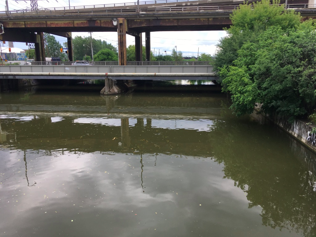
Later, the trail follows the 3rd Welland Canal, the one from the 1880’s – the sun had come out again by then, and I stopped several times to admire the view of the old locks cut into the escarpment.

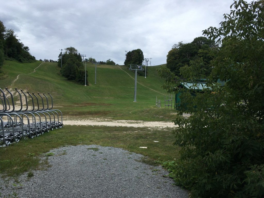
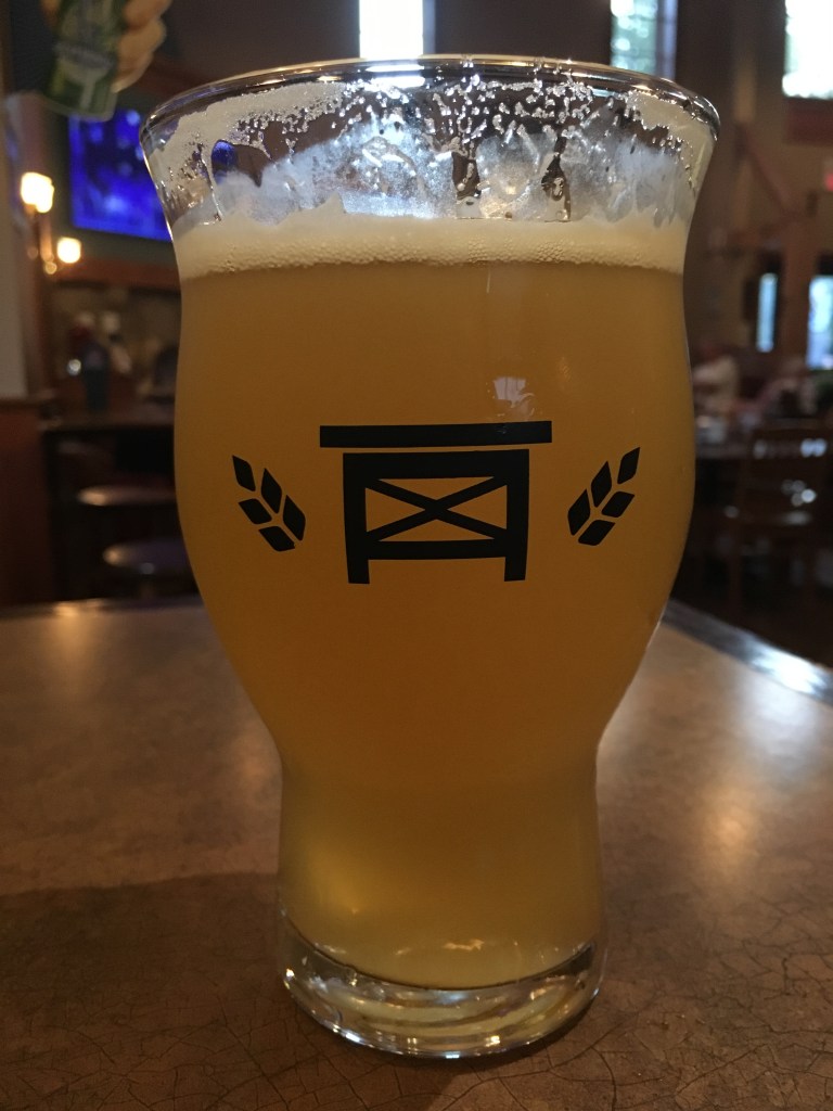
It was a grind to finish the Trail that day. I was tired and running short of water, so it was with great relief that I came off the Trail at Glendale Avenue, in the Merriton neighbourhood of St. Catherines. I was below the escarpment at this point, and I knew that the next day I would have to climb it once more. With that thought, I checked into my hotel and enjoyed a hot shower and a welcome glass of wine. Day 1 done.

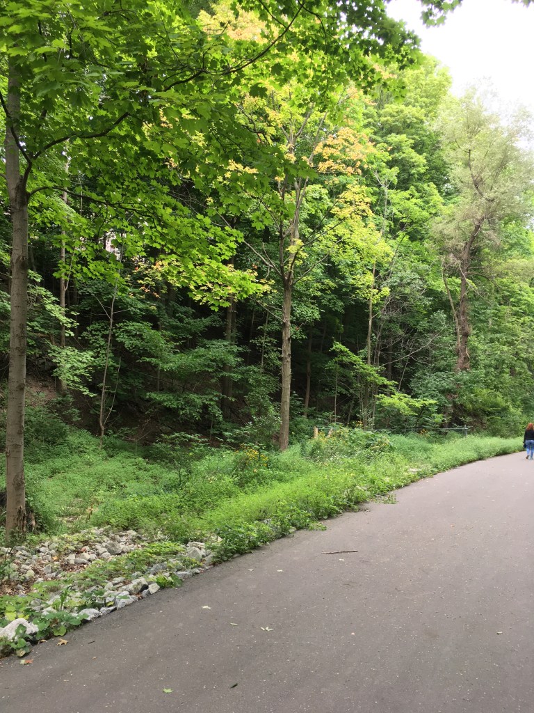
In the morning, I thought that I’d feel stiff as a board, but to my relief it wasn’t too hard to get going. After walking back to where I’d left the Trail the day before, I followed it along Glendale Avenue and then climbed the escarpment up Tremont Drive. Here you’re walking through a residential neighbourhood, but very soon you step into forests again as you reach the top – in fact you’ve entered the grounds of Brock University. The walking is easy here – the forest is old with open ground under the trees and it’s easy to follow the markings.

Winding through the campus, I popped out passing by the Brock University athletic facilities, where I took a quick pic for my wife, a Brock Alumnus.

As you leave the campus, the trail takes you into the Short Hills Provincial Park. It’s mixed ground here, with some open meadows skirting fields, as well as laneways through the forest. The ever-present air cannonade still dominated the soundscape, but the open spaces teemed with the buzz and chirp of crickets, grasshoppers, and cicadas.

It was a gorgeous day, welcome after the rain the day before, and I made what I thought was pretty good time. When I took a break, however, and checked my fitness tracker and then the map, I was shocked to discover that after several hours of walking, I still had 15 km to go. I was doing a lot of walking but a lot of it was up and down, not forward towards my goal, so while the fitness tracker clocked kms I wasn’t advancing on the map. My strategy became short breaks and motoring on.

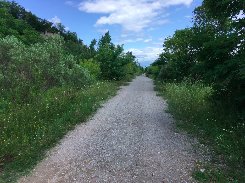
Here the Trail continues through several more conservation areas, and you keep climbing and descending, up and down gullies and sometimes up and down the whole escarpment. The terrain gets harder too – by the time I got to Rockaway Conservation Area, I ran into several km of broken rock underfoot. Each step took concentration to avoid a slip or worse, and several times I lost the trail and had to back track – in looking down at your feet you lose track of the markers. Even when it wasn’t rocky underfoot, it was narrow and twisty. Despite my best efforts I knew I was only covering about 3 km per hour, well under my planned pace.

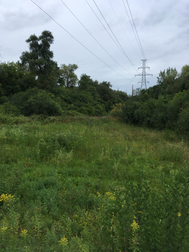
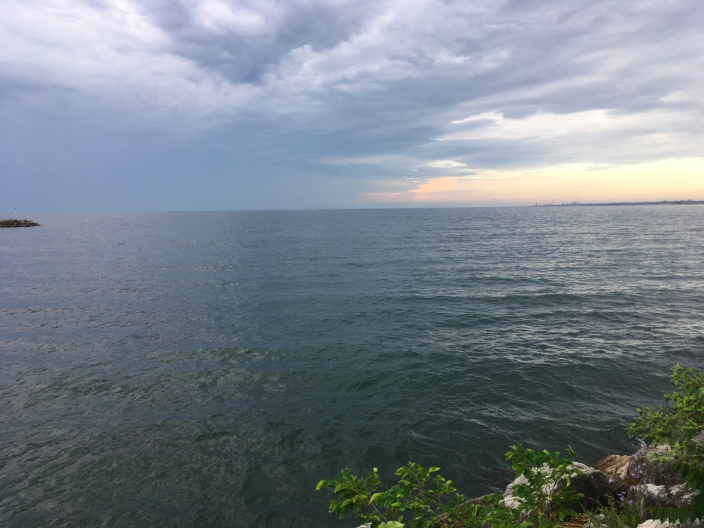
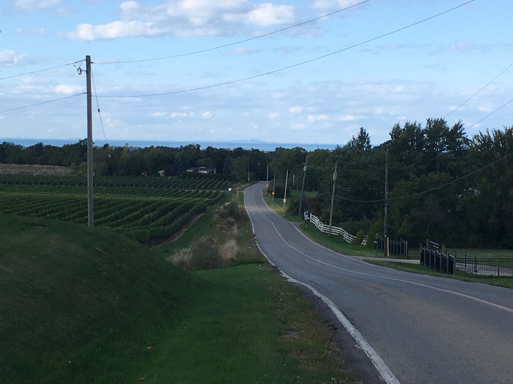
Eventually, the Trail emerges from trees to follow a couple of country roads, and looking down one of them I had a perfect view of Toronto on the horizon. It was probably 50 km across the lake, and I knew there were at least 100 km to reach it.

There were more twists and climbs yet on the Trail that day. Near the end of the day, I came across a photographer set up in a gully, with a camera on a tripod aimed at single tree. He said he’d been photographing it for the past year, and was waiting for the perfect shaft of autumn sunlight to light up the leaves. While we chatted, just such a gleam appeared, and he happily fired off several exposures.

Leaving him behind, I followed what seemed like a hundred km of broken rock trail, and I was tired, sweaty, thirsty, and sore by the time I reached my Trail exit near Jordan. I reckoned I earned my beverage of choice that day.

On Day 3, I awoke still feeling pretty good – a bit stiff but otherwise ready for the day ahead. On paper, it looked easier – this was was going to be my shortest planned day, only around 25 km, and I thought I could knock it off in 7 hours or so.

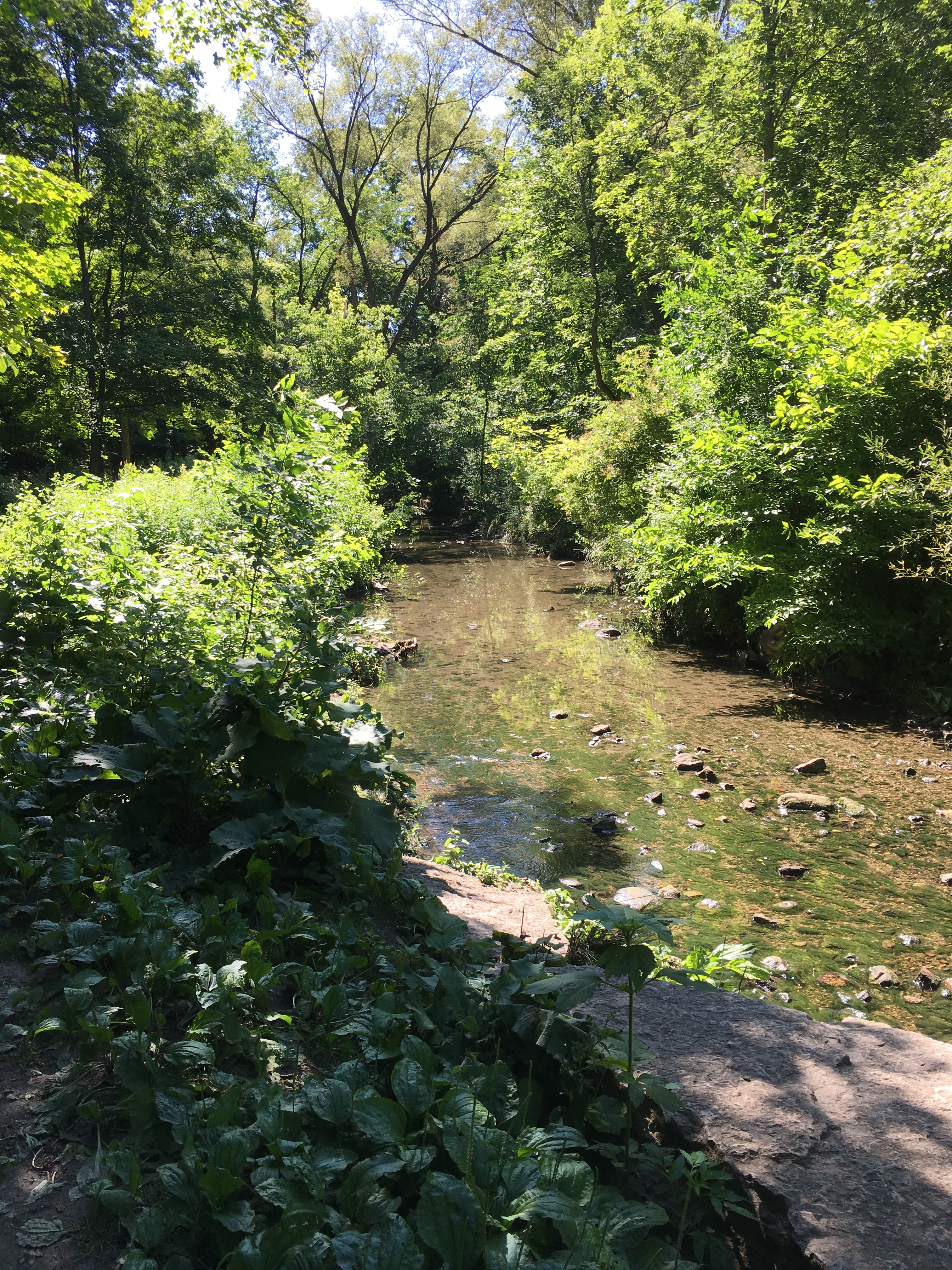
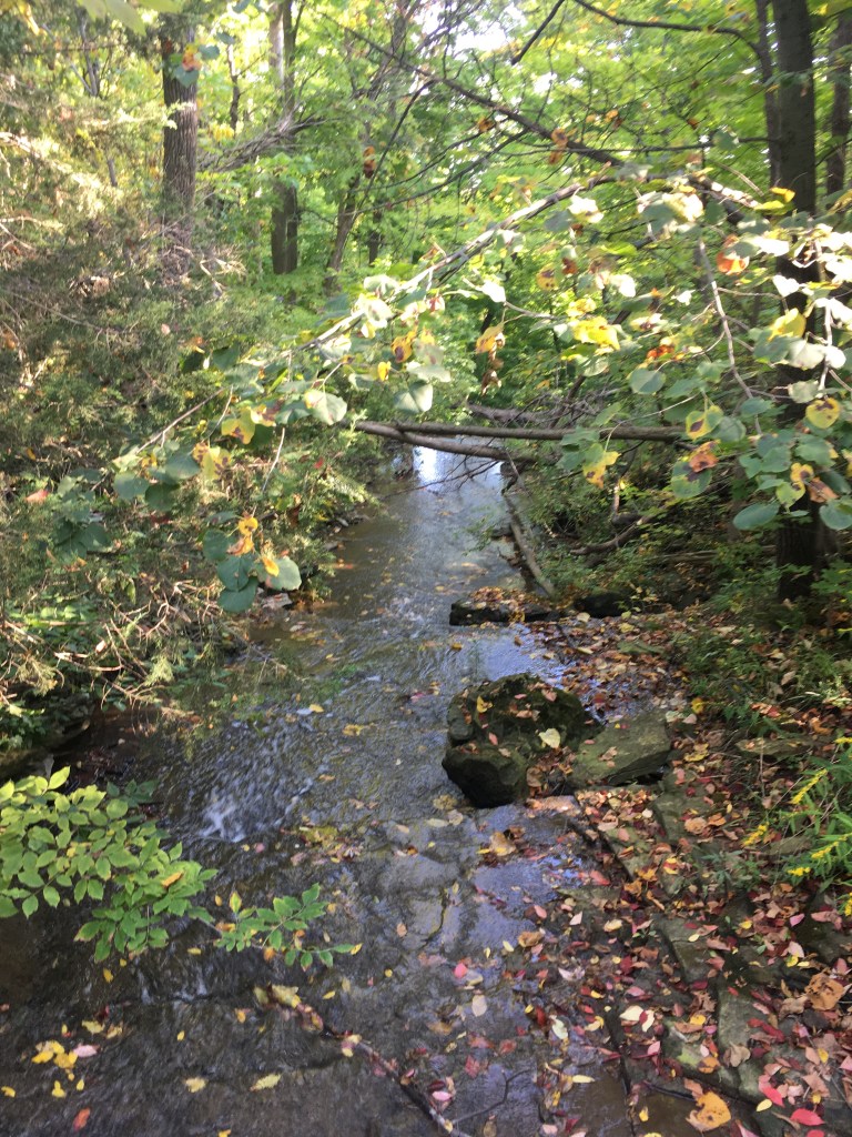
I soon changed my mind when I rejoined the trail outside Jordan and entered the Balls Falls Conservation Area. You descend here, and along the bottom of the escarpment you follow the Twenty Mile Creek upriver. There’s a lovely little rock pool and with the sun shining, the water burbling, and the breeze tickling the leaves I couldn’t help but smile.

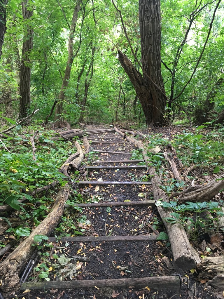
And then I came to the Stairs.

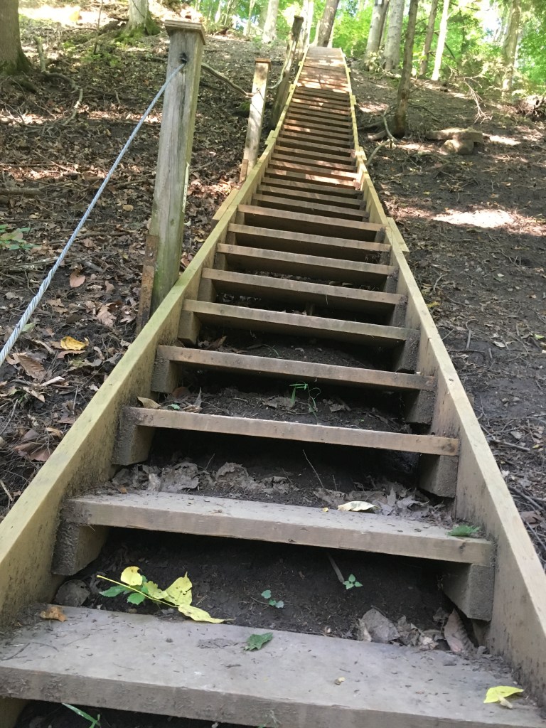
They stretch more or less straight up the escarpment, 120 steps in all, with another few meters of trail climb at the top. I was gassed by the time I got there, dripping with sweat and huffing and puffing. A kind soul has put a log in place so you can sit and catch your breath, and I took full advantage of it to recover.

From here you walk through the upper part of the Balls Falls area, and it’s gorgeous. The trail is friendly here, wide and level, with lots of open spaces to view the gorge of the Twenty Creek.

A couple of wild turkeys trotted along in front of me for a bit, and other than them and a few dog walkers, I had the trail to myself.

Those few km after the Stairs lulled me into a false sense of security, thinking that this was going to be an easy walk. That changed as I left the Balls Falls Conservation Area. The trail follows the escarpment quite closely, and I descended it to spend several km scrambling along the bottom over broken rock. I tripped here and fell, the only time I did so on the Trail, and then at the Cave Spring Conservation Area I climbed again back to the top of the escarpment. It was a slog on an increasingly hot day, but the view from the top was worth it.

I wasn’t the only one enjoying the view. I came across a through-hiker who had the foresight to carry a small camp chair and a portable set of watercolours. He was sitting, focused, a palette attached to one hand and a small canvas on his knee. I didn’t want to disturb him, and after a quick sneak peak at what looked like a pretty good landscape, I left him to his labours and continued along.

Past Cave Springs, there’s a small park with welcome benches where I could sit, take off my shoes, and have a bite. I had developed a blister on one toe, the first of the journey, and it a few minutes to treat that. After what ended up as a longer break than I wanted, I was shocked to check the Trail map and realize I still had 10+ km to go, and it was already around 2:00 pm – that meant 3 hours of walking so time to start chugging.

The Trail takes you through the Mountainview Conservation Area, and then the Thirty Mile Creek woods, with a lot of broken rock, gullies, muddy sloughs, and few breaks of open forest. There are a couple of stretches following roads where you can catch your breath, but otherwise it just keeps leading you up and down the slope of the escarpment. I could feel my pulse pounding and the blister on my toe was starting to bug me too. I was exhausted but relieved to pop out onto a road a couple of km from Grimsby to find the B&B I’d booked for the night right there in front of me. I was so tired that I abandoned thoughts of finishing the last 2.5 km of trail that would complete the Niagara section, instead checking in for the night. Day 3 was done, I was done, and also done, as it turned out, was my journey along the Niagara section of the Bruce Trail.

It rained overnight, and the next morning it was still damp and grey with a bit of misty rain in the air. I thought of polishing off the remaining bit of Trail, but I knew that it would be wet and muddy, and the map showed a steep descent and then a climb over that remaining couple of km, which I knew would be tough. Reluctantly, I decided to skip this last short section of the Trail. Officially I did all but 2.5 km of the Niagara section of the Bruce trail, but I’ll pick it up from there one day when I do the next section of the Bruce.

So what did I learn? Firstly, that I could actually do it even though it was tough going in many places. Ironically, I was travelling through fabulously scenic countryside and yet I didn’t actually see that much. I spent most of my time looking down for roots and rocks. At most I’d glance up every 5-10 seconds to catch the next blaze, and otherwise I kept my head down. Even so I must have tripped or slipped a few dozen times a day despite my best concentration – the Trail is not for the wandering mind.

I was also sobered to think that if the Niagara section is one of the easier stretches of the Bruce, then the toughest parts would take a lot more planning and prep. For this journey I had planned to do around 30 km a day but knowing what I know now, I think 20-25 km is more realistic.

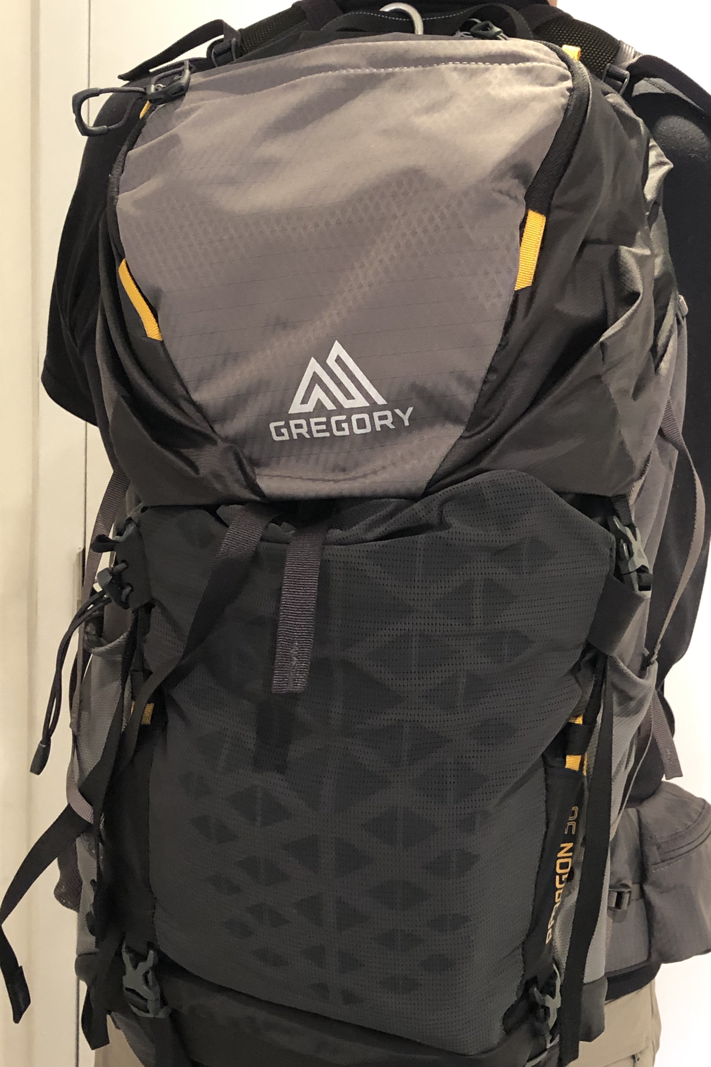
As well, I carried a relatively light pack since I was staying at hotels along the way. Even so, that 11 kg felt pretty heavy near the end of each day so in future I’ll have to build in more training walks carrying at least that much weight, so I’m better acclimated.

I also learned that there are few areas on the Bruce for just sitting, and very few places to refill with potable water from a tap. On the more remote sections, I’ll need to plan to filter and treat water along the trail from streams and springs.

Finally, as beautiful as it is, and as famous as it is in the hiking community, I thought the Bruce was surprisingly lightly travelled. I only met 2 other through-hikers and just a handful of day walkers over 3 days on one of the busiest sections of the Trail. Granted it was a bit late in the season, but the weather was generally good. I was conditioned by my walks along Toronto trails to expect to meet people at least a few times an hour.

Several people have asked me what I do when I’m walking – do I listen to music, do I get bored, do I feel lonely walking by myself. No. The beauty of the Bruce, for me, is the peace and quiet. I loved it.

Walkabout Montreal / Se promener à Montréal

Recently, we were in Montreal for a few days. While it doesn’t seem like 17+ years have gone by, our son is entering his final year of high school, and since he wanted to check out McGill University, we arranged a short visit to the city so we could do a campus tour and get away for a short break.

We arrived on a Thursday afternoon. We’d booked an apart-hotel on Rue St. Urbain, just a few blocks east of the University, and centrally located for exploring the city as well. Our plan was to do the campus tour on Friday morning, go for a walk and visit some of the nearby neighbourhoods, and then explore some more on Saturday before driving home Sunday.

Because we arrived in late afternoon, we had time for a short walk to pick up a few groceries before we headed out to Old Montreal for dinner. Our flat was near the area known as the Quartier des Spectacles, and there are some interesting sculpture gardens to explore, which made the stroll to the shops more than just a routine walk. I love that about Montreal.

For dinner that first night, we’d booked a place in the Vieux Portes area, and on a late summer evening it was packed with tourists and locals alike, sitting outside and enjoying a perfect evening.

the cobbled streets of Old Montreal

It was within an easy walk of our flat, and we were famished by the time we sat down at Bevo, a great pizza bar on Rue St. Vincent. It was worth the walk – the appetizers, pizzas, salads, and wines were excellent. “Good choice Dad!” – high praise from a teenager.

The next day, we strolled over to McGill, only about 15 minutes away along Rue Sherbrooke. It was another gorgeous day, and we passed a couple of the university residences where families were making piles of trunks and suitcases as they dropped off their kids – it looked like the Hogwarts departure scene at Kings Cross Station minus the owls and chocolate frogs. My wife and I glanced at each other and thought – just one short year from now, that will be us.

McGill is in the heart of the city, nestled on the south side of Mount Royal. It’s one of the oldest universities in Canada, coming up on 200 years, and is one of the top-ranked schools in the world. As parents, our impressions were of course different from our son’s. We saw a compact campus compared to some other downtown schools such as University of Toronto, with clean, well maintained facilities and gorgeous stone buildings. He saw dorms and libraries and lecture halls and kept quiet as the reality of university sunk in.

What struck all of us was the sense of the campus as a world unto itself, even though you’re just steps to the downtown core. The school is impressive – modern yet respective of its history, with a welcoming and confident atmosphere.

After the tour, we decided to walk east to Rue St. Laurent and then north to Schwartz’s Deli, a Montreal landmark for 90+ years and famous for its smoked meat sandwiches.

At 11:30 in the morning, there was a queue already for lunch, and once packed into one of it’s “cozy” tables, we devoured a mound of artery-hardening goodness along with classic coleslaw and the perfect pickle to cut through the richness of the brisket. If you’ve never had Montreal-style smoked meat, you’re missing a treat, and while many local places feature it on their menus, Schwartz’s has been making it on premises for decades and they have the old-school deli thing down pat. When we came out, the queue to get in stretched most of the way down the block – glad we got there early.

After that lunch, we needed a walk so we continued north up St. Laurent. This area, the Plateau, has seen waves of immigration over the past 100 years and the blend of cultures greets your nose as you pass Portuguese restaurants, Jewish delis, Italian coffee bars, and Indian roti houses. St. Laurent reminds me a bit of Queen Street in Toronto – it’s changing and gentrifying, and the hipsters have their haunts, but the old school places are still there too.

Since we were in an apart-hotel with a kitchen and a barbeque, we had invited our nephew, who lives in Montreal, to come by for dinner that Friday night. Exploring the Plateau after lunch, we found a great fish place and picked up giant prawns and smoked salmon for starters, then stumbled upon a fromagerie for bread and cheese. Our main course came from a local grocery that did whole Portuguese-style chickens ready to grill. Dessert was local Quebec strawberries and raspberries picked up at a little greengrocer. By the time we wandered back to our flat we’d hunted and gathered everything we needed (and then some), all within a few blocks along St. Laurent.

We had a merry dinner, and enjoyed some entertaining stories of our nephew’s recent trip to Ireland, which meant that we all wanted a lazy Saturday morning. It took us a decent amount of coffee before we decided to head off, this time to towards the downtown area.

One of the main shopping streets in Montreal is Ste. Catherine’s, so we headed west along that from St. Urbain. It’s changed a lot in the 25+ years since I worked in Montreal back in the early 90’s. Unfortunately, it was still changing when we were there, with most of the length of the street torn up to replace water and sewer lines. That was a little disappointing, but we found some shops that looked fun and kept walking east until before we knew it, we were all the way over to Rue Guy.

At this point, I had the thought of wandering south and west to Griffintown, a gentrifying hip area full of renovated old warehouses and coffee houses, so we started off in that direction. It proved to be farther than we wanted to walk (that is, my wife’s commanding royal “we”), so we turned around and walked back east along St. Jacques all the way to old Montreal.

There, on the north end of the Place des Armes, is the HQ of the Bank of Montreal, where my father in law had worked when they lived in Montreal (my wife is a native Montrealer). She and I met when we both worked for BMO in Toronto, so we had to snap a picture of the rather imposing building for old time’s sake.

BMO HQ in old Montreal

We kept wandering through the crowded-with-tourists-all-snapping-selfies cobblestone streets, and since we were famished, when we stumbled onto an inventive little place called Invitation V we piled in. We didn’t notice till we’d sat down and looked at the menu that it was a vegan restaurant, and were pleasantly surprised to find ourselves enjoying our plant-based “burgers”. Delicious food, and the interior is nicely decorated too, taking full advantage of the exposed brick and beams of an old office building.

Don’t look at the growing bald spot on the back of my head. Look at my half a head taller than me son – and I remember when I could carry him around!

Wandering around in the old part of the city, I was happy to see so many tourists enjoying the weather and the sights – Montreal has done a great job investing in this area to make attractive while retaining its charm. At the same time, you can only walk down so many cobbled streets past yet another shop selling tourist tat, before it gets old. Our enthusiasm waned and we turned our steps north back to the flat – it was time to chill out with a cup of tea.

That evening we capped off our visit to Montreal by walking a bit west and south, to the area around Concordia University. There, on Rue Mackay south of Ste. Catherines, we had dinner at the Beirut Garage, a modestly decorated but full-flavoured Lebanese restaurant. It’s small, packed, welcoming, and worth the journey – the food was fantastic. A proper Lebanese coffee after our meal meant that I needed the stroll home along Sherbrooke to burn off the caffeine, and on warm late summer evening there was no hurry – we could window shop, people watch, and meander.

The next day, we had to pile back into the car for the drive home to Toronto, but before we did we needed to make one last stop. North along Park Avenue on the north side of the mountain, the Mile End neighbourhood has been home to Montreal’s Jewish community for decades.

Near the Mordecai Richler library, we joined the out-the-door queue at the St. Viateur bakery for what are reckoned to be the best Montreal-style bagels in the city. We bought some to snack on during the drive home.

When I think of Montreal, I think partly of the food, partly of the history, and partly of the many visits we’ve made over the years. It’s a cultural melting pot, like most cities in Canada, and it’s also a gateway to Canada for tourists from around the world, who want to experience its old-world charms and blend of French and Anglo-Scottish history. It’s a 4-season city, though residents will tell you that spring and autumn are a lovely 2-week breaks between freezing and friggin’ hot. Late August is a great time to go, and September is even better. Whenever you go, walk around – it’s a city that lends itself to nosing through neighbourhoods. And when you go, bring your appetite.

Walk Journal – Labour Day Weekend

Where: Sunday Sep 1, north Toronto exploring the West Don River valley. On Monday Sep. 2, south Toronto along the lake while watching part of the CNE Air Show.

Duration: Sunday Sep 1 – about 4 hours covering around 18 km; on Monday Sep 2, about 2 hours covering about 8 km.

Weather: Grey and rainy on Sunday, mostly sunny on Monday – around 18-22 C

This past weekend was the unofficial end of summer, marked by Labour Day weekend. Toronto always has an end of season feel to it the first weekend in September, even if the calendar says the official end of summer is still a few weeks off. With most kids going back to school the Tuesday after Labour Day, it means the summer holidays are over so everyone wants to cram in one last weekend of activity before buckling down.

It’s also true that the weather usually starts to change a bit in late August – we usually get a bit of a cooler spell after the heat of July and early August, and the humidity levels drop. That’s what we had this year as well, along with some rain.

All that added up to an excuse to do some walking over the long weekend. I decided to break it up into 2 days. On the Sunday, I did a long walk on my own, and on the Monday, my wife and I did a shorter one by the lake. Each was interesting in its own way, and showed off some of the things I like best about Toronto, as well as some of the things that are annoying.

For my Sunday walk, I set off up Avenue Road, all the way to Armour Heights just north of the 401. From here, I followed Westgate Blvd down down into the West Don River valley to enter Earl Bales Park and from there followed the trails along the river to the Hinder Property on the north side of Sheppard Avenue. At that point, I had to leave the parks to cross Bathurst St. and cut through the Bathurst Manor neighbourhood to reach the Forest Valley Outdoor Education Centre and then the West Don Parkland trails to continue north and west through to Finch Avenue. Finally, I crossed into G. Ross Lord Park to reach the Finch Hydro Corridor Park and followed that back east to Yonge Street, where I took the subway back home.

I’ve done this walk before, but in reverse from the north to south, when I walked the East and West Don River over a two day span in May 2018. That time, I started at Finch subway and walked west through the Hydro Corridor to G. Ross Lord Park and then worked my way south. On this day, going north from the Earl Bales Park, in late summer, made for a very different feel. For one thing, there were just a few hints of the cooler autumn weather to come, with a few trees just starting to turn colour, the rustle of dried leaves, and the skitter of squirrels gathering winter food.

Hints of autumn colours on September 1 in Earl Bales Park

There was also a reminder in Earl Bales Park – the ski lifts. This is one of the only places within the city where you can learn to ski and snowboard. Walking past them on a late summer day, you can’t help but think that within about 10 weeks, these could be in use.

It was a quiet day for walking. There were a few people out on the trails, but for the most part the city was chilling out – even the ever-present background traffic hum was dimmer than usual. I had to cross out of the parks and walk through some neighbourhood streets between the Hinder Property and the West Don Parklands, and there was little activity to be seen. The air was heavy and there were a few drops of rain sneaking about, and other than a bit of yard work going on, there was a sense of restfulness combined with anticipation – chill now, school soon.

I was also surprised by the changes in the trail. When I walked it from the north in the spring of 2018, there was an actual trail to follow from Finch down through the West Don Parkland. At that time, I had eventually come out of the trail near the Prosserman Community Centre on the west side of Bathurst, where I’d climbed out of the valley to the west and cut through side streets to cross Bathurst and enter the Hinder Property. But on this day, standing at the bottom of the same river valley, opposite the Community Centre, I couldn’t find the northward trail at all.

Where’s the trail? Google Maps says it’s somewhere under those power lines.

There was a dense growth of wild flowers and tall grasses, and while Google Maps insisted that there was a trail somewhere amidst the growth, I couldn’t find it. After chasing dragonflies and swatting mosquitoes for a few minutes squelching through the marshy ground, I gave up. I had to climb back out of the valley and cut through side streets before I could descend again towards the river, at the Toronto District School Board’s Forest Valley Outdoor Education centre, and even there I had to jump a fence to pick up the trail again. I assume that since there is a lot of construction going on around the Prosserman Community Centre, there’s no way to get out of the valley past it to cross Bathurst and get to the Hinder Property, plus I don’t think this is official City of Toronto Parks property, hence there’s no trail maintenance. I’ll have to see if I can walk this again in winter, when the trail may be more obvious.

Since it was raining lightly at this point, I kept going into G. Ross Lord Park, and crossed the dam over the West Don River to reach the Finch Hydro Corridor.

The reservoir was low, and with the grasses and bushes looking dry, it had a melancholy feel, as if it had been abandoned. The river is tamed here, not that it needs another barrier on top of the concrete channels and golf courses that already bind its flow. The line of pylons carrying electrical transmission wires stretched off to the east and the west, spreading out from the valley and taking your eyes with them away from the trees below and towards the ever-marching forest of apartment and condo towers.

I had intended to keep going north and west, following the river north past Steeles and then heading home along Black Creek, but that sense of the city hemming me in, and the threatening skies, made me turn back east and head towards Yonge.

As I walked, it started to rain, properly now, so that I had to get out my rain gear, and that lowered my mood even more. But as I walked, I started to hear music. It took a few minutes to realize that it was coming from a festival at Esther Shiner Stadium. As I got closer, I could make out words, though not in English. I didn’t recognize the language, but I did pick up some tantalizing aromas coming from food tents, and I quickened my steps. But when I got the stadium, alas, the festival was ending – I must have been hearing the closing ceremonies, because there was a mass of people leaving as I came up. It was great to see a community event, but don’t tempt me with food and then close up when I get there!

So, trudging on in the rain I eventually came to Hendon Park, where there are several baseball diamonds. There were a couple of young guys throwing a ball around but otherwise it was deserted, as I sat down for a breather. Just then my son texted me from the Blue Jays game he was at, to tell me that the opposing pitcher, Justin Verlander, was in the midst of throwing a no-hitter – great, I thought, why am I sitting here in an empty baseball park in the rain when something historic like that is going on? And on that note, I lumbered off to the subway and home.

The next day, the weather had cleared and it was a lovely 22 C blue-sky morning. My wife and I decided to drive down towards High Park and walk down to the lakeshore to watch some of the air show.

We arrived just as Canada’s RCAF Snowbirds aerial display team has started their performance. Walking down a side street towards King, jets were roaring overhead and we kept catching glimpses through the trees, and them coming out into the open at King, the whole squadron came into view, doing a loop over the lake.

We stood with many others, all craning their necks as they watched the sky, and when the Snowbirds had finished with a roar and a flypast, we crossed the train tracks and the highway to get to Sunnyside Park, near the Palais Royale ballroom. We found a little open space by the water and sat on some rocks to watch a bit more of the show. I’ve always been a plane geek, and it was tremendous fun to spot the planes and identify them. This year there was a fly past of a Mig-15 Korean War-era fighter jet, and I’d never seen one before. It took me back 25 years, to when my friend Paul and I would play a flight simulator game flying against each other, taking turns with the Mig-15 against the F-86 Sabre.

After that break, we meandered west along the Sunnyside boardwalk, stopping to get a hot dog along the way. It was crowded with families, couples, kids, dogs, prams, and scooters. There were volleyball games going on, and kids splashing in the water. The planes kept zooming overhead – “hey look, that’s a Yak-50” “that’s nice” – and the sun was gentling baking with a lovely cool breeze to keep things bearable. It was a perfect way to end the summer.

I love Toronto on days like that – people from all over, diverse, mingling, and happy, taking advantage of the parks and the waterfront, and enjoying a long-standing summer-end tradition with the airshow. It was everything that makes Toronto my home. And I got to hold hands with my darling on the boardwalk. Take that winter!

Crossing Toronto Stage 2 – The Don to the Rouge

After a good first stage on my Crossing Toronto Big Walk, I was looking forward to Stage 2, covering the section east of the Don River. This would follow the Waterfront Trail as much as possible, taking me from Corktown Common on the Don River eastwards all the way to the Rouge River.

Since this stage meant that I could take the subway to King Station and walk to Corktown, along the way I knew I would pass by St. Lawrence Market. I didn’t want to repeat my coffeeless start of the day before, so I stopped at an old favourite, Paddington’s Pump, for a right proper diner breakfast.

The mushroom omelette with home fries and toast (and don’t forget the token tomato!) – yummm!

From the Market, it’s about 2 km to Corktown Common, so I added that to my journey. It was a gorgeous summer morning, and walking along the Esplanade, I passed the apartment block that was our first home when my wife and I married. There are basketball courts out front, and gardens, and kids, and joyful play – it was perfect. It put a spring into my steps, and I felt pretty good considering the 20+ km I’d covered the previous day.

Arriving at Corktown from the west, you have to climb a few steps to the crown of a small hill. The warm, wet summer we’ve been having meant that the steps were lined with greenery that burst its bounds and crowded the path like the waving throngs that cheer on a parade. Welcome brave hiker!

On the east side of the park, the path takes you down onto the Lower Don Trail, and turning south you come to a bridge over the Don. On a Friday morning, it was a stream of cyclists heading into the city – I actually had to wait for the traffic to pass. Build a bike infrastructure, and lo and behold, it will be used!

Martin Goodman Trail along Lakeshore Blvd East

Once you cross the Don, the Lower Don Trail turns into the Martin Goodman Trail, which is part of the Waterfront Trail. I followed it eastwards parallel to Lakeshore Blvd East, towards Ashbridge’s Bay Park where I could pick up the Boardwalk.

Toronto is sometimes referred to as Hollywood North, given the number of movies and TV shows that have been produced here. Walking east from the Don, you see that writ large. The Lakeshore and Leslie area is known as Studio City, home to several large production companies, and you pass their sound stage facilities as you go, along with prop rental companies, location scouts, and parking lots full of movie shoot vehicles (including various NYC taxis, police cars, and buses – amazing how often Toronto doubles for New York).

Further east, in the Beaches, you see our own version of Venice Beach North. There is a gorgeous beach of course, and the boardwalk. And there are bodybuilders and joggers, spandexed cyclists and beach yogaists. We have soy lattes and organic cold pressed juice, très cute dogs, and Bugaboo baby carriages. I even passed an aerobics class complete with enthusiastic trainers, energy pop music, and the requisite Lululemon outfits, and I had to repress a smile – “Keep it Going! Count it Down! Seven!, Six!, Five!, Four! …..”.

the Boardwalk @ Woodbine Beach, freshly groomed on a summer morning

Continuing along the Boardwalk beside Woodbine Beach and then Kew Beach, I kept passing little scenes that amused. There was an independent video shoot featuring a young actor who ran fetchingly towards the water and then stopped, to stare pensively off into the distance. There was a charming older couple strolling hand in hand wearing impressively large sun hats. There were sun worshippers stretched out reading books, kids making sand castles, newby paddle boarders trying to stay upright. It was perfect.

But time presses, and eventually I came to the end of the Boardwalk at Balmy Beach. I took a short break there, and then followed the Waterfront Trail signs up to Queen Street East. Near the eastern end of Queen, I passed a citadel-like structure that reminded me of the fortifications of Citadel Hill in Halifax, but this is actually a fortress of sanitation called the RC Harris Water Treatment Plant.

Past that, Queen Street ends and the road turns north to become Fallingbrook Drive. The Waterfront Trail climbs here and takes you north to just south of Kingston Road. When I was planning the walk, I had been afraid that I’d have to walk long stretches along the busy Kingston Road, but the route planners of the Waterfront Trail must have had an equal aversion to traffic, so instead they’ve chosen streets that get you as close to the water as private property allows, and along the actual lakeshore whenever public parks permit.

(I have to apologize here for my alliterative aspirations. I positively promise to pare back this predilection.)

Following the Trail, I realized that I had also forgotten some basic geography. The Beaches Boardwalk is essentially at lake elevation. As you go east from there, however, the land behind the water’s edge rises steeply to become the Scarborough Bluffs, in places 90 meters above the lake. Obviously I had to climb, and climb, and climb, and then descend, descend, descend. I ended up doing the equivalent of 75 flights of stairs as a result – oh my aching quads.

Continuing east along the Trail, I passed a familiar landmark – the Toronto Hunt golf course. As it happens, we live in the Hunt’s original 1919 building, now refurbished into condos. When this building was requisitioned by the Canadian government during WW2 and subsequently retained by the Ministry of Defence, the club needed to relocate and so they bought land to the east of the city in Scarborough. That became the Toronto Hunt property, and it was also eventually surrounded as the city expanded eastwards, so the club turned their land into a golf course and it was the familiar club crest that greeted me on the wall outside the golf course. I pondered wandering in claiming membership by proxy, but decided they’d probably throw out a sweaty hiker.

Entrance to the Toronto Hunt golf course

East of the Toronto Hunt, the Trail took me through the Rosetta McClain Gardens. I was stunned at the beauty of the grounds. It’s a gem of a park, and yet having lived 35+ years in Toronto I’d never heard of it. You have to go there – this park deserves to be better known.

Rosetta McClain Gardens

As well as the flowers, the park offers fantastic views over the lake – you’re near the maximum height of the Bluffs at this point, 90 meters above the lake, and on a clear summer’s day it’s easy to convince yourself that you’re staring over oceans and dreaming of fragrant shores.

The views, the views …..

As I left the Gardens, I realized that I was not yet half way on my journey, and despite the big breakfast I was getting hungry. I probably should have stopped in the Gardens, but it had only been about 11:30 or so at that point. I kept following the Trail east for several km, about an hour of walking and winding through the backstreets of the Cliffside and Cliffcrest neighbourhoods, and since there was nowhere to picnic I just kept plowing along.

Eventually I came to the Doris McCarthy Trail which plunges down Gates Gully next to Sylvan Park. The Waterfront Trail signs by the road indicated that I should continue to follow the trail along the Hill Crescent roadway rather than descend, but I decided to go off piste and follow the alternative trail. I trusted that Google Maps, which showed an unnamed trail along the beach, would not leave me stranded and it was a gamble that paid off in spades.

The McCarthy Trail takes you about 70 or 80 meters down a steep gravel path, and after a few minutes of slithering I thought to myself that this better work out because I DO NOT want to climb back up. But after continuing on, when I reached the bottom along the lake shore, I found myself on a waterside trail that stretched east along the base of the bluffs for as far as I could see. And there was no one around – I had the trail to myself.

By this time I was starving so I found a little point where a tree provided shelter overlooking the lake, and stretched out on a rock to eat my lunch. The only sound was the surge of a gentle swell. It was heaven.

After that much needed break, I followed the beach trail east. It’s not private property, but it’s not a city park either. It looks like the City has built the trail in order to construct a breakwater along the base of the bluffs, to prevent erosion. If that’s the case, then it’s public property but I was amazed at seeing no other hikers. I guess since there are no washrooms, no actual beach, and – god forbid – no parking, there’s no attraction for most people. I didn’t care, I was just amazed to be able to walk for several km just listening to the birds and the waves.

Still, after 45 minutes walking, I was starting to wonder when I’d come to a way off the beach. The bluffs were still at least 50-60 meters high at this point so there was no way to climb vertically, and I didn’t want to have to turn back and climb up the gully, but eventually I found a trail up and off the beach. It turned out to be a maintenance road climbing into the Guild Park and that led me (after scrambling over a fence) back to the Waterfront Trail on the Guildwood Parkway.

Despite the best intentions of the Waterfront Trail designers, there’s no option here but to include several km of rather boring road-walk stretches between Guildwood Parkway and the start of the Port Union Waterfront Park, by Beechgrove Drive.

By this time, I was 20+ km in, and wondering how much longer I had to go. I’d drunk most of my water but there no parks at which to refill (though ironically I passed a water treatment plant and wondered if I could just pop in and borrow a cup).

Following the Waterfront Trail signs, I saw that I was in an industrial part of Scarborough – a chemical plant, train lines, and the olfactory delights of the Highland Creek Waste Treatment Plant, where sewage is biologically digested. The prevailing winds from the west meant that the aromas followed me for a km or so.

The Trail here runs, in part, parallel to the Lakeshore east rail line, and with the industries in the area, the soundscape is dominated by trucks, trains, and transport. And yet, along Copperfield Road, the track is lined with marsh grasses, and in quiet stretches the breeze rustling the reeds made me appreciate the difference between the higher-pitched “HISSSSSSS” of wind through grasses compared to the lower-timbred “Shushhhhh” of leaves in trees.

After that road stretch, I was glad to reach the Port Union Waterfront Park where I could descend again down to water level. I was just nicely onto this trail, about 4 km from my destination, when the clouds that had been gathering unloaded and I had to scramble into rain gear. I kept walking through the rain, and soon enough it stopped. I was footsore and thirsty, still looking for a place to fill a water bottle, and was just chugging for the finish by this time.

There are many species of insects along the waterfront, and one of the more annoying ones is a small type of fly that congregates in wavering columns along the open stretches near the water, often at about head-height. When you are walking, you have to keep your mouth closed to avoid digesting them. I was pleased to pass a flock of swallows, and then a swarm of dragonflies, both doing their best to reduce the population.

The Port Union Waterfront Park is exactly that – it offers a well maintained trail that runs along the shore for several km. There are little lookouts with benches, and trees have been planted to anchor the shore against erosion. There were people about here, families on bikes, strolling lovers, a few fishermen, and even 3 guys who were apparently shooting a music video. It was all interesting, but I was tired and just wanted to get to the finish.

And then, the rain came back one more time, just a few hundred meters from the Rouge River. It only lasted about 5 minutes and I needed 2 of that to get back into rain gear, so I was wet, sweating, and grumpy when I arrived at the Rouge National Urban Park, to find the washrooms closed due to high water and crowd of kids blocking access to the water fountain. But I’d made it – Corktown to the Rouge.

The Rouge River

The Park is interesting. It represents an understanding that natural marshlands are the best way to absorb rain water, while providing a diverse mix of flora and fauna. We’ve paved over, constrained, and covered the mouth of the Don, which used to look like the Rouge. We’ve tried to rebuild a watershed with landfill and parks at the mouth of the Humber. But the natural state that the Rouge park preserves is the way that nature has evolved to handle rivers and creeks. If we can just get out of the way, we can let the elements rearrange themselves into a sustainable ecosystem.

A family of ducks ignoring the speed bump

Crossing Toronto Stage 1 – Etobicoke to the Don

Storm clouds over the lake

Once you’ve made a plan, the next step is to execute it. Stage 1 of my Crossing Toronto plan was to walk from Etobicoke Creek to Corktown Common, beside the Don River. It meant starting at the western edge of the city, and since the Long Branch GO train station is only a few hundred meters from Etobicoke Creek, that was the perfect jumping off point. I had to hustle to catch my train that morning but I could relax and conserve energy on the way there.

From the train station, I walked west along Lakeshore Blvd West over Etobicoke Creek, leaving Toronto and entering Mississauga, where I could pick up a trail down the west side of the creek through Marie Curtis Park.

Etobicoke Creek at Marie Curtis Park

In Marie Curtis park, I turned east to re-enter Toronto by crossing the creek on the Waterfront Trail, part of the Great Lakes Waterfront Trail system. Within Toronto, the Waterfront Trail joins together multiple shorter Trails like the Martin Goodman Trail, the Beaches Boardwalk, and the trail through Port Union Waterfront Park. It’s well signed the whole way, and I would realize over the course of my journey that following its markers made navigation easy.

MapsDonate Now

Great Lakes Waterfront Trail

Given the transit time to get to Long Branch, it was already 9:00 a.m. by the time I got going, with grey skies and forecasts for some rain, and sure enough within 20 minutes some sprinkles forced me to drag out the rain gear, before a light rain took me into a Tim’s for a coffee. That unplanned early stop was welcome nevertheless, because in dashing for my train I hadn’t had a chance to buy a coffee and I was feeling caffeine-starved.

While sitting there drinking my coffee, my mind wandered onto Tim Horton, the hockey player. The current president of the Toronto Maple Leafs is Brendan Shanahan, who was born and raised in Mimico. Tim Horton was a star defenceman who anchored the championship Leafs teams in the 1960’s, including the 1967 team that last claimed the Stanley Cup for Toronto. He was also a canny businessman whose investment in a donut shop grew into a food empire spanning the country, so that today you can order a double-double from St. John’s to Victoria to Iqaliut. For those, unfamiliar with Tim’s, a double-double is a coffee with 2 creams or milks and 2 sugars, and if you say you’re doing a Tim’s run in any workplace in Canada, a chorus of heads will pop up to place their orders.

After that little break, I listened to my inner Gandalf and resolved to follow the Trail. Since much of this area is private property, it can’t always follow the shoreline of the lake so in many places it winds through the back streets of New Toronto and into Mimico, for the most part along Lakeshore Drive (not to be confused with the larger, busier Lakeshore Boulevard which runs parallel but north of Lakeshore Drive). These neighbourhoods have welcomed many new Canadians for decades, arriving from many countries including Poland, and that’s why the Polish Consulate in Toronto is located on Lakeshore Blvd at Royal York in Mimico.

And speaking of immigrants, I also noticed many hints of Newfoundlanders in the area, from bumper stickers to ironic boat names like Chateau Newf. There are many in St. John’s who would view a move to Toronto as move to a foreign country so I guess that’s in keeping with the neighbourhood.

It was a quiet morning, a Thursday in mid summer, and the sky was glowering. There was a bit of humidity though the temperatures weren’t that high, so it felt very close and you knew rain was in the air. There wasn’t that much breeze, nor much traffic, and it felt like I was out on my own – there were few fellow walkers about.

Along the way, I passed through Colonel Samuel Smith Park, which contains some great walking trails (and a really cool ice trail for winter skating). The early part of my walk was quiet and serene – birds everywhere, wildflowers in bloom, bees and butterflies, and even a turtle plopping back into the water. Something about the looming clouds made it even more intimate, like a darkened room.

Col Sam Smith park, in addition to wonderful trails, is also home to the Lakeshore Yacht Club. I spent many a night there with my friend Paul throwing darts, as he was a member. Walking past the boats brought back some warm memories.

Lakeshore Yacht Club – it was actually about 10:00 a.m. but the rain clouds made it look like sunset

Continuing on, I passed through a series of parks that have been created around the mouth of the Humber River – Humber Bay West, Humber Bay East, Humber Bay Shores – where the famous white-painted arched foot bridge welcomed me into the old city of Toronto. Prior the 1990’s, Etobicoke was a separate City in its own right, and walking through the area it still has a distinct feel to it.

The Humber River foot bridge

Once you cross the bridge, you’re in Sunnyside Park, where a boardwalk starts and continues on for several km. The boardwalk makes for great people watching as well as bird-spotting. There were Canada geese everywhere and their poo grenades made the boardwalk slippery. There were also mallard ducks, wood ducks, cormorants, herring gulls, swans, and even a great blue heron. I’m not a bird watcher, but it was funny seeing a flotilla of geese gliding majestically along the shore while in the distance a smaller and more ragged flotilla of sail boats competed in a race.

Along the waterfront, the City has installed hundreds of Adirondack-style chairs, dotted along the path all the way to Queens Quay. I chose one that gave a great view and enjoyed a bit of lunch. I was at about 12 km, so just over half-way, and ready for a rest.

From Sunnyside, the Waterfront Trail follows the shoreline east through a series of parks, and past landmarks like the Argonaut Rowing Club, the Palais Royale, and the Boulevard Club. The Trail is also adjacent to the Gardiner Expressway, and as I was walking along I noticed a large semi truck and trailer passing by. It caught my eye because the sides of the trailer were brightly painted with faces of some of the performers in Wrestlemania. And then I spotted another vehicle in the Wrestlemania caravan, and another, and another, till I lost count at around 15. How much stuff does it take to mount this particular circus? Does the world need 15 trucks worth of loud, spandexed athlete entertainers to consider itself amused? It put my walking into perspective – I amuse myself differently I guess.

At around the 15 km mark I passed Exhibition Place, and there noticed one of the 3 sure signs of the end of summer – I spotted a truck turning into the Exhibition grounds loaded with rides to set up for the Canadian National Exhibition aka the CNE or just the Ex (the other 2 signs being the calls of bluejays (the bird, not the baseball team), and the calls of commentators on the state of the Maple Leafs).

I have to say, this stretch of the Trail is a slog, exposed to the sun, greenery-free, and sandwiched between a busy Lakeshore Blvd/Gardiner Expressway and acres of car parks. But finally you come to Coronation Park. It’s a welcome stretch of greenery and is usually quiet, but on this day I came across a fundraising group that was having a softball home run derby – some of those folks could really put a charge into a ball, and the PA announcer was providing a running commentary.

East of Coronation Park, the trail passes through the Little Norway neighbourhood and then along Queens Quay, past the Toronto Music Garden. This is an interesting idea – the plantings are arranged to illustrate different styles of music. It’s lost on me, tone-deaf as I am, but worth a visit all the same.

I had just reached the shelter of the trees there when the rains returned in buckets, and I had to make a dash for another Tim Hortons along Queens Quay, where I sheltered alongside tourists from many places, judging by the snatches of Spanish, Italian, German, and American that I overheard. They struggled with the concept of a small double-double – that’s not how one orders coffee in Rome.

After a short wait, the rain cleared and I set my sights on the Don. I was about 18 km into the walk, and it was time to push on to the finish. There is an incredible amount of construction happening near the lake, from Yonge east to the river. Condos and office towers are going up left and right, and despite the marked Waterfront Trail, you have to dodge dump trucks and skip over muddy puddles trying to follow it. After the peaceful quiet of the morning’s walk, this was a loud reminder of Toronto’s constant growth. It shouldn’t have been a surprise – Col Sam Smith Park is just one of many built in part on landfill excavated during earlier waves of building, and Toronto is no mood to slow down.

That industrial character is also evident in landmarks like the Redpath Sugar Mills and the grain elevators. As you go east towards the Don, you lose sight of the lake amidst the new construction as well as the docks, wharves, and shipping warehouses that still dominate the area. It’s hard to follow the Waterfront Trail through this mess, but if you want to pass the mouth of the Don and get to Corktown Commons, you have to put up with the noise of traffic and construction.

Keating Channel, where the Don River meets Lake Ontario
The mouth of the Don

When you do get to the river, it’s sadness that overwhelms you. Once this was marsh and wetlands alive with wildlife. Today it’s brown lifeless water and rusty bridges, with traffic roars drowning out any hint of birdsong or frog croak.

And then you follow the path a few more meters and there under the Gardiner Expressway, a bright soul has created a series of fantastic murals that add colour and life to the grey concreted mess.

That little artistic interlude takes you past the worst of the construction and then you finally arrive at Corktown Common. It’s a wonderful park, and the warm wet summer we’ve been having has brought wildflowers and greenery exploding onto the paths. 30 years ago, the area that is now the park was a wasteland of old industrial buildings, car parks, and rusty containers. Today, this green oasis served to remind me that the shocking state of the mouth of the Don can be reversed, a fitting thought to finish the first stage of my journey.

Crossing Toronto

Since unforeseen circumstances postponed my first attempt at a Big Walk (the Toronto to Niagara-on-the-Lake journey), I’ve decided to take advantage of a slowish time at work to cross off a different Bucket List Big Walk.

I call this Big Walk the Toronto Crossing. I’ve had the idea for about a year or so, of walking east-west and north-south to criss-cross Toronto. At first I thought of walking west to east along Eglinton or Lawrence Ave and then south to north up Yonge St, because those roads more or less bisect the city north/south and east/west.

But then I had a better thought – Toronto as a walkable city features some fabulous parks and trails, and many of these exist because of the water features that have shaped our landscape. That includes not just the lakefront, but also the many creeks and rivers that flow north/south.

What better way to criss-cross Toronto than to follow the watercourses that define it? By walking west to east across Toronto following the lake shore, and walking south to north following the Don River, I’ll have a much more interesting journey than following rivers of asphalt.

Looking at a map, it’s pretty clear that I’ll cover more than 50 km west to east, and probably 25 km or so south to north, so that means breaking it up into 3 stages. Since the western boundary of Toronto is formed in part by Etobicoke Creek, and the eastern boundary in part by the Rouge River, I am going to make these the starting point in the west and the ending point in the east. Conveniently for my plan, there are rail stations at Long Branch near Etobicoke Creek, and at Rouge Hill near the Rouge River, so that gives me an easier way to get to/from the starting and ending places.

Also since the Don flows into the lake about halfway between Etobicoke and the Rouge, it makes a good half-way spot to break up the west-east stages. It also runs north past the city boundary at Steeles Avenue so that gives me a south-north corridor. Finally, the mouth of the Don is marked by the Corktown Commons, so this park is a perfect nexus to tie the 3 walks together.

Thus the plan: First stage, from Etobicoke Creek to Corktown Common., about 23 km. Second stage, from Corktown to the Rouge River, about 30 km. Finally, the third stage from Corktown north to Steeles along the Don, again around 23 km.

One complication is that given the split of the Don River into the East and West Don branches in the middle of Toronto, I have to choose one or the other to follow. After some consulting of the map, I’ve decided to follow a combination of the two – I’ll follow the West Don from the forks to Sunnybrook Park, and then the East Don from the Betty Sutherland Trail north to the Steeles Avenue city limit. In between these two legs, I’ll follow Wilket Creek for part of it and go urban cross-country for the rest.

Along the way, this 3 day Big Walk will be a chance to test my stamina for the 6 day TONotL Big Walk. It will also let me explore parts of Toronto that I’ve never explored close-up, like Etobicoke and Rouge Hill. While I’ve been to many of the places along the way, and have hiked sections of this Big Walk, I’ve never tied them together. I’m hoping I’ll learn something about the city and get a chance to lots of exercise and fresh air.

So that’s the plan – criss-cross Toronto, get some good walks in, enjoy the sun and summer, and see what I can see. Here goes.

Walk Journal – July 27

Where: Parks (Cedarvale, Ramsden, Chorley, Oriole), ravines (Cedervale, Nordheimer, Moore), neighbourhoods (Forest Hill, Rosedale, Bennington Heights, Moore Park, Chaplin Estates), and trails (Beltline, Lower Don) in mid-town Toronto

Duration: about 4 hours, around 18.5 km

Weather: Summery hot, about 28 C with a lot of humidity that made it feel like the mid-30’s, and a mix of sun and rain showers

I hadn’t done a long walk in a couple of weeks, so it was time to stretch out a hike. While it was warm, it wasn’t crazy hot and there was a nice breeze at times that helped to cool things. I decided to make a big loop heading west along the Beltline to the Allen Expressway (why does everyone lean over and touch the wall when the reach it?) and then south through the parks and ravines to get to Ramsden Park.

Crossing Yonge, I headed down into the Rosedale Valley and followed that it to Bayview to pick up the Lower Don Trail, and then turned north up to the Brickworks. I was going to take a break there before continuing up the Don Valley to come home through Sunnybrook Park, but there were threatening skies looming so I decided to come home.

That meant a detour up through Chorley Park in Rosedale, where I took a wrong turn, forgetting that you can’t cross the train tracks north of the park, and ended up heading walking back east along Douglas and over Governor’s Bridge into the Nesbitt Park neighbourhood.

That detour took me back to Bayview south of Moore Avenue, so I had to climb up to cut through Bennington Heights to Heath St. East, and then across the pedestrian bridge over the Moore Ravine and into the Moore Park neighbourhood. From there I went west to Mount Pleasant Road, north to Mount Pleasant Cemetery, then northwest through the Cemetery to connect with the Belt Line near Yonge. I was almost home by then, and just had to follow the Belt Line to Oriole Park and turn north Lacelles Boulevard through the Chaplin Estates neighbourhood to Eglinton, and on to home.

The threat of rain, which never did turn into more than light showers, kept me walking without a break, so by the time I got home I was tired and hungry. It had been a deceptively warm day, with the humidex over 30 C but with enough clouds and breeze that it didn’t feel that bad while walking, and yet those kinds of days are draining – I was dripping by the time I got home. I’m enjoying the summer, but I’ll be glad to get a nice autumn day with blue skies and about 15 C.

On a walk like this, my focus is on the workout, keeping a steady pace up and down the hills while remembering to hydrate. I’m wasn’t really paying too much attention to my surroundings, but nevertheless I did notice a few vignettes that stuck with me: the cricket match underway in Cedervale Park (a bowler with a funky herky-jerky run-up, the “well run” shouts for a stolen single on a dribbler to 3rd slip). Or the way the light rain brought out the colours of the flowers along the trail. And then there was the discovery of what is probably a namesake distant relative, Jimmie Bradt, buried in Mount Pleasant Cemetery.

There were lots of people out, walking or biking, and it’s always fun to listen in to parents coaching their young children on their bikes, or to eavesdrop on conversations as you pass someone. I heard the cry of a hawk a couple of times, in the Don Valley and in Mount Pleasant, and followed a trio of birders who were in turn following the sounds of the hawks (“did you see the other one?” “they are nesting over there”).

These walks also offer a chance to choose a street or a path that you’ve never followed, even if you’re in a familiar neighbourhood. Today it was Standish, north of Chorley Park. It’s a quiet little street that is in a cul de sac neighbourhood, because of the train tracks to the north that can’t be crossed. Traffic is minimal so there are lots of kids out playing, and there’s lots of trees to shade the sidewalks. It looks like a great place for families.

It was a fun walk, and a good cap to the week. I’m thinking of doing my Toronto to Niagara-on-the-Lake trip in late September or early October, and I need more walks like today to stay in shape and be ready. I felt pretty good today, covering more than half the 30 km I plan to cover each day on that journey and doing it in under 4 hours. I need to keep that up to be ready, and I’m looking forward to it. Till then, I’ll enjoy the weather and the walks.

Walking in Summer

The West Don River at Serena Gundy Park

Toronto is a city of climatic extremes. Winters can dip to -30 C, while summers can soar into the mid 30’s. A 6-month swing of 60 C between January and July leaves just a few weeks of middle temps in late spring and early autumn when walking is at its best. The extremes of summer are a walker’s labour, but you have to get out and get through it.

So yes, it gets hot here, and these past few days it has been officially HOT. The City of Toronto declares a Heat Alert when temps exceed 31 C during the day and stay above 20 C overnight, and we’re in one right now. Forecast highs are in the mid 30s and it will feel like 40+ with the humidity.

All of that heat makes walking hot work. There’s no way round it, if you want to go out you’re going to feel it. Just like extreme cold in winter, when it gets this hot you tend to stay indoors out of the sun. Still, you need to get to work, so for me it means leaving early while it’s still cool, cutting across the park to smell the dewy grass.

Eglinton Park at 7:00 a.m. on the way to the subway

Walking in the heat also means dressing for it – loose, light fabrics that breath, hats to shade your nose and ears, and a water bottle to stay hydrated. I’m lucky, the software shop where I’m working is very casual so I can get away with a tee shirt and shorts, though the irony of AC means that I need an extra layer when in the office.

Walking in heat is also a bit of a dance, cutting back and forth across the street to find shade from buildings or better yet trees. It’s also a slow waltz rather than a fast foxtrot. Take your time to conserve energy, and drift from shade to shade.

Summer walks can feel like a desert journey from oasis to oasis, trudging through sun-baked streets to reach parks that have water fountains and shady cool grass, stringing the parks together to reach a destination. Toronto’s park system helps to make that possible, while generations of urban planning has ensured that many streets are lined with mature trees.

Burkes Brook at Chatsworth Ravine

Downtown, however, it’s a concrete heat sink. The buildings, sidewalks, roads, and rooftops suck up the heat and radiate it back out so that even in the shade you feel it roasting you. Getting from the subway to the office for me is less than a 20 minute walk, but that 20 minutes leaves me drenched. No one wants to crowd on the subway, we’re all feeling sticky, so we spread out and bless the AC.

When walking in summer, there are clues to the heat. The silvery shimmer on the underside of maple leaves turned up by hot breezes. Old tongue-lolling dogs slowly shambling to find shade or cool grass upon which to lie panting. Young, trim athletes in skimpy work out gear running in the heat to sweat-shame the lazy and unfit.

And then there are small moments of relief, like passing an open office door to be hit with a blast of AC. Or a cool breeze off the lake finds a path down an alley onto the sidewalk, or a drifting cloud turns off the heat lamp. These little moments of relief remind you that in just a few weeks we’ll be into the autumn and wondering where the summer went. Our summers are short, really only about 8-10 weeks of hot weather, and despite that we moan when it’s hot just as we moan when it’s cold.

It’s a constant conversation topic, the weather, in Toronto and everywhere. Did humans evolve language specifically to moan about the weather? Perhaps it’s not far-fetched to think that “too hot” may have been mankind’s first words. And with climate change a reality, will “too hot” be our last words as well?

Walking in the Heart of the City

A couple of months ago, I wrote a post about walking in the suburbs. Lately I’ve been doing the opposite of that and walking in the city.

I’ve been working downtown of late, in the King and Spadina area – the Entertainment district as the city calls it.

Weather permitting, I’ve been getting off the subway at King Station and walking west on King to my client, just west of Spadina. Most days if the weather is good, I try to get out a lunch time and go for a 10-20 minute walk round the neighbhourhood – along King to Portland, up to Adelaide or Richmond or Queen, then back east to Spadina and down to King again.

It’s a really interesting walk. The vibe, compared to north-west Toronto around Steeles & Weston Road in Emeryville, is totally different. Downtown it’s walk and bike friendly. King Street has been designated as a streetcar zone so car traffic is limited. There are lots of pedestrians around and lots of bikes, scooters, and skateboards.

Uptown in Emeryville, it’s car-city – walking is an afterthought and you never see bikes or scooters. Public transit is limited to buses and those are used by the people who work in the light industries that dot the area.

Downtown, the street traffic is either young and professional (software industry, design industry, or hip retail for the most part) or else young and destitute (pan-handlers or barrista wannabes). The tattoo-to-skin ratio is way higher down here compared to uptown in Emeryville. I feel out of place walking around without nose ring.

There are funky food options everywhere downtown, as well as retail options for everything from clothes to bongs to adult toys. Emeryville has no retail other than fast food and Tim Hortons.

I like it downtown – there’s an energy that makes you feel like you belong, and you want to shop and eat locally. It reminds me of why I wanted to move from a small town to the big city in the first place, 35 years ago. It buzzes and it accepts – I can wear shorts and a tee shirt to work and no one cares. I can walk to a restaurant that has something tasty to eat (hello porchetta), and I can relax my car alert spidy-sense in a pedestrian-friendly zone where the humans rule the streets instead of cars. I love it.

Whenever I’ve travelled to other cities, I’ve tried to walk the downtown core and savour the experience. Working and walking downtown in Toronto has reminded me why I gravitate to the heart of the cities I’ve visited. There’s energy and informality and diversity, and there are real people going about real lives and real jobs. That urban tapestry is much thinner and paler in the burbs compared to the Technicolour downtown – I can get sushi or burritos or pizza or ramen or burgers or sandwiches or babimbop all within 5 minutes of the office.

This is urban, and it’s why I love cities.

Big Walk Diary – TONotL Prep

As I’ve mentioned, I have a bucket list of Big Walks I would like to do, and this year I’ve set myself the challenge of attempting the first one. I’m calling it my TONotL walk – Toronto to Niagara-on-the-Lake. I’m giving myself 6 days to do the planned 160km (the map above doesn’t show all the twists and turns of the Bruce Trail), and I’ll be carrying clothes, lunches, water, etc. so my pack will be around 8-10 kg.

Since it’s my first Big Walk, I’ve invested in gear like boots and a good backpack, and part of the prep for this trek is breaking in and getting used to the gear. That’s especially true of the boots and pack. I’ve been using walks to try out combinations of socks and orthotics in the boots that will be comfortable over the journey. I’ve also been getting used to carrying a decent weight over the day while ensuring the pack is comfortable and adjusted to suit my body and style. I’ve also been trying out trekking poles, which I haven’t used before.

My prep walks have mostly taken in the Don Valley and related parks and trails, so that I can get lots of up and down hills and a mixture of trails and paved paths. The weather has finally warmed up and it’s been good to work up a sweat.

The biggest challenge has been with my boots. My custom orthotics don’t quite fit into my boots – they are extra thick with cushioning and my feet are too cramped in the boots if I use them. Instead I’ve been trying different off the shelf orthotics combined with different socks to get the arch support combined with cushioning. My custom orthotics do work with my running shoes and this TONotL walk will have a lot of paved trail to it, so I could just go with the running shoes. It will depend on the portion of the walk that covers the Bruce Trail – that will need good hiking shoes at the least and the boots will be better, so I’m trying to get used to them. Still, what I’m finding is that I have the stamina for 20k plus but my feet are killing me after a couple of hours. I’ll need to work through this.

Other than working out issues with my the boots, the rest of the training has been pretty good. I’ve loaded up my pack with some free weights, books, and other ballast so that I carry 10+ kg, probably more than I’ll have on the walk. The pack fits great, and makes it easy to carry the weight. I’ve done 3 hours + with that, and I’ve also done 25 km with a day pack in around 5 hours, so I figure if I give myself 8 hours or so to cover 30 km with the pack, I’ll have time for rest breaks and should be ok covering the distance with the load. I just need to get in another 2 long walks before I jump off and I should be ready to go.

Otherwise the rest of the planning and prep is going well. I’ve arranged my work schedule so that I have the 1st week of July clear, so now I’m following the weather forecast like an anxious farmer. I don’t expect to get 6 consecutive dry days, but I don’t want to walk for 2-3 days in pouring rain and thunderstorms either, so as long as it’s looking good a couple of days ahead of time then the walk will be on.

I’m aiming to do this in 6 legs, each around 30 km, give or take. The route will take me through Toronto to the Lake and then west along the shore to Port Credit. From there the next day it’s on to Burlington, then Grimsby, Jordan, Thorold, and finally Niagara-on-the-Lake. From Grimsby to Queenston outside Niagara Falls I’ll be doing the 88 km stretch of the Bruce Trail known as the Niagara section, and finally the last 10 km from Queenston to Niagara-on-the-Lake will be along the Niagara River trail. It will give me both interesting city life and quiet countryside, fields, and forests.

I’ve picked this route as a starter because the first 3 days are easy flat ground walking near the lake, so I can work out the kinks before I get to some hills climbing the Niagara Escarpment onto the Bruce Trail, plus I get an easy finish on the last day with a relaxing walk on a flat shaded trail. Even so I know it will be challenging just because it’s my first Big Walk, yet I’m also hoping it’s a small enough challenge that I can enjoy it as a good walk through interesting places.

The countdown has started. Stay tuned.