Between mid-May to late June 2024, I will be walking along the SW coast of Ireland, taking in the Kerry Way, the Dingle Way, the North Kerry Way, and parts of the Burren Way in Clare and the Western Way in Galway. This is the story of part of that journey.
A big thank you to everyone who has bought me a coffee over the past year. The Buy Me a Coffee service allows patrons like you to fund writers like me, to cover things like the costs of running this blog, new shoes and gear, and journeys like this. If that sounds like a worthy idea to you, then go ahead – keep buying me coffees.
*****
So having decided to walk about in Ireland, I went through the gear I took last year in walking about Nova Scotia, and told myself that I needed to pare down the weight. I schlepped the best part of 40 lbs with food, water, stove fuel, plus all the other stuff – tent, sleep system, cooking gear, spare clothes, etc.
It was right at the limit of what I could carry, and knowing that, I made some choices to either leave stuff out for this trip, or replace it with some lighter kit.
So here’s the list of what I am planning to carry. I’m down from about 14 kg (32 lbs) base weight to more like 9 kg (20 lbs), and with Ireland being well supplied with corner shops for food and wee streams for water, I can carry less weight there too. I am hoping that most days I’ll be at about 11 kg (25 lbs), with about 12.5 kg (29 lb) max if I have 2-3 days of food and full water.
*****
Gear
I bought all the gear myself – I didn’t receive anything from any supplier as a promo or in exchange for a review. I bought most of my stuff from the following:
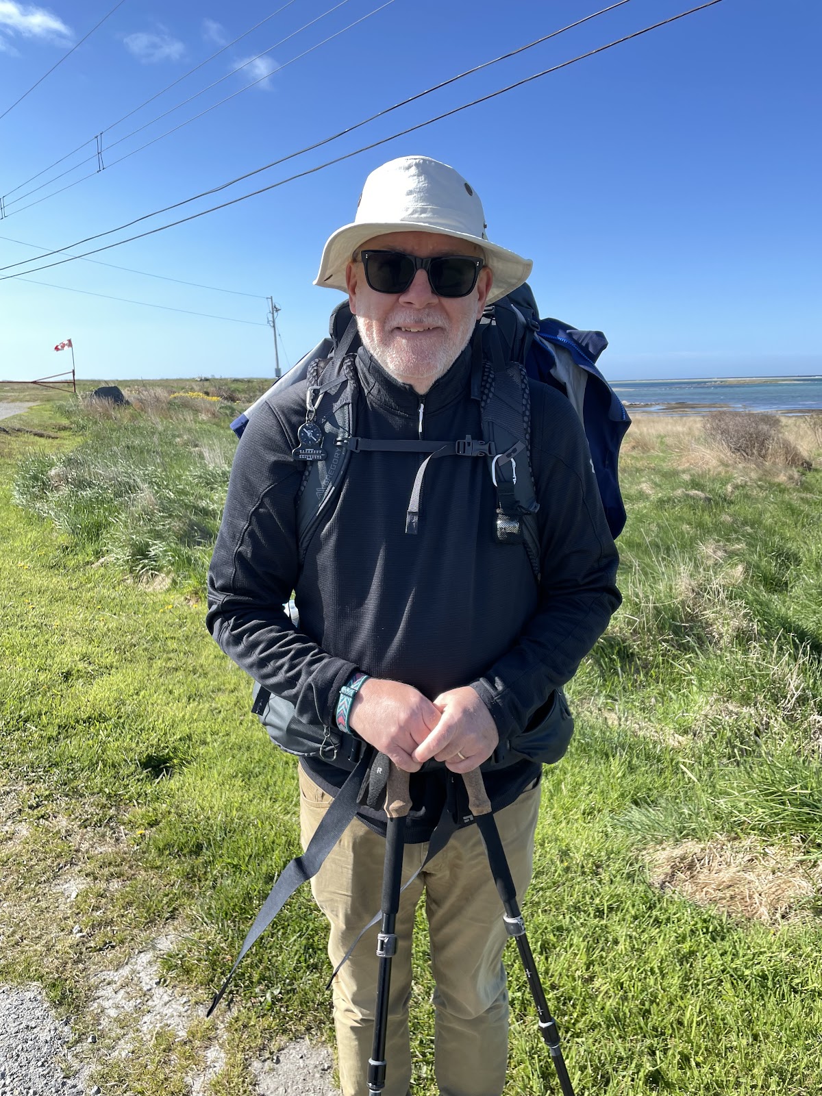
All my gear fits either inside the pack or in the outside stuff pockets
Trekking poles
Black Diamond Trail collapsible poles – they are almost always in my hands, but I can tuck them into one of the outside pack pockets if needed
Shelter system
Durston X-Mid 1P tent, with the optional groundsheet
Durston tent stuff sack
6 MSR Mini Groundhog stakes plus 2 Durston shepherd hook stakes
8 spare mini titanium stakes plus a set of 4 MSR spare guylines – I’m anticipating windy conditions
A piece of plastic salvaged from a shipping bag as a small vestibule groundsheet to keep my pack off the wet grass
(The tent on the left is the Durston)
I agonized over this choice, by the way. It will rain, often, this being Ireland, and I thought the bigger 2-person MEC tent that I have would be nice if I’m hunkered down for hours out of the wet.
But it weighs about 800g more than the Durston, so in the end I decided to go with the lighter tent. Besides, I like the coziness of the Durston having used it last year, and it has the advantage of allowing a quick fly-first pitch so that the inner stays dry if you are setting up in the rain.
Sleep system
Therm-a-Rest Vesper 0C rated down quilt
Therm-a-Rest Prolite Short self-inflating sleeping pad
Appalachian Gear Company Alpaca sleeping bag liner
MEC inflatable pillow with a merino wool buff as a pillow case
a pair of light sweatpants used as pajamas
a long sleeve T shirt used as pajamas
a 10L dry bag to hold all the sleep gear
Clothes
What I will wear every day
a pair of walking shorts, merino wool socks, athletic underwear, and athletic wick away T-shirt, and an athletic wick away long sleeve shirt
A MEC baseball style sun hat
a pair of Merrell Rogue high top hiking shoes
In the pack is a 10L dry bag with spare clothes
1 pair of walking pants (convertible to shorts)
1 wick away synthetic material athletic T-shirt
1 pair of merino wool hiking socks
1 pair of wick away synthetic material athletic underwear
Also in the pack are my outer layers
1 lightweight fleecy
1 lightweight Patagonia Houdini water resistant windbreaker
1 Sea to Summit rain poncho (converts to a tarp if needed)
1 MEC light down puffy jacket
1 pair of runners lightweight gloves
A pair of camp flip flops
A dirty clothes bag – just a reusable cloth grocery store bag that I could wash
Cook System
A MSR Pocket Rocket stove w 110g fuel canister and MSR stove supports
A Vargo titanium mug
An MSR titanium 700 ml pot
A Vargo long-handled titanium spoon
A plastic spork
A fire steel sparker
A back-up small disposable lighter in a Ziplock bag
A small scrubber, a washcloth, and some Wilderness Wash soap, in a Ziplock bag
A leather pot grabber made from scraps I got from our local cobbler
Salt and pepper in little packets inside a small watertight container
Health and Safety
A toiletries kit in a 3L dry bag with a quick dry camp towel, a small washcloth, deodorant, nail clippers, toothbrush, regular toothpaste, and a salt/baking soda tooth cleaning mix for when I am in a wilderness spot
A first aid kit with tick tweezers, blister & regular bandages, KT tape, petroleum jelly, alcohol swabs, scissors, allergy tablets, and ibuprofen tablets
A headlamp
A bug net to wear over my hat
A whistle (built-in to the pack’s sternum strap)
A VersaFlow water filtration kit + a CNOC 2L Vecto collapsible water bag
A supply of water purification tablets (if in doubt about the water source, I like to filter plus use the tabs, to be safe)
A Vargo titanium shovel for digging cat holes, aka the poop shovel
A small supply of toilet paper in a zip lock bag
A package of compostable disposable wipes
A packet of Sea to Summit travel wash soap leaves
A bottle of Sea to Summit Wilderness Wash concentrated all-purpose soap
A mini tube of sunblock
A small container of hand sanitizer
Electronics
Electronics in a small dry bag
iPad mini
A couple of multi-connector cables
A Nitecore 10,000 milliamp power pack
A dual port charging brick
A Canada to Ireland plug adapter
Apple earbuds
A headlamp
Tools and Repair Kit
A fix-it kit with some safety pins, a couple of small ring clamps, a short roll of duct tape, a mini sewing kit, and some inflatable-gear patches
A spare bootlace that doubles as a clothes line
A food hang kit – 10m of paracord with a carabiner attached to a loop on one end, plus a small drawstring sack used as a rock bag
A few small carabiners
4 plastic clothes pegs
2 mini bungee cords
My sunglasses in a zip lock bag
My Swiss Army knife
A few disposable eyeglass wipes
A reflective arm band
A Crunch-It fuel canister recycling tool
Consumables
A 20L KINStudio Kevlar critterproof food bag that holds my cooking gear plus
Trail snacks – some combo of granola bars, raw pumpkin and/or sunflower seeds, dried fruit, turkey jerky, banana chips, sesame bars, etc.
1 day’s worth of food (usually, but I will have a couple of short stretches where I will need 2-3 days worth) – tortillas or pita breads, cheese, noodles, ramen, canned fish, oatmeal, etc.
A ziplock bag with instant coffee packets and tea bags
A fuel canister for the stove
1L of water, at start of day
If I am far from a water source for the night, I will use my 2L CNOC bottle for extra
What I’m Not Taking
The stuff I’ve omitted to save weight is perhaps as interesting as what I am taking.
Swapping a Gregory Baltoro 65L pack for the Osprey Exos Pro saves about 1.5 kg
Carrying 1 change of clothes instead of 2 saves about 1 kg
Carrying less water and food saves about 1 to 1.5 kg
Swapping my old MEC rain jacket and rain pants for a poncho and a light windbreaker saved about 500g, more than enough to offset the extra weight of the down puffy jacket
Leaving behind the Helinox Chair Zero camp chair saved almost 500g
Paring down my first aid kit, toiletries, fix-it kit, and misc gear saved more than 500g
Swapping my Vargo alcohol stove for the iso-butane stove saved about 250g on the fuel and associated fuel bottle
Buying some other lighter gear like a new fleece jumper, new dry bags, new power bank and charger, etc saved another 250g or so
It’s amazing how little things add up. Just reducing the number of stuff sacks and zip lock bags was more than 100g in weight savings. If you really want to save pack weight, put each individual item on a kitchen scale and measure it to the gram, and soon you too will be cutting the ends off your toothbrush.
Between mid-May to late June 2024, I will be walking along the SW coast of Ireland, taking in the Kerry Way, the Dingle Way, the North Kerry Way, and parts of the Burren Way in Clare and the Western Way in Galway. This is the story of part of that journey.
A big thank you to everyone who has bought me a coffee over the past year. The Buy Me a Coffee service allows patrons like you to fund writers like me, to cover things like the costs of running this blog, new shoes and gear, and journeys like this. If that sounds like a worthy idea to you, then go ahead – keep buying me coffees.
So as of 2024, surprise, surprise, I’m still not getting any younger. My bucket list of walks that I’d love to do keeps growing, but the likelihood of completing even a fraction of these keeps shrinking.
Which means it’s time to get out and get going. And since Ann has family in Ireland, and since with Covid and moving to Nova Scotia and whatnot we’ve not visited in several years, it is time to get back over.
And that coincides with some of the walks on my bucket list – Ireland is crisscrossed with official walking trails and wee country lanes that I have been itching to explore. So this year is the year to get to it.
Starting in mid-May, I will be travelling to Dublin and then taking the train to Killarney in County Kerry, in the SW of Ireland. From there I’ll follow the coast north for about 1000 km through Kerry, Clare, and Galway, on waymarked trails and wee country lanes:
Starting in Killarney, walk the Kerry Way clockwise round the Iveragh Peninsula and back to Killarney, with maybe a detour to visit Skellig Michael, weather and legs and schedule depending
After a rest day in Killarney, head north along wee roads up to Camp on the Dingle Peninsula to join the Dingle Way
Follow that round anti-clockwise and near Dunquin, make a detour to visit Great Blasket Island and the westernmost tip of Ireland at Dunmore Head
Then rejoin the Dingle Way and continue back to Camp, and then complete the trail by walking to Tralee (and incidentally thus complete the Kerry Camino which takes you from Dingle Town to Tralee)
After another rest day in Tralee, follow the North Kerry Way up the coast to Ballyheigue, and then continue on back roads north, across the River Shannon at Tarbert, and on up to Lahinch
Between May 18 and July 5 of 2023, I walked from The Hawk on Cape Sable Island, the southern tip of Nova Scotia, to its northern tip at Cape North on Cape Breton Island, a 1000+ km trek. This is the story of part of that journey. See these posts to read about the whole journey:
A big thank you to everyone who hasbought me a coffee over the past year. The Buy Me a Coffee service allows patrons like you to fund writers like me, to cover things like the costs of running this blog, new shoes and gear, and journeys like this. If that sounds like a worthy idea to you, then go ahead – keepbuying me coffees.
Where am I now?
Home, in Lunenburg. I’ve had a few days now to let things sink in – that I finished my journey; that I made a plan and saw it through; that I have a life to fit back into, everyday things to do, friends to see, family to hug and hold.
Fun Facts
I walked a total of 1,027 km, which is about the same as:
walking from Toronto to Montreal and back again
walking from Paris to Berlin
walking a bit more than 24 marathons
It took me around 264 hours of walking to do it, so I averaged just under 3.9 kph, which sounds slow but in my defence that walking time includes rest breaks. I probably rested around 10-12 minutes for every hour I walked.
I climbed just under 4500 flights of stairs, according to FitBit, and a flight of stairs in Fitbit-land is equal to roughly 3 meters, making it more than 13 km of vertical ascent (and descent, since I started and ended more or less at sea level). That’s like:
climbing both Mount Everest and Mount Blanc
climbing the CN Tower in Toronto 31 times
descending the 1829 meter deep Grand Canyon more than 7 times
It took me about 1.4 million steps to do it. Think about that the next time you’re walking on an exercise machine.
I crossed 32 rivers – here’s the list, see how many you recognize: Barrington, Clyde, Roseway, Jordan, Sable, Tidney, Broad, Mersey, Medway, Petite, Lahave, Mushamush, Martins, Gold, Middle, East (the one west of Halifax), Musquodoboit, West, East (the other East River next to Sheet Harbour), Salmon, Moser, Ecum Secum, Liscomb, Gaspereaux, St. Mary’s, Larry’s, Salmon (the other one near Guysborough), Southwest Mabou, Mabou, Margaree, Fishing Cove, and the North Aspy. Not to mention dozens of brooks and streams.
I passed through several hundred cities, towns, and hamlets with names that include one of these words: Bay, Basin, Cove, Harbour, Lake, or Point.
I saw at least one moose, beaver, seal, deer, whale, bald eagle, osprey, otter, fox, snake, turtle, frog, toad, squirrel, and chipmunk.
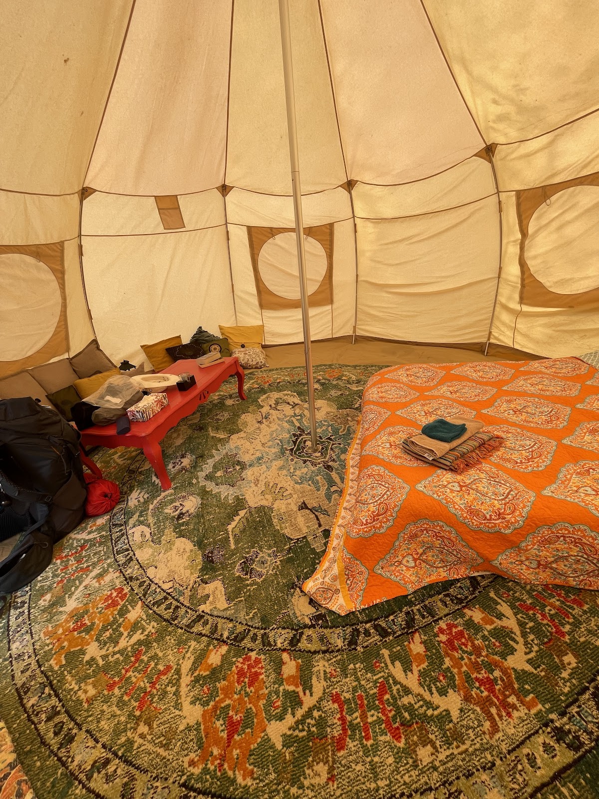
I slept in my tent in provincial park campgrounds, National park campgrounds, private campgrounds, a couple of backyards, and on crown land. I also spent the night in several inns, hotel, and motels, as well as in a couple of apartments, four houses or cottages, a glamping tent, a yurt, a fancy manor inn, an RV, and on the floor of a house under renovation. Somehow I missed sleeping in a barn.
I lost about 5 lbs in weight in total and about an inch off my waistline, and gained a few pounds of leg muscle.
I saw the following objects by the side of the road:
A spoon, a fork, a knife, in separate locations hundreds of km apart
A kids backyard play set
Enough furniture to fit out a living room including a sofa, an armchair, several coffee tables, and an ottoman
A ladies black patent leather pump, left foot, 3 inch heel, fortunately empty
A men’s black rubber boot, also empty
Several tires
Many banana peels
Hundreds of work gloves
With hand on heart, I can truthfully sing:
I’ve been to Ecum Secum and I’ve been to Chezzetcook.
I’ve passed through East Port Medway and I’ve walked to Necum Teuch.
I’ve crossed the River Mushamush and been to Mushaboom.
I climbed up Cape North mountain and I’ve seen the lilacs bloom.
From Barrington to St Lawrence Bay I’ve hiked through many trials,
And from cape to cape along the way I’ve gotten a million smiles.
The Blooper Reel
When you take on any project, there will be mistakes made and lessons learned. I am the first to admit that I got lucky on several occasions – the God of Fools was watching over me.
First and foremost, had I started my journey just a few days later in May, I would have been stopped right away by the forest fires near Shelburne. And despite central Nova Scotia getting flooded out with rain for days on end in June, I really only had a few bad-weather days to walk in the rain. So luck played a big part in my ability to complete the journey with minimal fuss.
But the God of Fools also made sure that I was bitten on the arse by my own mistakes, just to make sure that I learned something:
Like when I tried to follow the maps I was using, stubbornly, when my own eyes told me that there wasn’t a road there to follow.
Like when I didn’t check my map and just assumed I was on the right road, which took me several km in the wrong direction near Voglers Cove.
Like when I made accommodation arrangements in advance, but forgot to change or cancel them when I changed my plans. I ended up cancelling things last minute, too late to get a full refund, or even a partial refund in some cases.
Like when I refused to use bug spray but sat out anyway amidst swarms of black flies. I was bitten so badly in Sheet Harbour that my ears and right arm were swollen and puffed out red, itchy blisters.
Like when I didn’t keep my water bottles full and ran low in high temps, near Judique, and nearly collapsed from heat exhaustion.
My Favourite Things
Lupins and daisies and ferns in green grasses,
Sunlight that dazzles the sea through my glasses.
Lichens on rocks and the ferns under forest,
Blue jays and robins and the crows in their chorus.
Tumbling water and waves on sands sings,
These Scotian delights are my favourite things.
Ahem. Apologies for the parody. But here are a few of my favourite things from the journey:
Favourite coffee – Uprooted Cafe in Musquodoboit Harbour
Favourite sandwich – the breakfast wrap from LaHave Bakery in LaHave
Favourite meal – tie between the lobster dinner hosted by Jude Avery in Larry’s River and the dinner of pasta with cured shad roe prepared by Eric Southey in East Port Medway.
Favourite moment – sitting by the Clyde River just listening to the water
Thoughts
If there was one question that came up again and again from people I met, from Barrington to Bay St. Lawrence, it was “why are you walking this journey?”
There isn’t a single answer to that. What I told people during my journey was part of the answer: that I did it because I wanted to see if I could; that I wanted to explore the province and see places that I’d never visited before; and that deep down, I had this nagging feeling that I’m getting older and if I don’t do these things now, I may not get the chance in future.
But when I was a child, a middle child who was always content to imagine his own adventures, I would make lists, devouring mail order catalogues searching for jack knives and hiking boots and tents and sleeping bags and ropes and axes and all the things that I’d need for the journeys I wanted to make; borrow every book in the town library that told tales of adventures and explorations; and lacking the ability to actually buy the things I thought I wanted or travel off to strange lands, I’d cobble together backpacks from scraps of wood and an old pair of jeans and fill them with cookies and sandwiches and my pretend camping gear, to set off through the nearby fields and bush lots to find my dreams.
And now I am, perhaps, a grown-up child, able to peruse online catalogues to purchase real packs and tents and gear, and buy it and take some food and few clothes, to set off on actual adventures, sleeping in the woods and meeting strange creatures and overcoming fierce adversity to accomplish my quest. Are we not all kids at heart, at least some of the time? Maybe deep down, this was my boy’s own adventure.
I don’t know, to be honest. I’m sure I walked this for many reasons, only some of which are transparent to me. But I do know that I’m glad that I did it.
*****
What was the best part of the journey? Hands down, I’d have to say it was meeting the many, many people who stopped to chat with me. I had dozens of interesting conversations, with people in every community I passed through, always with smiles and often handshakes as well as a few hugs.
The kindness shown, again and again, reaffirmed my belief that most people, in most places most of the time, are decent, warm, thoughtful, and caring, and to be able to share their thoughts as I passed through their community remains my enduring memory.
*****
There were often times when I’d be explaining my journey to someone and they would ask, “are you doing this on your own?” And I would say yes, I’m walking it solo.
Maybe I was in a physical sense, but I was never alone. Ann was always with me. She was constantly in my thoughts, and we would touch base several times a day.
But deeper than that, she was with me because she’s a part of me. We’ve been through a lot together. I could not have completed this kind of journey without her support. Thank you, my love.
What next?
More walks, of course. I have my bucket list of journeys, and I hope to cross off a few more. Ann has relatives in Ireland who are getting older, we haven’t been there in a few years, and we know we need to get there soon. Maybe a walk or 3 there could be next.
And of course, I’ve only scratched the surface of Nova Scotia and the Maritimes; parks I haven’t visited, places I haven’t seen. I’d love to walk the shores of the Bay of Fundy, along both the New Brunswick and Nova Scotia coasts; do the circular hike round Kejimkujik National Park or the coastal path along Cape Chignecto Provincial Park; the rail trail along the Annapolis Valley; or more of Cape Breton Island, along the eastern shore.
But in the short term, I think it’s about consolidation. Sorting out what I learned, what I liked, what I’m leery of repeating. Saving up. Planning and preparing.
And lastly, I think, there’s some writing to do. I told myself on this walk that I should try to turn this into something publishable. So let’s see.
Like what you read? Buy me a coffee. Your donation helps offset the costs of maintaining this blog.
Between May 18 and July 5 of 2023, I walked from The Hawk on Cape Sable Island, the southern tip of Nova Scotia, to its northern tip at Cape North on Cape Breton Island, a 1000+ km trek. This is the story of part of that journey. See these posts to read about the whole journey:
A big thank you to everyone who hasbought me a coffee over the past year. The Buy Me a Coffee service allows patrons like you to fund writers like me, to cover things like the costs of running this blog, new shoes and gear, and journeys like this. If that sounds like a worthy idea to you, then go ahead – keepbuying me coffees.
Where am I now?
In my hotel in Bay St. Lawrence, drinking Lunenburg Ironworks Bluenose Rum from a tea mug and eating a somewhat worse-for-wear bar of Peace By Chocolate that I’ve been carting around in my pack for two weeks since Antigonish, after completing my journey by reaching Cape North. Done.
*****
How I got here from Cheticamp, the précis version:
followed the Cabot Trail highway through Cape Breton Highlands National Park and on past it to the town of Cape North
turned north and followed the Bay St Lawrence road to that town, at the top of the island.
from there, slogged up the Money Point Road to reach the lighthouse
slogged back the same way to return to the hotel where I’m staying
*****
There was a bit more to it than that of course. When I left Cheticamp, I had a ride booked to take me to where I’d left off, at the parking lot for the Skyline Trail. It was July 1, Canada Day, and I was expecting the road to be busy, but for the first hour I mostly had the road to myself. Quiet enough, in fact, that I saw a moose about 30 meters into the bog and bush.
Shortly afterwards, a Mountie passed me and waved. And when I thought about the beaver I’d seen the day before, I reckoned that was as Canadian of a hat trick as you could want on Canada Day. Eh.
I had climbed to the interior plateau the previous day, so it was relatively easy walking up and down modest dips and rises before beginning the descent to Pleasant Bay. There were several viewing points along the way and I took advantage of those for rest stops in the muggy heat.
Dropping from 400 meters to near sea level takes only about 4-5 km, so the road twists through S-bends, sometimes at about 8% grades.
It was hard on my legs, tougher in fact than the climb the day before.
And I crossed out of the Park and entered Pleasant Bay.
With clouds building, I chugged on through, stopping only at the local restaurant to borrow their Wifi for a few minutes to send a text home, and at the general store to pick up dinner – ramen noodles! – pressing on to reach MacIntosh Brook campground before 3:00.
I was worried because there are only about 10 spots at that campground and I had visions of no room at the inn. But when I arrived to see about 6 or 7 cars in the parking lot, I was surprised, in looking around, to see no tents or campers. There’s a short hiking trail out of that campground and apparently everyone else was off on that.
I walked around and picked a good spot, set up my tent, and went into the well-equipped cooking shelter. Empty. I quickly unpacked my cooking gear and made myself a cup of tea. I spread out my gear. I took off my shoes. I plugged in my phone to charge, and got out the iPad to read a book. I made myself quite at home, really.
And then it started to rain. It was still sunny off to the west, so I thought it would be brief, but two hours later it was still raining. All the hikers had left and I had the place to myself. I was starting to think about sleeping in the cooking shelter when a young single mom arrived with two kids.
Her English was only moderately better than my horrible French, and we had one of those fractured conversations where the gist of the meaning gets across with gestures and the occasional word.
And then after a while three cyclists arrived, and set up. And before I knew it we were having a very Canadian conversation, swapping thoughts on the virtues of different camping gear and where to get it, sharing travel stories, and comparing horror stories about the bane of outdoor life in Canada – mosquitoes, black flies, deer flies, and horse flies – “and then a big one flew right up my nose!”
A very fitting end to Canada Day.
*****
In the morning I was up early, finishing breakfast and packing up to make an early start – it promised to be hot and muggy, and I had another climb day to do. It’s 15 km from MacIntosh Brook to the east edge of the Park where the Big Intervale campground is located. To get there you have about 350 meters of vertical up and vertical down to do.
The road rises gently at first, and when the hills start you’re quickly onto an 8%-9% grade – nearly a meter of height gain for every 10 meters forward.
I took it slowly, sweat dripping in the muggy heat. The road shoulder sometimes narrows to near nothing, so I was listening for oncoming traffic while walking the road. A cyclist passed me, pushing himself steadily, weaving across the road sometimes, but never stopping. “Allez, allez, allez!”, I shouted, and he grinned through gritted teeth.
It took me more than an hour to crest the mountain and reach the plateau. I took a break there sitting on the steps of an emergency shelter, and took off my soaked shirt to dry for a bit in the wind.
The downhill, like before, was harder on my legs than the up. I could feel my Achilles tendons protesting as I gradually moved from viewing point to viewing point, until I finally reached the lower flat section.
The Big Intervale campground was a major disappointment. I had known in advance that it was unserviced, but so was MacIntosh Brook. I was dismayed to see that in this case “unserviced” meant no running water, no flush toilets, no cooking shelter, no food storage lockers or decent trees to hang a food bag, and only 3 lousy tent sites with minimal trees to screen and provide some shelter. And it was forecast to rain that night.
I hemmed and hawed. Stay? Press on 12 km (and 145 meters more climb) to the town of Cape North, where there was a hostel? Or try to hitch a lift back to MacIntosh Brook?
I didn’t have the energy to get to Cape North, and staying put seemed a last resort, so I ended up by the side of the road with my thumb out. No takers for nearly an hour while I was being nipped by flies. Granted, I did look sweaty and my prominent backpack was probably off-putting as well. And then a young family of 5, and their dog, stopped and I piled into their van.
We chatted away for the 10 minute ride – did you see any moose? Yes, one. We saw 5! Where are you going? Guess how much my pack weighs? Was that your green tent at MacIntosh Brook yesterday? – we saw it when we came out of the trail there.
They were lovely, gracious, and didn’t overtly wrinkle their noses at my sweaty aroma, and I thanked them profusely when they dropped me off. A Trail Angel family.
That night, once again it seemed like I’d be the only camper and I was actually preparing to just sleep in the cook shelter, when a family came in just as it was getting dark. I didn’t want them coming in to find me sleeping on a bench, so I quickly set up my tent and crawled in, as swarms of mosquitoes buzzed against the mesh.
*****
It rained fairly hard overnight, and during a lull in the drops at 6:30 in the morning I quickly packed up and moved everything into the cook shelter. I spread the tent out to dry, made breakfast, and got myself organized for the day. After the previous day’s experience, I was reckoning on another hour or more to hitch a lift back to Big Intervale.
And then a park employee came by to check on things, and we got chatting about my journey, which he must have found interesting enough that he become Trail Angel #2, breaking the rules to give me a lift back to where I’d left off.
A 2-hour walk in off-and-on rain brought me to Cape North, where I had been looking forward to breakfast at the only restaurant in town. It was closed when I got there, however, opening in about 30 minutes, so I wandered down to the local general store to pick up some groceries. Turns out dinner and lunch and breakfast for the next two days were about to be tortilla wraps with cheese and sardines, fruit cups, and some yogurt drinks for the vitamins.
After catching up on email while I had lunch at the restaurant (after 2 days of no cell data or voice service in the park), I finished my day reaching a little place that offered very basic hiker cabins for the night.
But the outdoor shower I took in the rain was refreshing, steaming under hot water while cold drops fell from the sky. And while the hut was just a roof and walls and a simple bed, it was worth it when the heavens poured a deluge overnight, hammering on the tin overhead at 4 a.m.
*****
And then the next day, it was off to Bay St Lawrence, after stopping for an hour to have coffee with Gerard, the owner of the rustic cabins. A very personable and friendly native of the area, he gave me some great tips about the Cape North trail.
The road was surprisingly busy with traffic, but it didn’t take long to climb up into the hills and over a low pass to come down into St Margaret’s Village
and then on to Bay St Lawrence.
I headed straight for the local seafood takeaway, and arrived to find it closed. Since I was by the water anyway, I made sure to take a selfie standing at the very end of the road, the northernmost bit you can drive to on the Island, and took a pic looking back south.
I went up to the motel where I was staying and wimped out on camping on their grounds, instead opting to stay in an RV they keep for overflow guests. I didn’t think I’d sleep that night, but eventually did, after walking back down to buy fish and chips from the seafood shack which had in fact opened for the evening.
*****
And then this morning, it was up with the birds, eating quickly, and putting only day essentials into the pack. I took a selfie and sent it to Ann, who said I looked way too serious.
But the thought of climbing over the mountain that you can see over my shoulder, and then back again, was weighing me down. That, and the realization that I was a few hours away from the finish.
The climb up, and then down the other side, was every bit as tough as I had thought it would be.
The old road that the lighthouse keepers used to use is now essentially just a very rough rocky trail, rising in spots at about a 20%-25% grade – a meter of rise every 4 or 5 forward.
It took me more than 2 hours to cover the 5 or 6 km distance to the other side, with a few close shaves where fallen trees nearly blocked the trail completely.
Stumbling down the last few meters brought me to a rough path along open grassy meadows at the foot of the cliff, the last bit of northward trek to do.
I swore out loud when, just a few meters from reaching the point, coastal erosion almost stopped me – there was a narrow, looks-dodgy-but-what-choice-do-I-have, more-or-less way past,
and then I was through and standing at the base of the light.
I took the selfies that I had told myself I would, and tried to smile or at least look like I was happy to be there.
But I couldn’t sit down. I wandered around for a bit, exploring and finding some photo worthy sights,
and then set off to see if I could get water at a brook that was on my map. I found the stream
and filled the bag of my water filter kit, clambering up from the stream to walk back to where I’d left my pack, and then had to retrace my steps to pick up the filter hose that I’d dropped.
By the time I sat down to eat something, it had started to mizzle a light mist, the kind that gets you wet without seeming to rain hard.
I asked myself what I was thinking. I hoped for something profound, but maybe that will come in hindsight. All roads come to an end, and if you’re lucky it’s where you wanted to go.
And then, just like that, I packed up, and turned to go – walking south for the first time in 7 weeks.
Sleeps and Eats
This was a feed-myself stretch – oatmeal, dried fruit, cheese, tortilla wraps, ramen, and granola bars. There’s a grocery store in Cheticamp, but after that just a couple of modest general stores in Pleasant Bay and Cape North.
I did have a takeaway fisherman’s platter from the Seaside Shack in Bay St Lawrence. Meh. But I was hungry.
Oh, and I had a decent fish lunch at Morrisons in Cape North – that was ok, the staff were friendly, and they let me park my soppy, wet-clothed butt for almost 2 hours while I poached their wifi.
As for stays, there were two camping nights in the Park at the MacIntosh Brook campground. I liked it – the only thing missing was a hot shower, but with essentially no one there, I made do with a standup washcloth bath and that was refreshing enough.
Gerard’s place, which he calls Asbaigh-a-Tuath (the Gaelic for Aspy Bay), is deliberately quite simple. It’s basically the same price as a campsite in a private campground, without the RVs and with a roof instead of a tent. It suited me fine, and meeting Gerard was a bonus.
Finally, I am currently at Burton’s Sunset Oasis motel in Bay St Lawrence. It’s a small 5-room place that books up in summer, as it’s the only motel in town. It’s simple, very clean and tidy, has kitchenette facilities in each room, and a great view back to the west over the town.
Stories
I was sitting at a scenic lookout, about an hour’s walk outside of Pleasant Bay. There had been a little gaggle of cars and gawkers there when I arrived, but in the way of the Cabotistas they took their selfies and quickly motored on. Once they left it was peaceful, and I sat in the sun enjoying the quiet.
A car pulled in with Ontario plates and two couples got out, a bit older than me I thought. They saw my pack and came over. We got chatting about my walk, and then one of the ladies asked “so where are you from?”
“Lunenburg.”
“Oh, were you born there?”
“No, I was born in the most southerly place in Canada.”
“Leamington! You were born in Leamington? We’re from Leamington too!”
And then a cascade of “Do you know so and so?” followed.
After a bit of further chat, one of the guys just shook his head and chuckled- “ what are the odds?”, he said.
*****
At another scenic stop, I walked in to see a car parked and a mom and dad taking pics of their kids with the view in the background. I slumped off the backpack and sat on the guardrail to catch my breath.
The dad noticed and came over, and we started chatting. He asked where I was walking to, and I explained about the tip to tip thing. He was from Michigan, so I tried to convert kilometres to miles for him. “Wow, that’s impressive.” He turned to his teenage daughter and drew her in – “did you hear that, he’s walking the whole of Nova Scotia”. Then asked if he could pick up my pack. “Holy cow, you’re carrying that!?!”. “Yep”.
Why does everyone want to know how much my pack weighs?
*****
I had finished the journey, reached the Cape, and now I was on my way back. It had been tiring already, and I was halfway up the mountain on the return when I thought I heard voices. Huh?
I looked up to see two people coming down, soon joined by two more. The pair of couples were from Britain, and they asked what I had thought of the Cape. “It was pretty special, especially for me since it’s the end of a long journey – I’ve walked a 1000 kilometres the length of Nova Scotia to get here”.
“Well, then we’re glad that we didn’t get there too soon and disturb you.”
“Yes, thank you for that.”
“Where next?”
“Well, actually I’ve always wanted to walk Lands End to John o’Groats”.
“Oh you should.”
Yes, I thought, I should. But not now.
Where next?
Home. Well, Baddeck first, and then Mabou. But I can’t wait to get home.
Route
Here’s the original plan. I have more or less followed it as written, though had some changes due to the fires around Halifax. But I’m done. Time for step 33.
Pick up the Shelburne County Rail trail and follow it to Clyde River
Then walk along the tedious Highway 103 to Shelburne
Where you’ll get back onto the rail trail to walk to Lockeport
And then from Lockport, continue following the rail trail through and past the Tidney River Wilderness area to reach Highway 3 at Summerville.
Where you continue on the highway for a bit and then get back onto the rail trail to reach Liverpool
And then continue on the rail trail up to around Port Medway, before exiting onto Route 331, the Lighthouse Route coastal road, to walk all the way to LeHave.
From LeHave, take the ferry over the river and walk to Lunenburg on the local back roads, and then
From Lunenburg, take the Rum Runners Trail through Mahone Bay, past Chester, and on past Hubbards to Upper Tantallon, and then
Detour south onto the Joshua Slocum Trail to reach old dirt roads through Five Bridges Wilderness Area to reach Glen Margaret, where you
Pick up Route 333, the Peggy’s Cove Road, to walk down to the lighthouse, and then bear east towards Prospect to connect with
The Old Halifax road which takes you north back to Glen Margaret
Where you connect onto the old St. Margaret’s Bay Road to walk east to Halifax
And then walk through the city to the ferry terminal.
There you catch the ferry over to Woodside in Dartmouth
To reach the Shearwater Flyer rail trail, which takes you northeast to Lawrencetown
Where you follow back roads to Porters Lake and then onto Highway 7 to reach Chezzetcook,
Where you turn onto Route 211 and follow the coast road northeast to Isaacs Harbour, and then
Branch onto Route 316 and follow that to Larry’s River.
At Larry’s River, you follow (natch), Larry’s River Road north to reach Highway 16 outside Guysborough,
And Highway 16 takes you to Boylston where you get onto Route 344, which
Bears northeast and then north and then west, around the coast to Aulds Cove, where the TransCanada Highway Canso Causeway clambers across to Cape Breton Island.
Turn the corner and follow the Cabot Trail east, up across the island past Big Intervale and Sunrise to reach the hamlet of Cape North (not the actual Cape North, just yet).
Turn onto the Bay Saint Lawrence Road and follow that to Bay Saint Lawrence.
Between May 18 and July 5 of 2023, I walked from The Hawk on Cape Sable Island, the southern tip of Nova Scotia, to its northern tip at Cape North on Cape Breton Island, a 1000+ km trek. This is the story of part of that journey. See these posts to read about the whole journey:
A big thank you to everyone who hasbought me a coffee over the past year. The Buy Me a Coffee service allows patrons like you to fund writers like me, to cover things like the costs of running this blog, new shoes and gear, and journeys like this. If that sounds like a worthy idea to you, then go ahead – keepbuying me coffees.
Where am I now?
Cheticamp. I arrived yesterday (June 29) and am spending two nights here.
To get here, I left Inverness and followed Highway 19 for a bit before turning off onto a Shore road, the Broad Cove Marsh Road, a decision that was rewarded with some amazing views down the coast and over the water.
This took me to Dunvegan, where I joined Route 219 for a tedious, humid, misty/rainy, sweltering slog to Whale Cove, (though I did get a nice sunset there),
and then on to Margaree Harbour. I picked up the Cabot Trail here,
after a short detour (let’s not call it a navigation mistake) through the town past the harbour and a lovely white wooden church
and back to the highway. The road crosses the Margaree River and the wind that day was blowing from the right direction to cause the steel bridge structure to hum like a wind chime, holding a note which brought to mind the long E-major piano chord at the end of the Beatles’ A Day In The Life.
After that, it was road-walking along the Cabot Trail all the way past St Joseph du Moine, Grand Étang,
and finally into Cheticamp. It was a gusty, windy day, and with my pack acting like a sail I was blown off balance several times. And the wind played more music, as it set the overhead wires singing and the long grasses swaying.
Almost immediately, I was rewarded by the sight of a young beaver swimming in a small pond next to the road,
a sight that makes me feel extra Canadian on the eve of Canada Day.
Soon after that little shot of Canuckness, I turned off the road and followed a couple of the hiking trails – the Chemin du Buttereau
and the Vieux Chemin de Cap-Rouge, both of which trace the old roads used by the Acadian settlers who lived in the area prior to the creation of the park in 1936.
They were similar in terms of scenery, I.e. you didn’t see much other than the forest that’s regrown over the land
since the Acadians’ land was expropriated for the park, but that’s a reminder of the reason today’s Nova Scotia Acadian population still holds deep feelings about the many ways they were shoved about since 1748 as pawns of first the colonial and later the provincial powers.
Together these two trails took me to about Cap-Rouge, and from there I slowly climbed the Cabot Trail highway
past the veterans monument that always brings a tear to my eye – there is one of these placed in a national park in every province. I took my hat off and stood quietly for a moment.
And after that moment was ended by a family of three driving up and taking pics of each of other with the coastline in the background, I trudged onwards, relentlessly up and up and up.
Rounding a corner, I could see small windswept little trees hugging the top of the next mountain, and then realized the trees were moving – I was looking at other hikers exposed above me as they did the Skyline Trail.
I ended the day when I reached the parking lot for that trail, and cursed a bit that I wasn’t able to hike it – I would have liked to have done but since it’s a loop that takes 3-4 hours to do, it doesn’t get me closer to my finish. Another time.
Here are the stats so far:
Total kilometres walked – 956
Total # of days spent walking – 40
Total # of steps walked – 1,297,000+
Total # of hours spent walking – about 243
Total # of stairs climbed according to FitBit – 4148
Sleeps and Eats
Hmm, less to tell here. The AirBnB in Cheticamp is quite nice and centrally located in town near the grocery store. As a result I am enjoying two nights of my own cooking, along with some nice Nova Scotia wine.
That’s with the knowledge that the remainder of this trip will be backpacking food – ramen, couscous, oatmeal, dried fruit, pumpkin seeds, and turkey jerky. Yum!
The stay at Whale Cove is best left alone on the theory that if you can’t say something nice then don’t say anything at all.
And beyond that, I’ve only stopped at one place for lunch, the Belle View restaurant in Belle Cote just outside Margaree Harbour. They make a perfectly respectable breakfast, which kept me going for a few hours.
Stories
As I was taking a water break at a little photo op spot on the Cabot Trail outside Belle Cote, a cyclist came in for a quick water break as well. I walked over to her. “Where did you start this morning?”. “Dingwall”, she said. Holy crap, I thought, that’s at least 90 km from here, and she’s not even sweating, as I looked down at my soaked T-shirt.
“Good ride? At least it’s downhill for you from that direction”.
“Yes, but this headwind (she was going south) is annoying. It was so strong it pulled my helmet back and strained my neck.”
“Well, on the bright side”, I said in a voice that would have had my son rolling his eyes at my Dad tone, “at least it keeps the bugs down.”
“Thanks for that positive spin”, she said, and sped off nonchalantly towards Baddeck, another 50+ km in front of her, and she still wasn’t sweating! Lord, to be young.
And then 5 minutes later a guy on a cycle passed me, whom I assumed to be her partner. He was grunting uphill into the wind as we met, and I shouted out “you eat headwinds for breakfast!” If he was her partner, I pictured them comparing notes at the end of day and joking about the old guy they’d seen backpacking.
*****
When I got to the Park, I went into the visitor center to see if there was anything they could tell me about walking through. I explained what I was doing to the young guy behind the desk. He got up and had a quick chat with his colleague. “This guy is walking through the park. What pass does he need?”, I overheard. “Why?”, she asked. More huddled conversation. He came back, and after some fiddling decided that I needed a three-day visitor’s pass, but since the next day was Canada Day which was free, and the next day was Sunday which think he said was also free, charged me $8.50 for a one-day pass. I guess they don’t get a lot of foot traffic.
*****
Because I was staying in Cheticamp again after walking partway through the Park, I had arranged for a ride service to pick me up at the end of the day’s walk and bring me back to town. The driver pulled up and I put my stuff in and climbed into the front seat. We got chatting.
“So where did you start from?”
“This morning from Cheticamp, and overall from Cape Sable Island. I’m walking the length of Nova Scotia.”
“How old are you?”
“I turned 60 this year”.
Glances, gives me a once-over. “Crap”, he thinks to himself so loudly I can hear it, “he’s in better shape than I am and I’m younger than he is”.
We natter for a bit about training and exercise and then I said that really this trip was about the journey, exploring the province. I explained that I’d resolved to find at least one moment every day when things are peaceful and calm, to remind myself that there’s always a good moment if you stop to notice it when it happens.
He looked at me and nodded, then shared a very personal story of loss, and I could only say how sorry I was. He shook his head – “Thank you for telling me that, about finding that moment every day. That helps.”
We got to my place and I tried to give him a tip along with the fee. “Keep it. Just don’t charge me for the therapy you just provided”.
We shook hands as I got out, and I was reminded again that the people I meet on this journey are the best reason for doing it.
Where next?
Looking at my plan, I have less than a 100 km to go, though there is more than 4000m of climb and descent in that. Ann texted to remind me that I am now 5 sleeps from my goal. It’s hitting me now, I’m close.
From tomorrow it’s two more days to finish walking through the Park, then on to Cape North the town and turn left towards Aspy Bay for a night, then keep going up to Bay St Lawrence to sleep if I can on the last night, and then it’s up over the mountain to the Cape North lighthouse for a selfie before a return climb over the mountain to Bay St Lawrence. Et Finis.
Route
Here’s the original plan. I have more or less followed it as written until part way through Step 9, where I had to move off the trail, skip steps 10-13, and just followed the road from East Chester and through Halifax (step 14).
This latest bit has seen me complete Steps 25-27, though I have to skip Step as I can’t go to Fishing Cove so from here it’s onto Step 29. After that, it’s still more or less the plan as described.
Pick up the Shelburne County Rail trail and follow it to Clyde River
Then walk along the tedious Highway 103 to Shelburne
Where you’ll get back onto the rail trail to walk to Lockeport
And then from Lockport, continue following the rail trail through and past the Tidney River Wilderness area to reach Highway 3 at Summerville.
Where you continue on the highway for a bit and then get back onto the rail trail to reach Liverpool
And then continue on the rail trail up to around Port Medway, before exiting onto Route 331, the Lighthouse Route coastal road, to walk all the way to LeHave.
From LeHave, take the ferry over the river and walk to Lunenburg on the local back roads, and then
From Lunenburg, take the Rum Runners Trail through Mahone Bay, past Chester, and on past Hubbards to Upper Tantallon, and then
Detour south onto the Joshua Slocum Trail to reach old dirt roads through Five Bridges Wilderness Area to reach Glen Margaret, where you
Pick up Route 333, the Peggy’s Cove Road, to walk down to the lighthouse, and then bear east towards Prospect to connect with
The Old Halifax road which takes you north back to Glen Margaret
Where you connect onto the old St. Margaret’s Bay Road to walk east to Halifax
And then walk through the city to the ferry terminal.
There you catch the ferry over to Woodside in Dartmouth
To reach the Shearwater Flyer rail trail, which takes you northeast to Lawrencetown
Where you follow back roads to Porters Lake and then onto Highway 7 to reach Chezzetcook,
Where you turn onto Route 211 and follow the coast road northeast to Isaacs Harbour, and then
Branch onto Route 316 and follow that to Larry’s River.
At Larry’s River, you follow (natch), Larry’s River Road north to reach Highway 16 outside Guysborough,
And Highway 16 takes you to Boylston where you get onto Route 344, which
Bears northeast and then north and then west, around the coast to Aulds Cove, where the TransCanada Highway Canso Causeway clambers across to Cape Breton Island.
Turn the corner and follow the Cabot Trail east, up across the island past Big Intervale and Sunrise to reach the hamlet of Cape North (not the actual Cape North, just yet).
Turn onto the Bay Saint Lawrence Road and follow that to Bay Saint Lawrence.
Between May 18 and July 5 of 2023, I walked from The Hawk on Cape Sable Island, the southern tip of Nova Scotia, to its northern tip at Cape North on Cape Breton Island, a 1000+ km trek. This is the story of part of that journey. See these posts to read about the whole journey:
A big thank you to everyone who hasbought me a coffee over the past year. The Buy Me a Coffee service allows patrons like you to fund writers like me, to cover things like the costs of running this blog, new shoes and gear, and journeys like this. If that sounds like a worthy idea to you, then go ahead – keepbuying me coffees.
Where am I now?
Actually, Cheticamp.
However, two days ago I finished walking the Celtic Coastal Trail when I reached Inverness, and I wrote a post for that – but I tried to finish it in my tent and fell asleep. So here it is two days later.
And to be perfectly honest, I am sitting in the laundry room of the Inverness Beach Village Campground waiting for my stuff to dry and taking advantage of a spot where there are no black flies, but there is power to charge my phone and a wifi connection.
Oh oh, mild panic – in sorting through my laundry as I was putting it into the washer, I realized I was missing a T-shirt. Thinking back, I recalled that it was the one I’d worn that day. I mentally retraced my day step by step – put on T-shirt and a long sleeve over that, start walking, get hot, take off T-shirt and just wear long sleeve to keep bugs off, stuff T-shirt into water bottle pocket of pack, keep walking, stop for lunch, drink water, move T-shirt to front pocket of pack, walk to Inverness, stop and get groceries, walk to campground, set up, gather laundry – aha where did it go missing? I didn’t want to walk 9-10 km back to Lake Ainslie where I had had lunch – the last place I knew I’d had it. Alas, poor T-shirt, I’ll miss you. But oh yeah, I had the rain cover on my pack after lunch so it couldn’t have fallen out there. Where did I take off the rain cover? Bingo – the grocery store. Ergo, it must be somewhere between the grocery store and campground. That’s only about 1.5 km back – so, finish laundry, put boots back on, walk back to grocery store, et voila!, my T-shirt, lying forlornly in a heap in the parking lot, apparently untouched. So lesson learned, don’t stuff loose clothes into a loose front pocket of your pack.
Sorry for that digression.
To get here, I started in Port Hastings and followed the trail from KM 0,
up along the west coast of Cape Breton Island, passing through Troy, Judique, Port Hood,
Glencoe Station, Mabou,
Glendyer, and on to Inverness.
It took me 4 days to walk the 89 km of the trail, and the first day especially was sweltering. There was a breeze off the water that day so while I was feeling the heat, it wasn’t as bad as it might have been.
Yes that is a slimmer me -800 km into the walk
However at Long Point I left the trail to walk to the accommodation I had booked, which was off a side road about 4.5 km inland, and once I got away from the ocean breeze I started to bake. It didn’t help that the Old Chisholm Mill Road that the map said was there
was invisible from the highway –
I spent 20 steamy minutes looking for it before giving up. I ended up backtracking a km or so, and taking another road that eventually did get me to the right one where the house was.
And by then I was low on energy, low on water, low on patience, and just plain out of gas. It didn’t help that the road kept rising, and rising, and rising. I’d stagger up a low hill, turn a corner, and rise some more. I was gasping for breath by the time the place came into sight. Reaching it, fumbling the lock code 3 times (natch) and falling inside, I was opened the fridge to find several litres of ice water. It took about 6 glasses to cool me off and rehydrate me. I slept very well that night.
And after that things picked up. The weather cooled a bit, and it even rained a bit. Port Hood had a nice little restaurant where I had dinner, Mabou had the famous Red Shoe pub, and the trail scenery was low key but interesting,
I even had a few chats with people along the Trail. There was a family from New Jersey touring Nova Scotia whom I met on the bikes they’d rented to ride from Mabou to Port Hood – “You’re walking to Cape North? We were there – I can send you the pics and save you the trip”.
Or the retired coast guard serviceman who told me about Cape North, saying that the Money Pit Road that I intend to follow is passable for 4-wheel drive vehicles but is so steep that they have to stop every few km to let the oil in the engines drain back to the right parts to avoid overheating – good to know it’s passable because the satellite pics aren’t encouraging, but oh man that sounds like a tough walk.
And finally, a lovely chat with two women out walking a dog near Mabou, one of whom had the lilt in her voice and the twinkle in her eye of Catherine O’Hara.
*****
Oh, and I have to say a big thank you to all the trail volunteers who help to maintain it. It was the best walking trail I’ve been on in Nova Scotia.
The surface, other than a short bit between Port Hood and Mabou that had been a bit ATV’ed, is level firm gravel with hardly a rut or pot hole.
And there are a decent number of benches and picnic tables scattered along the trail,
the interpretive and directional signage is great,
and the washrooms are spotless.
Well done to all involved.
Sleeps and Eats
Well, it was going to be 3 camps and a motel, but it’s turned out to be 2 motels, an AirBnB, and a camp.
The weather forecast for the 2 nights after I left Port Hastings called for lots of rain, so I decided that discretion was the better part of valour and booked the roofed accommodations. And of course then it didn’t really rain enough to justify that.
But the Hebridean Motel in Port Hood was good, and so was the Ceilidh Trail Motel in Mabou, both simple, clean, efficient places with friendly staff. And the AirBnB was a nice place, super quiet as it was set back in the woods – I just wish it wasn’t an uphill walk to get there.
This campground I’m in, the Inverness Beach Village, is pretty good too, although I have to say I am getting a bit tired of private campgrounds putting the RVs on the ocean and the tents at the back, which usually means next to the highway. But the washrooms are squeaky clean and the wifi reaches my tent.
As for eats, the Clove Hitch Bistro and Bar in Port Hood was fine – friendly service, generous wine pours, and decent fish and chips. But I really enjoyed the Red Shoe in Mabou. The two musicians playing when I went in immediately transported me to Ireland, and the veggie pasta was the healthy, tasty, and filling option I needed.
Stories
Hmm, I think I have told my stories already – losing my shirt (literally rather than figuratively in a card game), losing a road, dying of heat exhaustion.
But a couple of little stories stand out.
*****
I was sitting on a bench overlooking the water, around Judique. It was very calm, just a light shimmer offshore, and inshore a patch of ripples. And in that patch, a head appeared – too big at that distance to be a seal, it must have been a pilot whale. I sat enchanted for about 5 minutes, as it surfaced several times in that patch of ripples, which must have been a school of mackerel which was providing its lunch.
And then he dived – I say “he” but I can’t tell the difference – and moved off somewhere else. And I sat for a bit longer, and I moved off too. We all have our paths to follow.
*****
As I walked into Inverness, I noticed a lilac bush in full perfumed bloom. Thinking back, the lilacs were just coming on in Barrington in mid-May, and then filling the air with wafts of scent in Halifax in early June as I passed through. I think I am walking this journey at the speed of lilacs.
Where next?
From Inverness, it’s back to road-walking, up the coast to Whale Cove, Margaree Harbour, Grand Étang, and on to Cheticamp. That’s the gateway to the Cape Breton Highlands National Park, and the climbing challenge starts there – I will have several days where the vertical distance climbed will be over 500m, compared to the 50-150m range I have had so far.
Route
Here’s the original plan. I have more or less followed it as written until part way through Step 9, where I had to move off the trail, skip steps 10-13, and just followed the road from East Chester and through Halifax (step 14).
This latest bit has seen me start at Step 24. After that, it’s still more or less the plan as described, although my replanning has meant that I can’t do the Skyline Trail in Step 27 and I couldn’t get a campsite booking for Fishing Cove so no step 28. But otherwise it’s like this.
Pick up the Shelburne County Rail trail and follow it to Clyde River
Then walk along the tedious Highway 103 to Shelburne
Where you’ll get back onto the rail trail to walk to Lockeport
And then from Lockport, continue following the rail trail through and past the Tidney River Wilderness area to reach Highway 3 at Summerville.
Where you continue on the highway for a bit and then get back onto the rail trail to reach Liverpool
And then continue on the rail trail up to around Port Medway, before exiting onto Route 331, the Lighthouse Route coastal road, to walk all the way to LeHave.
From LeHave, take the ferry over the river and walk to Lunenburg on the local back roads, and then
From Lunenburg, take the Rum Runners Trail through Mahone Bay, past Chester, and on past Hubbards to Upper Tantallon, and then
Detour south onto the Joshua Slocum Trail to reach old dirt roads through Five Bridges Wilderness Area to reach Glen Margaret, where you
Pick up Route 333, the Peggy’s Cove Road, to walk down to the lighthouse, and then bear east towards Prospect to connect with
The Old Halifax road which takes you north back to Glen Margaret
Where you connect onto the old St. Margaret’s Bay Road to walk east to Halifax
And then walk through the city to the ferry terminal.
There you catch the ferry over to Woodside in Dartmouth
To reach the Shearwater Flyer rail trail, which takes you northeast to Lawrencetown
Where you follow back roads to Porters Lake and then onto Highway 7 to reach Chezzetcook,
Where you turn onto Route 211 and follow the coast road northeast to Isaacs Harbour, and then
Branch onto Route 316 and follow that to Larry’s River.
At Larry’s River, you follow (natch), Larry’s River Road north to reach Highway 16 outside Guysborough,
And Highway 16 takes you to Boylston where you get onto Route 344, which
Bears northeast and then north and then west, around the coast to Aulds Cove, where the TransCanada Highway Canso Causeway clambers across to Cape Breton Island.
Turn the corner and follow the Cabot Trail east, up across the island past Big Intervale and Sunrise to reach the hamlet of Cape North (not the actual Cape North, just yet).
Turn onto the Bay Saint Lawrence Road and follow that to Bay Saint Lawrence.
Between May 18 and July 5 of 2023, I walked from The Hawk on Cape Sable Island, the southern tip of Nova Scotia, to its northern tip at Cape North on Cape Breton Island, a 1000+ km trek. This is the story of part of that journey. See these posts to read about the whole journey:
A big thank you to everyone who hasbought me a coffee over the past year. The Buy Me a Coffee service allows patrons like you to fund writers like me, to cover things like the costs of running this blog, new shoes and gear, and journeys like this. If that sounds like a worthy idea to you, then go ahead – keepbuying me coffees.
Where am I now?
Cape Breton Island!
I scrambled across the causeway
to reach Port Hastings this afternoon, and then took a taxi to Port Hawkesbury where there’s more choice for places to stay and shops.
To get here since I last posted from Port Bickerton on Sunday, June 18, I’ve walked through Country Harbour, Isaac’s Harbour, Goldboro, Drum Head, Larry’s River, Guysborough, Boylston, Monastery, Linwood, Havre Boucher, and Aulds Cove.
The weather was rainy and cold at the start of this stretch, but by the time I got here summer was well and truly in force – blue skies, blazing sunshine, and sweltering temps.
And, by the way, the little corner of the province tucked along the Northumberland Strait by Cape Jack is gorgeous – green rolling fields with a background of blue seas and the mountains of Cape Breton. My morning walk today was wonderful, meandering the backroads to Havre Boucher.
Oh, and I can’t forget to mention the lovely rolling hills around Guysborough and Milford Haven.
Or the rugged countryside between Goldsboro and Seal Cove.
Or the Acadian charm of Larry’s River.
This past week has taken me though parts of the province which were not only new to me, they also surprised me with their history and the strength of their communities. This was the best part of my trip so far, and that’s saying something on a journey that’s been full of great experiences.
Here are some stats about the walk so far:
Total kilometres walked – 765
Total # of days spent walking – 33
Total # of steps walked – 1,037,000+
Total # of hours spent walking – about 194
Total # of flights of stairs climbed according to FitBit – 3062
Looking ahead, I have just under 260 km still to go, give or take a few. I have 11 more walking days planned – still unsure whether I need to add one.
Sleeps and Eats
This stretch has not only surprised me with the scenery and history, the stays and meals have been full of unexpected charms.
In Drum Head, I stopped at the Market store and met Martin, the owner. We had corresponded previously and I’d asked him about places where I might camp. When I arrived, wet after a misty/foggy/chilly day, I wasn’t really looking forward to setting up my still wet tent but gamely approached him for advice. After looking at the map, and not seeing anything that appealed, he offered to let me sleep around the back of a house he owned that was being renovated.
We walked over to see what would work, and he mentioned that the plumbing was partly done so there was cold water plus a working toilet. We went into the house to check that, and I looked around to see that the floors were down and the windows in, while outside fog swirled and sopping wet grasses sagged mournfully – “can I camp out in here?”, I asked. Sure he said, so that’s what I did; spread out my sleeping gear under a dry roof and kipped down quite comfortably.
And, since he owned a general store full of foods, I picked out a frozen pizza which he baked for me for dinner, then in the morning he made me a breakfast burrito and a cheese wrap for my lunch. Simple but tasty and very much appreciated.
The next night in Larry’s River was even more interesting. I stayed at a lovely B&B called Murphy‘s Inn, which was very comfortable and would have been a great evening all by itself. But on top of that, Bob, the owner, had become interested in my journey when I explained what I was doing, and he arranged with a local author, historian, and raconteur named Jude Avery to have me invited to a lobster dinner party that Jude arranges on occasion.
What an evening! Huge, perfectly cooked lobsters were the featured course, along with salads, wines, cakes, and cookies – I was properly stuffed at the end.
And even better than the food was the conversation, on subjects ranging from my journey, to the youthful antics of some of the dinner guests, to the history of the Acadian deportations in the 1750’s. I had a wonderful time, and I can’t say thank you enough to everyone who made me feel so welcome, especially Jude, the host.
After that, my stay in Guysborough seems a bit anticlimactic, but of course it wasn’t because Ann joined me for a couple of nights. We stayed at the Desbarres Manor Inn, a bit of luxury compared to my camping nights. Since I had planned for a rest day while she was there, we drove over to Antigonish for an afternoon of browsing the shops and enjoying a lingering lunch before returning to the Inn for a drink on the deck.
Leaving Guysborough, I walked to Linwood and camped for the night at the Linwood Harbour Campground, which was quite pleasant, though the bugs forced me into my tent before 8 pm. We won’t talk about my Mac ‘n cheese meal.
Stories
Reaching Cape Breton Island is a major milestone for me. But getting here over the causeway was more of a challenge than I thought. I wasn’t sure if I could even walk across, because when I looked in detail at satellite pictures I couldn’t see a pedestrian pathway.
And as I got closer to the on-ramp, the shoulder of the road faded to near nothingness. I looked for signs saying No Pedestrian Access or some such thing but didn’t see anything. I passed a truck weigh station with a security vehicle parked outside but no one shouted out to stop me.
So I kept going, and found myself picking my way over a shattered jumble of rocks, which I assume are pushed up when winter ice jams against the structure, along with stray garbage and vehicle parts and other flotsam, tangled with straggly tall grasses and weeds.
It’s about 1.2 km across and it took me the best part of 20 minutes to do it. And while perhaps I shouldn’t have walked it, I would have felt that I had cheated had I been forced to hitch a ride for this short but crucial piece.
*****
Trail Angels, part 2
Martin, owner of the Drum Head Market, who made me dinner, breakfast, and lunch, plus tea and coffee; let me camp in his under-renovation property; and kept me entertained with stories and conversation about the local area, wind and solar power generation, software development, and military history, amongst other things.
Gary, owner of Gary’s Groceries in Havre Boucher, who let me sit in the shade on the deck of his house to cool off on a blazing morning.
The owner of the campground in Linwood who watched me squelch sweatily into the office to register, took a look at my soaked hat, shirt, and hair, and silently reached into the fridge to get a cold bottle of water, pushing it across the counter and letting me gulp down half before he asked me who I was
The woman in Port Hawkesbury (whom I swear was Mary Walsh or her twin sister), who called out from her pickup “I hope you’ve had a wonderful day” with a big smile, to end my day on a high note.
Where next?
This last leg of my journey will end when I reach the Cape North Lighthouse. To get there, the immediate next step is to follow the Ceilidh Trail from Port Hastings to Inverness, staying in the Judique area, Port Hood, and Mabou along the way.
This is the heart of Gaelic Cape Breton, and a highlight for me will be visiting the Red Shoe pub in Mabou, where there’s always live music to enjoy.
And between here and there, I have two days of rain in the forecast. Time to get the wet gear out again.
Like what you read? Buy me a coffee. Your donation helps offset the costs of maintaining this blog.
Between May 18 and July 5 of 2023, I walked from The Hawk on Cape Sable Island, the southern tip of Nova Scotia, to its northern tip at Cape North on Cape Breton Island, a 1000+ km trek. This is the story of part of that journey. See these posts to read about the whole journey:
A big thank you to everyone who hasbought me a coffee over the past year. The Buy Me a Coffee service allows patrons like you to fund writers like me, to cover things like the costs of running this blog, new shoes and gear, and journeys like this. If that sounds like a worthy idea to you, then go ahead – keepbuying me coffees.
Where am I now?
In Port Bickerton, sitting in Whitney’s Corner Store so I can use the WiFi, get some breakfast, and eavesdrop on the locals chatting.
Since Thursday, I have walked from Moser River to Liscomb Mills, then from there to Sherbrooke, and now to Port Bickerton (which the locals seem to pronounce as Beckerton).
Here are some stats about the walk so far:
Total kilometres walked – 628
Total # of days spent walking – 25
Total # of steps walked – 855,000+
Total # of hours spent walking – about 162
Total # of stairs climbed according to FitBit – 2450
Looking ahead, I have just under 400 km still to go, give or take a few. I have 16 more walking days planned – we’ll see whether I need to add one or two. Hope not, but those hills and mountains on Cape Breton Island get bigger every time I review my plans.
Sleeps and Eats
I spent a couple of nights at the Liscombe Lodge, and very welcome it was in the pouring rain on Wednesday past, when I walked from Port Dufferin to Moser River.
It’s a nice resort-style inn, with outdoorsy facilities like hiking trails or indoorsy ones like swimming pools – the sort of place that’s in most of the tourist guides and attracts people from all over. While I was there I overheard bits of German and French, English lilts and American twang, and Maritime and Ontario accents.
The demographics, this time of year, are skewed to an older guest – I was one of the younger diners one night, just looking around. Then again, school isn’t out yet so families are still a few weeks away. But there was a nice little ceremony I noticed when walking past one of the ballrooms, to see what I think was a high school graduation party in progress. Good on them.
I also camped for a night at the River’s Edge Campground in Sherbrooke, a nice place by the St Mary’s River.
The view over the water was lovely, watching the swallows swoop and dive, and the sound of it burbling made for a peaceful sleep.
And this morning as I write this, I had a wet and windy night of it camping on some property in Port Bickerton owned by Whitney, of Whitney’s Corner Store. A big thank you to her and her husband Kevin for letting me do that.
And, by the way, they are also a restaurant serving a generously-sized order of fish and chips, amongst other things, which I had for dinner last night – just what I needed after 6 hours of walking. Plus they do a hot breakfast (yummy veggie omelette), which solved my cooking in the rain conundrum.
I also took advantage of the opening of the Sherbrooke Market to browse, pick up lunch, chat with some locals, listen to music, and wolf down a delicious grilled sausage. Open Saturday’s, starting June 17 this year and probably running through Labour Day.
Stories
In a previous post, I talked about the God of Fools, who has been looking over my shoulder on this trip. The other day, I set out from Moser River to walk to Liscomb. I started out at a good pace, motoring along and taking pictures of things along the way.
I came upon a picturesque church
and went to grab my phone, only to realize in a panic that I didn’t have it. After patting all my pockets 3 times, I decided to leave my pack at the church and back-walked along the road. I finally found it more than a kilometre away, lying on the shoulder of the road at the last place I’d taken a pic. It must not have slipped into my pocket securely.
I thanked my stars that it had fallen on the road shoulder, so it didn’t get run over. But retrieving it cost 30 min of the day, so I decided to skip a bit of a detour I had planned to make, taking an extra hour to follow the coast around by Mitchell Bay.
But the God of Fools was working behind the scenes. By not taking the detour, it meant I was back to the Lodge about 2 minutes before the heavens opened to a one-hour downpour. Had I not dropped my phone, I would have gotten soaked.
*****
Hikers doing one of the long distance trails in the US, such as the Appalachian Trail or the Pacific Crest Trail, are often helped out by locals along the way, with little gifts of food or baked goods, cold drinks, or rides from the trail to nearby towns to pick up supplies. The hiking community likes to call them Trail Angels.
And on my journey so far, I’ve had help from several Trail Angels here in Nova Scotia.
The kind local gentleman outside Voglers Cove who gave me a lift back to town after I made a wrong turn
My neighbours from Lunenburg, Susan and Robert, who drove down to Sable River to bring me a hot dinner and treats
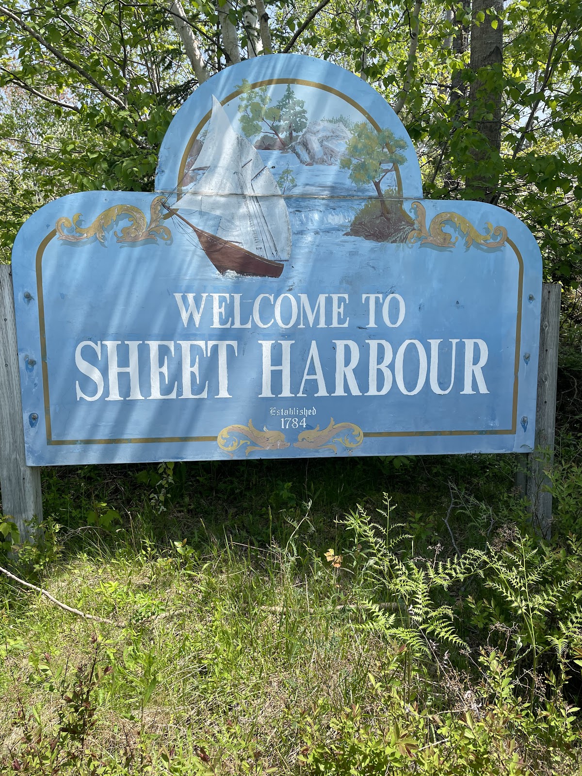
The cheerful and chatty ladies whom I met in Sheet Harbour, who slyly bought me breakfast while I was nattering on about my trip
The firefighters from Sheet Harbour who called their chief to get me permission to camp behind the fire hall in Moser River (a welcome offer, but one that I declined due to the heavy rain that day which led me to arrange a lift so I could stay at a hotel)
The kind woman who saw me walking to Sherbrooke as she drove there, picked me up a sandwich and a bottle of water, and dropped them off with a “thought you might be hungry and thirsty” when she saw me on her drive back
The local Port Hilford baker who saw me at the Sherbrooke Market, and gave me a homemade chocolate cookie when she came across me 15 km later along the road.
And the dozens of people I’ve chatted with along the way who have wished me well, and the hundreds of who have brightened my journey with a car horn toot and a wave.
I’ve been amazed and gratified and uplifted every day by all of these acts of kindness. Thank you everyone.
Where next?
I’m 3 days walk from Guysborough, where Ann is joining me for a couple of nights while I take a rest day. To get there I need to trek along Route 211 from Port Bickerton to Isaac Harbour and connect with Route 316 to Drum Head to camp, and then keep going Larry’s River for a stay at Murphy’s Inn, and finally on to Guysborough. I’m really looking forward to the break.
And from Guysborough, I have one more night on the mainland at Linwood, and then it’s over the causeway and onto the Island. I’m looking forward to that as well – I haven’t been to Cape Breton in 30 odd years.
I’m getting there, one story at a time.
Route
Here’s the original plan. I have more or less followed it as written until part way through Step 9, where I had to move off the trail, skip steps 10-13, and just followed the road from East Chester and through Halifax (step 14).
This latest bit has seen me start at Step 15, for Step 16 followed route 207 instead of the trail, did step 17 and 18, and am now in the middle of a step 19. After that, it’s still more or less the plan as described.
Pick up the Shelburne County Rail trail and follow it to Clyde River
Then walk along the tedious Highway 103 to Shelburne
Where you’ll get back onto the rail trail to walk to Lockeport
And then from Lockport, continue following the rail trail through and past the Tidney River Wilderness area to reach Highway 3 at Summerville.
Where you continue on the highway for a bit and then get back onto the rail trail to reach Liverpool
And then continue on the rail trail up to around Port Medway, before exiting onto Route 331, the Lighthouse Route coastal road, to walk all the way to LeHave.
From LeHave, take the ferry over the river and walk to Lunenburg on the local back roads, and then
From Lunenburg, take the Rum Runners Trail through Mahone Bay, past Chester, and on past Hubbards to Upper Tantallon, and then
Detour south onto the Joshua Slocum Trail to reach old dirt roads through Five Bridges Wilderness Area to reach Glen Margaret, where you
Pick up Route 333, the Peggy’s Cove Road, to walk down to the lighthouse, and then bear east towards Prospect to connect with
The Old Halifax road which takes you north back to Glen Margaret
Where you connect onto the old St. Margaret’s Bay Road to walk east to Halifax
And then walk through the city to the ferry terminal.
There you catch the ferry over to Woodside in Dartmouth
To reach the Shearwater Flyer rail trail, which takes you northeast to Lawrencetown
Where you follow back roads to Porters Lake and then onto Highway 7 to reach Chezzetcook,
Where you turn onto Route 211 and follow the coast road northeast to Isaacs Harbour, and then
Branch onto Route 316 and follow that to Larry’s River.
At Larry’s River, you follow (natch), Larry’s River Road north to reach Highway 16 outside Guysborough,
And Highway 16 takes you to Boylston where you get onto Route 344, which
Bears northeast and then north and then west, around the coast to Aulds Cove, where the TransCanada Highway Canso Causeway clambers across to Cape Breton Island.
Turn the corner and follow the Cabot Trail east, up across the island past Big Intervale and Sunrise to reach the hamlet of Cape North (not the actual Cape North, just yet).
Turn onto the Bay Saint Lawrence Road and follow that to Bay Saint Lawrence.
Between May 18 and July 5 of 2023, I walked from The Hawk on Cape Sable Island, the southern tip of Nova Scotia, to its northern tip at Cape North on Cape Breton Island, a 1000+ km trek. This is the story of part of that journey. See these posts to read about the whole journey:
A big thank you to everyone who hasbought me a coffee over the past year. The Buy Me a Coffee service allows patrons like you to fund writers like me, to cover things like the costs of running this blog, new shoes and gear, and journeys like this. If that sounds like a worthy idea to you, then go ahead – keepbuying me coffees.
Where am I now?
On the road, at Norse Cove Campground outside East Ship Harbour, where I am camping for the night the Marmalade Motel in Port Dufferin the Liscombe Lodge in Liscomb Mills. (Started this post a couple of days ago and am trying to finish it, I swear!)
This 3rd leg of my journey along the Eastern Shore began on June 6 in Halifax at the Ferry Terminal. At time of writing (June 10June 13 June 14) I’m about 100150 165 some odd km from Halifax, and almost have just passed the halfway point of the journey.
Places
I had never taken the ferry to Dartmouth before, so it was fun and vaguely reminiscent of taking the ferry in Sydney, to board it that morning.
After landing, I was off and since then I’ve passed through Dartmouth, Cole Harbour, Lawrencetown, Porters Lake, Musquodoboit Harbour, Head of Jeddore, Salmon River, Ship Harbour, East Ship Harbour, Spry Harbour, Spry Bay, Mushaboom, Sheet Harbour, Port Dufferin, East and West Quoddy, Moosehead (isn’t that a Bluenose name!), and Moser River.
And it’s a bit of a story but given a persistent day of rain, instead of stopping and camping in Moser River and then walking on to Liscomb Mills the next day, as I had planned, I decided not to be a martyr; instead I booked two nights at Liscombe Lodge, walked to and stopped at Moser River in driving rain, got picked up by a nice guy named Doug who drove me to the Lodge, and am now lording it in a fancy dining room having a glass of wine looking out over the Liscomb River at misty, rainy, low fog under which I might otherwise have camped, on sodden grass. So there.
But to get back to the journey.
The character of the Eastern Shore is different from the South Shore – more rural, more rugged, and less populated. Almost the entirety of this leg of my journey has been road walking, and since Musquodoboit Harbour it’s been along Highway 7.
I have diverted a few times along some back roads, but for the most part what I see has been determined by whether the road is near the coast or whether it veers inland.
So it’s road walking, which can mean brain-off slogging sometimes, but also offers the little serendipitous scenes that catch the eye as you walk.
Like passing a farm where the washing was out on a line, all black clothes, except for a lime green shirt in the middle.
Or some of the interesting mail boxes I’ve come to expect.
Or the ghost stairs that are the only remaining part of what had been a house.
And I’ve kept myself amused noting some of the road signs I’ve passed, some for businesses
And some for other things
As places go, Sheet Harbour is the town that sticks out for me. The only other town since Dartmouth that actually felt like a town was Musquodoboit Harbour, and even it didn’t have the shops and restaurants and varied businesses that make a town a living entity.
Sheet Harbour in that sense is a proper town with a library and a hospital and a big school, and parks, and actual sidewalks. I liked it more than I thought I would.
That’s probably because I met a number of interesting people there, from the hardware store manager who gave me directions to a good cafe, to the firefighters who stopped to chat about my journey when they saw me walking past with my pack.
So thank you Sheet Harbour. But next time, you can keep the black flies to yourself.
Sleeps and Eats
So far on this leg of the journey, I’ve had a range of accommodations. I’ve camped 4 times, once at Porters Lake Provincial Park, where I was the only camper in the whole place making for a spooky evening as the fog rolled in off the lake and the crows gathered to glower at me from the trees surrounding my tent.
Spry Bay and East River were fine, though they cater primarily to RV campers. I was the only tenter at either one, which was good for me since it meant that no one else was using the washrooms, and being early in the season both were almost empty and very quiet. I slipped in, set up, slept, and slipped out without much fuss at either place.
Norse Cove was cool because it’s almost entirely a tenting campground, and the sites are set into the forest on platforms so you get a level space for your tent and a view of the bay in front of you.
The campers there are much younger than at the RV resorts – very different demographics – and the vibe is very laid back. I met a young woman there who was friends with another woman who had inadvertently overheard me explaining my journey on the phone. She stopped to chat as I was charging my devices, curious to know more. I explained where I was going and she wished me good luck and safe travels. And it turned out that her friend was from Lahave, just up the road from Lunenburg. I love small world moments.
I’ve also had a couple of AirBnB stays, including a simple but spacious and comfortable basement apartment near Mineville hosted by Andrew, on my first night out of Dartmouth, which had a private deck overlooking his green oasis of a garden.
Plus, a great glamping tent stay on a quiet lake hosted by Kim and Mark – I loved the fact that I got the closeness to nature of camping but someone else dealt with the tent and provided a much comfier bed than I use backpacking.
And finally I’ve had a couple of stays at little inns. The Salmon River Country Inn is run by Margit, originally from Bavaria, so it has a German country inn feel which reminded me of trips to Munich.
And then there was the Marmalade Motel, once an old school motel and now a fully renovated and eclectic little gem, full of character and designer chic. And when I arrived at the Marmalade, I got the bonus of a wedding going on outside
(part of this post was written while I was being serenaded by the wedding party singing karaoke – Gangnam Style, Dancing Queen, etc – badly and with much laughter).
And tonight I am at one of Nova Scotia’s classic country inns, the Liscombe Lodge, old school perhaps but charming and staffed by lovely warm people who call you Hon.
*****
Along the way, I’ve had some memorable meals as well. My glamping tent hosts, Kim and Mark, run a restaurant and pantry called Lupin, and even though the restaurant wasn’t open when I was there, Kim cooked one of her take-home-pantry chicken and broccoli casseroles for me – simple comfort food done well.
And Margit at the Salmon River Country Inn does Bavarian favourites, so naturally I had chicken schnitzel, traditionally prepared and perfectly served, still sizzling, accompanied by the simple potato and cucumber salads I remember from my visits to Munich.
Uprooted Market and Cafe in Musquodoboit Harbour serves great coffee, makes a tasty vegetarian egg breakfast sandwich, and offers a pretty darn fine oatmeal cookie.
I’ve eaten my share of room service club sandwiches at hotels all over the place, when I travelled on business back in the day, and Ralph’s Down East Diner does theirs really well. And the fries are great too.
The Marmalade Cafe in Sheet Harbour is another good spot for coffee, plus they do breakfasts, sandwiches, salads, and soups.
The Slippery Oyster, also in Sheet Harbour, served a surprisingly tasty chicken quesadilla, not something you find on many Nova Scotia menus.
And the Marmalade Motel offers picnic lunches and continental breakfasts. I ordered the picnic as my dinner and was amazed and delighted to be served a massive tray of tasty food that really hit the spot after a day of walking.
The Liscombe Lodge offers its signature planked salmon as well as classics like steaks, chicken supreme, and Caesar salads, but even if the menu is stuck in 1985 and looking around I see that I’m one of the younger people here, the food is prepared with care and is comfortably part of my culinary past, the wine is good, and the atmosphere is relaxed and welcoming.
And of course, since I’ve camped several times, I’ve also had a few backpacker meals. My staples are things like oatmeal for breakfast
or just-add-hot-water things like Raman noodles.
And camping has offered the bonus of being eaten alive by mosquitoes and black flies. Nothing says Yum like slurping noodles with one hand while holding your bug net off your face with the other.
Stories
Oh my, the stories. As this journey has unfolded, it seems the people and stories have gotten better and better.
I stopped at Ship Harbour at the only restaurant between Salmon River and Norse Cove – Ralph’s Down East Diner. I walked in, wearing my pack, and all eyes swiveled onto my sweaty figure. No one said anything at first, just watched as I put my pack down and ordered. And then the one guy who’s in every room said loudly enough for the whole place to overhear, “So where’d you walk from?”
“From Salmon River this morning. I left Dartmouth 5 days ago.”
“Where you headed?”
“Cape Breton. I’m walking the length of Nova Scotia, headed for Cape North.”
“Are you? Good for you.”
And then as the guy was leaving, he said “Good luck buddy, and stick to it.” You know you’re down east when someone calls you Buddy.
*****
And just after I left that diner, I passed a house where two young boys, maybe 9 or 10, were out playing on the front porch. They looked up as I passed. The bold one called out, “Did you walk from down there?”, pointing back along the road.
“Yep. From Halifax.”
“Really?”
“Yep.”
“Where are you going?”
“Cape Breton.”
Shock, eyes growing wide and a disbelieving glance at his friend. After a moment to pick up his jaw, he blurted out “Why?”
“To explore, to see things. That’s how you learn, by exploring.”
Dubious shake of the head, another quick glance at his friend. “Good luck, mister.”
“Thanks.”
*****
Sheet Harbour offered a wealth of characters. There was the owner of the East River campground, who asked about my journey, and after we got to chattin’, offered to give me a lift to a local restaurant and then stayed to have dinner with me. We talked for an hour about travelling, life in general, and just doing things while you can and are able – we were both of a certain age. Afterwards he gave me a guided tour of the town and shook my hand as we parted – “good luck”.
Then the next morning I went to the Marmalade Cafe for breakfast. I spent an hour reviewing my upcoming plans while eating, as regulars came and went. When I got up to leave, and walked over to where I’d left my pack, two women came up. “Where are you off to then?”
“Cape Breton.”
“Are you now. Where did you start from?”
And then after a few minutes of chit and chat as I explained my journey, they asked where I was heading next. “Port Dufferin to the Marmalade Inn tonight, and then somewhere around Moser River, but I don’t know where I’ll stay that night.”
More chat and suggestions and conferring between themselves and offers to call a friend to see whether I could camp on so-and-so’s land, and several other suggestions. Finally, I said thank you for their advice and we wished each other well. “Keep going, you’ll do it”, they said.
And then, after they’d left, I turned to pay for my breakfast. “It’s paid for”, said the server. “Those two ladies took care of it“. So thank you, the Ladies of Sheet Harbour Who Frequent The Marmalade Cafe. I’m smiling as I write this.
Where next?
The immediate next step is to go back to Moser River, then walk to Liscomb Mills as I’d planned and keep going along the Eastern Shore. Once I reach Sherbrooke, I can finally get off of Highway 7. I’ll follow Route 211 for a while and then at Isaac’s Harbour I’ll connect with Route 316 which will take me to Larry’s River.
Oh, and here’s another story. At Larry’s River, a treat is in store. In booking my stay at Murphy’s Inn, I was corresponding with the owner, Bob. I explained about my journey, and he in turn was interested enough to chat about it with others in the area. The upshot is that he’s arranged to have me invited to a lobster supper, with chats with several local historians and fellow guests interested in the history of the area and the Inn, and on top of that I’ll be interviewed by the local paper. Thanks Bob, I’m very much looking forward to it.
And that’s really the story of this journey, it’s been about meeting great people – the finest kind.
Thank you, Nova Scotia.
Route
Here’s the original plan. I have more or less followed it as written until part way through Step 9, where I had to move off the trail, skip steps 10-13, and just followed the road from East Chester and through Halifax (step 14).
This latest bit has seen me start at Step 15, for Step 16 followed route 207 instead of the trail, did step 17, and am now in the middle of a step 18. After that, it’s still more or less the plan as described.
Pick up the Shelburne County Rail trail and follow it to Clyde River
Then walk along the tedious Highway 103 to Shelburne
Where you’ll get back onto the rail trail to walk to Lockeport
And then from Lockport, continue following the rail trail through and past the Tidney River Wilderness area to reach Highway 3 at Summerville.
Where you continue on the highway for a bit and then get back onto the rail trail to reach Liverpool
And then continue on the rail trail up to around Port Medway, before exiting onto Route 331, the Lighthouse Route coastal road, to walk all the way to LeHave.
From LeHave, take the ferry over the river and walk to Lunenburg on the local back roads, and then
From Lunenburg, take the Rum Runners Trail through Mahone Bay, past Chester, and on past Hubbards to Upper Tantallon, and then
Detour south onto the Joshua Slocum Trail to reach old dirt roads through Five Bridges Wilderness Area to reach Glen Margaret, where you
Pick up Route 333, the Peggy’s Cove Road, to walk down to the lighthouse, and then bear east towards Prospect to connect with
The Old Halifax road which takes you north back to Glen Margaret
Where you connect onto the old St. Margaret’s Bay Road to walk east to Halifax
And then walk through the city to the ferry terminal.
There you catch the ferry over to Woodside in Dartmouth
To reach the Shearwater Flyer rail trail, which takes you northeast to Lawrencetown
Where you follow back roads to Porters Lake and then onto Highway 7 to reach Chezzetcook,
Where you turn onto Route 211 and follow the coast road northeast to Isaacs Harbour, and then
Branch onto Route 316 and follow that to Larry’s River.
At Larry’s River, you follow (natch), Larry’s River Road north to reach Highway 16 outside Guysborough,
And Highway 16 takes you to Boylston where you get onto Route 344, which
Bears northeast and then north and then west, around the coast to Aulds Cove, where the TransCanada Highway Canso Causeway clambers across to Cape Breton Island.
Turn the corner and follow the Cabot Trail east, up across the island past Big Intervale and Sunrise to reach the hamlet of Cape North (not the actual Cape North, just yet).
Turn onto the Bay Saint Lawrence Road and follow that to Bay Saint Lawrence.
Between May 18 and July 5 of 2023, I walked from The Hawk on Cape Sable Island, the southern tip of Nova Scotia, to its northern tip at Cape North on Cape Breton Island, a 1000+ km trek. This is the story of part of that journey. See these posts to read about the whole journey:
A big thank you to everyone who hasbought me a coffee over the past year. The Buy Me a Coffee service allows patrons like you to fund writers like me, to cover things like the costs of running this blog, new shoes and gear, and journeys like this. If that sounds like a worthy idea to you, then go ahead – keepbuying me coffees.
Where am I now?
Home, in Lunenburg, where the rain is washing the blossoms off of the crab apple tree to create a pink snowfall in the drive,
and Ann has just made chocolate chip cookies – yum!
I started on May 18 at The Hawk on Cape Sable Island and have now walked all the way to Halifax, reaching the Ferry Terminal on June 2. At time of writing (June 3), I’m home for a couple of rest/wait-out-the-rain days.
Where have I been?
My plan all along was to walk this journey in stages. On May 16 I did my final pack run-through to get ready,
and on May 17 Ann and I drove down to Barrington Passage to be ready for the big beginning.
So between May 18 and May 28, I did Stage 1, from The Hawk on Cape Sable Island (with the Cape Sable lighthouse behind my shoulder)
to Lunenburg, covering approximately 240 km over 10 days. I walked along the Shelburne, Queens, and Lunenburg county rail trails,
as well as many kilometers of roads, passing through Barrington, Clyde River, Shelburne, Lockeport, Sable River, Port Mouton, Summerville, Liverpool, East Port Medway, Broad Cove, Petite Riviere, and LaHave along the way.
And as it turned out, had I started my walk a week later, the massive wildfire in the Barrington Lake/Shelburne area would have stopped me right at the beginning. It would not be the only time that the God of Fools looked out for me.
(To explain, I have to think that there must be at least one god of fools in many of the world’s mythologies and theologies. Whomever/whatever that god(s) is/was/are/were, that’s my patron saint(s), my deus stultorum. Let’s call him/her/they “Goff”. I picture he/her/they wearing a befuddled frown and one shoe, with a broken lace.)
While I was walking from Liverpool towards home, and during my rest day in Lunenburg, news reports escalated about two wildfire situations, one behind me in the Shelburne area which had burned some of the areas I’d just walked through, and one ahead of me north west of Halifax that threatened to block my way to the city.
During my rest day, I looked at the fire situation, and decided to continue with the second stage, following my planned route as closely as I could between Lunenburg and Halifax. I wanted to follow the rail trail to Upper Tantallon and then detour south through the Chebucto peninsula’s wilderness areas to Peggy’s Cove and back towards the city, but the wildfire situation changed rapidly as I walked.
For the first 2 days of this second stage, I was able to follow the Rum Runners Trail, reaching East Chester and staying at Graves Island Provincial Park. After that, however, the provincial government closed access to the woods and trails, so it was road-walking the rest of the way.
That ruled out the detour to Peggy’s Cove, since I couldn’t wild camp in the wilderness areas. And that in turn led me to come home each night instead of camping, in case the fire situation changed again and I had to stop entirely.
Over 3 days, I walked along Hwy 3 between East Chester and Halifax, passing through Hubbards, Queensland, Ingramport, Upper Tantallon, Hubley, Timberlea, Beechville and finally Halifax, to reach the Ferry Terminal on June 2,
having walked just under 120 km to get there in this chunk, and a total of about 360 kilometers so far over 15 walking days.
During the three days of the East Chester-to-Halifax portion, I relied on Ann as well as our neighbour Robert to drop me off and pick me up. This included a very draining June 1 slog through the hottest June 1 on record in Nova Scotia, 34 sweltering degrees, while fire-fighters worked like heroes just 10 km north of the road I travelled, accompanied by the smell of smoke, its haze and grey columns clouding the sky.
Reaching Halifax felt anti-climactic under the circumstances. I’m just happy to have been able to complete this part, but I can’t help feeling guilty that I was focused on my precious little Quixotic quest while people nearby were evacuated from their homes.
Where have I stayed? Any memorable meals?
So far, I’ve had a range of accommodations. I’ve camped a couple of nights on Crown Land, once next to the Clyde River (in a spot now sadly burned out, as it happens)
And I had a fun night camping on private land at the invitation of Eric Southey, who is creating a glamping experience on his property. There was still work in progress when I was there so he offered me a choice spot overlooking Port Medway.
As well, I had two great AirBnB stays, in a funky yurt in Shelburne
and in a great apartment where I could dry my gear
in Liverpool, with two wonderful hosts who could not have been more helpful, Vanessa and Shani respectively.
And finally, I had a warm and dry night in a cottage at the Lockeport Campground and Cottages, when I arrived on a very wet day with a tent site booked and changed it to the roofed accommodation so I could dry all my stuff.
As for eats along the way, I’ve had several memorable meals. Best of all was the one that Eric cooked when he invited me to share a dinner with himself and his partner Annie – homemade duck-egg tagliatelle with home-cured shad roe (in the style of Italian Bottarga) followed by spruce-tip and lemon mousse. Wowsa.
And the haddock bites from Seaside Seafoods in Hunts Point were great as well. And the coffees that Andreas makes along with their fresh-baked pastries at the Main and Mersey cafe in Liverpool. And the brie and apple with basil pesto sandwich at the Broad Cove Cafe. And the breakfast burrito from LaHave Bakery. And the fish burger from Katch which I enjoyed having finally reached Halifax, sitting in spots of rain on the waterfront boardwalk. And the backpackers dried-food evening meal I had sitting by Clyde River watching the bats swoop low over water in the dusk of soft spring night. And the morning oatmeal and coffee I made sitting by Wilkins Lake watching the sunrise. All wonderful experiences.
Am I actually enjoying this?
Well, yeah, I am. It’s hard, yet that’s part of the appeal for me. I’ve met many people along the way to whom I’ve explained my journey, and they always ask the same question – “why?”
The short answers are, first, to see if I can do it, and second, to explore the province. The longer answer lies in the experience of a walking journey. You see things and smell things and hear things while walking that you don’t experience in a car or even on a bike.
Like the sweet fragrance of lilac that perfumed the neighbourhoods in Halifax as I passed through. Or the tang of tar and creosote that rises from the old rail trestles you cross, especially on hot days.
Or the shriek of ospreys, the cackle of crows. Or the offbeat sights, like the many interesting ways in which people decorate their mail boxes.
You need to be there – walking allows that.
What’s the best thing that’s happened so far?
Two things really. One is the realization that almost every day, there will be at least one moment of perfect peace, perfect beauty. (Perfect truth, if you agree with Keats). Recognizing that moment, absorbing it, savouring it, has become my goal. Live each day for that moment and embrace it.
The other is that the world is full of kind and lovely people. I know you don’t read that in the papers, but walking through communities, along roads and trails, past shops and businesses, I get many waves and smiles every day, many good mornings and good afternoons, many chats and best wishes on my journey, and often many good conversations. I like this province more and more as I walk it. The finest kind, as that Maritime and New England expression goes.
What’s the worst thing?
OK, so there’ve been some niggles and nags, that’s life. Walking most of the day in the rain between Shelburne and Lockeport comes to mind.
Or sweltering in heat on another day. Or coughing on car exhaust along a busy road. All stuff I knew that I’d encounter and was more or less prepared for.
So, really, I’ve been lucky that (oh thank you God of Fools!) so far there’s only been one no-good-not-very-nice day, which featured a quadfecta of poopiness. Walking between East Port Medway and Rissers Beach, on the penultimate day before I reached Lunenburg for a rest, I managed to shoot myself in the foot not once, not twice, not three times, but a full Golden Sombrero four times.
First of all, I took a wrong turn in Voglers Cove and didn’t pay attention while for more than an hour, I trudged 7 kilometers in zoned-out mode, up the wrong road. After finally realizing my mistake, I was quick-stepping back down the road when I was bailed out by the kindness of a local, who picked me up and drove me back to Voglers Cove (see, the world is full of wonderful people. And yes, my life is ruled by the God of Fools).
Later that day, I decided to walk the old “Bear Trap Road” from Broad Cove to Petite Riviere, only to discover that the road mostly isn’t there anymore, forcing me to scramble across rocks for several km (because I was too stubborn to turn around, natch!)
And then, when I finally arrived at Rissers Beach Provincial Park where I’d booked a seaside tent site, I discovered that when I’d changed my walk plan a few weeks earlier to shorten this stage by a day, I’d forgotten to change the park reservation I’d previously made – no reservation for you! Fortunately, (God of Fools again – there’s a theme here), there was a site available – but to reach it I had to trudge another half km on top of an extra long, tough day due to 1 and 2 above.
And since the luck of the God of Fools cuts both ways, in trying to set up my tent, tired after a long and testing day, I accidentally tore a hole in the inner bug mesh of my still almost-new tent. Arghh.
And yet, despite all that, I still had my moment of peace that day, when I got lost for a bit in the views over the water and the sound of the waves after finally coming off the “road” from Broad Cove and I stopped for a rest.
Any other good stories?
OK, here’s one. Following the Shelburne Rail Trail between Lockeport and Port Mouton, I passed through the Tidney River Wilderness Area. I had planned to wild camp near the trail on crown land, hoping there would be a good spot near the Tidney River itself, but when I got there the area near the river was too low-lying and boggy and mosquito-ridden for even a tired hiker.
Plan B was to keep going, and going, and going, for another 4 km along the trail, hoping to find a flattish, dry spot where I could pitch up (while carrying the weight of an extra 2 liters of water in my reservoir that I grabbed at the river because I wasn’t sure where I’d get it if I had to camp in the woods).
I finally noticed a rough trail leading towards Wilkins Lake, and followed it for about 300 muddy meters to reach the shore of the lake. And was rewarded (say it with me – God of Fools!) with a perfect campsite – elevated, on dry ground and sheltered from the wind,
with a little beach below where the breeze swept away the mosquitoes.
After an hour of setting up camp, finding a food-hang tree, getting water filtered, and making dinner, I was just lowering myself into my camp chair on the little beach with my food in my hands when …. I heard the snarling brrr of an ATV engine. Two engines. Three. Coming closer. “You’ve got to be effing kidding me”.
Setting my food down, I walked back up to my campsite to find 3 machines carrying a total of 5 people coming along the trail, headed straight for me. They stopped when they saw my tent, and I spoke to the guy in front. “We like to come here to ride our machines through the water to wash off the mud”. Of course you do, I thought. That explained the ruts in the track, and unfortunately, also the litter of beer cans in the area.
They could see that I was camped and settled for the night, so one of them tried to go around my site through a deep-puddled gully, and promptly got himself horribly stuck. And so for the NEXT 3 HOURS! the group swore and cursed, yelled back and forth, drank beer and smoked, and crashed through the bushes, crushing small trees, breaking winch cables, burning out an engine, and spewing mud in all directions, trying to pull this machine out. They eventually called in reinforcements in the form of 2 more ATVs, because there just wasn’t enough noise from 3.
It was dark by the time they finally extricated their friend, and after apologizing for the disturbance, they slowly and mostly-soberly motored back up the trail. My meal was cold by the time I ate it, and after the last fart of exhaust had faded in the distance, I took out my headlamp so that I could see to put things away and get ready for bed. Click – nothing. The batteries were dead. I skipped brushing my teeth, had a quick pee nearby where I hoped there were no ticks, and crawled into my tent in pitch darkness, where I spent the coldest night of my trip huddled in layers of clothing under my quilt. Arghh.
But after all that, the morning coffee and oatmeal sitting by the lake watching the sun burn the mist off the water was magical.
Where next?
My original plan was to take the ferry to Dartmouth and follow the Salt Marsh Trail out towards Lawrencetown, and from there road-walk the rest of the way to Cape Breton. There, I planned to follow the Ceilidh Trail to Inverness, road-walk through Cheticamp to Cape Breton Highlands National Park, and follow hiking trails and the Cabot Trail through the Park to reach the coast road which would take me to the finish at Cape North. Along the way I’d planned to wild camp a few times, and back-country camp at Fishing Cove in the Park.
However, with trail and woodland access closed for the whole province until June 25 (as of time of writing), I’m having to re-plan my route. The next stage is still about walking the Eastern Shore from Halifax to Auld Cove to reach the causeway to the Island, and after that I still want to walk the length of Cape Breton Island to finish the journey.
However, the wildfire restrictions will mean road-walking all the way, unless, as I hope may happen, the trail and woodland access restrictions are lifted sometime before I finish. This is also changing some of my accommodation plans – no wild camping for now, and in Cape Breton Highlands National Park, access to the Fishing Cove hike-in backcountry sites is closed.
The other thing that’s happening is that I’m applying some of the lessons of the first 2 stages, to shorten some of the daily distances. I find that when carrying the full pack I’m good for around 20-25 km a day, whereas my original plan featured a few 30-35 km days. My body is too tired at the end of the day to enjoy those long slogs, so best to cut them out.
All this means I’m adding some extra days to the overall journey, so right now I am not sure what my end day will be. But I’ll get there.
Route
Here’s the original plan. I have more or less followed it as written until part way through Step 9, where I had to move off the trail, skip steps 10-13, and just follow the road from East Chester and through Halifax (step 14). Next up is Step 15, but for Step 16 I’ll follow route 207 instead of the trail. After that, it’s still the plan as described.
Pick up the Shelburne County Rail trail and follow it to Clyde River
Then walk along the tedious Highway 103 to Shelburne
Where you’ll get back onto the rail trail to walk to Lockeport
And then from Lockport, continue following the rail trail through and past the Tidney River Wilderness area to reach Highway 3 at Summerville.
Where you continue on the highway for a bit and then get back onto the rail trail to reach Liverpool
And then continue on the rail trail up to around Port Medway, before exiting onto Route 331, the Lighthouse Route coastal road, to walk all the way to LeHave.
From LeHave, take the ferry over the river and walk to Lunenburg on the local back roads, and then
From Lunenburg, take the Rum Runners Trail through Mahone Bay, past Chester, and on past Hubbards to Upper Tantallon, and then
Detour south onto the Joshua Slocum Trail to reach old dirt roads through Five Bridges Wilderness Area to reach Glen Margaret, where you
Pick up Route 333, the Peggy’s Cove Road, to walk down to the lighthouse, and then bear east towards Prospect to connect with
The Old Halifax road which takes you north back to Glen Margaret
Where you connect onto the old St. Margaret’s Bay Road to walk east to Halifax
And then walk through the city to the ferry terminal.
There you catch the ferry over to Woodside in Dartmouth
To reach the Shearwater Flyer rail trail, which takes you northeast to Lawrencetown
Where you follow back roads to Porters Lake and then onto Highway 7 to reach Chezzetcook,
Where you turn onto Route 211 and follow the coast road northeast to Isaacs Harbour, and then
Branch onto Route 316 and follow that to Larry’s River.
At Larry’s River, you follow (natch), Larry’s River Road north to reach Highway 16 outside Guysborough,
And Highway 16 takes you to Boylston where you get onto Route 344, which
Bears northeast and then north and then west, around the coast to Aulds Cove, where the TransCanada Highway Canso Causeway clambers across to Cape Breton Island.
Turn the corner and follow the Cabot Trail east, up across the island past Big Intervale and Sunrise to reach the hamlet of Cape North (not the actual Cape North, just yet).
Turn onto the Bay Saint Lawrence Road and follow that to Bay Saint Lawrence.