Between May 18 and July 5 of 2023, I walked from The Hawk on Cape Sable Island, the southern tip of Nova Scotia, to its northern tip at Cape North on Cape Breton Island, a 1000+ km trek. This is the story of part of that journey. See these posts to read about the whole journey:
- Cape to Cape #1 – Getting Ready
- Cape to Cape #2 – Cape Sable to Halifax
- Cape to Cape #3 – Halifax to Moser River
- Cape to Cape #4 – Moser River to Port Bickerton
- Cape to Cape #5 – Port Bickerton to Port Hastings
- Cape to Cape #6 – Port Hastings to Inverness
- Cape to Cape #7 – Inverness to Cape Breton Highlands National Park
- Cape to Cape #8 – Cape Breton Highlands National Park to Cape North
A big thank you to everyone who has bought me a coffee over the past year. The Buy Me a Coffee service allows patrons like you to fund writers like me, to cover things like the costs of running this blog, new shoes and gear, and journeys like this. If that sounds like a worthy idea to you, then go ahead – keep buying me coffees.
Where am I now?
Actually, Cheticamp.
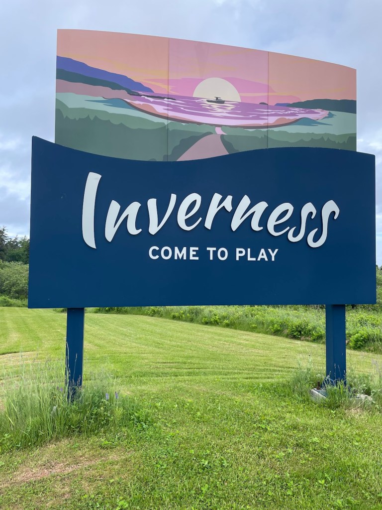
However, two days ago I finished walking the Celtic Coastal Trail when I reached Inverness, and I wrote a post for that – but I tried to finish it in my tent and fell asleep. So here it is two days later.
*****
Inverness (2 days ago when I wrote this). I finished walking the Celtic Shore Coastal Trail.

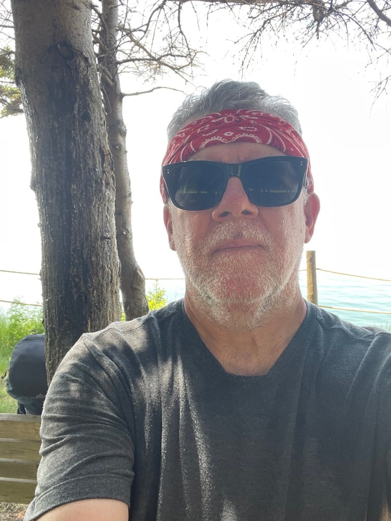
And to be perfectly honest, I am sitting in the laundry room of the Inverness Beach Village Campground waiting for my stuff to dry and taking advantage of a spot where there are no black flies, but there is power to charge my phone and a wifi connection.
Oh oh, mild panic – in sorting through my laundry as I was putting it into the washer, I realized I was missing a T-shirt. Thinking back, I recalled that it was the one I’d worn that day. I mentally retraced my day step by step – put on T-shirt and a long sleeve over that, start walking, get hot, take off T-shirt and just wear long sleeve to keep bugs off, stuff T-shirt into water bottle pocket of pack, keep walking, stop for lunch, drink water, move T-shirt to front pocket of pack, walk to Inverness, stop and get groceries, walk to campground, set up, gather laundry – aha where did it go missing? I didn’t want to walk 9-10 km back to Lake Ainslie where I had had lunch – the last place I knew I’d had it. Alas, poor T-shirt, I’ll miss you. But oh yeah, I had the rain cover on my pack after lunch so it couldn’t have fallen out there. Where did I take off the rain cover? Bingo – the grocery store. Ergo, it must be somewhere between the grocery store and campground. That’s only about 1.5 km back – so, finish laundry, put boots back on, walk back to grocery store, et voila!, my T-shirt, lying forlornly in a heap in the parking lot, apparently untouched. So lesson learned, don’t stuff loose clothes into a loose front pocket of your pack.
Sorry for that digression.
To get here, I started in Port Hastings and followed the trail from KM 0,

up along the west coast of Cape Breton Island, passing through Troy, Judique, Port Hood,

Glencoe Station, Mabou,

Glendyer, and on to Inverness.
It took me 4 days to walk the 89 km of the trail, and the first day especially was sweltering. There was a breeze off the water that day so while I was feeling the heat, it wasn’t as bad as it might have been.
However at Long Point I left the trail to walk to the accommodation I had booked, which was off a side road about 4.5 km inland, and once I got away from the ocean breeze I started to bake. It didn’t help that the Old Chisholm Mill Road that the map said was there

was invisible from the highway –
I spent 20 steamy minutes looking for it before giving up. I ended up backtracking a km or so, and taking another road that eventually did get me to the right one where the house was.
And by then I was low on energy, low on water, low on patience, and just plain out of gas. It didn’t help that the road kept rising, and rising, and rising. I’d stagger up a low hill, turn a corner, and rise some more. I was gasping for breath by the time the place came into sight. Reaching it, fumbling the lock code 3 times (natch) and falling inside, I was opened the fridge to find several litres of ice water. It took about 6 glasses to cool me off and rehydrate me. I slept very well that night.
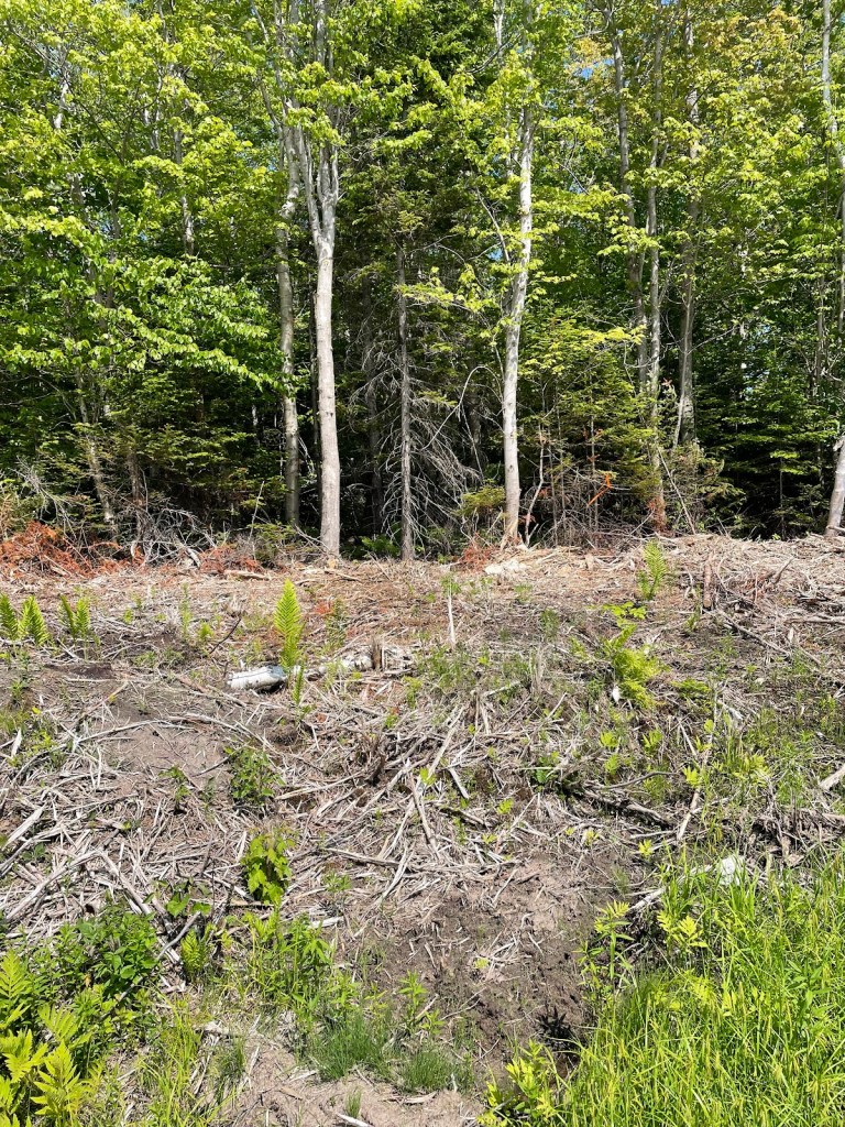
And after that things picked up. The weather cooled a bit, and it even rained a bit. Port Hood had a nice little restaurant where I had dinner, Mabou had the famous Red Shoe pub, and the trail scenery was low key but interesting,

I even had a few chats with people along the Trail. There was a family from New Jersey touring Nova Scotia whom I met on the bikes they’d rented to ride from Mabou to Port Hood – “You’re walking to Cape North? We were there – I can send you the pics and save you the trip”.
Or the retired coast guard serviceman who told me about Cape North, saying that the Money Pit Road that I intend to follow is passable for 4-wheel drive vehicles but is so steep that they have to stop every few km to let the oil in the engines drain back to the right parts to avoid overheating – good to know it’s passable because the satellite pics aren’t encouraging, but oh man that sounds like a tough walk.
And finally, a lovely chat with two women out walking a dog near Mabou, one of whom had the lilt in her voice and the twinkle in her eye of Catherine O’Hara.
*****
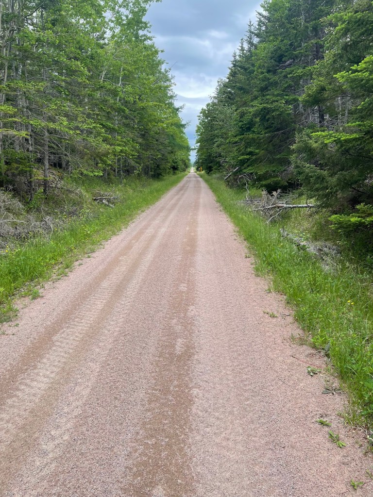
Oh, and I have to say a big thank you to all the trail volunteers who help to maintain it. It was the best walking trail I’ve been on in Nova Scotia.
The surface, other than a short bit between Port Hood and Mabou that had been a bit ATV’ed, is level firm gravel with hardly a rut or pot hole.
And there are a decent number of benches and picnic tables scattered along the trail,

the interpretive and directional signage is great,
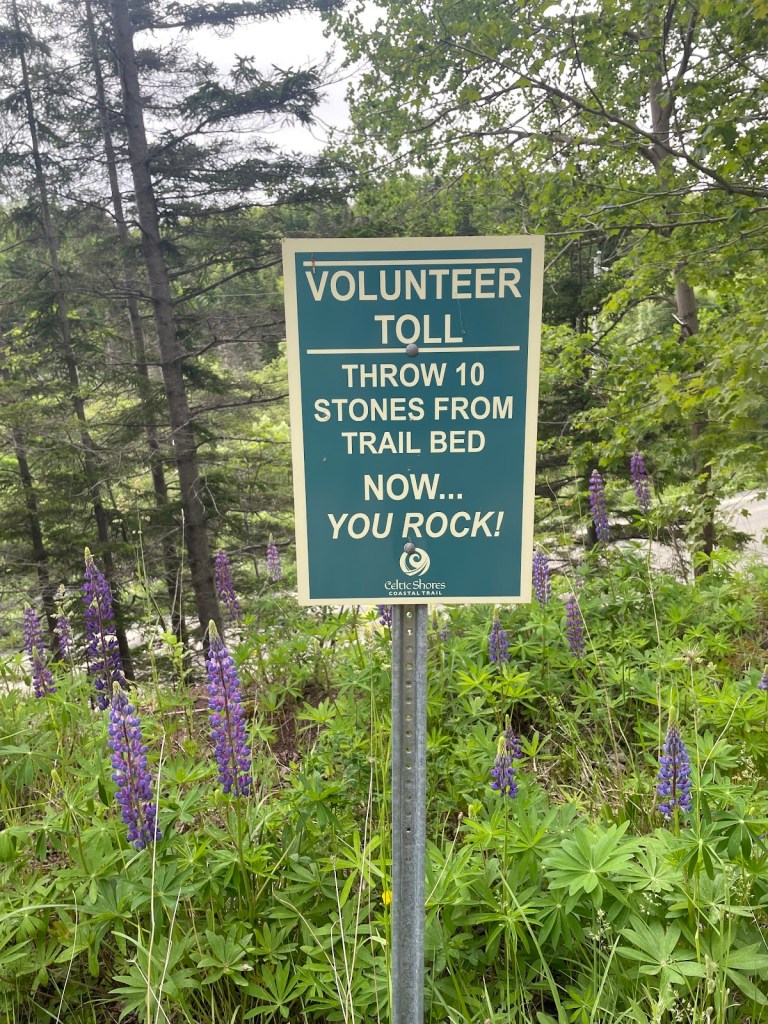
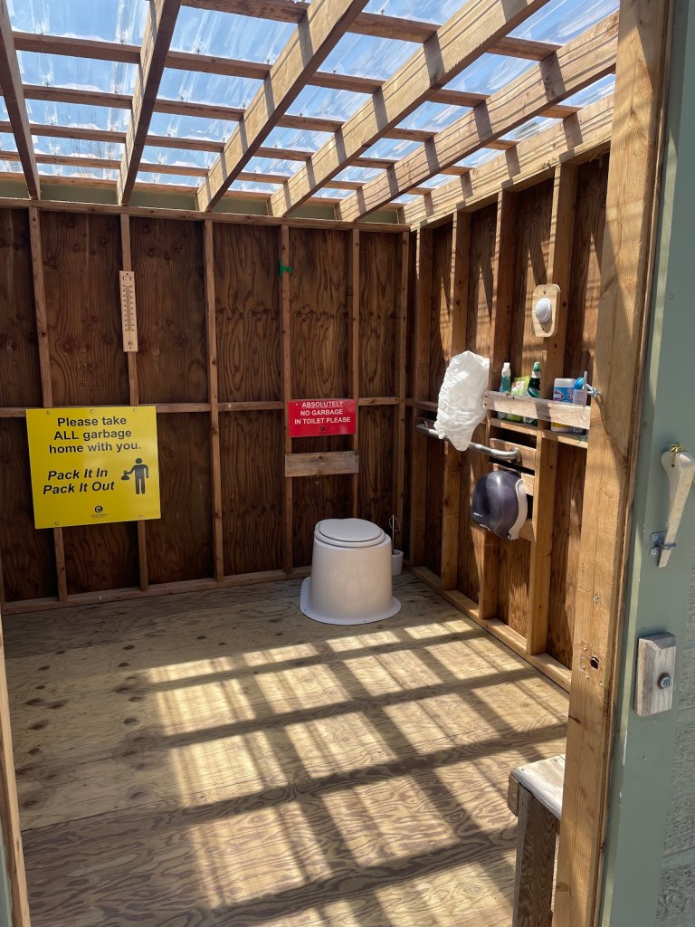
and the washrooms are spotless.
Well done to all involved.
Sleeps and Eats
Well, it was going to be 3 camps and a motel, but it’s turned out to be 2 motels, an AirBnB, and a camp.
The weather forecast for the 2 nights after I left Port Hastings called for lots of rain, so I decided that discretion was the better part of valour and booked the roofed accommodations. And of course then it didn’t really rain enough to justify that.
But the Hebridean Motel in Port Hood was good, and so was the Ceilidh Trail Motel in Mabou, both simple, clean, efficient places with friendly staff. And the AirBnB was a nice place, super quiet as it was set back in the woods – I just wish it wasn’t an uphill walk to get there.
This campground I’m in, the Inverness Beach Village, is pretty good too, although I have to say I am getting a bit tired of private campgrounds putting the RVs on the ocean and the tents at the back, which usually means next to the highway. But the washrooms are squeaky clean and the wifi reaches my tent.
As for eats, the Clove Hitch Bistro and Bar in Port Hood was fine – friendly service, generous wine pours, and decent fish and chips. But I really enjoyed the Red Shoe in Mabou. The two musicians playing when I went in immediately transported me to Ireland, and the veggie pasta was the healthy, tasty, and filling option I needed.
Stories
Hmm, I think I have told my stories already – losing my shirt (literally rather than figuratively in a card game), losing a road, dying of heat exhaustion.
But a couple of little stories stand out.
*****
I was sitting on a bench overlooking the water, around Judique. It was very calm, just a light shimmer offshore, and inshore a patch of ripples. And in that patch, a head appeared – too big at that distance to be a seal, it must have been a pilot whale. I sat enchanted for about 5 minutes, as it surfaced several times in that patch of ripples, which must have been a school of mackerel which was providing its lunch.
And then he dived – I say “he” but I can’t tell the difference – and moved off somewhere else. And I sat for a bit longer, and I moved off too. We all have our paths to follow.
*****
As I walked into Inverness, I noticed a lilac bush in full perfumed bloom. Thinking back, the lilacs were just coming on in Barrington in mid-May, and then filling the air with wafts of scent in Halifax in early June as I passed through. I think I am walking this journey at the speed of lilacs.
Where next?
From Inverness, it’s back to road-walking, up the coast to Whale Cove, Margaree Harbour, Grand Étang, and on to Cheticamp. That’s the gateway to the Cape Breton Highlands National Park, and the climbing challenge starts there – I will have several days where the vertical distance climbed will be over 500m, compared to the 50-150m range I have had so far.
Route
Here’s the original plan. I have more or less followed it as written until part way through Step 9, where I had to move off the trail, skip steps 10-13, and just followed the road from East Chester and through Halifax (step 14).
This latest bit has seen me start at Step 24. After that, it’s still more or less the plan as described, although my replanning has meant that I can’t do the Skyline Trail in Step 27 and I couldn’t get a campsite booking for Fishing Cove so no step 28. But otherwise it’s like this.
Start atThe Hawk on Cape Sable Island, and follow coastal roads to reach Barrington Passage.Pick up the Shelburne County Rail trail and follow it to Clyde RiverThen walk along the tedious Highway 103 toShelburneWhere you’ll get back onto the rail trail to walk toLockeportAnd then from Lockport, continue following the rail trail through and past theTidney River Wildernessarea to reach Highway 3 atSummerville.Where you continue on the highway for a bit and then get back onto the rail trail to reachLiverpoolAnd then continue on the rail trail up to around Port Medway, before exiting onto Route 331, the Lighthouse Route coastal road, to walk all the way toLeHave.From LeHave, take the ferry over the river and walk toLunenburgon the local back roads, and thenFrom Lunenburg, take theRum Runners Trailthrough Mahone Bay, past Chester, and on past Hubbards to Upper Tantallon, and thenDetour south onto the Joshua Slocum Trail to reach old dirt roads through Five Bridges Wilderness Area to reach Glen Margaret, where youPick up Route 333, the Peggy’s Cove Road, to walk down to thelighthouse, and then bear east towards Prospect to connect withThe Old Halifax road which takes you north back to Glen MargaretWhere you connect onto the old St. Margaret’s Bay Road to walk east to HalifaxAnd then walk through the city to the ferry terminal.There you catch the ferry over to Woodside in DartmouthTo reach theShearwater Flyerrail trail, which takes you northeast to LawrencetownWhere you follow back roads to Porters Lake and then onto Highway 7 to reach Chezzetcook,And then keep following Highway 7, pastMusquodoboit, Jeddore, Ship Harbour, Spry Bay,Sheet Harbour, Moosehead, Ecum Secum, and Liscombe, all the way to Sherbrooke.Where you turn onto Route 211 and follow the coast road northeast to Isaacs Harbour, and thenBranch onto Route 316 and follow that toLarry’s River.At Larry’s River, you follow (natch), Larry’s River Road north to reach Highway 16 outsideGuysborough,And Highway 16 takes you to Boylston where you get onto Route 344, whichBears northeast and then north and then west, around the coast to Aulds Cove, where theTransCanada Highway Canso Causewayclambers across to Cape Breton Island.You feet fall onto theCeltic Shore Coastal Trail, and follow that all the way toInverness.- From Inverness, follow Highway 19 to Dunvegan and then branch onto Route 219 along the coast to Margaree Harbour.
- Pick up Highway 30 and follow that to Cheticamp, and Grand Etang where you’ll enter Cape Breton Highlands National Park.
- Follow hiking trails, including the Skyline Trail, northwards before rejoining Highway 30 again.
- Continue along that north until you reach Fishing Cove, and detour there down hiking trails to the water.
- Retrace your steps back to Highway 30 (the Cabot Trail) and follow it north to Pleasant Bay
- Turn the corner and follow the Cabot Trail east, up across the island past Big Intervale and Sunrise to reach the hamlet of Cape North (not the actual Cape North, just yet).
- Turn onto the Bay Saint Lawrence Road and follow that to Bay Saint Lawrence.
- Follow the Money Point Road to reach your goal, the lighthouse at Cape North!
- Walk back to Bay Saint Lawrence and meet your darling wife who will drive you to Baddeck for a well-earned rest
If all goes well, I’ll finish in early July 2023. More blog posts to follow, of course.
Like what you read? Buy me a coffee. Your donation helps offset the costs of maintaining this blog.
