Between mid-May to late June 2024, I will be walking along the SW coast of Ireland, taking in the Kerry Way, the Dingle Way, the North Kerry Way, and parts of the Burren Way in Clare and the Western Way in Galway. This is the story of part of that journey.
A big thank you to everyone who has bought me a coffee over the past year. The Buy Me a Coffee service allows patrons like you to fund writers like me, to cover things like the costs of running this blog, new shoes and gear, and journeys like this. If that sounds like a worthy idea to you, then go ahead – keep buying me coffees.
Where Am I?
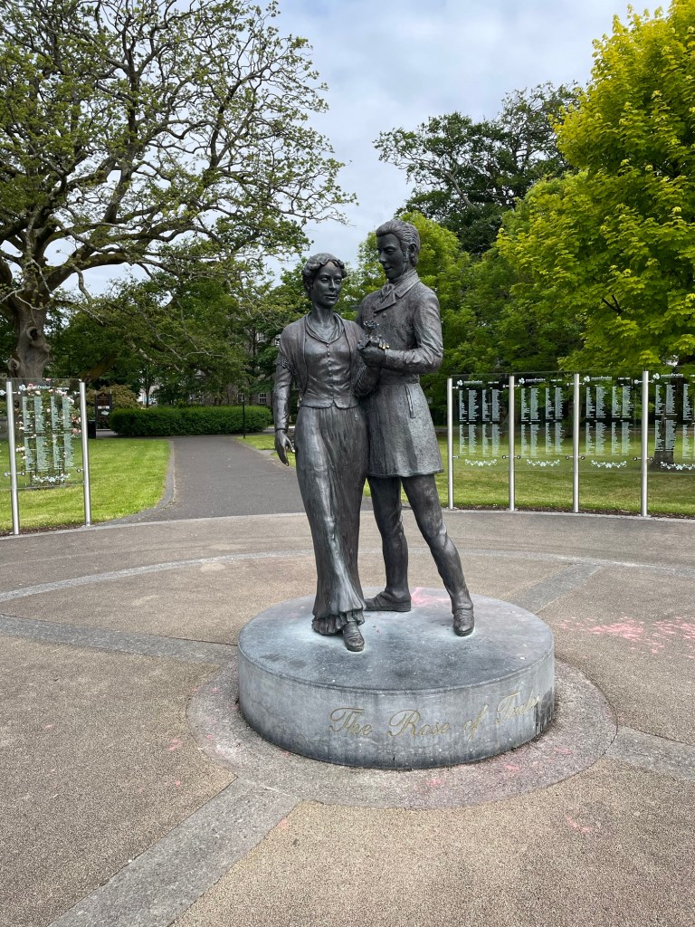
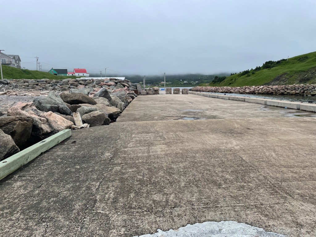
In Tralee, taking a break before starting the second half of my journey.
The Rose of Tralee statue
I got here by walking about 500 km over 3 weeks, starting in Killarney, and walking –
more or less the whole 220+ km of the Kerry Way
with a detour between Waterville and Cahersiveen to take in the Cliffs of Kerry, Portmagee, and Valentia Island
plus a road walk between Killarney and Camp on the Dingle Peninsula to get onto the Dingle Way
and then the 200 km or so of the Dingle Way which finishes in Tralee
from which I finished my first half with a 26 km section of the North Kerry Way up to Ballyheigue
There’s much to tell about those sections, probably in some future posts. In the meantime, here are a few stories and pics from my journey so far.
Stories and Pictures Along The Way
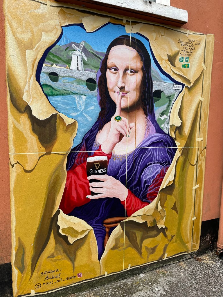
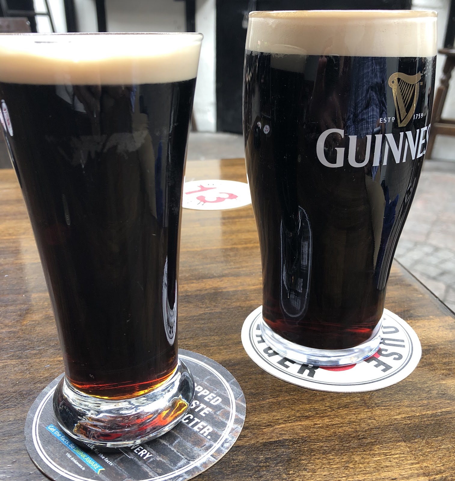
I’ve noticed in some of the towns I’ve been in that some of the pubs have gone all out to come up with creative Guinness art. Here are a few of the ones I saw just wandering here in Tralee.
*****
The beaches in Ireland are an under-appreciated attraction. The Dingle Way in particular includes about 20 km of beach walking. Unfortunately for me, about 15 km of those came on a day when the wind was lashing and the rain was off and on, always hard in my face. Attempting to wear a rain poncho in those conditions was futile, so I was soaked and chilled by the end of the day.
And yet the scenery, the pounding surf, the salt spray tang in my nostrils – it was exhilarating. Exhausting too.
*****
It was around mid-day, after leaving Kenmare. I was up on a hillside following a dirt lane, and turned a corner near an old farmhouse. The scent of a turf fire wafted faintly, and instantly my mind jumped 300 km northwards – memories of sitting round the kitchen at the Doherty family farm outside Donegal town, next to a warm turf stove, trying to decipher Charles’ story through his Irish accent, drinking tea and laughing, laughing.
*****
And speaking of accents, I was walking down a wee road, and as I was going down a man was coming up, on the same side of the road as me. We approached, and he didn’t move, so I stepped aside as he said “Good morning, and how do you do?” in such a musical faith-and-begorrah south Kerry accent that I almost burst out laughing.
I nodded politely instead, and continued on, and only later realized that I had been on the left side of the road, and he was correctly walking on the right, hence our collision course. His polite question was his way of inquiring as to whether I was the addled foreigner that I appeared to be, and a reminder to me that in Ireland one walks on the right side of the road to face oncoming traffic.
*****
Trail food for me has been a combination of ready made things picked up in shops, mostly sandwiches, as well as things I can heat up with minimal cooking. Instant rice mixed with tinned fish is a staple. It isn’t the most flavoursome meal but it fills you up and is relatively healthy.
But when in a town, I’ll eat at local cafes and pubs. Favourite meals so far have included the fish and chips at the South Pole Inn in Anascaul, the pizza at Tango Street Food in Killarney, and the grilled local fish that I had at Pisces Restaurant in Castlegregory.
And of course, it’s Ireland, I wouldn’t be exploring if I didn’t sample the pubs along the way. I do like a pint of Guinness, so that’s been my beverage of choice when in a pub.
Probably my favourite pub and pint was at O’Connor’s Bar in Cloghane – it had been a rainy blustery day, and was still a rainy evening, cold to boot, and I was tired and cranky.
I walked into a properly old-fashioned place, cobwebby wooden beams overhead and dusty flagstones on the floor, with a bar propped up by regulars and the requisite loud American, a turf fire smoldering away.
That pint was delicious. I spent 2 hours eavesdropping on the conversations going on all around me
“that bloke is creepy, look at him leering”
“who’s that?” – referring to a movie playing on a telly in the corner – “Sean Connery”; “who’s Sean Connery?”
“What if we buy a round for everyone in the bar and put it on the musicians tab”
and listening to a young guy playing the piano and singing songs like Raglan Road. There was the Celtic magic I’d been searching for. Sláinte.
*****
And it wouldn’t be Ireland without tea. One of the toughest parts of the Kerry Way for me was the section between Glencar and the Black Valley. This had two steep climbs in it, and by the time I had huffed and puffed up the second one, I was gasping and hungry.
So I paused at the top, got out my cooking gear, and made myself a cup of tea – cure’s everything, as Ann’s gran used to say.
*****
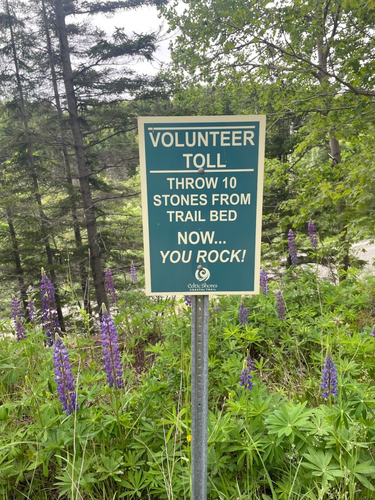
In walking the Kerry Way , and then the Dingle Way, I covered two of the three most popular walking trails in Ireland (the other being the Wicklow Way). Even though it’s still early in the tourist season, there were many other walkers with whom I crossed paths.
They come from all over, though I would say that the majority of hikers that I’ve met so far have been from Germany, with Americans a close second. Other accents and languages I’ve overheard include French, Spanish, Icelandic, Irish, English, Australian, Canadian, and Italian.
It’s an international community, and very different from my experience walking in Canada, on the Bruce Trail, the Island Walk, and my Nova Scotia journey last year. The national waymarked trails of Ireland are a treasure, and I’m deeply jealous – I would love it if Canada had such a system of trails dedicated to walkers.
*****
When I reached Camp, after walking in the wind and rain for several hours, I was delighted to find a snug little place called Anne’s Cafe. I went in, grateful to be warm and dry, and ordered a pot of tea and a bite.
I was just sitting down when a young family came in and asked if they could share the table. They had two youngsters, about 5 and 3 years old.
We got chatting, and I explained a bit about the walk I’m on, and they talked about walking the Camino Frances a few years ago.
We were comparing experiences, and I said that one of the things that I had told myself on my previous long walk in Nova Scotia was that I should try to find at least one moment every day when I felt at peace, a place of total calmness.
It occurred to me as I was explaining it, that I hadn’t been consciously doing that on this trip. I had had my Zen moments, but I hadn’t had to say to myself “ok, focus, this is your Zen moment “. I realized that I had simply felt it – absorbed the calm in the moment – without having to prompt myself.
I guess that’s growth. Old dogs and new tricks and all that.
Where to Next?
From Tralee, I’ve changed my route a bit. I think I want to head as directly towards Doolin as I can so that I can spend a bit more time on the Aran Islands, and then in Connemara.
Weather and circumstances may change that, of course, but my time is pretty flexible. As long as I make it to Galway in time to catch a train to Dublin so that I can rejoin Ann, I’m fine. Let’s see where I go.
Like what you read? Buy me a coffee. Your donation helps offset the costs of maintaining this blog.
Between mid-May to late June 2024, I will be walking along the SW coast of Ireland, taking in the Kerry Way, the Dingle Way, the North Kerry Way, and parts of the Burren Way in Clare and the Western Way in Galway. This is the story of part of that journey.
A big thank you to everyone who has bought me a coffee over the past year. The Buy Me a Coffee service allows patrons like you to fund writers like me, to cover things like the costs of running this blog, new shoes and gear, and journeys like this. If that sounds like a worthy idea to you, then go ahead – keep buying me coffees.
Where Am I?
In Waterville, catching up on blog posts.
In Killarney, catching up on blog posts.
In Castlegregory, catching up on blog posts.
*****
My last blog post saw me reaching Kenmare after a scary night and a soggy, sloggy day. But after a good night’s rest, with dried out clothes and gear and a tummy full of a proper Irish vegetarian breakfast (eggs, fried tomato, fried mushrooms, and baked beans, but no rasher or sausage or black pudding, if you must know), I was ready to press rewind and start off on a better foot.
I should explain that I walked the Kerry Way clockwise, starting from Killarney and heading southwest towards Kenmare and then along the south coast of the Iveragh Peninsula to Waterville, turning the corner there and continuing up and around to Cahersiveen and Glenbeigh and so on back along the coast to Killarney.
Most guidebooks for the trail, however, suggest that you walk it counterclockwise, going from Killarney northwest towards Glenbeigh on the north coast of the peninsula and continuing so on round, finishing the trail with the Kenmare to Killarney leg.
My reasoning for the contrarian approach was that the first half of the walk, as I was doing it, would have less climbing and descending than the second half. I reckoned that would mean more time to ease my legs into it.
And so, on the whole, it proved. The trail from Kenmare to Cahersiveen does take you up and down many hills, but the total meters climbed are a bit less than if you went Killarney to Cahersiveen.
But – there’s always a but, isn’t there? – what I found was that the Kenmare to Cahersiveen hills are in general more rocky, muddy, or boggy, so even though you climb a bit less you work harder to do it. At the least, that was my impression but it also rained all day coming out of Kenmare and that didn’t help.
But, but, but … A point in favour of my way of doing it that I realized as I was finishing was that the scenery just gets better and better as you go – the stretch from Cahersiveen to Killarney is wonderful, especially if you get clear days as I did.
If you go in the guidebook direction, then the best scenery is upfront. I’d rather delay the payoff, as it were, but that’s just me.
The first half of the Kerry Way as I walked it, including my detour to the Kerry Cliffs
*****
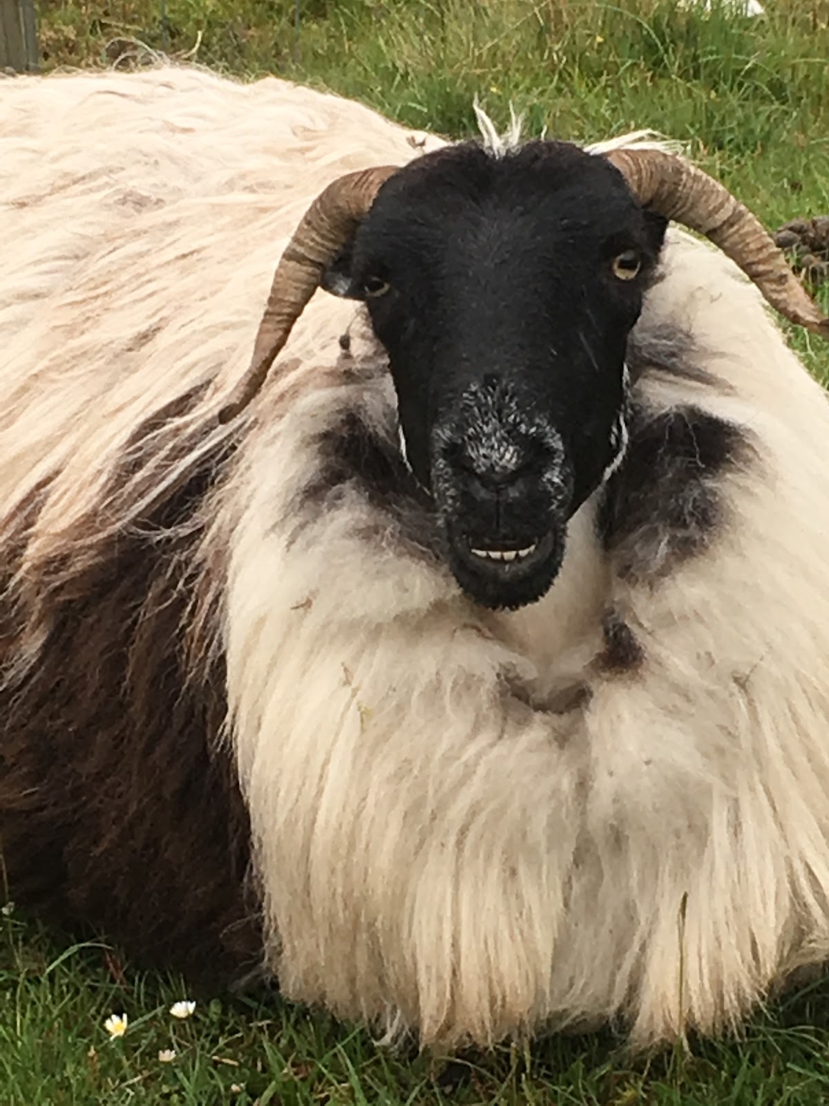
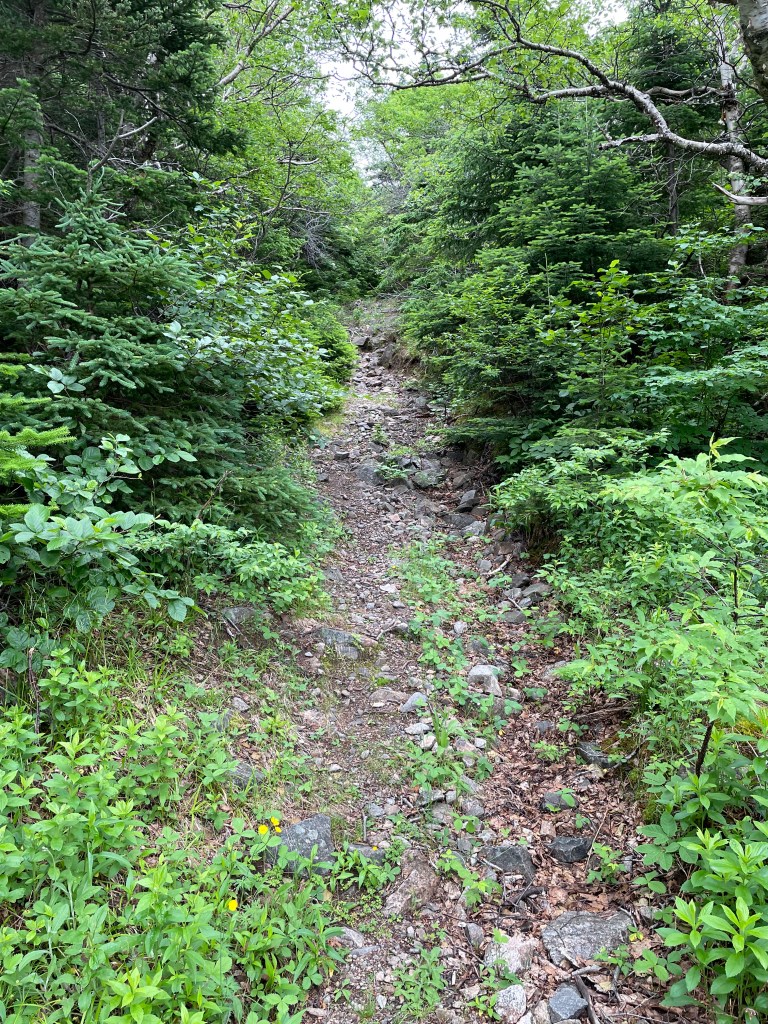
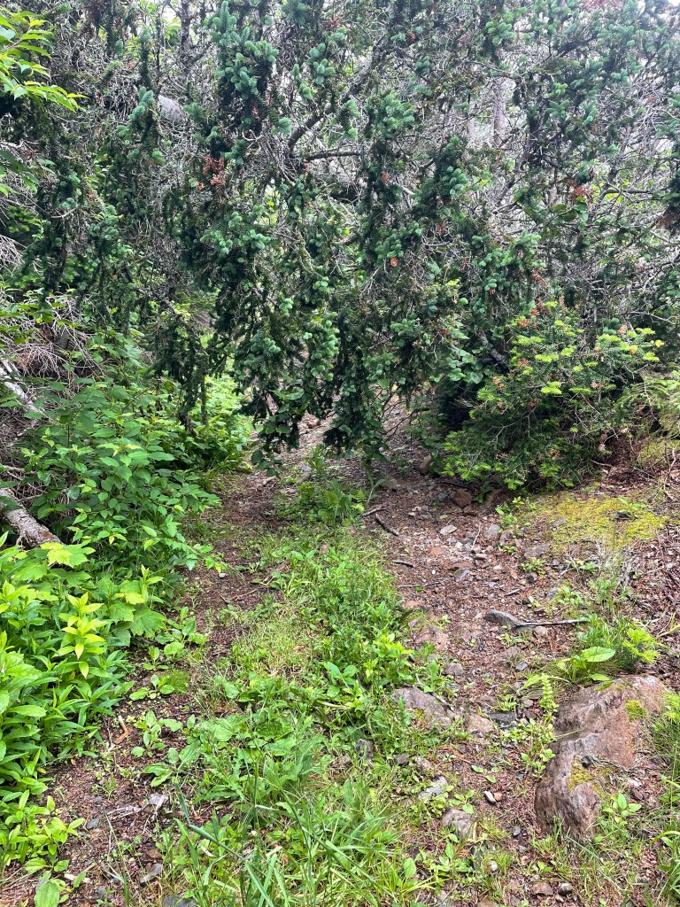
The first day out of Kenmare took me through all the trail conditions I would encounter for the rest of the way – muddy, boggy, rocky, grassy, gravelly, sheep-ploppy, and cow-floppy, with all the combinations thereof. My favourite was a stretch of grassy-muddy-boggy-sheep ploppy-cow floppy conditions that threatened to fill my boots again with mucky water.
It rained more or less all day, sometimes easing off only to come down harder later. I took it in stride, however, happy to be walking after my near-disaster, and made good progress to reach a pretty stretch of the Way right by the shores of Kenmare Bay near Lackeen Point.
I had planned to wild camp in this area but could find nothing level enough, or far enough off the trail, to work, so I kept going and eventually came upon a good spot sheltered by trees near Blackwater Bridge.
It rained all that night, making for a very wet stay, but it was pleasant enough listening to the birds, the plop of rain drops, and the murmur of the Black River nearby.
The next day I set off towards Sneem, relieved to find in the morning that the rain had finally cleared. It was a gently taxing walk, some hills and muck but no real challenges, yet still long enough to bring on an appetite by the time I reached Sneem.
I had lunch at the Village Cafe, just getting in ahead of a bus load of tourists, and sat outside to dry my tent a bit while I had tea and a sandwich. Several tourists stopped to ask where I was walking, was I camping, what was it like, etc. But the locals ignored the tourists, including me.
From Sneem I continued on, intending to camp off the trail in a stretch of forest about halfway to Caherdaniel which, on the map at least, seemed promising. But upon reaching it, I could see that the ground sloped far too much to offer any hope of level ground. Not for the last time, I was forced to keep on walking, down a steep, rocky, slippery hill and on towards Caherdaniel.
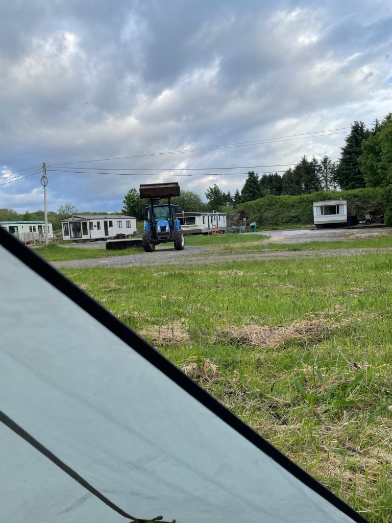
I had thoughts of going on to that town that evening because I knew there were a couple of B&Bs, but with about 5km to go and after about 10 hours of walking, I ran out of energy near the hamlet of Castle Cove. I left the Way there and walked into the town where I eventually found a spot to camp for the night, in a deserted caravan park.
The next morning, I was up early to sunshine and a fresh breeze, which helped me on to Caherdaniel. I’d hoped to find a little cafe which might at least offer tea and perhaps a full breakfast, but there were only a couple of pubs, neither yet open.
Leaving Caherdaniel, the Kerry Way offers two options, one longer but with less climbing along the coast, or the one which I took, shorter but hillier.
The sun was out and the views were lovely as the Way left the rough tracks across hillside sheep pastures behind, and instead followed wee back roads into Waterville.
I reached town in good time and checked into a B&B after two nights of camping, pleased to be able to wash some socks and have a very welcome hot shower, after drinking a lovely cup of tea. A pleasant meal sitting by the seashore rounded out the day.
While sipping my beer that night, I studied the map. From Waterville, I had two choices. Following the Kerry Way involved a 30+ km stretch to reach Cahersiveen that had 860+ meters of climb and descent in it, much of it along the spine of a mountain ridge.
The views would be lovely (assuming clear weather), but there was no chance of camping along there given the exposed slopes, and since I knew I would struggle to do that stretch in a single day, it posed a very tough challenge.
Instead, I opted to follow the coast road out of Waterville towards Ballinskellig, which offered a lovely 2km beach walk,
and then took the Skelligs Ring route on back roads to reach St Finan’s Bay.
After a rest there and a delicious bowl of seafood chowder at the Driftwood Surf Cafe, I continued along the road out of the village towards Portmagee, which took me up a steep switchbacked 250m hill climb,
but cresting the hill offered gorgeous views,
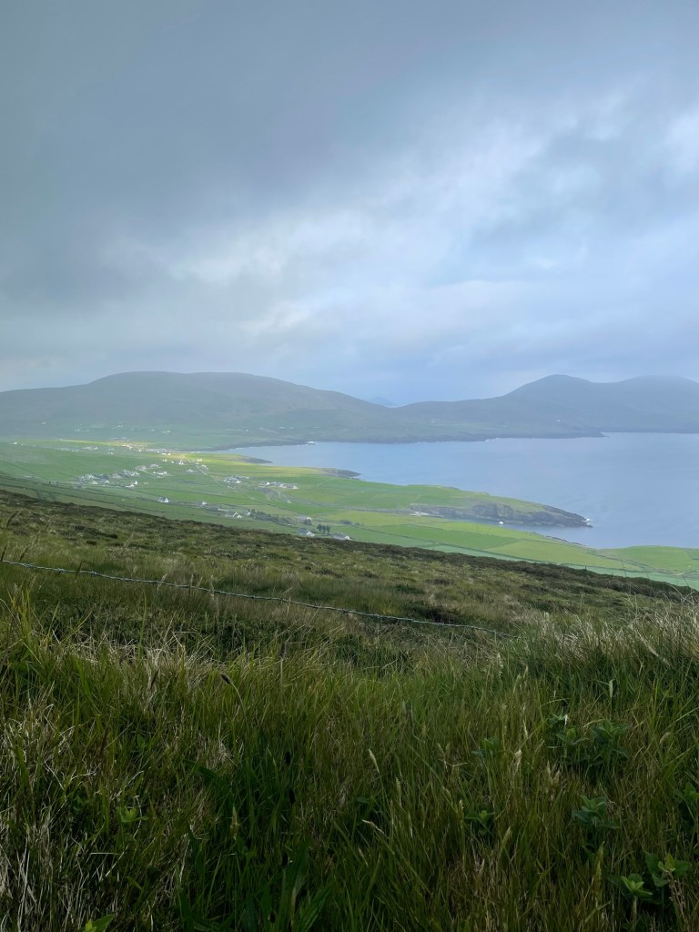
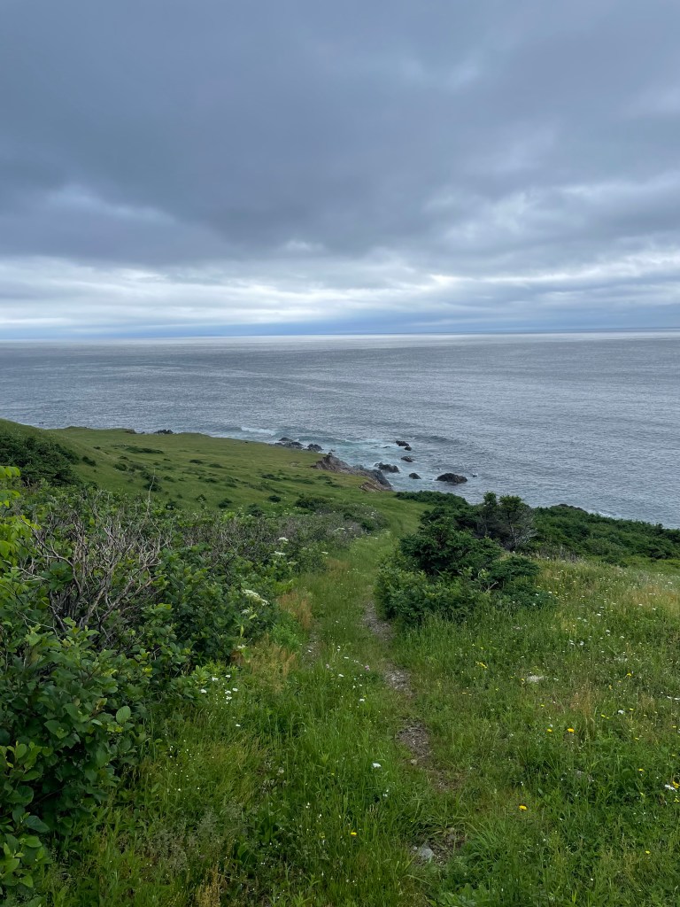
And in coming down from that I reached the Kerry Cliffs.
This privately owned tourist attraction is well situated on rugged coastline offering stupendous views westwards from cliff tops 80 m above the churning sea.
I camped there right up on the cliff tops, nervous about the wind, but snug enough tucked under a turf bank.
The next morning took me down into Portmagee for yet another great Irish vegetarian breakfast and tea. The bridge to Valentia Island beckoned, and I followed back roads along the length of the island to reach the delightful Knightstown, (strangely reminiscent of Cornwall – must have been the palm trees). I recharged there with a very good flat white made by an Irish guy who remarked that the Aussies had nothing to teach him about the art of making coffee.
The ferry ride from Knightstown back to the mainland is short, less than a km, reminiscent in this case of the Lehave River ferry back home in Nova Scotia.
When I stepped off the ferry I had only a short 4 km walk to reach Cahersiveen, arriving early in the afternoon as the sun was coming out.
The Mannix Point campground there was fantastic, the best I’ve stayed in, and I happily lounged about doing some laundry, having a shower, reading, and just relaxing.
The weather was glorious that evening, warm and sunny, and forecast to remain so for a couple days. If I hadn’t wanted to see more of the Kerry Way I would have stayed there for a bit.
But the trail tugged at me, as it always does.
Stories Along The Way
Walking out of Kenmare, it was dry(ish) but there was rain in the air. I hadn’t gotten more than about a km up the hill when the first drops confirmed my intuition.
I pulled out my rain poncho, which I hadn’t worn the day during my soaked walk into Kenmare, since I was already wet to the skin by the time I had a chance to put it on.
It took a minute to figure out how to get it on over me and over my backpack – the trick, I realized, was to stand facing the wind and let the breeze carry it up and over my shoulders and then quickly spin around as I pulled it down so the wind held it against my back.
I had it settled after a bit of wrestling, and continued up the hill. I wore it the rest of the day, congratulating myself on my choice of rain gear since it was much lighter in weight than my previous rain jacket but at the same time allowed more ventilation, especially when worn with shorts.
As I walked I thought that the clever hiker would have a spare boot lace (I did!) and a carabiner or two (I did again!!) and could use those to fashion a simple belt to hold the bottom of the poncho down against any strong gusts.
And then I thought the really, really clever hiker would have had the idea before he put the poncho on and had the belt ready in a convenient pocket. Oh well.
*****
I must confess that I did try to put the poncho on during that wild Monday morning. But the best method I can see for donning a rain poncho in a gale is:
Get out poncho
Spend 5 minutes attempting to don it while the wind swirls it in all directions threatening to alternately smother you and blind you (cursing is optional during this step)
Give up and resign yourself to getting wet
*****
When I reached Cahersiveen, I was pleased to see that there were laundry facilities at the campground I was in. I wanted to wash everything that I could, including my sleep clothes, which meant that the only remaining clothes that I had to wear were a T-shirt and a pair of underwear.
So I improvised. I tossed everything into the machine, and waited for it to finish wearing my windbreaker as a kilt.
Very fashionable amongst the hiking set, I’m told.
*****
Walking from Caherdaniel to Waterville, I was passing along a nice stretch of the trail, facing a charming blue sea set off by the green of the hills sloping down towards it.
This was one of those spots where a bench had been placed, and I took advantage to sit for a few minutes and have a sip of water.
I was minding my own business when I noticed another hiker coming towards me. She also noticed the bench and made for it. I waited, not wanting to seem rude, as if I was getting up to avoid her.
She sat down and we struck up a conversation. She was German, and perhaps (though a gentleman never speculates about a lady’s age) of about my vintage. We remarked on the trail and the scenery and the weather, and then she said, looking at the shorts I was wearing, “that is a good idea, it is getting warm now”.
And she reached down to unzip the legs off her trousers – they converted into shorts you see – and pulled off one leg and then the other to reveal, ahem, rather shapely legs.
I looked away, not to seem as if I was leering, and coughed and excused myself and headed on my way.
And later I thought, that was like that scene in The Graduate. She was Mrs Robinson, so I must be Benjamin. And she did kind of look like Anne Bancroft. Hey, maybe I’ve still got it. It’s that #hikerDude mystique. Gotta be …
I walked off humming the Simon and Garfunkel hit song from that movie.
When I reached Castle Cove, I passed by a pub and restaurant that had a big Accommodations sign out front. I went in and was through a seemingly deserted interior, calling out Hello. Eventually a woman came out of the back, and replied to my inquiry that they weren’t doing accommodation just then.
I asked if I could set up my tent in their garden, since there appeared to be about a half acre of grass there. “No”, she said. Just that. Hmm, ok. “Do you know of anywhere nearby where I can camp?”. “Right down the road, just go down to the main road, turn right and cross the bridge, and it’s the first entrance, there’s a campground there.”
So I thanked her and went next door, into was not a campground so much as a caravan park, and a deserted one at that. I walked round the place, not a soul in sight, no cars, nothing to indicate that any of the units were occupied. And there was no office either, just a big sign that said “You are under CCTV Surveillance “.
I returned to the pub and knocked, and reported my findings. Can I camp there? It’s not a campground, there’s no one round to ask, and the sign says No Trespassing. And there’s no water outlets anywhere.
“Yes”, she said, “it’s fine. Just set up on any patch of grass and you’ll be ok”. Hmm, alright, “can you please fill my water container then”. She grudgingly did so, and turned away, obviously dismissing me.
I walked back, and wandered around some more, finally settling on a relatively secluded spot that wasn’t too obvious from the road. As I started to set up my tent I realized I had forgotten my trekking poles back at the pub. Trudge over, trudge back. Finally my tent is set up.
I groan as I take off my boots and crawl in, arrange my gear, break out my cooking gear, and start to boil water for my meal. I just get dinner ready when …
Wait for it …
A large tractor pulls into the park and starts cutting the grass.
It’s roaring away and slowly getting closer to where I am set up. The driver eventually sees me. I think about going out to tell him that the lady next door said I could camp here. To hell with it, I think. I’m tired, I’m damned if I’m moving my tent at this point, and I just want him to finish so I can go to bed.
He eventually does all the grass that he can except for my patch, coming within about 10m of me. He gives me one last look, and heads off. I can see him on his phone as he drives away.
I go to bed expecting the Garda to show up in the dark to haul me off for trespassing. But there’s no further disturbance, except for the squawks of angry crows. Céad míle fáilte my arse.
Where to Next?
From Cahersiveen, I walked the second half (my version that is) of the Kerry Way to return to Killarney. More on that later.
Like what you read? Buy me a coffee. Your donation helps offset the costs of maintaining this blog.
Between mid-May to late June 2024, I will be walking along the SW coast of Ireland, taking in the Kerry Way, the Dingle Way, the North Kerry Way, and parts of the Burren Way in Clare and the Western Way in Galway. This is the story of part of that journey.
A big thank you to everyone who has bought me a coffee over the past year. The Buy Me a Coffee service allows patrons like you to fund writers like me, to cover things like the costs of running this blog, new shoes and gear, and journeys like this. If that sounds like a worthy idea to you, then go ahead – keep buying me coffees.
*****
Where Am I?
In Killarney, at a B&B, catching up on blog writing.
I arrived in Kenmare by taking the train from Dublin to Killarney, getting in at about 1:30. The train ride was fine, not a ton of scenery, but quiet so I was able to read for a bit.
As soon as I stepped off the train, my feet were itching to go. But I had to visit a grocery store first for dinner that night, and some food for the next day. The local Tesco’s had a good selection of simple healthy hiker foods so I stocked up. But in a foretaste of things to come, I realized later that I had lost one of the rubber tips for my hiking poles.
After finally setting off, I was quickly at and then past the official start of the Kerry Way near the Killarney Tourist Office, opposite Killarney House.
I sailed along the path beside the busy roadway, with Sunday tourists out in force on a nice day.
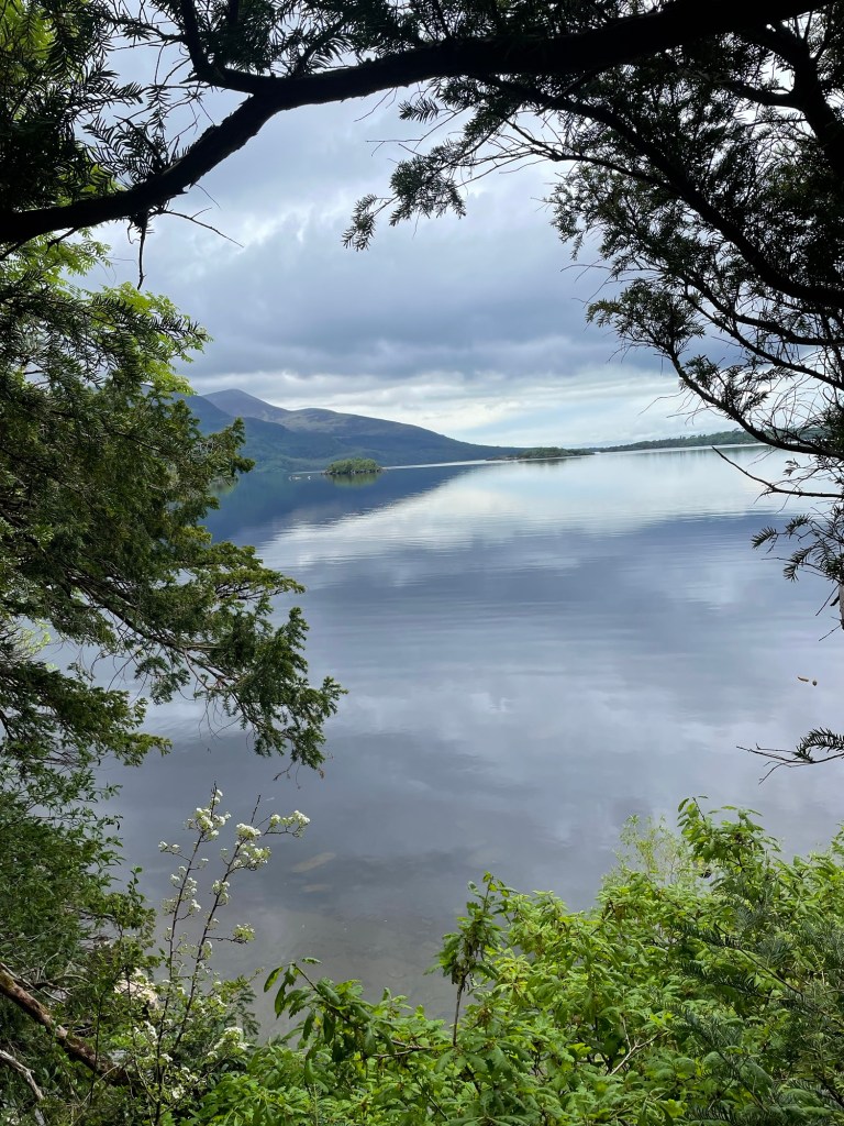
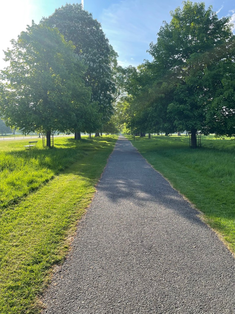
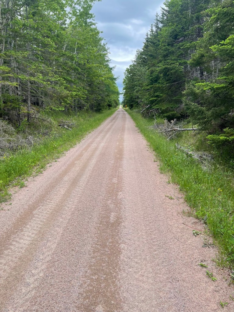
It’s about a 4 km walk to reach the entrance to Killarney National Park, through which the trail traverses. Soon I was staring at stunning views over Mucross Lake towards the hills.
After a quick but much-needed pit stop at one of the Park’s conveniences (a thousand flowers of blessing upon the inventor of the toilet), I joined a steady stream of day hikers climbing the path to the Torc Waterfall. It’s beautiful, I assume, though I couldn’t see it as it was meant to be, unadorned with selfie grabbers.
The climb up past the waterfall is steep, about 100m in total, but after that I was out past the last of the day trippers and onto the trail proper.
I walked at a good pace on fresh legs and feet, anxious to find a camping spot. I’d spent more time than I had planned to get to this point. It was past 5 pm as I approached the edge of the forested area. My original thought had been to camp just inside these woods, near the Owengarrif River, which on satellite pics looked doable.
In practice however the ground was too uneven, a foretaste of what I was to encounter along much of the trail – the right combination of sheltered, level, dry, and off the trail was elusive much of the way, as I was to find.
But I did settle on a spot after searching a bit, an old sheep pasture with a lovely view, and set up camp there for the night.
After an eventful night (more on that later), I woke to rain and slogged the next day, soaked and grumpy, into Kenmare.
A hot Irish breakfast and strong pot of tea did wonders, reviving me enough to find a nice B&B that was right beside the trail just outside of town, and I checked in there to change out of and dry my sopping clothes. The first 2 nights had given me a wet intro to my journey.
Stories Along The Way
As I have learned on my travels in the past, trail angels come in all forms. The first on this journey was Fionnulla, at the Kenmare B&B, who let me put my wet boots, pack, and socks in the boiler room to dry out, and took my wet sweat pants and threw them in the dryer. Between that, and judicious use of the hair dryer, I had all my stuff dried off ready for the next day.
*****
Right near the start of my journey, about 2 km out of Killarney, I met Chris, a Kerry Way thru hiker who was just finishing. As we sized up each other, I realized he and I were pretty similar – same build, same age, same #HikerDude fashion sense, even similar Osprey packs.
We chatted for a bit, and he remarked about how wonderful the trail is. “You’ll love it”, he said. I walked away feeling pretty good about myself – if he was about my age and had just solo walked it, then it should be no problem. Right?
*****
As I said, I had an eventful first night, on my seemingly lovely bit of sheep pasture.
By the time I had set up my tent, made dinner, and climbed into bed, it was about 8 pm. The skies were clear and there was no wind to speak of. Still, I had made sure to place two bracing guy lines on the tent plus added two extra side pegs. I drifted off to sleep thinking, “I should be ok”.
I woke up at about 10:30 to the sound of rain against the tent, driven by moderate winds. I fell back asleep, only to be awakened at about 3:30 am by the side of the tent slapping my face. The wind had picked up tremendously, and the whole thing was shaking. I reached out and checked the corners from the inside – all seemed secure so far.
After that, I just lay awake, weighing up my options. The tent was taking a pounding but it was holding, in part because my weight lying on the tent floor was helping to provide stability. It was still dark at 4, and at 4:30, and finally a predawn twilight crept in around 5. I could see that things were holding, but the wind wasn’t just refusing to ease, it was getting fiercer, as was the lashing rain.
I was tempted to make a run for the trail, about 200 meters up the sloped pasture, but packing up my gear and taking down the tent in that gale was foolish. Better to wait it out.
Suddenly, a corner peg let go, followed by one on the side holding the vestibule. I snatched a couple of spare pegs from my pack and stretched out on the wet ground to grab the snapping fabric, jabbing the corner peg in as best I could, and wrestling with a flapping peg strap to get the other one in. But that held for just a minute or two and then it was loose again and crackling wildly, like a blown out sail in a gale.
It was clear that I couldn’t hold the tent down with my hands from the inside, the wind kept tearing it from my grip. I risked losing it altogether if another peg went, so I decided to make a run for it. I turned from madly stuffing my gear into the pack to see that one of my trekking poles, which is used to support the tent, had come loose from the grommet which should have held it and had punctured the tent fabric.
Yanking out the trekking pole while trying not to tear things further, rolling on the wet ground out of the tent dragging my pack, and simultaneously trying to hold onto the tent fabric, was a slow motion nightmare. Somehow I gathered up the sopping fabric and stuffed it into the pack, trying to count the pegs as I pulled them out.
I was missing 3 but thought myself lucky it wasn’t worse. As it was I had to stumble across the uneven ground in untied boots to catch my pack cover before the gale whipped it off into the gloom.
Then came a slipping, sliding, soaking climb back up to the trail, more panic-driven than I want to admit. I couldn’t find the spot in the stone wall around the pasture that led out the way I’d come down, so I searched frantically for a path through thickets of prickly gorse, sloshing through boggy puddles which filled my boots to the brim with muddy water.
At one point I took a wrong step into a hole and lost my balance, falling face first into the muck. “Slow down and think!” I struggled back to my feet, checked make sure both boots were still on, and kept moving upwards, panting through grasping gorse and snagging brambles, at last nearly falling to the ground when I finally reached the trail.
Taking a deep breath – “slow down dummy!” – helped me to regroup. I realized I was still wearing my sleep pants, just cheap cotton sweats, and they were soaked. My light windbreaker was saturated and my clothes underneath were wet to the skin. I couldn’t change clothes there, but I could and did empty a pool of water from each boot before lacing them up properly.
And since there was no way I was crawling back to Killarney with my tail between my legs, I turned towards Kenmare, slipping and sloshing with each step. Finally, about a km or two later, I found a semi-sheltered spot where I could take a breather, eat something, change out of my wet sweats into my hiking pants, take off my socks and wring them out, and generally get a grip on myself.
After that, I relaxed a bit. I wasn’t in any immediate danger, I was relatively warm even though sopping, and Kenmare was only about 15 km away. I trudged through gradually diminishing rain and winds, until just a misty mizzle remained to ensure I stayed wet all the way into town.
A hard lesson that could have been worse. But I made it through. What would the Trail bring next to test me.
Where to Next?
From Kenmare, I continued to follow the Kerry Way – Blackwater Bridge, Sneem, Waterville, and Cahersiveen were up next.
Between mid-May to late June 2024, I will be walking along the SW coast of Ireland, taking in the Kerry Way, the Dingle Way, the North Kerry Way, and parts of the Burren Way in Clare and the Western Way in Galway. This is the story of part of that journey.
A big thank you to everyone who has bought me a coffee over the past year. The Buy Me a Coffee service allows patrons like you to fund writers like me, to cover things like the costs of running this blog, new shoes and gear, and journeys like this. If that sounds like a worthy idea to you, then go ahead – keep buying me coffees.
*****
Where Am I?
On the train from Dublin to Killarney.
I left this morning from Ann’s cousin Mairead’s house in Castleknock outside Dublin, and walked through Phoenix Park to the station, a lovely start to the journey with fine spring weather, birdsong, and green grass and lilac scents.
To get to Mairead’s, I left home a week ago, with Ann, and travelled to Ontario to visit first my family in Leamington, and then Ann’s family in Peterborough. It was great to catch up and see everyone and to celebrate my father-in-law Stan’s 90th birthday, and yet I was mentally counting down the days and then the hours till departure.
My flight out of Toronto Dublin was ok, the usual airport stuff, and the usual lack of sleep on the plane. Mairead collected me at the airport, and after a quick cup of tea and a chat, a nap and a shower revived me in time for an early dinner with her and her daughters. After a pint of the black at the local pub, and a whiskey nightcap, it was an early bedtime and a much needed sleep.
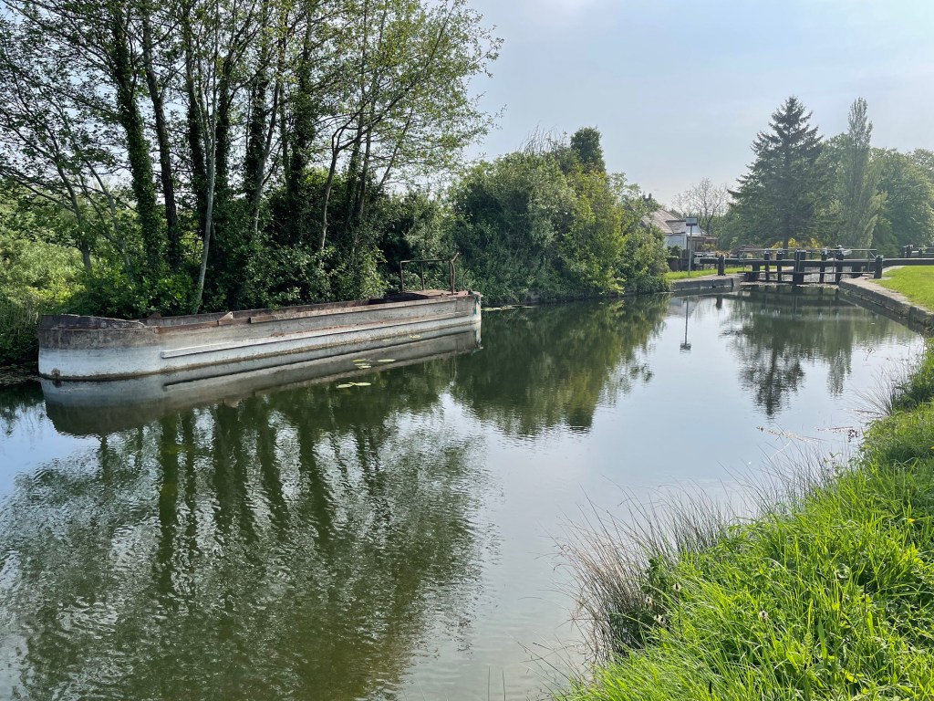
The next day, I walked into Dublin along the Royal Canal, beautiful and peaceful under clear blue-skied sunshine
and meandered in town, picking up a fuel canister for my stove and a few trail snacks. I ate lunch like a tourist off Grafton Street, and savoured a beer. I strolled past St Stephen’s Green, and St Patrick’s Cathedral, and the Guinness Storehouse, and through Phoenix Park, getting back to Castleknock in time for a cup of tea and a shower before dinner.
After some adventures at the Hill of Tara, and a last glass of wine, it was after midnight before getting to sleep. But I woke early, before my alarm, and was coffeed up and ready to go before 8.
And with a quick hug and a thank you, I was off.
Finally.
Stories Along The Way
When we reached Ontario, Ann and I decided to spend the night on our own in Stratford, so we’d have a bit of quiet to ourselves to celebrate my birthday. We had a lovely dinner at a place called Lovage, and the next morning as we were packing up I noticed that I had somehow chipped a tooth, not realizing it at the time.
For the next couple of days, I worried at it, running my tongue over the bicuspid in question, trying to decide if it was bad enough to have fixed before I left. I didn’t have any pain from the tooth, but it nagged at me, and finally when we were in Peterborough 2 days before my departure I decided I should get it fixed.
Since my regular dentist was in Nova Scotia, I called around and found a walk-in dental clinic in Toronto and arranged to go in the afternoon before my flight.
When I got into the chair and explained to the dentist about the tooth, he took a look, took another look, and sat back to ask – “where? I can’t see a chip”.
It was a small one, granted, but it felt obvious to me having had multiple such chips of my too-brittle teeth over the years. He finally picked at it and agreed that if it was bugging me, it was enough of a problem to fix – “We aim to please”, he exclaimed – and without the need for much more than a bit of epoxy filling and some polishing, I was in and out in 15 minutes.
*****
Walking through Phoenix Park on the way to the train station, I glanced over towards the south. The Wicklow Mountains loomed, close to the edge of the city, mist shrouded and mysterious. I had a sudden urge to turn right and walk towards them, throwing out my careful plan, to wander the hills and go where I pleased.
My feet were in auto mode, stride locked in and step by step the urge faded.
But what if ….
*****
The night I arrived in Dublin coincided with an impressive display of the northern lights, which Mairead’s daughter caught on camera and shared with us. Since in Dublin there was too much light pollution to see, the next night, my final one in Dublin, we decided to go out of town to the Hill of Tara, to get a better view of what was to have been another great display.
We reached the hill around 2115, at sunset, to find a jammed car park with the overflow crammed along the side of the narrow road. We found a spot and walked up the hill, exploring a bit whilst waiting for the twilight to fade.
Unfortunately, clouds were moving in, and while the slim crescent moon was a charming sight, we couldn’t see the aurora through the mist. We gave up after an hour and headed back to the car.
By now, the parked cars were lined along the road for several hundred meters, making it a one-lane passage. But as we started down the hill, we came to a car coming up, and behind it 3 more. With nowhere to go but back, Mairead started to slowly inch a hundred meters in the dark, in reverse, and in little spurts and wobbles as she dodged pedestrians, overhanging shrubs, and jutting cars.
We got lucky when a parked car left, putting another downhill soul in front of us and by now several behind us, allowing an uphill soul to park, and giving us the numerical advantage to start down again, now forcing the cars in front of us to reverse themselves.
They slowly inched back as we crept forward, and after 20 stressful minutes, and with a surprising lack of curses from Mairead (I would have been swearing down the gods upon all heads), we finally reached the road back to Dublin.
This is why I walk – no traffic jams for me.
*****
Preparing for this journey has been a long process, probably too long as I endlessly stared at maps and imagined routes and stopping points. Part of my prep has been spent watching YouTube videos made by a number of Irish walkers, in particular Ellie and Carl who have a website and YouTube channel called Tough Soles, and Derek Cullen who has his own adventure website and channel.
These were great sources, showing me the conditions on the trail and pointing out things to see along the way. And I especially liked Derek’s mantra, which he repeats every day: “Feet good, body good, head good, heart good – All good”.
Thank you for your inspiration.
Where to Next?
My train journey ends in Killarney, and about a kilometer from the station is the official start point of the Kerry Way.
I’ll follow that route for the next 10 days, clockwise round the circular route, from Killarney to Kenmare, to Sneem, to Waterville, to Cahersiveen, to Glenbeigh, to Glencoe, to Blackwater, and finally back into Kerry.
I’ll be camping along the way, with a planned first night somewhere off the trail near Killarney National Park, perhaps 8-10 km outside of Killarney. Hope it’s relatively dry.
Like what you read? Buy me a coffee. Your donation helps offset the costs of maintaining this blog.
Between mid-May to late June 2024, I will be walking along the SW coast of Ireland, taking in the Kerry Way, the Dingle Way, the North Kerry Way, and parts of the Burren Way in Clare and the Western Way in Galway. This is the story of part of that journey.
A big thank you to everyone who has bought me a coffee over the past year. The Buy Me a Coffee service allows patrons like you to fund writers like me, to cover things like the costs of running this blog, new shoes and gear, and journeys like this. If that sounds like a worthy idea to you, then go ahead – keep buying me coffees.
*****
So having decided to walk about in Ireland, I went through the gear I took last year in walking about Nova Scotia, and told myself that I needed to pare down the weight. I schlepped the best part of 40 lbs with food, water, stove fuel, plus all the other stuff – tent, sleep system, cooking gear, spare clothes, etc.
It was right at the limit of what I could carry, and knowing that, I made some choices to either leave stuff out for this trip, or replace it with some lighter kit.
So here’s the list of what I am planning to carry. I’m down from about 14 kg (32 lbs) base weight to more like 9 kg (20 lbs), and with Ireland being well supplied with corner shops for food and wee streams for water, I can carry less weight there too. I am hoping that most days I’ll be at about 11 kg (25 lbs), with about 12.5 kg (29 lb) max if I have 2-3 days of food and full water.
*****
Gear
I bought all the gear myself – I didn’t receive anything from any supplier as a promo or in exchange for a review. I bought most of my stuff from the following:
All my gear fits either inside the pack or in the outside stuff pockets
Trekking poles
Black Diamond Trail collapsible poles – they are almost always in my hands, but I can tuck them into one of the outside pack pockets if needed
Shelter system
Durston X-Mid 1P tent, with the optional groundsheet
Durston tent stuff sack
6 MSR Mini Groundhog stakes plus 2 Durston shepherd hook stakes
8 spare mini titanium stakes plus a set of 4 MSR spare guylines – I’m anticipating windy conditions
A piece of plastic salvaged from a shipping bag as a small vestibule groundsheet to keep my pack off the wet grass
(The tent on the left is the Durston)
I agonized over this choice, by the way. It will rain, often, this being Ireland, and I thought the bigger 2-person MEC tent that I have would be nice if I’m hunkered down for hours out of the wet.
But it weighs about 800g more than the Durston, so in the end I decided to go with the lighter tent. Besides, I like the coziness of the Durston having used it last year, and it has the advantage of allowing a quick fly-first pitch so that the inner stays dry if you are setting up in the rain.
Sleep system
Therm-a-Rest Vesper 0C rated down quilt
Therm-a-Rest Prolite Short self-inflating sleeping pad
Appalachian Gear Company Alpaca sleeping bag liner
MEC inflatable pillow with a merino wool buff as a pillow case
a pair of light sweatpants used as pajamas
a long sleeve T shirt used as pajamas
a 10L dry bag to hold all the sleep gear
Clothes
What I will wear every day
a pair of walking shorts, merino wool socks, athletic underwear, and athletic wick away T-shirt, and an athletic wick away long sleeve shirt
A MEC baseball style sun hat
a pair of Merrell Rogue high top hiking shoes
In the pack is a 10L dry bag with spare clothes
1 pair of walking pants (convertible to shorts)
1 wick away synthetic material athletic T-shirt
1 pair of merino wool hiking socks
1 pair of wick away synthetic material athletic underwear
Also in the pack are my outer layers
1 lightweight fleecy
1 lightweight Patagonia Houdini water resistant windbreaker
1 Sea to Summit rain poncho (converts to a tarp if needed)
1 MEC light down puffy jacket
1 pair of runners lightweight gloves
A pair of camp flip flops
A dirty clothes bag – just a reusable cloth grocery store bag that I could wash
Cook System
A MSR Pocket Rocket stove w 110g fuel canister and MSR stove supports
A Vargo titanium mug
An MSR titanium 700 ml pot
A Vargo long-handled titanium spoon
A plastic spork
A fire steel sparker
A back-up small disposable lighter in a Ziplock bag
A small scrubber, a washcloth, and some Wilderness Wash soap, in a Ziplock bag
A leather pot grabber made from scraps I got from our local cobbler
Salt and pepper in little packets inside a small watertight container
Health and Safety
A toiletries kit in a 3L dry bag with a quick dry camp towel, a small washcloth, deodorant, nail clippers, toothbrush, regular toothpaste, and a salt/baking soda tooth cleaning mix for when I am in a wilderness spot
A first aid kit with tick tweezers, blister & regular bandages, KT tape, petroleum jelly, alcohol swabs, scissors, allergy tablets, and ibuprofen tablets
A headlamp
A bug net to wear over my hat
A whistle (built-in to the pack’s sternum strap)
A VersaFlow water filtration kit + a CNOC 2L Vecto collapsible water bag
A supply of water purification tablets (if in doubt about the water source, I like to filter plus use the tabs, to be safe)
A Vargo titanium shovel for digging cat holes, aka the poop shovel
A small supply of toilet paper in a zip lock bag
A package of compostable disposable wipes
A packet of Sea to Summit travel wash soap leaves
A bottle of Sea to Summit Wilderness Wash concentrated all-purpose soap
A mini tube of sunblock
A small container of hand sanitizer
Electronics
Electronics in a small dry bag
iPad mini
A couple of multi-connector cables
A Nitecore 10,000 milliamp power pack
A dual port charging brick
A Canada to Ireland plug adapter
Apple earbuds
A headlamp
Tools and Repair Kit
A fix-it kit with some safety pins, a couple of small ring clamps, a short roll of duct tape, a mini sewing kit, and some inflatable-gear patches
A spare bootlace that doubles as a clothes line
A food hang kit – 10m of paracord with a carabiner attached to a loop on one end, plus a small drawstring sack used as a rock bag
A few small carabiners
4 plastic clothes pegs
2 mini bungee cords
My sunglasses in a zip lock bag
My Swiss Army knife
A few disposable eyeglass wipes
A reflective arm band
A Crunch-It fuel canister recycling tool
Consumables
A 20L KINStudio Kevlar critterproof food bag that holds my cooking gear plus
Trail snacks – some combo of granola bars, raw pumpkin and/or sunflower seeds, dried fruit, turkey jerky, banana chips, sesame bars, etc.
1 day’s worth of food (usually, but I will have a couple of short stretches where I will need 2-3 days worth) – tortillas or pita breads, cheese, noodles, ramen, canned fish, oatmeal, etc.
A ziplock bag with instant coffee packets and tea bags
A fuel canister for the stove
1L of water, at start of day
If I am far from a water source for the night, I will use my 2L CNOC bottle for extra
What I’m Not Taking
The stuff I’ve omitted to save weight is perhaps as interesting as what I am taking.
Swapping a Gregory Baltoro 65L pack for the Osprey Exos Pro saves about 1.5 kg
Carrying 1 change of clothes instead of 2 saves about 1 kg
Carrying less water and food saves about 1 to 1.5 kg
Swapping my old MEC rain jacket and rain pants for a poncho and a light windbreaker saved about 500g, more than enough to offset the extra weight of the down puffy jacket
Leaving behind the Helinox Chair Zero camp chair saved almost 500g
Paring down my first aid kit, toiletries, fix-it kit, and misc gear saved more than 500g
Swapping my Vargo alcohol stove for the iso-butane stove saved about 250g on the fuel and associated fuel bottle
Buying some other lighter gear like a new fleece jumper, new dry bags, new power bank and charger, etc saved another 250g or so
It’s amazing how little things add up. Just reducing the number of stuff sacks and zip lock bags was more than 100g in weight savings. If you really want to save pack weight, put each individual item on a kitchen scale and measure it to the gram, and soon you too will be cutting the ends off your toothbrush.
Between mid-May to late June 2024, I will be walking along the SW coast of Ireland, taking in the Kerry Way, the Dingle Way, the North Kerry Way, and parts of the Burren Way in Clare and the Western Way in Galway. This is the story of part of that journey.
A big thank you to everyone who has bought me a coffee over the past year. The Buy Me a Coffee service allows patrons like you to fund writers like me, to cover things like the costs of running this blog, new shoes and gear, and journeys like this. If that sounds like a worthy idea to you, then go ahead – keep buying me coffees.
So as of 2024, surprise, surprise, I’m still not getting any younger. My bucket list of walks that I’d love to do keeps growing, but the likelihood of completing even a fraction of these keeps shrinking.
Which means it’s time to get out and get going. And since Ann has family in Ireland, and since with Covid and moving to Nova Scotia and whatnot we’ve not visited in several years, it is time to get back over.
And that coincides with some of the walks on my bucket list – Ireland is crisscrossed with official walking trails and wee country lanes that I have been itching to explore. So this year is the year to get to it.
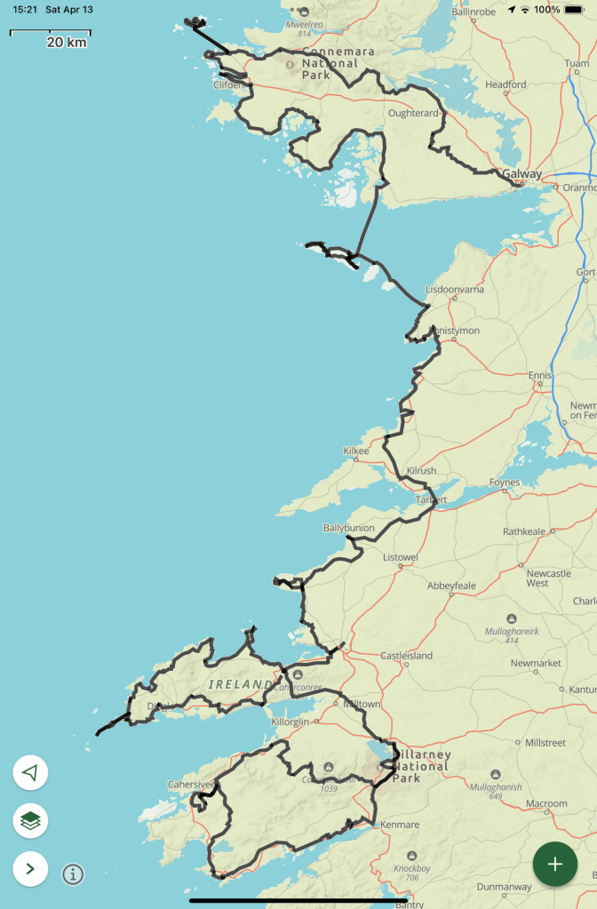
Starting in mid-May, I will be travelling to Dublin and then taking the train to Killarney in County Kerry, in the SW of Ireland. From there I’ll follow the coast north for about 1000 km through Kerry, Clare, and Galway, on waymarked trails and wee country lanes:
Starting in Killarney, walk the Kerry Way clockwise round the Iveragh Peninsula and back to Killarney, with maybe a detour to visit Skellig Michael, weather and legs and schedule depending
After a rest day in Killarney, head north along wee roads up to Camp on the Dingle Peninsula to join the Dingle Way
Follow that round anti-clockwise and near Dunquin, make a detour to visit Great Blasket Island and the westernmost tip of Ireland at Dunmore Head
Then rejoin the Dingle Way and continue back to Camp, and then complete the trail by walking to Tralee (and incidentally thus complete the Kerry Camino which takes you from Dingle Town to Tralee)
After another rest day in Tralee, follow the North Kerry Way up the coast to Ballyheigue, and then continue on back roads north, across the River Shannon at Tarbert, and on up to Lahinch
Between May 18 and July 5 of 2023, I walked from The Hawk on Cape Sable Island, the southern tip of Nova Scotia, to its northern tip at Cape North on Cape Breton Island, a 1000+ km trek. This is the story of part of that journey. See these posts to read about the whole journey:
A big thank you to everyone who hasbought me a coffee over the past year. The Buy Me a Coffee service allows patrons like you to fund writers like me, to cover things like the costs of running this blog, new shoes and gear, and journeys like this. If that sounds like a worthy idea to you, then go ahead – keepbuying me coffees.
Where am I now?
Home, in Lunenburg. I’ve had a few days now to let things sink in – that I finished my journey; that I made a plan and saw it through; that I have a life to fit back into, everyday things to do, friends to see, family to hug and hold.
Fun Facts
I walked a total of 1,027 km, which is about the same as:
walking from Toronto to Montreal and back again
walking from Paris to Berlin
walking a bit more than 24 marathons
It took me around 264 hours of walking to do it, so I averaged just under 3.9 kph, which sounds slow but in my defence that walking time includes rest breaks. I probably rested around 10-12 minutes for every hour I walked.
I climbed just under 4500 flights of stairs, according to FitBit, and a flight of stairs in Fitbit-land is equal to roughly 3 meters, making it more than 13 km of vertical ascent (and descent, since I started and ended more or less at sea level). That’s like:
climbing both Mount Everest and Mount Blanc
climbing the CN Tower in Toronto 31 times
descending the 1829 meter deep Grand Canyon more than 7 times
It took me about 1.4 million steps to do it. Think about that the next time you’re walking on an exercise machine.
I crossed 32 rivers – here’s the list, see how many you recognize: Barrington, Clyde, Roseway, Jordan, Sable, Tidney, Broad, Mersey, Medway, Petite, Lahave, Mushamush, Martins, Gold, Middle, East (the one west of Halifax), Musquodoboit, West, East (the other East River next to Sheet Harbour), Salmon, Moser, Ecum Secum, Liscomb, Gaspereaux, St. Mary’s, Larry’s, Salmon (the other one near Guysborough), Southwest Mabou, Mabou, Margaree, Fishing Cove, and the North Aspy. Not to mention dozens of brooks and streams.
I passed through several hundred cities, towns, and hamlets with names that include one of these words: Bay, Basin, Cove, Harbour, Lake, or Point.
I saw at least one moose, beaver, seal, deer, whale, bald eagle, osprey, otter, fox, snake, turtle, frog, toad, squirrel, and chipmunk.
I slept in my tent in provincial park campgrounds, National park campgrounds, private campgrounds, a couple of backyards, and on crown land. I also spent the night in several inns, hotel, and motels, as well as in a couple of apartments, four houses or cottages, a glamping tent, a yurt, a fancy manor inn, an RV, and on the floor of a house under renovation. Somehow I missed sleeping in a barn.
I lost about 5 lbs in weight in total and about an inch off my waistline, and gained a few pounds of leg muscle.
I saw the following objects by the side of the road:
A spoon, a fork, a knife, in separate locations hundreds of km apart
A kids backyard play set
Enough furniture to fit out a living room including a sofa, an armchair, several coffee tables, and an ottoman
A ladies black patent leather pump, left foot, 3 inch heel, fortunately empty
A men’s black rubber boot, also empty
Several tires
Many banana peels
Hundreds of work gloves
With hand on heart, I can truthfully sing:
I’ve been to Ecum Secum and I’ve been to Chezzetcook.
I’ve passed through East Port Medway and I’ve walked to Necum Teuch.
I’ve crossed the River Mushamush and been to Mushaboom.
I climbed up Cape North mountain and I’ve seen the lilacs bloom.
From Barrington to St Lawrence Bay I’ve hiked through many trials,
And from cape to cape along the way I’ve gotten a million smiles.
The Blooper Reel
When you take on any project, there will be mistakes made and lessons learned. I am the first to admit that I got lucky on several occasions – the God of Fools was watching over me.
First and foremost, had I started my journey just a few days later in May, I would have been stopped right away by the forest fires near Shelburne. And despite central Nova Scotia getting flooded out with rain for days on end in June, I really only had a few bad-weather days to walk in the rain. So luck played a big part in my ability to complete the journey with minimal fuss.
But the God of Fools also made sure that I was bitten on the arse by my own mistakes, just to make sure that I learned something:
Like when I tried to follow the maps I was using, stubbornly, when my own eyes told me that there wasn’t a road there to follow.
Like when I didn’t check my map and just assumed I was on the right road, which took me several km in the wrong direction near Voglers Cove.
Like when I made accommodation arrangements in advance, but forgot to change or cancel them when I changed my plans. I ended up cancelling things last minute, too late to get a full refund, or even a partial refund in some cases.
Like when I refused to use bug spray but sat out anyway amidst swarms of black flies. I was bitten so badly in Sheet Harbour that my ears and right arm were swollen and puffed out red, itchy blisters.
Like when I didn’t keep my water bottles full and ran low in high temps, near Judique, and nearly collapsed from heat exhaustion.
My Favourite Things
Lupins and daisies and ferns in green grasses,
Sunlight that dazzles the sea through my glasses.
Lichens on rocks and the ferns under forest,
Blue jays and robins and the crows in their chorus.
Tumbling water and waves on sands sings,
These Scotian delights are my favourite things.
Ahem. Apologies for the parody. But here are a few of my favourite things from the journey:
Favourite coffee – Uprooted Cafe in Musquodoboit Harbour
Favourite sandwich – the breakfast wrap from LaHave Bakery in LaHave
Favourite meal – tie between the lobster dinner hosted by Jude Avery in Larry’s River and the dinner of pasta with cured shad roe prepared by Eric Southey in East Port Medway.
Favourite moment – sitting by the Clyde River just listening to the water
Thoughts
If there was one question that came up again and again from people I met, from Barrington to Bay St. Lawrence, it was “why are you walking this journey?”
There isn’t a single answer to that. What I told people during my journey was part of the answer: that I did it because I wanted to see if I could; that I wanted to explore the province and see places that I’d never visited before; and that deep down, I had this nagging feeling that I’m getting older and if I don’t do these things now, I may not get the chance in future.
But when I was a child, a middle child who was always content to imagine his own adventures, I would make lists, devouring mail order catalogues searching for jack knives and hiking boots and tents and sleeping bags and ropes and axes and all the things that I’d need for the journeys I wanted to make; borrow every book in the town library that told tales of adventures and explorations; and lacking the ability to actually buy the things I thought I wanted or travel off to strange lands, I’d cobble together backpacks from scraps of wood and an old pair of jeans and fill them with cookies and sandwiches and my pretend camping gear, to set off through the nearby fields and bush lots to find my dreams.
And now I am, perhaps, a grown-up child, able to peruse online catalogues to purchase real packs and tents and gear, and buy it and take some food and few clothes, to set off on actual adventures, sleeping in the woods and meeting strange creatures and overcoming fierce adversity to accomplish my quest. Are we not all kids at heart, at least some of the time? Maybe deep down, this was my boy’s own adventure.
I don’t know, to be honest. I’m sure I walked this for many reasons, only some of which are transparent to me. But I do know that I’m glad that I did it.
*****
What was the best part of the journey? Hands down, I’d have to say it was meeting the many, many people who stopped to chat with me. I had dozens of interesting conversations, with people in every community I passed through, always with smiles and often handshakes as well as a few hugs.
The kindness shown, again and again, reaffirmed my belief that most people, in most places most of the time, are decent, warm, thoughtful, and caring, and to be able to share their thoughts as I passed through their community remains my enduring memory.
*****
There were often times when I’d be explaining my journey to someone and they would ask, “are you doing this on your own?” And I would say yes, I’m walking it solo.
Maybe I was in a physical sense, but I was never alone. Ann was always with me. She was constantly in my thoughts, and we would touch base several times a day.
But deeper than that, she was with me because she’s a part of me. We’ve been through a lot together. I could not have completed this kind of journey without her support. Thank you, my love.
What next?
More walks, of course. I have my bucket list of journeys, and I hope to cross off a few more. Ann has relatives in Ireland who are getting older, we haven’t been there in a few years, and we know we need to get there soon. Maybe a walk or 3 there could be next.
And of course, I’ve only scratched the surface of Nova Scotia and the Maritimes; parks I haven’t visited, places I haven’t seen. I’d love to walk the shores of the Bay of Fundy, along both the New Brunswick and Nova Scotia coasts; do the circular hike round Kejimkujik National Park or the coastal path along Cape Chignecto Provincial Park; the rail trail along the Annapolis Valley; or more of Cape Breton Island, along the eastern shore.
But in the short term, I think it’s about consolidation. Sorting out what I learned, what I liked, what I’m leery of repeating. Saving up. Planning and preparing.
And lastly, I think, there’s some writing to do. I told myself on this walk that I should try to turn this into something publishable. So let’s see.
Like what you read? Buy me a coffee. Your donation helps offset the costs of maintaining this blog.
Between May 18 and July 5 of 2023, I walked from The Hawk on Cape Sable Island, the southern tip of Nova Scotia, to its northern tip at Cape North on Cape Breton Island, a 1000+ km trek. This is the story of part of that journey. See these posts to read about the whole journey:
A big thank you to everyone who hasbought me a coffee over the past year. The Buy Me a Coffee service allows patrons like you to fund writers like me, to cover things like the costs of running this blog, new shoes and gear, and journeys like this. If that sounds like a worthy idea to you, then go ahead – keepbuying me coffees.
Where am I now?
In my hotel in Bay St. Lawrence, drinking Lunenburg Ironworks Bluenose Rum from a tea mug and eating a somewhat worse-for-wear bar of Peace By Chocolate that I’ve been carting around in my pack for two weeks since Antigonish, after completing my journey by reaching Cape North. Done.
*****
How I got here from Cheticamp, the précis version:
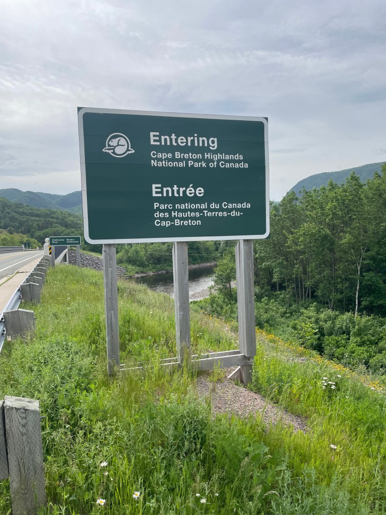
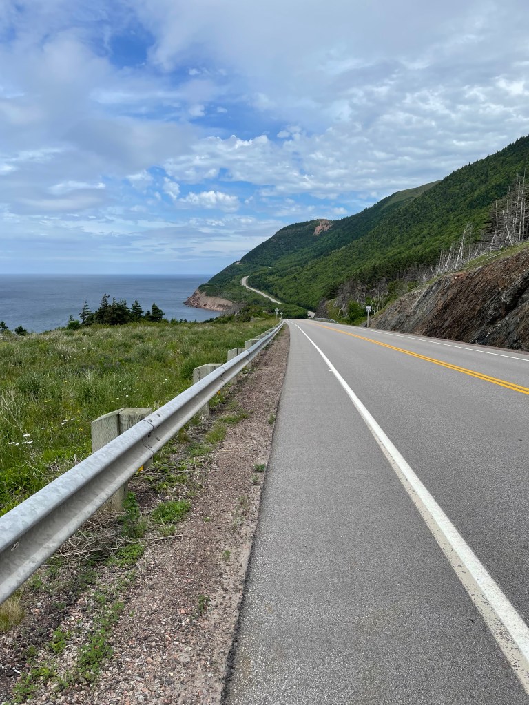
followed the Cabot Trail highway through Cape Breton Highlands National Park and on past it to the town of Cape North
turned north and followed the Bay St Lawrence road to that town, at the top of the island.
from there, slogged up the Money Point Road to reach the lighthouse
slogged back the same way to return to the hotel where I’m staying
*****
There was a bit more to it than that of course. When I left Cheticamp, I had a ride booked to take me to where I’d left off, at the parking lot for the Skyline Trail. It was July 1, Canada Day, and I was expecting the road to be busy, but for the first hour I mostly had the road to myself. Quiet enough, in fact, that I saw a moose about 30 meters into the bog and bush.
Shortly afterwards, a Mountie passed me and waved. And when I thought about the beaver I’d seen the day before, I reckoned that was as Canadian of a hat trick as you could want on Canada Day. Eh.
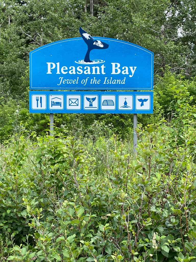
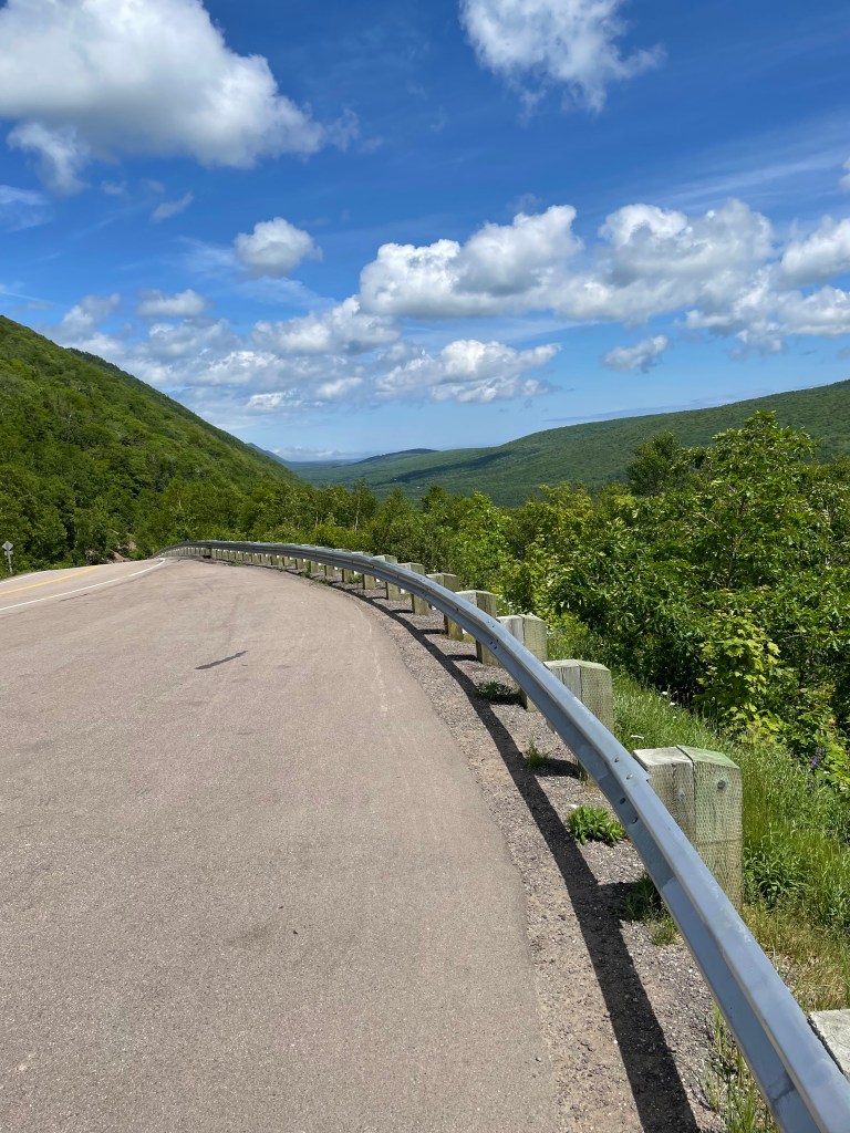
I had climbed to the interior plateau the previous day, so it was relatively easy walking up and down modest dips and rises before beginning the descent to Pleasant Bay. There were several viewing points along the way and I took advantage of those for rest stops in the muggy heat.
Dropping from 400 meters to near sea level takes only about 4-5 km, so the road twists through S-bends, sometimes at about 8% grades.
It was hard on my legs, tougher in fact than the climb the day before.
And I crossed out of the Park and entered Pleasant Bay.
With clouds building, I chugged on through, stopping only at the local restaurant to borrow their Wifi for a few minutes to send a text home, and at the general store to pick up dinner – ramen noodles! – pressing on to reach MacIntosh Brook campground before 3:00.
I was worried because there are only about 10 spots at that campground and I had visions of no room at the inn. But when I arrived to see about 6 or 7 cars in the parking lot, I was surprised, in looking around, to see no tents or campers. There’s a short hiking trail out of that campground and apparently everyone else was off on that.
I walked around and picked a good spot, set up my tent, and went into the well-equipped cooking shelter. Empty. I quickly unpacked my cooking gear and made myself a cup of tea. I spread out my gear. I took off my shoes. I plugged in my phone to charge, and got out the iPad to read a book. I made myself quite at home, really.
And then it started to rain. It was still sunny off to the west, so I thought it would be brief, but two hours later it was still raining. All the hikers had left and I had the place to myself. I was starting to think about sleeping in the cooking shelter when a young single mom arrived with two kids.
Her English was only moderately better than my horrible French, and we had one of those fractured conversations where the gist of the meaning gets across with gestures and the occasional word.
And then after a while three cyclists arrived, and set up. And before I knew it we were having a very Canadian conversation, swapping thoughts on the virtues of different camping gear and where to get it, sharing travel stories, and comparing horror stories about the bane of outdoor life in Canada – mosquitoes, black flies, deer flies, and horse flies – “and then a big one flew right up my nose!”
A very fitting end to Canada Day.
*****
In the morning I was up early, finishing breakfast and packing up to make an early start – it promised to be hot and muggy, and I had another climb day to do. It’s 15 km from MacIntosh Brook to the east edge of the Park where the Big Intervale campground is located. To get there you have about 350 meters of vertical up and vertical down to do.
The road rises gently at first, and when the hills start you’re quickly onto an 8%-9% grade – nearly a meter of height gain for every 10 meters forward.
I took it slowly, sweat dripping in the muggy heat. The road shoulder sometimes narrows to near nothing, so I was listening for oncoming traffic while walking the road. A cyclist passed me, pushing himself steadily, weaving across the road sometimes, but never stopping. “Allez, allez, allez!”, I shouted, and he grinned through gritted teeth.
It took me more than an hour to crest the mountain and reach the plateau. I took a break there sitting on the steps of an emergency shelter, and took off my soaked shirt to dry for a bit in the wind.
The downhill, like before, was harder on my legs than the up. I could feel my Achilles tendons protesting as I gradually moved from viewing point to viewing point, until I finally reached the lower flat section.
The Big Intervale campground was a major disappointment. I had known in advance that it was unserviced, but so was MacIntosh Brook. I was dismayed to see that in this case “unserviced” meant no running water, no flush toilets, no cooking shelter, no food storage lockers or decent trees to hang a food bag, and only 3 lousy tent sites with minimal trees to screen and provide some shelter. And it was forecast to rain that night.
I hemmed and hawed. Stay? Press on 12 km (and 145 meters more climb) to the town of Cape North, where there was a hostel? Or try to hitch a lift back to MacIntosh Brook?
I didn’t have the energy to get to Cape North, and staying put seemed a last resort, so I ended up by the side of the road with my thumb out. No takers for nearly an hour while I was being nipped by flies. Granted, I did look sweaty and my prominent backpack was probably off-putting as well. And then a young family of 5, and their dog, stopped and I piled into their van.
We chatted away for the 10 minute ride – did you see any moose? Yes, one. We saw 5! Where are you going? Guess how much my pack weighs? Was that your green tent at MacIntosh Brook yesterday? – we saw it when we came out of the trail there.
They were lovely, gracious, and didn’t overtly wrinkle their noses at my sweaty aroma, and I thanked them profusely when they dropped me off. A Trail Angel family.
That night, once again it seemed like I’d be the only camper and I was actually preparing to just sleep in the cook shelter, when a family came in just as it was getting dark. I didn’t want them coming in to find me sleeping on a bench, so I quickly set up my tent and crawled in, as swarms of mosquitoes buzzed against the mesh.
*****
It rained fairly hard overnight, and during a lull in the drops at 6:30 in the morning I quickly packed up and moved everything into the cook shelter. I spread the tent out to dry, made breakfast, and got myself organized for the day. After the previous day’s experience, I was reckoning on another hour or more to hitch a lift back to Big Intervale.
And then a park employee came by to check on things, and we got chatting about my journey, which he must have found interesting enough that he become Trail Angel #2, breaking the rules to give me a lift back to where I’d left off.
A 2-hour walk in off-and-on rain brought me to Cape North, where I had been looking forward to breakfast at the only restaurant in town. It was closed when I got there, however, opening in about 30 minutes, so I wandered down to the local general store to pick up some groceries. Turns out dinner and lunch and breakfast for the next two days were about to be tortilla wraps with cheese and sardines, fruit cups, and some yogurt drinks for the vitamins.
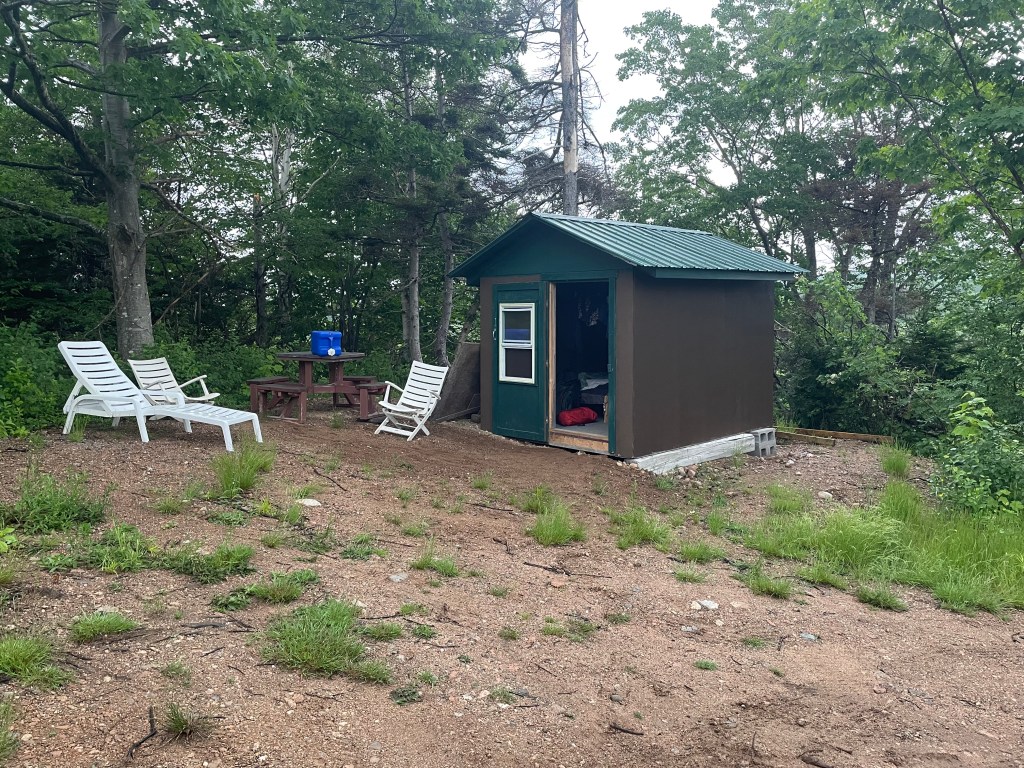
After catching up on email while I had lunch at the restaurant (after 2 days of no cell data or voice service in the park), I finished my day reaching a little place that offered very basic hiker cabins for the night.
But the outdoor shower I took in the rain was refreshing, steaming under hot water while cold drops fell from the sky. And while the hut was just a roof and walls and a simple bed, it was worth it when the heavens poured a deluge overnight, hammering on the tin overhead at 4 a.m.
*****
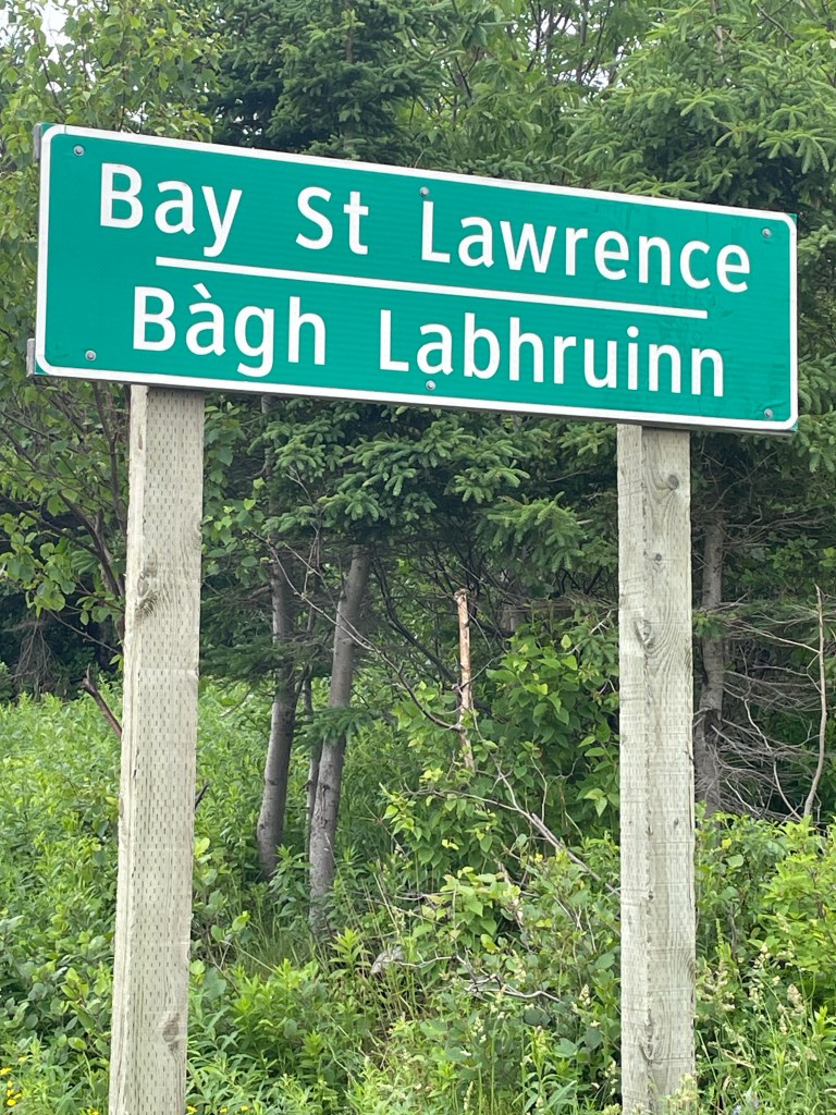
And then the next day, it was off to Bay St Lawrence, after stopping for an hour to have coffee with Gerard, the owner of the rustic cabins. A very personable and friendly native of the area, he gave me some great tips about the Cape North trail.
The road was surprisingly busy with traffic, but it didn’t take long to climb up into the hills and over a low pass to come down into St Margaret’s Village
and then on to Bay St Lawrence.
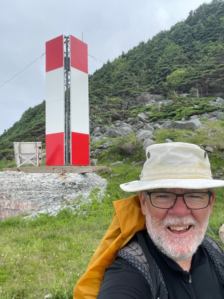
I headed straight for the local seafood takeaway, and arrived to find it closed. Since I was by the water anyway, I made sure to take a selfie standing at the very end of the road, the northernmost bit you can drive to on the Island, and took a pic looking back south.
I went up to the motel where I was staying and wimped out on camping on their grounds, instead opting to stay in an RV they keep for overflow guests. I didn’t think I’d sleep that night, but eventually did, after walking back down to buy fish and chips from the seafood shack which had in fact opened for the evening.
*****
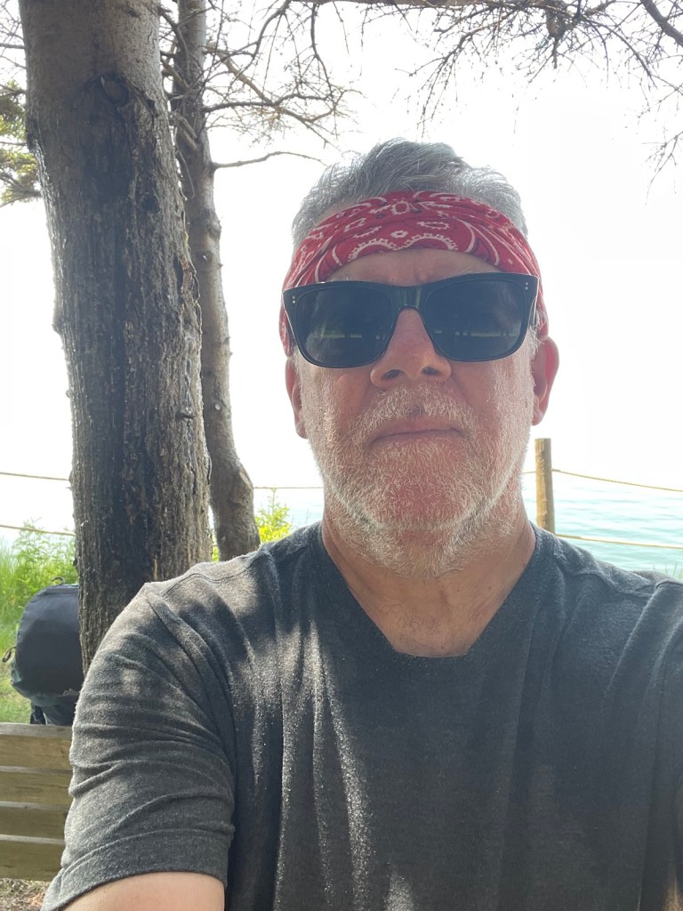
And then this morning, it was up with the birds, eating quickly, and putting only day essentials into the pack. I took a selfie and sent it to Ann, who said I looked way too serious.
But the thought of climbing over the mountain that you can see over my shoulder, and then back again, was weighing me down. That, and the realization that I was a few hours away from the finish.
The climb up, and then down the other side, was every bit as tough as I had thought it would be.
The old road that the lighthouse keepers used to use is now essentially just a very rough rocky trail, rising in spots at about a 20%-25% grade – a meter of rise every 4 or 5 forward.
It took me more than 2 hours to cover the 5 or 6 km distance to the other side, with a few close shaves where fallen trees nearly blocked the trail completely.
Stumbling down the last few meters brought me to a rough path along open grassy meadows at the foot of the cliff, the last bit of northward trek to do.
I swore out loud when, just a few meters from reaching the point, coastal erosion almost stopped me – there was a narrow, looks-dodgy-but-what-choice-do-I-have, more-or-less way past,
and then I was through and standing at the base of the light.
I took the selfies that I had told myself I would, and tried to smile or at least look like I was happy to be there.
But I couldn’t sit down. I wandered around for a bit, exploring and finding some photo worthy sights,
and then set off to see if I could get water at a brook that was on my map. I found the stream
and filled the bag of my water filter kit, clambering up from the stream to walk back to where I’d left my pack, and then had to retrace my steps to pick up the filter hose that I’d dropped.
By the time I sat down to eat something, it had started to mizzle a light mist, the kind that gets you wet without seeming to rain hard.
I asked myself what I was thinking. I hoped for something profound, but maybe that will come in hindsight. All roads come to an end, and if you’re lucky it’s where you wanted to go.
And then, just like that, I packed up, and turned to go – walking south for the first time in 7 weeks.
Sleeps and Eats
This was a feed-myself stretch – oatmeal, dried fruit, cheese, tortilla wraps, ramen, and granola bars. There’s a grocery store in Cheticamp, but after that just a couple of modest general stores in Pleasant Bay and Cape North.
I did have a takeaway fisherman’s platter from the Seaside Shack in Bay St Lawrence. Meh. But I was hungry.
Oh, and I had a decent fish lunch at Morrisons in Cape North – that was ok, the staff were friendly, and they let me park my soppy, wet-clothed butt for almost 2 hours while I poached their wifi.
As for stays, there were two camping nights in the Park at the MacIntosh Brook campground. I liked it – the only thing missing was a hot shower, but with essentially no one there, I made do with a standup washcloth bath and that was refreshing enough.
Gerard’s place, which he calls Asbaigh-a-Tuath (the Gaelic for Aspy Bay), is deliberately quite simple. It’s basically the same price as a campsite in a private campground, without the RVs and with a roof instead of a tent. It suited me fine, and meeting Gerard was a bonus.
Finally, I am currently at Burton’s Sunset Oasis motel in Bay St Lawrence. It’s a small 5-room place that books up in summer, as it’s the only motel in town. It’s simple, very clean and tidy, has kitchenette facilities in each room, and a great view back to the west over the town.
Stories
I was sitting at a scenic lookout, about an hour’s walk outside of Pleasant Bay. There had been a little gaggle of cars and gawkers there when I arrived, but in the way of the Cabotistas they took their selfies and quickly motored on. Once they left it was peaceful, and I sat in the sun enjoying the quiet.
A car pulled in with Ontario plates and two couples got out, a bit older than me I thought. They saw my pack and came over. We got chatting about my walk, and then one of the ladies asked “so where are you from?”
“Lunenburg.”
“Oh, were you born there?”
“No, I was born in the most southerly place in Canada.”
“Leamington! You were born in Leamington? We’re from Leamington too!”
And then a cascade of “Do you know so and so?” followed.
After a bit of further chat, one of the guys just shook his head and chuckled- “ what are the odds?”, he said.
*****
At another scenic stop, I walked in to see a car parked and a mom and dad taking pics of their kids with the view in the background. I slumped off the backpack and sat on the guardrail to catch my breath.
The dad noticed and came over, and we started chatting. He asked where I was walking to, and I explained about the tip to tip thing. He was from Michigan, so I tried to convert kilometres to miles for him. “Wow, that’s impressive.” He turned to his teenage daughter and drew her in – “did you hear that, he’s walking the whole of Nova Scotia”. Then asked if he could pick up my pack. “Holy cow, you’re carrying that!?!”. “Yep”.
Why does everyone want to know how much my pack weighs?
*****
I had finished the journey, reached the Cape, and now I was on my way back. It had been tiring already, and I was halfway up the mountain on the return when I thought I heard voices. Huh?
I looked up to see two people coming down, soon joined by two more. The pair of couples were from Britain, and they asked what I had thought of the Cape. “It was pretty special, especially for me since it’s the end of a long journey – I’ve walked a 1000 kilometres the length of Nova Scotia to get here”.
“Well, then we’re glad that we didn’t get there too soon and disturb you.”
“Yes, thank you for that.”
“Where next?”
“Well, actually I’ve always wanted to walk Lands End to John o’Groats”.
“Oh you should.”
Yes, I thought, I should. But not now.
Where next?
Home. Well, Baddeck first, and then Mabou. But I can’t wait to get home.
Route
Here’s the original plan. I have more or less followed it as written, though had some changes due to the fires around Halifax. But I’m done. Time for step 33.
Pick up the Shelburne County Rail trail and follow it to Clyde River
Then walk along the tedious Highway 103 to Shelburne
Where you’ll get back onto the rail trail to walk to Lockeport
And then from Lockport, continue following the rail trail through and past the Tidney River Wilderness area to reach Highway 3 at Summerville.
Where you continue on the highway for a bit and then get back onto the rail trail to reach Liverpool
And then continue on the rail trail up to around Port Medway, before exiting onto Route 331, the Lighthouse Route coastal road, to walk all the way to LeHave.
From LeHave, take the ferry over the river and walk to Lunenburg on the local back roads, and then
From Lunenburg, take the Rum Runners Trail through Mahone Bay, past Chester, and on past Hubbards to Upper Tantallon, and then
Detour south onto the Joshua Slocum Trail to reach old dirt roads through Five Bridges Wilderness Area to reach Glen Margaret, where you
Pick up Route 333, the Peggy’s Cove Road, to walk down to the lighthouse, and then bear east towards Prospect to connect with
The Old Halifax road which takes you north back to Glen Margaret
Where you connect onto the old St. Margaret’s Bay Road to walk east to Halifax
And then walk through the city to the ferry terminal.
There you catch the ferry over to Woodside in Dartmouth
To reach the Shearwater Flyer rail trail, which takes you northeast to Lawrencetown
Where you follow back roads to Porters Lake and then onto Highway 7 to reach Chezzetcook,
Where you turn onto Route 211 and follow the coast road northeast to Isaacs Harbour, and then
Branch onto Route 316 and follow that to Larry’s River.
At Larry’s River, you follow (natch), Larry’s River Road north to reach Highway 16 outside Guysborough,
And Highway 16 takes you to Boylston where you get onto Route 344, which
Bears northeast and then north and then west, around the coast to Aulds Cove, where the TransCanada Highway Canso Causeway clambers across to Cape Breton Island.
Turn the corner and follow the Cabot Trail east, up across the island past Big Intervale and Sunrise to reach the hamlet of Cape North (not the actual Cape North, just yet).
Turn onto the Bay Saint Lawrence Road and follow that to Bay Saint Lawrence.
Between May 18 and July 5 of 2023, I walked from The Hawk on Cape Sable Island, the southern tip of Nova Scotia, to its northern tip at Cape North on Cape Breton Island, a 1000+ km trek. This is the story of part of that journey. See these posts to read about the whole journey:
A big thank you to everyone who hasbought me a coffee over the past year. The Buy Me a Coffee service allows patrons like you to fund writers like me, to cover things like the costs of running this blog, new shoes and gear, and journeys like this. If that sounds like a worthy idea to you, then go ahead – keepbuying me coffees.
Where am I now?
Cheticamp. I arrived yesterday (June 29) and am spending two nights here.
To get here, I left Inverness and followed Highway 19 for a bit before turning off onto a Shore road, the Broad Cove Marsh Road, a decision that was rewarded with some amazing views down the coast and over the water.
This took me to Dunvegan, where I joined Route 219 for a tedious, humid, misty/rainy, sweltering slog to Whale Cove, (though I did get a nice sunset there),
and then on to Margaree Harbour. I picked up the Cabot Trail here,
after a short detour (let’s not call it a navigation mistake) through the town past the harbour and a lovely white wooden church
and back to the highway. The road crosses the Margaree River and the wind that day was blowing from the right direction to cause the steel bridge structure to hum like a wind chime, holding a note which brought to mind the long E-major piano chord at the end of the Beatles’ A Day In The Life.
After that, it was road-walking along the Cabot Trail all the way past St Joseph du Moine, Grand Étang,
and finally into Cheticamp. It was a gusty, windy day, and with my pack acting like a sail I was blown off balance several times. And the wind played more music, as it set the overhead wires singing and the long grasses swaying.
Almost immediately, I was rewarded by the sight of a young beaver swimming in a small pond next to the road,
a sight that makes me feel extra Canadian on the eve of Canada Day.
Soon after that little shot of Canuckness, I turned off the road and followed a couple of the hiking trails – the Chemin du Buttereau
and the Vieux Chemin de Cap-Rouge, both of which trace the old roads used by the Acadian settlers who lived in the area prior to the creation of the park in 1936.
They were similar in terms of scenery, I.e. you didn’t see much other than the forest that’s regrown over the land
since the Acadians’ land was expropriated for the park, but that’s a reminder of the reason today’s Nova Scotia Acadian population still holds deep feelings about the many ways they were shoved about since 1748 as pawns of first the colonial and later the provincial powers.
Together these two trails took me to about Cap-Rouge, and from there I slowly climbed the Cabot Trail highway
past the veterans monument that always brings a tear to my eye – there is one of these placed in a national park in every province. I took my hat off and stood quietly for a moment.
And after that moment was ended by a family of three driving up and taking pics of each of other with the coastline in the background, I trudged onwards, relentlessly up and up and up.
Rounding a corner, I could see small windswept little trees hugging the top of the next mountain, and then realized the trees were moving – I was looking at other hikers exposed above me as they did the Skyline Trail.
I ended the day when I reached the parking lot for that trail, and cursed a bit that I wasn’t able to hike it – I would have liked to have done but since it’s a loop that takes 3-4 hours to do, it doesn’t get me closer to my finish. Another time.
Here are the stats so far:
Total kilometres walked – 956
Total # of days spent walking – 40
Total # of steps walked – 1,297,000+
Total # of hours spent walking – about 243
Total # of stairs climbed according to FitBit – 4148
Sleeps and Eats
Hmm, less to tell here. The AirBnB in Cheticamp is quite nice and centrally located in town near the grocery store. As a result I am enjoying two nights of my own cooking, along with some nice Nova Scotia wine.
That’s with the knowledge that the remainder of this trip will be backpacking food – ramen, couscous, oatmeal, dried fruit, pumpkin seeds, and turkey jerky. Yum!
The stay at Whale Cove is best left alone on the theory that if you can’t say something nice then don’t say anything at all.
And beyond that, I’ve only stopped at one place for lunch, the Belle View restaurant in Belle Cote just outside Margaree Harbour. They make a perfectly respectable breakfast, which kept me going for a few hours.
Stories
As I was taking a water break at a little photo op spot on the Cabot Trail outside Belle Cote, a cyclist came in for a quick water break as well. I walked over to her. “Where did you start this morning?”. “Dingwall”, she said. Holy crap, I thought, that’s at least 90 km from here, and she’s not even sweating, as I looked down at my soaked T-shirt.
“Good ride? At least it’s downhill for you from that direction”.
“Yes, but this headwind (she was going south) is annoying. It was so strong it pulled my helmet back and strained my neck.”
“Well, on the bright side”, I said in a voice that would have had my son rolling his eyes at my Dad tone, “at least it keeps the bugs down.”
“Thanks for that positive spin”, she said, and sped off nonchalantly towards Baddeck, another 50+ km in front of her, and she still wasn’t sweating! Lord, to be young.
And then 5 minutes later a guy on a cycle passed me, whom I assumed to be her partner. He was grunting uphill into the wind as we met, and I shouted out “you eat headwinds for breakfast!” If he was her partner, I pictured them comparing notes at the end of day and joking about the old guy they’d seen backpacking.
*****
When I got to the Park, I went into the visitor center to see if there was anything they could tell me about walking through. I explained what I was doing to the young guy behind the desk. He got up and had a quick chat with his colleague. “This guy is walking through the park. What pass does he need?”, I overheard. “Why?”, she asked. More huddled conversation. He came back, and after some fiddling decided that I needed a three-day visitor’s pass, but since the next day was Canada Day which was free, and the next day was Sunday which think he said was also free, charged me $8.50 for a one-day pass. I guess they don’t get a lot of foot traffic.
*****
Because I was staying in Cheticamp again after walking partway through the Park, I had arranged for a ride service to pick me up at the end of the day’s walk and bring me back to town. The driver pulled up and I put my stuff in and climbed into the front seat. We got chatting.
“So where did you start from?”
“This morning from Cheticamp, and overall from Cape Sable Island. I’m walking the length of Nova Scotia.”
“How old are you?”
“I turned 60 this year”.
Glances, gives me a once-over. “Crap”, he thinks to himself so loudly I can hear it, “he’s in better shape than I am and I’m younger than he is”.
We natter for a bit about training and exercise and then I said that really this trip was about the journey, exploring the province. I explained that I’d resolved to find at least one moment every day when things are peaceful and calm, to remind myself that there’s always a good moment if you stop to notice it when it happens.
He looked at me and nodded, then shared a very personal story of loss, and I could only say how sorry I was. He shook his head – “Thank you for telling me that, about finding that moment every day. That helps.”
We got to my place and I tried to give him a tip along with the fee. “Keep it. Just don’t charge me for the therapy you just provided”.
We shook hands as I got out, and I was reminded again that the people I meet on this journey are the best reason for doing it.
Where next?
Looking at my plan, I have less than a 100 km to go, though there is more than 4000m of climb and descent in that. Ann texted to remind me that I am now 5 sleeps from my goal. It’s hitting me now, I’m close.
From tomorrow it’s two more days to finish walking through the Park, then on to Cape North the town and turn left towards Aspy Bay for a night, then keep going up to Bay St Lawrence to sleep if I can on the last night, and then it’s up over the mountain to the Cape North lighthouse for a selfie before a return climb over the mountain to Bay St Lawrence. Et Finis.
Route
Here’s the original plan. I have more or less followed it as written until part way through Step 9, where I had to move off the trail, skip steps 10-13, and just followed the road from East Chester and through Halifax (step 14).
This latest bit has seen me complete Steps 25-27, though I have to skip Step as I can’t go to Fishing Cove so from here it’s onto Step 29. After that, it’s still more or less the plan as described.
Pick up the Shelburne County Rail trail and follow it to Clyde River
Then walk along the tedious Highway 103 to Shelburne
Where you’ll get back onto the rail trail to walk to Lockeport
And then from Lockport, continue following the rail trail through and past the Tidney River Wilderness area to reach Highway 3 at Summerville.
Where you continue on the highway for a bit and then get back onto the rail trail to reach Liverpool
And then continue on the rail trail up to around Port Medway, before exiting onto Route 331, the Lighthouse Route coastal road, to walk all the way to LeHave.
From LeHave, take the ferry over the river and walk to Lunenburg on the local back roads, and then
From Lunenburg, take the Rum Runners Trail through Mahone Bay, past Chester, and on past Hubbards to Upper Tantallon, and then
Detour south onto the Joshua Slocum Trail to reach old dirt roads through Five Bridges Wilderness Area to reach Glen Margaret, where you
Pick up Route 333, the Peggy’s Cove Road, to walk down to the lighthouse, and then bear east towards Prospect to connect with
The Old Halifax road which takes you north back to Glen Margaret
Where you connect onto the old St. Margaret’s Bay Road to walk east to Halifax
And then walk through the city to the ferry terminal.
There you catch the ferry over to Woodside in Dartmouth
To reach the Shearwater Flyer rail trail, which takes you northeast to Lawrencetown
Where you follow back roads to Porters Lake and then onto Highway 7 to reach Chezzetcook,
Where you turn onto Route 211 and follow the coast road northeast to Isaacs Harbour, and then
Branch onto Route 316 and follow that to Larry’s River.
At Larry’s River, you follow (natch), Larry’s River Road north to reach Highway 16 outside Guysborough,
And Highway 16 takes you to Boylston where you get onto Route 344, which
Bears northeast and then north and then west, around the coast to Aulds Cove, where the TransCanada Highway Canso Causeway clambers across to Cape Breton Island.
Turn the corner and follow the Cabot Trail east, up across the island past Big Intervale and Sunrise to reach the hamlet of Cape North (not the actual Cape North, just yet).
Turn onto the Bay Saint Lawrence Road and follow that to Bay Saint Lawrence.
Between May 18 and July 5 of 2023, I walked from The Hawk on Cape Sable Island, the southern tip of Nova Scotia, to its northern tip at Cape North on Cape Breton Island, a 1000+ km trek. This is the story of part of that journey. See these posts to read about the whole journey:
A big thank you to everyone who hasbought me a coffee over the past year. The Buy Me a Coffee service allows patrons like you to fund writers like me, to cover things like the costs of running this blog, new shoes and gear, and journeys like this. If that sounds like a worthy idea to you, then go ahead – keepbuying me coffees.
Where am I now?
Actually, Cheticamp.
However, two days ago I finished walking the Celtic Coastal Trail when I reached Inverness, and I wrote a post for that – but I tried to finish it in my tent and fell asleep. So here it is two days later.
And to be perfectly honest, I am sitting in the laundry room of the Inverness Beach Village Campground waiting for my stuff to dry and taking advantage of a spot where there are no black flies, but there is power to charge my phone and a wifi connection.
Oh oh, mild panic – in sorting through my laundry as I was putting it into the washer, I realized I was missing a T-shirt. Thinking back, I recalled that it was the one I’d worn that day. I mentally retraced my day step by step – put on T-shirt and a long sleeve over that, start walking, get hot, take off T-shirt and just wear long sleeve to keep bugs off, stuff T-shirt into water bottle pocket of pack, keep walking, stop for lunch, drink water, move T-shirt to front pocket of pack, walk to Inverness, stop and get groceries, walk to campground, set up, gather laundry – aha where did it go missing? I didn’t want to walk 9-10 km back to Lake Ainslie where I had had lunch – the last place I knew I’d had it. Alas, poor T-shirt, I’ll miss you. But oh yeah, I had the rain cover on my pack after lunch so it couldn’t have fallen out there. Where did I take off the rain cover? Bingo – the grocery store. Ergo, it must be somewhere between the grocery store and campground. That’s only about 1.5 km back – so, finish laundry, put boots back on, walk back to grocery store, et voila!, my T-shirt, lying forlornly in a heap in the parking lot, apparently untouched. So lesson learned, don’t stuff loose clothes into a loose front pocket of your pack.
Sorry for that digression.
To get here, I started in Port Hastings and followed the trail from KM 0,
up along the west coast of Cape Breton Island, passing through Troy, Judique, Port Hood,
Glencoe Station, Mabou,
Glendyer, and on to Inverness.
It took me 4 days to walk the 89 km of the trail, and the first day especially was sweltering. There was a breeze off the water that day so while I was feeling the heat, it wasn’t as bad as it might have been.
Yes that is a slimmer me -800 km into the walk
However at Long Point I left the trail to walk to the accommodation I had booked, which was off a side road about 4.5 km inland, and once I got away from the ocean breeze I started to bake. It didn’t help that the Old Chisholm Mill Road that the map said was there
was invisible from the highway –
I spent 20 steamy minutes looking for it before giving up. I ended up backtracking a km or so, and taking another road that eventually did get me to the right one where the house was.
And by then I was low on energy, low on water, low on patience, and just plain out of gas. It didn’t help that the road kept rising, and rising, and rising. I’d stagger up a low hill, turn a corner, and rise some more. I was gasping for breath by the time the place came into sight. Reaching it, fumbling the lock code 3 times (natch) and falling inside, I was opened the fridge to find several litres of ice water. It took about 6 glasses to cool me off and rehydrate me. I slept very well that night.
And after that things picked up. The weather cooled a bit, and it even rained a bit. Port Hood had a nice little restaurant where I had dinner, Mabou had the famous Red Shoe pub, and the trail scenery was low key but interesting,
I even had a few chats with people along the Trail. There was a family from New Jersey touring Nova Scotia whom I met on the bikes they’d rented to ride from Mabou to Port Hood – “You’re walking to Cape North? We were there – I can send you the pics and save you the trip”.
Or the retired coast guard serviceman who told me about Cape North, saying that the Money Pit Road that I intend to follow is passable for 4-wheel drive vehicles but is so steep that they have to stop every few km to let the oil in the engines drain back to the right parts to avoid overheating – good to know it’s passable because the satellite pics aren’t encouraging, but oh man that sounds like a tough walk.
And finally, a lovely chat with two women out walking a dog near Mabou, one of whom had the lilt in her voice and the twinkle in her eye of Catherine O’Hara.
*****
Oh, and I have to say a big thank you to all the trail volunteers who help to maintain it. It was the best walking trail I’ve been on in Nova Scotia.
The surface, other than a short bit between Port Hood and Mabou that had been a bit ATV’ed, is level firm gravel with hardly a rut or pot hole.
And there are a decent number of benches and picnic tables scattered along the trail,
the interpretive and directional signage is great,
and the washrooms are spotless.
Well done to all involved.
Sleeps and Eats
Well, it was going to be 3 camps and a motel, but it’s turned out to be 2 motels, an AirBnB, and a camp.
The weather forecast for the 2 nights after I left Port Hastings called for lots of rain, so I decided that discretion was the better part of valour and booked the roofed accommodations. And of course then it didn’t really rain enough to justify that.
But the Hebridean Motel in Port Hood was good, and so was the Ceilidh Trail Motel in Mabou, both simple, clean, efficient places with friendly staff. And the AirBnB was a nice place, super quiet as it was set back in the woods – I just wish it wasn’t an uphill walk to get there.
This campground I’m in, the Inverness Beach Village, is pretty good too, although I have to say I am getting a bit tired of private campgrounds putting the RVs on the ocean and the tents at the back, which usually means next to the highway. But the washrooms are squeaky clean and the wifi reaches my tent.
As for eats, the Clove Hitch Bistro and Bar in Port Hood was fine – friendly service, generous wine pours, and decent fish and chips. But I really enjoyed the Red Shoe in Mabou. The two musicians playing when I went in immediately transported me to Ireland, and the veggie pasta was the healthy, tasty, and filling option I needed.
Stories
Hmm, I think I have told my stories already – losing my shirt (literally rather than figuratively in a card game), losing a road, dying of heat exhaustion.
But a couple of little stories stand out.
*****
I was sitting on a bench overlooking the water, around Judique. It was very calm, just a light shimmer offshore, and inshore a patch of ripples. And in that patch, a head appeared – too big at that distance to be a seal, it must have been a pilot whale. I sat enchanted for about 5 minutes, as it surfaced several times in that patch of ripples, which must have been a school of mackerel which was providing its lunch.
And then he dived – I say “he” but I can’t tell the difference – and moved off somewhere else. And I sat for a bit longer, and I moved off too. We all have our paths to follow.
*****
As I walked into Inverness, I noticed a lilac bush in full perfumed bloom. Thinking back, the lilacs were just coming on in Barrington in mid-May, and then filling the air with wafts of scent in Halifax in early June as I passed through. I think I am walking this journey at the speed of lilacs.
Where next?
From Inverness, it’s back to road-walking, up the coast to Whale Cove, Margaree Harbour, Grand Étang, and on to Cheticamp. That’s the gateway to the Cape Breton Highlands National Park, and the climbing challenge starts there – I will have several days where the vertical distance climbed will be over 500m, compared to the 50-150m range I have had so far.
Route
Here’s the original plan. I have more or less followed it as written until part way through Step 9, where I had to move off the trail, skip steps 10-13, and just followed the road from East Chester and through Halifax (step 14).
This latest bit has seen me start at Step 24. After that, it’s still more or less the plan as described, although my replanning has meant that I can’t do the Skyline Trail in Step 27 and I couldn’t get a campsite booking for Fishing Cove so no step 28. But otherwise it’s like this.
Pick up the Shelburne County Rail trail and follow it to Clyde River
Then walk along the tedious Highway 103 to Shelburne
Where you’ll get back onto the rail trail to walk to Lockeport
And then from Lockport, continue following the rail trail through and past the Tidney River Wilderness area to reach Highway 3 at Summerville.
Where you continue on the highway for a bit and then get back onto the rail trail to reach Liverpool
And then continue on the rail trail up to around Port Medway, before exiting onto Route 331, the Lighthouse Route coastal road, to walk all the way to LeHave.
From LeHave, take the ferry over the river and walk to Lunenburg on the local back roads, and then
From Lunenburg, take the Rum Runners Trail through Mahone Bay, past Chester, and on past Hubbards to Upper Tantallon, and then
Detour south onto the Joshua Slocum Trail to reach old dirt roads through Five Bridges Wilderness Area to reach Glen Margaret, where you
Pick up Route 333, the Peggy’s Cove Road, to walk down to the lighthouse, and then bear east towards Prospect to connect with
The Old Halifax road which takes you north back to Glen Margaret
Where you connect onto the old St. Margaret’s Bay Road to walk east to Halifax
And then walk through the city to the ferry terminal.
There you catch the ferry over to Woodside in Dartmouth
To reach the Shearwater Flyer rail trail, which takes you northeast to Lawrencetown
Where you follow back roads to Porters Lake and then onto Highway 7 to reach Chezzetcook,
Where you turn onto Route 211 and follow the coast road northeast to Isaacs Harbour, and then
Branch onto Route 316 and follow that to Larry’s River.
At Larry’s River, you follow (natch), Larry’s River Road north to reach Highway 16 outside Guysborough,
And Highway 16 takes you to Boylston where you get onto Route 344, which
Bears northeast and then north and then west, around the coast to Aulds Cove, where the TransCanada Highway Canso Causeway clambers across to Cape Breton Island.
Turn the corner and follow the Cabot Trail east, up across the island past Big Intervale and Sunrise to reach the hamlet of Cape North (not the actual Cape North, just yet).
Turn onto the Bay Saint Lawrence Road and follow that to Bay Saint Lawrence.