Favourite Toronto Walks – Yonge Street

Part of a series on my favourite walking trails in Toronto.

Hey Toronto, remember to practice Physical Distancing during the COVID-19 pandemic! Also be aware that some of the amenities, parks, or services listed below may have limited availability. Please check the links included below for up to date information on what’s open and what’s not.

And now on to the regular post …..

Samual Johnson once said, “when a man is tired of London he is tired of life”. With a nod to Dr. Johnson, I’d say that also applies to Yonge Street in Toronto.

The foot of Yonge looking north from the Lake

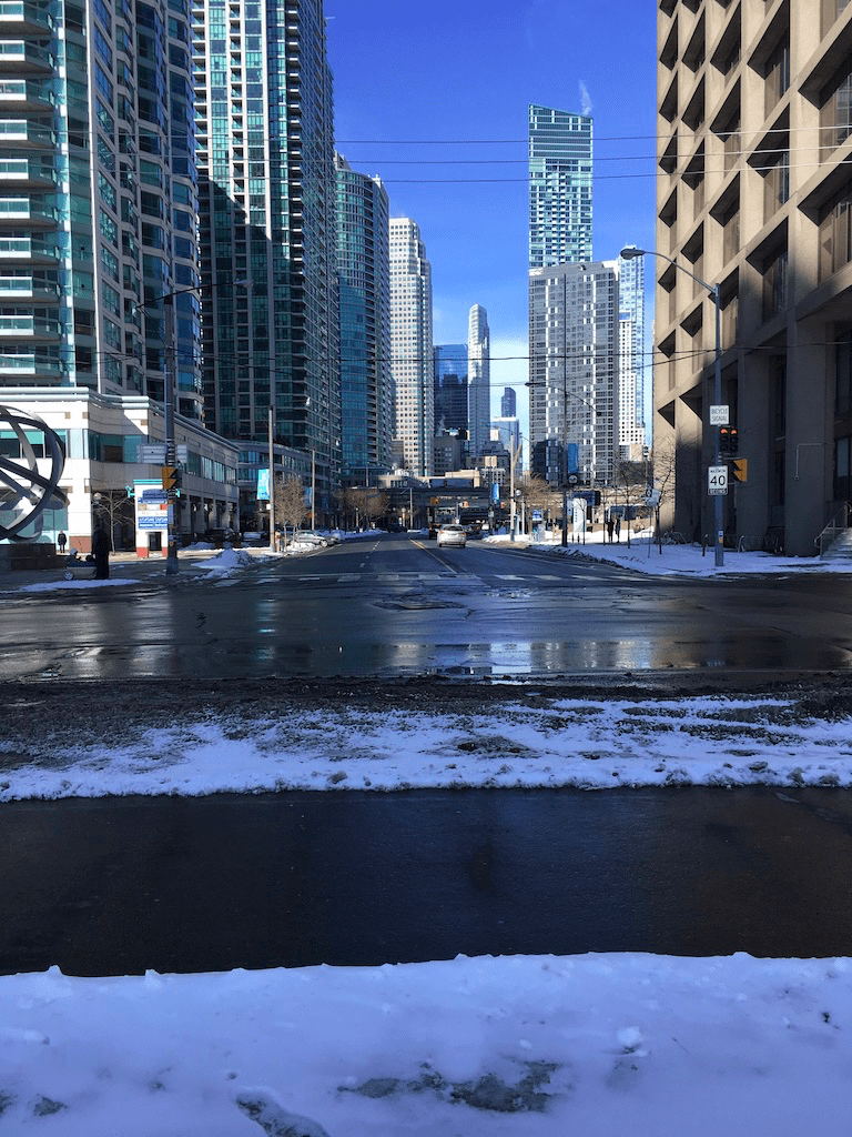
Many cities have a well-known street – Broadway in New York, Oxford Street in London, George Street in Sydney – but Yonge is a different from those thoroughfares in that, in a sense, there isn’t one “Yonge Street”. While it may be a single road, because it’s such a long street it takes on many moods, so that multiple stretches of Yonge form distinct little neighbourhoods, referred to usually by the cross streets – Yonge & Dundas, Yonge & Bloor, Summerhill, Yonge & St. Clair, Yonge & Eg, and so on as it goes north. Walking any 3-4 km stretch of Yonge between Steeles and the Lake will take you through at least a couple of these neighbourhoods, each with its own atmosphere and vibe. That, and Toronto’s famous mix of cultures from round the world, means that walking Yonge is like a mini tour of the United Nations dipped in maple syrup. I love it.

Length: Yonge is a little more than 20 km from the lake to Steeles, so allow about 5 hours if you want to walk the whole thing. That said, an hour’s stretch at picked at random is lots of fun and lets you explore the surrounding neighbourhoods too.

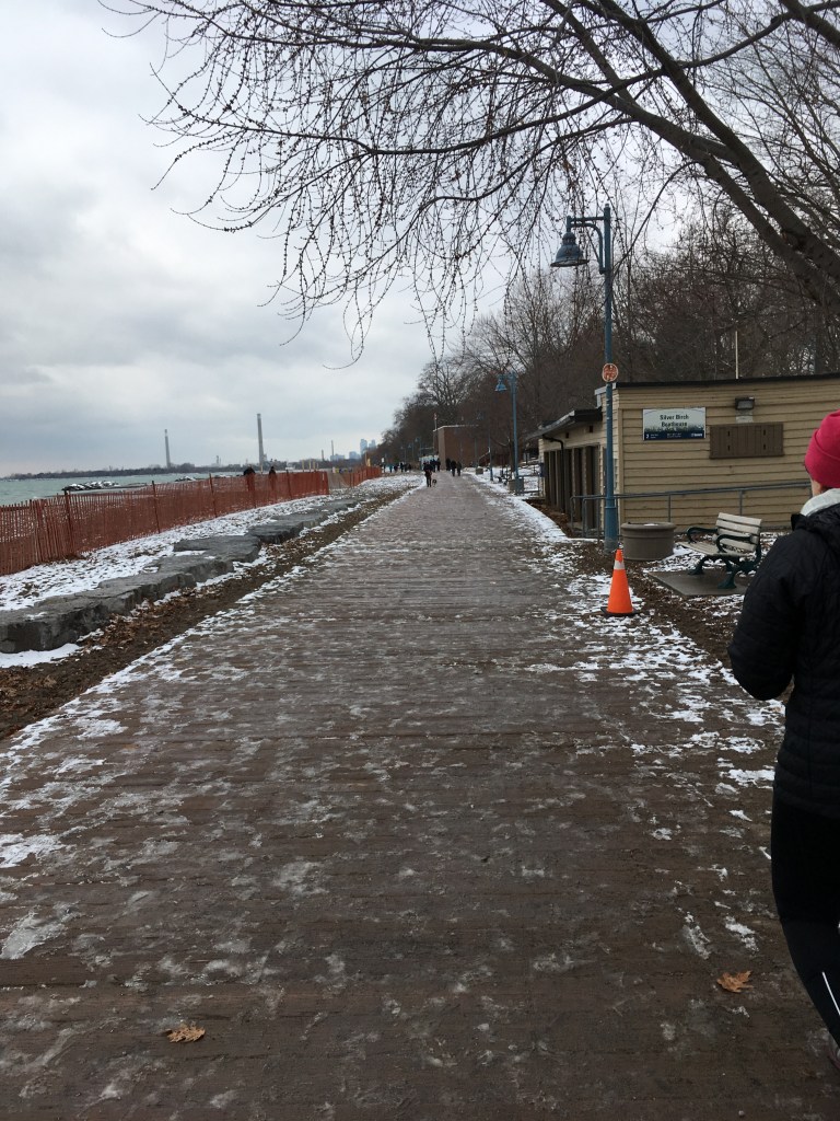
Surface: It’s a public road so concrete, concrete, concrete, and in winter add large dollops of salt. Wear comfy shoes.

Public Transit: Subway Line 1 runs most of the length of Yonge, from King up to Finch, and bus route 97 covers most of Yonge as well so it’s very easy to pick start and stopping points based on one of the subway or bus stops.

Route:

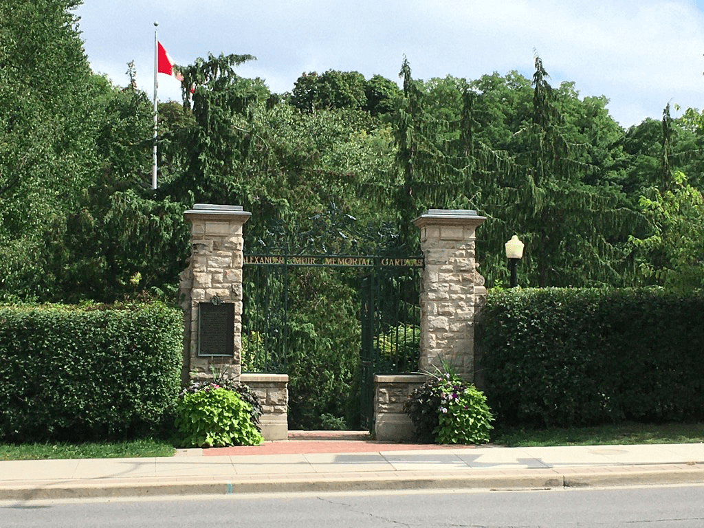
If it were me, I’d pick a stretch partly based on the weather and partly on the kind of food I like to eat. Starting down at the Lake on a sunny late spring day can be fantastic, and so can exploring mid-town or uptown. Downtown, mid-town, and uptown there are too many restaurants and shops to count, and there are parks like Ramsden or Alexander Muir Gardens or York Mills along the way too.

One way to decide is to simply pick a subway stop at random and then tell yourself you’re going to walk at least 3 subway stops either north or south along Yonge – keeping in mind that north of St. Clair, the stops are quite a bit farther apart than they are downtown.

The Beltline Bridge over Yonge, just south of Davisville

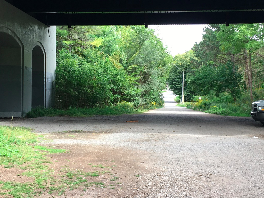
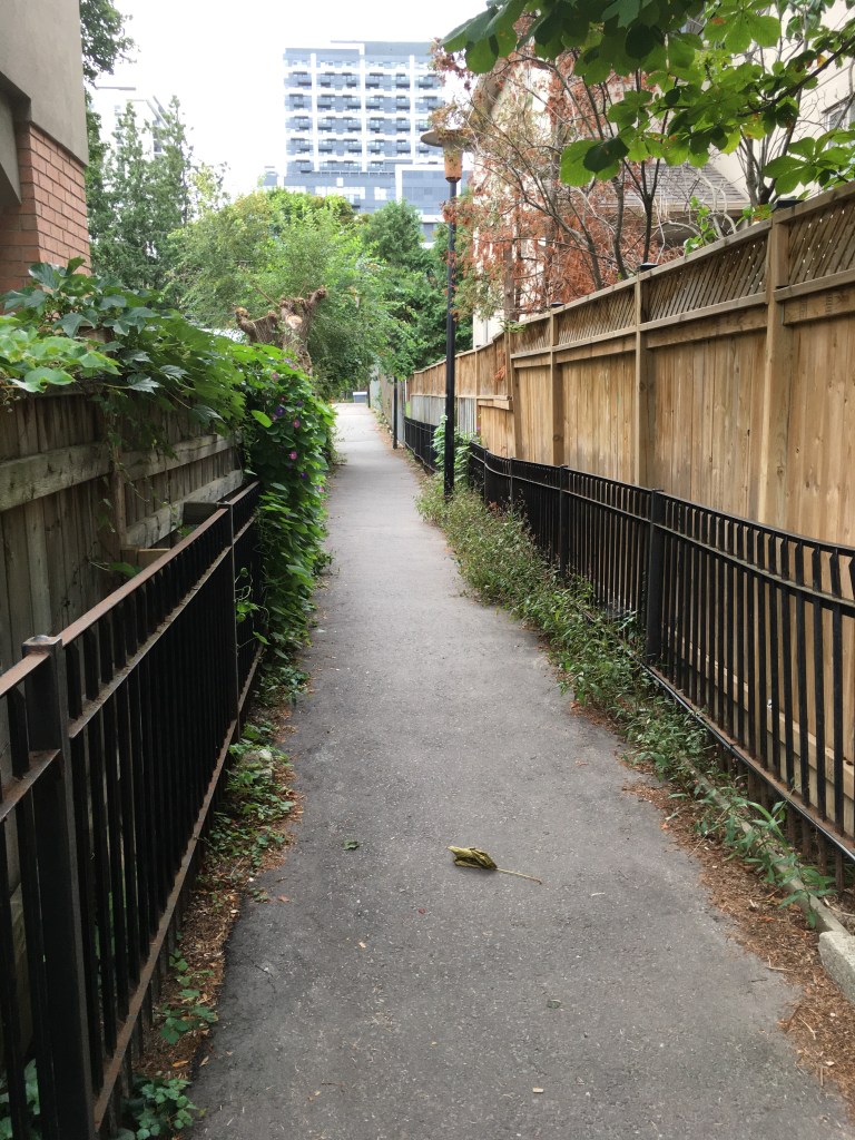
However you do it, try walking not just Yonge but also the surrounding streets that parallel it. Often a block east or west of Yonge takes you into residential streets and that’s a great way to explore too, and also get away a bit from the traffic and hustle.

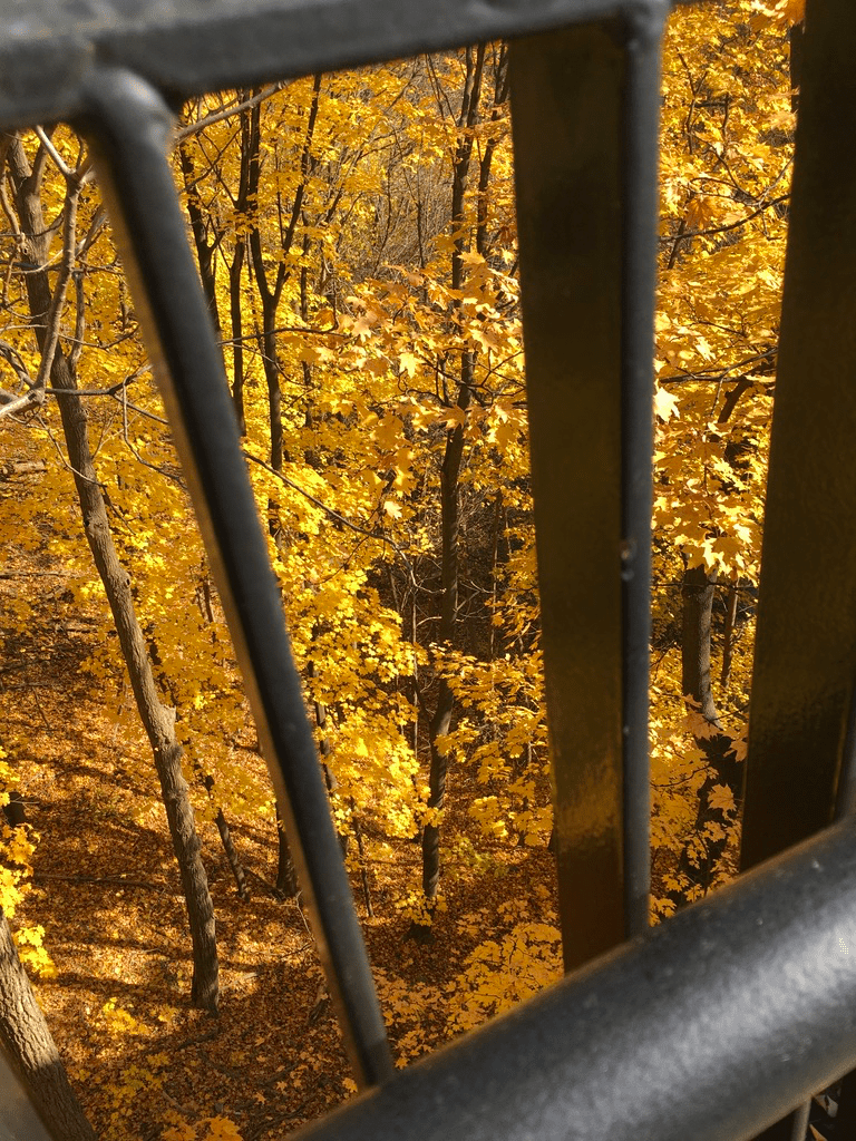
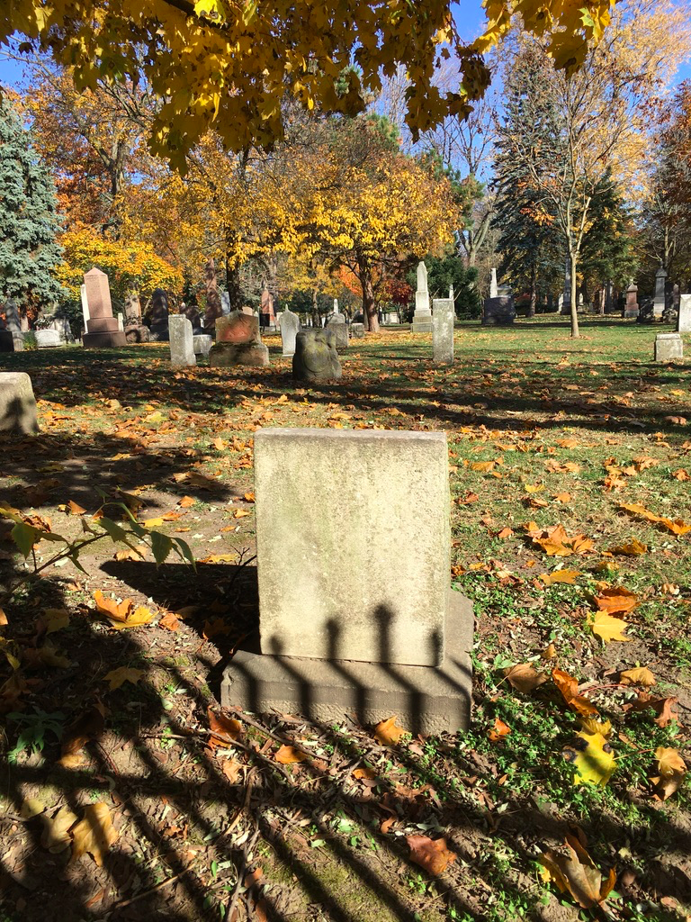
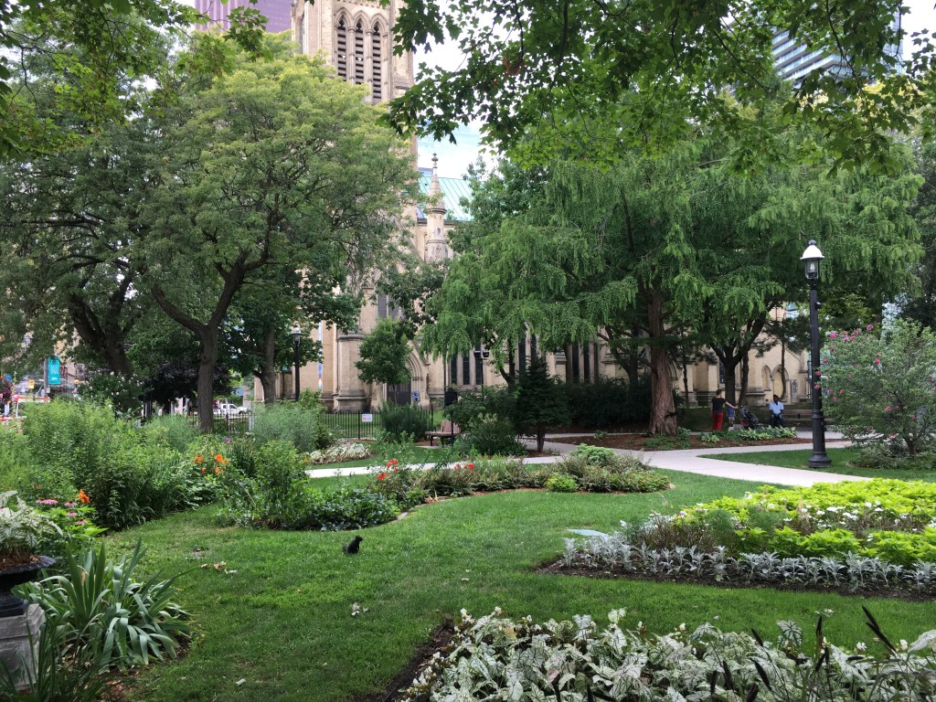
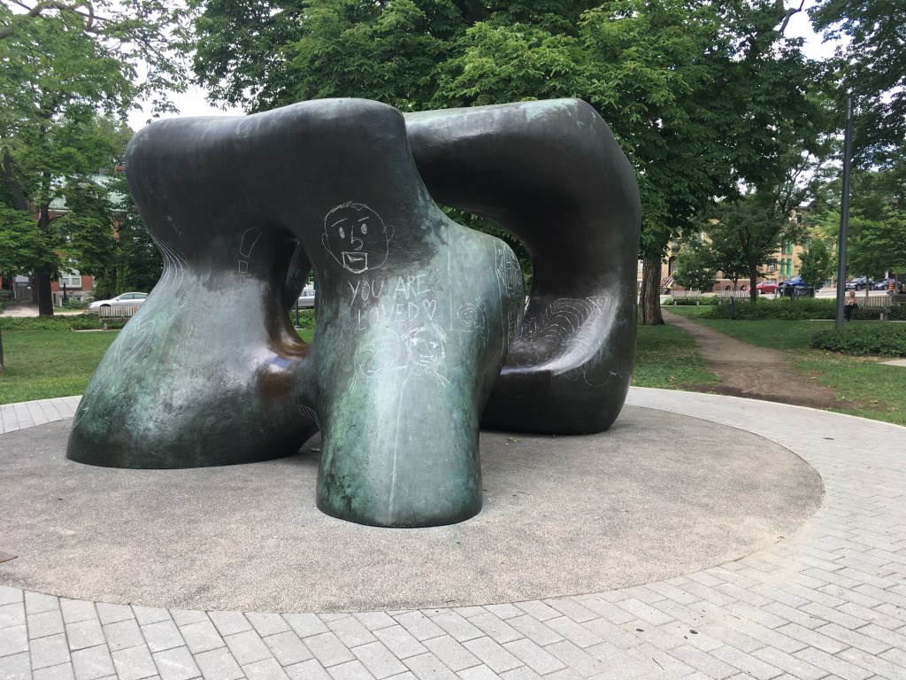
A favourite stretch of Yonge for me is in mid-town, between Bloor and north past Eglinton. This stretch goes past Ramsden Park (a mid-town jewel) as well as Mount Pleasant Cemetery, and it’s lovely to detour into those treed oases for cooling greenness on a hot summer day.

The entrance to Alexander Muir Park on the east side of Yonge, about 2 blocks south of Lawrence Ave

Sights:

Sights on Yonge are as much or more about the people than about the buildings or shops. People watching on Yonge is a year-round sport, and endless fun. Part of that is being people-watched yourself – the way you walk down Yonge, what you wear and what you carry, will provide gossip for others just as much as you can gossip about them. In summer, that includes sitting at one of the sidewalk cafes and patios and people-watching the street scene, sipping a cold glass of something while the passers-by judge you by the food you’re eating. Oh the joys.

Of course, there is history along Yonge as well, if you want to explore. Yonge-Dundas Square, which has become a celebration point when something big happens, like the Raptors NBA Championship win in 2019. Or little bits of history like the plaque that marks the Montgomery Tavern at Yonge and Montgomery, where William Lyon Mackenzie set off with a group of like-minded followers in 1837 during the so-called Upper Canada Rebellion to protest against the government of the day. And landmarks like the clock tower of the old CN rail station at Summerhill that’s now become an iconic location of the LCBO.

The Hockey Hall of Fame at Yonge and Front Street

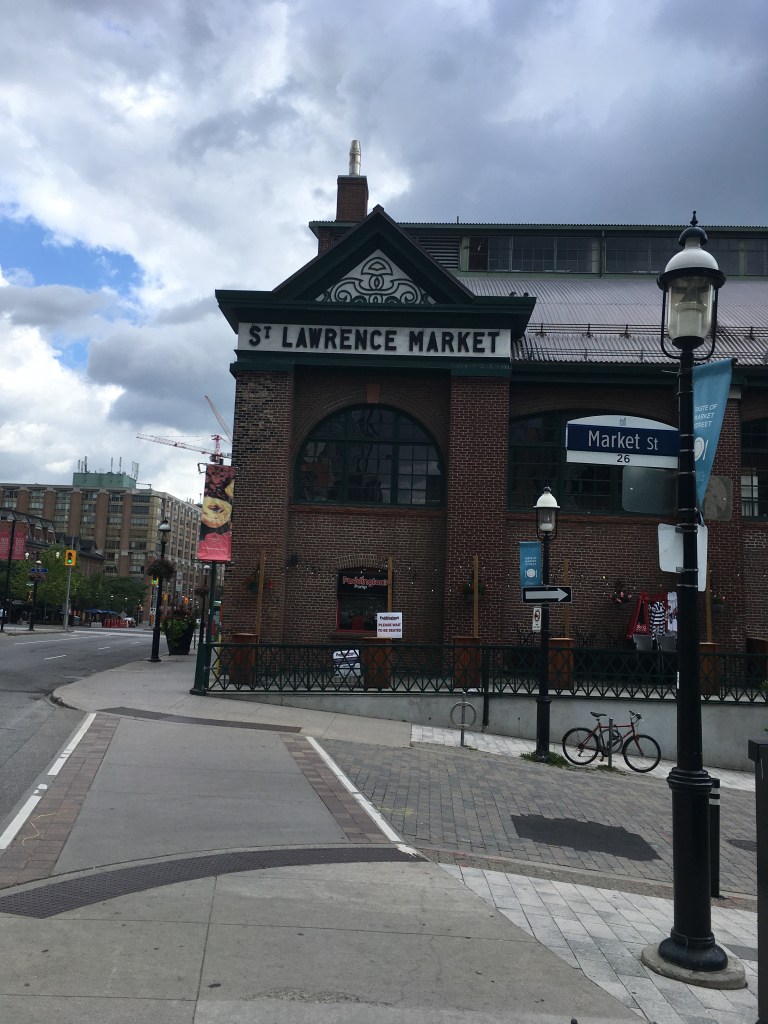
Of course, for many people Yonge is really about the shopping. For most of it’s length, it’s lined by shops of all descriptions – antiques, clothing, shoes, foods, guitars, bikes, tea, electronics, and so much more. We lived for many years just off Yonge in mid-town and did all of our daily shopping within a 2-block stretch of Yonge that included a fishmonger, a greengrocer, a cheese shop & deli, a bakery, and a butcher, all great little shops where we knew the shopkeepers and they greeted us by name. Sure, Yonge has its share of the big chain stores, but why would you bother when you find some little neighbourhood gem for a unique experience? Between the shops and the many unique little restaurants and bars, you can shop local and follow your 100-km diet. Who needs more?

Food & Refreshment:

It’s Yonge, so expect at least a coffee shop if not an actual restaurant or takeaway every few hundred meters pretty much the whole length of the street. You’ll find virtually every type of cuisine the city offers, and every type of establishment from bars to bistros. There are also countless food shops, butchers, cheese shops, fishmongers, grocery stores, and greengrocers, so you can do all your shopping along Yonge – bring a knapsack and some shopping bags.

Keep in mind that Yonge is an urban streetscape for most of its length, so a hot summer’s day can feel even hotter, just a cold winter’s blast of wind can freeze to the bone. The many shops and refreshments along the way will give you breaks from the weather.

Finally, while there are no public toilets or water fountains available on Yonge Street itself, there are many options available. Downtown, there are washrooms & water fountains in the malls off Yonge at the Eaton Centre, College Park, and Yonge-Bloor. At mid-town, there are washrooms in the mall on the north-east corner at Yonge & St. Clair, and on the north-west corner at Yonge & Eglinton. Uptown, there are malls on the north-east corner at Yonge & Sheppard and the south-west corner at Yonge & Steeles. Of course, there are tons of coffee shops along the way so you can always pop into one of those.

Diversions:

  1. Make a game of it – how many coffee shops can you find along Yonge? How many couples walking dogs will you spot? How many BMWs per block?
  2. You can also use Yonge as a corridor between wider neighbourhoods that are well worth exploring, like Yorkville, Rosedale, Deer Park, or Lawrence Park. In that case, pick a couple of neighbourhoods that are separated by a few km of Yonge, and use the street to walk between them.
  3. There’s much debate about what counts as “downtown”, “mid-town”, and “uptown”. If you want to break down Yonge by those labels, then I’d say downtown is Yonge from Bloor south to the Lake; midtown is Yonge between Bloor and Eg; and uptown is north of Eglinton. Of course, ask 10 people and you’ll get 10 different definitions so try exploring what your friends suggest is downtown or midtown or whatever.
  4. Yonge is ever-changing and flows with the seasons, so exploring any part of it will be very different in December versus June.

Walking by numbers

Recently, we’ve been in a stretch of above normal, spring-like November weather. It’s a bit incongruous to be out in shorts and a t-shirt under balmy blue skies and warm temps, while shuffling through piles of autumn leaves.

That said, it’s meant for glorious days that beg for a walk, and I’ve obliged as much as I can. Out recently, I decided to walk from our place in mid-town Toronto to meet my wife in Leslieville. It’s an easy walk, mostly downhill through the heart of the city, and as I was out, I got to thinking about it in terms of numbers.

There are numbers about the walk itself – about10km, about 1:45 minutes, 20 C, etc. And then there are numbers about things along the way, like how many parks I passed by or cut through – 7 of them, if you count Riverdale East and Riverdale West as two parks. Or the bridges that I crossed over or under – 5 as I recall, including the delightful Glen Road pedestrian bridge over the Rosedale Valley.

And what about the number of languages I overheard as I walked – there were at least 6 I think, not counting English – French, Arabic, Hindi, Italian, Spanish, and what I think was Cantonese and Russian. Plus, at least 6 accents to the English voices I overheard – mid-Canadian, north-east American, Caribbean, English, Irish, and South African.

I also passed by 3 cemeteries at Mount Pleasant, St. Michaels, and St. James, and marvelled at the gorgeous colour in each.

I stopped counting upscale cars very quickly, as in passing through Rosedale every drive seemed to have multiple examples. I did count 1 completely over-the-top car, however – a Rolls-Royce middle-finger-to-the-world SUV that was more tank than anything else, that rolled majestically through Cabbagetown down the middle of the road piloted by a blond middle-aged woman who may as well have had “Karen” stamped on her forehead.

I also stopped counting the number of people I saw who were also out for a stroll – dozens of fellow walkers, all in Lululemon it seemed, and ranging from new parents with infants to retired couples in their 80’s. Will they still be out in January when it’s -20?

Countless as well were the number of scents and aromas that I could distinguish as I passed – cannaboid funk in many places, 5-spice cookery along Broadview in old east Chinatown, frying onions from a dozen pubs, and everywhere autumn leaves, along with stale urine in the Glen road underpass, and the dreary pall of diesel exhaust.

All along the way, there was only one real constant, and that was the clear blue above as it danced through the golden leaves.

And there was only one ridiculously cute great-nephew whom I met at the end of my walk – Miles, named after mine and my nephew’s favourite musician. Kinda blue, just like the sky.

Favourite Toronto Walks – Lytton-Lawrence Loop

Part of a series on my favourite walking trails in Toronto.

Hey Toronto, remember to practice Physical Distancing during the COVID-19 pandemic! Also be aware that some of the amenities, parks, or services listed below may have limited availability. Please check the links included below for up to date information on what’s open and what’s not.

And now on to the regular post …..

I live in mid-town Toronto, so I frequently go for walks about the neighbourhood to get my daily exercise. I was out one day recently and it occurred to me that while I take it for granted sometimes, there is a lot of appeal in the nearby streets, parks, and ravines that would make a great walk for both residents of the city as well as visitors to Toronto. I’ve laid out this route to take in the best features of the Lytton Park and Lawrence Park neighbourhoods including several of the local sights and providing a glimpse of the charms of mid-town. I mean really, downtown hipsters, every once in awhile it won’t kill you to venture north of Bloor.

Length: About 8 km, so around 1.5 hrs.

Surface: Mostly paved, with some gravel paths in the ravines

Public Transit: Start and end at Eglinton Station on the Line 1 subway

Route:

entrance to Eglinton Park

Starting at Eglinton Station, use the exit at the south end of the platform so that you come out on west side of Yonge Street and south of Eglinton. As you exit the station, turn right (south) and walk about 100m to Berwick Avenue, and turn right (west). Follow Berwick about 200m to Duplex Ave and turn right (north). After about 100m, turn left (west), crossing Duplex and following Anderson Street. Continue 3 blocks to Lascelles Boulevard, then turn right (north). Take Lascelles north to Eglinton, where you can cross at the traffic lights and enter Eglinton Park.

Follow the path to the right of the Community Centre and past the arena and parking lot to enter the park itself. The path continues along the east side of the park and exits at Roselawn Avenue. Cross Roselawn at the crosswalk, and continue north up Rosewell Avenue. This continues for about 6 blocks north to Lytton Avenue. At Lytton, turn left (west) and follow it as it descends and curves north. At the corner of Lytton and Alexandria, you will pass the delightful Lytton Sunken Gardens.

Continuing up Alexandria, the road ascends and curves right (east). Follow Alexandria to Rosewell Avenue, then turn left (north). Follow Rosewell north for about 4 blocks past the John Ross Robertson and Glenview public schools. Just north of Glenview school, there is a foot path along the top edge of the bowl-shaped ravine in which the school’s playing fields are laid out. Follow this and then turn right (east) on the foot path along the north edge of the school yards, with Lawrence Park Collegiate Institute on your left.

The foot path between Lawrence Park Collegiate and Glenview School

At the end of this foot path where it joins Cheritan Avenue, there is a roadway on your right descending down into the Glenview playing field. Follow this down and at the bottom, turn left and walk back east past the baseball diamond to find the entrance gate to the Chatsworth Ravine. Enter the gate and follow the path beside Burkes Brook, crossing the bridge and then continuing till you reach Duplex Avenue. There is a steep flat path on the right or a set of stairs on the left – either takes you up out of the ravine and onto Duplex.

Cross Duplex and on the east side of the street you will see the steps descending into the Duplex Parkette (which are not on Google Maps, so it thinks you can’t get down into the park – that’s not true, though in winter if it’s icy, you can take Chatsworth Drive down to Yonge instead). Follow the stairs down and then continue east along the path towards Yonge Street. Near Yonge, the path forks, so go left to get to the crossing lights at Yonge and Chatsworth. Cross Yonge here and then turn right (north) and walk up the street less than 100m to the entrance to Alexander Muir Memorial Gardens.

Entrance to Alexander Muir Park

Enter the park and meander through the gardens until you come to tennis courts. Turn right leave the gardens to get onto the roadway that runs east parallel to the tennis courts. Follow that and you enter Blythwood Ravine along the foot path beside Burkes Brook which is channelled underground between Duplex and Yonge. Follow the foot path beside the stream east, crossing under Mount Pleasant Road.

Path under Mount Pleasant Road with Strathgowan Avenue straight ahead

On the east side of Mount Pleasant, the path ends, with a new path on your right and a roadway directly ahead (Strathgowan Avenue). Continue straight along Strathgowan for about 50m and then turn left (north) to climb the public foot path up onto Dundurn Road. Follow Dundurn north for about 4 blocks to Dinnick Crescent and then bear right to follow Dinnick another block north to Cheltenham Avenue. Turn right (east) and follow Cheltenham for about 3/4 of a km to Mildenhall Road. Cross Mildenhall to enter Cheltenham Park, and follow the path east through the park to emerge on the other side at Bayview Wood. Keep going straight and the road bends right (south) turning into St. Albans Crescent. Keep following this round as it continues bending right and starts heading back west.

After completely turning back west, as you continue straight ahead Rochester Avenue begins, so follow this east past Mildenhall Road to St. Ives Avenue. Turn left (south) on St. Ives and follow it south to St. Leonards Avenue. Turn left and then immediately right after less than 100m to St. Leonards Crescent, turning right here and following it south as it bends east a bit. At the junction with Dawlish Avenue, St. Leonards Crescent turns into Fidella Avenue which continues south and bending west. Follow that south until you reach Strathgowan Crescent. Turn right (west) and follow the crescent for about 100 m as it curves south and climbs the hill. At Strathgowan Avenue, turn right (west) with the Blythwood School yard on your left. Follow Strathgowan down the hill till you come to the path back into Blythwood Ravine, on your left just before get to the Mount Pleasant Road underpass.

Turn left onto the path into Blythwood Ravine and follow it north and east. After several hundred meters, the path ascends and connects to Blythwood Road. As you come out of the ravine, cross Blythwood using the crosswalk and turn right (west). Climb up the hill and cross Mount Pleasant Road at the traffic lights. Continue on Blythwood for about 500m to Blythwood Crescent. Turn left and follow that to Sheldrake Blvd. Turn right (west) and follow Sheldrake to Yonge Street. Turn left (south) on Yonge and walk back to Eglinton Avenue to the finish.

Sights:

Of the many delights of this route, my favourite is probably just wandering along wide, tree-lined, quiet streets as I walk through the Lytton Park and Lawrence Park neighbourhoods. Often, especially on weekends, there’s no one about and it’s peaceful and calm. The only people you do meet are locals out walking dogs or doing a bit of yard work. Some of my most relaxing walks have been through these streets on a misty, rainy early spring day, and you can kick up little piles of leaves in the autumn or enjoy the shade in the summer too.

Burkes Brook in Chatsworth Ravine

These streets were laid out in the early part of the 20th century and many of the homes date back to the 1920s and 1930s. Nowadays (sadly to my tastes), a number of these older homes have been demolished and replaced with large modern structures, but there are enough of the older ones left that you can see see hints both of the original agricultural past in early Toronto (look for the original farmhouses on Blythwood in between Mount Pleasant and Yonge) as well as the early city planning in the lay out of the roads. Those early planners were keen to provide lots of winding streets, in an era when the car was starting to dominate planning – hence the width of the streets and in many cases the lack of sidewalks.

There is history here too. Alexander Muir Gardens is named after the man who wrote what for many years was the unofficial Canadian national anthem (at least to English Canadians) – The Maple Leaf Forever. The gardens were laid out in the 1930s to honour him, and the wind may oblige you to provide a nice shot of the flag that bears that symbol.

The parks and ravines are also lovely. Burkes Brook is one of the many small tributaries of the Don River and the City of Toronto has both exposed it in some parts and buried it in others. Following its course is a bit of an adventure as you go from wooded ravines to parks to urban street crossings – check out the Lost Rivers Project to learn more about these hidden creeks and streams.

Many people don’t realize it, but Elginton Park is also set in a filled-in creek ravine. Mud Creek is flowing under it and under Eglinton Avenue itself, and then crosses under Yonge south of Eglinton near Manor Road, to follow the line of Tullis Drive on the east side of Yonge and eventually flow under Mount Pleasant Cemetery into the ravine under St. Clair Avenue and onwards to the Don. These hidden creeks are all over Toronto and help to explain why some of the streets curve and bend the way they do.

This walk is also linked by the spine provided by Yonge Street. Between Eglinton and Lawrence Ave, Yonge is a solid line of shops and retail, providing those who leave nearby with their everyday needs and ensuring that this is actually a fantastic, walkable area both east and west of Yonge.

There are also at least 10 schools in the area, along with the parks, so this is a family-friendly place as well. That explains the bajillion dogs and their owners, as it seems to be a neighbourhood requirement to have 2.5 kids, 3.5 bikes, and 4.5 dogs per household. And also, it should be said, 1.5 luxury cars per driveway, reflecting the upper middle-class demographic. This area used to be very, shall we say monochrome, and is now becoming more diverse culturally, echoing Toronto as whole though also echoing its social/cultural stratifications as well. Property prices here have not gone done, to say the least.

The Eglinton Park fieldhouse

Finally, I like this area simply because I’ve lived here on and off for close to 40 years, since I arrived in Toronto to attend university at Glendon College, which is just east of Lawrence Park. I’ve watched the neighbourhood change and grow and evolve over the years. I’ve coached my son’s baseball teams playing in Eglinton Park, and I’ve pushed him on his toboggan down the hill at Glenview School, where he also did his swimming lessons. It’s been a wonderful place to live, and when we’ve returned to the hood after living elsewhere, we’ve always settled right back in like the proverbial dirty sock. It’s home.

Food & Refreshment:

Yonge and Eglinton is amply supplied with many food shops, restaurants, coffee shops, and bars to stock up for a picnic, fuel up ahead of the walk, or rest up afterwards. There is a great breakfast place called Boom on Eg at Lascelles, just as you enter Eglinton Park, and there is one of my favourite greasy spoon diners on Yonge near Castlefield (Good Bite is just that, and no disrespect intended calling it a greasy spoon). All of that choice means it’s easy to combine a nice walk with some shopping, with the subway right there so that you can leave the car at home.

As well, Eglinton Park has both water fountains and public washrooms, and there are also both of these in the Community Center itself so that you can stop off year round. There are water fountains in Alexander Muir Gardens, Duplex Parkette, and Cheltenham Park, though all of these are turned off between October and May. Otherwise, take advantage of the coffee shops along Yonge or in the Yonge-Eglinton shopping centre.

Diversions:

  1. The route describes exits Burkes Brook ravine at Blythswood Road. If you want to stretch yourself further, instead of heading to Yonge along Blythswood Road, cross it and descend on the south side of the road, so you can keep going on the path as you enter Sherwood Park. After about 500m, past the picnic area, you can either turn right to climb up out of the park at Sherwood Avenue and so return to Yonge, or else turn left (east) and follow the path along Burkes Brook through the east end of the ravine to Bayview Avenue. If you do that, then a great way to get back to Yonge is to go south on Bayview to Mount Hope Cemetery and cut through that peaceful spot to exit onto Erskine Avenue which will take you east back to Yonge. If Mount Hope Cemetery is closed, then continue south on Bayview to Broadway Avenue, where you can turn right (west) and follow it all the way to Yonge.
  2. As you go up Rosewell Avenue and come to Glenview School, you will notice that there is a treed ravine on the west side of the street. These are part of the grounds of Havergal College, a private school and thus private property. This ravine, however, is part of Burkes Brook, so to keep following it north, walk around Havergal by going north up Rosewell to Lawrence Ave, turning left to get cross to the west side of Avenue Road, then turning right (north) across Lawrence to go north up Avenue Road to Woburn Avenue. Here, on the northwest corner, there is the entrance to Brookdale Park. The path here keeps going north, and if you follow that onto Grey Road, you can keep going up to about Brooke Avenue and so follow more or less follow the course of upper Burkes Brook.

Favourite Toronto Walks -East Toronto Loop

Part of a series on my favourite walking trails in Toronto.

Hey Toronto, remember to practice Physical Distancing during the COVID-19 pandemic! Also be aware that some of the amenities, parks, or services listed below may have limited availability or opening hours. Please check the links included below for up to date information on what’s open and what’s not.

And now on to the regular post …..

Several years ago, I was training to do the Toronto Waterfront Marathon. I had never done a walk (and I walked it more than I ran it) of more than about 20 km, and since a marathon is 42 km, I planned out a walk that would be about 30 km in length and incorporate some ups and downs to get my legs built up.

This walk starts and ends in mid-town Toronto at Yonge and Eglinton, and takes in parts of the Beltline, the Don Valley Brickworks, the Lower Don Trail, Riverdale Park, Corktown Common, the Martin Goodman Trail, the Beaches Boardwalk, the Glen Stewart Ravine, the Taylor-Massey Creek Trail, E.T. Seton Park, Wilket Creek Park, Sunnybrook Park, the Burkes Brook Ravine, and Sherwood Park – whew!

Length: About 32 km, including about 200m of vertical ups and downs

Surface: Mostly paved, with gravel path on some of the ravine trails, plus the wooden boardwalk in the Beaches.

Public Transit: Start and end at Eglinton Station on the Line 1 subway

Route:

Starting from Eglinton Station, head south on east side of Yonge St and turn east (left) at Manor Road. Cross the street and turn right (south) down Tullis Drive. Follow Tulis south to Belsize Avenue, crossing the street to the south side. You’ll see a fence laneway in front of you – take that as it’s a public right of way and follow it to Millwood.

Laneway between Belsize and Millwood

Turn left (east) on Millwood and proceed down the hill. At Acacia, turn south (right) and follow that to Davisville Avenue. Cross Davisville and turn west (right) for a few meters to Pailton Crescent. Turn left (south) and follow Pailton to Merton Street. As you cross Merton at the crosswalk, there is a path directly in front of you beside a condominium building and that takes you to the Beltline Trail.

At the Beltline, turn left (east) and follow it for about 100m to the entrance into Mount Pleasant Cemetery. Inside the Cemetery follow the purple painted lines on the road, following it east under Mount Pleasant Road and around towards the memorial gardens. The marked path takes you east and south and exits the cemetery at Moore Avenue, opposite the entrance to the Moore Ravine Trail – careful, there are always many impatient drivers as you try to cross.

Descend on the trail into the ravine and follow it for about 1km. When you reach the entrance to the Don Valley Brickworks, you can detour left over the bridge and follow the trails in the Brickworks, or else continue on the Beltline south until you enter the Brickworks opposite the main buildings near the car park. Exit the Brickworks complex here, crossing Bayview Ave at the lights to join the Lower Don Trail (turn right, south). Follow the Don Trail south parallel to Bayview for about 1.5 km to the traffic lights at Rosedale Valley Drive. Cross here and directly in front of you will be the stairs up the hill beside St. James Cemetery. Climb up to reach Wellesley Park.

Walk through the park and onto Wellesley Street, and keep going about 100m to Sumach Street. Turn left (south) and follow Sumach to the entrance to Riverdale Park. Turn left into the Park and follow the path diagonally across past Riverdale Farm, in a south-east direction, to reach the stairs leading down into the Don Valley. Follow the path down to reach the bridge over Bayview Avenue – climb up, cross the road, and then take the stairs down onto the Lower Don Trail. Follow the Trail south about 1.5 km to Corktown Common.

If you go past the Common, the Trail bends a bit west and then east under the Don Valley Parkway overpass, to come to a trail junction. Turn left (east) here to cross the Don River and then join the Martin Goodman Trail parallel to Lakeshore Blvd. If you detoured into the Common, follow the paths in the park back out through the junction tunnel that passes under the train tracks to rejoin the Lower Don Trail.

Once on the Martin Goodman Trail, follow it east for 2-3 km to reach the entrance to Woodbine Beach park. It’s better to walk on the north side of Lakeshore, as the cycle path and foot path are separated here so you’re not constantly being dinged by cyclist’s bells.

Martin Goodman Trail between Carlaw and Leslie

When you reach Woodbine Beach park, cross Lakeshore at the traffic lights and turn into the park, follow the Martin Goodman trail pathway connect to the west end of the Beaches Boardwalk. Keep going east following the boardwalk for 2 km to reach Balmy Beach Park.

the Boardwalk at Beaches park.

At Balmy Beach, at the end of the Boardwalk, turn north (left) onto Silver Birch Drive and follow it north to Queen Street. At Queen, turn left (west) and follow it for about 500 m to the entrance to Ivan Forest Gardens park, on the north side of the street. Turn into the park and follow the trail north through the park, which will turn into Glen Stewart Park, and exit at Glen Manor Road East. Cross that street and descend into the Glen Stewart Ravine, following the trail north and east.

Exit the Glen Stewart Ravine trail at Kingston Road and turn right (east). Walk along Kingston Road east – you can either go all the way to Victoria Park Ave and then turn left (north) or else turn north up one of the side streets such as Scarborough Road and follow that to Gerrard – if you do that, turn right (east) on Gerrard and walk east to Victoria Park, then turn left (north). Once on Victoria Park, follow it north under the train tracks and on past Danforth Avenue. Keep going north past the Victoria Park subway station, and about 500m north of the station the road descends into a gulley. On the west side of the road opposite the Dentonia Park Golf Course you will find a set of stairs descending into the Taylor-Massey Creek Park trail system.

Once on the trail here, follow it west for about 4 km to reach the lower Don parklands. At the Lower Don off-leash dog park, turn right (north) and follow the trail north and then west crossing under the Don Valley Parkway to reach the junction with the Don Valley Trail system. Turn right (north) crossing the Don River over the old Don Mills Road bridge,

the old Don Mills Road bridge

and follow the trail through the parking lot to reach a bridge over the train tracks. Turn left (west) at the top of the bridge and follow the trail to reach the entrance to E. T. Seton Park.

In Seton Park, cut across the car park and turn right (north) along the roadway. Follow the road north till you pick up the West Don Trail inside the park, and then take that trail north through E. T. Seton park all the way to the car park on the south side of Eglinton Ave near Leslie Street. Turn left (west) at that car park and follow the roadway west and then north to cross under Eglinton and enter Wilket Creek Park.

hints of autumn on a September day

Keep going north through Wilket Creek till you reach the junction of the roadway/trail that turns west (left) heading towards Sunnybrook Park. Follow that roadway/trail west into and through Sunnybrook Park, towards the Riding Stables. Just before you reach the Stables, there is a path on the west side of the road that leads to a bridge which crosses the West Don River. Take that path west and on the other side of the river, turn left (south) on the trail beside the off-leash dog park. Follow the trail heading south and then bending west. On the west side of the dog park, turn right (north) onto the Burkes Brook trail. Follow this north and bend to the west to keep going parallel to the water. The trail officially ends after about 500-600m, but you can exit the official trail and keep going west on the unofficial trail. This continues for another 500 m to reach a steep hill climbing up out of the ravine to reach Bayview Avenue.

Cross Bayview (either directly here or else a bit to the north at the traffic lights by Sunnybrook Hospital). On the opposite side of Bayview, reenter the Burkes Brook trail and descend into the ravine again. Follow this trail west for about 1km, climbing the stairs passing through the off-leash dog area, to descend into Sherwood Park. At Sherwood Park, turn north and then west at the bridge over Burkes Brook (next to the City of Toronto maintenance buildings) and climb the hill along the roadway to exit the ravine/park onto Sherwood Avenue.

Up the stairs in Burkes Brook

Follow Sherwood west for about 500m to Mount Pleasant Road. Cross at the traffic lights and continue west along Sherwood for about another km or so to reach Yonge Street. Turn left (south) on Yonge and follow it for about 1km to reach the finish back at Eglinton Station.

Sights:

I like this walk because of the variety of scenery – the forests and wildness of the ravines, the garden settings in the parks, the sand and the lake along the Boardwalk, and the urban stretches through the upper beaches. That variety keeps it interesting over the whole length of the walk, and it also means that in any season there will something different. The ravines and shaded streets also mean you have some shelter from summer sun, though note that in winter most of the trails are not cleared or salted so they can get icy.

The Beltline down Moore Ravine

Another cool thing about this walk is that it actually follows a number of the various creeks and brooks that have been buried over time. For example, at the start of the walk, Tullis Drive follows the course of Mud Creek. If you listen carefully at the manhole cover at the corner of Tullis and Glebe Road, you can usually hear the stream following under your feet. The same happens on Millwood in the little gully that you descend into – that gully is there because of the creek. Check out the Lost Rivers project to learn more about this fascinating part of Toronto’s history.

down the hill on Millwood into the Mud Creek gulley

I also like this route for the many angles it gives you on the Toronto skyline. From the Don Valley near the Brickworks, you see it from the north and east. From beaches, you see it directly along the lake and you get the tall chimneys of industry poking up as well. You always see the CN Tower poking through and that landmark is usefully to navigate by. These landmarks are reminders that while you’re walking through many beautiful natural settings, the industrial and commercial aspects of the city are always around you.

Industrial Toronto reclaimed – the old railway bridge at the north end of E.T. Seton Park

The many parks that this route takes in are also little time capsules. Corktown Common and the Brickworks, for example, are relatively new additions to the City’s park system, having been created in the 2010’s as part of the revitalization of what had been industrial areas. A generation earlier, in the 1970’s, parks such as E.T. Seton were added, and to offer the growing middle classes not just trails but also recreational amenities like a disk golf course and an archery range. A generation before that, in the 1940s after WW2, Sunnybrook Park was laid out after a private estate was taken over during the war to create a health facility for returning veterans. And finally, another generation back in the 1920s, the parks in the Beaches are 100 years old and reflect the formal gardens, picnic areas, and baseball diamonds that were popular then.

Taylor Creek

Finally, this route, especially around the Beaches, is great for people watching, I’ve seen everything from multi-generational families out for a stroll to movie shoots to outdoor aerobics classes. It can get crowded in high summer, especially on a weekend, but for people watching that just adds to the fun.

Food & Refreshment:

There are several spots where clusters of restaurants and coffee shops will set you up for the journey. That starts with Yonge & Eglinton, which is packed with places to grab some food as you set out or as you finish.

In the Brickworks there are washrooms, water fountains, and a great cafe, plus on weekends there are often farmers markets or festivals on (note that COVID-19 may crimp these a lot so check ahead).

At Corktown, there are washrooms and water fountains, and there are several coffee shops nearby. Near the Common, the shops/restaurants at the Distillery District, or the St. Lawrence Market, offer lots of choice.

In the Beaches, there are washrooms and water fountains in several of the parks. There are also cafes near the Boardwalk, and of course along Queen Street itself there are many places to chose from. If you are paying attention to the route, you’ll see that Queen between Silver Birch Drive and Ivan Forest Gardens is about half-way, so it makes a natural spot to stop for a break.

North of the Beaches, your last chance for coffee or food is near Victoria Park and Danforth. After that, if you are following the route as described, there are no coffee shops until you get back to Yonge Street. There are some washrooms and water fountains in Taylor-Massey Creek, E. T. Seton, Wilket Creek, and Sunnybrook Parks.

Note that all of the public washrooms and water fountains in any of the city parks are seasonal, so they close around October and don’t reopen till May. Note also that COVID-19 is causing restrictions on some of these facilities. In winter, you may need to use coffee shops along the route.

Diversions:

  1. I’ve described the route in a counter-clockwise direction. You can of course reverse that and go clockwise round. The hills are the same I think – you are still climbing in and out of various ravines, but it might be a bit easier going clockwise as the climbs are less steep.
  2. It’s easy to break this up if you want and tackle it over different days. Jump on/off points include the Brickworks, Corktown Common, Queen Street, or Victoria Park Station.
  3. The Distillery District and Corktown St. Lawrence are worth exploring in their own rights, as is the Beaches neighbourhood. If you break up the route, you could spend a few hours in either area and that would be a great way to explore the eastern part of the city.
  4. As noted, seasons matter quite a bit on this route. Summer near the lake is awesome, the trees in the ravines are stunning in autumn, the wildflowers in spring are gorgeous, and the quiet of a fresh snowfall is peaceful. You could walk this route multiple times and see different things every time.

TO Walks – The COVID-19 New Normal

For the past several months now, I’ve been starting off most of my posts with this:

Hey Toronto, remember to practice Physical Distancing during the COVID-19 pandemic! Also be aware that some of the amenities, parks, or services listed below may have limited availability. Please check the links included below for up to date information on what’s open and what’s not.

And after 6 months of the COVID-19 pandemic, I’m wondering if I need to keep saying that. Don’t we all know this by now?

You hear people talk about “the new normal”, and the idea that what we have become used to with COVID-19 is what we’re going to have to keep doing for the foreseeable future. We all hope there will be a vaccine soon, but in the meantime we just need to keep doing the right things to manage the epidemic.

  • practicing physical distancing: 2m = 1 hockey stick = 3 dog-lengths
  • wearing a mask where physical distancing isn’t practical, like shops and indoor public spaces
  • washing hands and avoiding contact points
  • cheering each other up with sidewalk chalk art

While that’s become mundane, at least for me, what’s also become part of my new normal is the way I’m walking these last few months. For example, I’ve stopped thinking or planning for long multi-day out of town walks. The Bruce Trail is out right now, partly because sections are closed, partly because the Bruce Trail Org is actively discouraging through-hikes, and partly because I’m reluctant to book B&Bs or hotels right now.

And then, within the city, my routine has changed. In the Before Times, I would take public transit to some end point and walk home. Now I don’t want to use those the bus or subway, and since the City has closed many public washrooms in parks and has shut off public water fountains, I need to plan my routes carefully around pit stops while carrying extra water with me.

All of that means much of my walking has been local, 1-2 hour forays around nearby neighbourhoods. Thankfully, we live in mid-town and there are many quiet, shaded backstreets to chose from, so most days I ask Siri to just randomly pick a direction – North, East, South, or West – and head off that way.

With tricks like this, and some others I’ve learned, my new normal COVID-19 walking routine is helping me to keep sane.

COVID-19 Walking Hints and Tips

  • Walk on the left when you can. This means you’re facing the traffic if you have to step into the street briefly to give space on the sidewalk to someone else
  • Backstreets have less foot traffic. On busy streets like Yonge, I sometimes feel like I need to wear a mask because of the density of other pedestrians. On side streets, there’s hardly anyone about any day of the week, and it’s quieter so I can hear the birds.
  • Plan your route. Like I said, washrooms and water can be tricky. I can carry water, and I guess I can pee in the bushes if I need to, but that only works in forested parks and ravines. The neighbours don’t take kindly to pits stops in their hedges.
  • Planning ahead also means both hydrating before I leave as well as emptying the bladder.
  • Avoid bike trails, especially on weekends. Toronto has many multi-use trails, like the Don Valley Trail, and they are mostly too narrow to allow 2m of physical distancing from cyclists. Weekends are the most congested with would-be Tour de France pelotonistes, so I look for walker-friendly options.
  • Take a picnic. With many coffee shops and restaurants still limited in seating, and requiring mask-usage if you do go in, it’s easier to just take some snacks and have a bite on a park bench somewhere.
  • Skip parks with off-leash dog runs or playgrounds. Parks like this usually mean more pedestrians and less physical-distancing, which should mean more mask-wearing, and I don’t like to wear a mask outdoors, so I just don’t go near those parks.
  • Look for big, natural settings. Toronto is blessed with a wonderful system of ravines, trails, and parks that are big enough to offer lots of trails and fewer people for lower density, especially during mid-week.
  • Look for quiet neighbourhoods with lots of windy streets. Toronto has many areas that feature beautiful homes, lots of shade, and little traffic. Often these are quiet any day of the week so you can go for walks when the weekend-warriors are clogging the parks. Personal favourites include:
    • Lawrence Park
    • Lytton Park
    • Cedarvale / Wychwood
    • Hoggs Hollow
    • Rosedale and Rosedale Heights
    • Forest Hill and Upper Forest Hill
    • Moore Park
    • Chaplin Estates
    • Davisville
    • Leaside
    • Rathnelly
    • The Beaches
    • Leslieville
  • Check out the cemeteries. I’ve written many times about walking through Mount Pleasant Cemetery, and Mount Hope and Prospect Cemeteries are favourites too. They’re quiet, shaded, and usually free of cyclists, and this time of year I can fill my water bottle at one of the taps around the grounds. That said, please do remember that first and foremost these are places of memory and quiet contemplation.
  • The worse the weather, the fewer people about. If it’s raining or really hot/cold, you can avoid crowds by using the weather to keep crowds down. Remember – there’s no bad weather, just poor clothing choices.

And probably most importantly, remember that we’re all in this together. We’re all missing something, we’re all a bit inconvenienced, and we’re all impatient to be able to get back to whatever it was we thought was normal before.

TO Places – The Beaches

Part of a series on my favourite places to go for a walk in Toronto

Hey Toronto, remember to practice Physical Distancing during the COVID-19 pandemic! Restrictions on social gathering or use of public spaces placed by either the Province of Ontario or the City of Toronto may limit what you can do. Check the links for the latest info.

And now on to the regular post …..

Any time of the year is a good time for the beach

If you live in Toronto, just saying “the Beaches” probably brings up several images – the shops, restaurants and bars, ice cream, the parks, the sand, the boardwalk, and probably more besides. Whether you are a lifelong resident or a weekend visitor, strolling the boardwalk and staring at the waves is magical.

Location: There’s the “beach” part of the Beaches and then there’s the neighbourhood. The sandy lakefront starts at Woodbine Beach and continues along the lake to Balmy Beach Park. The neighbourhood stretches along Queen eastward from around Woodbine Avenue to the end of Queen Street near Victoria Park Avenue, and then south to the lake and north to Kingston Road.

Public Transit: Take the Queen 501 Streetcar east from Queen Station on Line 1 and get off at Coxwell Avenue for Woodbine Park, or a bit further east past Woodbine Ave for the shops.

Why I like it:

For me the Beaches bring up several other images. One is of Canada Day in 1999 – we had just arrived back in Toronto that day, having returned from London, so we thought we’d go for a walk to get reacquainted with the City. The Beaches seemed like the perfect spot to do that. There was a big celebration and party going on in Kew Gardens, and we nearly cried thinking about what we had left behind in London and what was welcoming us back to Toronto.

And then when we were expecting our son and my wife was well along in her pregnancy, in fact a day or 2 past her due date, we decided to go for a walk along the boardwalk. We’d heard that exercise was a good way to get things going, along with eating spicy food, so on our stroll we also grabbed a slice of hot pepperoni pizza.

With no signs of impending labour, we wandered the neighbourhood and came across a home for sale with an open house in progress. We popped in, and must have fit the estate agent’s profile, because she was all over us. We were living in a downtown condo at the time and knew that eventually we’d want a home with a garden and some space for a toddler, and this was a nice family house that backed onto the local school – you could send your child off through the backyard gate into the school grounds – and for a few moments we had serious thoughts of “what if we lived in the Beaches”.

And then we realized that the timing wasn’t great – she was only days from delivery and we didn’t fancy moving with a 1 or 2 month old – so we kept on strolling. Soon enough, within a few days our son was born, and we had more important things to do.

And as he got older, every few months we’d drive out to the Beaches, this time with a stroller, and walk along the boardwalk. Later our strolls took in the parks and playgrounds and ice creams and chasing him along the sand and tossing pebbles into the waves. Once he even won a prize by guessing the # of jelly beans in a jar at a local antique called The Seagull – it was a framed picture of well-known Beaches shops and restaurants. We kept that for years afterwards.

And then there’s the Toronto Waterfront Marathon. I did that in 2017, and the last quarter of the route took in Queen Street right through the heart of the neighbourhood. The eastern end of the route was at Maclean Avenue, where you turned and headed back down Queen, and from that turn there were about 8-9 km to the finish. I was exhausted when I came up Woodbine Ave onto Queen and as I plowed along I kept thinking “where is Maclean, when do I get there”. I was one of the stragglers at the end of the race but there were still lots of locals cheering on us slowpokes as we dragged ourselves through. I still think of that whenever I pass Maclean.

So all of those memories colour how I see the Beaches. I’m sure I’m not the only Torontonian who has a range of memories of the neighbourhood, and I’m sure that as long as we live here we’ll continue to visit to soak up the spirit of the place.

Sights:

The lakefront and the sand are why this area is popular, and the sightseeing starts there.

Woodbine Beach

There’s much more to the area than the actual beaches, of course. The parks are great for picnics and playgrounds. There’s also the pool at Woodbine Park, the outdoor skating rink at Kew Gardens, and many great spots to run around as a kid, an adult, or a dog (there are several off-leash dog run areas along the beach). Plus there are dozens of benches and Adirondack chairs along the boardwalk, perfect for people-watching or just staring at the lake.

The people-watching and window-shopping are also fun along Queen. The area is constantly changing, and old favourites like Seagull Antiques or Lick’s Burgers have sadly closed up, but new places open constantly and there are still some familiar spots like the Sunset Grill and the Beacher Cafe. COVID-19 has put a dent into the retail character of the area, but it will bounce back over time and in the meantime there’s plenty to see and do.

That’s true any time of the year, by the way. The changing seasons are reflected in the parks and the lake. On a hot summer day, the water is blue and enticing, while on a cold January day it can be grey-green and forbidding, but it’s always fascinating. The autumn colours are wonderful, and the spring flowers too. And the many places to pop into along Queen mean that you can always warm up or cool down no matter what the weather.

New Year’s Day at Balmy Beach

Food & Refreshment:

There are dozens of ice cream, coffee, burger, pizza, and other takeaway places in the area, including a Pizza Pizza outlet in Kew Gardens at the Boardwalk. There are also usually food trucks around on weekends. And of course, there are many local bars and restaurants to choose from, offering casual to formal options.

Another great idea is to visit some of the many food shops along Queen and grab the ingredients for a picnic – fresh fruit, bakeries, cheeses, snacks, coffee, tea, soft drinks, and more are all available, and there are many picnic tables scattered around the parks along with shady spots and sunny sand where you can enjoy your feast.

There are public washrooms in the parks, along with public water fountains. These are seasonal, open from about May 1 to about Oct 1 depending on the weather. Outside those months, the many coffee shops on Queen are good places for a pit stop.

Diversions:

  1. The Leslieville neighbourhood lies just to the west of the Beaches, along Queen between about Broadview to about Leslie. It’s only about a 2 km walk or so between the neighbourhoods, and there are lots of shops and sights in between, so breakfasting in Leslieville and lunching in the Beaches makes for a great day out.
  2. If the weather is kind, walking from Queen Station on Line 1 along Queen out to the Beaches will take you about an hour and a half, and then you can take the Streetcar back. You can also do that in reverse, and walk back to Queen Station.
  3. The Martin Goodman Trail follows the lakefront all the way across Toronto. Walking or cycling that trail to and from the Beaches is a great way to get some exercise.
  4. The Glen Stewart Ravine runs north from Queen at about Glen Manor Drive, and takes you along a wonderful trail up to Kingston Road. The autumn colours here are spectacular.
The RC Harris Water Treatment Plant at the east end of Queen

Toronto Discovery Walks

Part of a series on my favourite walking trails in Toronto.

Hey Toronto, remember to practice Physical Distancing during the COVID-19 pandemic! Also be aware that some of the amenities, parks, or services listed below may have limited availability. Please check the links included below for up to date information on what’s open and what’s not.

And now on to the regular post …..

Over the past several months, I’ve written about a number of my favourite walks in Toronto. This time, I wanted to highlight something a bit different.

One of the many great things about living in Toronto is the work that the City has put into exploring its past and making it accessible to a new generation of residents and visitors. One of they ways of doing that is a fantastic program called Discovery Walks.

Each of these walking routes explores some of City’s many natural features like the lakefront or the ravine trail system, and along the way points out the history of the City.

For example, the Garrison Creek walk takes you through downtown Toronto following the route of the now-buried creek that, back in the 1790’s, emptied into Lake Ontario near what today is about Bathurst Street. Following this route takes you through some interesting inner-city neighbourhoods that are full of history, as well as fantastic shopping, bars, and restaurants.

Other Discovery Walks include perennial favourites that I’ve covered, like the Beltline. They also include some lesser known yet well worth the walk trails like the upper west Humber, the eastern ravines and the beaches, or the Don Valley Hills and Dales.

If you visit the City’s website, the list of walks shown includes a map for each route. There are currently 11 of them, and they’re all great. Whether you’re a lifelong resident of Toronto or a visitor with an afternoon to fill, check them out! Toronto is a great walking city (ahem, it’s what I’ve been blogging about for months now!) and these walks prove it.

Length: Each trail is different. They are usually in the 1-3 hour range for a typical walker, and you can jump on/off any of these walks in many places.

Surface: A mixture – mostly they are paved and suitable for strollers and mobility devices, though there can be some gravel portions. Check each route map for details.

Public Transit: Each walk is accessible at start and finish by public transit, usually a combination of streetcar and subway, with some bus travel too. Each route map has details.

Route: See the City website for details. Each route has a detailed map that you can download.

Sights: Each of the walks has many sights to take in. Some are more nature-oriented, like the Humber Marshes, and some are more urban, like the Downtown or Uptown walks.

Any of these walks works well in any season. That said, I’ve always liked Toronto best in about mid-October on a crisp early autumn blue-sky day when the leaves have started to turn but it’s still warm enough for light clothes.

Food & Refreshment:

Most of the routes take you past at least some type of refreshments, either along the route or near the start or finish. Each route map will have some details.

Also, most of the routes take you at least partially through various City parks and trails, and there are public washrooms in most of them. There are also water fountains in most parks. Be aware, however, that these are usually seasonal so they are closed between roughly late October through early May.

Besides the public facilities, Toronto is well-endowed with coffee shops, bars, restaurants, and numerous other places where you can make a pit stop of one kind or another.

Diversions:

  1. Can I suggest blending some of my Favourite Walks with the Discovery Walks? Check out my list and you’ll see that portions of my favourite walks cover the same trails (the Beltline for example) as one of the Discovery Walks. You can walk my route but use the Discovery Walk for more historical info. Or you can walk the Discovery Walk and use my walk for pictures and maps. Mix and match.
  2. As the late great Ernie Banks used to say, let’s play two – why stop at one Discovery Walk when you can link them together and make a great outdoor day. For example, the Lambton House walk route is adjacent to the Humber River route.

Favourite Toronto Walks – A Downtown Loop

Part of a series on my favourite walking trails in Toronto.

Hey Toronto, remember to practice Physical Distancing during the COVID-19 pandemic! As part of its COVID-19 strategy, the City of Toronto may have closed some of the parks or other public facilities mentioned. Check with the City first.

And now on to the regular post …..

The Crystal at the ROM

I’ve often wandered Toronto’s core, whether out for a noon stroll when I was working downtown, or just taking a roundabout way home when we lived near St. Lawrence Market. I thought it would be fun to put together a walking route of around 10 km that took in many of the sights, offered plenty of shopping, eating, and resting options, and provided a bit of tour through some of the historic parts of the city. I hope this route ticks those boxes for you.

Tip: I’ve included lots of links for some of the sights along this walk – check ahead to confirm opening times, and to find out about special shows or exhibits and things to do.

Length: About 10-12 km, depending on wanderings, so about 2.5 to 3 hours at a leisurely pace.

Surface: Paved.

Public Transit: I set this up to start and end at Nathan Philips Square, which is a block west from Queen Station on subway Line 1. You can also take the subway to Osgoode Station, also on Line 1 (on the University Ave side of the loop) and walk about 3 blocks east. Finally, you could adjust the walk to follow the loop shown but start/stop at Union Station, if you are coming in by GO train.

Route:

Starting at Nathan Philips Square, in front of the Toronto sign, head south-east towards Bay Street, and follow Bay south through the financial district to Front Street. Turn east on Front (left) and walk towards Yonge Street, passing the Hockey Hall of Fame. Continue east on Front Street past Berczy Park, crossing Church Street and continuing to Jarvis Street by the St. Lawrence Market.

Turn north on Jarvis and walk up to King Street, then turn west on King. You can cut through the gardens at St James Park if you’d like, or just keep going along King to Church Street. Turn north (right) on Church and continue up to Queen Street. Turn west (left) on Queen and continue to Yonge Street. Turn north (right) and walk up Yonge past Dundas Square, Ryerson University, and College Park, to reach Wellesley Street. Turn west (left) on Wellesley for about 50m, then turn north (right) onto St. Nicholas Street. Follow St. Nicholas north to Charles Street. Turn east (right) and return to Yonge Street, then turn north (left) and go up Yonge to Bloor Street.

Turn west (left) on Bloor and continue to Bay Street, crossing to the west side. Turn north on Bay and walk up to Cumberland Street. Turn west (left) on Cumberland and walk through Yorkville to Avenue Road. Turn south (left) on Avenue and walk down to Bloor. Cross Avenue and then cross Bloor, to reach the south-west corner by the Royal Ontario Museum. Continue west on Bloor to the gates marking the entrance to the Philosopher’s Walk, just west of the ROM.

Follow Philosopher’s Walk (fun fact – Philosopher’s Walk follows the ravine of the now-buried Taddle Creek) south to Hoskin Avenue. Cross Hoskin and then turn west (right) for about 50m to Tower Road on the University of Toronto campus. Turn south on Tower road and follow it through the arch at Soldier’s Tower. South of the Tower, follow Kings College Circle south and west and then cut west through the campus to reach the corner of St. George and Russell Street. Follow Russell Street west to Spadina Circle, then turn south on Spadina to reach College Street. Cross College and then Spadina to reach the south-west corner, and then continue west on College to reach Augusta Avenue. Turn south (left) down Augusta into Kensington Market. At Baldwin Street, turn east (left) and continue a few meters to reach Kensington Street. Turn south (right) and follow Kensington to Dundas Street.

At Dundas, turn east (left) and follow it, crossing Spadina in Chinatown. Continue on Dundas to Beverley Street, crossing to the south-east corner by the Art Gallery of Ontario. Turn south on Beverly and walk down to Grange Park. Enter the Park and cut through past the Henry Moore sculpture to reach Stephanie Street. Turn east on Stephanie and then after a few meters turn south to walk through the little park at St. Patrick’s Market. Continue south to Queen Street. Turn east (left) on Queen and cross University Avenue to the north-east corner. Jog north on University a few meters to the gate into Osgoode Hall gardens, turning east and walking through the Gardens to emerge on the west side of Nathan Philips Square. Walk through the Square to take a selfie in front of the Toronto sign!

Sights:

There are too many sights along this walk to list them all. If you want public spaces then there’s Nathan Philips Square, Berczy Park‘s famous Dog Fountain, Yorkville Park, and Grange Park and a few more.

St. James Park gardens

If you want famous/interesting buildings there’s the Old and New City Halls, Brookfield Place, St. James Cathedral, College Park, all of U of T, and plenty of others too.

University College at U of T

If you want culture, there’s the Royal Ontario Museum and the Art Gallery of Ontario, not to mention the Hockey Hall of Fame.

Hockey Hall of Fame

And if you want shopping, there’s St. Lawrence Market, the Eaton Centre, Yorkville and the Mink Mile, Kensington Market, and the many shops along the route.

Lunch!

This walk was designed to tempt you with lots of sights, so I wouldn’t be surprised if you started out with the best of intentions to finish and got so distracted that you have to come back another day.

The Henry Moore sculpture at Grange Park

Also, this walk works in any season. I did it recently on a scorching July day, and being able to pop into places like the Eaton Centre for some AC cooling was really nice. Passing so many covered shopping areas like that also means that on a rainy or snowy day, you can duck out of the weather. Then again, like so many walks in Toronto, I think this would be at its best in early autumn, to catch the foliage in Queens Park and U of T, and to take advantage of the harvest foods at the markets. And finally, don’t forget that in winter, you can go skating on the outdoor rink at Nathan Philips Square. Really, any time of the year will work.

Food & Refreshment:

I set this up going anti-clockwise round the downtown core, which means you go by St. Lawrence Market near the start, a perfect place for breakfast or lunch or a snack. Going in this direction lets you pass through Kensington Market near the end, which is also a great spot for food plus it has lots of coffee joints, juice bars, and beer-and-alcoholic drink bars. In between, there are coffee shops, restaurants, ice cream parlours, bakeries, donut shops, food trucks, and more that cover the spectrum from quick takeaway to full service sit-down.

As far as restrooms and toilets are concerned, there are lots – Nathan Philips Square, St. Lawrence Market, the Eaton Centre, College Park, and Yorkville all have public facilities, and of course the many coffee shops and restaurants along the way provide lots of options.

One thing there isn’t a lot of is water fountains – there are ones in St. Lawrence Market and in the Eaton Centre, but other than that you may want to carry water with you. Of course, the many food/drink options along the way will tempt you if you’re thirsty, so staying hydrated shouldn’t be a problem.

Diversions:

  1. This whole route offers detours, distractions, and diversions. My advice is to use the marked route as a rough guide and just let your curiosity take over.
  2. That said, the two food markets (Kensington and St. Lawrence) are destinations in themselves for me, and so are the AGO, the ROM, and the Hockey Hall of Fame. I could spend hours at any of these places.
  3. From the St. Lawrence Market area, heading east a bit and taking in the Distillery District is good fun. There’s a great holiday market there in December, and some tasty food and shopping options year-round.
  4. Starting at about Carlton Street, and running north about a block east of Yonge along Church Street, the Village is a vibrant, fun, and colourful neighbourhood that’s Toronto’s spiritual home of Pride and its LGBTQ community. The annual Pride parade attracts hundreds of thousands of people of all ages and is centred along Church.
  5. A few blocks further east of the Village, along Parliament Street between about Gerrard and Wellesley, the Cabbagetown neighbourhood showed Toronto what we could do with our beautiful Victorian homes. It’s full of good shops and quiet little streets that are perfect for a stroll, and nearby Riverdale Park and the Riverdale Farm offer lots of things for kids to do.
  6. Yorkville covers several square blocks between Yonge Street and Avenue Road, and between Bloor and Scollard Streets. A hippie hangout in the 1960’s, today it’s full of high-end shops, art galleries, bars, restaurants, and some of the best people-watching in the city.

TO Places – Riverside and Leslieville

Part of a series on my favourite places to go for a walk in Toronto

Hey Toronto, remember to practice Physical Distancing during the COVID-19 pandemic! Restrictions placed by either the Province of Ontario or the City of Toronto may limit what you can do. Check the links for the latest info.

And now on to the regular post …..

One of the oldest neighbourhoods in Toronto is the area along Queen Street East, and east of the Don River. It has several names. The City calls it South Riverdale, on Google Maps it’s Riverside and Leslieville, and to Torontonians it’s now mostly thought of as just Leslieville. Whatever you call it, it’s a great area to wander and explore.

Location: For me, what I’ll call Leslieville is a bit more compact than what the City calls South Riverdale. I think of it as extending a few blocks north and south of Queen between Broadview and Greenwood Avenue to the east, and Eastern Avenue and Dundas Street to the south and north. Most Torontonians think of Riverdale as being a bit on the east and west sides of the Don along queen, from River St in the west to Broadview (or a bit past that to the train tracks) in the east. If that’s Riverdale to you, then Leslieville is the area east of Riverdale along Queen to Greenwood.

Public Transit: Take the Line 1 subway to Queen Station, then catch the 501 Streetcar east to about Broadview if you want to wander east through Leslieville. Or stay on the streetcar to about Greenwood and then you can wander back west. It’s only about 4.5 km along Queen back to the subway.

Why I like it:

I like it for several reasons. First of all, there are a ton of little shops, bars, restaurants, and funky dives. OK, it did go through an overly-hipster stretch a few years ago, but now it’s matured into a gentler post-hipster family neighbourhood that still tries to show a little edge here and there, yet not enough to actually be dark and edgy – the equivalent of parents in their early 30’s. For me as a parent pushing 60, it’s great walking around and seeing young families starting out.

Another reason to like it is that it’s a foodie place and I do like to eat. There are plenty of places and they create some competition for each other – you have to be good to stand out. And that foodie scene is then echoed in some of the food shops – cheesemongers, butchers, fishmongers, organic greengrocers, bakers, and more. You could dine very well for breakfast, lunch, and dinner, and finish in a cool bar, anywhere in a 2 km stretch of Queen between Broadview and Leslie. That competition also means that places turn over, so if you go back every few months there will be something new to try.

One other fun fact – back in the 1980’s, Canada’s national broadcaster the CBC ran a show for teens called the Kids of Degrassi Street, about inner-city kids living on what is a real street that’s smack in the middle of the area. In the 2000’s, a revived and updated version of Degrassi Street starred a little known young actor named Aubrey Graham, who today is better known as Drake. Today, you can wander along the real Degrassi street looking at the renovated homes that are now everywhere – a far cry from the working class world of the original Degrassi Street TV series.

Sights:

The most obvious sights are along Queen, and just walking up and down here you’ll find something to catch your eye, whether it’s a cool design/clothing place, a retro bar, or a thrift shop full of bargains. The streets will be a mixture of locals and tourists, young and old, new parents, grandparents, kids, dogs, bikes, strollers, and little wagons. It’s a real neighbourhood, not a manufactured one, where people live and work and play. Walking around you see Toronto in its diversity, though it’s also true that the gentrification and ensuing increase in housing costs means that it’s losing some of its funky edge.

Besides the shops, you see that gentrification when you wander the side streets, increasingly full of older homes renovated and updated. The time to buy here was 5-10 years ago – a $500k fixer-upper then will probably be worth well north of $1m now. If you are into houses and home reno’s, wandering about will give you lots of ideas to try.

There are also some nods to history throughout the neighbourhood. Just north of Queen, on Broadview, there is the former Don Jail, built in the 1860’s and only closed in the 2000’s.

Today, the building has been restored and incorporated as the admin wing of BridgePoint Hospital, and you can tour the grounds to admire the architecture.

There’s also nods to local history at places like the Leslieville Pumps. This gas station is now known more for it’s takeout or eat-in BBQ than it is for petrol.

Food & Refreshment:

Too many to list, there’s everything from fine dining to bistros to diners along Queen. Toronto’s diversity is reflected as well – pizza, sushi, BBQ, Indian, Thai, Caribbean, you name it.

There are lots of coffee places and bars too, many with outdoor tables which are perfect for people watching. Summer is the best time for that, and sun-starved winter warriors are often sitting out in March or April whenever they can.

There are some public washrooms at the community centre at Jimmy Simpson Park. Other than that, a coffee place is your best bet for quick pit stop.

Diversions:

  1. It’s not massively far to start out at St. Lawrence Market for breakfast and then walk north and east through Corktown to Queen and then on over the Don River into Leslieville. You can of course go the other way, starting in Leslieville and ending perhaps at the Distillery District or at St. Lawrence. Either way, you tie together 2 great foodie areas with a nice 4-5 km walk.
  2. To the north of Leslieville along Gerrard Street, is one of Toronto’s several Chinatowns, centred around Broadview. A loop up Broadview from Queen to Gerrard and then east to about Carlaw will take you through that vibrant scene.
  3. If you keep going east on Gerrard, past about Leslie, you come to Little India, the downtown’s place for authentic south Asian foods, fashion, and charm.
  4. At the east end of Leslieville at about Greenwood, a short walk south and east takes you to Ashbridges Bay, which is basically the entry into the Beaches neighbourhood.