Part of a series on my favourite walking trails in Toronto.
Blog posts are a labour of love for me, and yet there is a cost to running this site and organizing my walks. If you’d like to help with that, I’d really appreciate something for my tip jar. The Buy Me a Coffee service allows patrons like you to fund writers like me. If that sounds like a worthy idea to you, then go ahead – keep buying me coffees. Thank You Very Much to everyone who has contributed already!
*****
Back in the 1950’s and 1960’s, Toronto was growing and like many North American cities at that time, was investing in transportation infrastructure, and in particular in roads, which led to a plan to create the Spadina Expressway. Thankfully, that wasn’t fully built (other than a short section now known as the Allen Expressway), and instead we have the park and ravine trail system that I think of as Cedarvale. It’s a great walk, and I like to extend it a bit and include Ramsden Park as well so that I end on Yonge.
Length: about 5.5 km, around 1.5 hours
Surface: about 50/50 paved and gravel
Public Transit: To start, take Subway Line 1 to Eglinton West-Allen Station and walk south a few hundred meters to the entrance to Cedarvale Park. Finish and the exit from Ramsden Park at Yonge street, opposite Subway Line 1 Rosedale Station.
Route: From the entrance to Cedarvale Park, off Ava Road, walk south following the paved trail. Continue past the Off Leash Dog Walk area and down into Cedarvale Ravine. Follow the gravel trail through the Ravine and exit at Heath Street. Cross the street and cut through the St. Michael’s College grounds past the Loblaws grocery store to St. Clair Avenue. Cross the street and enter Nordheimer Ravine. Follow the gravel trail down through the ravine to exit at Poplar Plains Road. Cross the road, follow Poplar Plains Crescent to Rathnelly Avenue, then turn south and follow it to MacPherson Avenue. Turn east and walk to Avenue Road, then turn south, crossing Avenue at the traffic lights at Dupont, then keep going south on Avenue to Pears Avenue. Turn east and enter Ramsden Park. Follow the paved trail through the park to finish at the park exit at Yonge Street.
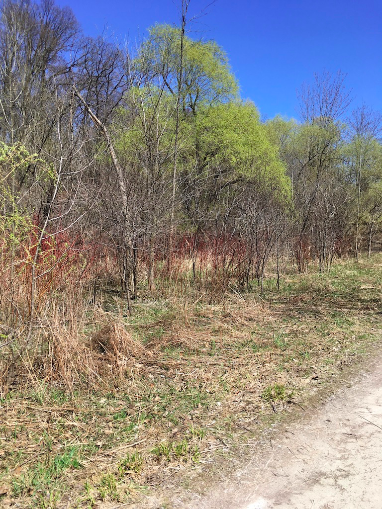
Sights: I love this walk any time of the year. In summer, you might be able to watch a bit of cricket at the pitch in Cedarvale Park, or perhaps some baseball in Ramsden. There are often lots of other walkers, joggers, and strollers of all ages, so people watching is fun too. And there are some wild stretches along the ravine trails where marshy ground combines with bushes and trees to create wetland ecosystems full of wildlife in the heart of the city.

It’s also fun to take your time and stroll on this route, because the many park benches provide opportunities to chill out in the shade or bask in the sun and just sit, soaking up the birds and crickets. It’s usually pretty quiet, especially Monday-Friday, so there’s often times when there’s no one in sight as you’re walking the trail.
Finally, there’s history here as well. For example, cutting through the Rathnelly neighbourhood takes you what is known as The Republic of Rathnelly. It got its name in 1967, when a group of residents decided to form an independent republic, as a bit of joke that turned into a semi-serious movement that was instrumental in fighting the Spadina Expressway.
Between late autumn and early spring, the ravines can be pretty muddy, slushy, or icy, and that just adds to the fun. I’ve done this route in all seasons and the changing scenery keeps it interesting.
Food & Refreshment: On Eglinton near the start, there are several restaurants and coffee shops where you can grab a bite before you start. At the finish on Yonge, there are several places as well, so it’s easy to eat and then walk, or walk and then eat. I’ve also stopped at the Loblaws on St. Clair and grabbed a sandwich. Plus, there are several water fountains in the parks, though they are turned off between November – April.
There are public washrooms at the community arena in Cedarvale Park, and in Ramsden Park. You can also use the washroom at the Loblaws.
Diversions: If you’re feeling in the mood for a longer walk, you can keep going past Ramsden Park, crossing Yonge and entering the Rosedale Valley behind Rosedale Station. Follow Rosedale Valley Road down to Bayview Avenue and cross to join the Lower Don Trail. You can then turn north and follow that trail up to the Evergreen Brickworks. If you are feeling especially frisky, you can keep following the Beltline Trail from the Brickworks up through Moore Ravine, through Mount Pleasant Cemetery, and finish at Yonge near Davisville Station.
I’ve also done all this in reverse, starting at Mount Pleasant Cemetery and following the Beltline to the Brickworks, then going up Rosedale Valley Road to Ramsden, and on continuing up through the ravines to end back at Eglinton. It’s mostly uphill in that direction so it’s a tougher walk.
Finally, since I live close to Yonge & Eg, you can start there at Eglinton Station, and either walk along Eg to Cedarvale, or better yet, go south to Davisville to pick up the Kay Gardiner Beltline Trail and follow that all the way to the Allen, where it ends. Then just cut south a few blocks through the back streets and you end up next to Eg West station, where you can start the route described above. Doing it that way adds another 45 minutes or so to the route.
