Walk Journal – January 1, 2020

The pond at Earl Bales Park

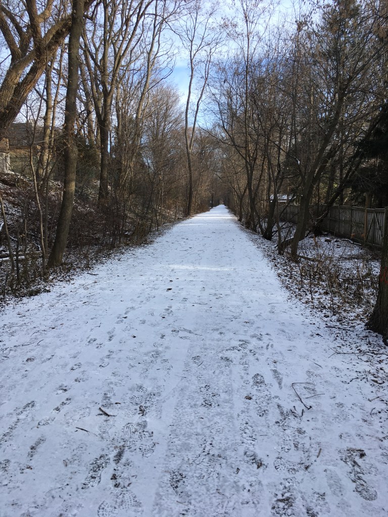
Where: West Don Valley through Earl Bales Park

Distance: about 7 km, 1.5 hours

Weather: about 0 with a chilly wind, cloudy at first and then some sun

Most years, we try to get out for a walk on New Year’s Day, and this year was no different. I wanted to take Ann somewhere she’d never been, so we drove a short way north up Avenue Road, to the top of the road just north of the 401. Here, Avenue ends in the Armour Heights neighbourhood, and by following Bombay Avenue west a few blocks and then going north up Armour Blvd to West Gate, we parked at the entrance to the West Don Valley trail system.

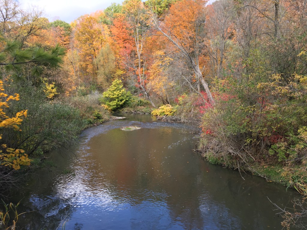
There had been a bit of snow on New Year’s Eve so there was some ice about but otherwise it was a nice walk. I’ve been through here in summer, so it was interesting for me to see it in winter. As you come down the hill on the trail going east and north, there’s a pond down in the valley at the south end of Earl Bales Park, opposite the Don Valley golf course, and it was frozen over today. The bits of snow, the ice, the grey skies – their dreariness was contrasted by red bursts of colour from the sumac buds, and the deep purple of berries on shrubs.

There were a fair number of walkers about, and we meandered north along the trail deeper into Earl Bales Park. Walking past the ski lifts, I was a bit surprised that no one was skiing, but then again there wasn’t very much snow – a bare couple of cm at best and mostly grass in other places. Still, it always pleases me to see that you can ski right in the middle of the city. Parks like Earl Bales are the reason that Toronto is so livable.

Continuing north, we passed the inevitable dog barks and owners’ shouts near the off leash dog area – I guess on New Year’s Day, all parties need some time out. Continuing north, under Sheppard Avenue along Don River Boulevard, we crossed the West Don River and walked into a little collection of houses in the valley that feels like its own world. I’m sure that 50 or 75 years ago, this was the edge of the countryside, and it felt like that today.

There were planes flying overhead, and some apartment high rise buildings on the skyline, but otherwise you could be miles out of the city.

After a few hundred meters, the road ends and there are trails that keep going north into the Hinder Property. We weren’t feeling that ambitious, so we turned east and climbed up out of the valley on a side trail to Burnett Park, and from there followed the local streets east and south back towards Sheppard Avenue.

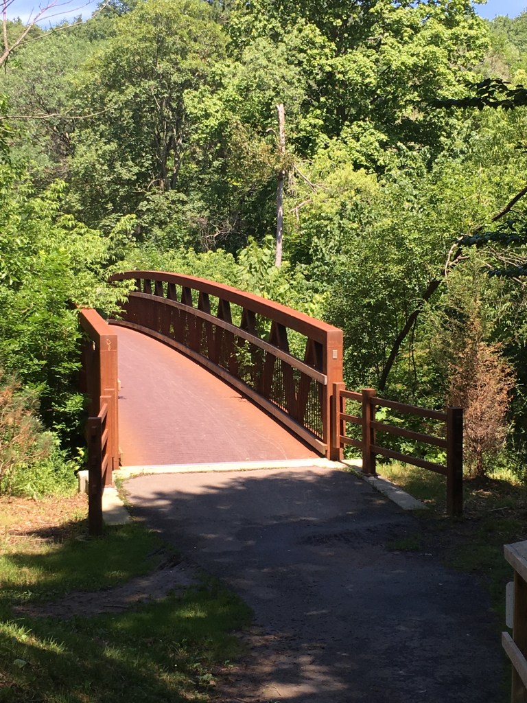
At Addington Avenue, we crossed a bridge over a ravine and stopped to read the plaque. It was built in 1966, when the area north of Sheppard Avenue was still outside of the city of Toronto – this was then known as North Toronto Township. It was a reminder of how much the city has grown in just a couple of generations – soon after this bridge was built, the area became the City of North York which was itself part of Metropolitan Toronto, and then in the 1990’s became part of the redefined and expanded City of Toronto.

From there, coming south back to Sheppard, we headed west back over the West Don River to Bathurst Street, and then turned south to walk a couple of blocks back to the upper part of Earl Bales Park, by the community centre. One of Toronto’s oldest remaining homes, the original Bales farmhouse, is located here, built in 1824. Today it houses the Russia Society of Toronto and we were amused to see on the notice board that salsa lessons were coming up soon.

Earl Bales is a big park, and much of it was a farm owned by the Bales family back when this area was well north of the town that was then known as York. Later, when the city extended north to Eglinton, the area of today’s park became a golf course, and in 1975 the city took it over to create the park. Many of the houses in the area date from the 1960’s and 1970’s, really only 50-60 years or so, but there is still a bit of a rural feel in the park and the West Don River valley.

As we walked, I couldn’t help thinking about the rapid growth that Toronto has experienced in the past 75 years, and is still undergoing. People move here from all around the globe (on a different recent walk, we passed through Italy, Portugal, Mexico, and Jamaica in the span of a few blocks of St. Clair West). Those immigrants fuel the relentless push of its boundaries north, east, and west, and it would probably go south too if not for the lake. Despite that push, and the need for housing that goes with it, the City has done a great job holding onto relatively unspoiled ravines, wood lots, meadows, parks, and green space. We need that space, to moderate the concrete and give wildlife some breathing room.

By then, the afternoon was winding down and we were feeling a bit chilled, so we wandered back to where we’d parked. Overall, it was a shorter outing compared to some years, though still interesting in a melancholy way. Can we keep growing, keep building, keep paving, keep thrusting up, and yet keep our green soul? The turning of a new year, a new decade this time, should be a time for optimism, but I couldn’t help thinking about change and the evidence for it that we’d walked through – almost 200 years of history, captured in Earl Bales Park and its surroundings. What would the next 200 years bring?

And yet, despite that thought, the day ended with a fantastic sunset, hopefully a good omen for the city and the coming decade, and also for me personally, for the hiking and trekking plans I’ve got for the coming year.

Here’s to a new decade, new journeys, and long walks. Slainte.

A Year of Walkablog

It’s hard to believe that a year has gone by and I’m at my first anniversary of blogging. Looking back, I’m proud of myself for accomplishing some bucket list goals, like the TONotL walk and the Crossing Toronto walk. I’ve also been able to complete some great walks around Toronto that I’d been wanting to do for quite awhile, like the Humber River walk, and that’s been fun too. And then there have been some especially memorable walks, for different reasons – my change of plans or our wandering around in Bermuda.

It’s also been a period of transition. I’ve been slowing down at work over the past couple of years, gradually reducing my consulting work, and now with the turn of the decade I’m going to take a long pause, possibly a permanent working pause, and try turning my semi-retirement into something closer to full retirement. I’m ready for long walks, multi-day or multi-week, or even multi-month, travels and treks. My bucket list isn’t getting shorter, because I keep reading about this or that trail that I’d like to try, so I want to hit the road and see what I can do.

So the plan for the coming year is more of the same, and then some. Walks around Toronto for sure, and hopefully chunks of the Great Trail, the Waterfront Trail, the Bruce Trail, and maybe others. Long walks, short walks, journeys, treks, and trails. New boots and new gear, and proper hikes with tents and sleeping bags. New posts with new stories. New memories, for sure.

Happy holidays, and may the road rise to meet you.

Following Your Nose

The other day, as I was walking, my mind was noodling along by itself, mulling over expressions that we use in everyday conversation. I’ve been re-reading (for the 5th time I think) Aubrey-Maturin series of novels by Patrick O’Brian. They’re set in the Royal Navy of the early 19th C, and I can’t recommend them highly enough.

One of thing many things that sets them apart is O’Brian’s command of the vernacular of the time. While written more than 150 years after their settings, he’s able to immerse himself in the language of the time and put words into the mouths of his characters that their actual contemporaries would have used, especially the many seafaring terms used at the time on a sailing vessel. Phrases likes “batten down the hatches“, “by and large“, or “to the bitter end” all have a naval origin but as they’ve been absorbed into everyday speech their original meaning has been lost to the casual user.

And that made me wonder, what phrases do we use in every day speech that arise from walking and travelling? How about “follow your nose”? When we use this, do we mean it literally?

I know there have been times when I have, literally, followed my nose. I remember wandering and exploring in downtown Kuwait City, and catching the scent of grilled lamb, which lead me through some backstreets to the old souk and its maze of little restaurants where I snacked on shwarma as I continued to wander.

There have also been times when I’ve more or less done the opposite, and followed my nose away from something, like when I’ve been walking near the Beaches Boardwalk in Toronto and caught a whiff of the Ashbridge’s Bay Sewage Treatment facility – it definitely puts some extra humpety into your steps to get downwind in a hurry.

But when we use that phrase, do we mean it literally like that? It’s true that you do actually have to follow your nose since it sticks out on the front of your head, so anytime you walk you’re doing just that. Still, I think we often mean it figuratively more than literally, as something like “it’s right there in front of you so just keep going”.

And then again, I think we use that phrase, to follow your nose, more along the lines of going after something that you know instinctively you really want. Deep down, I have this itch to go on long walks, to see new places and explore, to trek the Bruce Trail or the Waterfront Trail and see how far I can go and what I’ll find along the way. I want to follow my nose and see where it goes.

So follow your nose. It always knows where to point your toes.

Favourite Toronto Walks – Don Valley Trails

Part of a series on my favourite walking trails in Toronto.

Blog posts are a labour of love for me, and yet there is a cost to running this site and organizing my walks.If you’d like to help with that, I’d really appreciate something for my tip jar.The Buy Me a Coffee service allows patrons like you to fund writers like me.  If that sounds like a worthy idea to you, then go ahead – keep buying me coffees.Thank You Very Much to everyone who has contributed already!

*****

A great walk in any season, following the Don River north from the lake takes you through some of the best parks in Toronto.

Length: about 13.5 km

Surface: 90% paved with a bit of packed gravel

Public Transit options to get to Corktown include the street car from King Station on subway Line 1, along King to Cherry Street and then a short walk to Corktown. I like to subway to King Station and walk from there to Corktown, about 2 km. At the other end, there’s the Leslie 51 or the Lawrence East 54 bus from Edwards Gardens, which both take you back to Eglinton Station on subway Line 1.

From the south end at Corktown Common, the Lower Don Trail takes you up past several points where you can jump on or off – at Queen Street, Riverdale Park, Pottery Road, Crothers Woods, Don Mills, Thorncliffe, or Eglinton. You can take public transit to or from all of these, or you can find parking in many of the parks. Also the Toronto cycle path network intersects with the Trail at multiple points, so you can jump on/off that way as well.

In addition to starting at a Park at Corktown and ending in one at the Toronto Botanical Gardens, you’ll also travel through or past multiple parks along the way, including Riverdale Park, Riverdale Farm, the Evergreen Brickworks, Crother’s Woods, E.T. Seton Park, Serena Gundy Park, and Wilket Creek Park. Any of these offer shade, benches, and picnic tables, and water fountains and toilets are available from May through October. If you’re walking November through April, there are washrooms and water fountains at the Brickworks and at Riverdale Farm, as well as Edwards Gardens.

I like to start at Corktown Common and go north. Years ago, this area was industrial, rundown, and polluted – I can remember travelling through here at the bottom of the Bayview Extension. Starting in the early 2000’s, the City of Toronto has led a transformation, so that today the new residential buildings are anchored by the green space of the park.

I’ve walked these trails in both directions multiple times, in all seasons. There’s always wildlife – ducks and geese, salmon spawning in the autumn, chipmunks and squirrels, coyotes, deer, raccoons, robins, redwing blackbirds, jays, crows, hawks, and falcons. There’s also the wildflowers, the autumn colours, the spring blooms, and the cool shaded groves, the willowy grasses and the whispering reeds. And of course the burble of the river, especially north of the Bloor Viaduct, is a constant.

There is a downside in the traffic on the Don Valley Expressway, which the trail abuts along the lower stretch, but you leave that behind once you get to E.T. Seton Park. When you walk north, you’re walking from the urban to the suburban, from the industrial to the pastoral.

Also, when you walk north you realize that there is a significant elevation gradient to Toronto. The Lake is at roughly 90 m above mean sea level, so at Corktown you’re just above that. Travelling north you are climbing, and by the time you get to the Botanical Gardens, you’ll have gained almost 100m to about 180m or so above MSL. That, plus the humps over the bridges, will easily get your stair count up.

That said, since the trail is mostly paved and you are climbing gently over a 13 km length, it’s an easy walk. You can stroll it or jog it, and it’s suitable for mobility devices like walkers and wheel chairs, as well as for baby carriages, strollers, and wagons. Just keep in mind that it is a shared path for bikes, so you have to keep an eye out for them.

Finally, there are lots of options for food and refreshment along the way. Near Corktown is the Distillery District, where there are several restaurants and bars. A bit further west from there is St. Lawrence Market, with even more choice. As you head north, there is a good restaurant at the Don Valley Brickworks, and there’s a cafe at the Botanical Gardens at the end of your hike. Or you can do what I like to do, and take a picnic lunch with you and find a spot to enjoy it – a favourite is the fish ladder about 1 km north of Pottery Road where you can sit by the river in the shade.

Armchair Walks

On a cold, blustery, snowy, sleety, grey, and miserably wintery day, the thought of getting out for a walk is less than appealing. I know I should go out, but it looks nasty and it’s hard to muster the energy to put on the layers and winter gear.

So instead, I’m lingering inside over coffee and thinking about walks – armchair trekking if you will.

There’s the local walks around the city I could do over the winter – perhaps the Rouge River trails, or the upper Humber. And there are neighbourhood walks that are fun, like Bloor West and around High Park. Then again, I can revisit old favs, like the Don Valley, the Brickworks, and Wilket Creek/Sunnybrook Park. All that can keep me busy, but it doesn’t really need a lot of armchair planning.

So what about the long walks I want to do in the summer – perhaps another section or 2 of the Bruce Trail, or some parts of the Great Trail or the Waterfront Trail? There are lots of trails on my bucket list that I’d like to get to. I’m poring over maps looking at the trail and figuring out distances between accommodation. That will keep me occupied for a bit.

I like doing that, what might be termed map planning or “maplanning” – opening up All Trails or Google Maps and exploring different places where I’d like to take a long walk, like the Chemins de Grandes Randonnées in France, or the National Trails of England, or the Te Aroroa Trail in New Zealand.

Of course, you aren’t armchair walking if you’re not gear-dreaming too – what will I need if I take a particular trail? Is there enough accommodation available that I can skip a tent? How rugged is the trail so what foot gear is best? What about clothes – is it wet or dry, cool or hot? What percentage of time will I need to be in a tent versus a warm, dry bed? How big of a pack will I need? What’s the mean length of time between hot showers likely to be?

And logistics – how long will it take? How many days do I plan for? How do I get to and from the start and end points? How much does it cost to fly to that country in the first place? What sort of budget will I need? What time of year is best for that trail, in terms of weather, accommodation, and avoiding the tourist hordes?

Of course I’d like to actually be out on the trails actually walking carrying actual gear. Armchair walking is fun for an afternoon, but sooner or later you need to get to it. Soon … when the snow stops.

Walking for the Long Term

Recently, my wife and I had dinner at the home of a work colleague, where we met his wife as well. I’ve worked with him for a number of years but hour respective spouses had not met us or each other. You go into these social situations with a bit of nerves because you want to hit it off but you’re never quite sure. In this case, it was great – a simple, tasty yet slow meal, enjoyed while sitting for hours at the table chatting till midnight.

I thought of that as I was out for a walk the next day. The pleasure of a simple meal, good chat, laughter and smiles. I like simple things, and I like enjoying them at leisure, like reading a good book for hours of an evening while sipping on a whiskey in front of the fire. And I like long walks, for similar reasons – they’re simple, and yet they are savoured slowly, providing ample time for uncluttered thought. Over the space of several recent walks, on grey and glooming November days, I mulled over some recent news items I’ve seen recently.

The first one was about an announcement by the Ontario government, for a plan to build another major highway and then later for a different proposal to widen one of the major highways in the west end of the Greater Toronto Area. These projects have been mooted for years, and there’s a debate about whether to go ahead with their construction. The argument for is that traffic loads have increased so that more roads are needed to reduce congestion and delays. The argument against is the opposite – that building more roads just increases their supply which effectively lowers the price of driving (i.e. congestion delays) thus creating new demand that soon results in new congestion and delay. In other words, increasing the supply induces demand by reducing price – a basic piece of economics. This might also be phrased as “if you build it, they will come”.

Another recent thought-provoking news item was about Artificial Intelligence (AI). We’re heading quite quickly into a world where AI can power transport. Likely within the next 10-20 years, as cars become more autonomous, AI systems will improve traffic efficiency – in other words more cars can use existing roads. Taking humans out of the equation will also help us reduce and then eliminate the impatience and selfishness that leads to shake-your-head silliness like driving on sidewalks (which really happened recently just a few blocks from where I live).

At the same time, young people do not seem to be driving as much as their parents did nor seem as interested in owning a vehicle (based on a sample size of 1, our son, in mid-town Toronto). Plus, jobs are changing, so that we’re much more able to telecommute rather than physically commute. And then there’s the retirement of the boomer generation (which grew up with cars), and their workplace replacements see less need to drive, especially as public transit improves. All these trends argue that at the very least, traffic patterns are likely to change, if not reduce in volume.

On top of all of this there’s climate change, the cause for which the overwhelming weight of evidence points to carbon dioxide emissions from burning fossil fuels. Cars, and other forms of transport (trucks especially), are one of Canada’s largest sources of carbon dioxide, especially when you take into account the extraction of oil, its transportation, and its refinement into fuel. Adding to that, remember that building roads by itself generates a lot of CO2 emissions – making cement for concrete is an energy-intensive process largely fuelled by natural gas, and asphalt is held together by bitumen tar which comes from petroleum.

So the notion of building more highways, now, at this point of the 21st century, seems like a reactive response to a “today” problem based on the practice from 20 years ago, rather than a proactive response to head off anticipated problems 20 years from now. In other words, it’s backwards-looking decision making. Between advances in AI, changes in demographics, and the need to respond to climate change, it would seem to make more sense to invest the billions of dollars a new highway will cost into better public transit and urban planning.

All that seemed clear to me as I turned over these thoughts on my walks. And then, shortly after the announcements about these highway projects, I saw a much less publicized article about a plan to improve and expand the Waterfront Trail sections near the Scarborough Bluffs, an area through which I had walked this past summer and about which had thought at the time that it was both spectacular and under-utilized. Hallelujah I thought – induced demand strikes again. If you build trails and parks, then walkers will appear.

And that led me back to why I walk. Walking is a simple and self-contained activity – it needs no real equipment or practice, it accomplishes a goal, it requires minimal infrastructure, and it benefits both the practitioner and their fellow citizens. Long term thinking about walking abounds – there is an abundance of urban planning studies, social studies, and practical evidence that making neighbourhoods and cities walkable increases the well-being of the residents.

What gives me hope is that over the past 10-20 years, we’ve seen an increase in walking and cycling infrastructure. Volunteer-led organizations have mapped out, built, and maintained the Great Trail, the Waterfront Trail, and the Bruce Trail, and thousands of other local organizations have created recreational trails throughout Canada. There is a groundswell of interest in and demand for walking infrastructure.

It’s true that there are fewer opportunities for political grandstanding and ribbon-cutting when a new trail opens. The local city councillor and maybe a provincial MPP will show up for a quick photo and that’s about it, compared to premiers and prime ministers who host press conferences and photo ops in hard hats while holding silver shovels, whenever a new highway is announced. Hundreds of walkers will use the former, but hundreds of thousands of voters will use the latter, so where’s the sexy in opening a $2 million trail when you can cut the ribbon on a $2 billion highway?

Still, I see that as blockbuster thinking rather than incremental thinking, big splashy announcements instead of quiet openings. We know from studies in geology and from biology, that evolutionary forces are powerful yet slow-moving. There are few occasions (dinosaur-killing asteroid strikes aside) when evolution must pick up its pace. Long-term, slow changes are the norm. So in why does our decision making insist on quick wins, big announcements, and the timescales of one election to the next? In human terms, long-term ought to mean generational thinking – 20, 50, or 100+-year timespans. Does it help you now, or does it help your great-grandchildren?

We focus on the now, it seems to me, because that our time horizons have shrunk. We want to shop on-demand, eat on-demand, and entertain ourselves on-demand. Why defer gratification? Why can’t we have it now?

What does a walk have to do with this? Part of the answer is that a walk takes time. As a form of exercise, walking is a slow burn activity – you need a 2 hour walk to burn off similar amounts of calories from a 30 minute high intensity work-out. That’s why walking encourages long-term thinking, because it just takes a while to do it. If I want to walk to Montreal (and that’s on my bucket list), it’s going to take 3-4 weeks instead of 3-4 hours.

Plus walking is green. It’s human-powered and needs minimal infrastructure and equipment. Our ancestors walked barefoot over grasslands, and we can walk with just a pair of shoes over gravelled paths. Building a few km of simple trail, even if you include some park benches, waste bins, toilets, and water fountains, doesn’t cost much because it doesn’t take much effort or equipment. And that also means it’s quick, a concession to our instant gratification culture.

All of this means that walking for the long term has multiple levels. On timescales of hours, walking for the long term is about contemplation, finding space to think and consider and survey multiple points of view before coming to conclusions. On timescales of months and years, walking for the long term is about exercise and health and retaining the ability to contemplate. And on timescales of decades and generations, walking for the long term is about the conservation of resources, creating a legacy for future generations, and attempting to avoid the worst consequences of the now-inevitable changes in climate that we’ve sparked.

Deep thoughts from a few walks on grey days. Maybe I need another stroll to mull it over.

Little Walks – The Beaches Boardwalk

Blog posts are a labour of love for me, and yet there is a cost to running this site and organizing my walks.If you’d like to help with that, I’d really appreciate something for my tip jar.The Buy Me a Coffee service allows patrons like you to fund writers like me.  If that sounds like a worthy idea to you, then go ahead – keep buying me coffees.Thank You Very Much to everyone who has contributed already!

*****

On a chilly, rainy, grey, November day that felt more like December, I was trying to cheer myself up with recollections of warmer days. Strolling in the Beaches came to mind. The neighbourhood is perfect for Little Walks on a summer’s day (and any time of the year for that matter).

I do like walking the Boardwalk. Starting at Ashbridge’s Bay Park, it follows the lake past Kew Gardens and Kew Beach, Woodbine Beach, and ends at Balmy Beach Park.

On mid-week summer’s day, there are parents and little kids, camp groups, seniors, tourists, ice-cream eaters, sunbathers, paddlers, cyclists, roller-bladers, and more. There’s usually a breeze off the lake, even on the hottest days, and there are lots of shaded benches, not to mention the lake itself for cooling your toes. The city has put lots of Adirondack-style chairs along the route, perfect for people watching.

There’s a hot dog stand and a pizza outlet. There are sometimes food trucks, and often ice-cream vendors. Nearby Queen Street has many restaurants, grills, pubs, bars, and food shops. Your options are many and tempting.

Come on a weekend and it’s busier, and there are different events going on in the parks – concerts, ball games, markets, and more.

Come in other seasons and it’s much the same but with autumn’s blazing colours or winter’s natural ice sculptures or spring’s new growth. You can walk over and over, and still smile at something amusing each time.

It’s one my favourite Little Walks. When my wife and I returned to Canada in 1999, after living in London for a few years, the first place we came was to the Beaches on July 1, Canada Day. That stroll along the boardwalk was our welcome home. A few years later, we walked it again, this time a few days past my wife’s due date awaiting our son’s arrival, in hopes that the stroll and slice of spicy pizza would spur things along. And then recently we’ve made a semi-habit of walking it each New Year’s Day, for a blast of chilly fresh air.

If someone said to me, what should I do as a tourist in Toronto, strolling the boardwalk would be at the top of my list. You learn a lot about a place in observing how the locals relax and this is Toronto with its hair down wearing its weekend clothes. Come see.

Walking through a Mid-life Crisis

Lately, I find I’m a bit restless. I’ve written previously about my bucket list of Big Walks. It seems that since I crossed a couple of these off my list, I’ve been bitten by the Big Walk bug, and now I can’t wait to try another one.

People talk about mid-life crises. I don’t think it’s a crisis so much as a turning of the page. My professional life is slowing down, our son is soon off to university, and I’m ready for new challenges in my life. I’m relatively healthy, we can afford it, and I have time.

So now what? Winter has arrived, so big walks in Ontario in this weather are much tougher, especially if you’re carrying a pack over snowy/icy unpaved trails, and I’m not enough of a glutton for punishment to take these on right now, so that rules out things the Bruce Trail and the Great Trail until spring. Heading somewhere warmer would be a possibility except that we’ve already used up our travel budget for the year, what with trips to Bermuda, Ireland, and India, plus my Niagara to Toronto walk.

There are some shorter, paved-trail walks I can do as day trips to avoid carrying a pack and running up hotel bills – things like the Waterfront Trail from the Rouge River to Ajax – and that will help keep me fit over the winter.

Other than that, however, it seems that as much as I’d like to just take off on a long multi-day walk right now, I’ll have to do that in armchair fashion for the next few months. That’s ok, there’s something cozy sitting by the fire on a winter’s evening catching up on travel books about walking, diving into maps, and sketching out plans.

So that’s my mid-life crisis. Instead of a Porsche, I’ve invested in packs,

boots instead of a Bentley.

My fashion sense comes from Mountain Equipment Co-op – nothing says sexy like a good pair of GoreTex gaiters.

It’s an obsession, I admit. At least it’s cheaper than a sports car, and it’s better for the environment to boot.

Walks in Autumn

Autumn has always been my favourite season. In Toronto, there are phases to it. Coming out of September and through early October, we usually keep our late summer warmth with the bonus of dryer, clearer weather with lots of bright blue skies. Then as you drift through the rest of October and into early November, the nights get cooler and the autumn colours take over the parks and neighbourhoods. Around then, usually by early or mid- November, we’ll get our first frost overnight and our first snowflakes. Our autumn usually turns into winter temps and weather well before the winter solstice and turn of the season on Dec 21, so when you think about it, between the late summer bit and the early winter bit, a Toronto autumn is really the 4 weeks or so between about early October and early November.

And while it’s a short stretch of the calendar, it’s made for walking. We’ll get lots of dry days, not too cold, and with scenery that never gets old no matter how many times you’ve seen autumn colours transform a park. When we lived in England back in the 1990’s, I missed that turn of the season more than anything else.

This year, autumn arrived right on cue. Late September and early October were glorious – blue-sky autumn days that demanded to be used because you knew that in just a few weeks, those gentle blues would turn to steely greys and the autumn rains would turn to frosts and snow.

So I did – I headed out for several longish walks through favourite parks and soaked up the sun for as long as I could. One favourite hike in early October was through Mount Pleasant Cemetery and down the Moore Park Ravine to the Brickworks. The autumn colours were starting to develop and on a mid-week afternoon, there were only a few people about so I could savour the quiet. I love this place.

Wandering the paths through the park, it’s easy to forget that you’re in the middle of the city. The park is only about 15 years old, and is the result of natural regeneration nudged by careful planning, turning the clay quarry that provided many of the bricks that built Toronto landmarks like Old City Hall and Massey Hall into an urban oasis. It’s wonderful any time of the year, and at its best in the autumn.

Later, in mid-October, I did a hike through Highland Creek Park, Morningside Park, and the Gatineau Corridor as part of my completion of the Great Trail sections that are in Toronto. The weather had cooled just a bit, especially overnight, and the foliage in the parks was perfect.

As the month of October wore on, we started to get some grey skies and gusty rains, stripping those gorgeous colours off the trees and turning the trails to pointillist visions.

Every year, around mid October, there will be newspaper articles and social media posts about where to go to see the perfect fall colours. I ignore these. The perfect fall colours are right outside, in my favourite parks along my favourite trails. Toronto is awesome pretty much all of the time, and autumn is when it’s awesomeness on display, the more so because it’s natural and unforced. We take it for granted at lot of the time, so it’s worth reminding ourselves that we live, as the Parks Department motto says, in a city within a park.

And then in early November, other walks became reminders that winter is around the corner. I went up the East Don Trail on a blustery chilly day, maybe 4-5 C at best with an actual wind-chill under a grey forbidding sky, and was teased by a few snow flakes.

Then a few days later, we had actual snow, only a cm or 2 but enough to leave a trace on the ground. It feels like our 4 weeks of autumn have come and gone for this year. The forecast going forward is early winter – snow showers and low single digits as day time highs, with negative temps overnight.

That’s ok. The cycle of seasons means change, which means variety. Were the weather constant year-round, it would get tedious I think. So walking in wet leaves under blustery skies, now, is the path that leads to walking under soft spring breezes amongst new growth, in a few months. There’s greenery coming – you just have to be patient.

Tommy Thompson Park

In early October, we had a stretch of those blue-sky, warm-for-the-season, autumn days that demand that you use them. So I did – I headed out for a walk through a favourite park, Tommy Thompson, to take advantage of just-warm-enough-for-shorts-and-a-T-shirt temps and perfect sunshine, enough to keep you warm but not enough to make you overheat.

What I also wanted to do was fill in a gap – in looking at the map of the Great Trail, I could see that a big chunk of it within Toronto consists of the Waterfront Trail, and I’ve walked nearly all of that except for a short stretch through the port lands and along Cherry Beach. To get to Tommy Thompson Park, I could complete my missing bit of the Waterfront Trail and cross that off my list of completed sections of the Great Trail. (And by the way, when did I get to be a cross-off-the-list guy?)

I decided to start at the Distillery District and walk south along Cherry Street along the Martin Goodman Trail. This takes you over the Cherry Street bridge to cross the Don River channel. The view west is of the harbour.

The view east is of the Don River, lined with the construction sites that are slowly turning the port lands into parks and urban areas.

At the bottom of Cherry Street, you come to an unexpected little treasure – Cherry Street Beach park. The view across the water to the south is of Tommy Thompson park and looking west you get a view out past the Toronto Islands to the lake.

As I stood there looking out over the beach, a song from the soundtrack of my university days came into my head – the Pukka Orchestra’s 1984 hit called Cherry Beach Express. It’s a catchy tune though the lyrics are pretty dark – it’s about a practice that was alleged against the Toronto Police back in the 1970’s and ’80’s, of taking suspects out to Cherry Beach in the middle of the night and roughing them up. Standing there in the sun, it was hard to believe that 30-40 years ago Cherry Beach was not a place you’d visit voluntarily. The city has done a lot of growing up since then, both in terms of parks and its relationship with the lake, and more importantly in terms of social progress. I can’t believe that in today’s Toronto, such a practice would be tolerated (if it actually happened then). Still, like I said, it’s a catchy tune – look up Pukka Orchestra and check out their back catalog. Toronto produced a lot of great groups back then.

With that thought fading, I turned east to follow the Waterfront Trail and soon came to the hulk of the defunct Hearn generating station. This coal-fired electrical generation plant has been shut down for years but there seems to be no plan yet for it’s long term use, though the interior has served as a backdrop for several films and TV shows. The chimney dominates the view, looming over the trees along the trail as you near it.

From the Hearn, the trail takes you further east, to the corner of Commissioner’s Road and Leslie Street where a new entrance is being constructed for Tommy Thompson Park (what was once known as the Leslie Street Spit). It was such a gorgeous day, I wanted to do the full trail through the park out to the lighthouse at the tip.

There was a stongish breeze off the lake and a bit of chop so the soundscape was composed of waves slapping the shore, rustling reeds, and the shushhh of leaves in trees. While I was only a km from the downtown core, apart from the occasional aircraft overhead my footsteps were the only man-made sound.

If you stick to the lake-side of the park, the trail takes you through some new growth bush, and on this early autumn day it was just starting to turn colour in a few places. The sunshine made it warm enough for grasshoppers, crickets, and cicadas to serenade me as I walked, and I was joined by a couple of wee grass snakes sunning themselves.

As I walked, I passed only a couple of people out for a bike ride. On a mid-week visit, I mostly had the place to myself, something that helped me to tune out the world and just get into the zen of a hike on a beautiful day. My strides were on auto-pilot and I could enjoy the scenery, the sun, and the breeze. I kept to the left at the fork halfway down the trail so that I could take the loop around the ponds in the middle of the park, and then at the next trail intersection, I turned west to head out to the tip.

There, a small hill serves at the base for the lighthouse. It’s been much decorated with graffiti over the years.

Below the lighthouse, there isn’t a beach as such – instead the reclaimed nature of the park is on display. The whole of the park is based on excavated soil and construction debris that came from the gradual development of the buildings that now form the Toronto skyline. Over the years this landfill has supported the growth of plants that have transformed the old Leslie Street Spit into the new Tommy Thompson park. The underlying concrete and bricks on display at the lake-facing side of the tip have been used by artists to create sculptures that cover the area.

But when you turn back towards the city, the skyline view across the harbour is stunning, all the more so when you think that many of those buildings exist because their foundations required excavating soil that had to go somewhere, and that somewhere is where you are standing. One of these days, I’m going to come out here late in the evening to get a sunset view.

After taking a break to soak up the view and have a sandwich, I turned to head back. By taking the harbour-side trail I could complete the loop around the park, while passing the more mature wooded parts of the park, the oldest bits that have had the longest to generate plant cover. There are more of the improvised sculptures here, wherever old construction debris is exposed.

The trail is really a road along the harbour-side of the park, built for the trucks that until recently had been delivering more fill to extend the spit. Now that the park is closed to further dumping, this road has become a test track for bikes. I was passed and repassed frequently by cyclists doing time trials up and down the trail. They were in their zone and I was in mine, as I trudged back to the park entrance.

As you come out of the park, you pass a trail through what has recently been designated as Villiers Island. This part of the port lands is going to become part of the redeveloped mouth of the Don River. The idea is to carve a new channel for the Don that will allow the river to pass through a more natural wetland area instead of the shipping channel that it’s forced through today. By doing this, the original habitat will be partially restored and the wetlands will provide flood control as well as park space.

It’s great to see that, out of the growth of downtown Toronto and the many towers that make up its skyline, Tommy Thompson park has emerged and will be joined by even more green space. Come back in 20 years and you might not even realize that it’s all man-made.

As a society, we’ve often prioritized economic growth at the expense of making a mess, so I’m happy to see that now we’re getting good at cleaning up those messes and turning them into something that our kids and grandkids will appreciate.