Blog posts are a labour of love for me, and yet there is a cost to running this site and organizing my walks.If you’d like to help with that, I’d really appreciate something for my tip jar.The Buy Me a Coffee service allows patrons like you to fund writers like me. If that sounds like a worthy idea to you, then go ahead – keep buying me coffees.Thank You Very Much to everyone who has contributed already!
*****
And now on to the regular post …..
Over the past several months, I’ve written about a number of my favourite walks in Toronto. This time, I wanted to highlight something a bit different.
One of the many great things about living in Toronto is the work that the City has put into exploring its past and making it accessible to a new generation of residents and visitors. One of they ways of doing that is a fantastic program called Discovery Walks.
Each of these walking routes explores some of City’s many natural features like the lakefront or the ravine trail system, and along the way points out the history of the City.
For example, the Garrison Creek walk takes you through downtown Toronto following the route of the now-buried creek that, back in the 1790’s, emptied into Lake Ontario near what today is about Bathurst Street. Following this route takes you through some interesting inner-city neighbourhoods that are full of history, as well as fantastic shopping, bars, and restaurants.
If you visit the City’s website, the list of walks shown includes a map for each route. There are currently 11 of them, and they’re all great. Whether you’re a lifelong resident of Toronto or a visitor with an afternoon to fill, check them out! Toronto is a great walking city (ahem, it’s what I’ve been blogging about for months now!) and these walks prove it.
Length: Each trail is different. They are usually in the 1-3 hour range for a typical walker, and you can jump on/off any of these walks in many places.
Surface: A mixture – mostly they are paved and suitable for strollers and mobility devices, though there can be some gravel portions. Check each route map for details.
Public Transit: Each walk is accessible at start and finish by public transit, usually a combination of streetcar and subway, with some bus travel too. Each route map has details.
Route: See the City website for details. Each route has a detailed map that you can download.
Sights: Each of the walks has many sights to take in. Some are more nature-oriented, like the Humber Marshes, and some are more urban, like the Downtown or Uptown walks.
Any of these walks works well in any season. That said, I’ve always liked Toronto best in about mid-October on a crisp early autumn blue-sky day when the leaves have started to turn but it’s still warm enough for light clothes.
Food & Refreshment:
Most of the routes take you past at least some type of refreshments, either along the route or near the start or finish. Each route map will have some details.
Also, most of the routes take you at least partially through various City parks and trails, and there are public washrooms in most of them. There are also water fountains in most parks. Be aware, however, that these are usually seasonal so they are closed between roughly late October through early May.
Besides the public facilities, Toronto is well-endowed with coffee shops, bars, restaurants, and numerous other places where you can make a pit stop of one kind or another.
Diversions:
Can I suggest blending some of my Favourite Walks with the Discovery Walks? Check out my list and you’ll see that portions of my favourite walks cover the same trails (the Beltline for example) as one of the Discovery Walks. You can walk my route but use the Discovery Walk for more historical info. Or you can walk the Discovery Walk and use my walk for pictures and maps. Mix and match.
As the late great Ernie Banks used to say, let’s play two – why stop at one Discovery Walk when you can link them together and make a great outdoor day. For example, the Lambton House walk route is adjacent to the Humber River route.
Blog posts are a labour of love for me, and yet there is a cost to running this site and organizing my walks.If you’d like to help with that, I’d really appreciate something for my tip jar.The Buy Me a Coffee service allows patrons like you to fund writers like me. If that sounds like a worthy idea to you, then go ahead – keep buying me coffees.Thank You Very Much to everyone who has contributed already!
*****
Over the past couple of years of walking I’ve gone through a fair amount of gear, so I thought I would share some feedback for stuff that’s tried and trusted. Hope it helps.
What is it?: Gregory Paragon 38 backpack. I think this model is being discontinued however, as the Gregory website has it on clearance. There’s a bigger 48 model still available I think.
How much?: about $200 CAD including tax
Where, when, how do I use it?: I bought this in the spring of 2019, because I was planning to start doing some long multi-day walks. By multi-day, I mean anywhere from a couple of days to a couple of months. That said, this pack is more for walks with accommodation along the way than it is for pure backpack wilderness hiking. Think of things like the Camino de Santiago.
To date, while I haven’t taken it out of Ontario, it has been used for my 200km Niagara-on-the-Lake to Toronto walk. On that trip, I booked B&Bs and hotels for each night, so I was just carrying clothes, rain gear, shaving kit, first aid kit, an iPad, sundries, snacks, and water. Even so, my full pack weighed in at around 11 or 12 kg for the 6 day walk. I could have been more economical in packing, and with more planning and experience I am sure I could make it work for longer trips without adding too much if any weight.
I picked it because it fit well. Gregory packs are sized by length, and since I have a long torso I needed the medium/long model. When I tried it in the store, with a couple of 5 kg weights tossed in, I was able to adjust it easily to my frame and get the weight sitting on my hips. The belt system is good, and the straps allow you to adjust it pretty much however you need it.
This has an aluminum internal frame to carry the load and the material is relatively heavy nylon for durability. The back is meshed as are the cushions, and properly adjusted it will float a bit off your back so that there is some air circulation.
I like the storage. There are side pockets on the waist belt that are big enough for multiple Clif bars. The side mesh pockets can hold a 1L Nalgene bottle. There’s a big stretch mesh exterior pocket on the back that I used for my rain jacket and the rain cover. Inside, there are multiple pockets including one for a hydration bag, and the top cover has multiple pockets too that worked well for handy access to snacks and the first aid kit. I like that you can get into the main compartment from the top or from the bottom.
Another plus is that there are multiple strap and clip-on points. I used the ones on the bottom of the pack to strap on my walking poles, but I could still reach around and unclip the straps to get the poles while walking if I needed to. With a couple of bungee cords, you can use the exterior tie-down loops to hold other stuff too.
The pack kept my stuff dry in light rain, though I did have moisture inside the pack from sweating through the fabric. The rain cover works well in heavier downpours, and it’s a nice bright dayglo yellow so if I’m walking along a busy road I’ll use the rain cover just for the visibility.
The biggest con is the weight given the size. This is a 38L pack after all, yet it weighs nearly 1.5kg empty. There are lighter ones on the market that hold more, though they are also more expensive than this one.
Would I buy it again?: Not sure. I like the fit of the Gregory packs, and the versatility of the pockets and straps. However, if I could find something lighter with the same or greater volume, then I think I’d go for that as long as it wasn’t too much more expensive. All that said, if this model is discontinued then I’d have to look for a new bag anyway. I’d probably start with Gregory to see what they have, and if I couldn’t find what I needed then since I have an Osprey and a Deuter daypack, I’d see what those manufacturers had.
Disclaimer: This is not a “review”. I don’t go around sampling things, instead this is a summary of my own experience with a product I have used a lot. All opinions contained in this post are my own. I offer no warranties or assurances for your experiences with the same product. I bought the gear with my own money and have not received any form of compensation from the manufacturer. Take my feedback as given – caveat emptor.
Out for a walk recently, my mind wandered as it usually does and on this day I was singing a song to myself to set my pace, a Janis Joplin tune called Mercedes Benz.
Oh Lord, won’t you buy me a Mercedes Benz
My friends all drive Porches, and I must make amends
Worked hard all my lifetime, no help from my friends
So Lord, won’t you buy me a Mercedes Benz
Copyright Sony Music Entertainment
As those words revolved in my head, my train of thought moved on to the materialism that the song parodies, and that brought me round to the idea of “stuff”. Why do we have stuff?
A few years ago, I was flying home from a business trip to Madagascar.
My fellow passengers were mostly like me – businessmen in suits and jackets and ties – so I couldn’t help but notice a guy wearing bush shorts and a bush shirt, with thick woollen socks and heavy hiking boots. He was a bit older than me, perhaps late 60’s, yet with a healthy energy and a tanned outdoorsy complexion. He stood out for what he was wearing, and also for what he was carrying – an old-fashioned canvas rucksack and a little folding luggage cart to which was strapped a small crate full of hardcover books.
I watched him board and take his seat, and then as I took mine, I briefly noticed he was across the aisle from me, before I disappeared into my flight routine, taking out my headphones and book and settling down for a 4 hour hop to Johannesburg.
Partway through the flight, I looked up from my book to see that he was reading it over my shoulder along with me. When he saw me look up, he asked if I liked it – I think it was a James Clavell novel, Shogun or something – and we got to chatting. Over the remainder of the flight I learned a bit of his story.
He was a woodworker and carpenter, from outside Guelph in Ontario – less than a hundred km from Toronto, though we met on the other side of the world (how do Canadians always seem to find each other?). He lived on his own, though he had grown children. He liked to travel, and each winter he’d work for a few months and when he’d saved enough he’d head out somewhere. He’d just spent a couple of months in Madagascar, bird-watching and wildlife spotting, and was trying to decide where to head next once he got to Johannesburg. North he thought, maybe Morocco.
Other than bird-watching, he loved to read, hence the crate of books. He’d pick up any English-language books he could find and trade them with other travellers along the way. Sometimes he’d sell a few, or spend a bit of time teaching people to read in English to make a few dollars. Other than that, he had a few clothes, his binoculars, and a simple lifestyle, staying in hostels or crashing on people’s couches. He could spend 6 months travelling for a few thousand dollars, most of which went on airfare, and when his money ran low he’d head back to Canada to work for a few months and make enough to travel some more.
When we got to Johannesburg, I offered to buy him a coffee, but his next flight was going off through one terminal and mine through another, so we shook hands and wished each other safe travels.
I can’t remember now what his name was – Jack or Bill or something like that. But I think of him now and again, because I envy him, and that Janis Joplin song brought his image back to my mind.
When I’m walking, I’m usually just doing that – walking. I might take a water bottle or a small knapsack with some snacks, perhaps a rain jacket. That’s about it. I like walking because I can do it with so little.
And this is what I what was going through my mind as I thought about “stuff”. It was tied up with a recent family dinner conversation, my wife and son and I. We were talking about the homes of some of my son’s friends, which to be frank are considerably larger than ours, and moved on to stuff in general – the cars, smartphones, clothes, and other everyday things that people buy that can be outward signs of affluence. My son said that one of his goals was to be able to buy a nice house, and we talked about what “nice” meant and what you need in order to be comfortable – where the line was between comfortable and luxury and what “stuff” was a luxury, what was a necessity, and what was in between.
On my walk, that conversation muddled and mingled with my recollections of my long-ago fellow traveller, and the words in that song. His stuff was minimal – a few clothes and some books, and not much else. Janis was singing about materialism and mocking it. And as I walked I realized that I was meandering around Lytton Park and Forest Hill, relatively upscale neighbourhoods in mid-town Toronto.
And parked in their driveways, I’d often notice expensive cars (Mercedes Benzs and Porches amongst them, which is probably what triggered the memory of the song), and other conspicuous displays of consumption – fancy bikes, electric scaled-down cars for kids, and so on. Smug thoughts drifted through my head. What a wasteful carbon footprint.
And then I thought about my walks, and the recent series of posts that I’ve been doing about my gear. My pile of walking stuff is actually bigger than I’d like to admit – walking poles, knapsacks, water bottles, hiking boots, rain gear, and exercise clothes, not to mention the other stuff I’d like to buy including a tent, sleeping bag, sleeping pad, a bigger pack, a cook stove, and cooking gear.
As I mentally checked off the stuff on my so-called minimal list, my smugness faded. Is my footprint really so light? My stuff may feature eco-friendly, recycled polyester fleece, merino wool and ethically-raised duck-down, but does that make my stuff virtuous and their stuff vulgar? Who decides whose stuff is bling and whose is basic? At the end of the day, it’s still stuff.
So as often happens, if I walk long enough I come full circle in my thoughts. On my way home, I mulled over the idea of “unstuff”. As I’ve gotten older, I’ve told myself that I don’t need much. By the standards of many in Toronto, we live relatively modestly. I go for walks. I armchair shop for hiking gear. We drive a basic car. And while I’d like to think of that as unstuffing my life, if I’m honest it’s more a case of “less stuff” than it is “unstuff”.
I’d like to say I can step away from stuff, and walk lightly. Whether I can do that honestly – well, there’s a new thought to mull over as I walk.
Blog posts are a labour of love for me, and yet there is a cost to running this site and organizing my walks.If you’d like to help with that, I’d really appreciate something for my tip jar.The Buy Me a Coffee service allows patrons like you to fund writers like me. If that sounds like a worthy idea to you, then go ahead – keep buying me coffees.Thank You Very Much to everyone who has contributed already!
*****
And now on to the regular post …..
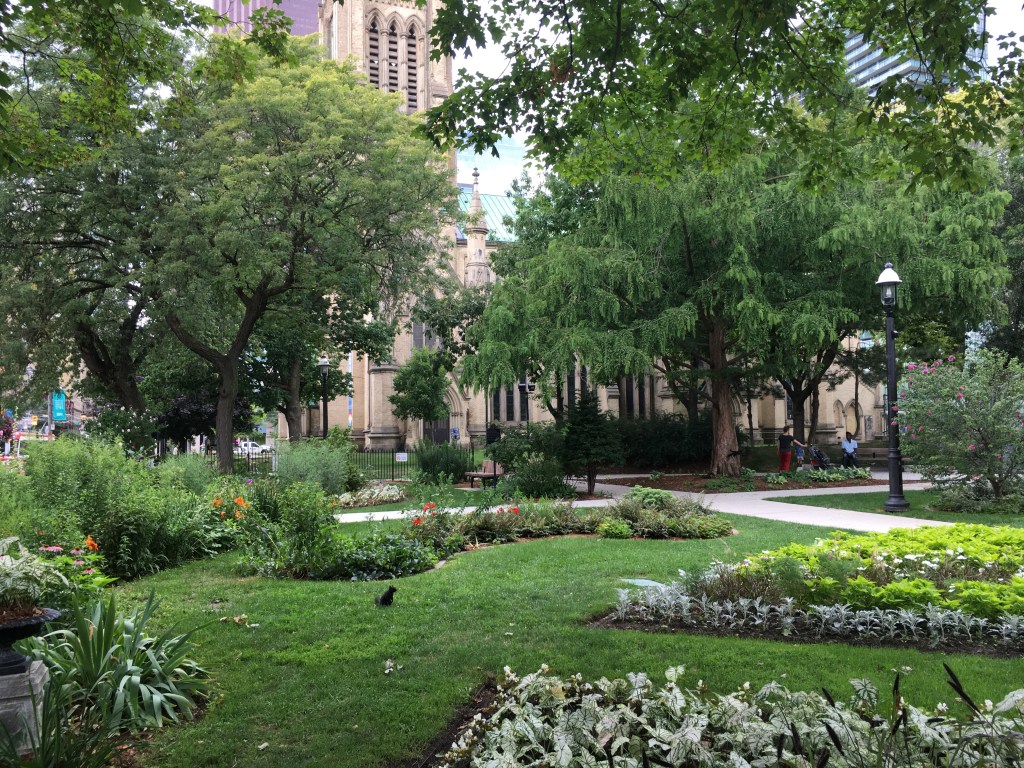
The Crystal at the ROM
I’ve often wandered Toronto’s core, whether out for a noon stroll when I was working downtown, or just taking a roundabout way home when we lived near St. Lawrence Market. I thought it would be fun to put together a walking route of around 10 km that took in many of the sights, offered plenty of shopping, eating, and resting options, and provided a bit of tour through some of the historic parts of the city. I hope this route ticks those boxes for you.
Tip: I’ve included lots of links for some of the sights along this walk – check ahead to confirm opening times, and to find out about special shows or exhibits and things to do.
Length: About 10-12 km, depending on wanderings, so about 2.5 to 3 hours at a leisurely pace.
Surface: Paved.
Public Transit: I set this up to start and end at Nathan Philips Square, which is a block west from Queen Station on subway Line 1. You can also take the subway to Osgoode Station, also on Line 1 (on the University Ave side of the loop) and walk about 3 blocks east. Finally, you could adjust the walk to follow the loop shown but start/stop at Union Station, if you are coming in by GO train.
Route:
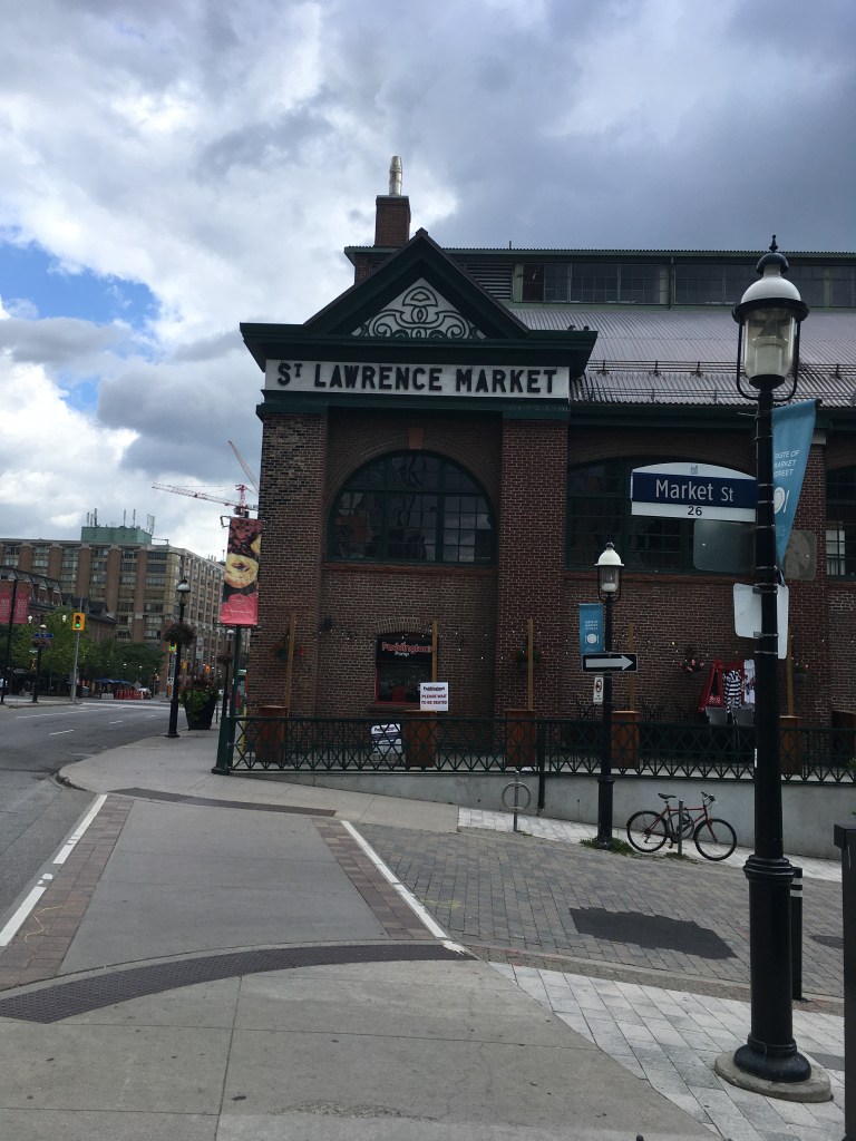
Starting at Nathan Philips Square, in front of the Toronto sign, head south-east towards Bay Street, and follow Bay south through the financial district to Front Street. Turn east on Front (left) and walk towards Yonge Street, passing the Hockey Hall of Fame. Continue east on Front Street past Berczy Park, crossing Church Street and continuing to Jarvis Street by the St. Lawrence Market.
Turn north on Jarvis and walk up to King Street, then turn west on King. You can cut through the gardens at St James Park if you’d like, or just keep going along King to Church Street. Turn north (right) on Church and continue up to Queen Street. Turn west (left) on Queen and continue to Yonge Street. Turn north (right) and walk up Yonge past Dundas Square, Ryerson University, and College Park, to reach Wellesley Street. Turn west (left) on Wellesley for about 50m, then turn north (right) onto St. Nicholas Street. Follow St. Nicholas north to Charles Street. Turn east (right) and return to Yonge Street, then turn north (left) and go up Yonge to Bloor Street.
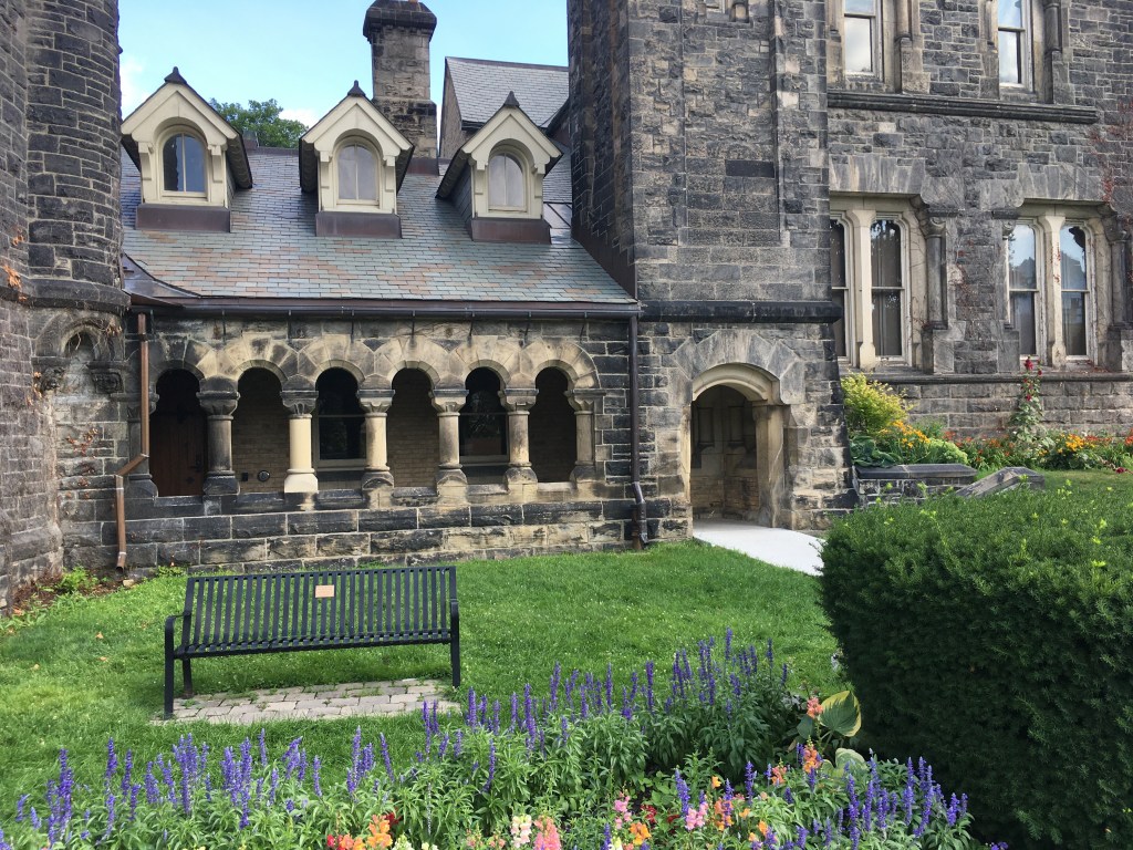
Turn west (left) on Bloor and continue to Bay Street, crossing to the west side. Turn north on Bay and walk up to Cumberland Street. Turn west (left) on Cumberland and walk through Yorkville to Avenue Road. Turn south (left) on Avenue and walk down to Bloor. Cross Avenue and then cross Bloor, to reach the south-west corner by the Royal Ontario Museum. Continue west on Bloor to the gates marking the entrance to the Philosopher’s Walk, just west of the ROM.
Follow Philosopher’s Walk (fun fact – Philosopher’s Walk follows the ravine of the now-buried Taddle Creek) south to Hoskin Avenue. Cross Hoskin and then turn west (right) for about 50m to Tower Road on the University of Toronto campus. Turn south on Tower road and follow it through the arch at Soldier’s Tower. South of the Tower, follow Kings College Circle south and west and then cut west through the campus to reach the corner of St. George and Russell Street. Follow Russell Street west to Spadina Circle, then turn south on Spadina to reach College Street. Cross College and then Spadina to reach the south-west corner, and then continue west on College to reach Augusta Avenue. Turn south (left) down Augusta into Kensington Market. At Baldwin Street, turn east (left) and continue a few meters to reach Kensington Street. Turn south (right) and follow Kensington to Dundas Street.
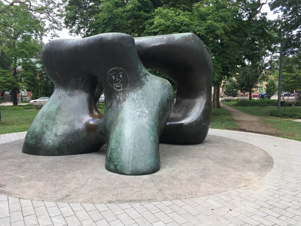
At Dundas, turn east (left) and follow it, crossing Spadina in Chinatown. Continue on Dundas to Beverley Street, crossing to the south-east corner by the Art Gallery of Ontario. Turn south on Beverly and walk down to Grange Park. Enter the Park and cut through past the Henry Moore sculpture to reach Stephanie Street. Turn east on Stephanie and then after a few meters turn south to walk through the little park at St. Patrick’s Market. Continue south to Queen Street. Turn east (left) on Queen and cross University Avenue to the north-east corner. Jog north on University a few meters to the gate into Osgoode Hall gardens, turning east and walking through the Gardens to emerge on the west side of Nathan Philips Square. Walk through the Square to take a selfie in front of the Toronto sign!
This walk was designed to tempt you with lots of sights, so I wouldn’t be surprised if you started out with the best of intentions to finish and got so distracted that you have to come back another day.
The Henry Moore sculpture at Grange Park
Also, this walk works in any season. I did it recently on a scorching July day, and being able to pop into places like the Eaton Centre for some AC cooling was really nice. Passing so many covered shopping areas like that also means that on a rainy or snowy day, you can duck out of the weather. Then again, like so many walks in Toronto, I think this would be at its best in early autumn, to catch the foliage in Queens Park and U of T, and to take advantage of the harvest foods at the markets. And finally, don’t forget that in winter, you can go skating on the outdoor rink at Nathan Philips Square. Really, any time of the year will work.
Food & Refreshment:
I set this up going anti-clockwise round the downtown core, which means you go by St. Lawrence Market near the start, a perfect place for breakfast or lunch or a snack. Going in this direction lets you pass through Kensington Market near the end, which is also a great spot for food plus it has lots of coffee joints, juice bars, and beer-and-alcoholic drink bars. In between, there are coffee shops, restaurants, ice cream parlours, bakeries, donut shops, food trucks, and more that cover the spectrum from quick takeaway to full service sit-down.
As far as restrooms and toilets are concerned, there are lots – Nathan Philips Square, St. Lawrence Market, the Eaton Centre, College Park, and Yorkville all have public facilities, and of course the many coffee shops and restaurants along the way provide lots of options.
One thing there isn’t a lot of is water fountains – there are ones in St. Lawrence Market and in the Eaton Centre, but other than that you may want to carry water with you. Of course, the many food/drink options along the way will tempt you if you’re thirsty, so staying hydrated shouldn’t be a problem.
Diversions:
This whole route offers detours, distractions, and diversions. My advice is to use the marked route as a rough guide and just let your curiosity take over.
That said, the two food markets (Kensington and St. Lawrence) are destinations in themselves for me, and so are the AGO, the ROM, and the Hockey Hall of Fame. I could spend hours at any of these places.
From the St. Lawrence Market area, heading east a bit and taking in the Distillery District is good fun. There’s a great holiday market there in December, and some tasty food and shopping options year-round.
Starting at about Carlton Street, and running north about a block east of Yonge along Church Street, the Village is a vibrant, fun, and colourful neighbourhood that’s Toronto’s spiritual home of Pride and its LGBTQ community. The annual Pride parade attracts hundreds of thousands of people of all ages and is centred along Church.
A few blocks further east of the Village, along Parliament Street between about Gerrard and Wellesley, the Cabbagetown neighbourhood showed Toronto what we could do with our beautiful Victorian homes. It’s full of good shops and quiet little streets that are perfect for a stroll, and nearby Riverdale Park and the Riverdale Farm offer lots of things for kids to do.
Yorkville covers several square blocks between Yonge Street and Avenue Road, and between Bloor and Scollard Streets. A hippie hangout in the 1960’s, today it’s full of high-end shops, art galleries, bars, restaurants, and some of the best people-watching in the city.
Blog posts are a labour of love for me, and yet there is a cost to running this site and organizing my walks.If you’d like to help with that, I’d really appreciate something for my tip jar.The Buy Me a Coffee service allows patrons like you to fund writers like me. If that sounds like a worthy idea to you, then go ahead – keep buying me coffees.Thank You Very Much to everyone who has contributed already!
*****
Over the past couple of years of walking I’ve gone through a fair amount of gear, so I thought I would share some feedback for stuff that’s tried and trusted. Hope it helps.
Where, when, how do I use it?: I bought these in 2018, anticipating that I was going to start doing some long hikes. Since then, I’ve taken them out on several hikes of different lengths, the longest a 200km walk from Niagara-on-the-Lake to Toronto which included about 88km of the Bruce Trail.
I wasn’t really a big believer in trekking poles. I had used borrowed ones before, in particular on a few hikes in Ireland. There, I was using just one pole because the owner had the other. It was useful when climbing bogging hill sides to have the extra “leg” but I didn’t think they’d make much difference on a flatter walk.
That changed when I used them on the Bruce Trail. The Niagara section is actually fairly moderate compared to the northern stretches of the Trail, but I found it a workout when carrying about 12kg in a backpack. Going up and down hills, cliffs, and ravines on rocky, uneven ground is tough, and the poles paid for themselves by saving me a couple of times from taking a header, spraining an ankle, or worse.
If you use trekking poles properly, adjusted for your height, you can transfer a fair amount of the work from your leg muscles to your arms which would otherwise just be swinging. That helps a lot both uphill and downhill. I also found them very useful going down hill on broken rock, to pick out which rocks seemed planted and which were loose.
I like the cork handles on these poles – I was walking in September but it was still in the mid-20s and I was perspiring a lot. Plastic handles would have become slippery, but the cork let you grip without feeling hot. In other seasons, the cork grips are still grippy even with gloves on in winter. These poles are “handed”, meaning there is a left and a right which you need to respect that so that the wrist straps sit correctly without chaffing. You can use them without the wrist straps, but it’s amazing how many times your hand comes off a pole so the straps mean fewer times bending down with a heavy pack on your back to pick them up.
The length adjustment and the folding mechanisms on these poles work pretty well. The pair I have extend to 120 cm, and that works for my height (175 cm). If you were taller, you’d probably want longer poles.
They are lightweight, since they are made of carbon fibre. They are plenty stiff however, and they’ve never bent or felt like they were getting wobbly even when I felt like I had most of my weight leaning on one pole.
I like the tips too. They have a smallish metal tip with a little plastic cap on it that works well on rock and rough ground, and they also come with a rubber cap that you can put on when on sidewalks or roads if the clicking bugs you. The metal tip with the plastic works well on snow, and you can get sharper metal winter tips if you need something even pointier. The standard baskets are fine for most seasons, even winter, but if you are facing deep snow you can get bigger baskets like you’d see on a ski pole.
Overall, I’m convinced. For everyday hikes around the city, I don’t bother with them. But for rough ground, especially with a pack, I’d go so far as to call good trekking poles a life-saver, and these Black Diamond poles fill that role really well. Granted, I’ve never used another pair so I can’t compare them to other makes and models, but these feel right and they work so that’s good enough for me.
Would I buy it again?: Yup. There used to be an advert in the UK for a brand of deck sealant, where the tagline was “It does exactly what it says on the tin”. That’s what I like about these poles – no fuss, they just work.
Disclaimer: This is not a “review”. I don’t go around sampling things, instead this is a summary of my own experience with a product I have used a lot. All opinions contained in this post are my own. I offer no warranties or assurances for your experiences with the same product. I bought the gear with my own money and have not received any form of compensation from the manufacturer. Take my feedback as given – caveat emptor.
Part of a series on my favourite places to go for a walk in Toronto
Blog posts are a labour of love for me, and yet there is a cost to running this site and organizing my walks.If you’d like to help with that, I’d really appreciate something for my tip jar.The Buy Me a Coffee service allows patrons like you to fund writers like me. If that sounds like a worthy idea to you, then go ahead – keep buying me coffees.Thank You Very Much to everyone who has contributed already!
*****
And now on to the regular post …..
One of the oldest neighbourhoods in Toronto is the area along Queen Street East, and east of the Don River. It has several names. The City calls it South Riverdale, on Google Maps it’s Riverside and Leslieville, and to Torontonians it’s now mostly thought of as just Leslieville. Whatever you call it, it’s a great area to wander and explore.
Location: For me, what I’ll call Leslieville is a bit more compact than what the City calls South Riverdale. I think of it as extending a few blocks north and south of Queen between Broadview and Greenwood Avenue to the east, and Eastern Avenue and Dundas Street to the south and north. Most Torontonians think of Riverdale as being a bit on the east and west sides of the Don along queen, from River St in the west to Broadview (or a bit past that to the train tracks) in the east. If that’s Riverdale to you, then Leslieville is the area east of Riverdale along Queen to Greenwood.
Public Transit: Take the Line 1 subway to Queen Station, then catch the 501 Streetcar east to about Broadview if you want to wander east through Leslieville. Or stay on the streetcar to about Greenwood and then you can wander back west. It’s only about 4.5 km along Queen back to the subway.
Why I like it:
I like it for several reasons. First of all, there are a ton of little shops, bars, restaurants, and funky dives. OK, it did go through an overly-hipster stretch a few years ago, but now it’s matured into a gentler post-hipster family neighbourhood that still tries to show a little edge here and there, yet not enough to actually be dark and edgy – the equivalent of parents in their early 30’s. For me as a parent pushing 60, it’s great walking around and seeing young families starting out.
Another reason to like it is that it’s a foodie place and I do like to eat. There are plenty of places and they create some competition for each other – you have to be good to stand out. And that foodie scene is then echoed in some of the food shops – cheesemongers, butchers, fishmongers, organic greengrocers, bakers, and more. You could dine very well for breakfast, lunch, and dinner, and finish in a cool bar, anywhere in a 2 km stretch of Queen between Broadview and Leslie. That competition also means that places turn over, so if you go back every few months there will be something new to try.
One other fun fact – back in the 1980’s, Canada’s national broadcaster the CBC ran a show for teens called the Kids of Degrassi Street, about inner-city kids living on what is a real street that’s smack in the middle of the area. In the 2000’s, a revived and updated version of Degrassi Street starred a little known young actor named Aubrey Graham, who today is better known as Drake. Today, you can wander along the real Degrassi street looking at the renovated homes that are now everywhere – a far cry from the working class world of the original Degrassi Street TV series.
Sights:
The most obvious sights are along Queen, and just walking up and down here you’ll find something to catch your eye, whether it’s a cool design/clothing place, a retro bar, or a thrift shop full of bargains. The streets will be a mixture of locals and tourists, young and old, new parents, grandparents, kids, dogs, bikes, strollers, and little wagons. It’s a real neighbourhood, not a manufactured one, where people live and work and play. Walking around you see Toronto in its diversity, though it’s also true that the gentrification and ensuing increase in housing costs means that it’s losing some of its funky edge.
Besides the shops, you see that gentrification when you wander the side streets, increasingly full of older homes renovated and updated. The time to buy here was 5-10 years ago – a $500k fixer-upper then will probably be worth well north of $1m now. If you are into houses and home reno’s, wandering about will give you lots of ideas to try.
There are also some nods to history throughout the neighbourhood. Just north of Queen, on Broadview, there is the former Don Jail, built in the 1860’s and only closed in the 2000’s.
Today, the building has been restored and incorporated as the admin wing of BridgePoint Hospital, and you can tour the grounds to admire the architecture.
There’s also nods to local history at places like the Leslieville Pumps. This gas station is now known more for it’s takeout or eat-in BBQ than it is for petrol.
Food & Refreshment:
Too many to list, there’s everything from fine dining to bistros to diners along Queen. Toronto’s diversity is reflected as well – pizza, sushi, BBQ, Indian, Thai, Caribbean, you name it.
There are lots of coffee places and bars too, many with outdoor tables which are perfect for people watching. Summer is the best time for that, and sun-starved winter warriors are often sitting out in March or April whenever they can.
There are some public washrooms at the community centre at Jimmy Simpson Park. Other than that, a coffee place is your best bet for quick pit stop.
Diversions:
It’s not massively far to start out at St. Lawrence Market for breakfast and then walk north and east through Corktown to Queen and then on over the Don River into Leslieville. You can of course go the other way, starting in Leslieville and ending perhaps at the Distillery District or at St. Lawrence. Either way, you tie together 2 great foodie areas with a nice 4-5 km walk.
To the north of Leslieville along Gerrard Street, is one of Toronto’s several Chinatowns, centred around Broadview. A loop up Broadview from Queen to Gerrard and then east to about Carlaw will take you through that vibrant scene.
If you keep going east on Gerrard, past about Leslie, you come to Little India, the downtown’s place for authentic south Asian foods, fashion, and charm.
At the east end of Leslieville at about Greenwood, a short walk south and east takes you to Ashbridges Bay, which is basically the entry into the Beaches neighbourhood.
Blog posts are a labour of love for me, and yet there is a cost to running this site and organizing my walks.If you’d like to help with that, I’d really appreciate something for my tip jar.The Buy Me a Coffee service allows patrons like you to fund writers like me. If that sounds like a worthy idea to you, then go ahead – keep buying me coffees.Thank You Very Much to everyone who has contributed already!
*****
And now on to the regular post …..
Graffiti art on the Lower Don
I was thinking about how to make an all-day walk that tied together some of my favourite parks and trails in mid-Toronto, and looking at a map I realized that I could put together something that stared and ended in mid-town and took in the Don Valley, the lakefront, and the parks and trails to the west around Roncesvalles. Here’s what I came up with:
Length: Depending on your exact route and any detours, it will be about 30-32 km. Allow yourself about 7-8 hours to give time for breaks, picnics, and perhaps some shopping.
Surface: Mostly paved, with some gravel paths along the Kay Gardner Beltline.
Public Transit: Take subway Line 1 to Davisville Station and walk south 2 blocks along Yonge Street to Merton Street. Cross at the lights, walk about 50m east and turn into the laneway behind condo to reach the Beltline Trail opposite the gate into Mount Pleasant Cemetery. The finish is the same spot, so just reverse your steps to get back to Davisville Station.
Route:
Starting in mid-town on the Kay Gardner Beltline Trail on the north side of Mount Pleasant Cemetery, it follows that Trail through the Cemetery and then out on the south-east end, to continue down the Moore Ravine past the Don Valley Brickworks. Here, divert to the Brickworks for a pitstop, and then cross Bayview to join the Lower Don Trail.
Continue south on the Don Valley Trail to Rosedale Valley Drive. Since the Don Trail stops here, it climbs the hill beside St. James Cemetery and then enters Riverdale Park, following the trails there back down into the Don Valley to pick up the Lower Don Trail again. Continuing south, it reaches Corktown Common and then bends around to the west as it joins the Martin Goodman Trail along the lake.
Continuing west on the Martin Goodman Trail, you go all the way across to Sunnyside Park, and then take the footbridge over the roads and rail lines to reach Roncesvalles Avenue. Walking north up Roncy, you reach Grenadier Road, turn east for a bit, and then jog north up Sorauren Avenue to reach Dundas St W. Turning east, you follow Dundas for about 100m to reach the start of the West Toronto Rail Trail. This takes you north for several km past Bloor Street, and deposits you on Osler St, where you jog north and west to reach Davenport Road, just west of Earlscourt Park.
Cutting through the park, you emerge onto St. Clair Avenue at the bottom of Prospect Cemetery. The roads through here wind north and exit onto Eglinton Avenue. Turning west for a bit, you find Caledonia Road, go north to Bowie Avenue, and then turn west to pick up the start of the York Beltline Trail. This then curves north and then east, taking you eventually to Marlee Avenue. Exiting this trail, you cross Marlee at the lights, follow Elmridge Drive over the Allen Expressway, and then turn into the lane to join the Kay Gardner Beltline again at its western end. Following this all the way back to Mount Pleasant Cemetery completes the loop.
Sights:
What I like about this route is that it shows off so many of the best parts of Toronto – the parks, the ravines, the trails, the lake, and diverse neighbourhoods full of shops, restaurants, and bars. You get some natural fun along with some urban colour.
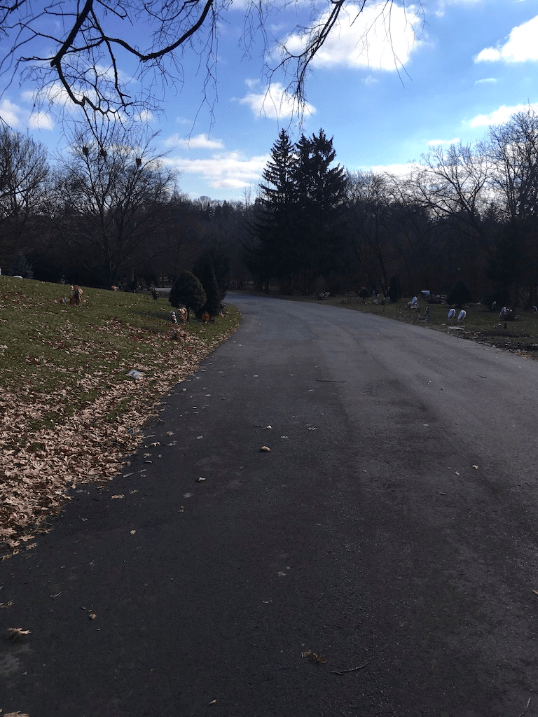
At the start, Mount Pleasant Cemetery is worth a visit all by itself. I love wondering its cool shaded roads and exploring the history of Toronto expressed in the headstones and monuments. The Kay Gardner Beltline Trail is incorporated into the Cemetery, so you can just follow the purple line painted on the road, or you can detour and explore a bit.
As you exit the Cemetery, you enter one of the best walking trails in Toronto, the Moore Ravine Trail. The trees, the quiet, the burbling of Mud Creek, and the people watching are all fantastic. It’s a short walk, but it then takes you past the Don Valley Brickworks, again a worthy destination on its own.
Cool Moore Ravine shade on a hot summer day
From the Brickworks, following the Lower Don Trail takes you under the Prince Edward Viaduct that carries Bloor Street and the subway over the Don Valley. Climbing the hill at Rosedale Valley Road takes you into Riverdale and east Cabbagetown. The zoo and park here are great fun for kids, and in summer the hot dog and ice cream vendors are worth a treat.
And of course, then there’s Corktown. The Common is one of my favourite recent additions to the City. I remember this area in the 1980’s as a post-industrial grey wasteland, and to see it now, transformed, is to be reminded that even if we badly bugger up the world, we can, if we put our minds to it, help nature reclaim and renew it.
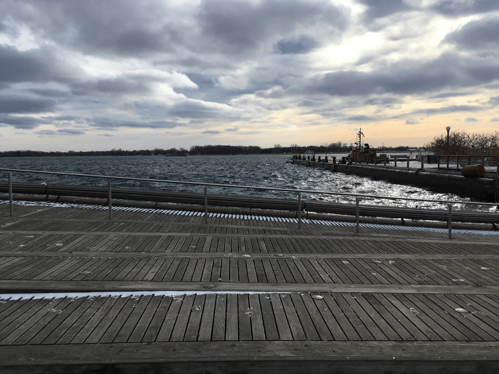
The wavedeck at the foot of Spadina
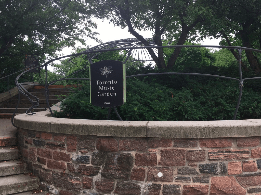
The Martin Goodman Trail takes you through the Queen’s Quay neighbourhood, another area that’s seen huge changes over the past 20 years. The shops at Queens Quay itself have been joined in the area by many condo’s, and while I can’t say I’m a fan of tall glass towers, it does mean that there’s a much more residential feel in the area now. Combine that with reminders of industry like the Redpath Sugar Mills along with the marinas, the Harbourfront Centre’s art galleries, and little parks like the Toronto Music Garden and you get a diverse area with many things worth a detour and exploration.
Past Queens Quay, the lakeshore all the way west is mostly one big big green space divided into several parks – Coronation, Marilynn Bell, and Sunnyside. Each is chockfull of picnic areas, benches, Adirondack chairs, and cool shade. I could do without the roar of traffic from the busy nearby roads, but when you get a little quiet lull, the honk of geese and splash of waves reminds you that you’re next to Toronto’s greatest feature – Lake Ontario.
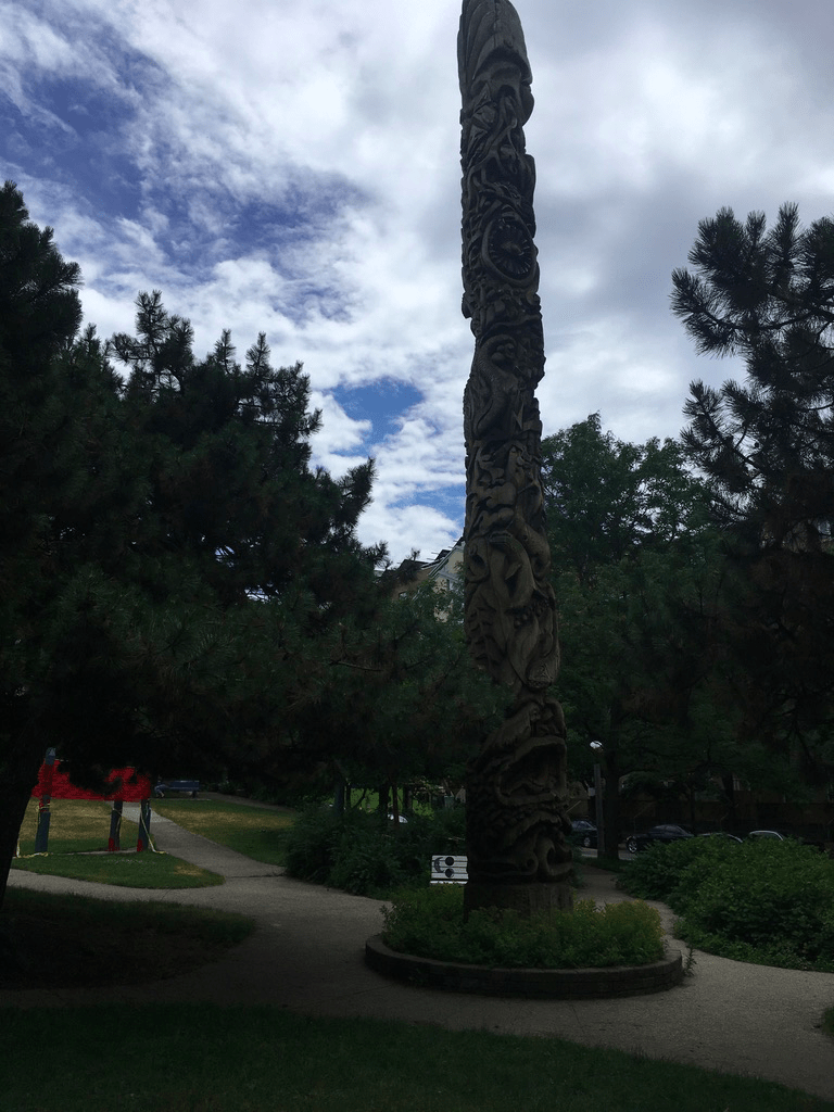
Little Norway Park along Queens Quay
Then you jump back into urban life, along Roncesvalles, where shops, restaurants, and bars abound. There’s a lot of life here and it’s changed so much over the past 20 years that I hardly recognize it. The recent addition of the Museum of Contemporary Art to the area just continues to boost an already-booming area.
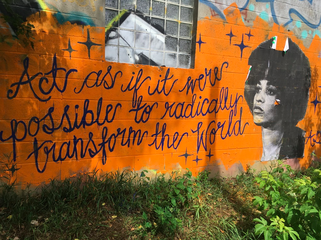
The West Toronto Rail Path leads you into an area that hasn’t yet been gentrified (yes there are still some of those in mid-Toronto). This area still has a lot of older untrendy shops that remind you that actual working-class people still live in actual working-class houses.
Graffiti art along the West Toronto Rail Path
And then Earlscourt Park, leading to the Corso Italia area along St. Clair Avenue West brings you into a slice of Toronto that has seen waves of newcomers bring life along with their culture and foods. It’s changing still as it always has – come back in 20 years and the Corso Italia may become Little Mexico.
Prospect Cemetery is a cool oasis about 3/4s of the way through this walk, and like Mount Pleasant, it’s a reminder of so many things about Toronto’s past. Whereas Mount Pleasant’s early headstones show the Anglo-Scots surnames of the “Toronto the Good” era, in Prospect Cemetery the names are Irish, Ukrainian, Polish, and Portuguese – west Toronto has been working class for more than one hundred years.
Prospect Cemetery
You see that working class vibe as you leave Prospect and cross Eglinton. The houses and shops here are smaller but no less well tended than the bigger places near, for example, Rosedale or Forest Hill. And then joining the York Beltline, you are joining a path that follows one of the key transportation links that made this area an industrial powerhouse for decades. It’s slowly becoming more residential, and as you walk east back towards the finish, you move back in time from the newer redevelopments into the older, greener mid-town neighbourhoods.
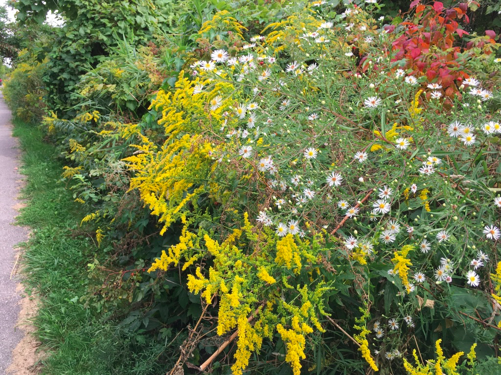
greenery along the Beltline
In walking this, in many ways you do loops in time and in demographics as well as geographically. Along the way, the route takes you from the old City of York which dates back to 1780’s, neighbourhoods that grew up between the mid-nineteenth though to the mid-twentieth centuries, and up into the latest waves of downtown urbanization. It covers inner-city rent-controlled public housing, the latest young-homeowner condo forests, older working-class, and upscale old-money. And, it shows off the natural features of Toronto that I like the most – the ravines, creeks, rivers, and the lake.
Finally, I’d be remiss if I didn’t mention that the time of year will offer a lot of variety to this walk. You can do this in any season, though some of the trails can get icy in January and February. It’s, shall we say, bracing to walk along the lake in the winter, but when it’s cold and the waves are high the natural ice sculptures can be dramatic. Of course, autumn would always be lovely given the many treed paths and parks so a crisp October day might be perfect. And spring and summer offer their own joys. I did this walk recently, in July 2020, and picked a day that was in the mid-20’s. There are some stretches, especially near Ontario Place and on the York Beltline, where there is little shade, so if it’s bright and sunny you’ll definitely need sun protection.
Food & Refreshment:
There are many, many options along this route. If you like picnics, this route offers some excellent locations in the parks you pass. If you like quick bites, then there’s that too – food trucks, ice cream, coffee, and little cafes. And of course, there are restaurants galore, in parks like the Brickworks, or in neighbourhoods like Queens Quay, Roncevalles, or the Corso Italia.
Washrooms are located in most of the parks along the way, though many are closed in the cold months (November-April). There are year-round washrooms at the Brickworks, along Queens Quay, and in the community centres at Earlscourt Park and Memorial Park. There are also many coffee shops along the way where you can use the facilities for the price of a coffee.
In terms of water fountains, it’s best to carry at least some water. There are places in many of the parks but these are turned off in the cold months. Other liquid refreshment options abound along Queens Quay and in Roncesvalles.
Diversions:
This is a route that is easy to break up over several days. The parks make good jumping on/off points – Corktown Common, Coronation Park, and Earlscourt Park are all near streetcar stops and can work well this way.
If you are coming in from outside Toronto, you might want to stop/start at Union Station instead of Davisville. You can take the GO Train to Union and walk down Bay Street to Queens Quay, and join the loop that way.
I’ve described this going clockwise around Toronto, but of course you could do it counter-clockwise. Either way, you have to descend from mid-town to the lake and climb back again, though I find the climb through Earlscourt and Prospect Cemetery to be a bit less steep than up the Don Valley and the Moore Ravine.
In walking this, you’ll pass some great shopping/dining areas, especially around Corktown – the Distillery District and St. Lawrence Market are an easy detour away, and you can avoid the industrial grunge around the bottom of the Lower Don Trail where it joins the Martin Goodman Trail.
If you really want to extend your loop, you can also incorporate the Toronto Islands. Just take the ferry at the bottom of Yonge over to Wards Island, walk the path west to Hanlon’s Point and ferry back to the docks to rejoin the path I’ve outlined. I’d allow at least 1.5 hours for this, including ferry waiting times.
Over the past couple of years of walking I’ve gone through a fair amount of gear, so I thought I would share some feedback for stuff that’s tried and trusted. Hope it helps.
What is it?: Fitbit Charge2 fitness tracker. The Fitbit Charge4 is the latest version. The Fitbit Inspire is close to the Charge2.
How much?: I got the Charge2 as a gift almost 4 years ago. The current model, the Charge4, is about $200, and the Inspire is about $100.
Where, when, how do I use it?: In 2016, my health wasn’t great – I was overweight, with high blood pressure and cholesterol levels, and suffering from stress-related angina. I knew I had to make some lifestyle changes, and my family helped out by buying me a Fitbit to get me off my butt and out walking.
And it’s worked. Since Nov 2016, I’ve logged more than 14 million steps over 10,600+ km while climbing the equivalent of 33,000 flights of stairs. I’ve lost about 30 pounds, my blood pressure is back to normal, and my cholesterol is under control.
Of course that’s not simply because of the Fitbit. I’m eating better, sleeping better, and walking daily. What the Fitbit does well is nudge you. I’ve set mine to vibrate every hour to remind me to get up out of my chair and walk at least 250 steps each hour. It also tracks my sleep so I can see how much restful deep sleep I’m getting. And it tracks my heart rate as it measures exercise, and that is logged against my activity targets. Having a goal and measuring against is a big part of the motivation you need to keep active – that, and having your son tell you that he doesn’t want you to die of a heart attack.
Over the years, it’s been pretty trouble-free. There isn’t much to do except wear it and charge it. So far the battery is holding up – I can still get about 3-4 days of use out of a full charge, down from 5+ originally, so I assume that is the limiting factor. Once the battery can’t hold a charge I’ll have to replace it.
That said, while this is supposed to be GPS enabled, it’s not super accurate on distances. Depending on the terrain, it can under- or over-shoot by as much as 15%, so on flat ground I find that I walk 10%-15% further as per Google Maps distance measurements compared to what the Fitbit says, and on hilly terrain it can be the opposite. For that reason, I take its distances with a grain of salt. What matters more to me is active minutes per day and per week – as long as it tracks my heart rate to motivate me to actually stay active, it doesn’t really matter to me whether Fitbit says I walked 9 km when I really did 10 km.
Would I buy it again?: Yes. I’ve worn out 3 bands on it, but the Charge2 is still chugging away. When I finally wear it out, I’ll by the latest model.
Disclaimer: This is not a “review”. I don’t go around sampling things, instead this is a summary of my own experience with a product I have used a lot. All opinions contained in this post are my own. I offer no warranties or assurances for your experiences with the same product. I bought the gear with my own money and have not received any form of compensation from the manufacturer. Take my feedback as given – caveat emptor.
Part of a series on my favourite places to go for a walk in Toronto
Blog posts are a labour of love for me, and yet there is a cost to running this site and organizing my walks.If you’d like to help with that, I’d really appreciate something for my tip jar.The Buy Me a Coffee service allows patrons like you to fund writers like me. If that sounds like a worthy idea to you, then go ahead – keep buying me coffees.Thank You Very Much to everyone who has contributed already!
*****
And now on to the regular post …..
Ronscesvalles is both a neighbourhood and a street, and its location next to High Park makes it a perfect area to explore, shop, and eat either before or after wandering the park.
Grenadier Pond in High Park
Location: The neighbourhood of Roncesvalles parallels the avenue of the same name for a few blocks to the east and west of the street. Roncesvalles Avenue starts a couple of blocks south of Bloor Street West, and runs south to end at Queen Street West. It’s bounded to the east by the train tracks that curve up from near Queen at about Landsdowne Street, and on the west by High Park, although many people would consider the streets immediately adjacent to the park to be the neighbourhood of High Park. Anyway, just aim for Roncesvalles Avenue and you know you are in Roncy the neighbourhood.
Art in the Park
Public Transit: Take Line 2 west to Keele Station, and walk south on Dundas a couple of blocks until the road forks – follow the right hand fork and you are on Roncesvalles Avenue. Or, take the 501 Queen streetcar from either Queen Station or Osgood Station on Line 1, and get off at the south end of Roncesvalles Avenue.
Why I like it:
Roncy the neighbourhood for me is really about the shops and restaurants along Roncesvalles Avenue. Years ago, when I first moved to Toronto, my brother had a tiny studio apartment at the corner of Dundas and Bloor. I used to visit and we’d walk down Roncy Avenue, which back then reflected the eastern European wave of immigration that had settled in the area in the 1920’s and 1930’s. You could get a decent schnitzel and a beer (but not much else) at a half-dozen places back then.
In the 1980’s and 1990’s, the area started changing. The older generation started to sell off to a younger, and as we moved into the 2000’s, these younger folks had a different food and shopping sense. The older eastern European places started to change hands and gradually, as part of restaurant trends throughout the city, new flavours and cultures started to settle. Today, it’s 2 km of funky restaurants mixed with old favourites, where you can get a great BBQ, quality seafood, Asian fusion, and much more. You can also shop for locally grown organic produce, cheeses, books, clothes, or antiques, stop for a local not-another-coffee-chain coffee, or indulge in a drink at one of several bars.
Plus, you are just a couple of blocks from High Park. It’s easy to start on Roncy for breakfast or lunch, then go for nice stroll around the Park and end up back on Roncy to pick up fruit and veg for dinner before heading home. Of course, you can do the opposite and start in the Park for a brisk, appetite-building walk before satisfying that hunger in one of Roncy’s many restaurants.
Sights:
To be honest, if your idea of sights includes tall buildings and high culture, then this may not your place. On the other hand, if your idea of sights includes some funky fresh menu options and window-shopping in a real neighbourhood filled with the diversity of Toronto, then you are in the right place. Combine that with the natural beauty of High Park and you’re set.
Even then, there is culture in the hood. Just east of Roncy there is the new Museum of Contemporary Art on Sterling Road. Since that opened, a number of gallery spaces have started up in the area, creating a new cluster of art buzz that takes you outside the cloister that used to be centred near the AGO in downtown Toronto. It’s definitely worth a visit.
Another cool option is the Dream in High Park, when the Canadian Stage Company puts on a full length play by Shakespeare during the summer. I remember going 30 years ago (Midsummer’s Night Dream?), and it’s still a tradition. [Sad note: COVID-19 has cancelled this for 2020, alas! Cross your fingers for 2021]
The Dream stage area looking very COVID neglected in the summer of 2020
Of course, walking in the park is its own type of culture. I like coming in any season. Autumn of course is a natural, with the turning leaves. Spring is also great, especially in May when the cherry blossoms bloom in High Park (beware the crowds though, weekends can be brutal). A summer day is great, and so is a winter’s afternoon. Oh, let’s be honest, it’s always good. Just come.
Food & Refreshment:
As I’ve said, there are many restaurant, food shop, and bar options up and down Roncesvalles Avenue. There are also many more along Bloor West which forms the northern border of High Park, especially to the west of the park. These days as well, if you walk the length of Roncy down to Queen West and then turn left (east), you’ll go through Parkdale and several other changing/renewing neighbourhoods. It can be a great walk that way too.
In High Park itself, there’s a couple of places to eat including the famous Grenadier Restaurant, and often ice cream or food truck vendors in summer. There are washrooms throughout the park and lots of water fountains [but COVID-19 has many water fountains shut off in 2020 so bring your own water], though these are open only in the warm months between May and October. In the cool months, there are lots of coffee shops back on Bloor or Roncy where you can have a quick pit stop.
Diversions:
Starting just east of Roncesvalle Avenue, at Lansdowne and Queen, is the newish West Toronto Railpath. It runs sort of north-south, and takes you up north of Bloor to near Davenport Road. It’s being expanded and in a few years will be connected into the city’s wider bike plan.
Within High Park itself there are many trails and roads, some paved and some not. On a quiet weekday, it’s easy to get lost in what can feel like a giant forest in the middle of Toronto. You can spend a couple of hours covering many km of trails.
High Park is also home to the High Park Zoo, a small but fun place for kids. We took our son there many times when he was a wee lad.
At the bottom of Roncesvalles Avenue, where it crosses Queen West, there is a bridge and connector trail that crosses the train tracks, the busy Gardiner Expressway, and Lakeshore Boulevard. This lets you jump onto the Martin Goodman Trail along the shore of Lake Ontario, at Sunnyside Park. Either direction, east or west, is fun. I like to go west and cross back over Lakeshore at about Ellis Avenue in order to walk north just to the west of High Park, through the neighbourhood of Swansea, and end up back on Bloor West. From there I can turn right (east) and finish back at Roncesvalles.
Blog posts are a labour of love for me, and yet there is a cost to running this site and organizing my walks.If you’d like to help with that, I’d really appreciate something for my tip jar.The Buy Me a Coffee service allows patrons like you to fund writers like me. If that sounds like a worthy idea to you, then go ahead – keep buying me coffees.Thank You Very Much to everyone who has contributed already!
*****
And now on to the regular post …..
Toronto, like any city, has many neighbourhoods and all of them have some history and uniqueness to them. Some are hip and trendy, some are gritty, and some are upscale and stately. Rosedale is the latter. It’s long been known as a district of fine older homes set amongst quiet leafy streets, and that makes it a great area for a summer’s shady walk. Here’s a route that I’ve done before, and it’s equally great in the spring and autumn too.
Length: around 8 km, so about 1.5 hrs
Surface: paved (except in the parks)
Public Transit: To start, take the subway Line 1 to St. Clair Station. The finish on the route map is at Line 1 Rosedale Station, but an alternative is to finish at Line 1 Summerhill Station, both on Yonge Street.
Route:
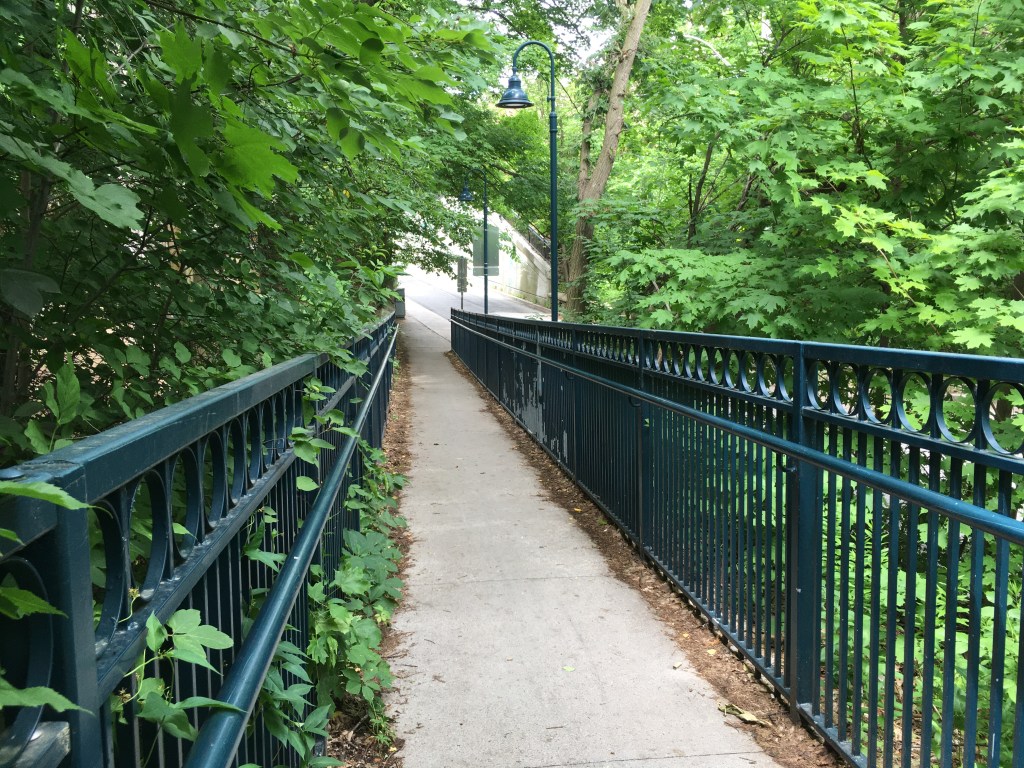
Starting at St. Clair Station, exit the subway onto St. Clair Avenue East. Walk east on St. Clair (on the south side of the road to Inglewood Drive. Turn south and follow Inglewood as it bends to the east. Cross Mount Pleasant Road at the traffic lights and continue east on Inglewood to its end, where it bends to the right (south) and becomes Rosedale Heights Drive. Follow Rosedale Heights south and back west until you come to MacLennan Avenue. Turn left (south) and walk down the hill to the ramp on your right leading upwards – follow that onto the pedestrian bridge over the train tracks, over, and down the ramp onto Summerhill Avenue.
Pedestrian ramp over the train tracks at Summerhill
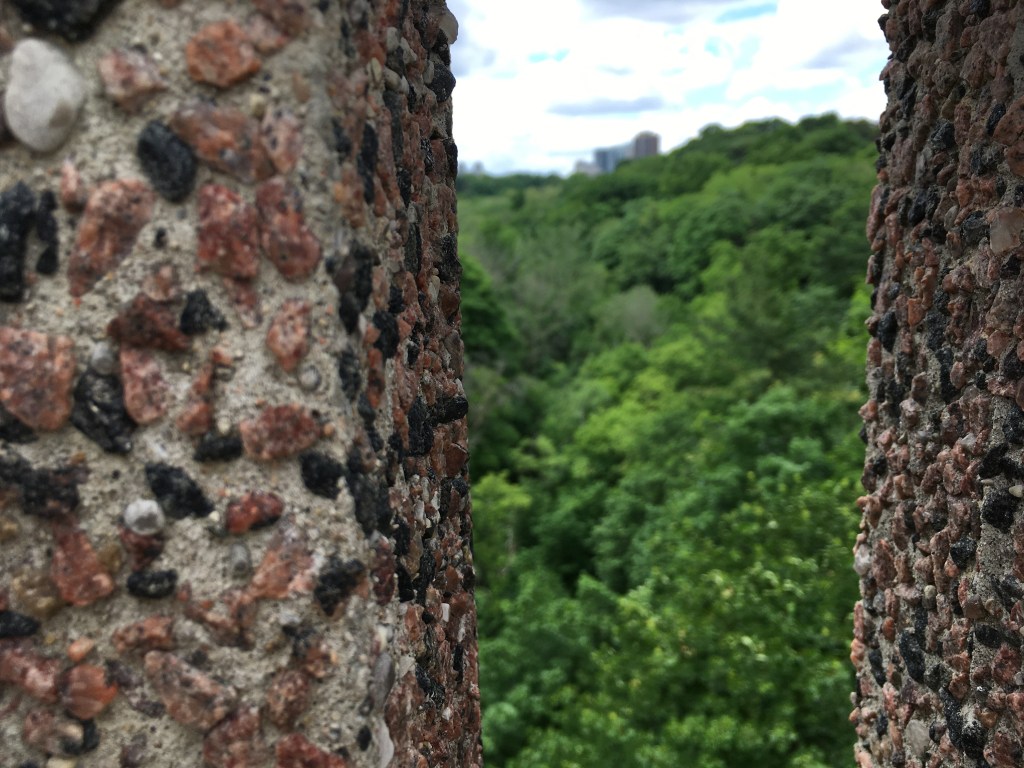
Once you are over the tracks, walk east on Summerhill to Chorley Park (a great spot for a picnic). Wander through the park and exit on the south west corner onto Roxborough Drive. Follow Roxborough west, passing Rosedale United Church and Whitney Park onto Edgar Avenue. Follow Edgar west to Rosedale Park, and turn left (south) onto MacLennnan. Follow that south to the roundabout and take the road to the south-east, Highland Avenue. Follow that southeast to Glen Road. Turn right on Glen Road and cross the bridge over the ravine.
View at the Glen Road Bridge
At South Drive, turn right (east) and follow that to Elm Avenue. Turn right (east) and follow Elm until it turns into Castlefrank Road. Follow Castlefrank east and then south as it bends. At Dale Avenue turn right (west) and follow Dale west to Glen Road. At Glen, turn right (north) and follow it to Maple Avenue, turning left (west) onto Maple and continuing to Sherbourne Street. At Sherbourne, turn right (north) and follow it to South Drive. Turn right (east) on South Drive and follow the curve around to the north, where it turns into Crescent Drive. Keep following Crescent as it curves around to the west and crosses over Mount Pleasant Road. To finish, follow Crescent west to to Rosedale Station, on Yonge Street.
Sights:
What’s lovely about this walk is that you get a combination of stately homes and parks for a rest. It’s a people-watching walk too, as there are always pedestrians out for a stroll. And it can be a fun, spot-the-flash-car walk as well – you’ll run out of fingers and toes before you run out of Porches to count, for example.
Rosedale prides itself on what it thinks of as understated elegance. This is not a bling-house neighbourhood, it’s more old money than new, more Chanel than Versace, more Mercedes than Ferrari. You walk here because it’s fun to imagine the lives behind the curtains.
While there’s no truly dramatic scenery nor any particularly impressive architecture, streets filled with large, red-brick homes dating back to the late 1800s tell a story of solidity and comfort. There is history here, in that the red bricks of the oldest homes probably came from the Don Valley Brickworks, like many of the other famous buildings in Toronto – Old City Hall, Massey Hall, and so on. And the area dates from a time when Canada and Toronto was establishing itself, post-1867 Confederation, as a prosperous, industrious part of the Empire.
While today, Toronto likes to think of itself as hip and is proud of natives like Drake promoting the 6, Rosedale still has a whiff of the Toronto-the-Good era, the so-called blue-light Toronto when nothing opened on Sundays, temperance movements tried to suppress the evils of alcohol, and good citizens meant good Protestants attending church on Sundays. Back then, non-WASPs had their own neighbourhoods, and Rosedale was a solidly white upper-class enclave. It’s more diverse today, but its still upper-class – the area is the wealthiest part of Toronto.
That wealth is visible in the homes, the cars, the land, and quiet streets. It’s also visible in the shops along Yonge, between Rosedale and Summerhill subway stations. There was a time when a strange face wandering through Rosedale would draw attention. Today, it’s less hide-bound, less class-ridden, and less uptight. But there’s a reason that one of the first LGBTQ bookstores in Toronto was called This Ain’t the Rosedale Library.
Food & Refreshment:
Food and refreshments on this walk are mostly around the start and finish – there are many cafes, coffee houses, restaurants, and food shops along Yonge near St. Clair, Rosedale, or Summerhill stations. In the heart of Rosedale, on Summerhill Avenue just over the train tracks, there is the Summerhill Market, Rosedale’s version of a corner store (and a fab gourmet stop on it’s own). All this gives many options to load up for a picnic, and Chorley Park is the perfect spot for that.
There are water fountains at Chorley and Rosedale Parks, available between about May-October, and there are public toilets at Rosedale Park as well. There are also public washrooms at St. Clair in the shopping mall at the north end of the station. Finally, there are washrooms, a great cafe, and water at the Brickworks if you divert from this walk (see below).
Diversions:
An alternative route is to turn north once you cross Mount Pleasant Road on Crescent Road, onto Wrentham Place. Follow that north to Roxborough Street and turn left (west), then north on Chestnut Park. Wind through these little streets and find Cluny Drive, turn north, and find Rowanwood Ave. Follow that around to the east onto Thornwood and then north and around to Pricefield Road. Take Pricefield west all the way past the Pricefield Playground and into Scrivener Square by the old Summerhill train station that is now the Summerhill LCBO at Yonge Street. Turn right and walk under the train tracks to Summerhill Avenue to the Summerhill Station on Line 1. This diversion takes you through more quiet, charming back streets and lets you end by the gourmet shops at Scrivener Square.
Another fun diversion is to cut through Chorley Park and join the connector trail that descends into the Moore Park Ravine – this will put you opposite the Don Valley Brickworks, and you can pop in there for a potty stop or food/water/coffee. The Chorley Park connector trail also puts you onto the Beltline Trail, and you can follow that south and around past the Brickworks. The Beltline continues north up through David Balfour Park, under St. Clair Avenue, and on into Mount Pleasant Cemetery to finish near Davisville Station on Line 1 subway. Or you can climb out of the trail just before you get to St. Clair, and walk back along that road to finish back at St. Clair Station.
You can also take the Chorley Park connector, follow the Beltline around, and then take Milkman’s Lane to climb out of the Yellow Creek Ravine and into Rosedale. This will put you onto South Drive by Glen Road, where you can rejoin the main route described above.