Between mid-May to late June 2024, I will be walking along the SW coast of Ireland, taking in the Kerry Way, the Dingle Way, the North Kerry Way, and parts of the Burren Way in Clare and the Western Way in Galway. This is the story of part of that journey.
A big thank you to everyone who has bought me a coffee over the past year. The Buy Me a Coffee service allows patrons like you to fund writers like me, to cover things like the costs of running this blog, new shoes and gear, and journeys like this. If that sounds like a worthy idea to you, then go ahead – keep buying me coffees.
Where Am I?
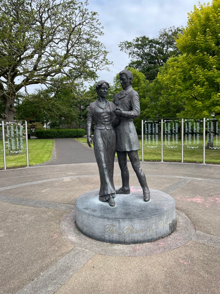
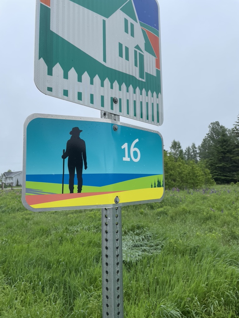
In Tralee, taking a break before starting the second half of my journey.
The Rose of Tralee statue
I got here by walking about 500 km over 3 weeks, starting in Killarney, and walking –
more or less the whole 220+ km of the Kerry Way
with a detour between Waterville and Cahersiveen to take in the Cliffs of Kerry, Portmagee, and Valentia Island
plus a road walk between Killarney and Camp on the Dingle Peninsula to get onto the Dingle Way
and then the 200 km or so of the Dingle Way which finishes in Tralee
from which I finished my first half with a 26 km section of the North Kerry Way up to Ballyheigue
There’s much to tell about those sections, probably in some future posts. In the meantime, here are a few stories and pics from my journey so far.
Stories and Pictures Along The Way
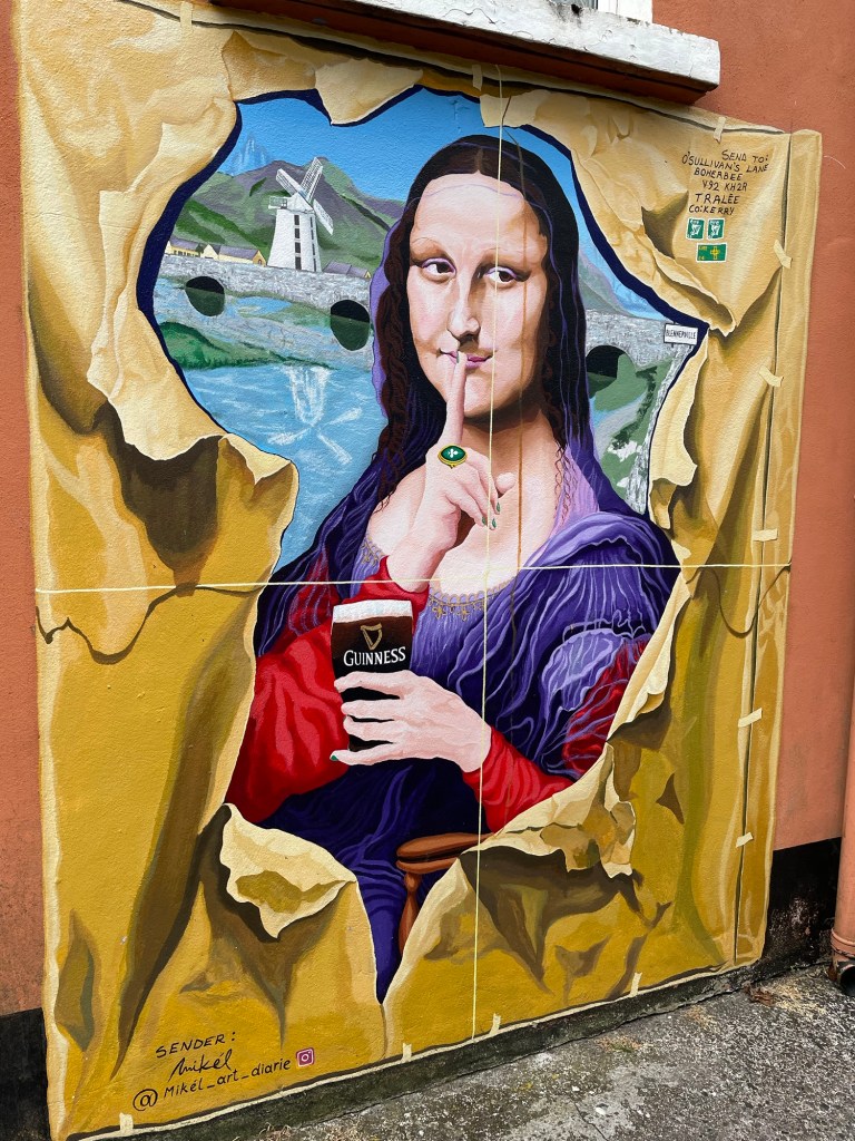
I’ve noticed in some of the towns I’ve been in that some of the pubs have gone all out to come up with creative Guinness art. Here are a few of the ones I saw just wandering here in Tralee.
*****
The beaches in Ireland are an under-appreciated attraction. The Dingle Way in particular includes about 20 km of beach walking. Unfortunately for me, about 15 km of those came on a day when the wind was lashing and the rain was off and on, always hard in my face. Attempting to wear a rain poncho in those conditions was futile, so I was soaked and chilled by the end of the day.
And yet the scenery, the pounding surf, the salt spray tang in my nostrils – it was exhilarating. Exhausting too.
*****
It was around mid-day, after leaving Kenmare. I was up on a hillside following a dirt lane, and turned a corner near an old farmhouse. The scent of a turf fire wafted faintly, and instantly my mind jumped 300 km northwards – memories of sitting round the kitchen at the Doherty family farm outside Donegal town, next to a warm turf stove, trying to decipher Charles’ story through his Irish accent, drinking tea and laughing, laughing.
*****
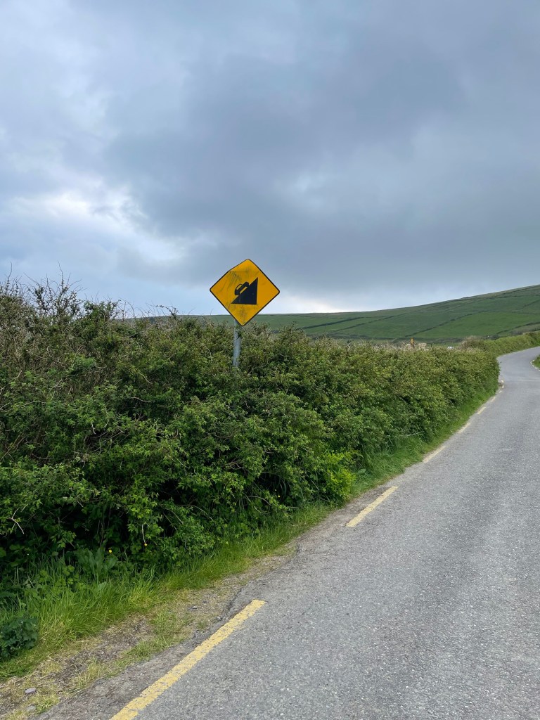
And speaking of accents, I was walking down a wee road, and as I was going down a man was coming up, on the same side of the road as me. We approached, and he didn’t move, so I stepped aside as he said “Good morning, and how do you do?” in such a musical faith-and-begorrah south Kerry accent that I almost burst out laughing.
I nodded politely instead, and continued on, and only later realized that I had been on the left side of the road, and he was correctly walking on the right, hence our collision course. His polite question was his way of inquiring as to whether I was the addled foreigner that I appeared to be, and a reminder to me that in Ireland one walks on the right side of the road to face oncoming traffic.
*****
Trail food for me has been a combination of ready made things picked up in shops, mostly sandwiches, as well as things I can heat up with minimal cooking. Instant rice mixed with tinned fish is a staple. It isn’t the most flavoursome meal but it fills you up and is relatively healthy.
But when in a town, I’ll eat at local cafes and pubs. Favourite meals so far have included the fish and chips at the South Pole Inn in Anascaul, the pizza at Tango Street Food in Killarney, and the grilled local fish that I had at Pisces Restaurant in Castlegregory.
And of course, it’s Ireland, I wouldn’t be exploring if I didn’t sample the pubs along the way. I do like a pint of Guinness, so that’s been my beverage of choice when in a pub.
Probably my favourite pub and pint was at O’Connor’s Bar in Cloghane – it had been a rainy blustery day, and was still a rainy evening, cold to boot, and I was tired and cranky.
I walked into a properly old-fashioned place, cobwebby wooden beams overhead and dusty flagstones on the floor, with a bar propped up by regulars and the requisite loud American, a turf fire smoldering away.
That pint was delicious. I spent 2 hours eavesdropping on the conversations going on all around me
“that bloke is creepy, look at him leering”
“who’s that?” – referring to a movie playing on a telly in the corner – “Sean Connery”; “who’s Sean Connery?”
“What if we buy a round for everyone in the bar and put it on the musicians tab”
and listening to a young guy playing the piano and singing songs like Raglan Road. There was the Celtic magic I’d been searching for. Sláinte.
*****
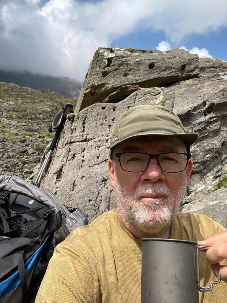
And it wouldn’t be Ireland without tea. One of the toughest parts of the Kerry Way for me was the section between Glencar and the Black Valley. This had two steep climbs in it, and by the time I had huffed and puffed up the second one, I was gasping and hungry.
So I paused at the top, got out my cooking gear, and made myself a cup of tea – cure’s everything, as Ann’s gran used to say.
*****
In walking the Kerry Way , and then the Dingle Way, I covered two of the three most popular walking trails in Ireland (the other being the Wicklow Way). Even though it’s still early in the tourist season, there were many other walkers with whom I crossed paths.
They come from all over, though I would say that the majority of hikers that I’ve met so far have been from Germany, with Americans a close second. Other accents and languages I’ve overheard include French, Spanish, Icelandic, Irish, English, Australian, Canadian, and Italian.
It’s an international community, and very different from my experience walking in Canada, on the Bruce Trail, the Island Walk, and my Nova Scotia journey last year. The national waymarked trails of Ireland are a treasure, and I’m deeply jealous – I would love it if Canada had such a system of trails dedicated to walkers.
*****
When I reached Camp, after walking in the wind and rain for several hours, I was delighted to find a snug little place called Anne’s Cafe. I went in, grateful to be warm and dry, and ordered a pot of tea and a bite.
I was just sitting down when a young family came in and asked if they could share the table. They had two youngsters, about 5 and 3 years old.
We got chatting, and I explained a bit about the walk I’m on, and they talked about walking the Camino Frances a few years ago.
We were comparing experiences, and I said that one of the things that I had told myself on my previous long walk in Nova Scotia was that I should try to find at least one moment every day when I felt at peace, a place of total calmness.
It occurred to me as I was explaining it, that I hadn’t been consciously doing that on this trip. I had had my Zen moments, but I hadn’t had to say to myself “ok, focus, this is your Zen moment “. I realized that I had simply felt it – absorbed the calm in the moment – without having to prompt myself.
I guess that’s growth. Old dogs and new tricks and all that.
Where to Next?
From Tralee, I’ve changed my route a bit. I think I want to head as directly towards Doolin as I can so that I can spend a bit more time on the Aran Islands, and then in Connemara.
Weather and circumstances may change that, of course, but my time is pretty flexible. As long as I make it to Galway in time to catch a train to Dublin so that I can rejoin Ann, I’m fine. Let’s see where I go.
Like what you read? Buy me a coffee. Your donation helps offset the costs of maintaining this blog.
Between mid-May to late June 2024, I will be walking along the SW coast of Ireland, taking in the Kerry Way, the Dingle Way, the North Kerry Way, and parts of the Burren Way in Clare and the Western Way in Galway. This is the story of part of that journey.
A big thank you to everyone who has bought me a coffee over the past year. The Buy Me a Coffee service allows patrons like you to fund writers like me, to cover things like the costs of running this blog, new shoes and gear, and journeys like this. If that sounds like a worthy idea to you, then go ahead – keep buying me coffees.
Where Am I?
In Waterville, catching up on blog posts.
In Killarney, catching up on blog posts.
In Castlegregory, catching up on blog posts.
*****
My last blog post saw me reaching Kenmare after a scary night and a soggy, sloggy day. But after a good night’s rest, with dried out clothes and gear and a tummy full of a proper Irish vegetarian breakfast (eggs, fried tomato, fried mushrooms, and baked beans, but no rasher or sausage or black pudding, if you must know), I was ready to press rewind and start off on a better foot.
I should explain that I walked the Kerry Way clockwise, starting from Killarney and heading southwest towards Kenmare and then along the south coast of the Iveragh Peninsula to Waterville, turning the corner there and continuing up and around to Cahersiveen and Glenbeigh and so on back along the coast to Killarney.
Most guidebooks for the trail, however, suggest that you walk it counterclockwise, going from Killarney northwest towards Glenbeigh on the north coast of the peninsula and continuing so on round, finishing the trail with the Kenmare to Killarney leg.
My reasoning for the contrarian approach was that the first half of the walk, as I was doing it, would have less climbing and descending than the second half. I reckoned that would mean more time to ease my legs into it.
And so, on the whole, it proved. The trail from Kenmare to Cahersiveen does take you up and down many hills, but the total meters climbed are a bit less than if you went Killarney to Cahersiveen.
But – there’s always a but, isn’t there? – what I found was that the Kenmare to Cahersiveen hills are in general more rocky, muddy, or boggy, so even though you climb a bit less you work harder to do it. At the least, that was my impression but it also rained all day coming out of Kenmare and that didn’t help.
But, but, but … A point in favour of my way of doing it that I realized as I was finishing was that the scenery just gets better and better as you go – the stretch from Cahersiveen to Killarney is wonderful, especially if you get clear days as I did.
If you go in the guidebook direction, then the best scenery is upfront. I’d rather delay the payoff, as it were, but that’s just me.
The first half of the Kerry Way as I walked it, including my detour to the Kerry Cliffs
*****
The first day out of Kenmare took me through all the trail conditions I would encounter for the rest of the way – muddy, boggy, rocky, grassy, gravelly, sheep-ploppy, and cow-floppy, with all the combinations thereof. My favourite was a stretch of grassy-muddy-boggy-sheep ploppy-cow floppy conditions that threatened to fill my boots again with mucky water.
It rained more or less all day, sometimes easing off only to come down harder later. I took it in stride, however, happy to be walking after my near-disaster, and made good progress to reach a pretty stretch of the Way right by the shores of Kenmare Bay near Lackeen Point.
I had planned to wild camp in this area but could find nothing level enough, or far enough off the trail, to work, so I kept going and eventually came upon a good spot sheltered by trees near Blackwater Bridge.
It rained all that night, making for a very wet stay, but it was pleasant enough listening to the birds, the plop of rain drops, and the murmur of the Black River nearby.
The next day I set off towards Sneem, relieved to find in the morning that the rain had finally cleared. It was a gently taxing walk, some hills and muck but no real challenges, yet still long enough to bring on an appetite by the time I reached Sneem.
I had lunch at the Village Cafe, just getting in ahead of a bus load of tourists, and sat outside to dry my tent a bit while I had tea and a sandwich. Several tourists stopped to ask where I was walking, was I camping, what was it like, etc. But the locals ignored the tourists, including me.
From Sneem I continued on, intending to camp off the trail in a stretch of forest about halfway to Caherdaniel which, on the map at least, seemed promising. But upon reaching it, I could see that the ground sloped far too much to offer any hope of level ground. Not for the last time, I was forced to keep on walking, down a steep, rocky, slippery hill and on towards Caherdaniel.
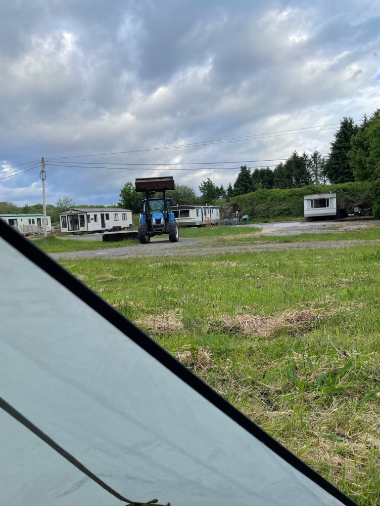
I had thoughts of going on to that town that evening because I knew there were a couple of B&Bs, but with about 5km to go and after about 10 hours of walking, I ran out of energy near the hamlet of Castle Cove. I left the Way there and walked into the town where I eventually found a spot to camp for the night, in a deserted caravan park.
The next morning, I was up early to sunshine and a fresh breeze, which helped me on to Caherdaniel. I’d hoped to find a little cafe which might at least offer tea and perhaps a full breakfast, but there were only a couple of pubs, neither yet open.
Leaving Caherdaniel, the Kerry Way offers two options, one longer but with less climbing along the coast, or the one which I took, shorter but hillier.
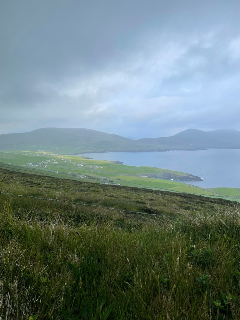
The sun was out and the views were lovely as the Way left the rough tracks across hillside sheep pastures behind, and instead followed wee back roads into Waterville.
I reached town in good time and checked into a B&B after two nights of camping, pleased to be able to wash some socks and have a very welcome hot shower, after drinking a lovely cup of tea. A pleasant meal sitting by the seashore rounded out the day.
While sipping my beer that night, I studied the map. From Waterville, I had two choices. Following the Kerry Way involved a 30+ km stretch to reach Cahersiveen that had 860+ meters of climb and descent in it, much of it along the spine of a mountain ridge.
The views would be lovely (assuming clear weather), but there was no chance of camping along there given the exposed slopes, and since I knew I would struggle to do that stretch in a single day, it posed a very tough challenge.
Instead, I opted to follow the coast road out of Waterville towards Ballinskellig, which offered a lovely 2km beach walk,
and then took the Skelligs Ring route on back roads to reach St Finan’s Bay.
After a rest there and a delicious bowl of seafood chowder at the Driftwood Surf Cafe, I continued along the road out of the village towards Portmagee, which took me up a steep switchbacked 250m hill climb,
but cresting the hill offered gorgeous views,
And in coming down from that I reached the Kerry Cliffs.
This privately owned tourist attraction is well situated on rugged coastline offering stupendous views westwards from cliff tops 80 m above the churning sea.
I camped there right up on the cliff tops, nervous about the wind, but snug enough tucked under a turf bank.
The next morning took me down into Portmagee for yet another great Irish vegetarian breakfast and tea. The bridge to Valentia Island beckoned, and I followed back roads along the length of the island to reach the delightful Knightstown, (strangely reminiscent of Cornwall – must have been the palm trees). I recharged there with a very good flat white made by an Irish guy who remarked that the Aussies had nothing to teach him about the art of making coffee.
The ferry ride from Knightstown back to the mainland is short, less than a km, reminiscent in this case of the Lehave River ferry back home in Nova Scotia.
When I stepped off the ferry I had only a short 4 km walk to reach Cahersiveen, arriving early in the afternoon as the sun was coming out.
The Mannix Point campground there was fantastic, the best I’ve stayed in, and I happily lounged about doing some laundry, having a shower, reading, and just relaxing.
The weather was glorious that evening, warm and sunny, and forecast to remain so for a couple days. If I hadn’t wanted to see more of the Kerry Way I would have stayed there for a bit.
But the trail tugged at me, as it always does.
Stories Along The Way
Walking out of Kenmare, it was dry(ish) but there was rain in the air. I hadn’t gotten more than about a km up the hill when the first drops confirmed my intuition.
I pulled out my rain poncho, which I hadn’t worn the day during my soaked walk into Kenmare, since I was already wet to the skin by the time I had a chance to put it on.
It took a minute to figure out how to get it on over me and over my backpack – the trick, I realized, was to stand facing the wind and let the breeze carry it up and over my shoulders and then quickly spin around as I pulled it down so the wind held it against my back.
I had it settled after a bit of wrestling, and continued up the hill. I wore it the rest of the day, congratulating myself on my choice of rain gear since it was much lighter in weight than my previous rain jacket but at the same time allowed more ventilation, especially when worn with shorts.
As I walked I thought that the clever hiker would have a spare boot lace (I did!) and a carabiner or two (I did again!!) and could use those to fashion a simple belt to hold the bottom of the poncho down against any strong gusts.
And then I thought the really, really clever hiker would have had the idea before he put the poncho on and had the belt ready in a convenient pocket. Oh well.
*****
I must confess that I did try to put the poncho on during that wild Monday morning. But the best method I can see for donning a rain poncho in a gale is:
Get out poncho
Spend 5 minutes attempting to don it while the wind swirls it in all directions threatening to alternately smother you and blind you (cursing is optional during this step)
Give up and resign yourself to getting wet
*****
When I reached Cahersiveen, I was pleased to see that there were laundry facilities at the campground I was in. I wanted to wash everything that I could, including my sleep clothes, which meant that the only remaining clothes that I had to wear were a T-shirt and a pair of underwear.
So I improvised. I tossed everything into the machine, and waited for it to finish wearing my windbreaker as a kilt.
Very fashionable amongst the hiking set, I’m told.
*****
Walking from Caherdaniel to Waterville, I was passing along a nice stretch of the trail, facing a charming blue sea set off by the green of the hills sloping down towards it.
This was one of those spots where a bench had been placed, and I took advantage to sit for a few minutes and have a sip of water.
I was minding my own business when I noticed another hiker coming towards me. She also noticed the bench and made for it. I waited, not wanting to seem rude, as if I was getting up to avoid her.
She sat down and we struck up a conversation. She was German, and perhaps (though a gentleman never speculates about a lady’s age) of about my vintage. We remarked on the trail and the scenery and the weather, and then she said, looking at the shorts I was wearing, “that is a good idea, it is getting warm now”.
And she reached down to unzip the legs off her trousers – they converted into shorts you see – and pulled off one leg and then the other to reveal, ahem, rather shapely legs.
I looked away, not to seem as if I was leering, and coughed and excused myself and headed on my way.
And later I thought, that was like that scene in The Graduate. She was Mrs Robinson, so I must be Benjamin. And she did kind of look like Anne Bancroft. Hey, maybe I’ve still got it. It’s that #hikerDude mystique. Gotta be …
I walked off humming the Simon and Garfunkel hit song from that movie.
When I reached Castle Cove, I passed by a pub and restaurant that had a big Accommodations sign out front. I went in and was through a seemingly deserted interior, calling out Hello. Eventually a woman came out of the back, and replied to my inquiry that they weren’t doing accommodation just then.
I asked if I could set up my tent in their garden, since there appeared to be about a half acre of grass there. “No”, she said. Just that. Hmm, ok. “Do you know of anywhere nearby where I can camp?”. “Right down the road, just go down to the main road, turn right and cross the bridge, and it’s the first entrance, there’s a campground there.”
So I thanked her and went next door, into was not a campground so much as a caravan park, and a deserted one at that. I walked round the place, not a soul in sight, no cars, nothing to indicate that any of the units were occupied. And there was no office either, just a big sign that said “You are under CCTV Surveillance “.
I returned to the pub and knocked, and reported my findings. Can I camp there? It’s not a campground, there’s no one round to ask, and the sign says No Trespassing. And there’s no water outlets anywhere.
“Yes”, she said, “it’s fine. Just set up on any patch of grass and you’ll be ok”. Hmm, alright, “can you please fill my water container then”. She grudgingly did so, and turned away, obviously dismissing me.
I walked back, and wandered around some more, finally settling on a relatively secluded spot that wasn’t too obvious from the road. As I started to set up my tent I realized I had forgotten my trekking poles back at the pub. Trudge over, trudge back. Finally my tent is set up.
I groan as I take off my boots and crawl in, arrange my gear, break out my cooking gear, and start to boil water for my meal. I just get dinner ready when …
Wait for it …
A large tractor pulls into the park and starts cutting the grass.
It’s roaring away and slowly getting closer to where I am set up. The driver eventually sees me. I think about going out to tell him that the lady next door said I could camp here. To hell with it, I think. I’m tired, I’m damned if I’m moving my tent at this point, and I just want him to finish so I can go to bed.
He eventually does all the grass that he can except for my patch, coming within about 10m of me. He gives me one last look, and heads off. I can see him on his phone as he drives away.
I go to bed expecting the Garda to show up in the dark to haul me off for trespassing. But there’s no further disturbance, except for the squawks of angry crows. Céad míle fáilte my arse.
Where to Next?
From Cahersiveen, I walked the second half (my version that is) of the Kerry Way to return to Killarney. More on that later.
Like what you read? Buy me a coffee. Your donation helps offset the costs of maintaining this blog.
Between mid-May to late June 2024, I will be walking along the SW coast of Ireland, taking in the Kerry Way, the Dingle Way, the North Kerry Way, and parts of the Burren Way in Clare and the Western Way in Galway. This is the story of part of that journey.
A big thank you to everyone who has bought me a coffee over the past year. The Buy Me a Coffee service allows patrons like you to fund writers like me, to cover things like the costs of running this blog, new shoes and gear, and journeys like this. If that sounds like a worthy idea to you, then go ahead – keep buying me coffees.
*****
Where Am I?
In Killarney, at a B&B, catching up on blog writing.
I arrived in Kenmare by taking the train from Dublin to Killarney, getting in at about 1:30. The train ride was fine, not a ton of scenery, but quiet so I was able to read for a bit.
As soon as I stepped off the train, my feet were itching to go. But I had to visit a grocery store first for dinner that night, and some food for the next day. The local Tesco’s had a good selection of simple healthy hiker foods so I stocked up. But in a foretaste of things to come, I realized later that I had lost one of the rubber tips for my hiking poles.
After finally setting off, I was quickly at and then past the official start of the Kerry Way near the Killarney Tourist Office, opposite Killarney House.
I sailed along the path beside the busy roadway, with Sunday tourists out in force on a nice day.
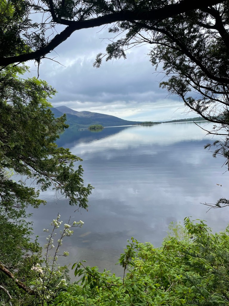
It’s about a 4 km walk to reach the entrance to Killarney National Park, through which the trail traverses. Soon I was staring at stunning views over Mucross Lake towards the hills.
After a quick but much-needed pit stop at one of the Park’s conveniences (a thousand flowers of blessing upon the inventor of the toilet), I joined a steady stream of day hikers climbing the path to the Torc Waterfall. It’s beautiful, I assume, though I couldn’t see it as it was meant to be, unadorned with selfie grabbers.
The climb up past the waterfall is steep, about 100m in total, but after that I was out past the last of the day trippers and onto the trail proper.
I walked at a good pace on fresh legs and feet, anxious to find a camping spot. I’d spent more time than I had planned to get to this point. It was past 5 pm as I approached the edge of the forested area. My original thought had been to camp just inside these woods, near the Owengarrif River, which on satellite pics looked doable.
In practice however the ground was too uneven, a foretaste of what I was to encounter along much of the trail – the right combination of sheltered, level, dry, and off the trail was elusive much of the way, as I was to find.
But I did settle on a spot after searching a bit, an old sheep pasture with a lovely view, and set up camp there for the night.
After an eventful night (more on that later), I woke to rain and slogged the next day, soaked and grumpy, into Kenmare.
A hot Irish breakfast and strong pot of tea did wonders, reviving me enough to find a nice B&B that was right beside the trail just outside of town, and I checked in there to change out of and dry my sopping clothes. The first 2 nights had given me a wet intro to my journey.
Stories Along The Way
As I have learned on my travels in the past, trail angels come in all forms. The first on this journey was Fionnulla, at the Kenmare B&B, who let me put my wet boots, pack, and socks in the boiler room to dry out, and took my wet sweat pants and threw them in the dryer. Between that, and judicious use of the hair dryer, I had all my stuff dried off ready for the next day.
*****
Right near the start of my journey, about 2 km out of Killarney, I met Chris, a Kerry Way thru hiker who was just finishing. As we sized up each other, I realized he and I were pretty similar – same build, same age, same #HikerDude fashion sense, even similar Osprey packs.
We chatted for a bit, and he remarked about how wonderful the trail is. “You’ll love it”, he said. I walked away feeling pretty good about myself – if he was about my age and had just solo walked it, then it should be no problem. Right?
*****
As I said, I had an eventful first night, on my seemingly lovely bit of sheep pasture.
By the time I had set up my tent, made dinner, and climbed into bed, it was about 8 pm. The skies were clear and there was no wind to speak of. Still, I had made sure to place two bracing guy lines on the tent plus added two extra side pegs. I drifted off to sleep thinking, “I should be ok”.
I woke up at about 10:30 to the sound of rain against the tent, driven by moderate winds. I fell back asleep, only to be awakened at about 3:30 am by the side of the tent slapping my face. The wind had picked up tremendously, and the whole thing was shaking. I reached out and checked the corners from the inside – all seemed secure so far.
After that, I just lay awake, weighing up my options. The tent was taking a pounding but it was holding, in part because my weight lying on the tent floor was helping to provide stability. It was still dark at 4, and at 4:30, and finally a predawn twilight crept in around 5. I could see that things were holding, but the wind wasn’t just refusing to ease, it was getting fiercer, as was the lashing rain.
I was tempted to make a run for the trail, about 200 meters up the sloped pasture, but packing up my gear and taking down the tent in that gale was foolish. Better to wait it out.
Suddenly, a corner peg let go, followed by one on the side holding the vestibule. I snatched a couple of spare pegs from my pack and stretched out on the wet ground to grab the snapping fabric, jabbing the corner peg in as best I could, and wrestling with a flapping peg strap to get the other one in. But that held for just a minute or two and then it was loose again and crackling wildly, like a blown out sail in a gale.
It was clear that I couldn’t hold the tent down with my hands from the inside, the wind kept tearing it from my grip. I risked losing it altogether if another peg went, so I decided to make a run for it. I turned from madly stuffing my gear into the pack to see that one of my trekking poles, which is used to support the tent, had come loose from the grommet which should have held it and had punctured the tent fabric.
Yanking out the trekking pole while trying not to tear things further, rolling on the wet ground out of the tent dragging my pack, and simultaneously trying to hold onto the tent fabric, was a slow motion nightmare. Somehow I gathered up the sopping fabric and stuffed it into the pack, trying to count the pegs as I pulled them out.
I was missing 3 but thought myself lucky it wasn’t worse. As it was I had to stumble across the uneven ground in untied boots to catch my pack cover before the gale whipped it off into the gloom.
Then came a slipping, sliding, soaking climb back up to the trail, more panic-driven than I want to admit. I couldn’t find the spot in the stone wall around the pasture that led out the way I’d come down, so I searched frantically for a path through thickets of prickly gorse, sloshing through boggy puddles which filled my boots to the brim with muddy water.
At one point I took a wrong step into a hole and lost my balance, falling face first into the muck. “Slow down and think!” I struggled back to my feet, checked make sure both boots were still on, and kept moving upwards, panting through grasping gorse and snagging brambles, at last nearly falling to the ground when I finally reached the trail.
Taking a deep breath – “slow down dummy!” – helped me to regroup. I realized I was still wearing my sleep pants, just cheap cotton sweats, and they were soaked. My light windbreaker was saturated and my clothes underneath were wet to the skin. I couldn’t change clothes there, but I could and did empty a pool of water from each boot before lacing them up properly.
And since there was no way I was crawling back to Killarney with my tail between my legs, I turned towards Kenmare, slipping and sloshing with each step. Finally, about a km or two later, I found a semi-sheltered spot where I could take a breather, eat something, change out of my wet sweats into my hiking pants, take off my socks and wring them out, and generally get a grip on myself.
After that, I relaxed a bit. I wasn’t in any immediate danger, I was relatively warm even though sopping, and Kenmare was only about 15 km away. I trudged through gradually diminishing rain and winds, until just a misty mizzle remained to ensure I stayed wet all the way into town.
A hard lesson that could have been worse. But I made it through. What would the Trail bring next to test me.
Where to Next?
From Kenmare, I continued to follow the Kerry Way – Blackwater Bridge, Sneem, Waterville, and Cahersiveen were up next.
Between mid-May to late June 2024, I will be walking along the SW coast of Ireland, taking in the Kerry Way, the Dingle Way, the North Kerry Way, and parts of the Burren Way in Clare and the Western Way in Galway. This is the story of part of that journey.
A big thank you to everyone who has bought me a coffee over the past year. The Buy Me a Coffee service allows patrons like you to fund writers like me, to cover things like the costs of running this blog, new shoes and gear, and journeys like this. If that sounds like a worthy idea to you, then go ahead – keep buying me coffees.
*****
Where Am I?
On the train from Dublin to Killarney.
I left this morning from Ann’s cousin Mairead’s house in Castleknock outside Dublin, and walked through Phoenix Park to the station, a lovely start to the journey with fine spring weather, birdsong, and green grass and lilac scents.
To get to Mairead’s, I left home a week ago, with Ann, and travelled to Ontario to visit first my family in Leamington, and then Ann’s family in Peterborough. It was great to catch up and see everyone and to celebrate my father-in-law Stan’s 90th birthday, and yet I was mentally counting down the days and then the hours till departure.
My flight out of Toronto Dublin was ok, the usual airport stuff, and the usual lack of sleep on the plane. Mairead collected me at the airport, and after a quick cup of tea and a chat, a nap and a shower revived me in time for an early dinner with her and her daughters. After a pint of the black at the local pub, and a whiskey nightcap, it was an early bedtime and a much needed sleep.
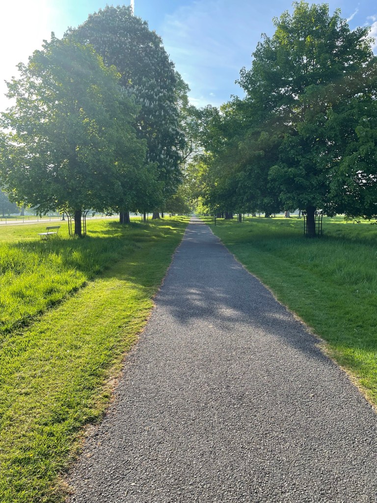
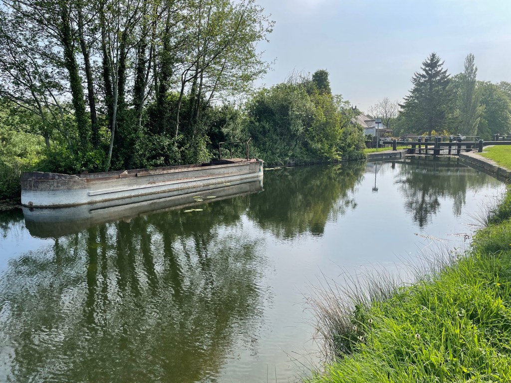
The next day, I walked into Dublin along the Royal Canal, beautiful and peaceful under clear blue-skied sunshine
and meandered in town, picking up a fuel canister for my stove and a few trail snacks. I ate lunch like a tourist off Grafton Street, and savoured a beer. I strolled past St Stephen’s Green, and St Patrick’s Cathedral, and the Guinness Storehouse, and through Phoenix Park, getting back to Castleknock in time for a cup of tea and a shower before dinner.
After some adventures at the Hill of Tara, and a last glass of wine, it was after midnight before getting to sleep. But I woke early, before my alarm, and was coffeed up and ready to go before 8.
And with a quick hug and a thank you, I was off.
Finally.
Stories Along The Way
When we reached Ontario, Ann and I decided to spend the night on our own in Stratford, so we’d have a bit of quiet to ourselves to celebrate my birthday. We had a lovely dinner at a place called Lovage, and the next morning as we were packing up I noticed that I had somehow chipped a tooth, not realizing it at the time.
For the next couple of days, I worried at it, running my tongue over the bicuspid in question, trying to decide if it was bad enough to have fixed before I left. I didn’t have any pain from the tooth, but it nagged at me, and finally when we were in Peterborough 2 days before my departure I decided I should get it fixed.
Since my regular dentist was in Nova Scotia, I called around and found a walk-in dental clinic in Toronto and arranged to go in the afternoon before my flight.
When I got into the chair and explained to the dentist about the tooth, he took a look, took another look, and sat back to ask – “where? I can’t see a chip”.
It was a small one, granted, but it felt obvious to me having had multiple such chips of my too-brittle teeth over the years. He finally picked at it and agreed that if it was bugging me, it was enough of a problem to fix – “We aim to please”, he exclaimed – and without the need for much more than a bit of epoxy filling and some polishing, I was in and out in 15 minutes.
*****
Walking through Phoenix Park on the way to the train station, I glanced over towards the south. The Wicklow Mountains loomed, close to the edge of the city, mist shrouded and mysterious. I had a sudden urge to turn right and walk towards them, throwing out my careful plan, to wander the hills and go where I pleased.
My feet were in auto mode, stride locked in and step by step the urge faded.
But what if ….
*****
The night I arrived in Dublin coincided with an impressive display of the northern lights, which Mairead’s daughter caught on camera and shared with us. Since in Dublin there was too much light pollution to see, the next night, my final one in Dublin, we decided to go out of town to the Hill of Tara, to get a better view of what was to have been another great display.
We reached the hill around 2115, at sunset, to find a jammed car park with the overflow crammed along the side of the narrow road. We found a spot and walked up the hill, exploring a bit whilst waiting for the twilight to fade.
Unfortunately, clouds were moving in, and while the slim crescent moon was a charming sight, we couldn’t see the aurora through the mist. We gave up after an hour and headed back to the car.
By now, the parked cars were lined along the road for several hundred meters, making it a one-lane passage. But as we started down the hill, we came to a car coming up, and behind it 3 more. With nowhere to go but back, Mairead started to slowly inch a hundred meters in the dark, in reverse, and in little spurts and wobbles as she dodged pedestrians, overhanging shrubs, and jutting cars.
We got lucky when a parked car left, putting another downhill soul in front of us and by now several behind us, allowing an uphill soul to park, and giving us the numerical advantage to start down again, now forcing the cars in front of us to reverse themselves.
They slowly inched back as we crept forward, and after 20 stressful minutes, and with a surprising lack of curses from Mairead (I would have been swearing down the gods upon all heads), we finally reached the road back to Dublin.
This is why I walk – no traffic jams for me.
*****
Preparing for this journey has been a long process, probably too long as I endlessly stared at maps and imagined routes and stopping points. Part of my prep has been spent watching YouTube videos made by a number of Irish walkers, in particular Ellie and Carl who have a website and YouTube channel called Tough Soles, and Derek Cullen who has his own adventure website and channel.
These were great sources, showing me the conditions on the trail and pointing out things to see along the way. And I especially liked Derek’s mantra, which he repeats every day: “Feet good, body good, head good, heart good – All good”.
Thank you for your inspiration.
Where to Next?
My train journey ends in Killarney, and about a kilometer from the station is the official start point of the Kerry Way.
I’ll follow that route for the next 10 days, clockwise round the circular route, from Killarney to Kenmare, to Sneem, to Waterville, to Cahersiveen, to Glenbeigh, to Glencoe, to Blackwater, and finally back into Kerry.
I’ll be camping along the way, with a planned first night somewhere off the trail near Killarney National Park, perhaps 8-10 km outside of Killarney. Hope it’s relatively dry.
Like what you read? Buy me a coffee. Your donation helps offset the costs of maintaining this blog.
Blog posts are a labour of love for me, and yet there is a cost to running this site and organizing my walks.If you’d like to help with that, I’d really appreciate something for my tip jar.The Buy Me a Coffee service allows patrons like you to fund writers like me. If that sounds like a worthy idea to you, then go ahead – keep buying me coffees.Thank You Very Much to everyone who has contributed already!
*****
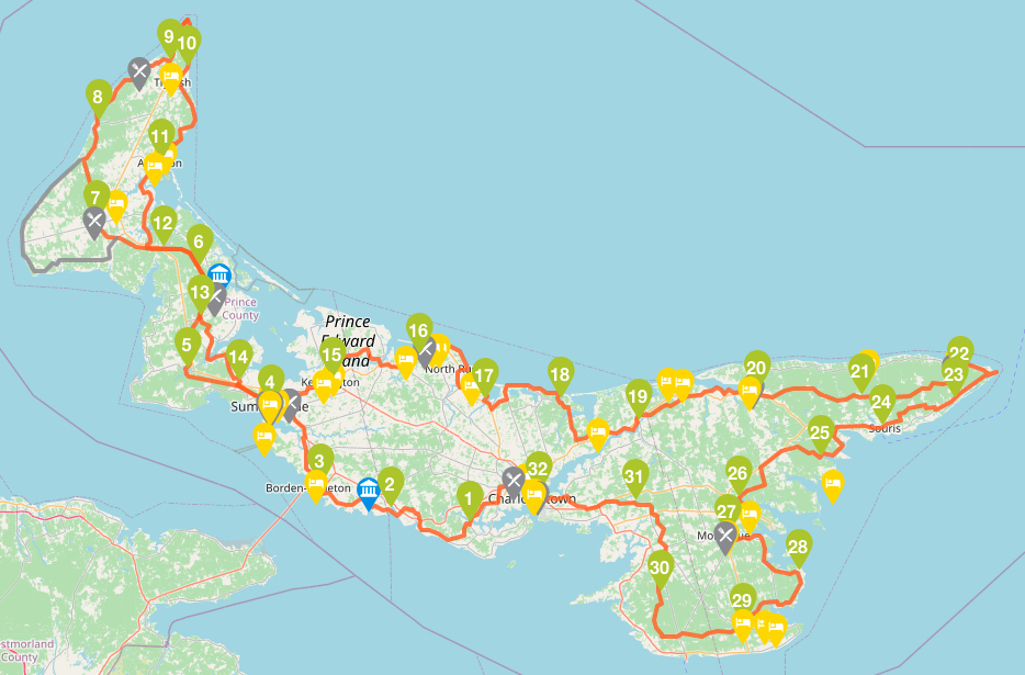
In June 2022, I completed the 700 km Island Walk, around Prince Edward Island. You can read about that walk over several posts, starting with this one.
This was before Hurricane Fiona caused so much damage on the Island, impacting many of the places which I had visited. Some of what I describe below may have changed by the time you do the Island Walk, but please, don’t let that stop you. PEI needs your tourist support as it recovers.
This post is about how I planned the walk, deciding on things like the pace to follow and gear to use; where I stayed and how I found accommodations; how I worked out logistics like getting to and from the route each day; and what lessons I learned along the way.
Forgive the wordiness and lack of pics – this is full geek mode for me.
Research
Once I’d decided to do it, I fell into my project planner mode, and started to figure out how I was going to walk it. How many days to take? Follow the route closely or ad lib in parts? What to take, and what to carry? Where to stay?
One of the good things about the Island Walk is that the PEI government has adopted it under its tourism umbrella, so the route signage is pretty good. The official website has a good map, and you can download to print out the route directions stage by stage if you want.
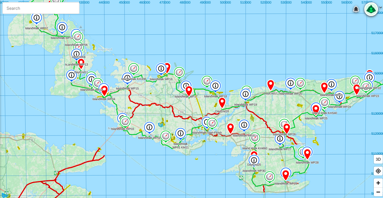
As well, the route has been added to map sets like Open Hiking and the Back Roads Map Books Canada Trails, which smart phone apps such as AllTrails or GaiaGPS can use. I used GaiaGPS on my walk, with a premium subscription so that I could trace my route and add waypoints. I did that in advance of the walk, to have markers show up for each of the 32 suggested stage end points as well as for each 30 km of the Walk.
There are other sources too. For example, the Island Walk website will point you to the official guide book which you can order online. I didn’t bother with it, to be honest, but it’s there. A few hours of Googlewhacking found several blog posts, Facebook pages, and YouTube videos about the walk, including one by the original founder of it, Brian Guptil, and I am sure that since I looked in the spring of 2022, there have been more posted.
There’s also an official Facebook page that’s linked to the Island Walk website, and that has a private message blog for which you’ll need to request access. That official blog is handy, because it lets you pose questions to other walkers and get advice on things like places to stay or eat, or transportation options.
Plans
While doing my research, I quickly determined that I wanted to do the walk in less than the suggested 32 days, partly to save money on accommodation and partly because I just didn’t want to be away from home that long. The stages as marked on the suggested route are mostly between 20-25 km, and I knew from experience that I could handle as many as 35 km in a day, so that led me to aim, initially, for about 30 km per day so that I could finish in about 23-24 days.
Based on that idea, and the notion that I’d walk from accommodation to accommodation each night (see the section below), I created a walking plan where each daily stage targeted about 30 km of the route, plus whatever distance I’d need to walk to/from accommodation each day. I used Google Maps to trace the route and scoured for places to stay – hotels, B&Bs, holiday cottages, and camp sites. I reckoned that I could take camping gear with me and use that for some of the nights.
The result was a plan that did get me round the Island in about 23 days, but which didn’t look very appealing. There were a number of pretty long days, approaching 40 km when I took the walk to/from accommodation into account. Also, in some cases there was only one B&B or holiday resort that would work given the stage lengths, but I was planning to do this starting in late May, and some of these didn’t open for the season till mid-June.
So Plan #1 went out the window.
For Plan #2, I went back to the drawing board. After more research, I saw that people on the Island Walk Blog were talking about using some of the towns as a base for several days, and arranging transport to/from there. That sounded like a better idea, so taking into account that the town I chose as a base had to be on the route and have some grocery stores and shops, I decided to use Summerside, Tignish, Kensington, and Murray Harbour as my bases. I rejgged my planned stages and was able to reduce the daily walking average to about 30 km, since with pickups and dropoffs I could stick closely to the route. That would get me to the finish in 23 days.
After talking it over with my wife, we also decided that she would join me for the 2nd half of the walk, so that she could explore the Island herself while schlepping me to and from the route each day. She had initially planned to be with me for the first couple of days anyway, so that gave me transport coverage for about 18 days out of the 23. Given that I could start or end a few stages in my base town, I assumed I would only need transport help for a few days.
Plan #2 survived the start of the walk, but hit a wall on Day 6.
I was slogging and foot sore, and everything felt like a grind, as I struggled up the west coast of the Island towards Tignish. I managed 20 odd km that day of a planned 32, and took a rest stop at Mimnigash, and then I basically couldn’t get up. After 30 minutes of self-pep-talk, followed by 30 more of now-what mental meanderings, I called my ride in Tignish and asked to be picked up early.
When I got settled into my hotel that afternoon, I called my wife and we talked through where I was at. I listened to her chuckling, as she said she had been wondering when I’d realize that 23 days was too short, and we agreed to lengthen the trip.
Looking at the official stages, I realized that I’d ended my Day 6 at the end of Stage 8, at Mimnigash. That put me 2 days ahead of the official 32 schedule already. To finish in 27 or 28 days, I just needed to pick up another 2-3 days over the rest of the walk, which I reckoned I could do by adding a couple of km per day to each of the remaining official stages. That approach allowed me to reduce my planned daily walk length from an average of about 30 km down to about 25-27 km per day, while increasing the duration to about 27 days in total. This became Plan #3.
In order to make this plan work, I needed to adjust my accommodation bookings. I had a place lined up in Kensington, and they were able to move my dates by a day, so that worked out. After that, however, I wasn’t sure where to go. B&Bs and AirBnBs were filling up fast, and were getting more expensive with the high season starting. Plus there was a festival of some kind in Charlottetown for the weekend I planned to finish, June 26-27, and hotels there were sold out.
Thus Plan #3 quickly evolved into Plan # 4, as I ended up booking a place in Murray Harbour, and then a final one in Vernon Bridge. This changed my stage plans, and I added one more day, so that I’d finish in 28 days. My daily average distance dropped a smidge more, and more importantly, things now looked doable.
And so parts of Plan #2 combined with Plan #4 became my actual as-walked plan. I ended up averaging 25.5 km per day, with a longest day of 34 km, and a shortest of 15 km. I started on Wednesday, June 1, and finished on Monday, June 28.
With all of that learned, my advice on Planning is simple – you should make one based on as much research as you have time for, and then you should expect and allow it to evolve as circumstances change. If I had tried to stick rigidly to my original plan, I wouldn’t have enjoyed the walk as much because I would have been more tired and possibly would have injured myself in pushing too much.
Routes
While I may have adjusted my plans a few times, in the end I did follow the official route quite closely in terms of the roads and trails followed, only deviating a bit around Summerside. I also had a few days where I walked the described route for a stage, and then added several km to it in order to get to/from that day’s accommodation. This added a few km to the overall total distance walked – it came to about 718 km compared to the official route length of 690 km, making my overall daily average of actual walking come to about 26.6 km.
Also, you will find that for the most part, the whole of the route is sign-posted quite well, with directional signs telling you when to turn onto this road or that.
The signs are placed with the assumption that you are walking correctly, and safely, facing oncoming traffic, i.e you are on the left side of the road with cars on your right. They are generally on the right side of the road – that is, on the opposite side of the one you should be walking on.
The signs are only on one side of the road, so this sign-posting practice also assumes that you are going clockwise round the island, following the sections from 1 to 32 in order (i.e start in Charlottetown, head to west Summerside, then north Tignish, etc). If you do the route the other way round, or a la carte in chunks, you may have to look over your shoulder for the signs.
There were a few places where I could have added a short detour to my day, to take in a place of interest. The official stage descriptions point out these sorts of things. For me, generally speaking, I didn’t do that. The only exception was the walk through Prince Edward Island National Park up around Cavendish and into North Rustico. There the official route follows the park walking/cycling trail, which is inland a bit beside the road. Instead, I cut down onto the beach and walked along it parallel to the road. It didn’t really change the distance but it was far more satisfying.
Over the course of my walk, I got into the habit each night of reviewing each day’s route as-walked, marking where I finished using my map app, and then scouting the next day’s route using Google Maps in satellite view to get a sense of the directions, sights, and possible rest stop options along the way. This became quite handy, particularly on road sections, as I quickly learned that finding a comfy spot to sit and rest was a challenge.
Later in the walk, when my wife joined me in PEI and drove me to/from the walk every day, using the map app and Google Maps also let me geomark the next day’s start and end points, and put those into my wife’s phone, so that she could just follow the directions in the car.
Accommodation
As you can see based on how my planning evolved, finding accommodation drove it as much as the route itself. While the Island Walk is referred to in some places as a “Camino” like walk, the reality is that it would be quite difficult to do it in the manner of the Camino de Santiago. You simply can’t walk from accommodation to accommodation expecting to find an inn or hostel or B&B more or less on the route every 5-10 km. The tourist accommodation on the island is concentrated in a few places (Charlottetown, Summerside, the Cavendish area, the Stanhope area, etc.), which leaves long sections at the west and east ends of the Island where there aren’t any B&Bs or hotels conveniently near the route.
It’s also important to realize when planning your accommodation that PEI has a short but intense tourist season. Many places only open after about mid-May or Victoria Day weekend (3rd Monday in May), and shut not long after Labour Day (first Monday in September) or at latest Thanksgiving (2nd Monday in October). But July and August are peak tourist – the island’s population doubles or even triples in these months. That leaves narrow 4-week shoulder seasons in June and in September, which can work as I found in June.
So all of that said, if you make your plans well in advance, e.g. in January for a walk in June or July, then you probably could book things out so that you could walk more or less from place to place, as long as you accept that you’re going to have more than a few days where you’ll need a lift as well as some extra distances to/from the route.
An alternative to that is to try to camp your way round the Island. There are some provincial parks that offer campsites as well as several private campgrounds, relatively near the route. In a few cases these align with the suggested stages, but for the most part they don’t, so you’ll have to improvise your stage lengths as needed. Even then, there aren’t formal campgrounds near the route in all cases.
For example, walking the Confederation Trail between St. Peter and North Lake covers more than 50 km, with essentially no nearby campsites. You could try knocking on doors and asking if you can camp in a field, and Islanders being pretty hospitable, you might be able to make that work. I wouldn’t try to stealth camp, though. There is essentially no crown land along the route, so if you try to stealth camp you’ll be trespassing on private land and that’s not just illegal, it’s downright rude.
By the way, another thing I learned in my research is that while there are many cottages for rent on the island, many of them are in holiday resorts where they only rent by the week. It was frustrating because some of these were right on the route, but since I only needed one night I couldn’t use them.
All of this is a long-winded way of explaining why I ended up replanning a couple of times and settling on a base-accommodation approach. In the end, I spent 5 nights in Summerside, 4 nights in Tignish, 6 nights in Kensington, 11 nights in Murrary Harbour, and finally 3 nights in Vernon Bridge. These places were a mixture of AirBnBs and inns. Since I had left it late, I had trouble finding AirBnBs around Montague and around Souris, which would have been a lot more convenient for the east end of the island than Murray Harbour, but on the other hand the place in Murray Harbour was great. If you book a few months ahead of time, and if you avoid peak season in July/August, you should be fine finding something.
Practicalities and Logistics
I met just a few fellow walkers on the trip, but in chatting with those few people a consensus emerged on a few things to keep in mind when planning this walk. In no particular order, I’d list them as follows.
Road walks = no place to sit down, no place to pee
Accommodation needs to be planned well ahead
Since accommodation is likely to be spread out and not near the route, transportation to/from the route is key
Timing is everything – you’ll have a short season to do the walk if you want things to be open but avoid the tourist crush
I think if I was going to do the walk again, I’d seriously consider packing a small portable stool or chair, which would be a blessing especially on the road walk sections. There are many stretches where you’re multiple hours between towns. Scouting each day’s route the night before using Google Maps in satellite mode helped me to spot community centres, public parks, churches, schools, post offices, and even cemeteries, where they might be a bench, as well as toilet facility candidates like gas stations, cafes, bakeries, and ice cream stands.
This let me make notes for myself about distances between these landmarks, so that, for example I could start on a morning knowing that after about 8 km I’d come to a church where I could sit on the steps for a break. Even then, I had a couple of frustrating days where I’d find the church I’d seen on the map but realize that it’s wooden steps had been removed because the church had been closed. On a rainy day when you don’t want to sit on the ground, that’s a real pain.
For most people, the other key is that while you need to stay hydrated, doing so usually leads to the need for a bio break every so often. If you are discreet and careful, you can sometimes find a conveniently located little stand of trees or bushes just off the road. Nevertheless, it always seemed that I had been walking for hours without seeing a car and then the moment I stepped off the road, 3 of them would trundle past. Or I’d walk along a promising stretch of road with houses on one side and fields on the other, only to realize that every stand of trees or bushes was exactly opposite someone’s house.
I did meet one fellow walker who’s strategy was simply to walk fast, drink little, and hold it all in. She would hydrate and pit stop before leaving, and then plow through each stage non-stop, only looking for a toilet when she had reached her destination at the end of a stage. That might have worked for her, but it wouldn’t work for everyone, and it certainly didn’t work for me. All I can say is that if you do need to “go”, al fresco, you need to be respectful of others and of private property and follow the backcountry rule – leave no trace.
Since getting to/from the trail and your accommodation may well require transportation, you’ll have to figure this out ahead of time. There are some options. If you’re near Summerside or Charlottetown, there are several taxi firms that you can book and they’ll drive you for 50 km or even 100 km if you need it so that you can be dropped at the start of a stage and picked up at the end. But that convenience will be pricey – expect to pay up to $2 per km.
An alternative is the T3 bus network, and it’s a good option in some cases. It’s very inexpensive at $2 per ride (as of June 2022). It runs from several of the towns you’ll pass through, on routes that lead back to Charllottetown but pass through several places, e.g. the route between Summerside and Charlottetown passes through Kensington. To use the service, you need to make a booking on their website, which can be same-day but is better done the night before.
Through careful planning, you can arrange these rides to get from your accommodation to your drop-off and pick-up points. The drawback is that the buses are on fixed schedules and run only 2-3 times a day, so there might be 4-5 hours between runs, thus you’ll have to time your walk to catch the bus. And, at least as of June 2022, the buses only run Monday-Friday so on weekends you’ll have to find alternate methods.
One of those alternate methods is to do the Walk without walking – ride a bike instead. I met several people who were doing the route this way. By riding, they could not only go a bit faster and do the route more quickly, they could also find accommodation as much as 10 km off the route, and they could adjust their daily stage lengths to go from town to town. The route is easy to cycle as the Confederation Trail is firmly gravelled, and the rest is on roads.
If cycling is not your thing, and buses don’t work, nor taxis, then one other option is to find a sherpa – a person to drive you to/from the route each day. This in turn takes several forms.
One is to use one of the private tour companies in PEI that have started to offer Island Walk packages combining accommodation arrangements as well as transportation, so that your luggage is schlepped for you and they take you from B&B to B&B. You can find outfits that do this by doing some research on the blog that goes with the Island Walk website.
A similar idea is to stay at one of several resorts, inns, and B&Bs which offer transportation to/from the route. You can usually book this at the time you book the accommodation. As the Island Walk becomes more popular, I suspect that this type of thing will grow. You can find these kinds of places by doing some research on the blog that goes with the Island Walk website.
One method I used was to ask for advice at one of the inns I stayed at, and they pointed me to a private tour operator named Stanley MacDonald. He runs custom small-group tours for cruise ship passengers coming into Charlottetown, and in between he’s happy to pick up Island Walkers like me and take them to/from anywhere on the island. There are several operators like this, and again, using the Island Walk blog can help you connect with them.
Finally, there’s the Little-Help-From-Your-Friends approach. In my case, my wife stayed with me for about half of the time I was doing the walk. She would drive me each day to/from my route, and in between she explored the island, visiting museums and shops and beaches and cafes and just generally chilling. Similarly, you could also walk with a buddy or two, and use two cars where you both drive to the endpoint to leave a car, then drive back to the start and park the other car, so that at the end of the day you can drive back and pick up the 1st car again.
There is one other way to do it, and that’s simply to plan your accommodation and your daily stages so that, as with the traditional Camino, you walk from place to place each day. A combination of camping (including asking people to stay in their field) along with B&Bs or hotels might well work, if you’re able to do the detailed planning required. I didn’t meet anyone on the Walk who was trying this, but I suppose it’s doable.
Food, Snacks, and Hydration
I’ve done all-day walks many times, and I’ve learned what works for me regarding nutrition. First of all, I focus on hydration – I’d rather carry the extra weight of an additional water bottle than run out on a hot day. For this trip, most days I started with about 1.5L of water and I tried to fill my bottles whenever I could at a store or coffee shop. On a few hot days, I also carried an extra 500ml water bottle, just in case. In addition, I always tried to include fruit with my snacks and lunches, since oranges, grapes, cherry tomatoes, etc. will provide a lot of hydration and electrolytes.
Regarding food, I try to eat lightly during the day while I am walking, saving the larger meal for the end of the day. That means starting with a simple breakfast – yoghurt and toast, a bagel and cream cheese, or oatmeal with honey, that sort of thing – and then carrying snacks and food to provide short bursts of calories every couple of hours during the walk.
I try to avoid junk foods like candy bars or high-sodium chips or jerky, and instead eat healthy foods like fresh fruits and veggie snacks, sandwiches with lean proteins like smoked turkey, whole grain breads, and so on. I’ll carry a few protein bars, as well as a nut-free (I’m allergic) trail mix of raw pumpkin and sunflower seeds, raisins, and dried fruit. I avoid things that need to stay cold – no tuna salad with mayo – so I can skip heavy ice packs.
On this walk, I also tried to limit caffeine during the day. I just had one cup of coffee in the morning, and then waited till I was done for the day before I had any more. Caffeine is a diuretic (it makes you pee), so limiting it made sense to me.
There were a couple of occasions where I was able to buy lunch along the route, but I think that only happened about 4-5 times for me. So the rest of the time I packed a lunch. You could adjust your route a bit I guess and hit a few more places, but you’ll need to pack a lunch at least half the time. I have seen that a number of the B&Bs and inns that offer Island Walk transportation and stay packages will sometimes offer to make you a packed lunch as well, so that’s up to you.
One other tip is to choose accommodation that’s near grocery stores – that’s in part why I chose to stay in Summerside, Tignish, and Kensington. It was much healthier to buy fresh food and prepare it myself for snacks and meals, rather than eating out all the time, and it was cheaper to boot. 30+ years of travelling on business taught me that there’s much to be said for home cooking.
Gear
As for what to wear and carry and take, I think there are only a few essentials.
Comfortable shoes
Comfortable walking clothes suitable for the day’s weather
Rain gear
A knapsack or day pack
Water
Snacks and often lunch
Bug protection
After that, it’s up to you. I carried a little inflatable seat pad, for example, and it came in handy several times when I couldn’t find anywhere to sit down. I also carried some spare clothes in a dry bag, tailored each day to the weather and conditions. It was great to be able to change out of a sweaty shirt before getting into the car for a 45-min ride back to my digs, or to have a warm fleecy handy, or a complete change of clothes when I knew I’d be walking in the rain. And the dry bag for these clothes was key as well. Despite the fact that I had a rain cover for my pack, there were a couple of all-day walks in the rain that would have soaked anything I was carrying.
On the other hand, I did not carry sunblock or bug spray. I don’t like putting chemicals on my skin (and suffered bug torment accordingly), but other walkers I met did have that on hand. It’s a personal choice, and of course the time of year will factor in as well. Peak mosquitoes are in May and June.
What else? Well, many people use walking poles, and I started with a set as well. I had used them previously on a 1-week 200 km walk from Niagra-on-the-Lake to Toronto that included part of the Bruce Trail, and they were essential gear there. However, after the 2nd day of the Island Walk, I gave them to my wife to take home, since the road and trail conditions were fine, and I wasn’t carrying a big pack. You decide.
A word on the foot wear – really, you could wear just about anything, as long as it’s comfortable. I wore mid-weight hiking boots, which I was careful to break in before the Walk, and they worked pretty well. I had some blisters early, and near the end of the walk I had a little bit of muscle/joint/ligament pain in the soles and ankles, but mostly that was just about walking for 6-7 hours a day. Overall I was quite pleased with the boots.
Other walkers whom I met wore running shoes, hiking/trail shoes, and in one case hiking boots, and I’m sure their respective choices worked for them too. Just keep in mind that if you’re doing the whole walk in one go like I was, you are going to exercise your feet more than you’re likely to have done before. Shoes that work for a 1 or 2 hour hike may not hold up for multiple 6-hour days of walking. Keep that in mind, and don’t wear either brand-new footwear or old comfortable-but-not-enough-mileage-left footwear.
As for clothing, it’s really about the weather. I walked in June, and at the start on June 1st the day’s high temp was about 10 C, with some rain showers and a cold wind in my face. I started the walk carrying a light touque and runner’s gloves, just in case. By the end of the walk, the daily temps were up in the mid-20’s and peaked around 30 C, with hours of blue sky above. I knew going in that I’d get a range of conditions, so I focused on lightweight layers that I could add or subtract as needed.
Also, since I had a few days where I’d be carrying all of my clothes and gear from one night’s accommodation to another, I kept my clothing selection small and focused on lightweight items – just 3 pairs of trousers, 3 wick-away fast-dry T-shirts, 3 pairs of underwear, 4 pairs of merino wool socks, 1 wick-away fast dry long-sleeve T-shirt, and 1 lightweight fleecy, and of course each day I’d wear part of that. All of my clothes fit into a 10L dry bag and I could get that plus everything else into a 38L overnight pack with no issue.
In addition to those clothes, I packed and often wore two bits of rain gear, a jacket and a pair of pants. The rain jacket also gave me another outer layer if it was cold, and it served well as mosquito defense too. As with most rain gear, you’re going to sweat under it if you’re working hard, GoreTex or not, so the jacket I used had underarm zips so that I could ventilate a bit as I walked while keeping out moisture. But even so, it’s hard to balance staying dry vs staying cool. Accept that rain gear helps but you’re going to get wet anyway.
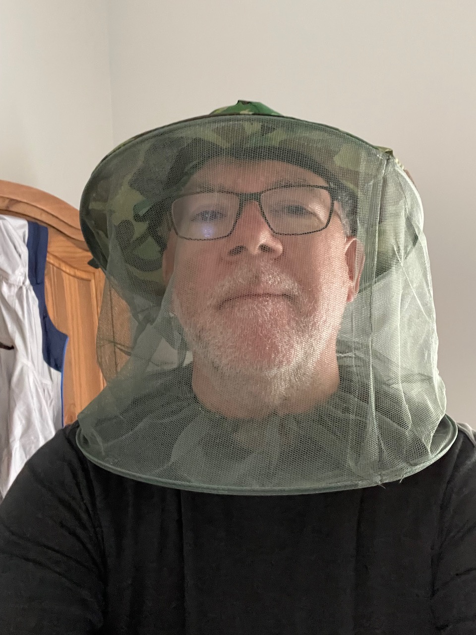
The final piece of essential gear for me was my hat. I actually had 3 of them – a full brim Tilley hat for sun protection, a baseball style hat that I could wear under my rain jacket hood to keep the rain off my glasses, and my bug hat.
The latter was picked up at a dollar store in Alberton in the 1st half of my journey, after battling mosquitoes along the Confederation Trail, and it turned out to be darn handy. Your head, your choice, just keep sun, rain, and bugs in mind.
I ended up using two different packs on the trip. I have a 55L multi-day pack that I really like and I used it for the first half of the trip. During this part, my wife wasn’t with me, so I had a few days where I had all my clothes and gear with me as I left one accommodation and moved on to the next, so I had to carry stuff that I didn’t need during the day on the trail – all my spare clothes, my indoor sandals, toiletries, snacks, electronics chargers and cables, an iPad. Altogether, with some extra snacks, lunch, and full water on board, my pack came in at roughly 11kg. I could have left a few things out of course, but the pack made carrying that weight all day quite comfortable.
During the 2nd half of my journey, my wife joined me so we had a car available, eliminating the need to carry everything. That let me switch to a lighter 38L overnight pack. This was, to be honest, still a bit bigger than I really needed, and I also own a 22L day pack which would have worked, but using the 38L pack meant that I could just chuck stuff in and not worry too much about packing carefully, and that way I always had spare clothes, rain gear, first aid kit, sitting pad, snacks, lunch, and water all to hand.
You could of course get by with a much smaller day pack, especially if you have someone able to sherpa you around each day. I met a walker during my journey who carried a little 15L day pack, with just a rain jacket, some water, and a light snack. You decide what works for you.
Let’s see, what else? I did carry a first aid kit every day, though fortunately I never needed it during the day while walking. I went through a bunch of blister bandages, though, and the associated alcohol swabs and antibiotic cream that you need to pop a blister while reducing the risk of infection. My first aid kit also had tick tweezers, and thankfully I never had to use them.
Outside of all that, there was other gear that I used at night, rather than carry on the trail. Toiletries of course – toothbrush, shampoo, deodorant, etc. Also an iPad for entertainment, and that meant chargers and cords. Plus I had indoor sandals to wear, and what a blessing that is when you finally take your boots off each night. I had thought about adding a fancier shirt in case I went out for dinner but in the end didn’t carry that. I did carry a little sewing and repair kit, but never needed it. Your choice.
Gear List
Gregory Balto 55L multi-day pack – used for the 1st half of the trip
Gregory Paragon 38L overnight pack – used for the 2nd half of the trip
3 pairs pants (all quick-dry synthetic material, 2 of them convertible into shorts)
3 wick-away stay dry T-shirts
4 pairs merino wool socks
3 pairs underwear
1 long-sleeve wick-away stay dry T-shirt
1 lightweight zip fleecy
1 pair slides as indoor shoes
1 merino wool lightweight touque
1 pair runners lightweight gloves
Training and Fitness
It’s a bit of a cliche, but really, how do you know if you’re ready to do a 700km walk without actually doing it? Do you train for a marathon by running a marathon?
In my case, I knew beforehand that a) I wanted to cover around 30km a day, and b) that I would be carrying clothes, rain gear, food, water, etc. each day that would add up to something like 6-8 kg. So I did a few training walks of 10-20 km around town and nearby areas, and then after a few such walks where I’d carried nothing, I started to add a full pack with between 10-15 kg of kettle bell weights in it. By the time I started the walk, I’d done a couple of 25 km hikes carrying more weight than I was planning for on the actual trip, so I reckoned I was good to go.
What that didn’t prepare me for, however, was the repetitive stress of walking every day. It’s one thing to work out, it’s another to do it over and over again. Your body is, literally, made for walking, so you will adjust and get used to it, but you’ll find that it takes some time. The first few days of walking, I had a fair amount of muscle and joint stiffness on top of tender feet due to blisters. By about day 7 or 8, however, I’d walked myself into decent shape and was generally fine each evening. But then, by day 25 or so, I was starting to feel new aches and pains, and I put those down to just long term wear and tear.
One thing I’d do differently in future would be to plan for a couple of rest days. I think taking a rest day every 10-15 days would be prudent, and as I get older will probably be essential. As it was, I walked every day and just used a couple of 3-hour/15 km days as a way to rest a bit, so that’s another way to do it – mix up your daily distances to give yourself some short days once in a while.
Everyone is different, of course, and while you definitely don’t need to be a high-performance athlete to do the Walk, you are likely to find that you do need to push yourself on this if you plan to do it in one continuous journey as I did. Some of that will be mental and some physical. As long as you let your body dictate your pace, and are honest with yourself, you’ll be fine. I did this at age 59, and wearing a spare 5 kg around my belly, and not only survived but enjoyed it.
Lessons
One of the reasons I decided to do the Island Walk was because my bucket list of walks includes a number of long-distance, multi-week journeys – things like the Camino de Santiago, for instance. I wanted to use the walk to learn what works for me. In that sense, it was a great test, and more than anything I learned what might be the most valuable thing I could have learned – simply that I can do it. There were times when I felt like bailing out, and I didn’t. Just knowing that I am able to push through that mental wall is important.
But more than that, If there is one key takeaway for me, it’s that this kind of journey is like a knife that pares away your preconceptions and strips you down to essentials. You walk, you eat, you sleep, you walk some more. Repeat. It’s an energizing feeling, that sense that you don’t need to worry about anything else. Just walk.
Here’s an update on my list of books about walks and walking. Enjoy some armchair trekking!
There have been many books written about walking – the techniques of walking, the destinations, the journey, the effort, the spirituality, and so on, and there will likely be many more to come. This is a by no means exhaustive list of those books in English which I have read and which have inspired me. I’ll update this list from time to time as I come across new ones. Let me know which books about walking have inspired you.
Author/Title
Description
Author: Emily Taylor Smith Title: Around the Province in 88 Days ISBN: 978-1-98828-668-6
A journal of the author’s walk around the coast of Nova Scotia in 2010. Written from the perspective of distance and published in 2019, it’s at least as much about growth, self-discovery, and perseverance as it is about the walk. And having moved to Nova Scotia, it was also a welcome introduction to the landscape and wonders of our new home, and the power of kindness to inspire.
Author: Emily Taylor Smith Title: No Thanks, I Want to Walk ISBN: 978-1-98972-533-7
A companion journal to the author’s previous work, this recounts her 2016 journey around the coast of New Brunswick and along the Gaspé Peninsula to Quebec City. As with her previous book, the self-discovery and insights are inspiring. The kindness of strangers is on full display throughout.
Author: Apsley Cherry-Gerrard Title: The Worst Journey in the World ISBN: 978-078670-437-8
An account of the Robert Scott expedition to Antarctica in 1910-13. The journey he refers to is one undertaken with 2 other companions to collect the eggs of emperor penguins in the depths of an Antarctic winter, an epic weeks-long hike which nearly killed them. The courage, strength, and deep bonds of companionship that were formed on that journey and then shattered when his companions died with Scott on the way back from the pole in 1912, are heartbreaking.
Author: Bill Bryson Title: A Walk in the Woods ISBN: 0385-408161
Comic, instructive, insightful, and far better than the film made of the book. Read it and draw inspiration from a middle-aged guy who found the determination to walk a big chunk of the Appalachian Trail.
Author: Nick Hunt Title: Walking the Woods and the Water ISBN: 978-1-85788-643-6
The subtitle is “In Patrick Leigh Fermor’s footsteps from the Hook of Holland to the Golden Horn”. Wonderfully well-written, charming, and inspirational.
Author: Nick Hunt Title: Where the Wild Winds Are ISBN:978-1-85788-656-6
A follow-up to his previous book, walking in the footsteps of Patrick Leigh Fermor. In this new book, he walks about Europe tracing the paths of famous winds – the Foehn, the Mistral, and more.
Authors: Lonely Planet Title: Epic Hikes of the World ISBN: 978-1-78701-417-6
A candy store of a book, with more than a hundred walks worthy of your bucket list. Dip into it on a rainy winter’s evening and make your plans.
Author: Barry Stone Title: The 50 Greatest Walks of the World ISBN: 978-178578-063-9
A subjective listing, of course, and somewhat overly interested in walks in Europe, but nevertheless it covers not just the biggies – the Camino de Santiago, the Appalachian Trail, etc. – but also many lesser known, shorter walks that are bucket-listable and achievable by the average walker.
Author: Levison Wood Title: Walking the Nile ISBN: 978-0-8021-2633-7
An account of a walk the length of the Nile river. The journey is fascinating, the people he meets are more so, and the landscape is bucket-list stuff.
Author: Rory Stewart Title: The Places In Between ISBN: 978-0-14-305330-9
A lyrical book, inspiring and engaging, about the author’s walk across Afghanistan in early 2002, just after the fall of the Taliban.
Author: Will Ferguson Title: Beyond Belfast ISBN: 978-0-14-317062-4
Funny and informative, the author walks 800+ km along the Ulster Way in Northern Ireland.
Author: David Downie Title: Paris to the Pyrenees ISBN: 978-1-60598-556-5
Part travelogue, part history, part internal meditation, the author and his wife set out to retrace the medeval pilgrimage route through France along the way of St. James, to Santiago de Compostella in Spain.
Author: John A. Cherrington Title: Walking to Camelot ISBN: 978-1-927958-62-9
Two Canadians walk the McMillan Way, from Boston to Chesil Beach through the heart of rural England, drinking in history and savouring the journey.
Author: J.R.R. Tolkein Title:The Hobbit
One of my favourite books, re-read many times, and far better than the overwrought movie version. The story is about much more than a walk, and yet Bilbo Baggins’ sub-title, There and Back Again perfectly describes my walks.
The other day, I was looking at the stats for this blog and checked to see what my most popular posts were. The answer was kind of interesting – of the top 20 posts on this blog, 19 of them are about different walks around Toronto. Collectively, those have generated more than 12,000 views.
That’s cool to think I’ve helped thousands of people enjoy walking around Toronto. Go TO!
The humbling part is that the majority of my posts have been about some particular scene or thought that’s occurred to me while walking. Those posts have been, how shall I put this, somewhat less widely viewed. Most of those have a handful of views (thanks Mom!) at best.
me contemplating the futility of my writing career ….
So this blog is helpful to people when I write about things that people want to look for – duh! – like gear reviews and walking routes and suggestions for places to try. Since we’ve moved out to the east coast, I’ve stayed away from those kinds of posts, because as a newcomer I didn’t want to claim any in-depth knowledge as yet.
Still, I do want to be helpful, so going forward I’ll try to include more like that featuring walks around the South Shore and Halifax, and other places in the Maritimes, and maybe some more back in TO whenever we are back to visit family.
To that end, check out my series called TO Walks and Maritime Walks, or my Gear Reviews, and see what those other readers have been browsing.
I haven’t posted in a bit and now I’m thinking I should get back into the habit. Soooo many excuses …
I’ll get to it later.
I’m busy.
I have to make dinner.
Et cetera, et cetera, et cetera ad nauseam
But the other night, we were having dinner with friends and the topic of travel came up – who’s ready to get back into it? Another couple at the table said hey were, and had just booked a week’s walking tour around Mount Blanc for this coming summer.
When I heard that, I thought about the walks I was going to do in 2020 – Toronto to Ottawa along the TransCanada Trail. And the walks in 2021 – in Ireland perhaps, from Dublin to Kerry through Wicklow. The COVID kibosh came along and those had to be set aside to wait and now it’s 2022 and what walks am I doing this year?
COVID-19 has been and continues to be a challenge. We’re all tired of it, we all just wish it would magically go away. We’re getting there, and the signs are pointing in the right direction, but I’m not getting any younger, and those bucket list
walks aren’t going to walk themselves. Sooner or later, I need to get up and get out and get going.
So, here’s hoping 2022 offers a chance to do that.
Our autumn is settling into a steady procession of rainy days. I knew in moving to the Maritimes that it would be wetter than in Toronto, and now I’m seeing it first hand. It hasn’t been too cold yet, just more wet days than dry, a bit Irish-weatherish I suppose.
And so if you don’t walk when it’s wet then you don’t walk much, so out I go, as long as it’s not an actual gale – anything under Force 7 or 8 is fair game.
I don’t mind walking in the wet like that. Dressing for the weather is a given, but as long as I do then I’m comfy and while there might be some blustery areas around the town, there are usually sheltered areas too so you can stay out of the worst of it.
The colours are more subdued in the wet, but they stand out too, especially this time of the year – a brightly painted house against a slate grey sky is cheerful. The flashes of colour from wellies and rain gear, the holiday lights, the boats in the harbour, a bird or two, the painted chairs along the harbour walk.
And the scents are more subtle too – damp undergrowth and harbour water and pine trees and diesel.
I love the sounds of gurgling water in rivulets and gutters, drips and gushes and splashes and sloshes. The slap of a wave against a boat, and the sloppy surge under the wharf.
And when I get back, I can hang up my soaked hat and coat, put on warm dry socks, and light the fire, and finish my coffee while reading a book. Till the next day when I walk in the rain again.
Out for a walk the other day, we came across something that I’d not seen before. A Nova Scotian artist named Angie Arsenault has created a little artists box of foraged inks made from natural ingredients – things like acorns and goldenrod and mountain ash roots – and put it on the trail beside the Lehave River in Bridgewater.
It’s called the Little Library of Foraged Inks, and it’s a fantastic find. We stopped and read her notes inside on how to use it
and came away smiling at the idea. It’s clever, it’s environmentally aware and awareness-raising, and most of all it’s fun. It’s a classic example of spreading joy through little acts of kindness.
It also reminded me of why I like to go for walks. I love to find these little things, sometimes man-made and sometimes natural, but either way always fascinating.