PEI’s Island Walk – Plans, Gear, and Lessons

Blog posts are a labour of love for me, and yet there is a cost to running this site and organizing my walks.If you’d like to help with that, I’d really appreciate something for my tip jar.The Buy Me a Coffee service allows patrons like you to fund writers like me.  If that sounds like a worthy idea to you, then go ahead – keep buying me coffees.Thank You Very Much to everyone who has contributed already!

*****

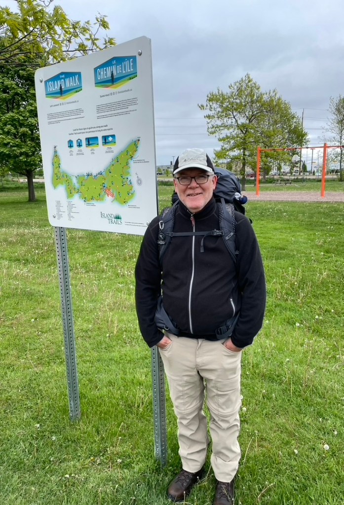
In June 2022, I completed the 700 km Island Walk, around Prince Edward Island. You can read about that walk over several posts, starting with this one.  

This was before Hurricane Fiona caused so much damage on the Island, impacting many of the places which I had visited.  Some of what I describe below may have changed by the time you do the Island Walk, but please, don’t let that stop you.  PEI needs your tourist support as it recovers.

This post is about how I planned the walk, deciding on things like the pace to follow and gear to use; where I stayed and how I found accommodations; how I worked out logistics like getting to and from the route each day; and what lessons I learned along the way.

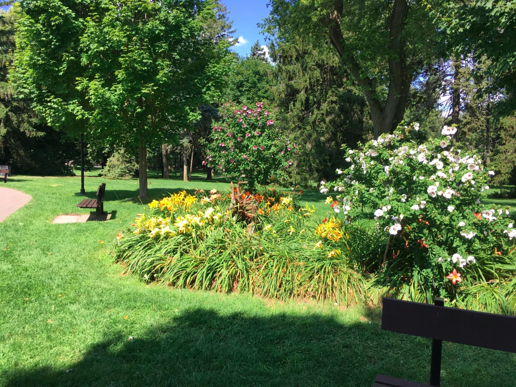
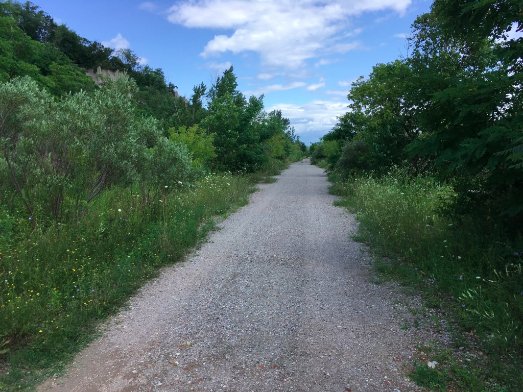
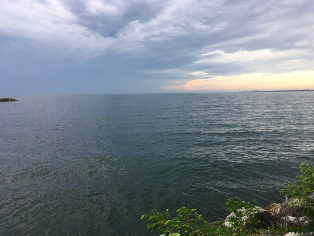
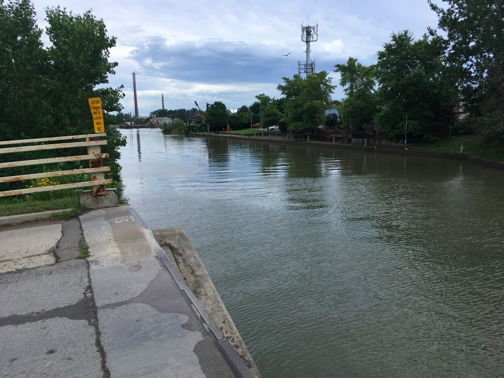
Forgive the wordiness and lack of pics – this is full geek mode for me.


Research

Once I’d decided to do it, I fell into my project planner mode, and started to figure out how I was going to walk it. How many days to take? Follow the route closely or ad lib in parts? What to take, and what to carry? Where to stay?

One of the good things about the Island Walk is that the PEI government has adopted it under its tourism umbrella, so the route signage is pretty good. The official website has a good map, and you can download to print out the route directions stage by stage if you want. 

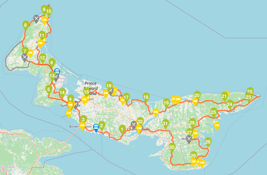
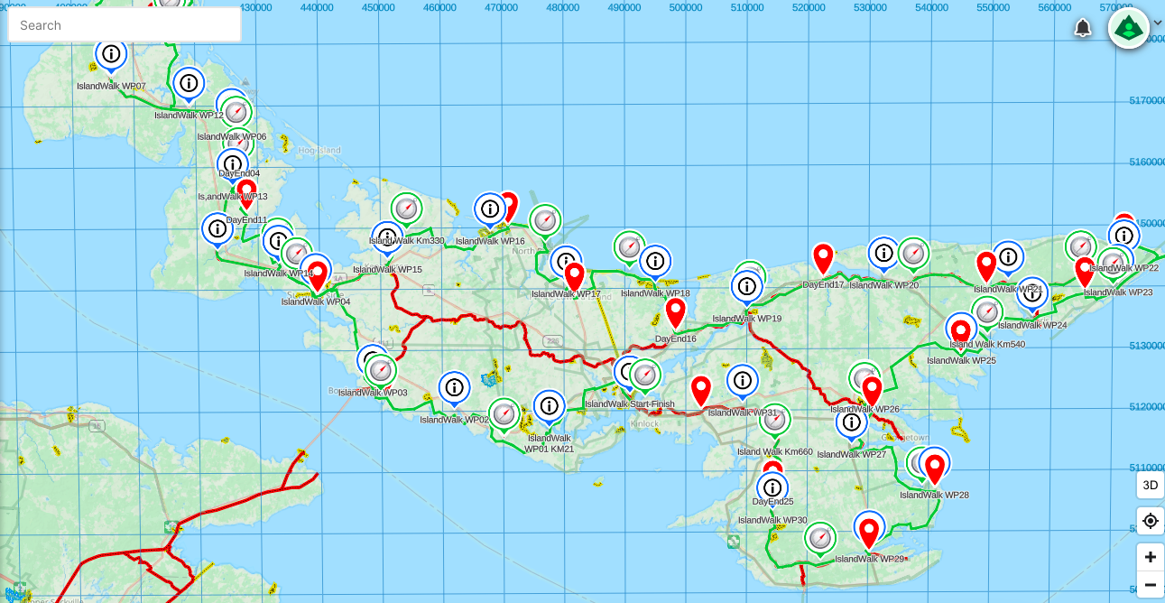
As well, the route has been added to map sets like Open Hiking and the Back Roads Map Books Canada Trails, which smart phone apps such as AllTrails or GaiaGPS can use. I used GaiaGPS on my walk, with a premium subscription so that I could trace my route and add waypoints. I did that in advance of the walk, to have markers show up for each of the 32 suggested stage end points as well as for each 30 km of the Walk.

There are other sources too.  For example, the Island Walk website will point you to the official guide book which you can order online. I didn’t bother with it, to be honest, but it’s there. A few hours of Googlewhacking found several blog posts, Facebook pages, and YouTube videos about the walk, including one by the original founder of it, Brian Guptil, and I am sure that since I looked in the spring of 2022, there have been more posted.

There’s also an official Facebook page that’s linked to the Island Walk website, and that has a private message blog for which you’ll need to request access. That official blog is handy, because it lets you pose questions to other walkers and get advice on things like places to stay or eat, or transportation options.

Plans

While doing my research, I quickly determined that I wanted to do the walk in less than the suggested 32 days, partly to save money on accommodation and partly because I just didn’t want to be away from home that long. The stages as marked on the suggested route are mostly between 20-25 km, and I knew from experience that I could handle as many as 35 km in a day, so that led me to aim, initially, for about 30 km per day so that I could finish in about 23-24 days. 

Based on that idea, and the notion that I’d walk from accommodation to accommodation each night (see the section below), I created a walking plan where each daily stage targeted about 30 km of the route, plus whatever distance I’d need to walk to/from accommodation each day.  I used Google Maps to trace the route and scoured for places to stay – hotels, B&Bs, holiday cottages, and camp sites.  I reckoned that I could take camping gear with me and use that for some of the nights.  

The result was a plan that did get me round the Island in about 23 days, but which didn’t look very appealing.  There were a number of pretty long days, approaching 40 km when I took the walk to/from accommodation into account.  Also, in some cases there was only one B&B or holiday resort that would work given the stage lengths, but I was planning to do this starting in late May, and some of these didn’t open for the season till mid-June. 

So Plan #1 went out the window.

For Plan #2, I went back to the drawing board.  After more research, I saw that people on the Island Walk Blog were talking about using some of the towns as a base for several days, and arranging transport to/from there.  That sounded like a better idea, so taking into account that the town I chose as a base had to be on the route and have some grocery stores and shops, I decided to use Summerside, Tignish, Kensington, and Murray Harbour as my bases.  I rejgged my planned stages and was able to reduce the daily walking average to about 30 km, since with pickups and dropoffs I could stick closely to the route.  That would get me to the finish in 23 days.

After talking it over with my wife, we also decided that she would join me for the 2nd half of the walk, so that she could explore the Island herself while schlepping me to and from the route each day.  She had initially planned to be with me for the first couple of days anyway, so that gave me transport coverage for about 18 days out of the 23.  Given that I could start or end a few stages in my base town, I assumed I would only need transport help for a few days.

Plan #2 survived the start of the walk, but hit a wall on Day 6.

I was slogging and foot sore, and everything felt like a grind, as I struggled up the west coast of the Island towards Tignish.  I managed 20 odd km that day of a planned 32, and took a rest stop at Mimnigash, and then I basically couldn’t get up.  After 30 minutes of self-pep-talk, followed by 30 more of now-what mental meanderings, I called my ride in Tignish and asked to be picked up early.  

When I got settled into my hotel that afternoon, I called my wife and we talked through where I was at.  I listened to her chuckling, as she said she had been wondering when I’d realize that 23 days was too short, and we agreed to lengthen the trip.

Looking at the official stages, I realized that I’d ended my Day 6 at the end of Stage 8, at Mimnigash.  That put me 2 days ahead of the official 32 schedule already.  To finish in 27 or 28 days, I just needed to pick up another 2-3 days over the rest of the walk, which I reckoned I could do by adding a couple of km per day to each of the remaining official stages.  That approach allowed me to reduce my planned daily walk length from an average of about 30 km down to about 25-27 km per day, while increasing the duration to about 27 days in total.  This became Plan #3. 

In order to make this plan work, I needed to adjust my accommodation bookings.  I had a place lined up in Kensington, and they were able to move my dates by a day, so that worked out.  After that, however, I wasn’t sure where to go.  B&Bs and AirBnBs were filling up fast, and were getting more expensive with the high season starting.  Plus there was a festival of some kind in Charlottetown for the weekend I planned to finish, June 26-27, and hotels there were sold out.

Thus Plan #3 quickly evolved into Plan # 4, as I ended up booking a place in Murray Harbour, and then a final one in Vernon Bridge.  This changed my stage plans, and I added one more day, so that I’d finish in 28 days.  My daily average distance dropped a smidge more, and more importantly, things now looked doable.

And so parts of Plan #2 combined with Plan #4 became my actual as-walked plan.  I ended up averaging 25.5 km per day, with a longest day of 34 km, and a shortest of 15 km.  I started on Wednesday, June 1, and finished on Monday, June 28.

With all of that learned, my advice on Planning is simple – you should make one based on as much research as you have time for, and then you should expect and allow it to evolve as circumstances change.  If I had tried to stick rigidly to my original plan, I wouldn’t have enjoyed the walk as much because I would have been more tired and possibly would have injured myself in pushing too much.   

Routes

While I may have adjusted my plans a few times, in the end I did follow the official route quite closely in terms of the roads and trails followed, only deviating a bit around Summerside. I also had a few days where I walked the described route for a stage, and then added several km to it in order to get to/from that day’s accommodation.  This added a few km to the overall total distance walked – it came to about 718 km compared to the official route length of 690 km, making my overall daily average of actual walking come to about 26.6 km.

Also, you will find that for the most part, the whole of the route is sign-posted quite well, with directional signs telling you when to turn onto this road or that.  

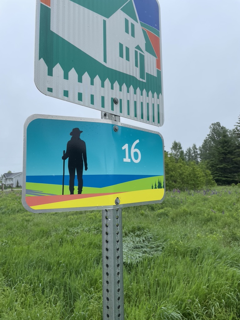
The signs are placed with the assumption that you are walking correctly, and safely, facing oncoming traffic, i.e you are on the left side of the road with cars on your right.  They are generally on the right side of the road – that is, on the opposite side of the one you should be walking on.

The signs are only on one side of the road, so this sign-posting practice also assumes that you are going clockwise round the island, following the sections from 1 to 32 in order (i.e start in Charlottetown, head to west Summerside, then north Tignish, etc).  If you do the route the other way round, or a la carte in chunks, you may have to look over your shoulder for the signs.

There were a few places where I could have added a short detour to my day, to take in a place of interest.  The official stage descriptions point out these sorts of things.  For me, generally speaking, I didn’t do that.  The only exception was the walk through Prince Edward Island National Park up around Cavendish and into North Rustico.  There the official route follows the park walking/cycling trail, which is inland a bit beside the road.  Instead, I cut down onto the beach and walked along it parallel to the road.  It didn’t really change the distance but it was far more satisfying.

Over the course of my walk, I got into the habit each night of reviewing each day’s route as-walked, marking where I finished using my map app, and then scouting the next day’s route using Google Maps in satellite view to get a sense of the directions, sights, and possible rest stop options along the way.  This became quite handy, particularly on road sections, as I quickly learned that finding a comfy spot to sit and rest was a challenge. 

Later in the walk, when my wife joined me in PEI and drove me to/from the walk every day, using the map app and Google Maps also let me geomark the next day’s start and end points, and put those into my wife’s phone, so that she could just follow the directions in the car.   

Accommodation

As you can see based on how my planning evolved, finding accommodation drove it as much as the route itself.  While the Island Walk is referred to in some places as a “Camino” like walk, the reality is that it would be quite difficult to do it in the manner of the Camino de Santiago.  You simply can’t walk from accommodation to accommodation expecting to find an inn or hostel or B&B more or less on the route every 5-10 km.  The tourist accommodation on the island is concentrated in a few places (Charlottetown, Summerside, the Cavendish area, the Stanhope area, etc.), which leaves long sections at the west and east ends of the Island where there aren’t any B&Bs or hotels conveniently near the route. 

It’s also important to realize when planning your accommodation that PEI has a short but intense tourist season.  Many places only open after about mid-May or Victoria Day weekend (3rd Monday in May), and shut not long after Labour Day (first Monday in September) or at latest Thanksgiving (2nd Monday in October).  But July and August are peak tourist – the island’s population doubles or even triples in these months.  That leaves narrow 4-week shoulder seasons in June and in September, which can work as I found in June.  

So all of that said, if you make your plans well in advance, e.g. in January for a walk in June or July, then you probably could book things out so that you could walk more or less from place to place, as long as you accept that you’re going to have more than a few days where you’ll need a lift as well as some extra distances to/from the route.

An alternative to that is to try to camp your way round the Island.  There are some provincial parks that offer campsites as well as several private campgrounds, relatively near the route.  In a few cases these align with the suggested stages, but for the most part they don’t, so you’ll have to improvise your stage lengths as needed.  Even then, there aren’t formal campgrounds near the route in all cases. 

For example, walking the Confederation Trail between St. Peter and North Lake covers more than 50 km, with essentially no nearby campsites.  You could try knocking on doors and asking if you can camp in a field, and Islanders being pretty hospitable, you might be able to make that work.  I wouldn’t try to stealth camp, though.  There is essentially no crown land along the route, so if you try to stealth camp you’ll be trespassing on private land and that’s not just illegal, it’s downright rude.  

By the way, another thing I learned in my research is that while there are many cottages for rent on the island, many of them are in holiday resorts where they only rent by the week.  It was frustrating because some of these were right on the route, but since I only needed one night I couldn’t use them.

All of this is a long-winded way of explaining why I ended up replanning a couple of times and settling on a base-accommodation approach.  In the end, I spent 5 nights in Summerside, 4 nights in Tignish, 6 nights in Kensington, 11 nights in Murrary Harbour, and finally 3 nights in Vernon Bridge.  These places were a mixture of AirBnBs and inns.  Since I had left it late, I had trouble finding AirBnBs around Montague and around Souris, which would have been a lot more convenient for the east end of the island than Murray Harbour, but on the other hand the place in Murray Harbour was great.  If you book a few months ahead of time, and if you avoid peak season in July/August, you should be fine finding something.

Practicalities and Logistics

I met just a few fellow walkers on the trip, but in chatting with those few people a consensus emerged on a few things to keep in mind when planning this walk.  In no particular order, I’d list them as follows.

  1. Road walks = no place to sit down, no place to pee
  2. Accommodation needs to be planned well ahead
  3. Since accommodation is likely to be spread out and not near the route, transportation to/from the route is key
  4. Timing is everything – you’ll have a short season to do the walk if you want things to be open but avoid the tourist crush

I think if I was going to do the walk again, I’d seriously consider packing a small portable stool or chair, which would be a blessing especially on the road walk sections.  There are many stretches where you’re multiple hours between towns.  Scouting each day’s route the night before using Google Maps in satellite mode helped me to spot community centres, public parks, churches, schools, post offices, and even cemeteries, where they might be a bench, as well as toilet facility candidates like gas stations, cafes, bakeries, and ice cream stands. 

This let me make notes for myself about distances between these landmarks, so that, for example I could start on a morning knowing that after about 8 km I’d come to a church where I could sit on the steps for a break.  Even then, I had a couple of frustrating days where I’d find the church I’d seen on the map but realize that it’s wooden steps had been removed because the church had been closed.  On a rainy day when you don’t want to sit on the ground, that’s a real pain.

For most people, the other key is that while you need to stay hydrated, doing so usually leads to the need for a bio break every so often.  If you are discreet and careful, you can sometimes find a conveniently located little stand of trees or bushes just off the road.  Nevertheless, it always seemed that I had been walking for hours without seeing a car and then the moment I stepped off the road, 3 of them would trundle past.  Or I’d walk along a promising stretch of road with houses on one side and fields on the other, only to realize that every stand of trees or bushes was exactly opposite someone’s house.  

I did meet one fellow walker who’s strategy was simply to walk fast, drink little, and hold it all in.  She would hydrate and pit stop before leaving, and then plow through each stage non-stop, only looking for a toilet when she had reached her destination at the end of a stage.  That might have worked for her, but it wouldn’t work for everyone, and it certainly didn’t work for me.  All I can say is that if you do need to “go”, al fresco, you need to be respectful of others and of private property and follow the backcountry rule – leave no trace.  

Since getting to/from the trail and your accommodation may well require transportation, you’ll have to figure this out ahead of time.  There are some options.  If you’re near Summerside or Charlottetown, there are several taxi firms that you can book and they’ll drive you for 50 km or even 100 km if you need it so that you can be dropped at the start of a stage and picked up at the end.  But that convenience  will be pricey – expect to pay up to $2 per km.

An alternative is the T3 bus network, and it’s a good option in some cases.  It’s very inexpensive at $2 per ride (as of June 2022).  It runs from several of the towns you’ll pass through, on routes that lead back to Charllottetown but pass through several places, e.g. the route between Summerside and Charlottetown passes through Kensington.  To use the service, you need to make a booking on their website, which can be same-day but is better done the night before. 

Through careful planning, you can arrange these rides to get from your accommodation to your drop-off and pick-up points.  The drawback is that the buses are on fixed schedules and run only 2-3 times a day, so there might be 4-5 hours between runs, thus you’ll have to time your walk to catch the bus.  And, at least as of June 2022, the buses only run Monday-Friday so on weekends you’ll have to find alternate methods.

One of those alternate methods is to do the Walk without walking – ride a bike instead.  I met several people who were doing the route this way.  By riding, they could not only go a bit faster and do the route more quickly, they could also find accommodation as much as 10 km off the route, and they could adjust their daily stage lengths to go from town to town.  The route is easy to cycle as the Confederation Trail is firmly gravelled, and the rest is on roads.  

If cycling is not your thing, and buses don’t work, nor taxis, then one other option is to find a sherpa – a person to drive you to/from the route each day.  This in turn takes several forms.

One is to use one of the private tour companies in PEI that have started to offer Island Walk packages combining accommodation arrangements as well as transportation, so that your luggage is schlepped for you and they take you from B&B to B&B.  You can find outfits that do this by doing some research on the blog that goes with the Island Walk website.

A similar idea is to stay at one of several resorts, inns, and B&Bs which offer transportation to/from the route.  You can usually book this at the time you book the accommodation.  As the Island Walk becomes more popular, I suspect that this type of thing will grow.  You can find these kinds of places by doing some research on the blog that goes with the Island Walk website.

One method I used was to ask for advice at one of the inns I stayed at, and they pointed me to a private tour operator named Stanley MacDonald.  He runs custom small-group tours for cruise ship passengers coming into Charlottetown, and in between he’s happy to pick up Island Walkers like me and take them to/from anywhere on the island.  There are several operators like this, and again, using the Island Walk blog can help you connect with them.

Finally, there’s the Little-Help-From-Your-Friends approach.  In my case, my wife stayed with me for about half of the time I was doing the walk.  She would drive me each day to/from my route, and in between she explored the island, visiting museums and shops and beaches and cafes and just generally chilling.  Similarly, you could also walk with a buddy or two, and use two cars where you both drive to the endpoint to leave a car, then drive back to the start and park the other car, so that at the end of the day you can drive back and pick up the 1st car again.  

There is one other way to do it, and that’s simply to plan your accommodation and your daily stages so that, as with the traditional Camino, you walk from place to place each day.  A combination of camping (including asking people to stay in their field) along with B&Bs or hotels might well work, if you’re able to do the detailed planning required.  I didn’t meet anyone on the Walk who was trying this, but I suppose it’s doable.

Food, Snacks, and Hydration

I’ve done all-day walks many times, and I’ve learned what works for me regarding nutrition.  First of all, I focus on hydration – I’d rather carry the extra weight of an additional water bottle than run out on a hot day.  For this trip, most days I started with about 1.5L of water and I tried to fill my bottles whenever I could at a store or coffee shop.  On a few hot days, I also carried an extra 500ml water bottle, just in case.  In addition, I always tried to include fruit with my snacks and lunches, since oranges, grapes, cherry tomatoes, etc. will provide a lot of hydration and electrolytes.

Regarding food, I try to eat lightly during the day while I am walking, saving the larger meal for the end of the day.  That means starting with a simple breakfast – yoghurt and toast, a bagel and cream cheese, or oatmeal with honey, that sort of thing – and then carrying snacks and food to provide short bursts of calories every couple of hours during the walk. 

I try to avoid junk foods like candy bars or high-sodium chips or jerky, and instead eat healthy foods like fresh fruits and veggie snacks, sandwiches with lean proteins like smoked turkey, whole grain breads, and so on.  I’ll carry a few protein bars, as well as a nut-free (I’m allergic) trail mix of raw pumpkin and sunflower seeds, raisins, and dried fruit.  I avoid things that need to stay cold – no tuna salad with mayo – so I can skip heavy ice packs.

On this walk, I also tried to limit caffeine during the day.  I just had one cup of coffee in the morning, and then waited till I was done for the day before I had any more.  Caffeine is a diuretic (it makes you pee), so limiting it made sense to me.

There were a couple of occasions where I was able to buy lunch along the route, but I think that only happened about 4-5 times for me.  So the rest of the time I packed a lunch.  You could adjust your route a bit I guess and hit a few more places, but you’ll need to pack a lunch at least half the time.  I have seen that a number of the B&Bs and inns that offer Island Walk transportation and stay packages will sometimes offer to make you a packed lunch as well, so that’s up to you.

One other tip is to choose accommodation that’s near grocery stores – that’s in part why I chose to stay in Summerside, Tignish, and Kensington.  It was much healthier to buy fresh food and prepare it myself for snacks and meals, rather than eating out all the time, and it was cheaper to boot.  30+ years of travelling on business taught me that there’s much to be said for home cooking.  

Gear

As for what to wear and carry and take, I think there are only a few essentials.

  1. Comfortable shoes
  2. Comfortable walking clothes suitable for the day’s weather
  3. Rain gear
  4. A knapsack or day pack
  5. Water
  6. Snacks and often lunch
  7. Bug protection

After that, it’s up to you.  I carried a little inflatable seat pad, for example, and it came in handy several times when I couldn’t find anywhere to sit down.  I also carried some spare clothes in a dry bag, tailored each day to the weather and conditions.  It was great to be able to change out of a sweaty shirt before getting into the car for a 45-min ride back to my digs, or to have a warm fleecy handy, or a complete change of clothes when I knew I’d be walking in the rain.  And the dry bag for these clothes was key as well.  Despite the fact that I had a rain cover for my pack, there were a couple of all-day walks in the rain that would have soaked anything I was carrying.

On the other hand, I did not carry sunblock or bug spray.  I don’t like putting chemicals on my skin (and suffered bug torment accordingly), but other walkers I met did have that on hand.  It’s a personal choice, and of course the time of year will factor in as well.  Peak mosquitoes are in May and June.

What else?  Well, many people use walking poles, and I started with a set as well.  I had used them previously on a 1-week 200 km walk from Niagra-on-the-Lake to Toronto that included part of the Bruce Trail, and they were essential gear there.  However, after the 2nd day of the Island Walk, I gave them to my wife to take home, since the road and trail conditions were fine, and I wasn’t carrying a big pack.  You decide.

A word on the foot wear – really, you could wear just about anything, as long as it’s comfortable.  I wore mid-weight hiking boots, which I was careful to break in before the Walk, and they worked pretty well.  I had some blisters early, and near the end of the walk I had a little bit of muscle/joint/ligament pain in the soles and ankles, but mostly that was just about walking for 6-7 hours a day.  Overall I was quite pleased with the boots. 

Other walkers whom I met wore running shoes, hiking/trail shoes, and in one case hiking boots, and I’m sure their respective choices worked for them too.  Just keep in mind that if you’re doing the whole walk in one go like I was, you are going to exercise your feet more than you’re likely to have done before.  Shoes that work for a 1 or 2 hour hike may not hold up for multiple 6-hour days of walking.  Keep that in mind, and don’t wear either brand-new footwear or old comfortable-but-not-enough-mileage-left footwear.

As for clothing, it’s really about the weather.  I walked in June, and at the start on June 1st the day’s high temp was about 10 C, with some rain showers and a cold wind in my face.  I started the walk carrying a light touque and runner’s gloves, just in case.  By the end of the walk, the daily temps were up in the mid-20’s and peaked around 30 C, with hours of blue sky above.  I knew going in that I’d get a range of conditions, so I focused on lightweight layers that I could add or subtract as needed. 

Also, since I had a few days where I’d be carrying all of my clothes and gear from one night’s accommodation to another, I kept my clothing selection small and focused on lightweight items – just 3 pairs of trousers, 3 wick-away fast-dry T-shirts, 3 pairs of underwear, 4 pairs of merino wool socks, 1 wick-away fast dry long-sleeve T-shirt, and 1 lightweight fleecy, and of course each day I’d wear part of that.  All of my clothes fit into a 10L dry bag and I could get that plus everything else into a 38L overnight pack with no issue.  

In addition to those clothes, I packed and often wore two bits of rain gear, a jacket and a pair of pants.  The rain jacket also gave me another outer layer if it was cold, and it served well as mosquito defense too.  As with most rain gear, you’re going to sweat under it if you’re working hard, GoreTex or not, so the jacket I used had underarm zips so that I could ventilate a bit as I walked while keeping out moisture.  But even so, it’s hard to balance staying dry vs staying cool.  Accept that rain gear helps but you’re going to get wet anyway.

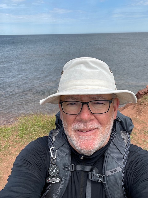
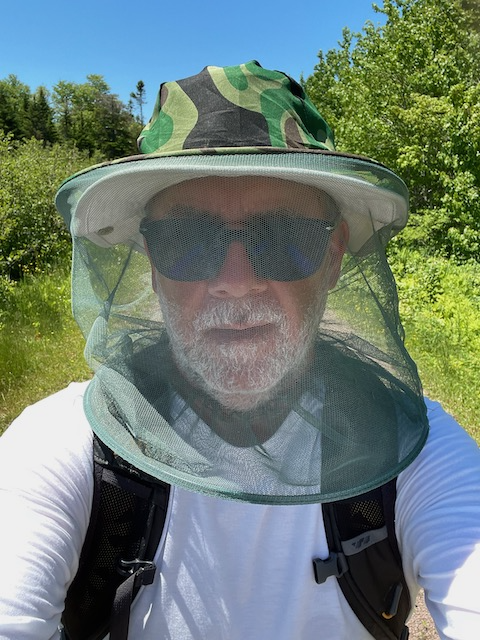
The final piece of essential gear for me was my hat.  I actually had 3 of them – a full brim Tilley hat for sun protection, a baseball style hat that I could wear under my rain jacket hood to keep the rain off my glasses, and my bug hat.  

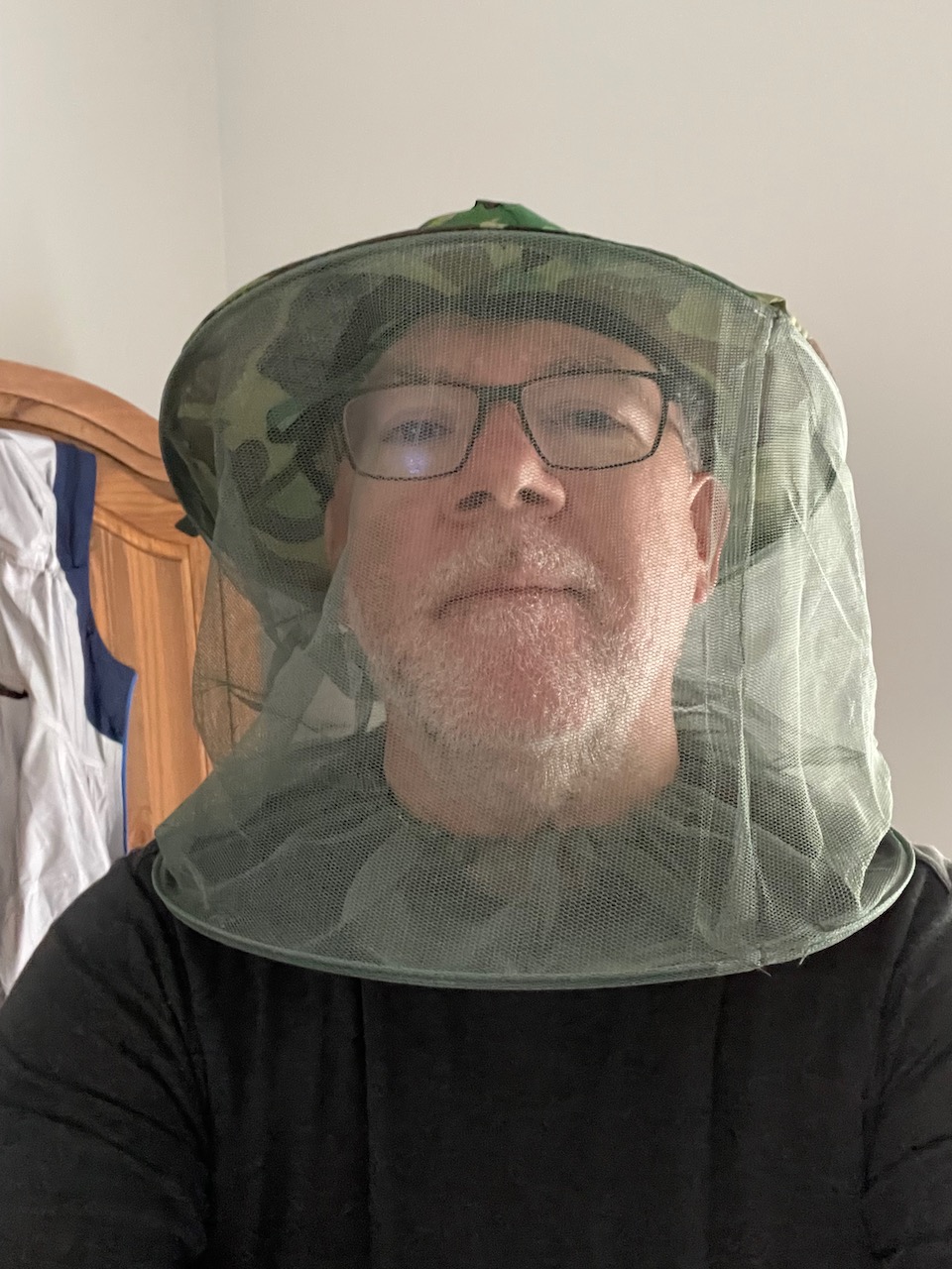
The latter was picked up at a dollar store in Alberton in the 1st half of  my journey, after battling mosquitoes along the Confederation Trail, and it turned out to be darn handy.  Your head, your choice, just keep sun, rain, and bugs in mind.

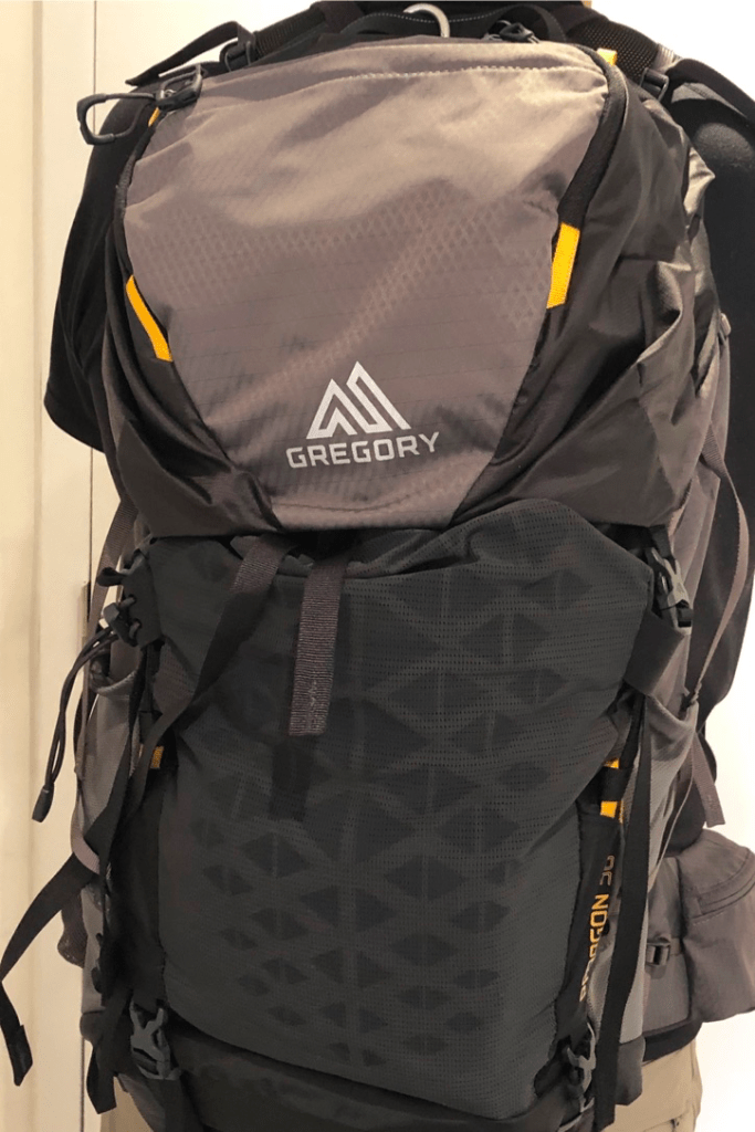
I ended up using two different packs on the trip.  I have a 55L multi-day pack that I really like and I used it for the first half of the trip.  During this part, my wife wasn’t with me, so I had a few days where I had all my clothes and gear with me as I left one accommodation and moved on to the next, so I had to carry stuff that I didn’t need during the day on the trail – all my spare clothes, my indoor sandals, toiletries, snacks, electronics chargers and cables, an iPad.  Altogether, with some extra snacks, lunch, and full water on board, my pack came in at roughly 11kg.  I could have left a few things out of course, but the pack made carrying that weight all day quite comfortable.

During the 2nd half of my journey, my wife joined me so we had a car available, eliminating the need to carry everything.  That let me switch to a lighter 38L overnight pack.  This was, to be honest, still a bit bigger than I really needed, and I also own a 22L day pack which would have worked, but using the 38L pack meant that I could just chuck stuff in and not worry too much about packing carefully, and that way I always had spare clothes, rain gear, first aid kit, sitting pad, snacks, lunch, and water all to hand.

You could of course get by with a much smaller day pack, especially if you have someone able to sherpa you around each day.  I met a walker during my journey who carried a little 15L day pack, with just a rain jacket, some water, and a light snack.  You decide what works for you.

Let’s see, what else?  I did carry a first aid kit every day, though fortunately I never needed it during the day while walking.  I went through a bunch of blister bandages, though, and the associated alcohol swabs and antibiotic cream that you need to pop a blister while reducing the risk of infection.  My first aid kit also had tick tweezers, and thankfully I never had to use them.

Outside of all that, there was other gear that I used at night, rather than carry on the trail.  Toiletries of course – toothbrush, shampoo, deodorant, etc.  Also an iPad for entertainment, and that meant chargers and cords.  Plus I had indoor sandals to wear, and what a blessing that is when you finally take your boots off each night.  I had thought about adding a fancier shirt in case I went out for dinner but in the end didn’t carry that.  I did carry a little sewing and repair kit, but never needed it.  Your choice.

Gear List

  • Gregory Balto 55L multi-day pack – used for the 1st half of the trip
  • Gregory Paragon 38L overnight pack – used for the 2nd half of the trip
  • Oboz Yellowstone hiking boots
  • Mountain Equipment Coop (MEC) Hydrofoil rain jacket
  • MEC Hydrofoil rain pants
  • MEC seat cushion
  • MEC 10L dry bag
  • Outdoor Research 5L dry bag
  • Tilley T3 sun hat
  • Outdoor Research baseball-style hat
  • 1 pair Black Diamond carbon fibre walking poles
  • Phone charger cubes and cables
  • iPad
  • Toiletries kit
  • First aid kit – lots of blister bandages, needle & antiseptic, moleskin, tweezers
  • Repair kit (sewing needles, thread, buttons, safety pins, duct tape, and light parachute cord)
  • Medium sized MEC quick dry trail towel
  • 1 L Nalgene water bottle
  • 600ml squeeze water bottle
  • Clothing
    • 3 pairs pants (all quick-dry synthetic material, 2 of them convertible into shorts)
    • 3 wick-away stay dry T-shirts 
    • 4 pairs merino wool socks
    • 3 pairs underwear
    • 1 long-sleeve wick-away stay dry T-shirt
    • 1 lightweight zip fleecy
    • 1 pair slides as indoor shoes
    • 1 merino wool lightweight touque
    • 1 pair runners lightweight gloves 

Training and Fitness

It’s a bit of a cliche, but really, how do you know if you’re ready to do a 700km walk without actually doing it?  Do you train for a marathon by running a marathon?  


In my case, I knew beforehand that a) I wanted to cover around 30km a day, and b) that I would be carrying clothes, rain gear, food, water, etc. each day that would add up to something like 6-8 kg.  So I did a few training walks of 10-20 km around town and nearby areas, and then after a few such walks where I’d carried nothing, I started to add a full pack with between 10-15 kg of kettle bell weights in it.  By the time I started the walk, I’d done a couple of 25 km hikes carrying more weight than I was planning for on the actual trip, so I reckoned I was good to go.

What that didn’t prepare me for, however, was the repetitive stress of walking every day.  It’s one thing to work out, it’s another to do it over and over again.  Your body is, literally, made for walking, so you will adjust and get used to it, but you’ll find that it takes some time.  The first few days of walking, I had a fair amount of muscle and joint stiffness on top of tender feet due to blisters.  By about day 7 or 8, however, I’d walked myself into decent shape and was generally fine each evening.  But then, by day 25 or so, I was starting to feel new aches and pains, and I put those down to just long term wear and tear.

One thing I’d do differently in future would be to plan for a couple of rest days.  I think taking a rest day every 10-15 days would be prudent, and as I get older will probably be essential.  As it was, I walked every day and just used a couple of 3-hour/15 km days as a way to rest a bit, so that’s another way to do it – mix up your daily distances to give yourself some short days once in a while.  

Everyone is different, of course, and while you definitely don’t need to be a high-performance athlete to do the Walk, you are likely to find that you do need to push yourself on this if you plan to do it in one continuous journey as I did.  Some of that will be mental and some physical.  As long as you let your body dictate your pace, and are honest with yourself, you’ll be fine.  I did this at age 59, and wearing a spare 5 kg around my belly, and not only survived but enjoyed it. 

Lessons

One of the reasons I decided to do the Island Walk was because my bucket list of walks includes a number of long-distance, multi-week journeys – things like the Camino de Santiago, for instance.  I wanted to use the walk to learn what works for me.  In that sense, it was a great test, and more than anything I learned what might be the most valuable thing I could have learned – simply that I can do it.  There were times when I felt like bailing out, and I didn’t.  Just knowing that I am able to push through that mental wall is important.

But more than that, If there is one key takeaway for me, it’s that this kind of journey is like a knife that pares away your preconceptions and strips you down to essentials.  You walk, you eat, you sleep, you walk some more.  Repeat.  It’s an energizing feeling, that sense that you don’t need to worry about anything else.  Just walk.  


Other Posts About this Journey


If you feel like supporting my blog, you can buy me a coffee.

Big Walks – PEI’s Island Walk

Blog posts are a labour of love for me, and yet there is a cost to running this site and organizing my walks.If you’d like to help with that, I’d really appreciate something for my tip jar.The Buy Me a Coffee service allows patrons like you to fund writers like me.  If that sounds like a worthy idea to you, then go ahead – keep buying me coffees.Thank You Very Much to everyone who has contributed already!

*****

Over the past few years, I’ve been thinking about doing a Big Walk. My bucket list has a number of them – the Camino de Santiago in France and Spain, the Bruce Trail in Ontario, and many more – and I keep reading about ideas for others as well. I had plans to take on at least one of these in each of 2020 and 2021, but the COVID-19 epidemic meant that those dreams stayed just that – dreams.

So come spring 2022, after 2 years of listening to me wish and sigh, my wife finally put the boot in and said it was time to either do one of these walks or else stop talking about it.

OK, agreed, but which walk to do? Knowing that 2022 would probably still have some COVID-19 travel disruptions, I decided to try something that was relatively close to home. Plus, knowing that this was going to be my first multi-week walk, it made sense to choose something that while challenging was also achievable in terms of length and terrain. That line of thought led me to the Island Walk.

Morning, Day 1

This is a relatively new addition to the world of long walks. It was first tried out in 2019 by a couple of experienced walkers from Prince Edward Island who had done the Camino de Santiago in Spain and who wanted to find a similar length walk that would showcase their home province. They came up with a route that combines walking on red-dirt back roads

with sections of the province’s Confederation Trail

to take you more or less around the coast of Prince Edward Island. It’s about 700 km in total, and is divided into a suggested 32 daily stages which range between 12 -26 km in length. In the end, I chose to do it a bit faster than that pace, finishing in 27 days.

Why?

The first question asked by most of the people I spoke to both on the walk as well as friends and family before and after is, why? Why do it?

The lazy answer to that is to say “because it’s there”, and that was part of it. Could I complete a long walk like that? And beyond that, I had a few other things in mind:

  • Exploring PEI – this was the only Maritime province I’d yet to visit, and seeing it on foot seemed like a great way to explore Canada’s smallest province
  • Physical challenge – despite trying to average 75 minutes of activity per day for the past 5 years, I’ve still managed to add a few pounds, and a good long walk was one way to shed a few of those
  • Trying out ideas – if I am going to do other long-distance multi-week walks, I’d like to figure out what works for me in terms of pace, gear, nutrition, etc. Doing so close to home was a bonus.
  • Thinking time – a walk is always a chance for me to clear my mind, but the mental challenge of maintaining focus while remaining observant while walking 5-6 hours a day is a new one
  • Put up or shut up – there comes a point where you either decide to do something or you put it aside.

Impressions

So having done, what did I think? Did I like it? Was it worth it? Did it meet my expectations or preconceptions?

At North Cape, Day 8

A couple of weeks have gone by since I finished it, and I’m still digesting it. There were things I liked – the structure of a long walk, the routine of getting up, getting ready, getting out, and getting it done, day after day. There was the rhythm of it, getting locked into a sort of Zen calmness and clarity, when the steady pace emptied my mind and I simply walked.

I liked some of the scenery. PEI is a low-key kind of place – no rugged mountains or crashing seas, but calm seas, long beaches,

green fields, wild flowers, fishing ports, and friendly people.

I liked the challenge, the push you need to start each day even when your feet hurt and the drive you need to see it through. I liked the solitude (I met exactly 6 other walkers and 4 cyclists on the route over 27 days) and I liked chatting to people that I met along the way.

I didn’t like the bugs – the mosquitoes were voracious.

I didn’t like the monotony of some stretches of the Confederation Trail, running flat and straight and on and on. I didn’t like having to to hitch rides most days to and from the route because there were few accommodation options adjacent to the route. And I didn’t like road walking, long stretches with no place to sit and rest, and hard asphalt that made my heels and ankles ache.

But those are quibbles. No journey contains only the highlights, there are always low lights and often no lights, and to expect otherwise is to be rudely awakened; but I wasn’t so much awakened to those things as resigned to them as being part of the journey that simply taught different lessons.

I guess the biggest takeaway for me is that a journey like this isn’t supposed to have one purpose, one impression, one lesson. Some time ago, a line I read in a blog post about the Camino de Santiago stuck in my head – “everyone walks their own Camino”. That message resonated again and again each day of my journey. No two people are going to do a walk like this, even if they are walking together, and do it for the same reasons while forming the same memories.

If I could distill anything out of this, I think it would be a few little mantras. Cherish the journey, respect the journey, and learn from it. Accept it on its own terms. Don’t overthink it. Your journey is its own lesson. Everybody walks their own Camino.

For the the last day, I’d deliberately walked extra distance on the preceding few days to ensure I’d have a short day at the end, partly in case of rain and partly because I didn’t want to finish the walk with a long sloggy day. And as I came into Charlottetown I was struggling to digest the journey, what it had meant, what I felt, how I thought of it. Ann wanted to meet me at Joe Ghiz Park where the route starts and ends, and a couple of friends, Michael and Carol, had come up from Lunenburg to surprise me and celebrate crossing the finish line. I was about a kilometre from the park, and way ahead of schedule, so I doddled a bit on the Hillsborough Bridge to look at the city skyline,

and then I texted Ann to say that I wanted to get there by myself so that I could try to process it. And so that’s what I did – walked the last bit trying to be normal, got to the park, took a selfie,

done

took off my pack, and when Ann walked in and gave me a hug, I started to cry. That was how I processed it – with tears, of relief and thanks. I thought I was walking by myself, and at that moment I realized that I was really walking with her.

Memories

Green on red – PEI’s colour palette in June is layers of green upon red earth, with little yellow and purple and pink and white flowered highlights.

Blue maritime skies. Grey rain-filled lowering clouds, and soft misty mornings. Green tunnels of trees and shrubs and bushes and ferns.

Odd sights.

Blue-green seas. Black crows. Red mud. And more green on red, red on green, again and again.

The rural character of the province sinks deep into your brain, until you expect no other colours. Green on red. Sunshine and trails. Memories.


Over the coming weeks, I’ll be writing more about this walk. Stay tuned.

If you feel like supporting my blog, you can buy me a coffee.


Other Posts About this Journey


If you feel like supporting my blog, you can buy me a coffee.

Boundaries

It’s human nature, I think, to look for the edges and test the boundaries of something. Or maybe that’s just my nature.

Water’s edge

I was thinking this the other day, walking the pier near the Lehave Bakery, testing the edges by walking out along the wharf. Walk to the edge, and follow it round.

That notion of following the edge has been in my head, because now that we’re here in Lunenburg I’ve been thinking about some of the walks I’d like to do within the province, adding them to my bucket list, and those walks are themed by the edges I’d follow.

Nova Scotia is predominately a coastal province. By that I mean that most of the population lives near the sea shore. The larger cities and towns are mostly on the coasts – Halifax, Yarmouth, Sydney, and not least Lunenburg. The population has always faced the sea and looked to it for their livelihood. It means there are lots of roads and now trails that follow those coasts, so that makes walking a coastline activity.

Thinking about that got me thinking about boundaries and edges and limits. There are limits of geography, like the coast lines, and I’ll follow those. There are limits of endurance and strength, and while I don’t think I need those in exceptional quantities, walking several hundred km around the coasts will certainly call for some gusting towards those limits, at least for me.

And then there are limits we set for ourselves, limits of ambition I’ll call them. What do we want to achieve? How far do we push ourselves? Where will we take ourselves? Those limits are different for everyone of course, and I think they are also different at different points in our lives. The limits I set myself in my teens and 20’s are not those of my 40’s, 50’s, and 60’s. Do I want to walk these walks now because I want to push back on the shrinking of those physical limits? Maybe. Or maybe it’s just that now that I am retired and have a more or less grown child and fewer responsibilities, I feel like I can stretch my limits in ways that would have seemed imprudent or impractical when I was younger and paying mortgages and climbing corporate ladders.

The Olympics are on as I write this, and that is the spectacle of human limits writ large. What are competitive athletics if not tests of the limits of human strength and endurance and ambition? My walks are not my Olympics by any means, but deep down they come from the same source. Find the edge, and explore it.

Bucket List Walks

Blog posts are a labour of love for me, and yet there is a cost to running this site and organizing my walks.If you’d like to help with that, I’d really appreciate something for my tip jar.The Buy Me a Coffee service allows patrons like you to fund writers like me.  If that sounds like a worthy idea to you, then go ahead – keep buying me coffees.Thank You Very Much to everyone who has contributed already!

*****

An ever-changing list of walks I’ve done or would like to do. If it’s in bold italics it means I Did It!

Walks close to home in the Maritimes

Walks in Ontario

  • The Bruce Trail, Ontario
    • Niagara Section
    • Iroquois Section
    • Toronto Section
    • Caledon Section
    • Dufferin Highland Section
    • Beaver Valley Section
    • Blue Mountain Section
    • Sydenham Section
    • Peninsula Section
  • Yonge Street (from Lake Ontario to Lake Simcoe)
  • Tracing the path of Lord Simcoe from Fort George in Niagara-on-the-Lake to Fort York in Toronto
  • The Great Trail T-O-M walk – Toronto to Ottawa to Montreal following the Great Trail routes
  • Montreal to Toronto following the Waterfront Trail

Walks in the Toronto area

  • Crisscross Toronto (west to east and south to north, across the city within its boundaries)
  • Waterfront to Wine
    • East, from Toronto to Prince Edward County along the Waterfront Trail
    • West, from Toronto to Niagara along the Waterfront Trail
    • South, from Toronto to Pelee Island along the Waterfront Trail
  • The Great Trail in Southern Ontario (within 2 hours of Toronto)
    • Toronto Waterfront Trail
    • Toronto Pan-Am Trail
    • Toronto Pan-Am Connector
    • Niagara River Recreational Trail
    • Pickering Waterfront Trail
    • Durham County Recreational Trails
    • Laura Secord Legacy Trail
    • City of Hamiton Trails
    • Fort Erie to Hamilton connector trails
    • Hamilton to Brantford Rail Trail
    • Brantford to Kitchener connector trails
    • Kitchener to Elora connector trails
    • Elora to Barrie connector trails
  • Oakridges Moraine Trail around greater Toronto

Walks out in the world someplace

Personal Journeys

  • The journey of the Bradt Brothers, tracing my ancestors from New Amsterdam (now New York) up the Hudson to Albany and then west across upstate NY, across to Fort Erie, and along the Talbot Trail to Leamington in Essex County, SW Ontario, where I was born.

The Great Trail

Having recently completed a couple of the bucket list Big Walks that I’d like to do, the experience has got me thinking about some of the other Big Walks on my list. The one I’m truly itching to do is the walk from John O’Groats in Scotland to Lands End in Cornwall, covering Great Britain end to end.

For various reasons I think that’s a couple of years down the road. For one thing, I’ll need probably 3 months to do it, and I just can’t see making that kind of time available quite yet. For another, I’ll need to train up to that kind of distance. So in the meantime, I’ve been exploring other long walks that are more doable in the here and now, and that’s led me to the Great Trail.

Also known as the Trans Canada Trail, this network of interconnected paths, roads, and waterways covers Canada from coast to coast to coast. The Trail is constantly being updated, and as of 2019 it’s at 24,000 km. Of that total, several thousand km are water-trails for canoe and kayak, so realistically I’ll never be able to walk the whole thing. Nevertheless, I can do parts of it, especially the bits nearby, so my bucket list now includes the approximately 1000 km or so of the Trail within a few hours of Toronto.

When I started exploring the Great Trail map, I realized that in fact I’ve already walked some of the parts that are within the City of Toronto – for example I covered about 80 km of the Waterfront Trail between Etobicoke Creek and the Rouge River this year. What I also noticed was that in Toronto, the Great Trail includes parts of the Toronto Pan-Am Trail and the Pan-Am Connector Trails.

I walked that recently, and now have added another 30 km or so to my lifetime total of the Great Trail. As it turns out, these trails are not yet very well signed-posted and documented trails. This path is a work in progress, but the general idea links together the Port Union Waterfront Trail from the Rouge River to Highland Creek, the Highland Creek trails through Colonel Danforth Park, the trails through Thompson Park, the Gatineau Hydro Corridor, the Taylor Creek Trail, and the Lower Don Trail to the lake. There are also some city streets to cover to link these together, and hopefully soon we’ll get these properly and completely mapped and linked.

Nevertheless, it’s already a great walk. I recently I covered the bulk of this on a glorious October day, and the scenery was spectacular, like this stretch below in Highland Creek Park.

That walk gave me a taste of what the Great Trail holds – if it’s so much fun in my own back yard, what about the other sections?

As a result, I’m now thinking about how to string together parts of the Great Trail into 1- and 2-week journeys that I can do over the next couple of years. For example, there are trails that link Niagara-on-the-Lake to Hamilton, Hamilton to Kitchener, Kitchener to Barrie, and so on.

All of these are within an hour or two from Toronto to either the start or the end of the trail, so the logistics are easy, plus some parts are even close enough that I could use the GO Train network to come home at night so that I can do them as day hikes. That gives me lots of ways to enjoy these trails, work up to long distance treks, and keep costs down.

Outside of Toronto, there are other parts of the Great Trail that look interesting, such as the 100 km Sea to Sky Trail from Vancouver to Whistler, the 200+ km Confederation Trail across Prince Edward Island, or the near-900 km cross-Newfoundland T’Railway Trail. That’s the beauty of it, there’s a range of trails from a few km to hundreds in length, and they cover the whole country.

And one of these days, if I want to get really ambitious, I think I might walk from Toronto to Ottawa (around 600 km by the Trail), walk from Ottawa to Montreal (also around 600 km), and possibly do both back to back over a couple of months – what I’m thinking of calling my TOM walk, from Toronto to Ottawa to Montreal.

I guess one of the perhaps unexpected consequences of the Big Walks I’ve done so far is that, having now scratched the Big Walk itch, I want to take on more of them. They’re a challenge physically, and I like the idea of planning for them and completing them. The Great Trail offers lots of ways to do that.

It reminds me of an old joke, that the best way to eat an elephant is one bite at a time. I’m thinking about the Great Trail that way – I’ll take bite-sized chunks from the Great Trail smorgasbord. I’m looking forward to it.

TONotL Countdown

As you may recall, back in June I was planning to take one of the Big Walks on my bucket list, and travel from Toronto to Niagara-on-the-Lake, something I called my TONotL walk.

Unfortunately, plans had to change when we travelled to Ireland for my wife’s Aunt Norah’s funeral.

Now that summer is ending, it’s time to put that plan back on the front burner. Starting next week, I’ll be setting off on my journey.

My original plan had been to walk from Toronto to Niagara-on-the-Lake, hence TONotL, but I’ve since decided to reverse it. I like the idea of walking towards home, instead of away from it. Plus, this way I get the Niagara section of the Bruce Trail done in the first 3 days of my trek when I am fresher and if that kills my knees then at least I’ll have completed one section of the Bruce. It’s also pretty much flat walking along the Waterfront Trail for the last 3 days following the lake, so hopefully I just have to deal with tired feet at the end.

I have to confess I’m nervous about kicking this off. My recent long hikes have gone ok though my feet have been tired the next day and after 3 days crossing Toronto my knees were feeling the stress, so I’m wondering how I am going to do this 6 days in a row. I’ve done 30+ km in a day many times, but I’ve never done 30+ km 6 days in a row, while carrying a pack. Hmmm.

Also the new boots I bought back in the spring, while sturdy and very supportive, fit so snugly that I can’t get my custom orthotics into them plus they make my feet overheat. Instead I’m debating between using my old broken-in boots versus a pair of walking shoes versus a part of cross-country running shoes.

New boots on the bottom left? Old boots on the upper left? Broken in cross-country running shoes on the bottom right? New high top walking shoes on the upper right?

The walking and running shoes work better with my custom orthotics, but I have to watch for blisters, especially with the new walking pair that fit the best with the insoles. On the other hand the old hiking boots and the cross-country running shoes are pretty comfortable and don’t cause blisters, but one foot gets tired because the orthotic doesn’t quite fit properly into the right one.

After some test walks this past week, I’ve decided on the new walking shoes. About 60% of the walk is on roads and sidewalks suited to running shoes, and the rest is along the Bruce Trail where it could be muddy or rocky, and the Goretex construction and treaded soles should work well there. After getting blisters during an early test walk, I’ve found a combination of socks and anti-chafing cream that seems to control that. I don’t want to afford the weight of taking 2 pairs of footwear, so it’s cross fingers and hope I made the right choice.

The weather looks pretty good, not too much rain forecast and comfortable temps. Even so, I need to think about staying hydrated. Should I carry an extra water bottle? What about water stops along the Bruce? How much water should I carry? I’ve decided on 2 litres, which will add 2 kg to my carrying weight at the start of the day but I’d rather not be caught without water on a back trail somewhere. And what about food? – no Tim Hortons along the Trail so what do I pack? Where are the grocery stores to stock up each morning? I’ll have to have a good breakfast each day and then carry light high-energy foods like dried fruit, energy bars, hard sausages, and pumpkin and sunflower seeds.

For my accommodation, I’m sorted. I had originally planned to day-hike part of the trek, by using the GO stations at Port Credit and Burlington to come home for 2 of the nights and then return the next morning. That’s changed, I guess because deep down it feels like cheating. It means I’m carrying a full pack of clothes, food, and rain gear each day. I’ve booked hotels or B&Bs for each night, so I have a destination locked in for each day’s walking. It means I’m looking at 7-8 hours per day including rest stops to cover the 30 km or so that I’ll need to cover.

I’ve also spent time pouring over Google Maps in detail, and I’ve downloaded the Bruce Trail app onto my phone. I’ve scouted for likely places to get water, to use the restroom facilities, to grab some lunch, and to take a break.

And of course I’ve gone over my packing list, and checked my gear, and I’ve done a full dress-rehearsal pack for a 3 hour hike, so I’m ready on that front. I’ve got my hiking socks, hiking clothes, rain gear, blister kits, sewing kit, first aid kit, food kit, and walking poles all sorted out. It adds up to just over 10 kg with water and food, so not too bad. My pack is fitted and adjusted. I’ve done just about everything I can to be ready.

Gear – check

Weather – check

Accommodation – check

Checklists – check, check, check

It’s just nerves, this overthinking. Time to get walking and let the rhythm sort it out. Check.

Crossing Toronto Stage 3 – Up the Don

After my long trek to the Rouge the day before, I was pleasantly surprised to wake up feeling pretty good for Stage 3 of my journey. My feet had been tired at the end of the day, but apart from stiffness in my knees, a good night’s sleep had set me up for the final leg of Crossing Toronto. I would hike from the southern boundary of the City at the lake northwards following the Don River as much as I could all the way the northern boundary at Steeles Avenue.

Since the Don forks in mid-Toronto, I had to choose which branch to follow and I’d decided on both – the way the river flows meant that I could climb the West Don for part of the way (since I could go through several parks that way) and then cut across city suburbs to pick up the East Don and follow that up to Steeles.

After the climbs and challenges of stage 2 between the Don and the Rouge, I reckoned that this final stage would be both easier and harder. Easier because it was a bit shorter than the 2nd stage and because much of it I’d walked before, and harder because after 2 long days of walking I was beginning to feel some of the stresses in my feet and knees.

The good thing about my route was that, like Stage 2, I could take the subway to King and walk past St. Lawrence Market, stopping to have breakfast at Paddington’s Pump once again. I had the same eggs, the same server, and the same warm happy glow of a full tummy when I set off at 8:30.

Since I was doing this final stage on a Saturday, there were many more people about at the Market. That’s their busiest day of the week, and I was tempted to hang about to sample the food, but of course I knew I had to get going. Just like the day before, I followed the Esplanade east through the Distillery District and crossed through Corktown Commons to pick up the Lower Don Trail.

Turning north, I was on a familiar path. I’ve walked this in both directions a number of times in various seasons, but on this day it had been several months since I’d followed the river north. The first thing I noticed was how much the shrubs, bushes, and trees along the trail had filled in and now sheltered the trail. It made for a welcome green tunnel of shade on a sunny summer morning.

Early on a Saturday morning, the trail is used more by cyclists than walkers or runners. You have to be on your toes, listening for bikes coming up behind you while watching for bikes coming towards you, since the trail is only about 2 meters wide. The bikes presume they have right of way since they’re faster, even though the trail etiquette is supposed to be that the pedestrians have priority. Why do cyclists think that if they ring their bell, you’ll just jump out of the way?

As I walked, my curiosity was piqued in noticing the difference between walkers and cyclists when travelling in pairs. A pair of walkers, especially couples, will often walk side by side even on a busy trail. A pair of cyclists, even if a couple, will usually ride in tandem. Why is that? The trail rang with bike bells as the cyclists wove amongst the walkers.

Continuing north, I found myself walking in “the zone”, spaced out and unaware of time passing. I knew the trail well so I didn’t pay much attention to the landmarks. Still, I was pleased to pop out of my walker’s trance when I came to the Prince Edward Viaduct, carrying the Bloor Street roadway as well as Line 2 of the subway over the Don Valley, in less than an hour after leaving St. Lawrence Market.

Past this, as you head north towards Pottery Road, there’s a little sculpture installation by artist Duane Linklater featuring some pieces meant to evoke old castles and crumbled monuments. I always tell myself I should stop and explore, and yet again this day my focus on walking meant that I paused just long enough to snap a picture, and then kept on walking.

Continuing past the sculptures, you soon come to Pottery Road. There’s a crossing island here and there was a queue of bikes in both directions waiting to cross. I had to fight to protect my pedestrian rights amongst them, as they surged forward in a break in the traffic.

From this point, about 5 km from Corktown, there’s a stretch of several km along the river that takes you to the forks of the Don near the Taylor Creek confluence. It’s a bipolar bit of trail – on the one hand the shimmering rapids, green shuffles of leaves, and meadows of nodding flowers, and on the other hand the steady intrusive hum and mumble of traffic on the Don Valley Expressway just to the east of the trail. It looks rustic but it sounds urban. The constant stream of cyclists didn’t help.

Another thing that I kept noticing was that stinging nettles were overgrowing onto the edge of the trail, so that you wanted to walk in the centre, but the bikes kept pushing you back to the edge where you risked brushing up against the nettles. Having grown up in the country and been stung by nettles in the past, I was in no mood for that, so I had to listen for approaching bikes whenever I skirted the nettles, making for an uncomfortable walk.

Watch out for nettles!

Eventually, however, I came to the forks of the Don. This is where the Lower Don Trail connects with both the Taylor Creek Trail (which initially follows the East Don River) and the West Don Trail. You hard to see the actual confluence of the two branches of the river, at least in summer with full greenery about, but again I was kind of head-down and focused and not paying too much attention. I just followed familiar trails and started heading west, crossing under Don Mills Road to enter E.T. Seton Park.

I took a break here, refilling my water bottles – I had 2 because I knew there were no water refills on the trail north of Lawrence – and sitting for a bit in some shade. There were still lots of cyclists and they often roved in packs of 3-5 riders. I made the assumption that they were all weekend warriors, and smugly sniggered at their Tour de Something wannabe jerseys and fancy kit.

As you continue north through E.T. Seaton Park you pass through one of Toronto’s only disk golf courses. The “holes” are on both sides of the trail and there were a few disk golfers out enjoying the sun.

Fore!

On weekends in good weather, E.T. Seaton Park fills up with families enjoying communal picnics and cookouts. The air is scented with tantalizing aromas, and the many cultures living in nearby Thorncliffe Park (one of the most diverse neighbourhoods in the country) gather to take advantage of the green space. I was a bit early for that, plowing through there well before noon, so I missed having my appetite stirred early. I resolved to keep walking in order to try to get north of Sheppard before stopping for lunch.

The Trail keeps going through E.T. Seton, and eventually you pass under Eglinton Avenue and into Serena Gundy Park. There is a lot of construction going on in this section, part of the Eglinton Crosstown rail project, and it’s muddy and busy with trucks. There are also lots of cars on a weekend, because the car parks are the base for the cyclists. It made me want to walk through as fast as I could so I continued through the east end of Serena Gundy Park to arrive at Wilket Creek and the entrance to the trail along that watercourse that would take me through Wilket Creek Park and on to Edwards Gardens.

Wilket Creek Park on a summer’s day – imagine this decked in full autumn colours

I kept chugging, with a clock in my head that wanted to get to Edwards Gardens well before noon. The trail through Wilket Creek is quite lovely, and having been through here previously in late September, I know it’s even prettier in autumn. I wasn’t thinking about that, however, I just wanted to get to Edwards Gardens for a rest break and a water refill.

I made it there before 11:30, 3 hours and around 13km out from St. Lawrence Market, and was a bit surprised to see that there was a sculpture market in full swing, with pieces set throughout the gardens. It was tempting, but how would I carry a $5000 piece of marble out on my back?

After a short break, I crossed out of the Gardens to the east side of Leslie Street, where there is the entrance to the Don Mills Trail. This follows a rail line north between Lawrence and York Mills. I set off up the trail with my inner clock still ticking, aiming to get to the East Don Trail at Sheppard by 12:30 so that I could find a quiet spot to rest.

The Don Mills Trail is fairly new, yet it’s matured quickly. There were lots of trees shading the trail, and there weren’t too many fellow walkers or bikers this day, so it was relatively peaceful. Nevertheless, it was also relatively boring – there’s no river, just the trail plowing strait and narrow through suburban backyards. I walked at a steady pace and chewed up the kms, to find myself at the north end. Unfortunately, the peacefulness of the Trail is undone by its finish under a road overpass. You have to climb up onto York Mills Road, and follow it east for a few hundred meters. At Lesmill Drive, you turn north again and follow the streets along the Valleybrook and Lesmill Bike Path.

Eventually, you come to Duncan Mills Road, where you can then connect with the Betty Sutherland Trail and rejoin the East Don River as you head north. This trail continues for about 3 km, and while it’s a lovely bit of woods, it’s hard to love the trail itself. I could hear the roar of traffic along the 12 lanes of the 401 expressway when I joined the trail and it just kept getting louder and louder as I approached. The trail actually goes under the 401, and it’s an unsettling experience to pass through a space where the slanted light reminded me of the columns of a cathedral and yet the traffic noise blocked any thoughts of tranquility.

When you come out the other side of the roadway, you find the trail continuing north for another half a km or so, soon depositing you at the exit of the trail upon Sheppard Avenue. There you have to cross from the south-east corner of Leslie & Sheppard to the north-west corner where you can drop down onto the East Don Trail.

By the time I reached this, just after 12:30, I was feeling quite hungry and ready for a rest, so I quickly rambled off looking for a nice quiet spot to have lunch. Unfortunately, while the trail is in the ravine of the river, it’s still just meters from Leslie Street and there seemed to be a stream of fire trucks and ambulances shrieking past. I had to walk for 5 minutes to get far enough along the trail to find a little clearing with a bench in the sun that was the perfect spot for lunch.

I had been prudent enough to use my breakfast stop at St. Lawrence Market to also visit Churrasco St. Lawrence and pick up one of their classic chicken sandwiches. It’s made with Portuguese-style rotisserie chicken on a soft bun, with piri piri sauce, mayo, lettuce, and tomato, and it’s been a favourite of mine since Churrasco St. Lawrence opened in the late 1980’s. Sitting in the sun, resting tired feet, savouring a sandwich, and listening to the birds was a perfect way to relax.

By this point, I’d covered about 18 km, and looking at the map I realized that I probably only needed about another hour to finish my journey. I had been so focused on my inner clock, passing through familiar trails, that I had lost track of time and distance. I was a bit disappointed, coming to that realization.

The point of my Crossing Toronto journey was to discover more about the city, and yet I’d managed to climb most of the way through the city and hadn’t really noticed anything. Upon reflection, it occurred to me that my Big Walks were going to be quite different in character from my regular walks, because the rhythm of steady day-in, day-out walking imposes a different kind of observation. On a more conventional 1 or 2 hour walk, I might zone out a for a bit, but for the most part I would notice my surroundings. On a Big Walk after a couple of days already spent “observing”, I was starting to feel both jaded in my attention-span and locked into the routine of walking. Big Walks take on a life of their own, and are about the quest, it seems, as much as they are about the journey.

On that somewhat depressing note, I resigned myself to “notice” something, and yet while the scenery on this part of the trail is perfectly fine, I had a hard time loving it. There’s only so much green-lined trail next to a burbling river that you can walk along.

The only observation of note that I could come up with was the predictable fact that as I had climbed north from the lake, the river had narrowed and diminished. It was interesting, however, to see that as the river’s flow grew smaller, the landscape dried out so that the upper reaches of the river now featured more meadow areas, and dryer ground trees like cedars and ash. The birds shifted from marsh species to meadow species, including a chorus of kill-deers that squawked noisily as I passed.

Those kill-deers did make me realize that the traffic noise had finally faded a bit, though even here traffic sounds were still noticeable. The soundscape of the Don Valley, unfortunately, is dominated by cars, trucks, motorcycles, and noise. You can mostly tune it out as you walk but it’s only when it diminishes to a background hum that you realize how loud it has been.

Soon I came to the Finch Hydro Corridor, a public space that traces the path of the high voltage electricity transmission lines across the top of the city. In the past, I’ve done part of this and it’s actually a great walk in its own right – one of these days I’ll see how far I can go across the top of the city following this path.

Finch Hydro Corridor Trail looking west from the East Don Trail

North of the Finch Hydro Corridor, the river forks again, somewhat confusingly, into a western arm and an eastern arm. The western arm is actually the East Don River and the eastern arm is German Mills Creek, but the western arm flows through private property so that you can’t actually follow it to Steeles. Instead I was forced to follow the eastern arm where a trail brings you to the south side of Steeles and the northern boundary of the City of Toronto.

By now, I wasn’t that interested in the niceties of hydrology and names, I just wanted to finish my journey. The river/creek was narrowing, and there weren’t many people about. I kept climbing, following the trail north-east towards Leslie. It continued to be green and lovely and boring, so it was anticlimactic to cross Leslie just south of Steeles and reach my finishing point, a pedestrian bridge crossing the creek adjacent to Steeles. I had climbed the Don (more or less) from the lake to leave the city, and yet it didn’t feel particularly memorable.

The eastern arm of the East Don River (aka German Mills Creek) crossing under Steeles Avenue

Toronto is a huge city in terms of land area. It stretches roughly 50 km east to west, and 20 km north to south – more than 1000 square km. It contains dozens of fascinating neighbourhoods, 100’s of parks, and many kilometres worth of trails. I had hoped that Crossing Toronto would teach me something the city, and it did in many ways.

Yet, more importantly, it taught me something about myself and the nature of a Big Walk. Big Walks are their own reward, they are the meal, and the observations along the way are the spices that make it interesting.

Crossing Toronto Stage 2 – The Don to the Rouge

After a good first stage on my Crossing Toronto Big Walk, I was looking forward to Stage 2, covering the section east of the Don River. This would follow the Waterfront Trail as much as possible, taking me from Corktown Common on the Don River eastwards all the way to the Rouge River.

Since this stage meant that I could take the subway to King Station and walk to Corktown, along the way I knew I would pass by St. Lawrence Market. I didn’t want to repeat my coffeeless start of the day before, so I stopped at an old favourite, Paddington’s Pump, for a right proper diner breakfast.

The mushroom omelette with home fries and toast (and don’t forget the token tomato!) – yummm!

From the Market, it’s about 2 km to Corktown Common, so I added that to my journey. It was a gorgeous summer morning, and walking along the Esplanade, I passed the apartment block that was our first home when my wife and I married. There are basketball courts out front, and gardens, and kids, and joyful play – it was perfect. It put a spring into my steps, and I felt pretty good considering the 20+ km I’d covered the previous day.

Arriving at Corktown from the west, you have to climb a few steps to the crown of a small hill. The warm, wet summer we’ve been having meant that the steps were lined with greenery that burst its bounds and crowded the path like the waving throngs that cheer on a parade. Welcome brave hiker!

On the east side of the park, the path takes you down onto the Lower Don Trail, and turning south you come to a bridge over the Don. On a Friday morning, it was a stream of cyclists heading into the city – I actually had to wait for the traffic to pass. Build a bike infrastructure, and lo and behold, it will be used!

Martin Goodman Trail along Lakeshore Blvd East

Once you cross the Don, the Lower Don Trail turns into the Martin Goodman Trail, which is part of the Waterfront Trail. I followed it eastwards parallel to Lakeshore Blvd East, towards Ashbridge’s Bay Park where I could pick up the Boardwalk.

Toronto is sometimes referred to as Hollywood North, given the number of movies and TV shows that have been produced here. Walking east from the Don, you see that writ large. The Lakeshore and Leslie area is known as Studio City, home to several large production companies, and you pass their sound stage facilities as you go, along with prop rental companies, location scouts, and parking lots full of movie shoot vehicles (including various NYC taxis, police cars, and buses – amazing how often Toronto doubles for New York).

Further east, in the Beaches, you see our own version of Venice Beach North. There is a gorgeous beach of course, and the boardwalk. And there are bodybuilders and joggers, spandexed cyclists and beach yogaists. We have soy lattes and organic cold pressed juice, très cute dogs, and Bugaboo baby carriages. I even passed an aerobics class complete with enthusiastic trainers, energy pop music, and the requisite Lululemon outfits, and I had to repress a smile – “Keep it Going! Count it Down! Seven!, Six!, Five!, Four! …..”.

the Boardwalk @ Woodbine Beach, freshly groomed on a summer morning

Continuing along the Boardwalk beside Woodbine Beach and then Kew Beach, I kept passing little scenes that amused. There was an independent video shoot featuring a young actor who ran fetchingly towards the water and then stopped, to stare pensively off into the distance. There was a charming older couple strolling hand in hand wearing impressively large sun hats. There were sun worshippers stretched out reading books, kids making sand castles, newby paddle boarders trying to stay upright. It was perfect.

But time presses, and eventually I came to the end of the Boardwalk at Balmy Beach. I took a short break there, and then followed the Waterfront Trail signs up to Queen Street East. Near the eastern end of Queen, I passed a citadel-like structure that reminded me of the fortifications of Citadel Hill in Halifax, but this is actually a fortress of sanitation called the RC Harris Water Treatment Plant.

Past that, Queen Street ends and the road turns north to become Fallingbrook Drive. The Waterfront Trail climbs here and takes you north to just south of Kingston Road. When I was planning the walk, I had been afraid that I’d have to walk long stretches along the busy Kingston Road, but the route planners of the Waterfront Trail must have had an equal aversion to traffic, so instead they’ve chosen streets that get you as close to the water as private property allows, and along the actual lakeshore whenever public parks permit.

(I have to apologize here for my alliterative aspirations. I positively promise to pare back this predilection.)

Following the Trail, I realized that I had also forgotten some basic geography. The Beaches Boardwalk is essentially at lake elevation. As you go east from there, however, the land behind the water’s edge rises steeply to become the Scarborough Bluffs, in places 90 meters above the lake. Obviously I had to climb, and climb, and climb, and then descend, descend, descend. I ended up doing the equivalent of 75 flights of stairs as a result – oh my aching quads.

Continuing east along the Trail, I passed a familiar landmark – the Toronto Hunt golf course. As it happens, we live in the Hunt’s original 1919 building, now refurbished into condos. When this building was requisitioned by the Canadian government during WW2 and subsequently retained by the Ministry of Defence, the club needed to relocate and so they bought land to the east of the city in Scarborough. That became the Toronto Hunt property, and it was also eventually surrounded as the city expanded eastwards, so the club turned their land into a golf course and it was the familiar club crest that greeted me on the wall outside the golf course. I pondered wandering in claiming membership by proxy, but decided they’d probably throw out a sweaty hiker.

Entrance to the Toronto Hunt golf course

East of the Toronto Hunt, the Trail took me through the Rosetta McClain Gardens. I was stunned at the beauty of the grounds. It’s a gem of a park, and yet having lived 35+ years in Toronto I’d never heard of it. You have to go there – this park deserves to be better known.

Rosetta McClain Gardens

As well as the flowers, the park offers fantastic views over the lake – you’re near the maximum height of the Bluffs at this point, 90 meters above the lake, and on a clear summer’s day it’s easy to convince yourself that you’re staring over oceans and dreaming of fragrant shores.

The views, the views …..

As I left the Gardens, I realized that I was not yet half way on my journey, and despite the big breakfast I was getting hungry. I probably should have stopped in the Gardens, but it had only been about 11:30 or so at that point. I kept following the Trail east for several km, about an hour of walking and winding through the backstreets of the Cliffside and Cliffcrest neighbourhoods, and since there was nowhere to picnic I just kept plowing along.

Eventually I came to the Doris McCarthy Trail which plunges down Gates Gully next to Sylvan Park. The Waterfront Trail signs by the road indicated that I should continue to follow the trail along the Hill Crescent roadway rather than descend, but I decided to go off piste and follow the alternative trail. I trusted that Google Maps, which showed an unnamed trail along the beach, would not leave me stranded and it was a gamble that paid off in spades.

The McCarthy Trail takes you about 70 or 80 meters down a steep gravel path, and after a few minutes of slithering I thought to myself that this better work out because I DO NOT want to climb back up. But after continuing on, when I reached the bottom along the lake shore, I found myself on a waterside trail that stretched east along the base of the bluffs for as far as I could see. And there was no one around – I had the trail to myself.

By this time I was starving so I found a little point where a tree provided shelter overlooking the lake, and stretched out on a rock to eat my lunch. The only sound was the surge of a gentle swell. It was heaven.

After that much needed break, I followed the beach trail east. It’s not private property, but it’s not a city park either. It looks like the City has built the trail in order to construct a breakwater along the base of the bluffs, to prevent erosion. If that’s the case, then it’s public property but I was amazed at seeing no other hikers. I guess since there are no washrooms, no actual beach, and – god forbid – no parking, there’s no attraction for most people. I didn’t care, I was just amazed to be able to walk for several km just listening to the birds and the waves.

Still, after 45 minutes walking, I was starting to wonder when I’d come to a way off the beach. The bluffs were still at least 50-60 meters high at this point so there was no way to climb vertically, and I didn’t want to have to turn back and climb up the gully, but eventually I found a trail up and off the beach. It turned out to be a maintenance road climbing into the Guild Park and that led me (after scrambling over a fence) back to the Waterfront Trail on the Guildwood Parkway.

Despite the best intentions of the Waterfront Trail designers, there’s no option here but to include several km of rather boring road-walk stretches between Guildwood Parkway and the start of the Port Union Waterfront Park, by Beechgrove Drive.

By this time, I was 20+ km in, and wondering how much longer I had to go. I’d drunk most of my water but there no parks at which to refill (though ironically I passed a water treatment plant and wondered if I could just pop in and borrow a cup).

Following the Waterfront Trail signs, I saw that I was in an industrial part of Scarborough – a chemical plant, train lines, and the olfactory delights of the Highland Creek Waste Treatment Plant, where sewage is biologically digested. The prevailing winds from the west meant that the aromas followed me for a km or so.

The Trail here runs, in part, parallel to the Lakeshore east rail line, and with the industries in the area, the soundscape is dominated by trucks, trains, and transport. And yet, along Copperfield Road, the track is lined with marsh grasses, and in quiet stretches the breeze rustling the reeds made me appreciate the difference between the higher-pitched “HISSSSSSS” of wind through grasses compared to the lower-timbred “Shushhhhh” of leaves in trees.

After that road stretch, I was glad to reach the Port Union Waterfront Park where I could descend again down to water level. I was just nicely onto this trail, about 4 km from my destination, when the clouds that had been gathering unloaded and I had to scramble into rain gear. I kept walking through the rain, and soon enough it stopped. I was footsore and thirsty, still looking for a place to fill a water bottle, and was just chugging for the finish by this time.

There are many species of insects along the waterfront, and one of the more annoying ones is a small type of fly that congregates in wavering columns along the open stretches near the water, often at about head-height. When you are walking, you have to keep your mouth closed to avoid digesting them. I was pleased to pass a flock of swallows, and then a swarm of dragonflies, both doing their best to reduce the population.

The Port Union Waterfront Park is exactly that – it offers a well maintained trail that runs along the shore for several km. There are little lookouts with benches, and trees have been planted to anchor the shore against erosion. There were people about here, families on bikes, strolling lovers, a few fishermen, and even 3 guys who were apparently shooting a music video. It was all interesting, but I was tired and just wanted to get to the finish.

And then, the rain came back one more time, just a few hundred meters from the Rouge River. It only lasted about 5 minutes and I needed 2 of that to get back into rain gear, so I was wet, sweating, and grumpy when I arrived at the Rouge National Urban Park, to find the washrooms closed due to high water and crowd of kids blocking access to the water fountain. But I’d made it – Corktown to the Rouge.

The Rouge River

The Park is interesting. It represents an understanding that natural marshlands are the best way to absorb rain water, while providing a diverse mix of flora and fauna. We’ve paved over, constrained, and covered the mouth of the Don, which used to look like the Rouge. We’ve tried to rebuild a watershed with landfill and parks at the mouth of the Humber. But the natural state that the Rouge park preserves is the way that nature has evolved to handle rivers and creeks. If we can just get out of the way, we can let the elements rearrange themselves into a sustainable ecosystem.

A family of ducks ignoring the speed bump

Crossing Toronto Stage 1 – Etobicoke to the Don

Storm clouds over the lake

Once you’ve made a plan, the next step is to execute it. Stage 1 of my Crossing Toronto plan was to walk from Etobicoke Creek to Corktown Common, beside the Don River. It meant starting at the western edge of the city, and since the Long Branch GO train station is only a few hundred meters from Etobicoke Creek, that was the perfect jumping off point. I had to hustle to catch my train that morning but I could relax and conserve energy on the way there.

From the train station, I walked west along Lakeshore Blvd West over Etobicoke Creek, leaving Toronto and entering Mississauga, where I could pick up a trail down the west side of the creek through Marie Curtis Park.

Etobicoke Creek at Marie Curtis Park

In Marie Curtis park, I turned east to re-enter Toronto by crossing the creek on the Waterfront Trail, part of the Great Lakes Waterfront Trail system. Within Toronto, the Waterfront Trail joins together multiple shorter Trails like the Martin Goodman Trail, the Beaches Boardwalk, and the trail through Port Union Waterfront Park. It’s well signed the whole way, and I would realize over the course of my journey that following its markers made navigation easy.

MapsDonate Now

Great Lakes Waterfront Trail

Given the transit time to get to Long Branch, it was already 9:00 a.m. by the time I got going, with grey skies and forecasts for some rain, and sure enough within 20 minutes some sprinkles forced me to drag out the rain gear, before a light rain took me into a Tim’s for a coffee. That unplanned early stop was welcome nevertheless, because in dashing for my train I hadn’t had a chance to buy a coffee and I was feeling caffeine-starved.

While sitting there drinking my coffee, my mind wandered onto Tim Horton, the hockey player. The current president of the Toronto Maple Leafs is Brendan Shanahan, who was born and raised in Mimico. Tim Horton was a star defenceman who anchored the championship Leafs teams in the 1960’s, including the 1967 team that last claimed the Stanley Cup for Toronto. He was also a canny businessman whose investment in a donut shop grew into a food empire spanning the country, so that today you can order a double-double from St. John’s to Victoria to Iqaliut. For those, unfamiliar with Tim’s, a double-double is a coffee with 2 creams or milks and 2 sugars, and if you say you’re doing a Tim’s run in any workplace in Canada, a chorus of heads will pop up to place their orders.

After that little break, I listened to my inner Gandalf and resolved to follow the Trail. Since much of this area is private property, it can’t always follow the shoreline of the lake so in many places it winds through the back streets of New Toronto and into Mimico, for the most part along Lakeshore Drive (not to be confused with the larger, busier Lakeshore Boulevard which runs parallel but north of Lakeshore Drive). These neighbourhoods have welcomed many new Canadians for decades, arriving from many countries including Poland, and that’s why the Polish Consulate in Toronto is located on Lakeshore Blvd at Royal York in Mimico.

And speaking of immigrants, I also noticed many hints of Newfoundlanders in the area, from bumper stickers to ironic boat names like Chateau Newf. There are many in St. John’s who would view a move to Toronto as move to a foreign country so I guess that’s in keeping with the neighbourhood.

It was a quiet morning, a Thursday in mid summer, and the sky was glowering. There was a bit of humidity though the temperatures weren’t that high, so it felt very close and you knew rain was in the air. There wasn’t that much breeze, nor much traffic, and it felt like I was out on my own – there were few fellow walkers about.

Along the way, I passed through Colonel Samuel Smith Park, which contains some great walking trails (and a really cool ice trail for winter skating). The early part of my walk was quiet and serene – birds everywhere, wildflowers in bloom, bees and butterflies, and even a turtle plopping back into the water. Something about the looming clouds made it even more intimate, like a darkened room.

Col Sam Smith park, in addition to wonderful trails, is also home to the Lakeshore Yacht Club. I spent many a night there with my friend Paul throwing darts, as he was a member. Walking past the boats brought back some warm memories.

Lakeshore Yacht Club – it was actually about 10:00 a.m. but the rain clouds made it look like sunset

Continuing on, I passed through a series of parks that have been created around the mouth of the Humber River – Humber Bay West, Humber Bay East, Humber Bay Shores – where the famous white-painted arched foot bridge welcomed me into the old city of Toronto. Prior the 1990’s, Etobicoke was a separate City in its own right, and walking through the area it still has a distinct feel to it.

The Humber River foot bridge

Once you cross the bridge, you’re in Sunnyside Park, where a boardwalk starts and continues on for several km. The boardwalk makes for great people watching as well as bird-spotting. There were Canada geese everywhere and their poo grenades made the boardwalk slippery. There were also mallard ducks, wood ducks, cormorants, herring gulls, swans, and even a great blue heron. I’m not a bird watcher, but it was funny seeing a flotilla of geese gliding majestically along the shore while in the distance a smaller and more ragged flotilla of sail boats competed in a race.

Along the waterfront, the City has installed hundreds of Adirondack-style chairs, dotted along the path all the way to Queens Quay. I chose one that gave a great view and enjoyed a bit of lunch. I was at about 12 km, so just over half-way, and ready for a rest.

From Sunnyside, the Waterfront Trail follows the shoreline east through a series of parks, and past landmarks like the Argonaut Rowing Club, the Palais Royale, and the Boulevard Club. The Trail is also adjacent to the Gardiner Expressway, and as I was walking along I noticed a large semi truck and trailer passing by. It caught my eye because the sides of the trailer were brightly painted with faces of some of the performers in Wrestlemania. And then I spotted another vehicle in the Wrestlemania caravan, and another, and another, till I lost count at around 15. How much stuff does it take to mount this particular circus? Does the world need 15 trucks worth of loud, spandexed athlete entertainers to consider itself amused? It put my walking into perspective – I amuse myself differently I guess.

At around the 15 km mark I passed Exhibition Place, and there noticed one of the 3 sure signs of the end of summer – I spotted a truck turning into the Exhibition grounds loaded with rides to set up for the Canadian National Exhibition aka the CNE or just the Ex (the other 2 signs being the calls of bluejays (the bird, not the baseball team), and the calls of commentators on the state of the Maple Leafs).

I have to say, this stretch of the Trail is a slog, exposed to the sun, greenery-free, and sandwiched between a busy Lakeshore Blvd/Gardiner Expressway and acres of car parks. But finally you come to Coronation Park. It’s a welcome stretch of greenery and is usually quiet, but on this day I came across a fundraising group that was having a softball home run derby – some of those folks could really put a charge into a ball, and the PA announcer was providing a running commentary.

East of Coronation Park, the trail passes through the Little Norway neighbourhood and then along Queens Quay, past the Toronto Music Garden. This is an interesting idea – the plantings are arranged to illustrate different styles of music. It’s lost on me, tone-deaf as I am, but worth a visit all the same.

I had just reached the shelter of the trees there when the rains returned in buckets, and I had to make a dash for another Tim Hortons along Queens Quay, where I sheltered alongside tourists from many places, judging by the snatches of Spanish, Italian, German, and American that I overheard. They struggled with the concept of a small double-double – that’s not how one orders coffee in Rome.

After a short wait, the rain cleared and I set my sights on the Don. I was about 18 km into the walk, and it was time to push on to the finish. There is an incredible amount of construction happening near the lake, from Yonge east to the river. Condos and office towers are going up left and right, and despite the marked Waterfront Trail, you have to dodge dump trucks and skip over muddy puddles trying to follow it. After the peaceful quiet of the morning’s walk, this was a loud reminder of Toronto’s constant growth. It shouldn’t have been a surprise – Col Sam Smith Park is just one of many built in part on landfill excavated during earlier waves of building, and Toronto is no mood to slow down.

That industrial character is also evident in landmarks like the Redpath Sugar Mills and the grain elevators. As you go east towards the Don, you lose sight of the lake amidst the new construction as well as the docks, wharves, and shipping warehouses that still dominate the area. It’s hard to follow the Waterfront Trail through this mess, but if you want to pass the mouth of the Don and get to Corktown Commons, you have to put up with the noise of traffic and construction.

Keating Channel, where the Don River meets Lake Ontario
The mouth of the Don

When you do get to the river, it’s sadness that overwhelms you. Once this was marsh and wetlands alive with wildlife. Today it’s brown lifeless water and rusty bridges, with traffic roars drowning out any hint of birdsong or frog croak.

And then you follow the path a few more meters and there under the Gardiner Expressway, a bright soul has created a series of fantastic murals that add colour and life to the grey concreted mess.

That little artistic interlude takes you past the worst of the construction and then you finally arrive at Corktown Common. It’s a wonderful park, and the warm wet summer we’ve been having has brought wildflowers and greenery exploding onto the paths. 30 years ago, the area that is now the park was a wasteland of old industrial buildings, car parks, and rusty containers. Today, this green oasis served to remind me that the shocking state of the mouth of the Don can be reversed, a fitting thought to finish the first stage of my journey.

Crossing Toronto

Since unforeseen circumstances postponed my first attempt at a Big Walk (the Toronto to Niagara-on-the-Lake journey), I’ve decided to take advantage of a slowish time at work to cross off a different Bucket List Big Walk.

I call this Big Walk the Toronto Crossing. I’ve had the idea for about a year or so, of walking east-west and north-south to criss-cross Toronto. At first I thought of walking west to east along Eglinton or Lawrence Ave and then south to north up Yonge St, because those roads more or less bisect the city north/south and east/west.

But then I had a better thought – Toronto as a walkable city features some fabulous parks and trails, and many of these exist because of the water features that have shaped our landscape. That includes not just the lakefront, but also the many creeks and rivers that flow north/south.

What better way to criss-cross Toronto than to follow the watercourses that define it? By walking west to east across Toronto following the lake shore, and walking south to north following the Don River, I’ll have a much more interesting journey than following rivers of asphalt.

Looking at a map, it’s pretty clear that I’ll cover more than 50 km west to east, and probably 25 km or so south to north, so that means breaking it up into 3 stages. Since the western boundary of Toronto is formed in part by Etobicoke Creek, and the eastern boundary in part by the Rouge River, I am going to make these the starting point in the west and the ending point in the east. Conveniently for my plan, there are rail stations at Long Branch near Etobicoke Creek, and at Rouge Hill near the Rouge River, so that gives me an easier way to get to/from the starting and ending places.

Also since the Don flows into the lake about halfway between Etobicoke and the Rouge, it makes a good half-way spot to break up the west-east stages. It also runs north past the city boundary at Steeles Avenue so that gives me a south-north corridor. Finally, the mouth of the Don is marked by the Corktown Commons, so this park is a perfect nexus to tie the 3 walks together.

Thus the plan: First stage, from Etobicoke Creek to Corktown Common., about 23 km. Second stage, from Corktown to the Rouge River, about 30 km. Finally, the third stage from Corktown north to Steeles along the Don, again around 23 km.

One complication is that given the split of the Don River into the East and West Don branches in the middle of Toronto, I have to choose one or the other to follow. After some consulting of the map, I’ve decided to follow a combination of the two – I’ll follow the West Don from the forks to Sunnybrook Park, and then the East Don from the Betty Sutherland Trail north to the Steeles Avenue city limit. In between these two legs, I’ll follow Wilket Creek for part of it and go urban cross-country for the rest.

Along the way, this 3 day Big Walk will be a chance to test my stamina for the 6 day TONotL Big Walk. It will also let me explore parts of Toronto that I’ve never explored close-up, like Etobicoke and Rouge Hill. While I’ve been to many of the places along the way, and have hiked sections of this Big Walk, I’ve never tied them together. I’m hoping I’ll learn something about the city and get a chance to lots of exercise and fresh air.

So that’s the plan – criss-cross Toronto, get some good walks in, enjoy the sun and summer, and see what I can see. Here goes.