Blog posts are a labour of love for me, and yet there is a cost to running this site and organizing my walks. If you’d like to help with that, I’d really appreciate something for my tip jar. The Buy Me a Coffee service allows patrons like you to fund writers like me. If that sounds like a worthy idea to you, then go ahead – keep buying me coffees. Thank You Very Much to everyone who has contributed already!
*****
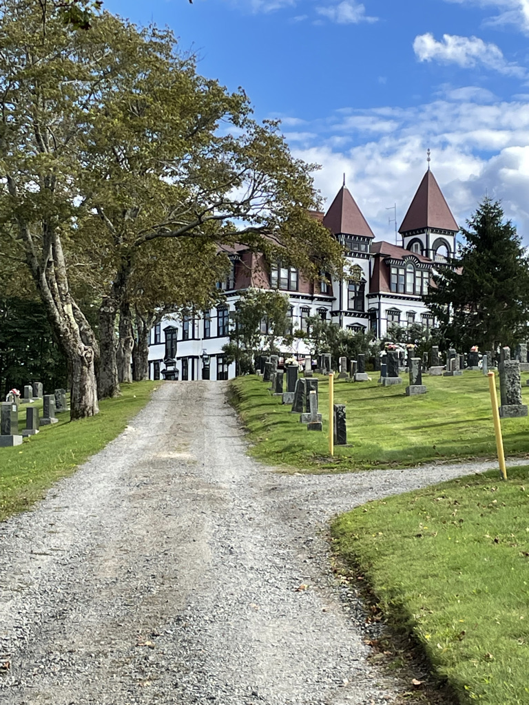
In June 2022, I completed the 700 km Island Walk, around Prince Edward Island. You can read about that walk over several posts, starting with this one.
This was before Hurricane Fiona caused so much damage on the Island, impacting many of the places which I had visited. Some of what I describe below may have changed by the time you do the Island Walk, but please, don’t let that stop you. PEI needs your tourist support as it recovers.
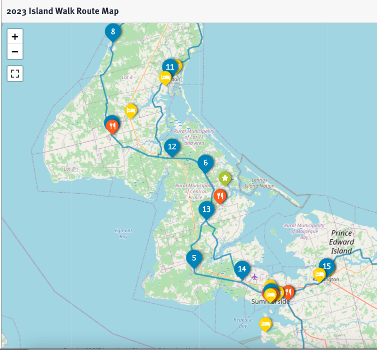
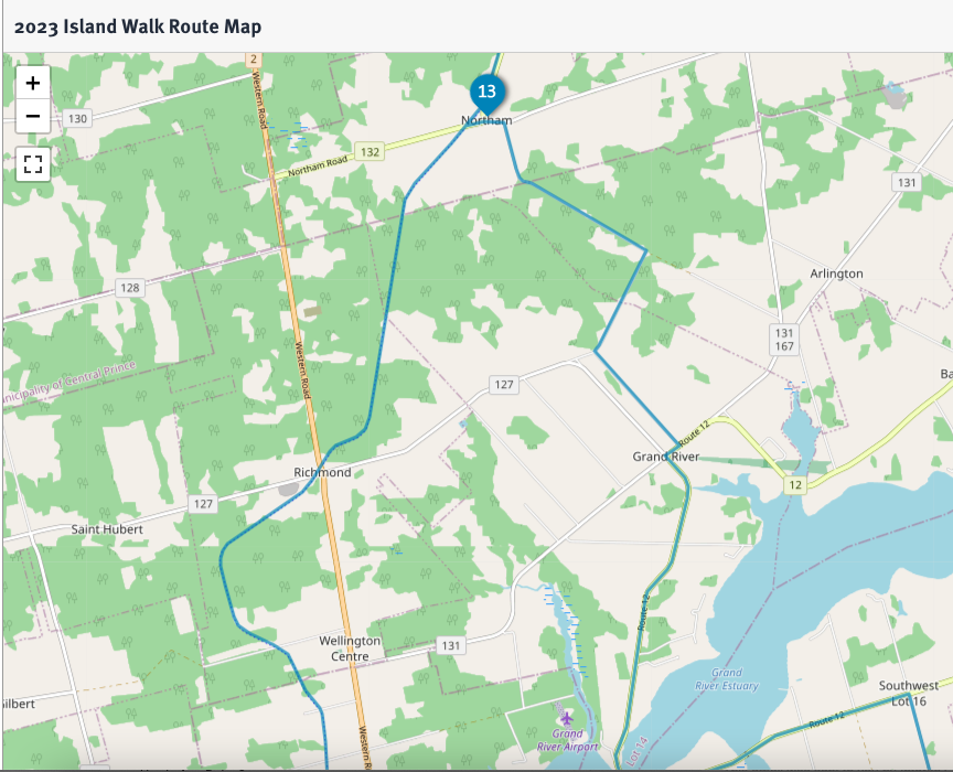
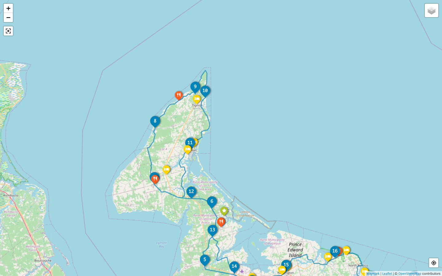
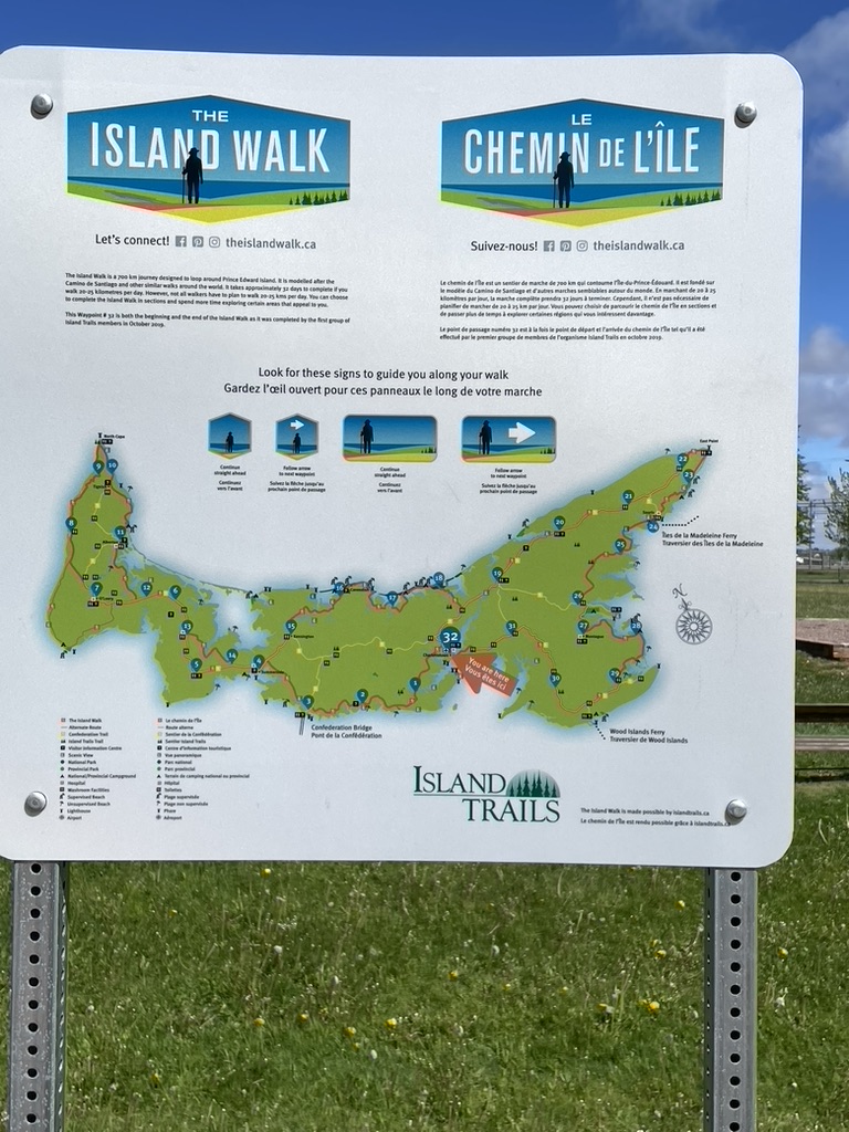
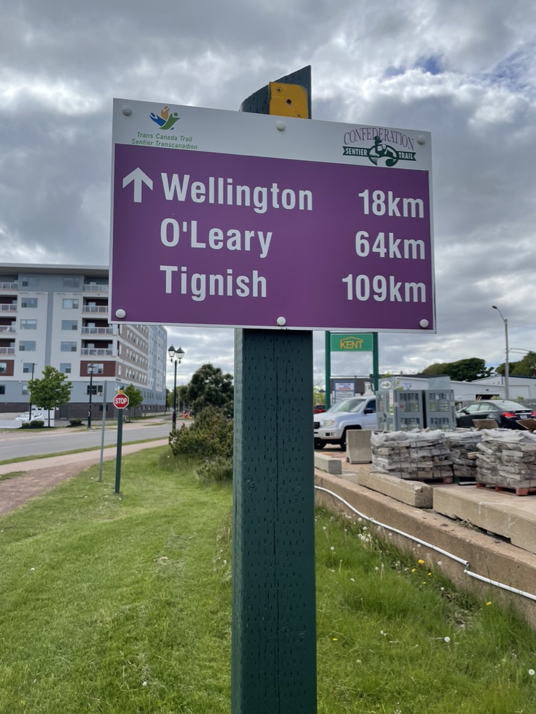
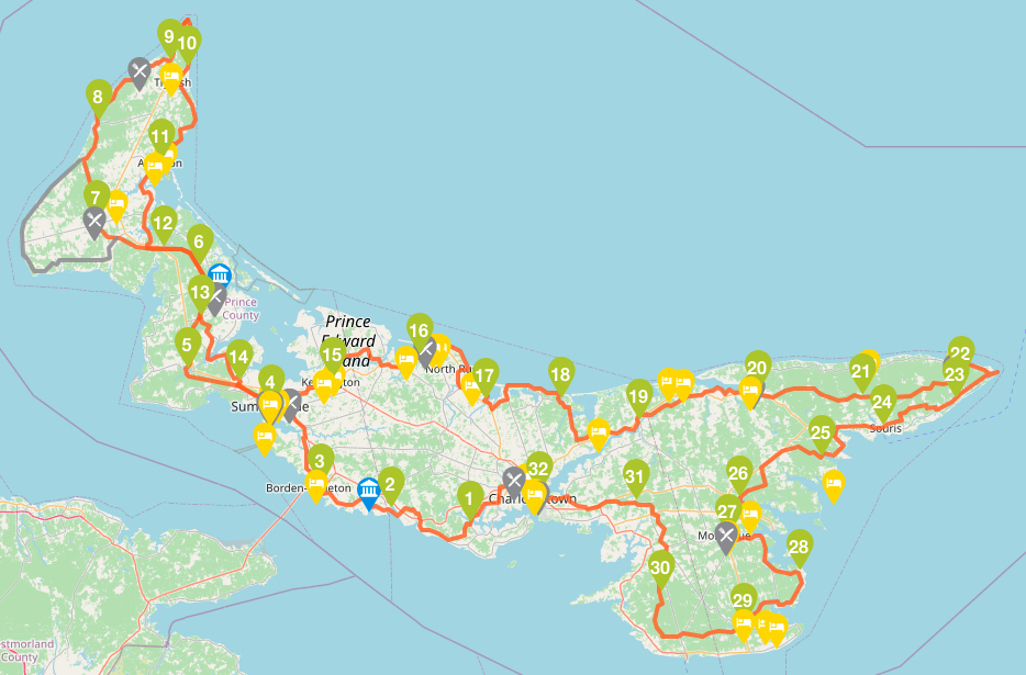
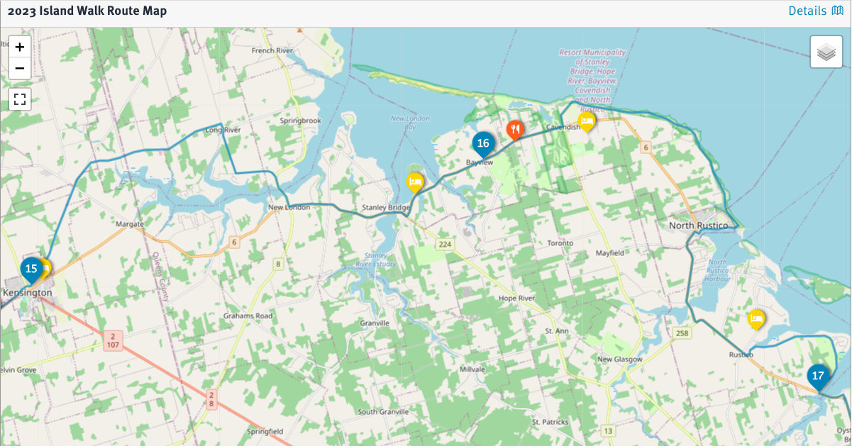
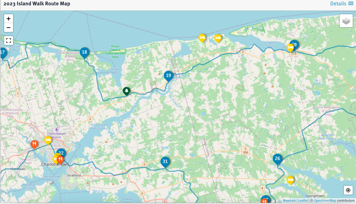
This post is about days 14-19 of my walk, between Kensington and North Lake. The links below have the details from the Island Walk website for the Sections that I covered.
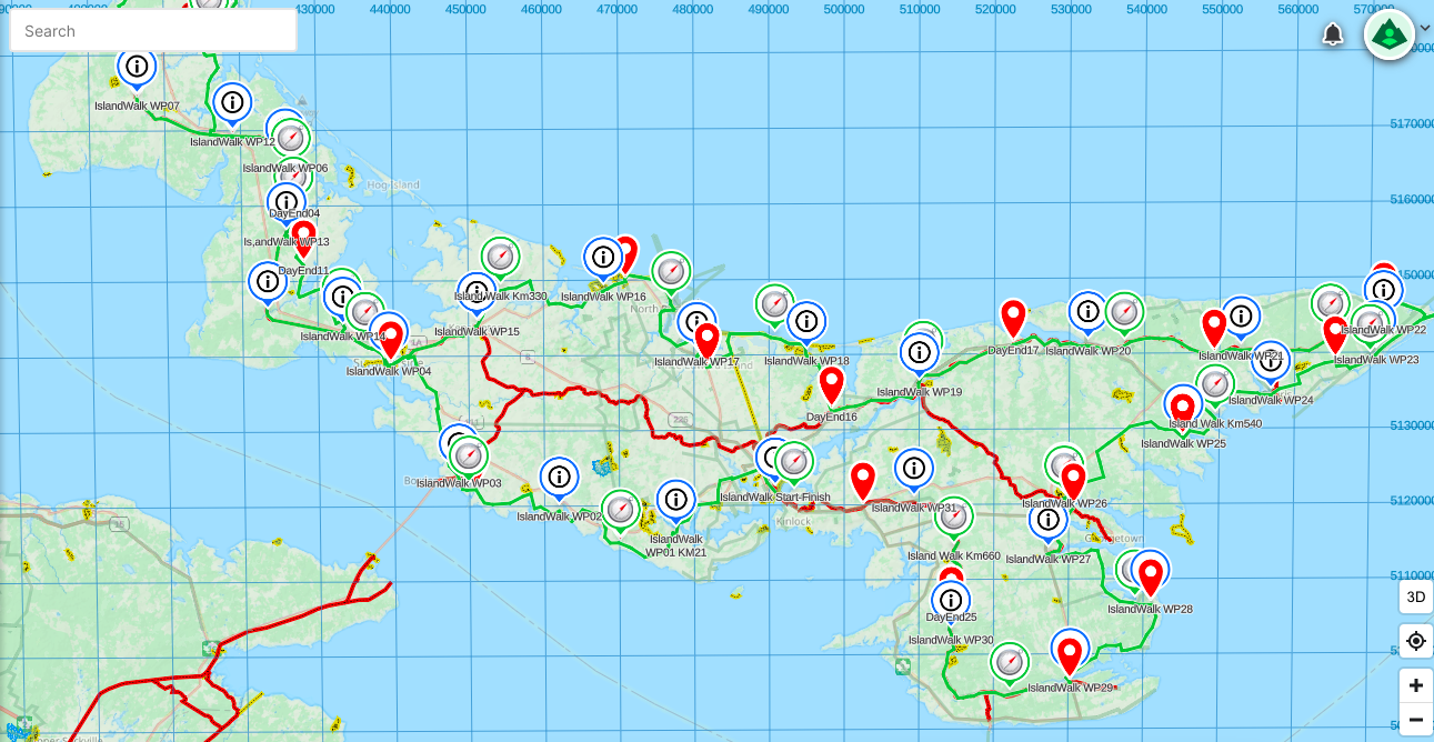
Note, by the way, that the section #s on the official website are somewhat confusingly labelled based on each start point, and since the overall walk start point is also the finish point, the 1st section is labelled as “32-1” with its accompanying web page titled as Section 32 (because it starts at the end of the last section, which is section 32) and goes to the end of section 1; thus the 2nd section is labelled as “1-2” and its webpage is titled Section 1, and so on. Whatever, the links below reflect the sections as I walked them.
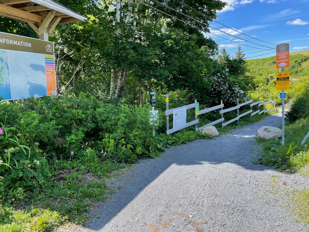
- Section 15-16 – 24 km from Kensington to Bayview
- Section 16-17 – 24 km from Bayview to Cymbria
- Section 17-18 – 21 km from Cymbria to Dalvay
- Section 18-19 – 23 km from Dalvay to Mt Stewart
- Section 19-20 – 27 km from Mt Stewart to St. Peter’s
- Section 20-21 – 23 km from St. Peter’s to New Zealand
- Section 21-22 – 21 km from New Zealand to Elmira
I highly recommend that you use the Island Walk website and its directions for the details of the official route, since that route can change from time to time such as for detours around major road works. That said, I also encourage you to use the official route and its sections as a starting point. Find your own pace, detour as and when your fancy takes you, walk the sections in whatever order seems sensible, and remember – everybody walks their own camino.
If you are planning on doing the walk in chunks spread over several months or years, this portion is self-contained and covers the most scenic and popular portions of the island, including the famous Ann of Green Gables and Prince Edward Island National Park along the north shore.
Anne of Green Gables Country
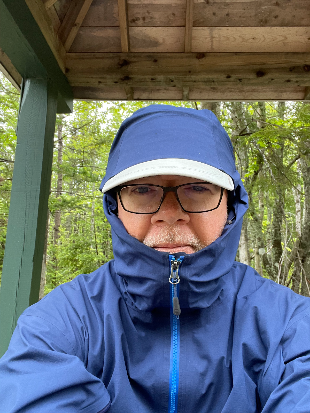
Day 14 of my walk dawned to rain, which was forecast to continue all day. I had known when I started the journey that sooner or later I’d have a walk-all-day-in-the-rain day, so in a back-handed way I was actually looking forward to demonstrating my resolve. A little rain can’t stop me! But within limits – I’m a pilgrim, not a martyr, so mostly I just wanted to get it over with.
And deep, deep down, more than anything else, I was excited. First because this was Halfway Day, when I would complete Section 16 of the 32 sections of the Island Walk. And second, this was my last solo day – Ann was joining me the next day, and I was keen to see her and to prevail upon her patience in acting as my transport Sherpa the rest of the way.
Since I was walking out of my hotel in Kensington to the start of Section 16 down by the old train station, I needed no drop-off that morning. Instead, I had arranged for Stanley MacDonald, who’d provided driving services for me over the past few days, to pick me up at the Tourist Info centre in Cavendish, about 5 and half hours of walking away, so all I had to do was get there.
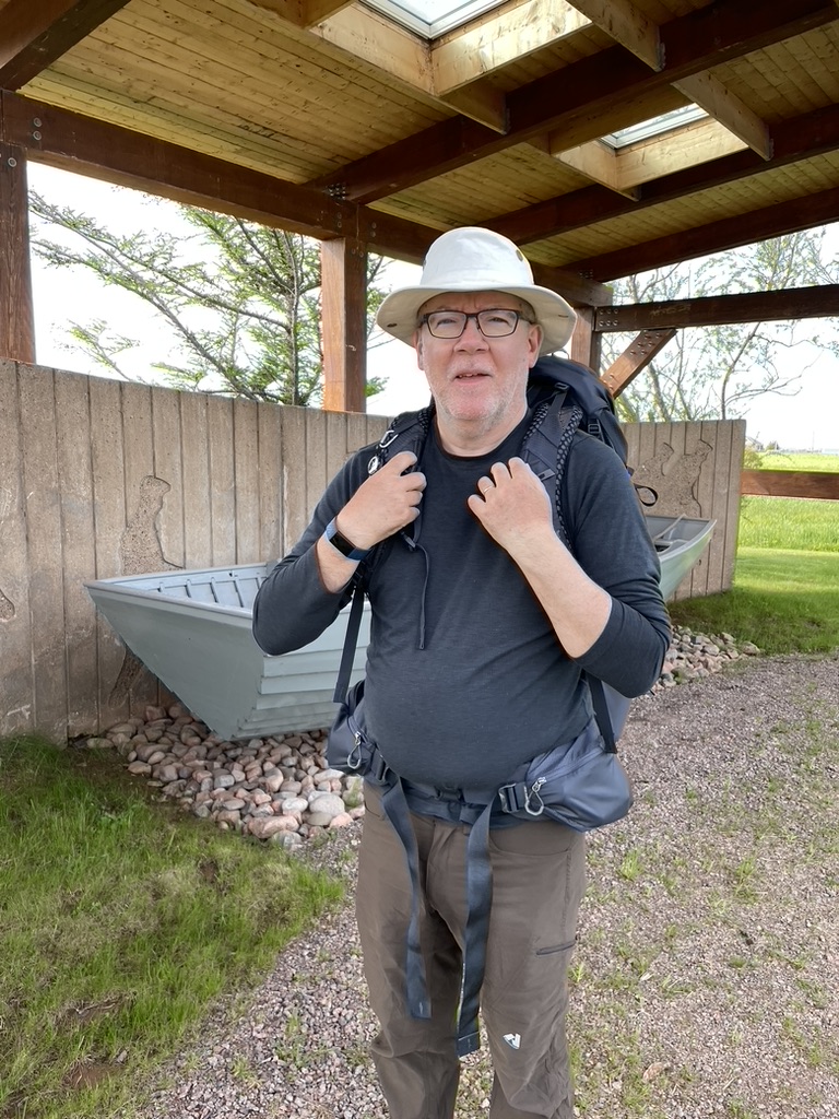
I packed a top-to-bottom change of clothes into a dry bag that went into the bottom of my pack along with the usual snacks and water and lunch and a fleecy. I put on my rain gear, tucked the rain cover onto my pack, took a deep breath, and stepped out into the wet.
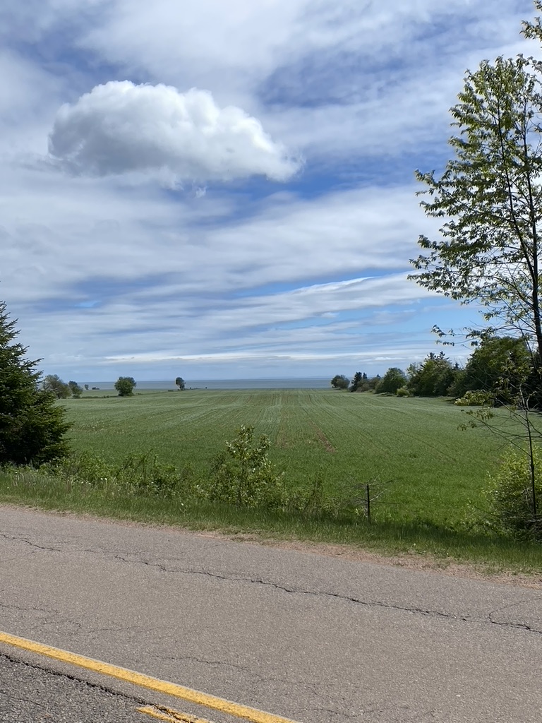
The Island Walk website describes Section 16 as “a road walk with spectacular ocean views, fishing villages, and a National Park.” That Section ends at Bayview, just outside Cavendish, so my goal was to complete all of it and then continue for the first 2 km of Section 17 to reach the Tourist Info office. That made for about a 26 or 27 km day, not too bad on a dry day, and adding those couple of kilometers would mean that for the next day, I could dawdle along the beach between Cavendish to North Rustico – that would be the candy. To earn it, though, I had my eat-your-roughage day in the wet.
Road walking can be tedious at the best of times, and wind-driven rain doesn’t improve things. Sights are subdued in dull light and mists, and puddles must either be skirted past, jumped over, or squelched through. Thankfully, traffic was relatively light on Route 101 heading north east out of Kensington, and drivers were courteous in giving me a wide berth to avoid splashes.
At Burlington, I turned off of Route 101 onto the smaller Route 234 heading east, and found even less traffic. The rain was steady, voluminous, a keep-the-farmers-out-of-the-fields drenching. No rain gear keeps you completely dry – any level of exercise has you sweating underneath, and eventually it “wets out” as the water-resistance is overwhelmed and starts to let water seep through the saturated material. I hit that point about an hour and a half into the morning.
I plodded along, and noticed a car slowing as it passed me, then pulling over. The driver reversed a bit to meet me and rolled down her window. She had a kindly, grandmotherly face framed by silver hair, and a concerned look on her face as she asked if I needed a lift. “No thank you”, I said, “I’m actually doing this on purpose – I’m doing the Island Walk”. Raised eyebrows, a slight frown. “Well you get yourself a nice hot cup of tea and some dry clothes as soon as you can”, she advised, and drove off shaking her head at the madness of tourists.
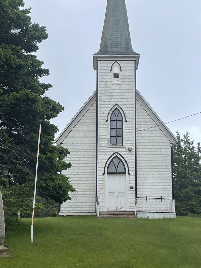
Two hours in, reaching Long River and turning onto the Long River Road to head south, I was ready for a rest break. During my nightly recon of the route, I’d noticed a church that I reckoned must be nearby, and quickened my steps as the steeple came into view. My heart sank when I saw that it had been closed and the front steps removed. There were no picnic tables or benches outside, and no other obvious place to sit, just an old and tired chestnut tree that drooped like my spirits, but offered a grudging bit of shelter while I stood and ate an energy bar.
Leaving that modest comfort, I turned east onto Marks Road. A wave of gloom lowered over my shoulders as I looked down at the road surface, which faded from pavement to gravel to red dirt mud within a few meters. Looking up from the mud, my mood plunged further, as looming in front of me was the steepest hill
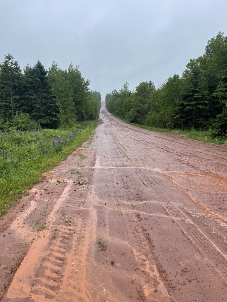
I’d seen on the island so far, just as the rain increased in intensity. Rust-red muddy rivulets cascaded down its slippery surface. I trudged slowly upwards, thinking, “please, please, please, don’t let a truck come bounding over the hill just now”.
Cresting the rise at last, I paused to look back over my shoulder. My imagination tried to fill in the gaps in what might have been a lovely view, now obscured by hazy mists and foggy grey clouds. Nothing for it but to continue, following the Island Walk markers as they led me onto Route 20 towards New London.
After about 2 and half hours, soaked with sweat but growing chilled, I desperately wanted a proper, dry, rest break. Just after crossing the Long River, I started to climb the hill out of the valley, and saw the Sou’west Cafe out of the corner of my eye. It looked open, though it was only about 11:00 and early for the tourist season.
I splashed up to the door and sloshed myself inside, to stand there puddling and steaming as I looked around. There were no other customers, just two servers setting up for the afternoon. “Table for one?”, they asked. They ignored my dripping, pointed me to a table, and brought me a very welcome pot of tea while I stripped off my soaked outer layers.
It took more than a few minutes to re-energize on caffeine, and steel myself to re-don my wet rain gear. I reckoned I was about 2-3 hours from Cavendish, and the rain wasn’t letting up.
Continuing on Route 20, within a kilometer I came to New London and passed the Lucy Maud Montgomery birthplace museum. It wasn’t a day for diversions, however, and it didn’t even look open, so I continued onto Route 6 towards Stanley Bridge. Tour buses appeared, with the early season Anne of Green Gables crowd, who stared out of their foggy windows at the madman in the blue rain gear trudging beside the road.
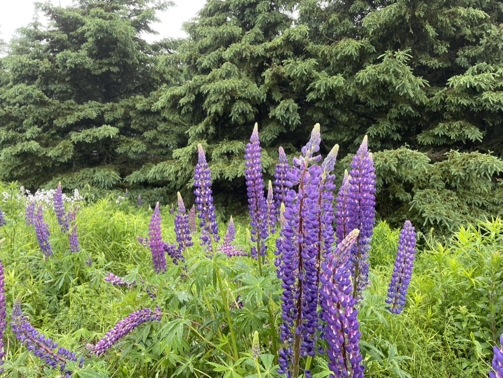
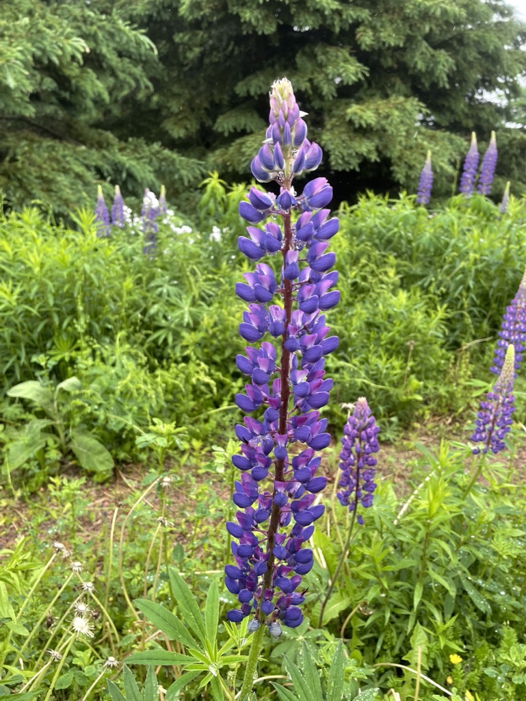
Past Stanley Bridge, the road turns northeast and climbs slowly up low rounded hills towards the community of Bayview. The consolation of rainy days is that colours deepen, drops of water shine amidst palettes of greens, greys, and auburns, purples, pinks, and creams.
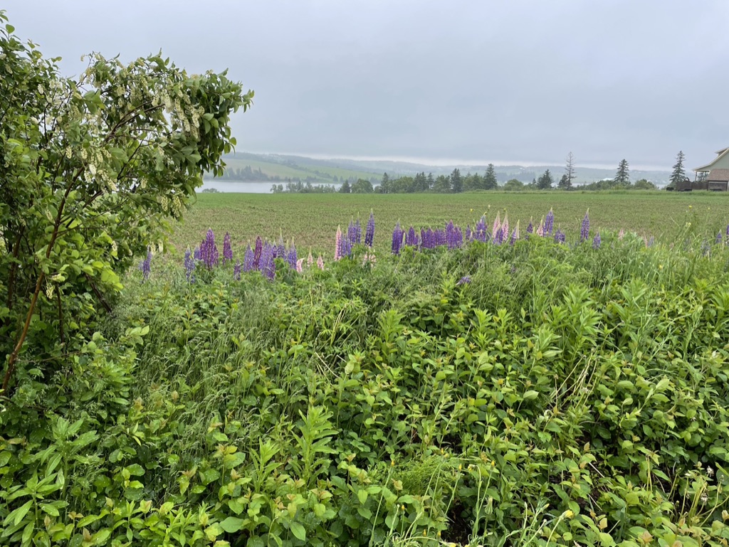
I stepped off the road a few times to try to find the perfect picture of lupins.

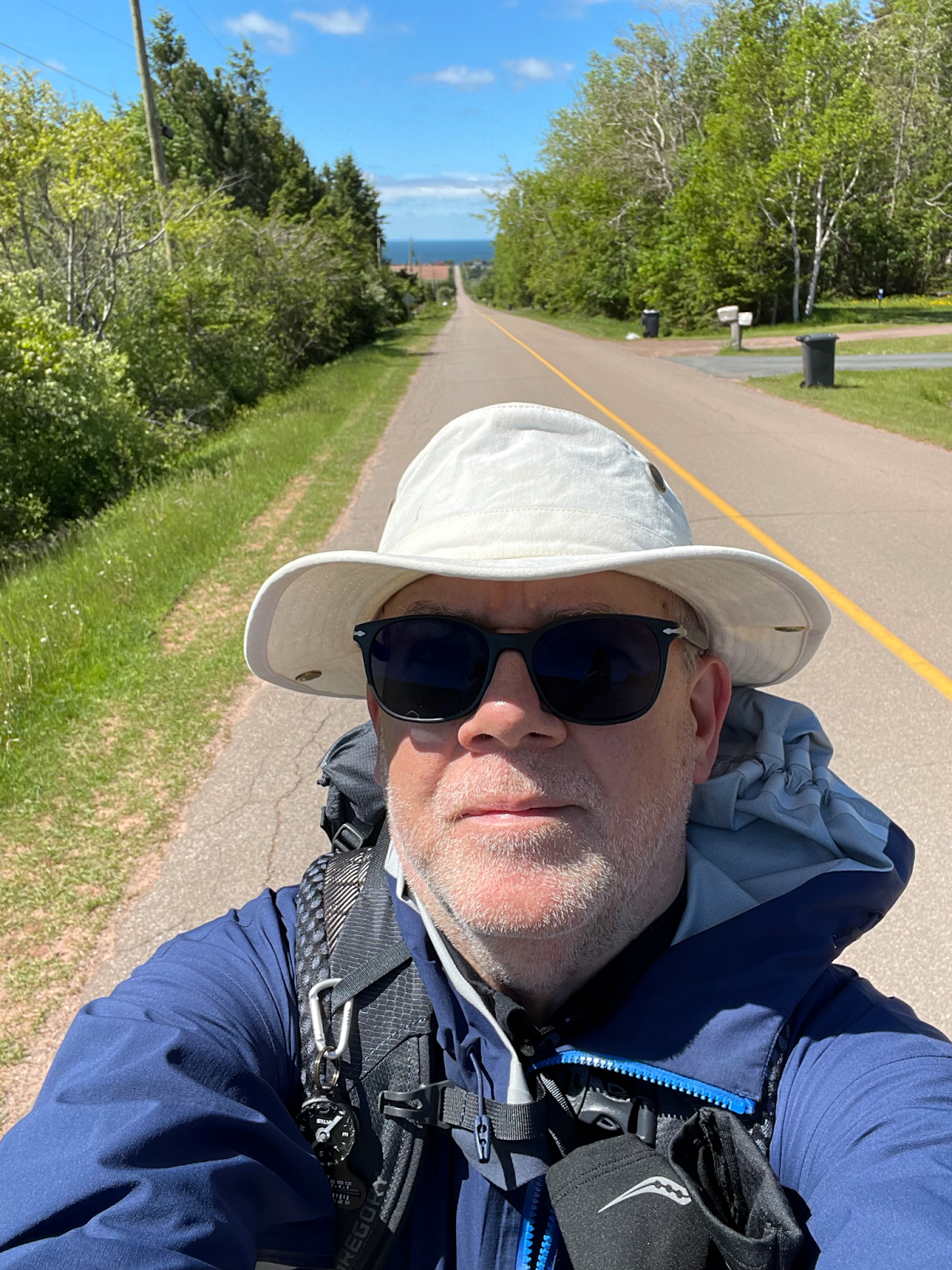
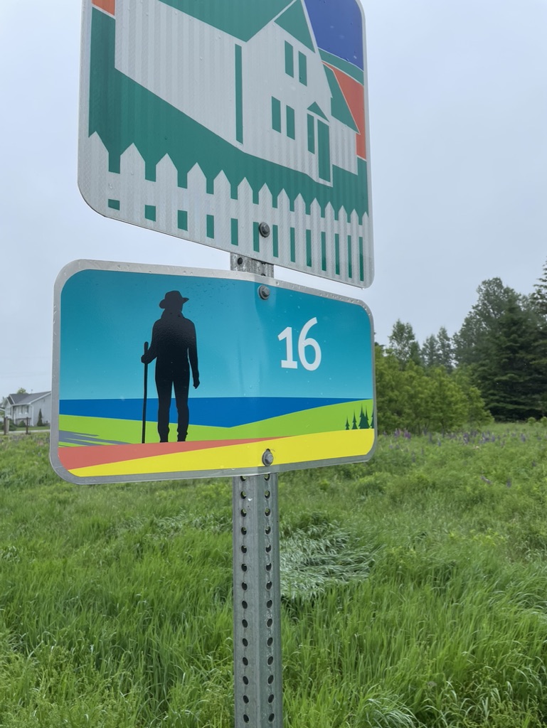
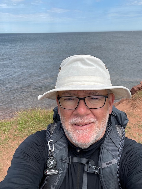
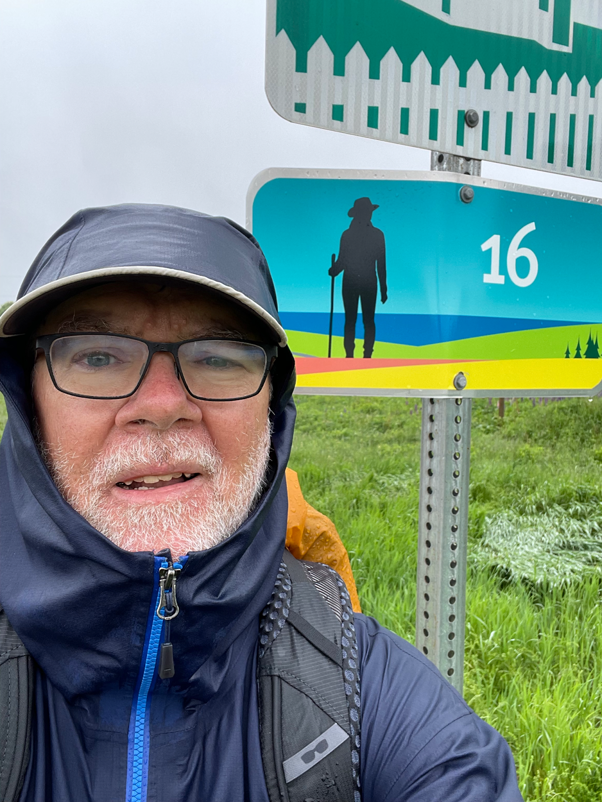
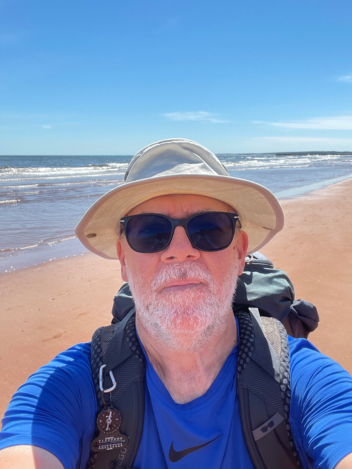
With a deep sense of relief at the thought that I was now close to Cavendish, and an even deeper sense of accomplishment, I stopped by the Island Walk marker sign that indicated the end point of Section 16, and took a soggy selfie.
By now I was on the outskirts of Cavendish, along a stretch of Route 6 that’s lined with tourist shops, cafes, sightseer-lunch-specials, hotels, motels, campgrounds, and golf courses all hawking Anne of Green Gables in one form or another. I had about another 30 minutes to go to reach the Tourist Info centre. By this point, touristy tat was irrelevant – my only focus was reaching that goal. I trudged, splashed, climbed, and plodded to reach Cawnpore Lane, turning at last towards the sea at the top of a hill, and finally catching sight of the Tourist Info building.
I must have looked pretty forlorn as I staggered through the doors. There were just two staff on duty, and no tourists other than my wet self. I dumped my pack from slumping shoulders, shrugged off the soaked outer layers, grabbed the dry bag from my pack, and sloshed off to change.
I felt much more human when I emerged from the washroom in fresh clothes, able at last to look around at some of the posters and maps, and form actual words in actual sentences to speak to the two staffers. “I’m doing the Island Walk”, I said. The attendant smiled ruefully – “We’ve had a few others earlier in the season, but not many. You’ve picked a good day for it.”
They kindly left me alone to eat my lunch while I slowly warmed and dried, still feeling bedraggled and spent. It was only then that I looked at my watch, to realize that I was nearly an hour ahead of the pick-up time I’d arranged with Stanley. The miserable weather had pushed me along faster than I’d realized.
Fortunately, when I called Stanley he happened to be nearby on other business, so it wasn’t long before I was back in my hotel. Everything I’d worn, my pack, my boots, were scattered about the room and over every chair, crowded near the heating, and I collapsed after a long hot shower. What a day.
The North Shore
The next morning, after packing up and checking out of my hotel, I looked out for my ride. I had booked a local taxi, as I’d said thank you and farewell to Stanley the night before; he was off all day with some passengers from the first cruise ship of the season. When the taxi arrived, I once again answered the inquiring look at my pack with the explanation that I was doing the Island Walk. Has no one on this Island heard of it?, I thought.
I marvelled at the change in the weather, which overnight had warmed by 15 degrees overnight and shed the gloomy rain for blue-skied sunshine and warm breezes. I was eager to continue along Section 17, which the Island Walk website calls “a walk along a paved hiking trail, followed by a beach walk into North Rustico and a road walk to Cymbria.”
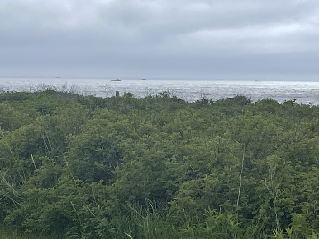
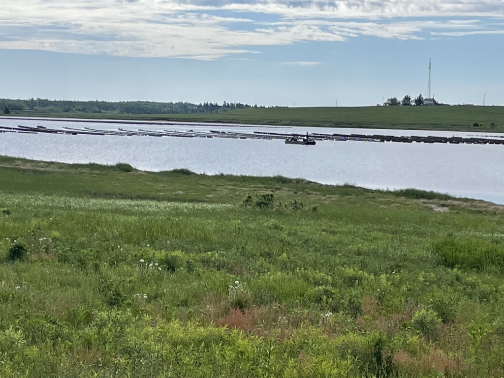
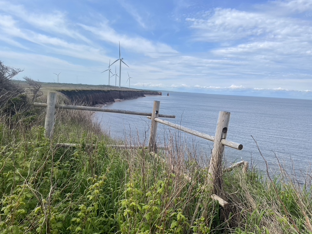
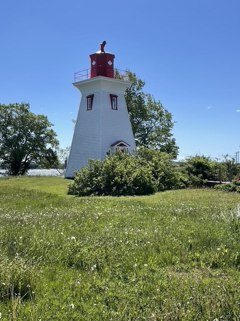
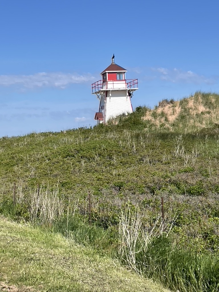
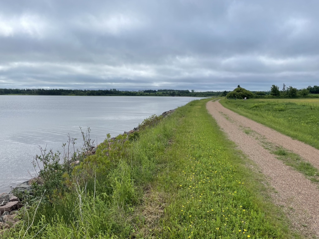
After a short walk north up Cawnpore Lane from the Tourist Info centre, I entered Prince Edward Island National Park, the sea glinting beyond dune grasses and shoreline trees. The roadway here parallels the shore, and the walking/biking trail parallels the road. The views over the water were sublime, with fishing boats chugging close to the shore trailing an escort of gulls wheeling above.
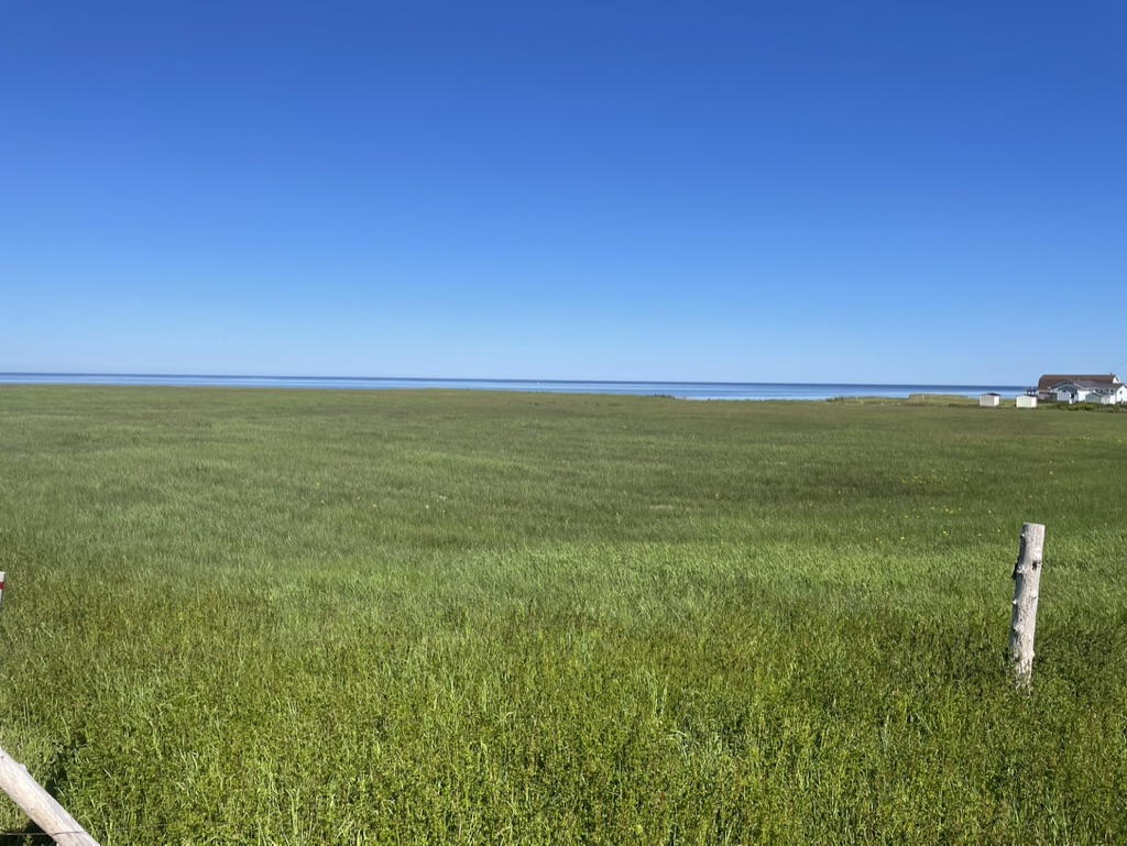
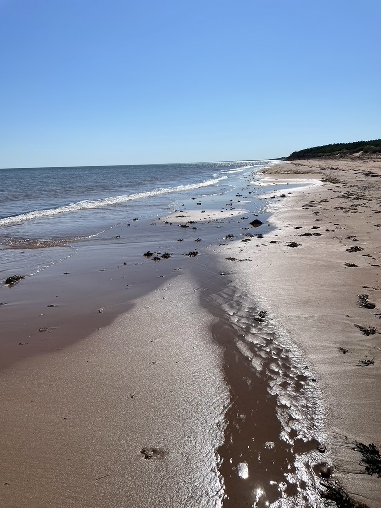
I couldn’t help giving up on the trailway after a few kilometers, instead descending to the beach. The tide was out, leaving firm sand to follow all the way to the North Rustico harbour.
It was magical, the best part of the walk so far. The hazy blue of the sea blending to a whitish, greyish horizon, and then upwards the haze thinning and fading into a cloudless azure sky. Gulls, sandpipers, and a few fishing boats offshore. A few people off in the distance, but otherwise just my thoughts and a bottomless well of contentment; the pilgrim’s peace.
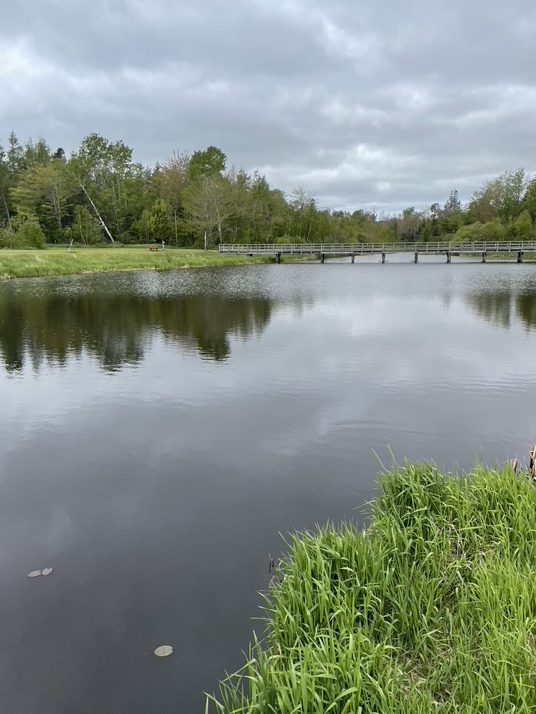
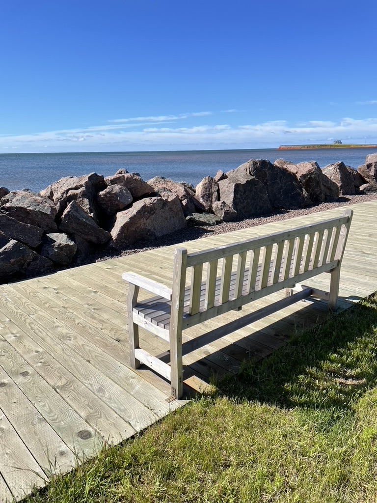
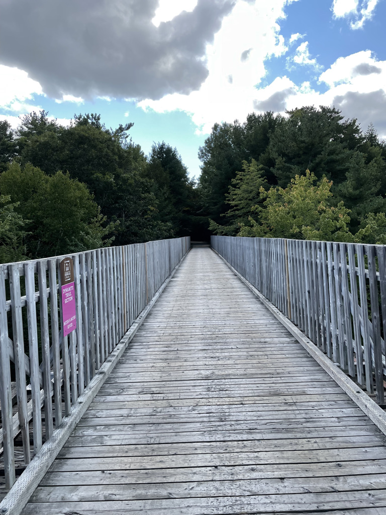
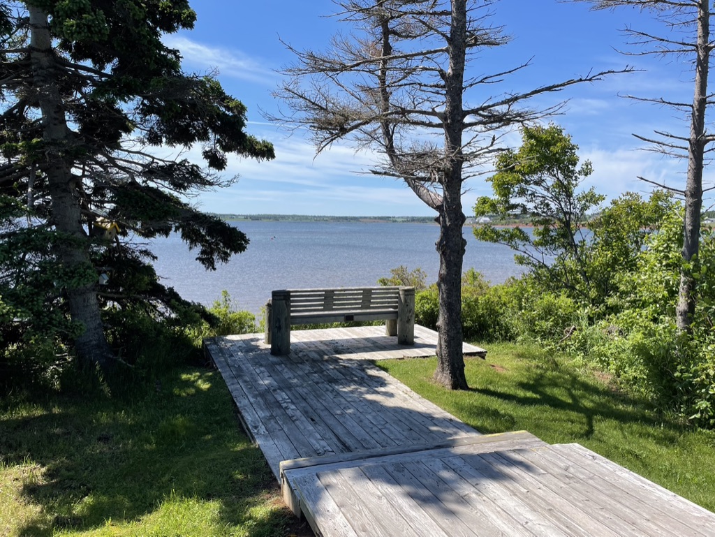
A timeless, effortless stretch. And then as all things must, an ending, as the mouth of the harbour forced a turn off the beach, past the Blue Mussel Cafe where Ann and I had enjoyed fabulous shellfish fresh from their own mussel beds a few hundred meters away, just before I started the Walk – it was tempting, and I might have stepped in, but I was on a schedule. I followed the road southwards towards North Rustico itself, and in compensation, soon came upon a beautiful wooden boardwalk
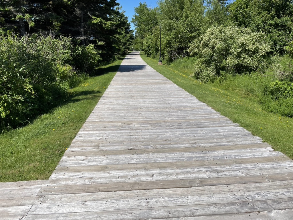
which lined the harbour for about 2 km towards the town. I stopped here at a bench overlooking the water, and savoured my picnic lunch.
I couldn’t believe the contrast between the previous day’s saturated slog and this day’s sunshine. Basking, face turned up the sky, eyes closed, I tried to soak up everything – the warmth, the quiet, the journey. Thinking of Ann and meeting up with her once again, got me back to my feet.
The Walk route takes you from the harbour boardwalk up through the park and into the town of North Rustico proper (where, by the way, there are a number of shops, restaurants, and places to stay), and once onto Route 6, it follows the road southeast towards the Hunter River bridge at Rusticoville.
Continuing from there, you climb the hill and follow Route 6 towards South Rustico, to then turn north along Grand Pere Point Road for a nice little 5 km loop diversion past marshes and fields and pastures
and then a golf course (where I stopped on a bench in the shade for a water break), before rejoining Route 6 again, at the bridge at Cymbria which completes Section 17.
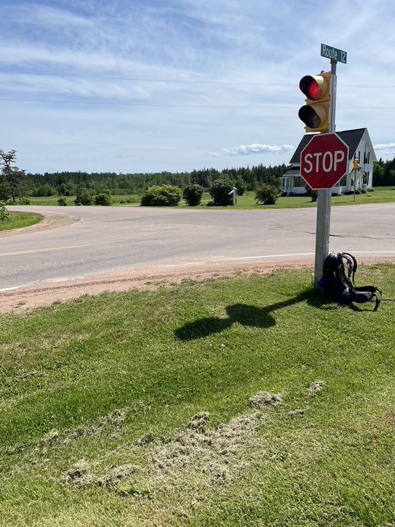
By now I was flushed and sweaty, feeling the day’s distance with a full pack – a few more kilometers to go. From Cymbria, following Route 6 once more, I completed the first couple of kilometers of Section 18, till I reached the crossroads at Oyster Bay Bridge. There, outside the petrol station by the roundabout, Big Mamma’s Pit Stop takeaway offered a tempting chicken quesadilla.
I’d only taken one bite when Ann pulled up, and after a quick hug, she sat down at the picnic table with me while we demolished the food and got caught up on news. From there, we headed to the accommodations we’d booked in Murray Harbour. It was good to be a team again.
When I’d looked at the 2nd half of the route in late spring while researching the Walk, it had seemed to me that making a base somewhere around Montague would be best, since that’s relatively central to the remaining Sections over the eastern end of the Island. Unfortunately, I’d reached this conclusion relatively late in the day, only a few weeks before I started, and by that point I couldn’t find any cottage or house to book in that area – something I wanted since it would be our base for 2 weeks.
So instead of Montague, we landed upon a converted church hall in Murray Harbour, now an AirBnB. It turned out to be a great choice as far as the home itself, but since Murray Harbour is further west and south than Montague, it did mean we had some long drives ahead of us to reach the eastern end of the island.
That evening, we chatted about what I’d seen so far, and about what was to come. But I felt like I was in a bubble, unwilling to emerge back into everyday life, and I doubt I was good company.
The next morning, day 16, Ann drove me back to Oyster Bed Bridge, to resume where I’d left off on Section 18 – “A road walk in the Park, with great Gulf views. Lots of opportunities to beach walk.” This follows Route 6 east for a bit, and I had just set off when a van pulled up alongside me.
The driver and his wife wondered if I was doing the Island Walk – “Yes, day 16 for me”. We chatted briefly, as they explained about some of the lovely scenery ahead of me, and they wished me well as they drove off. They were amongst the first Islanders I’d met who seemed quite familiar with the Walk, because, as I learned, they had done it themselves and were good friends with one of the original Walkers (Bryson Guptill) who had first mapped the route back in 2019. It felt great to be recognized as part of the Island Walk club.
Continuing along Route 6, quite soon I reached the turn to the north where I re-entered Prince Edward Island National Park, and rejoined the trail along the water’s edge. The weather again featured gorgeous sunshine and warm breezes, carrying me along with the infectious energy of early summer. At Cape Stanhope,
tired of the paved walking/cycling trailI, I cut down to the beach as I had the day before,
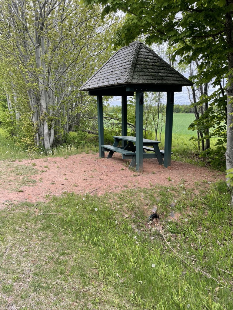
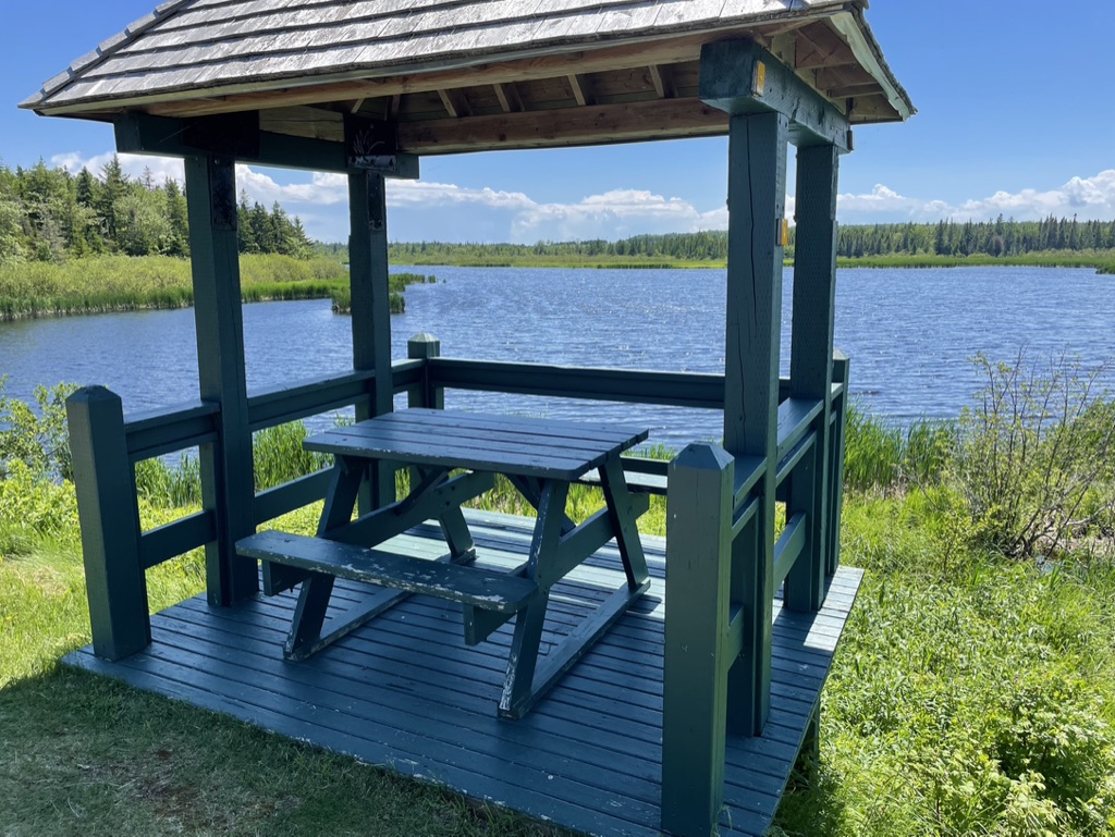
and once again strolled along the hard-packed sand for several kilometers. Near the Dalvay-by-the-Sea resort hotel, I emerged from the beach to find a seat under a shaded picnic shelter, a relief from the now-hot sunshine, and savoured a picnic lunch. Glorious.
From Dalvay, the route resumes on roads, heading south to exit the park and rejoin Route 6, completing Section 18. I had more planned for my day, however, continuing from here to target the first part of Section 19, “a road walk to the Confederation Trail, then trail walking through marshes.” I planned to do about half the Section that day, and had arranged for Ann to pick me up where the route rejoined the Confederation Trail at Bedford Station.
The warm morning sun had by now become a blazing 30C afternoon, and turning inland away from the sea I had lost the fresh ocean breeze. By the time I reached Grand Tracadie, it was a proper hot summer day, and my energy levels had melted like a snow cone in the sun.
I found a shaded picnic table in a little community park, and had a welcome break. From there, the Confederation Trail crossed Route 6 about an hour down a gently undulating road, past farms and fields, green and lush with promise. I poured myself sweatily into the car when I reached it, and turned the air conditioning to full for the ride back to Murray Harbour.
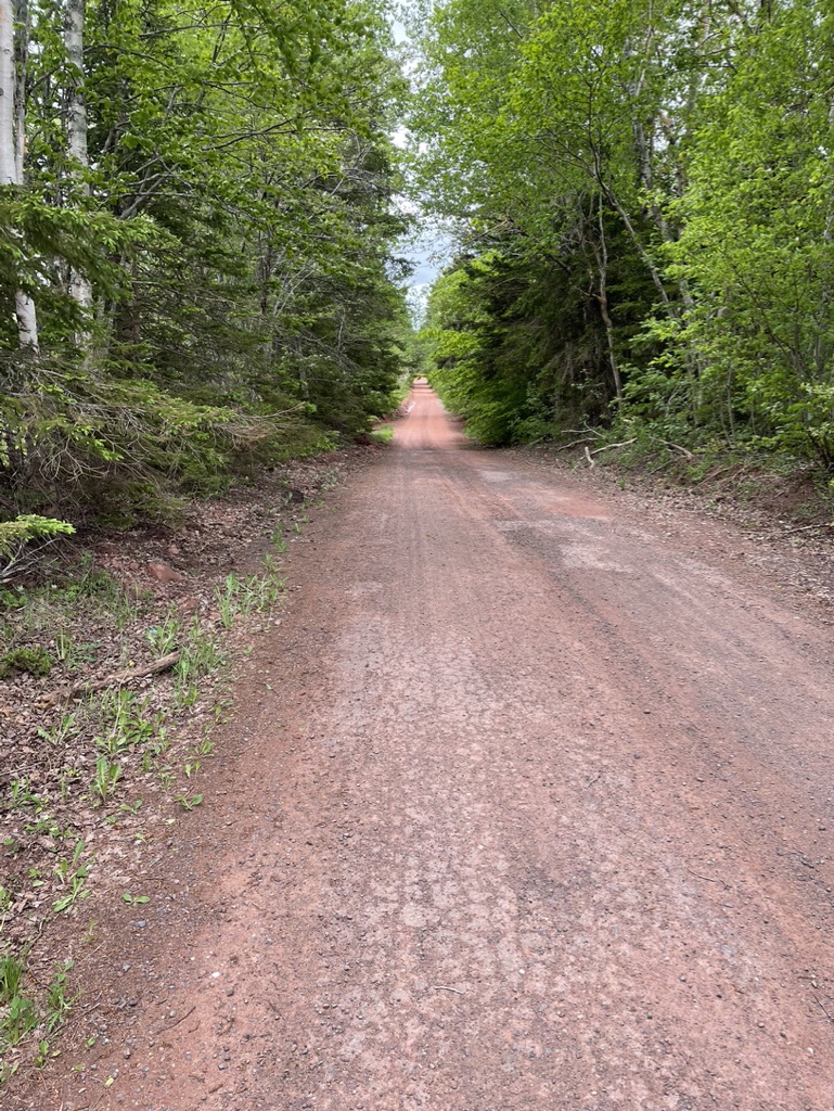
Back on the Trail to Morell
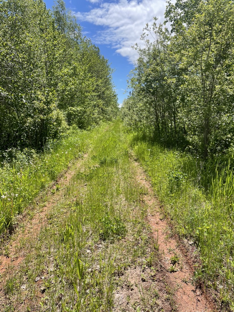
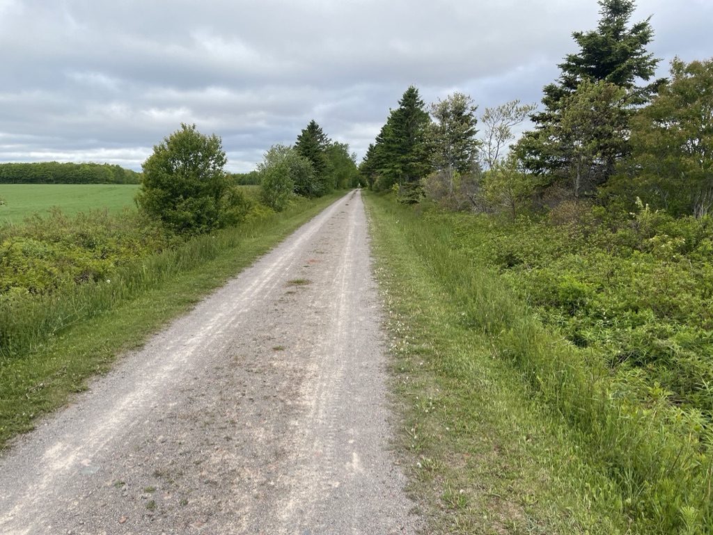
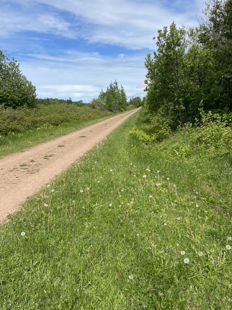
The next day was cooler and there was some rain in the air. After days of road walking, it was a relief to get back onto the Confederation Trail at Bedford Station to resume Section 19. There was a bit of a breeze to help divert the bugs, and the flat gravel surface felt kinder to my legs and feet than the crumbled asphalt of highway shoulders.
After 2 weeks of walking, I had by now settled into a pace that I could pick up without thinking. On the flat, my stride was a steady 110 steps per minute, about 6500 steps per hour, and measuring off the map confirmed that that many steps equaled about 5 km. And since I measured out my route each night to confirm the next day’s total distance, I could work out from that total how many steps were needed to cover it and how many hours were needed.
This is how I worked out my target pick-up times for Ann. As I walked, a glance at my step counter thus told me how far I’d come and how far I had to go that day, so I could text her to adjust the pick-up time if needed.
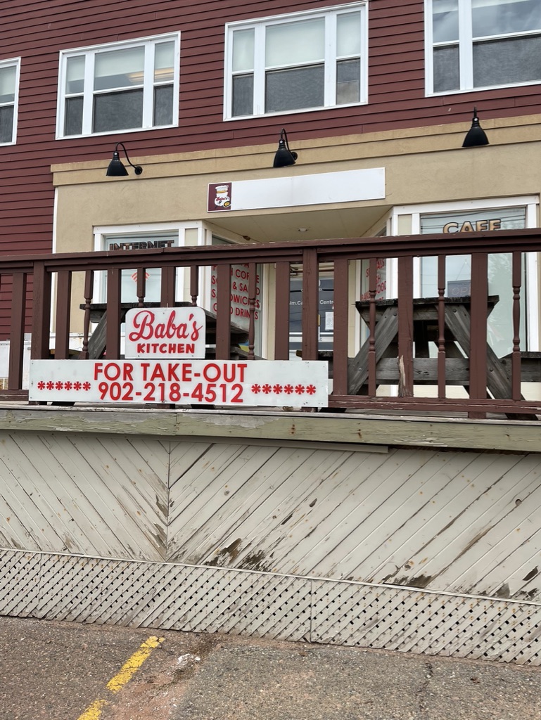
And that morning, with only a short water break sit-down needed on a cooler, easier day, my step counter told me I was making great time. I reached Mount Stewart to complete Section 19 just around mid-day. There, I took advantage of the In the Mix Bakery cafe, which occupies part of the old train station, and voraciously scarfed a proper, old-fashioned, fry-up breakfast. I reckoned I’d walk off the cholesterol.
Tummy and water bottle filled, I headed back out onto the Trail, aiming for Morell, which is about halfway through Section 20. Sated from lunch, I was obviously eggs-and-sausage muddled as well, because I was about 5 minutes down the Trail when I realized I’d left my water bottle back at the cafe. Kicking myself for a ninny, I retraced my steps to retrieve it, and then hurried off to make up the delay. Still, in hindsight I don’t recall any other time when I left something behind after a rest stop.
As I continued along the Trail, my original quick pace slowed until I was stopping frequently for a rest. I seldom eat an eggs & sausages breakfast anymore, because it’s just too heavy for my middle-aged digestion. Fried foods in my diet had given way over the past few years to fresh fruit and veg, a little grilled meat or fish, lentils, and brown rice. My stomach was churning and gurgling (churgling?) like an old washing machine by the time I reached Morell to meet up with Ann, making for a butt-clenching ride back to Murray Harbour and a dash for the toilet. Lesson learned – your teenage constitution is in the rear-view mirror. Stick to your fruits and veggies.
Morell to North Lake
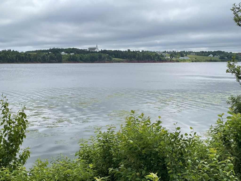
I felt better the next morning, Day 18, and looked forward to completing the remainder of Section 20 between Morell and St Peter’s Bay – “One of the most scenic sections of the Confederation Trail past bridges, fields and spectacular views of St. Peter’s Bay where you can see two lovely white clapboard churches.” This is the only part of the Confederation Trail that’s close to the shore, and the bloggers I’d read who’d done this had raved about it.
Ann dropped me in Morell, to continue on to St Peter’s Bay by herself to explore. Still early in the tourist season, I had the Trail mostly to myself. Peaceful, quiet walking, the views were lovely, though I couldn’t help feeling a bit let down. It was a bit lower-case when I’d expected upper, “wow” instead of “WOW”. Still, a charming yet sedate morning’s walk, like a stroll with your elderly auntie.
Near St Peter’s Bay, I passed a woman who was working in her garden which backed onto the Trail. She looked up and smiled, to ask if I was doing the Island Walk – “I walked the Dalvay to East Point portion last year – glorious. You’ll love the rest of this”, she said. I was just happy that someone had noticed that I was doing the Walk without my having to say so. Hurray!
Coming along the shore of St Peter’s Bay, there are two largish white wooden churches, and I found it amusing that one is high on a hill looking down on the other – no rivalry there I bet.
The Trail crosses the highway here and finishes Section 20 at the old rail station. Next to it there’s a small cluster of shops (including a very clean public washroom), and as importantly for me, the Black and White Cafe. It wasn’t yet mid-day and I’d only been walking for a couple of hours, but I decided to stop for an early lunch anyway. The breakfast burrito looked enticing, and with that and a proper large coffee I popped outside to enjoy them sitting by the water.
While I was eating, a couple appeared and claimed the other picnic table. I watched with interest as they produced from their knapsack, with an elegant flourish, a dozen fresh oysters and a bottle of wine, which they slurped happily while basking in the sun. My pack held granola bars. Good on them.
Rested and recuperated, I rose to set out on Section 21, “a peaceful walk through a forested section of the Confederation Trail.”
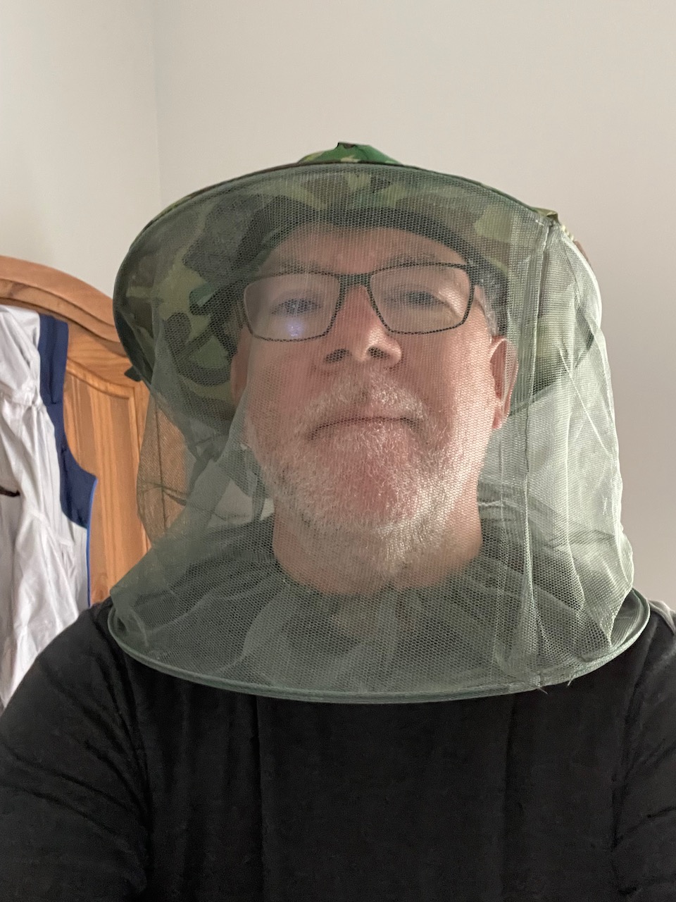
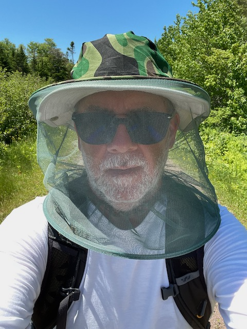
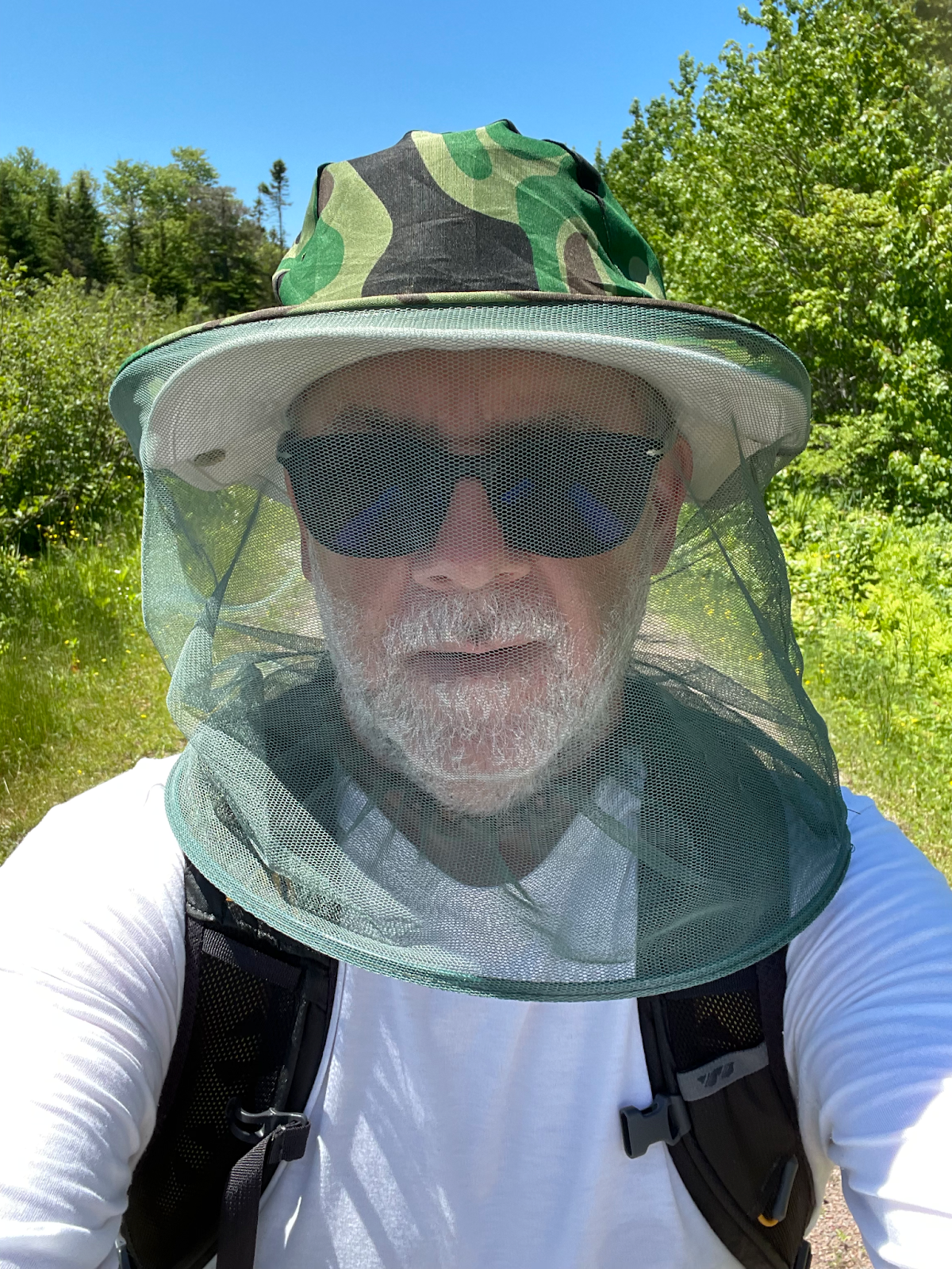
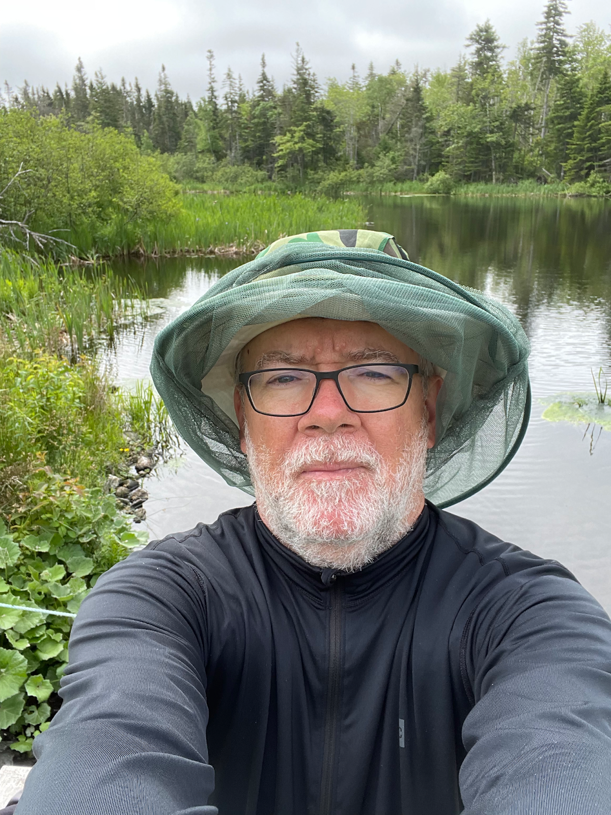
The path from St. Peter’s Bay leads gently uphill past small farms, peaceful in the sunshine, but while I was the only human on the trail, I was also the only lunch available for clouds of mosquitoes.
I dug into my pack for the $4 bug hat I’d purchased in Alberton, and wore it for the rest of the afternoon.
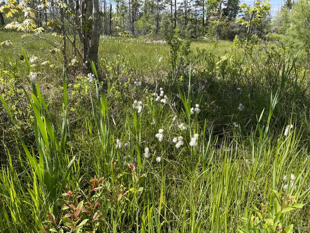
The breeze was blocked by the trees on either side of the Trail, and it was bordered by bogs and bushes though with occasional open spaces blessed with sun,
which I took advantage of for my rest stops. Otherwise, it was brisk walking, swatting and sweating under the hat.
Along here, walking in a bit of a mental fog, relaxed and zoned out, I was startled by a brown blur dashing at me low to the ground. It took a moment to realize it was a hen grouse,
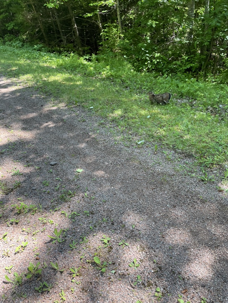
fluffing her feathers and dragging a wing as she tried to distract me, a threat from her chicks. She made a couple of passes, and kept up a constant cooing until I was safely out of the way. Looking back over my shoulder, I saw her shoo her young across the path into the deep brush.
Between the mosquitoes and the dark grey clouds I could see building behind me, I was moving along ahead of schedule, so I texted Ann to let her know. I reached her at my pick up point three-quarters of the way through Section 21, where the Trail crosses Bear River Road, about 5 minutes ahead of a dousing, and we drove through showers back to Murray Harbour.
The next day, knowing the relative lack of scenery on the Trail, I decided to do a longish 27 km day and finish this portion of my journey by completing the rest of Section 21 from Bear River Road to New Zealand, then walking all of Section 22 to Elmira, (the eastern end of the Confederation Trail), and finally to make a short start on Section 23 to finish the day at North Lake.
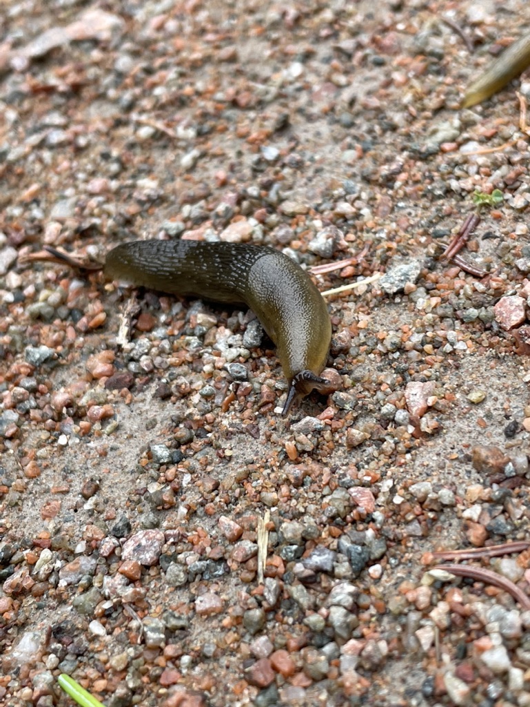
Ann dropped me off at what felt like the back of beyond at Bear River Road, and I started with a brisk pace. The dew had been heavy overnight, following the rain, and everything felt lush and dense. I was struck, as I had been several mornings when walking the Trail, to see so many fine fat little slugs making their way along. Their slow, patient, persistent slither held a metaphor for my journey.
I finished Section 21 in about an hour, at New Zealand. I was undeservedly amused by this, since I’ve been to the country of New Zealand several times and it doesn’t look a bit like this part of PEI. Bloody colonials naming everything after the old country regardless of the aptness of that comparison.
From New Zealand, Section 22 continues a “a walk on the Confederation Trail through a bird sanctuary and nature, including a spiritual spring next to the trail.” It was a similar walk to the day before. I had my bug hat on within the first 100 meters and wore it all the way to the ocean breezes at Elmira. Every rest stop brought swarms, with brief respites when the Trail edges opened out onto grassy fields. I did find a delightful little wooden bridge over a stream which made a fine morning rest stop.
And I also met a little friend along the trail – a baby skunk. When I spotted it, just a couple of meters in front of me, my brain frantically searched to recall whether skunks are born with fully developed spraying apparatus (no, not at birth), or whether they develop this ability as they matured (yes, at a few weeks old), though that was irrelevant since I couldn’t tell how mature the little thing was anyway. I didn’t want to find out first hand if this particular skunk could spray, but he or she was curious about, or perhaps dismayed by, this strange creature looming over it. It crouched and stared up from the middle of the path.

“OK little buddy, time to move along”. Nothing. “Shall I slide over this way?” Nothing. But the rustling in the grass beside me might have been Mother Skunk, so I scuttled left while the little one scurried right, and we both continued our ways along the Trail without me getting anointed, pilgrim though I might be.
The day passed quickly. While the Trail is easy walking, there’s little to see other than trees and bogs on either side. A pleasant diversion was the spring mentioned on the Island Walk website. An old wooden hand-painted sign pointed to the right, and up a little dirt lane to a clearing. There another sign pointed towards a small green pool, bubbles erupting like gentle frog farts from the spring below the surface. There was an old china mug there hanging from a tree branch. I passed on filling my water bottle, and instead drank in the calm of the leafy shade. Briefly. The bugs liked it too.
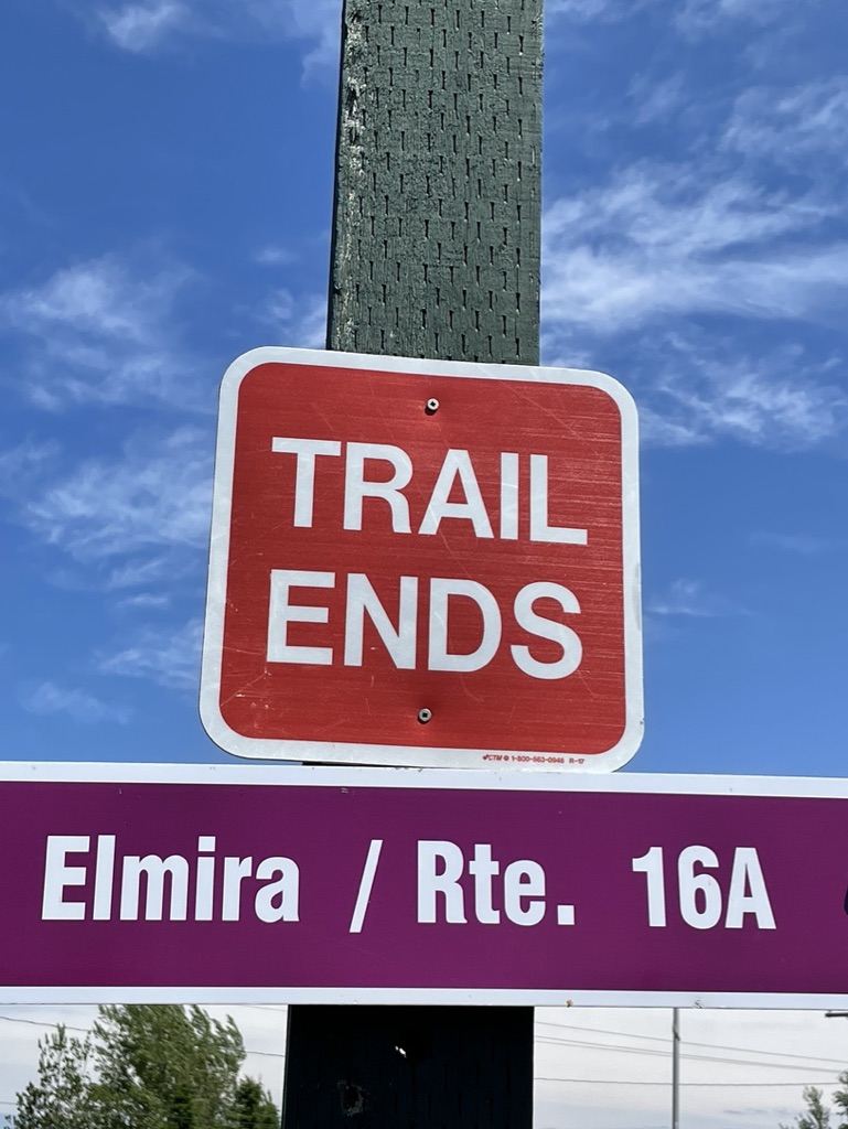
I reached Elmira well ahead of schedule, completing Section 22. There’s a cute little park, the Elmira Railway Museum, and a picnic area here, to mark the end of the Confederation Trail.
There was no one else around, and the buildings were closed. I sat for a long rest in the breezy sunshine solitude, glad to be away from the bugs. Pilgrims peace, once more.
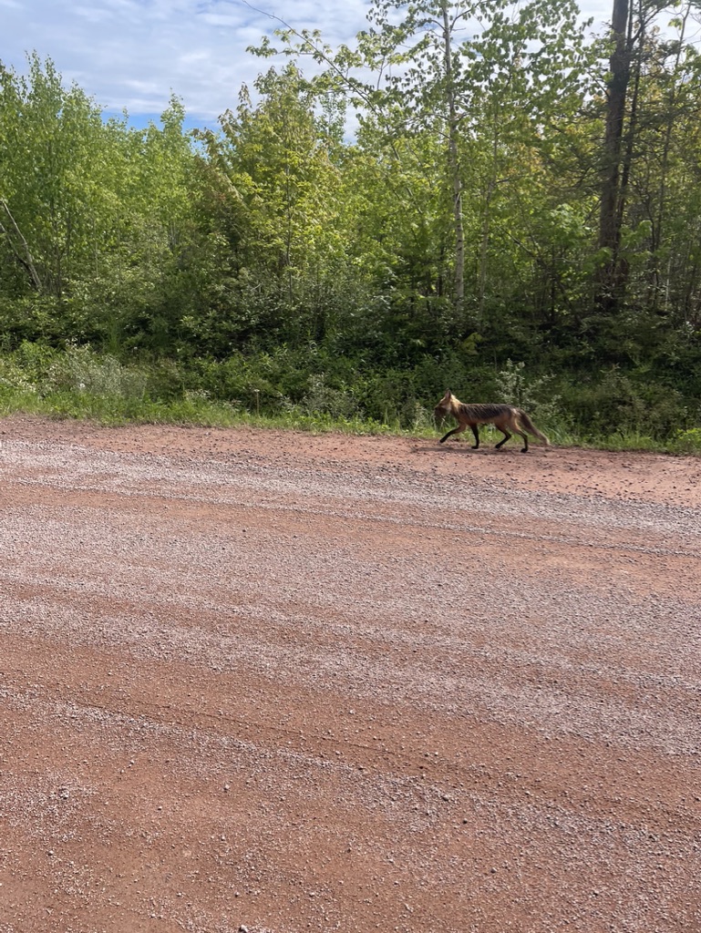
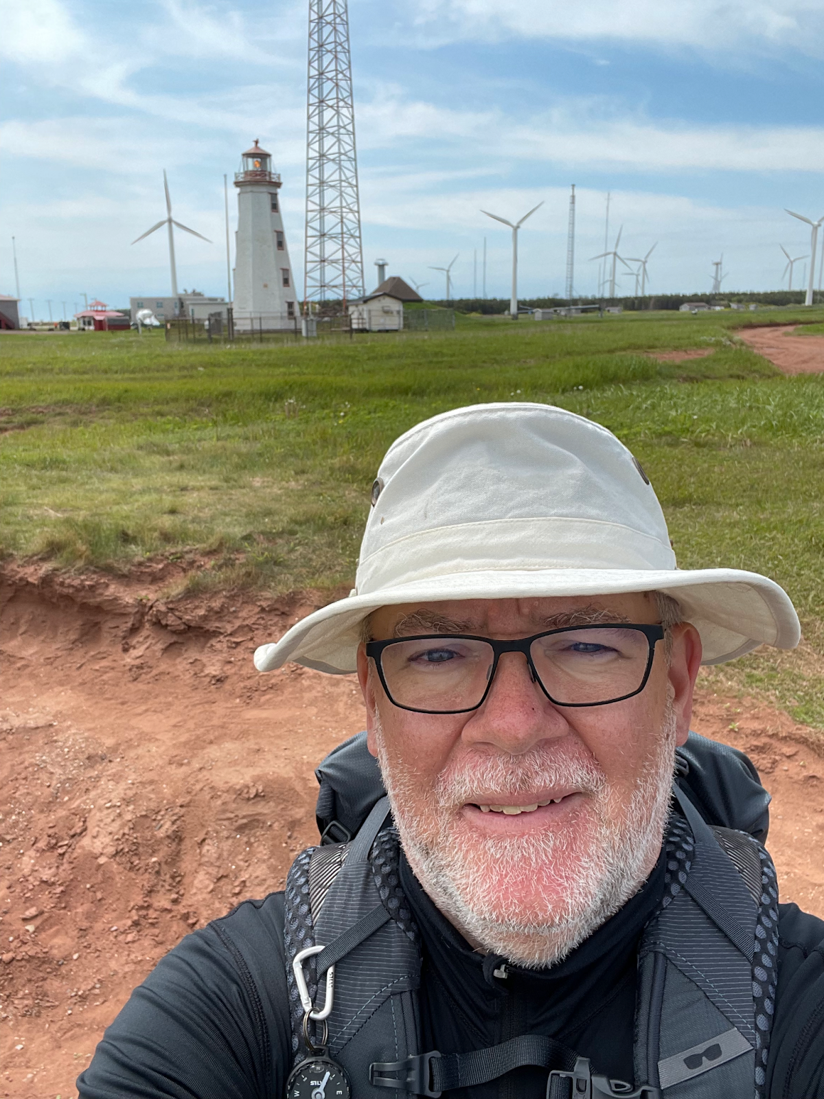
Reluctant to get up, I rose at last to start on Section 23 to reach Ann at North Lake. It was a short couple of kilometers, with the sea coming into view and a fine breeze to cool me off. We met by an old schoolhouse just off the highway, where together we watched a fox trot nonchalantly down the road.
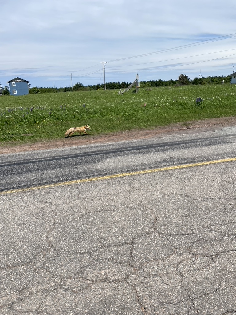
It seemed a good omen, to see a creature normally wary, but now careless of our presence. We drove off back to Murray Harbour, the longest pick up run of the trip, more than an hour along quiet roads. The glass of wine at dinner that night went down very nicely.
And with that, I finished the fourth part of my walk. I had visited some of the most scenic parts of the Island, the iconic red sand beaches and the rolling fields of Anne of Green Gables country, and had moved on from there to complete the eastern portion of the Confederation Trail. I was eager to walk the next morning, when I would turn the corner at East Point to start working my way back to Charlottetown.
Day 14 – Kensington to Cavendish
- The worst weather of my journey – solid rain with chilly, gusty winds, All. Day. Long.
- Completed Section 16 and part of Section 17
- Daily GPS distance = about 27 km, elapsed time 6 hours
- Fitbit daily stats = 30 km, 40,100 steps, 348 exercise minutes, 195 flights of stairs
Day 15 – Cavendish to Oyster Bed Bridge
- Sunny and fine, a perfect day for walking with a lovely breeze
- Completed the rest of Section 17, and a couple of km of Section 18
- Daily GPS distance = about 26 km, elapsed time just over 6 hours
- Fitbit daily stats = 29.4 km, 39,400 steps, 340 exercise minutes, 59 flights of stairs
Day 16 – Oyster Bed Bridge to Bedford Station
- Sunny day, hot, breezy
- Completed Section 18 and the first few km of Section 19
- Daily GPS distance – 29 km, elapsed time just under 7 hours
- Fitbit daily stats – 28.7 km, 38,500 steps, 339 exercise minutes, 48 flights of stairs
Day 17 – Bedford Station to Morell
- Decent day, warm, showers in the afternoon, but enough breeze to mostly keep the mosquitoes at bay
- Completed the rest of Section 19 and then the first half of Section 20
- Daily GPS distance – 29 km, elapsed time just under 7 hours
- Fitbit daily stats – 31 km, 41,500 steps, 358 exercise minutes, 41 flights of stairs
Day 18 – Morell to Bear River Road
- Pretty good weather, coolish at first and some clouds, later sunny and warm
- Completed the rest of Section 20 to St. Peter’s, then most of Section 21 to Bear River Road
- Daily GPS distance – 30 km, elapsed time 7 hours
- Fitbit daily stats – 31.4 km, 42,100 steps, 369 exercise minutes, 34 flights of stairs
Day 19 – Bear River Road to North Lake
- Sunny weather but not enough breeze to shake the mosquitoes
- Completed the rest of Section 21, then all of Section 22 to Elmira, and the first 3 km of Section 23 to end at North Lake
- Daily GPS distance – 27 km, elapsed time 6 hours
- Fitbit daily stats – 29.1 km, 38,900 steps, 326 exercise minutes, 22 flights of stairs
Suggestions
Kensington, North Rustico, and Souris are the biggest places in this part of the Walk, and those towns, along with Morell, Mt Stewart, and St. Peter’s Bay, have accommodations and restaurants nearby. I think it’s feasible, with some adjustment to daily route lengths, to walk from accommodation to accommodation between Kensington and St. Peter’s Bay.
After St. Peter’s Bay, as with the other parts of the Walk, I suggest booking something for a couple of days in one of the bigger communities and then arranging pick-up and drop-off transportation to the walk route – Souris would be the obvious choice I think.
In my case, since my wife was with me and could do the driving, we stayed in Murray Harbour while I did most of this portion. Admittedly, it was a bit out of the way for North Lake, but the place we stayed at was a lovely spot nonetheless. Regardless of where you stay, I’d strongly recommend booking accommodation well ahead, however, especially in high season, since there aren’t a ton of places to stay.
Kensington, North Rustico, and Souris are all big enough to use as a base for several days, with grocery shops, restaurants, pharmacies, bakeries, etc. so that you can keep yourself supplied and looked after. You’ll have to plan your route and accommodations carefully to take advantage of these bigger towns.
As for transport, in this part of PEI, you can use one of the Charlottetown taxi companies that cover most of the middle and east end of the island, but that can be expensive – expect rates in the region of $2 per km. I did not use them, since my wife was with me and she did the driving.
Other transportation options exist as well. There are some tour operators, who provide services such as I received from Stanley MacDonald in an earlier part of the walk. There is also the T3 bus network, which can get you to/from some of the points on the Island Walk route, but it may be of limited use by the time you’re in the middle of the Trail out by New Zealand. Check their website for full schedule info.
As for sustenance, for some of these sections there will be places to stop for lunch, such as at Cavendish, North Rustico, Mount Stewart, Morell, and St Peter’s Bay. In other parts, especially once you’re back on the Confederation Trail, you’ll need to pack a lunch, and of course, I would always recommend taking some snacks as well. Don’t forget your water – there are some places between Kensington and St Peter’s where you can fill up your bottle at a lunch stop, but on the Confederation Trail you’ll need to pack it.
As for bio pit stops, in this portion of the Walk you’re partly on roads, and partly on the Confederation Trail. The really touristy parts of PEI are in this stretch, so coffee shops, museums, restaurants, and towns with public washrooms are frequent between Cavendish and North Rustico. On the road sections outside of the touristy bits (e.g. past North Rustico), there are some stretches of road with forest whereas other stretches are pretty open, so plan your water consumption accordingly. Finally, wherever you are on the Trail, you’re back to improvising, i.e. stepping off into the bushes as needed.
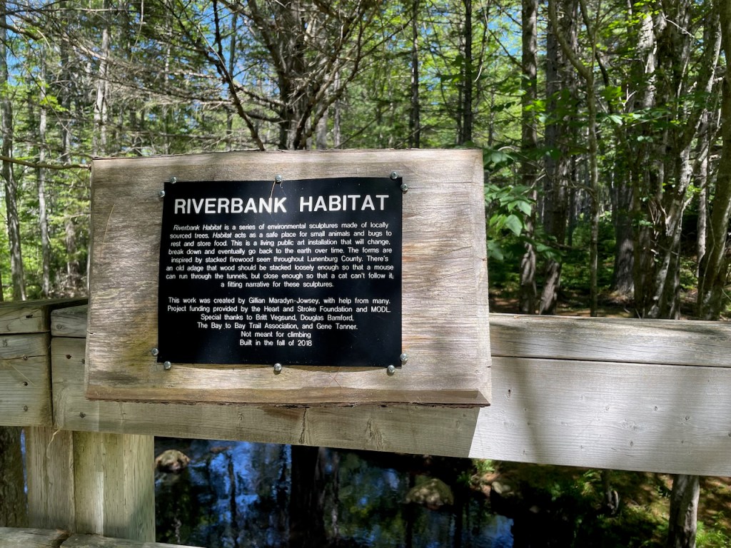
Finally, while early in this part of the Walk there are churches, community centres, and museums where you can stop for a rest, there are other long road stretches where those things are harder to find and you’ll have to improvise. When you are on the Confederation Trail, there are benches and picnic tables every few km, so you’ll be fine there.
Next – North Lake to Murray River
Other Posts About this Journey
- The Island Walk (a summary)
- The Island Walk Part 1 – Charlottetown to Summerside
- The Island Walk Part 2 – Summerside to Tignish
- The Island Walk Part 3 – Tignish to Kensington
- The Island Walk Part 4 – Kensington to North Lake
- The Island Walk Part 5 – North Lake to Murray River
- The Island Walk Part 6 – Murray River to Charlottetown
- The Island Walk – Plans, Gear, and Lessons
If you feel like supporting my blog, you can buy me a coffee.