After looking back, I realized that I’ve written a number of posts about favourite places in Toronto, so I wanted to collect them together onto one page so that you could find them. I’ll keep updating this page as I add more posts.
Blog posts are a labour of love for me, and yet there is a cost to running this site and organizing my walks.If you’d like to help with that, I’d really appreciate something for my tip jar.The Buy Me a Coffee service allows patrons like you to fund writers like me. If that sounds like a worthy idea to you, then go ahead – keep buying me coffees.Thank You Very Much to everyone who has contributed already!
*****
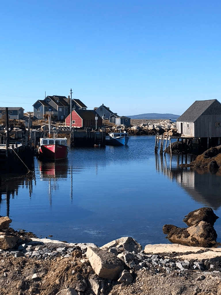
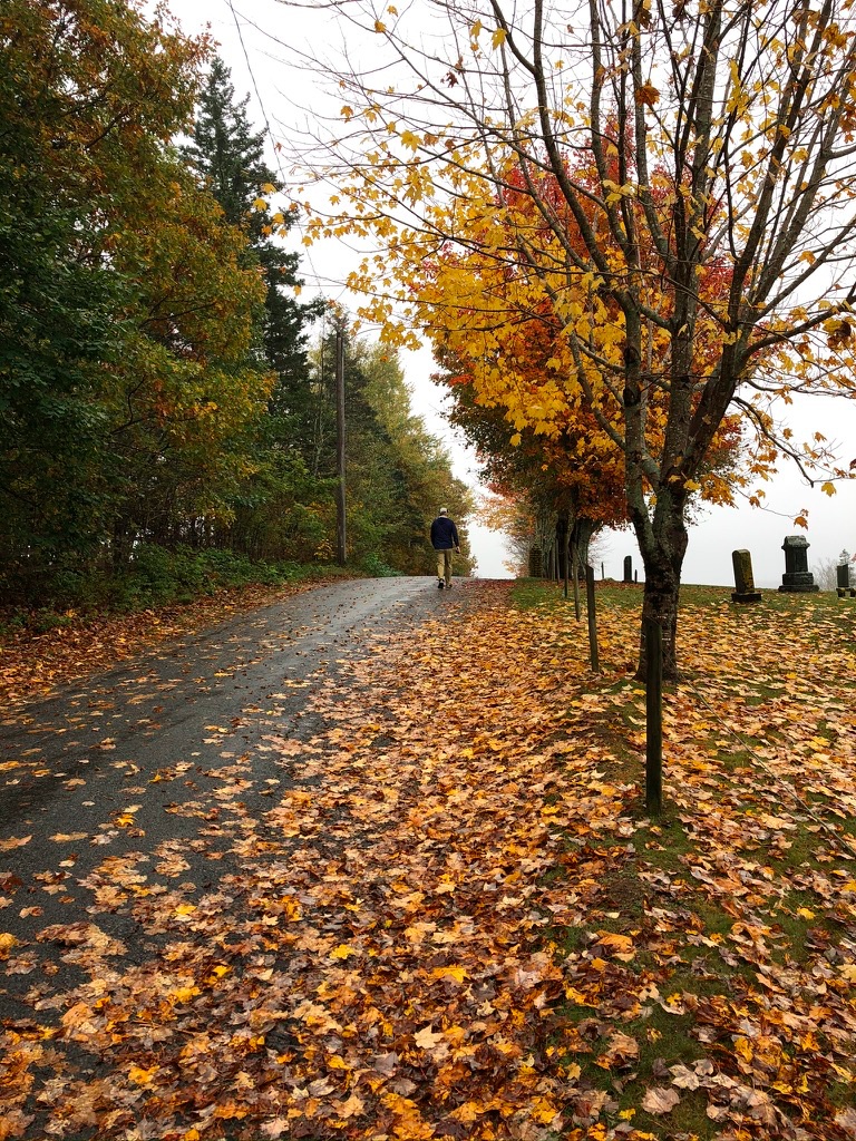
Over the past few weeks, we’ve had a chance to revisit some old haunts in Nova Scotia such as Mahone Bay and Lunenburg. That’s reminded me of walks past in different places along the South Shore. Since I’m writing this on a rainy autumn day, it’s as good a time as any describe some of our favourite places for a walk.
Mahone Bay
We first visited Mahone Bay nearly 30 years ago. Back then, it wasn’t quite as touristy as it is now. There were a few nice little B&Bs, and a few shops. The draw was the view, both of the harbour and the bay, and also of the iconic row of 3 churches that sit side by side along the shore at the top of the inlet.
Since then, we’ve visited the town many times, and twice have stayed in vacation properties there. Those visits have given us lots of opportunities to wander about the town, taking in more than just the waterfront. On one of those visits, we were out for a stroll after dinner along the quiet back streets of the town, and nearly jumped out of our skins when we came upon a deer which was contentedly munching flowers in someone’s garden.
It’s that kind of town. If you visit on a sunny summer Sunday in mid-afternoon, you’ll think the place is busy all the time and crowded with tourists. But wait a bit past dinner time, or visit mid-week, and you’ll find that once the city tourists are gone, the little town’s charms are all the more evident and available as you poke about the shops and restaurants. A leisurely 30 minutes will pretty much cover the town, and it will be a relaxing way to get to know the place.
Lunenburg
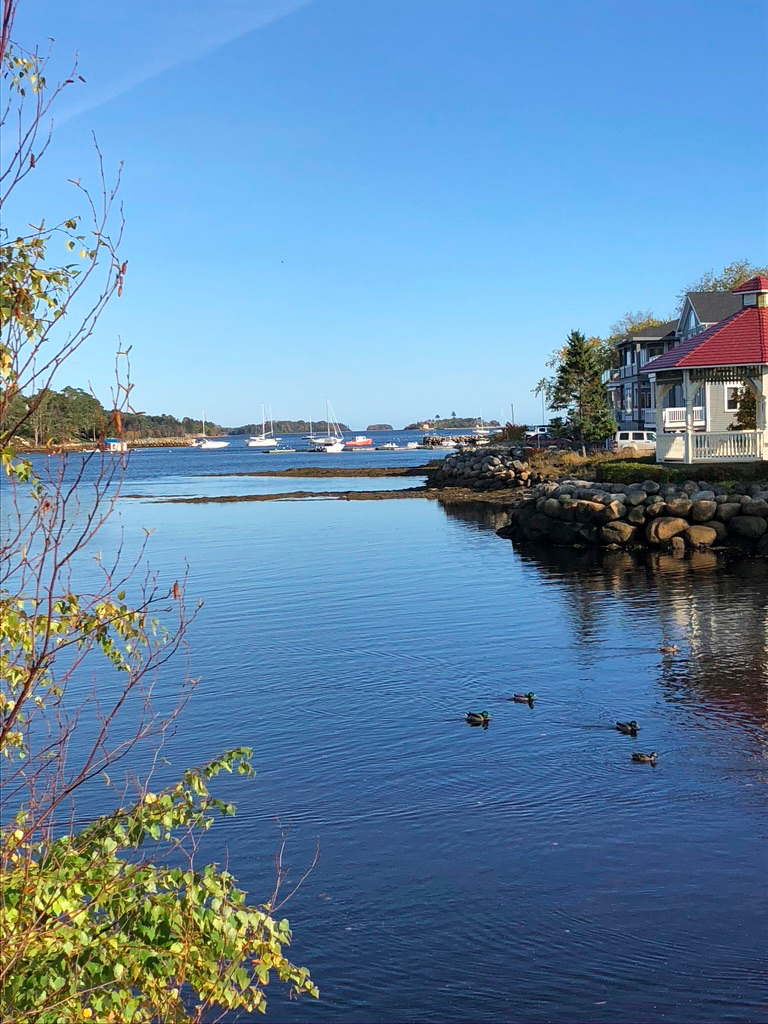
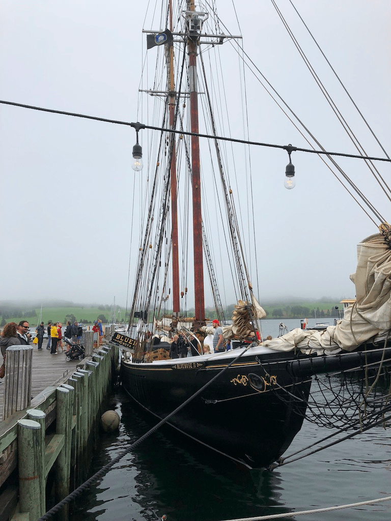
Lunenburg is most famous as the home of the Bluenose, the iconic schooner that graces a Canadian dime. Today, the Bluenose II is often in port, and you can tour the boat and even book a sailing cruise on her.
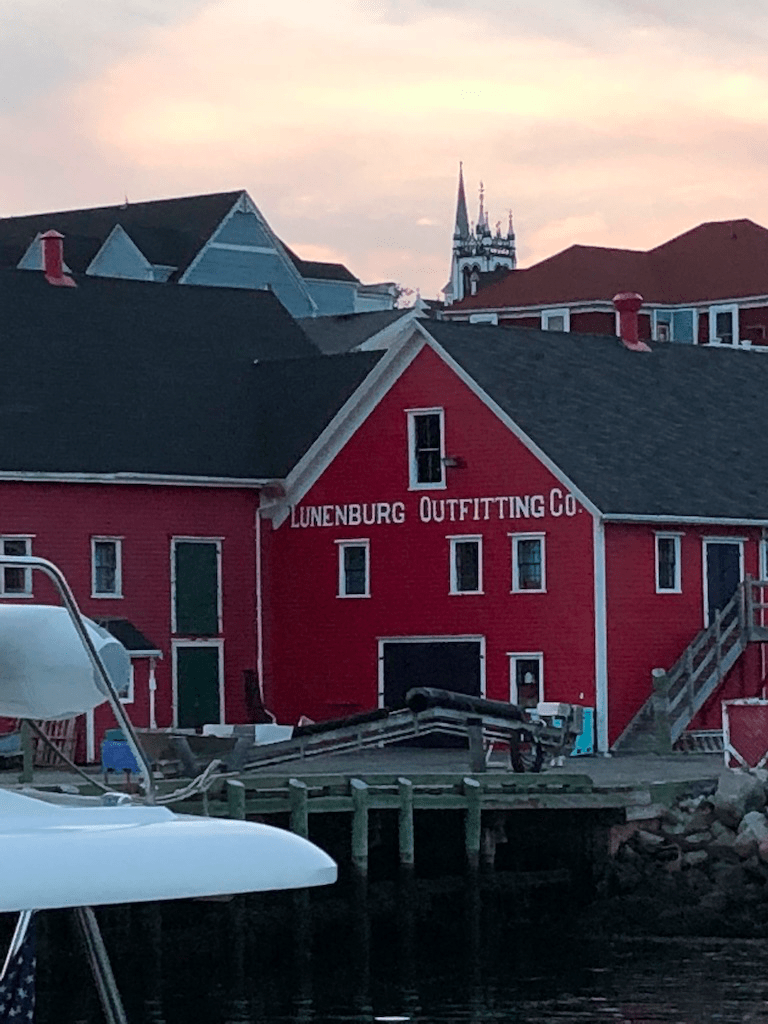
More than that, however, is the year-round town – the shops and services that the surrounding area depend on outside the tourist season. Because of that, we’ve visited many times. We love to wander up and down the steep streets that rise behind the harbour. You can spend an hour or so doing that and getting in a workout, and there’s also a lovely little walking trail that circles the town. That walking trail, by the way, also offers a way to walk Mahone Bay (about 10km), if you’re up for a longer hike.
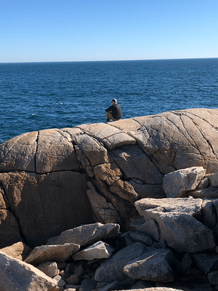
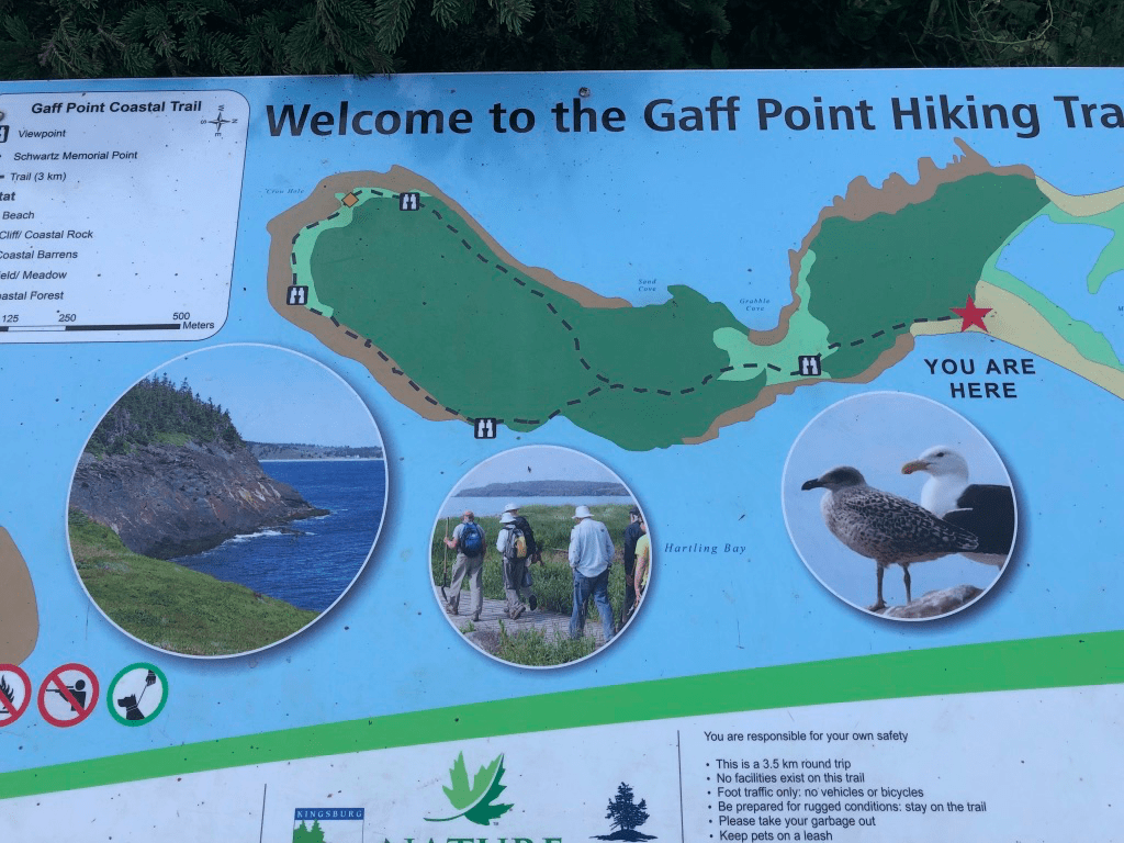
Hirtles Beach and the Gaff Point Trail
Another favourite that we discovered more than 10 years ago is the Gaff Point Trail. It’s a short drive out of Lunenburg, south east towards Kingsburg. The Trail starts at the parking lot for Hirtles Beach, another favourite spot for splashing in the waves, and follows the Beach towards Gaff Point itself.
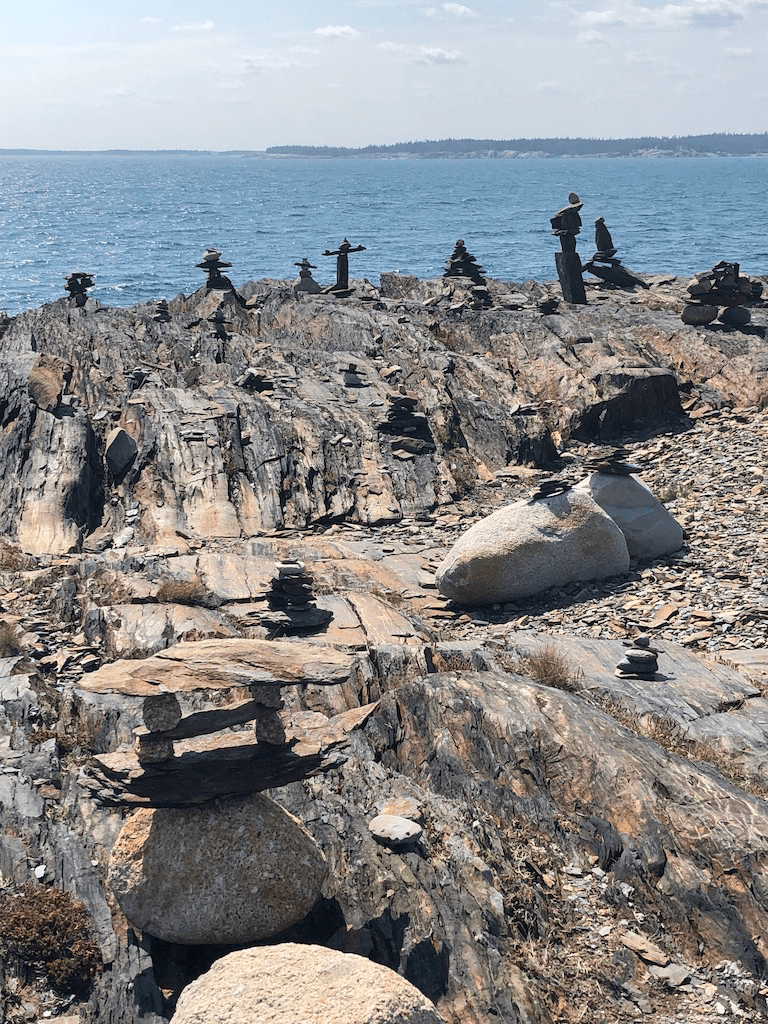
There, it loops around the tip of the point through forest and along the rocky shore, and provides fabulous views up and down the shore along with many spots where you can sit and just watch the waves and seabirds. We usually take a picnic when we go, and spend some time chilling. It’s about a 7.5km walk there and back so give yourself at least 2 hours, and if the weather is nice it’s great to kick off your shoes and splash along the water’s edge as you finish the hike. A pro tip is to do the walk at low tide so you can walk on the firm sand rather than along the rocky berm at the top of the beach.
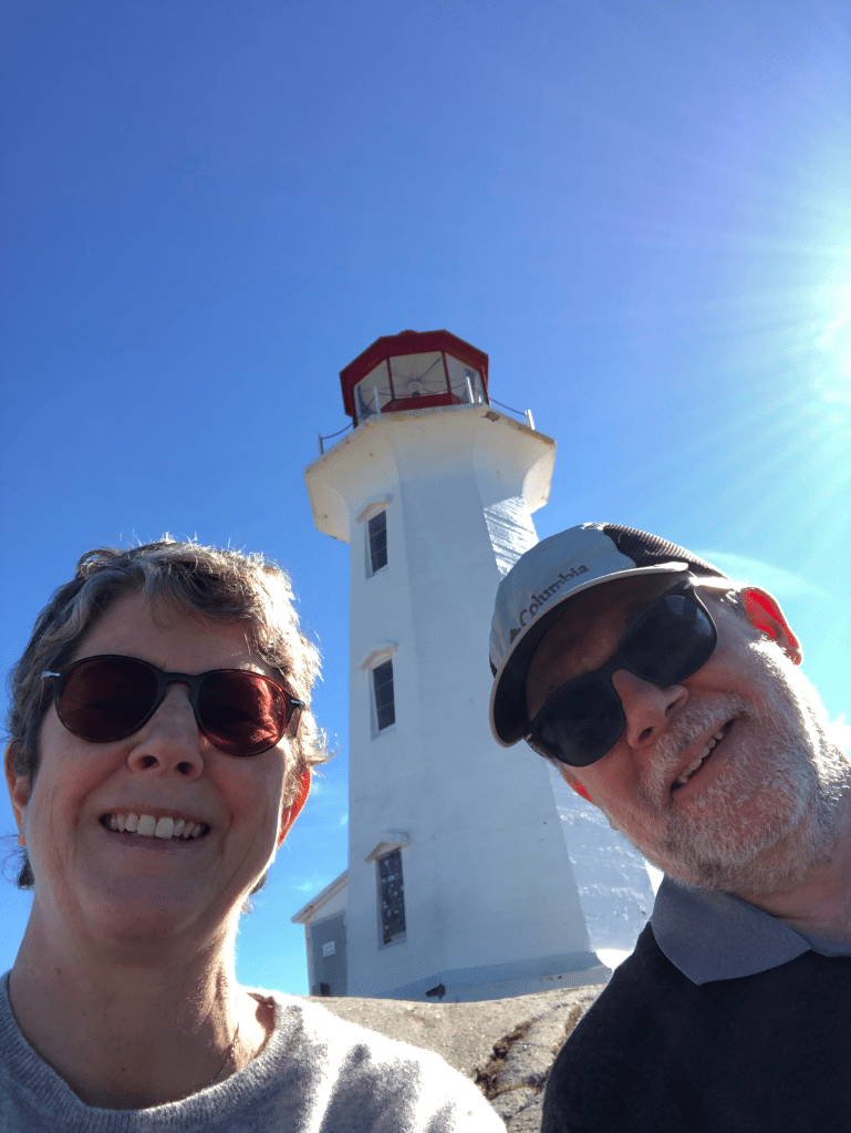
Peggy’s Cove
Over our various trips to Nova Scotia, we had always skipped Peggy’s Cove. My parent’s had dragged me there as a reluctant 8 year old back in the early 70’s, and ever since I had written it off as overly-touristed and out of date. That changed on our most recent trip. It was just my wife and I, and without our own child (now 18!) in tow, and at an off-season time of the year, it seemed like a good time to visit and see what the fuss was about.
I have to confess I didn’t know what to expect, but choosing a sunny October day was wise, because it’s lovely to sit on the rocks near the famous lighthouse and listen to the sea and bask in the sun. The little town itself is quaint, if conscious of its touristy charms, and even though you’ve probably taken a million selfies it’s still fun to grab one here.
Chester
Over the years, we’ve been to Chester a few times and I have to admit that I could never quite warm to it. It’s a bit of an anomaly for the South Shore – it’s a touristy place but also a place with a lot of wealth. The annual Chester Regatta is a famous tradition, and it’s attracted sailors for generations. Many of them have the money needed to go with large yachts, so many of the homes in Chester reflect that. It feels a little like Cape Cod in the summer.
This year, visiting on a misty damp October day, it felt quite different. There’s a bit of a melancholy air to a resort town out of season. Many of the houses are closed up for the winter, and the town’s year-round residents can get together in peace. Walking up and down its quiet streets, we realized that it’s actually a lovely little place. The trick, it would seem, is to come off-season.
There are some little parks and shops downtown, and the harbour area is atmospheric as well. We brought a picnic and ate it in the wet, and that made it that much more savoury, staring over the water and listening to the gulls. I have to take back what I said about Chester in the past – it’s not the snooty place I thought it was.
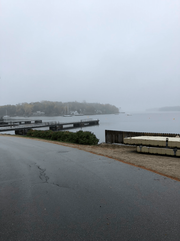
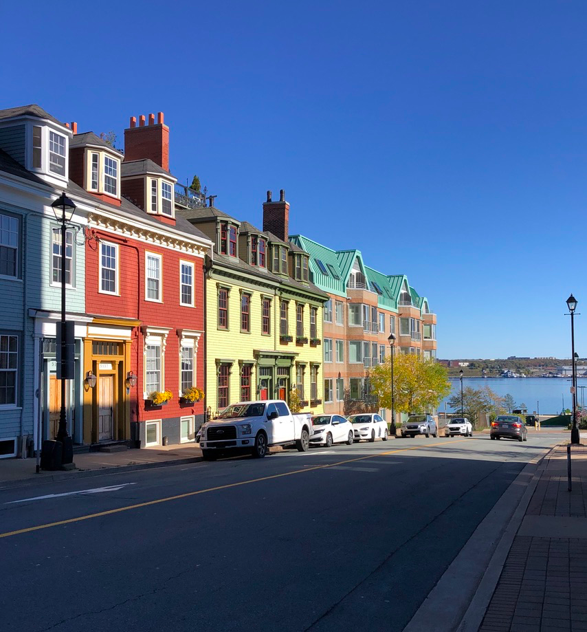
Now that we’ve been out in Halifax awhile and are a week out of quarantine, we’ve been able to explore the city a bit.
So far, I like a lot of what I’ve seen.
Outside Seaport Market
We booked a rental home that’s in downtown Halifax, only a few blocks from Lower Water Street, and from the shops along Spring Garden Road.
My wife’s homemade apple pie for Thanksgiving dinner!
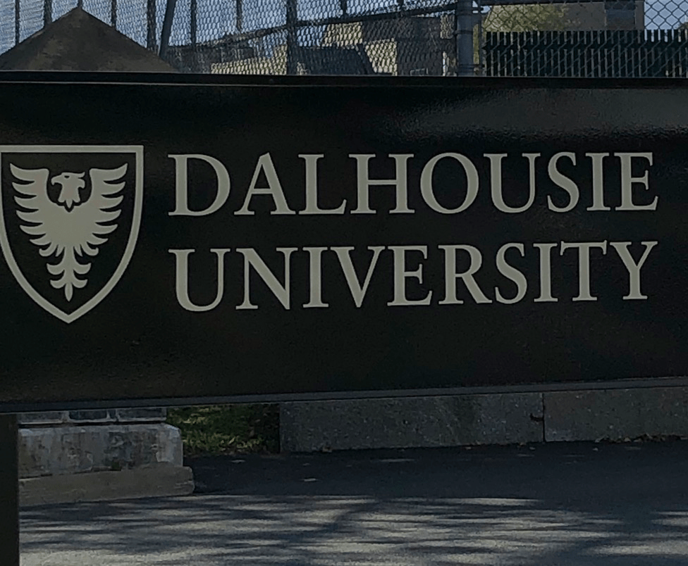
That’s allowed us to shop and explore in multiple directions – south through the residential neighbourhoods towards Pleasant Point Park, north up into the Hydrostone neighbourhood, east and along the waterfront, and a bit west towards the universities (our son is at Dalhousie).
It’s been a fun few days of wandering about. I’ve been to Halifax before – each time we came out to the east coast on vacation, we’d stay down along the South Shore at Mahone Bay or Lunenburg, and we’d always make a day trip into the city. Still, those excursions were short and confined to the touristy bits along the waterfront like the Maritime Museum or the Seaport Market or the Citadel.
Halifax Public Gardens
Now that we’re living here for a bit, we have a chance to settle into the life of the city. It’s been interesting for a few reasons. One thing we noticed right away is how courteous Halifax drivers and pedestrians are compared to Toronto. People wait for the pedestrian crossing signals! Cyclists actually stop at stop signs! Drivers politely wave pedestrians across the road at crosswalks! Who knew that somewhere actual courtesy and common sense existed outside the Big Smoke?
It’s also a lot quieter than Toronto. You don’t realize what the constant background hum of traffic is like until it’s not there. Come 6 pm, the streets are silent and sleeping with the windows open in the middle of the city is actually refreshing and calm. The only mildly loud thing once in awhile is the flight of helicopters overhead as they land across the harbour at the Shearwater RCAF base.
It’s also been interesting to see the way that people are dealing with COVID-19. In large part because of the mandatory quarantine for anyone arriving into Maritime Canada from anywhere else, the case count here is vanishingly small. Weeks go by with no new cases reported at all. Despite the lack of community spread, people are still wearing masks indoors as they shop, and often on the streets too, and there’s more or less no bellyaching about it. In fact, people are proud of their resilience and how they’ve handled COVID-19 so far, and they don’t want to undo all the sacrifices they’ve made by letting in any cases now. In the words of their Premier, Scott McNeil, if you have COVID-19 or even suspect you might, then “Stay the blazes home!”.
I’ve also been quite taken by the quiet charms of the east coast. People just seem more relaxed here, friendlier and less harassed than they do in the daily rat race of Toronto. Wandering a neighbourhood, you see people out for a walk but not in a hurry.
Plus, thank the stars, there is a wonderful lack of leafblowers and weed trimmers. I’ve explored various residential areas, including some relatively high income ones, and have barely heard those annoying noisemakers. There are trees here and the side streets are leafy and lovely, and yet they manage to live their lives without making a racket. Imagine that.
If I had to name a favourite walk so far, I’d say it was exploring the North End and Hydrostone.
We walked up their on a lovely sunny mid-October day. We found a great little pizza place that served excellent pies and a decent glass of wine. We circled Fort Needham park and explored the memorials to the Halifax Explosion victims. We nosed into shops and picked up some little treats. It reminds me a little bit of Leslieville in Toronto – lots of young families, some hipsterish little spots, and leafy quiet streets just off of busy roads. It’s just quieter, and you can get a house for well under a $1m, unlike anywhere in Toronto.
The grave of Alexander Keith with a tin of his eponymous ale
Canada’s east cost offers so much as a getaway destination, and Halifax as a gateway to it is a great place to start or end a holiday. Come out and explore, and you’ll love it too.
Blog posts are a labour of love for me, and yet there is a cost to running this site and organizing my walks.If you’d like to help with that, I’d really appreciate something for my tip jar.The Buy Me a Coffee service allows patrons like you to fund writers like me. If that sounds like a worthy idea to you, then go ahead – keep buying me coffees.Thank You Very Much to everyone who has contributed already!
*****
And now on to the regular post …..
I live in mid-town Toronto, so I frequently go for walks about the neighbourhood to get my daily exercise. I was out one day recently and it occurred to me that while I take it for granted sometimes, there is a lot of appeal in the nearby streets, parks, and ravines that would make a great walk for both residents of the city as well as visitors to Toronto. I’ve laid out this route to take in the best features of the Lytton Park and Lawrence Park neighbourhoods including several of the local sights and providing a glimpse of the charms of mid-town. I mean really, downtown hipsters, every once in awhile it won’t kill you to venture north of Bloor.
Length: About 8 km, so around 1.5 hrs.
Surface: Mostly paved, with some gravel paths in the ravines
Public Transit: Start and end at Eglinton Station on the Line 1 subway
Route:
entrance to Eglinton Park
Starting at Eglinton Station, use the exit at the south end of the platform so that you come out on west side of Yonge Street and south of Eglinton. As you exit the station, turn right (south) and walk about 100m to Berwick Avenue, and turn right (west). Follow Berwick about 200m to Duplex Ave and turn right (north). After about 100m, turn left (west), crossing Duplex and following Anderson Street. Continue 3 blocks to Lascelles Boulevard, then turn right (north). Take Lascelles north to Eglinton, where you can cross at the traffic lights and enter Eglinton Park.
Follow the path to the right of the Community Centre and past the arena and parking lot to enter the park itself. The path continues along the east side of the park and exits at Roselawn Avenue. Cross Roselawn at the crosswalk, and continue north up Rosewell Avenue. This continues for about 6 blocks north to Lytton Avenue. At Lytton, turn left (west) and follow it as it descends and curves north. At the corner of Lytton and Alexandria, you will pass the delightful Lytton Sunken Gardens.
Continuing up Alexandria, the road ascends and curves right (east). Follow Alexandria to Rosewell Avenue, then turn left (north). Follow Rosewell north for about 4 blocks past the John Ross Robertson and Glenview public schools. Just north of Glenview school, there is a foot path along the top edge of the bowl-shaped ravine in which the school’s playing fields are laid out. Follow this and then turn right (east) on the foot path along the north edge of the school yards, with Lawrence Park Collegiate Institute on your left.
The foot path between Lawrence Park Collegiate and Glenview School
At the end of this foot path where it joins Cheritan Avenue, there is a roadway on your right descending down into the Glenview playing field. Follow this down and at the bottom, turn left and walk back east past the baseball diamond to find the entrance gate to the Chatsworth Ravine. Enter the gate and follow the path beside Burkes Brook, crossing the bridge and then continuing till you reach Duplex Avenue. There is a steep flat path on the right or a set of stairs on the left – either takes you up out of the ravine and onto Duplex.
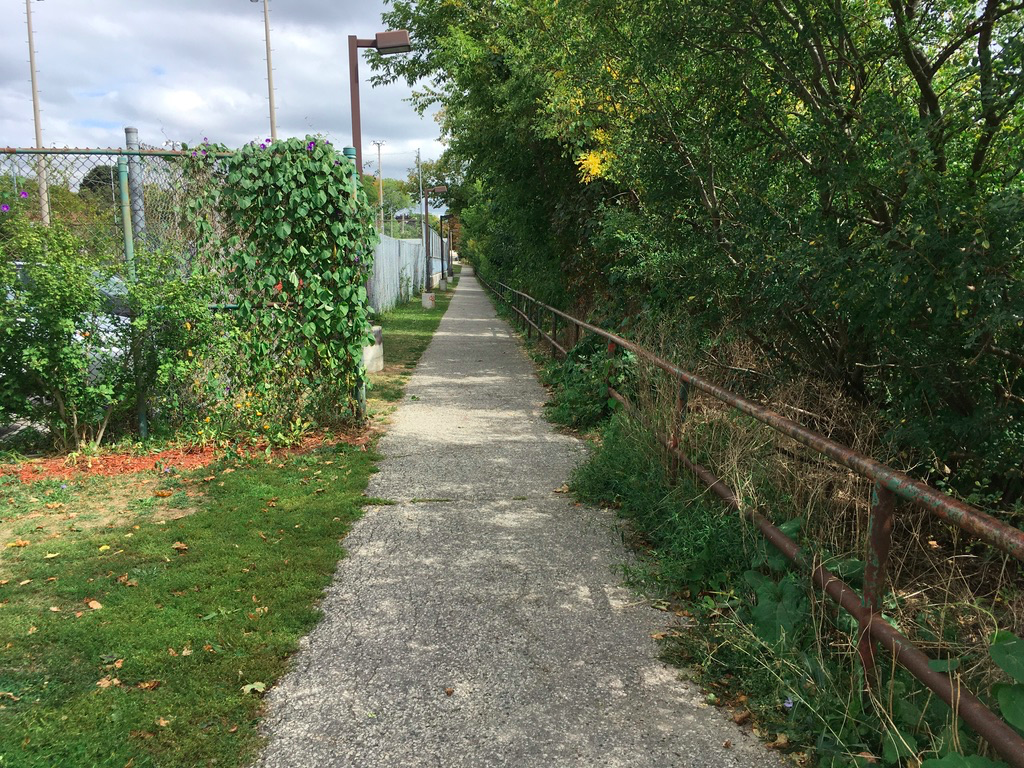
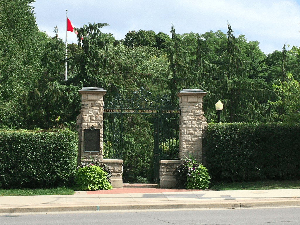
Cross Duplex and on the east side of the street you will see the steps descending into the Duplex Parkette (which are not on Google Maps, so it thinks you can’t get down into the park – that’s not true, though in winter if it’s icy, you can take Chatsworth Drive down to Yonge instead). Follow the stairs down and then continue east along the path towards Yonge Street. Near Yonge, the path forks, so go left to get to the crossing lights at Yonge and Chatsworth. Cross Yonge here and then turn right (north) and walk up the street less than 100m to the entrance to Alexander Muir Memorial Gardens.
Entrance to Alexander Muir Park
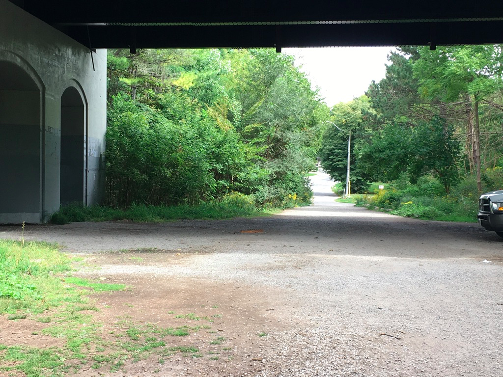
Enter the park and meander through the gardens until you come to tennis courts. Turn right leave the gardens to get onto the roadway that runs east parallel to the tennis courts. Follow that and you enter Blythwood Ravine along the foot path beside Burkes Brook which is channelled underground between Duplex and Yonge. Follow the foot path beside the stream east, crossing under Mount Pleasant Road.
Path under Mount Pleasant Road with Strathgowan Avenue straight ahead
On the east side of Mount Pleasant, the path ends, with a new path on your right and a roadway directly ahead (Strathgowan Avenue). Continue straight along Strathgowan for about 50m and then turn left (north) to climb the public foot path up onto Dundurn Road. Follow Dundurn north for about 4 blocks to Dinnick Crescent and then bear right to follow Dinnick another block north to Cheltenham Avenue. Turn right (east) and follow Cheltenham for about 3/4 of a km to Mildenhall Road. Cross Mildenhall to enter Cheltenham Park, and follow the path east through the park to emerge on the other side at Bayview Wood. Keep going straight and the road bends right (south) turning into St. Albans Crescent. Keep following this round as it continues bending right and starts heading back west.
After completely turning back west, as you continue straight ahead Rochester Avenue begins, so follow this east past Mildenhall Road to St. Ives Avenue. Turn left (south) on St. Ives and follow it south to St. Leonards Avenue. Turn left and then immediately right after less than 100m to St. Leonards Crescent, turning right here and following it south as it bends east a bit. At the junction with Dawlish Avenue, St. Leonards Crescent turns into Fidella Avenue which continues south and bending west. Follow that south until you reach Strathgowan Crescent. Turn right (west) and follow the crescent for about 100 m as it curves south and climbs the hill. At Strathgowan Avenue, turn right (west) with the Blythwood School yard on your left. Follow Strathgowan down the hill till you come to the path back into Blythwood Ravine, on your left just before get to the Mount Pleasant Road underpass.
Turn left onto the path into Blythwood Ravine and follow it north and east. After several hundred meters, the path ascends and connects to Blythwood Road. As you come out of the ravine, cross Blythwood using the crosswalk and turn right (west). Climb up the hill and cross Mount Pleasant Road at the traffic lights. Continue on Blythwood for about 500m to Blythwood Crescent. Turn left and follow that to Sheldrake Blvd. Turn right (west) and follow Sheldrake to Yonge Street. Turn left (south) on Yonge and walk back to Eglinton Avenue to the finish.
Sights:
Of the many delights of this route, my favourite is probably just wandering along wide, tree-lined, quiet streets as I walk through the Lytton Park and Lawrence Park neighbourhoods. Often, especially on weekends, there’s no one about and it’s peaceful and calm. The only people you do meet are locals out walking dogs or doing a bit of yard work. Some of my most relaxing walks have been through these streets on a misty, rainy early spring day, and you can kick up little piles of leaves in the autumn or enjoy the shade in the summer too.
Burkes Brook in Chatsworth Ravine
These streets were laid out in the early part of the 20th century and many of the homes date back to the 1920s and 1930s. Nowadays (sadly to my tastes), a number of these older homes have been demolished and replaced with large modern structures, but there are enough of the older ones left that you can see see hints both of the original agricultural past in early Toronto (look for the original farmhouses on Blythwood in between Mount Pleasant and Yonge) as well as the early city planning in the lay out of the roads. Those early planners were keen to provide lots of winding streets, in an era when the car was starting to dominate planning – hence the width of the streets and in many cases the lack of sidewalks.
There is history here too. Alexander Muir Gardens is named after the man who wrote what for many years was the unofficial Canadian national anthem (at least to English Canadians) – The Maple Leaf Forever. The gardens were laid out in the 1930s to honour him, and the wind may oblige you to provide a nice shot of the flag that bears that symbol.
The parks and ravines are also lovely. Burkes Brook is one of the many small tributaries of the Don River and the City of Toronto has both exposed it in some parts and buried it in others. Following its course is a bit of an adventure as you go from wooded ravines to parks to urban street crossings – check out the Lost Rivers Project to learn more about these hidden creeks and streams.
Many people don’t realize it, but Elginton Park is also set in a filled-in creek ravine. Mud Creek is flowing under it and under Eglinton Avenue itself, and then crosses under Yonge south of Eglinton near Manor Road, to follow the line of Tullis Drive on the east side of Yonge and eventually flow under Mount Pleasant Cemetery into the ravine under St. Clair Avenue and onwards to the Don. These hidden creeks are all over Toronto and help to explain why some of the streets curve and bend the way they do.
This walk is also linked by the spine provided by Yonge Street. Between Eglinton and Lawrence Ave, Yonge is a solid line of shops and retail, providing those who leave nearby with their everyday needs and ensuring that this is actually a fantastic, walkable area both east and west of Yonge.
There are also at least 10 schools in the area, along with the parks, so this is a family-friendly place as well. That explains the bajillion dogs and their owners, as it seems to be a neighbourhood requirement to have 2.5 kids, 3.5 bikes, and 4.5 dogs per household. And also, it should be said, 1.5 luxury cars per driveway, reflecting the upper middle-class demographic. This area used to be very, shall we say monochrome, and is now becoming more diverse culturally, echoing Toronto as whole though also echoing its social/cultural stratifications as well. Property prices here have not gone done, to say the least.
The Eglinton Park fieldhouse
Finally, I like this area simply because I’ve lived here on and off for close to 40 years, since I arrived in Toronto to attend university at Glendon College, which is just east of Lawrence Park. I’ve watched the neighbourhood change and grow and evolve over the years. I’ve coached my son’s baseball teams playing in Eglinton Park, and I’ve pushed him on his toboggan down the hill at Glenview School, where he also did his swimming lessons. It’s been a wonderful place to live, and when we’ve returned to the hood after living elsewhere, we’ve always settled right back in like the proverbial dirty sock. It’s home.
Food & Refreshment:
Yonge and Eglinton is amply supplied with many food shops, restaurants, coffee shops, and bars to stock up for a picnic, fuel up ahead of the walk, or rest up afterwards. There is a great breakfast place called Boom on Eg at Lascelles, just as you enter Eglinton Park, and there is one of my favourite greasy spoon diners on Yonge near Castlefield (Good Bite is just that, and no disrespect intended calling it a greasy spoon). All of that choice means it’s easy to combine a nice walk with some shopping, with the subway right there so that you can leave the car at home.
As well, Eglinton Park has both water fountains and public washrooms, and there are also both of these in the Community Center itself so that you can stop off year round. There are water fountains in Alexander Muir Gardens, Duplex Parkette, and Cheltenham Park, though all of these are turned off between October and May. Otherwise, take advantage of the coffee shops along Yonge or in the Yonge-Eglinton shopping centre.
Diversions:
The route describes exits Burkes Brook ravine at Blythswood Road. If you want to stretch yourself further, instead of heading to Yonge along Blythswood Road, cross it and descend on the south side of the road, so you can keep going on the path as you enter Sherwood Park. After about 500m, past the picnic area, you can either turn right to climb up out of the park at Sherwood Avenue and so return to Yonge, or else turn left (east) and follow the path along Burkes Brook through the east end of the ravine to Bayview Avenue. If you do that, then a great way to get back to Yonge is to go south on Bayview to Mount Hope Cemetery and cut through that peaceful spot to exit onto Erskine Avenue which will take you east back to Yonge. If Mount Hope Cemetery is closed, then continue south on Bayview to Broadway Avenue, where you can turn right (west) and follow it all the way to Yonge.
As you go up Rosewell Avenue and come to Glenview School, you will notice that there is a treed ravine on the west side of the street. These are part of the grounds of Havergal College, a private school and thus private property. This ravine, however, is part of Burkes Brook, so to keep following it north, walk around Havergal by going north up Rosewell to Lawrence Ave, turning left to get cross to the west side of Avenue Road, then turning right (north) across Lawrence to go north up Avenue Road to Woburn Avenue. Here, on the northwest corner, there is the entrance to Brookdale Park. The path here keeps going north, and if you follow that onto Grey Road, you can keep going up to about Brooke Avenue and so follow more or less follow the course of upper Burkes Brook.
Blog posts are a labour of love for me, and yet there is a cost to running this site and organizing my walks.If you’d like to help with that, I’d really appreciate something for my tip jar.The Buy Me a Coffee service allows patrons like you to fund writers like me. If that sounds like a worthy idea to you, then go ahead – keep buying me coffees.Thank You Very Much to everyone who has contributed already!
*****
And now on to the regular post …..
Several years ago, I was training to do the Toronto Waterfront Marathon. I had never done a walk (and I walked it more than I ran it) of more than about 20 km, and since a marathon is 42 km, I planned out a walk that would be about 30 km in length and incorporate some ups and downs to get my legs built up.
Length: About 32 km, including about 200m of vertical ups and downs
Surface: Mostly paved, with gravel path on some of the ravine trails, plus the wooden boardwalk in the Beaches.
Public Transit: Start and end at Eglinton Station on the Line 1 subway
Route:
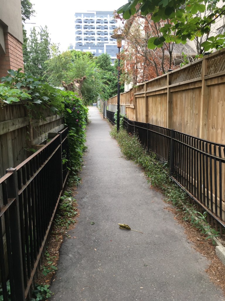
Starting from Eglinton Station, head south on east side of Yonge St and turn east (left) at Manor Road. Cross the street and turn right (south) down Tullis Drive. Follow Tulis south to Belsize Avenue, crossing the street to the south side. You’ll see a fence laneway in front of you – take that as it’s a public right of way and follow it to Millwood.
Laneway between Belsize and Millwood
Turn left (east) on Millwood and proceed down the hill. At Acacia, turn south (right) and follow that to Davisville Avenue. Cross Davisville and turn west (right) for a few meters to Pailton Crescent. Turn left (south) and follow Pailton to Merton Street. As you cross Merton at the crosswalk, there is a path directly in front of you beside a condominium building and that takes you to the Beltline Trail.
At the Beltline, turn left (east) and follow it for about 100m to the entrance into Mount Pleasant Cemetery. Inside the Cemetery follow the purple painted lines on the road, following it east under Mount Pleasant Road and around towards the memorial gardens. The marked path takes you east and south and exits the cemetery at Moore Avenue, opposite the entrance to the Moore Ravine Trail – careful, there are always many impatient drivers as you try to cross.
Descend on the trail into the ravine and follow it for about 1km. When you reach the entrance to the Don Valley Brickworks, you can detour left over the bridge and follow the trails in the Brickworks, or else continue on the Beltline south until you enter the Brickworks opposite the main buildings near the car park. Exit the Brickworks complex here, crossing Bayview Ave at the lights to join the Lower Don Trail (turn right, south). Follow the Don Trail south parallel to Bayview for about 1.5 km to the traffic lights at Rosedale Valley Drive. Cross here and directly in front of you will be the stairs up the hill beside St. James Cemetery. Climb up to reach Wellesley Park.
Walk through the park and onto Wellesley Street, and keep going about 100m to Sumach Street. Turn left (south) and follow Sumach to the entrance to Riverdale Park. Turn left into the Park and follow the path diagonally across past Riverdale Farm, in a south-east direction, to reach the stairs leading down into the Don Valley. Follow the path down to reach the bridge over Bayview Avenue – climb up, cross the road, and then take the stairs down onto the Lower Don Trail. Follow the Trail south about 1.5 km to Corktown Common.
If you go past the Common, the Trail bends a bit west and then east under the Don Valley Parkway overpass, to come to a trail junction. Turn left (east) here to cross the Don River and then join the Martin Goodman Trail parallel to Lakeshore Blvd. If you detoured into the Common, follow the paths in the park back out through the junction tunnel that passes under the train tracks to rejoin the Lower Don Trail.
Once on the Martin Goodman Trail, follow it east for 2-3 km to reach the entrance to Woodbine Beach park. It’s better to walk on the north side of Lakeshore, as the cycle path and foot path are separated here so you’re not constantly being dinged by cyclist’s bells.
Martin Goodman Trail between Carlaw and Leslie
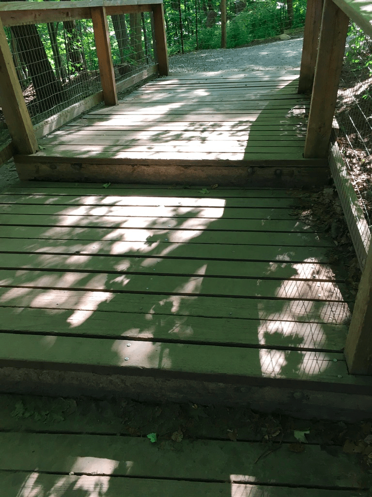
When you reach Woodbine Beach park, cross Lakeshore at the traffic lights and turn into the park, follow the Martin Goodman trail pathway connect to the west end of the Beaches Boardwalk. Keep going east following the boardwalk for 2 km to reach Balmy Beach Park.
the Boardwalk at Beaches park.
At Balmy Beach, at the end of the Boardwalk, turn north (left) onto Silver Birch Drive and follow it north to Queen Street. At Queen, turn left (west) and follow it for about 500 m to the entrance to Ivan Forest Gardens park, on the north side of the street. Turn into the park and follow the trail north through the park, which will turn into Glen Stewart Park, and exit at Glen Manor Road East. Cross that street and descend into the Glen Stewart Ravine, following the trail north and east.
Exit the Glen Stewart Ravine trail at Kingston Road and turn right (east). Walk along Kingston Road east – you can either go all the way to Victoria Park Ave and then turn left (north) or else turn north up one of the side streets such as Scarborough Road and follow that to Gerrard – if you do that, turn right (east) on Gerrard and walk east to Victoria Park, then turn left (north). Once on Victoria Park, follow it north under the train tracks and on past Danforth Avenue. Keep going north past the Victoria Park subway station, and about 500m north of the station the road descends into a gulley. On the west side of the road opposite the Dentonia Park Golf Course you will find a set of stairs descending into the Taylor-Massey Creek Park trail system.
Once on the trail here, follow it west for about 4 km to reach the lower Don parklands. At the Lower Don off-leash dog park, turn right (north) and follow the trail north and then west crossing under the Don Valley Parkway to reach the junction with the Don Valley Trail system. Turn right (north) crossing the Don River over the old Don Mills Road bridge,
the old Don Mills Road bridge
and follow the trail through the parking lot to reach a bridge over the train tracks. Turn left (west) at the top of the bridge and follow the trail to reach the entrance to E. T. Seton Park.
In Seton Park, cut across the car park and turn right (north) along the roadway. Follow the road north till you pick up the West Don Trail inside the park, and then take that trail north through E. T. Seton park all the way to the car park on the south side of Eglinton Ave near Leslie Street. Turn left (west) at that car park and follow the roadway west and then north to cross under Eglinton and enter Wilket Creek Park.
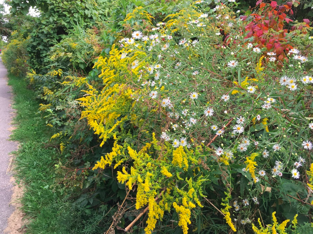
hints of autumn on a September day
Keep going north through Wilket Creek till you reach the junction of the roadway/trail that turns west (left) heading towards Sunnybrook Park. Follow that roadway/trail west into and through Sunnybrook Park, towards the Riding Stables. Just before you reach the Stables, there is a path on the west side of the road that leads to a bridge which crosses the West Don River. Take that path west and on the other side of the river, turn left (south) on the trail beside the off-leash dog park. Follow the trail heading south and then bending west. On the west side of the dog park, turn right (north) onto the Burkes Brook trail. Follow this north and bend to the west to keep going parallel to the water. The trail officially ends after about 500-600m, but you can exit the official trail and keep going west on the unofficial trail. This continues for another 500 m to reach a steep hill climbing up out of the ravine to reach Bayview Avenue.
Cross Bayview (either directly here or else a bit to the north at the traffic lights by Sunnybrook Hospital). On the opposite side of Bayview, reenter the Burkes Brook trail and descend into the ravine again. Follow this trail west for about 1km, climbing the stairs passing through the off-leash dog area, to descend into Sherwood Park. At Sherwood Park, turn north and then west at the bridge over Burkes Brook (next to the City of Toronto maintenance buildings) and climb the hill along the roadway to exit the ravine/park onto Sherwood Avenue.
Up the stairs in Burkes Brook
Follow Sherwood west for about 500m to Mount Pleasant Road. Cross at the traffic lights and continue west along Sherwood for about another km or so to reach Yonge Street. Turn left (south) on Yonge and follow it for about 1km to reach the finish back at Eglinton Station.
Sights:
I like this walk because of the variety of scenery – the forests and wildness of the ravines, the garden settings in the parks, the sand and the lake along the Boardwalk, and the urban stretches through the upper beaches. That variety keeps it interesting over the whole length of the walk, and it also means that in any season there will something different. The ravines and shaded streets also mean you have some shelter from summer sun, though note that in winter most of the trails are not cleared or salted so they can get icy.
The Beltline down Moore Ravine
Another cool thing about this walk is that it actually follows a number of the various creeks and brooks that have been buried over time. For example, at the start of the walk, Tullis Drive follows the course of Mud Creek. If you listen carefully at the manhole cover at the corner of Tullis and Glebe Road, you can usually hear the stream following under your feet. The same happens on Millwood in the little gully that you descend into – that gully is there because of the creek. Check out the Lost Rivers project to learn more about this fascinating part of Toronto’s history.
down the hill on Millwood into the Mud Creek gulley
I also like this route for the many angles it gives you on the Toronto skyline. From the Don Valley near the Brickworks, you see it from the north and east. From beaches, you see it directly along the lake and you get the tall chimneys of industry poking up as well. You always see the CN Tower poking through and that landmark is usefully to navigate by. These landmarks are reminders that while you’re walking through many beautiful natural settings, the industrial and commercial aspects of the city are always around you.
Industrial Toronto reclaimed – the old railway bridge at the north end of E.T. Seton Park
The many parks that this route takes in are also little time capsules. Corktown Common and the Brickworks, for example, are relatively new additions to the City’s park system, having been created in the 2010’s as part of the revitalization of what had been industrial areas. A generation earlier, in the 1970’s, parks such as E.T. Seton were added, and to offer the growing middle classes not just trails but also recreational amenities like a disk golf course and an archery range. A generation before that, in the 1940s after WW2, Sunnybrook Park was laid out after a private estate was taken over during the war to create a health facility for returning veterans. And finally, another generation back in the 1920s, the parks in the Beaches are 100 years old and reflect the formal gardens, picnic areas, and baseball diamonds that were popular then.
Taylor Creek
Finally, this route, especially around the Beaches, is great for people watching, I’ve seen everything from multi-generational families out for a stroll to movie shoots to outdoor aerobics classes. It can get crowded in high summer, especially on a weekend, but for people watching that just adds to the fun.
Food & Refreshment:
There are several spots where clusters of restaurants and coffee shops will set you up for the journey. That starts with Yonge & Eglinton, which is packed with places to grab some food as you set out or as you finish.
In the Brickworks there are washrooms, water fountains, and a great cafe, plus on weekends there are often farmers markets or festivals on (note that COVID-19 may crimp these a lot so check ahead).
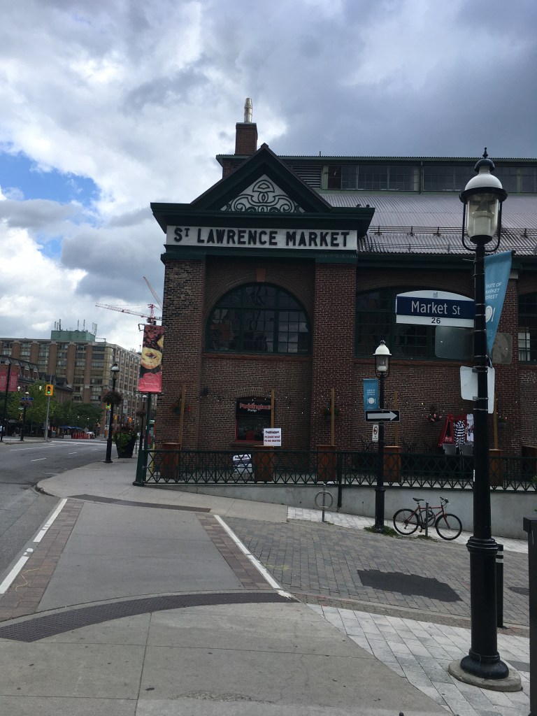
At Corktown, there are washrooms and water fountains, and there are several coffee shops nearby. Near the Common, the shops/restaurants at the Distillery District, or the St. Lawrence Market, offer lots of choice.
In the Beaches, there are washrooms and water fountains in several of the parks. There are also cafes near the Boardwalk, and of course along Queen Street itself there are many places to chose from. If you are paying attention to the route, you’ll see that Queen between Silver Birch Drive and Ivan Forest Gardens is about half-way, so it makes a natural spot to stop for a break.
North of the Beaches, your last chance for coffee or food is near Victoria Park and Danforth. After that, if you are following the route as described, there are no coffee shops until you get back to Yonge Street. There are some washrooms and water fountains in Taylor-Massey Creek, E. T. Seton, Wilket Creek, and Sunnybrook Parks.
Note that all of the public washrooms and water fountains in any of the city parks are seasonal, so they close around October and don’t reopen till May. Note also that COVID-19 is causing restrictions on some of these facilities. In winter, you may need to use coffee shops along the route.
Diversions:
I’ve described the route in a counter-clockwise direction. You can of course reverse that and go clockwise round. The hills are the same I think – you are still climbing in and out of various ravines, but it might be a bit easier going clockwise as the climbs are less steep.
It’s easy to break this up if you want and tackle it over different days. Jump on/off points include the Brickworks, Corktown Common, Queen Street, or Victoria Park Station.
The Distillery District and Corktown St. Lawrence are worth exploring in their own rights, as is the Beaches neighbourhood. If you break up the route, you could spend a few hours in either area and that would be a great way to explore the eastern part of the city.
As noted, seasons matter quite a bit on this route. Summer near the lake is awesome, the trees in the ravines are stunning in autumn, the wildflowers in spring are gorgeous, and the quiet of a fresh snowfall is peaceful. You could walk this route multiple times and see different things every time.
Part of a series on my favourite places to go for a walk in Toronto
Blog posts are a labour of love for me, and yet there is a cost to running this site and organizing my walks.If you’d like to help with that, I’d really appreciate something for my tip jar.The Buy Me a Coffee service allows patrons like you to fund writers like me. If that sounds like a worthy idea to you, then go ahead – keep buying me coffees.Thank You Very Much to everyone who has contributed already!
*****
And now on to the regular post …..
Any time of the year is a good time for the beach
If you live in Toronto, just saying “the Beaches” probably brings up several images – the shops, restaurants and bars, ice cream, the parks, the sand, the boardwalk, and probably more besides. Whether you are a lifelong resident or a weekend visitor, strolling the boardwalk and staring at the waves is magical.
Location: There’s the “beach” part of the Beaches and then there’s the neighbourhood. The sandy lakefront starts at Woodbine Beach and continues along the lake to Balmy Beach Park. The neighbourhood stretches along Queen eastward from around Woodbine Avenue to the end of Queen Street near Victoria Park Avenue, and then south to the lake and north to Kingston Road.
Public Transit: Take the Queen 501 Streetcar east from Queen Station on Line 1 and get off at Coxwell Avenue for Woodbine Park, or a bit further east past Woodbine Ave for the shops.
Why I like it:
For me the Beaches bring up several other images. One is of Canada Day in 1999 – we had just arrived back in Toronto that day, having returned from London, so we thought we’d go for a walk to get reacquainted with the City. The Beaches seemed like the perfect spot to do that. There was a big celebration and party going on in Kew Gardens, and we nearly cried thinking about what we had left behind in London and what was welcoming us back to Toronto.
And then when we were expecting our son and my wife was well along in her pregnancy, in fact a day or 2 past her due date, we decided to go for a walk along the boardwalk. We’d heard that exercise was a good way to get things going, along with eating spicy food, so on our stroll we also grabbed a slice of hot pepperoni pizza.
With no signs of impending labour, we wandered the neighbourhood and came across a home for sale with an open house in progress. We popped in, and must have fit the estate agent’s profile, because she was all over us. We were living in a downtown condo at the time and knew that eventually we’d want a home with a garden and some space for a toddler, and this was a nice family house that backed onto the local school – you could send your child off through the backyard gate into the school grounds – and for a few moments we had serious thoughts of “what if we lived in the Beaches”.
And then we realized that the timing wasn’t great – she was only days from delivery and we didn’t fancy moving with a 1 or 2 month old – so we kept on strolling. Soon enough, within a few days our son was born, and we had more important things to do.
And as he got older, every few months we’d drive out to the Beaches, this time with a stroller, and walk along the boardwalk. Later our strolls took in the parks and playgrounds and ice creams and chasing him along the sand and tossing pebbles into the waves. Once he even won a prize by guessing the # of jelly beans in a jar at a local antique called The Seagull – it was a framed picture of well-known Beaches shops and restaurants. We kept that for years afterwards.
And then there’s the Toronto Waterfront Marathon. I did that in 2017, and the last quarter of the route took in Queen Street right through the heart of the neighbourhood. The eastern end of the route was at Maclean Avenue, where you turned and headed back down Queen, and from that turn there were about 8-9 km to the finish. I was exhausted when I came up Woodbine Ave onto Queen and as I plowed along I kept thinking “where is Maclean, when do I get there”. I was one of the stragglers at the end of the race but there were still lots of locals cheering on us slowpokes as we dragged ourselves through. I still think of that whenever I pass Maclean.
So all of those memories colour how I see the Beaches. I’m sure I’m not the only Torontonian who has a range of memories of the neighbourhood, and I’m sure that as long as we live here we’ll continue to visit to soak up the spirit of the place.
Sights:
The lakefront and the sand are why this area is popular, and the sightseeing starts there.
Woodbine Beach
There’s much more to the area than the actual beaches, of course. The parks are great for picnics and playgrounds. There’s also the pool at Woodbine Park, the outdoor skating rink at Kew Gardens, and many great spots to run around as a kid, an adult, or a dog (there are several off-leash dog run areas along the beach). Plus there are dozens of benches and Adirondack chairs along the boardwalk, perfect for people-watching or just staring at the lake.
The people-watching and window-shopping are also fun along Queen. The area is constantly changing, and old favourites like Seagull Antiques or Lick’s Burgers have sadly closed up, but new places open constantly and there are still some familiar spots like the Sunset Grill and the Beacher Cafe. COVID-19 has put a dent into the retail character of the area, but it will bounce back over time and in the meantime there’s plenty to see and do.
That’s true any time of the year, by the way. The changing seasons are reflected in the parks and the lake. On a hot summer day, the water is blue and enticing, while on a cold January day it can be grey-green and forbidding, but it’s always fascinating. The autumn colours are wonderful, and the spring flowers too. And the many places to pop into along Queen mean that you can always warm up or cool down no matter what the weather.
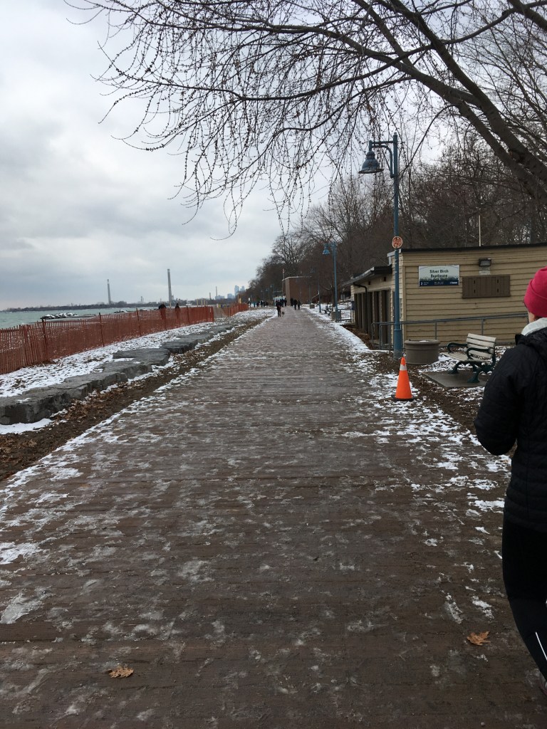
New Year’s Day at Balmy Beach
Food & Refreshment:
There are dozens of ice cream, coffee, burger, pizza, and other takeaway places in the area, including a Pizza Pizza outlet in Kew Gardens at the Boardwalk. There are also usually food trucks around on weekends. And of course, there are many local bars and restaurants to choose from, offering casual to formal options.
Another great idea is to visit some of the many food shops along Queen and grab the ingredients for a picnic – fresh fruit, bakeries, cheeses, snacks, coffee, tea, soft drinks, and more are all available, and there are many picnic tables scattered around the parks along with shady spots and sunny sand where you can enjoy your feast.
There are public washrooms in the parks, along with public water fountains. These are seasonal, open from about May 1 to about Oct 1 depending on the weather. Outside those months, the many coffee shops on Queen are good places for a pit stop.
Diversions:
The Leslieville neighbourhood lies just to the west of the Beaches, along Queen between about Broadview to about Leslie. It’s only about a 2 km walk or so between the neighbourhoods, and there are lots of shops and sights in between, so breakfasting in Leslieville and lunching in the Beaches makes for a great day out.
If the weather is kind, walking from Queen Station on Line 1 along Queen out to the Beaches will take you about an hour and a half, and then you can take the Streetcar back. You can also do that in reverse, and walk back to Queen Station.
The Martin Goodman Trail follows the lakefront all the way across Toronto. Walking or cycling that trail to and from the Beaches is a great way to get some exercise.
The Glen Stewart Ravine runs north from Queen at about Glen Manor Drive, and takes you along a wonderful trail up to Kingston Road. The autumn colours here are spectacular.
The RC Harris Water Treatment Plant at the east end of Queen
Blog posts are a labour of love for me, and yet there is a cost to running this site and organizing my walks.If you’d like to help with that, I’d really appreciate something for my tip jar.The Buy Me a Coffee service allows patrons like you to fund writers like me. If that sounds like a worthy idea to you, then go ahead – keep buying me coffees.Thank You Very Much to everyone who has contributed already!
*****
And now on to the regular post …..
Over the past several months, I’ve written about a number of my favourite walks in Toronto. This time, I wanted to highlight something a bit different.
One of the many great things about living in Toronto is the work that the City has put into exploring its past and making it accessible to a new generation of residents and visitors. One of they ways of doing that is a fantastic program called Discovery Walks.
Each of these walking routes explores some of City’s many natural features like the lakefront or the ravine trail system, and along the way points out the history of the City.
For example, the Garrison Creek walk takes you through downtown Toronto following the route of the now-buried creek that, back in the 1790’s, emptied into Lake Ontario near what today is about Bathurst Street. Following this route takes you through some interesting inner-city neighbourhoods that are full of history, as well as fantastic shopping, bars, and restaurants.
If you visit the City’s website, the list of walks shown includes a map for each route. There are currently 11 of them, and they’re all great. Whether you’re a lifelong resident of Toronto or a visitor with an afternoon to fill, check them out! Toronto is a great walking city (ahem, it’s what I’ve been blogging about for months now!) and these walks prove it.
Length: Each trail is different. They are usually in the 1-3 hour range for a typical walker, and you can jump on/off any of these walks in many places.
Surface: A mixture – mostly they are paved and suitable for strollers and mobility devices, though there can be some gravel portions. Check each route map for details.
Public Transit: Each walk is accessible at start and finish by public transit, usually a combination of streetcar and subway, with some bus travel too. Each route map has details.
Route: See the City website for details. Each route has a detailed map that you can download.
Sights: Each of the walks has many sights to take in. Some are more nature-oriented, like the Humber Marshes, and some are more urban, like the Downtown or Uptown walks.
Any of these walks works well in any season. That said, I’ve always liked Toronto best in about mid-October on a crisp early autumn blue-sky day when the leaves have started to turn but it’s still warm enough for light clothes.
Food & Refreshment:
Most of the routes take you past at least some type of refreshments, either along the route or near the start or finish. Each route map will have some details.
Also, most of the routes take you at least partially through various City parks and trails, and there are public washrooms in most of them. There are also water fountains in most parks. Be aware, however, that these are usually seasonal so they are closed between roughly late October through early May.
Besides the public facilities, Toronto is well-endowed with coffee shops, bars, restaurants, and numerous other places where you can make a pit stop of one kind or another.
Diversions:
Can I suggest blending some of my Favourite Walks with the Discovery Walks? Check out my list and you’ll see that portions of my favourite walks cover the same trails (the Beltline for example) as one of the Discovery Walks. You can walk my route but use the Discovery Walk for more historical info. Or you can walk the Discovery Walk and use my walk for pictures and maps. Mix and match.
As the late great Ernie Banks used to say, let’s play two – why stop at one Discovery Walk when you can link them together and make a great outdoor day. For example, the Lambton House walk route is adjacent to the Humber River route.
Blog posts are a labour of love for me, and yet there is a cost to running this site and organizing my walks.If you’d like to help with that, I’d really appreciate something for my tip jar.The Buy Me a Coffee service allows patrons like you to fund writers like me. If that sounds like a worthy idea to you, then go ahead – keep buying me coffees.Thank You Very Much to everyone who has contributed already!
*****
And now on to the regular post …..
The Crystal at the ROM
I’ve often wandered Toronto’s core, whether out for a noon stroll when I was working downtown, or just taking a roundabout way home when we lived near St. Lawrence Market. I thought it would be fun to put together a walking route of around 10 km that took in many of the sights, offered plenty of shopping, eating, and resting options, and provided a bit of tour through some of the historic parts of the city. I hope this route ticks those boxes for you.
Tip: I’ve included lots of links for some of the sights along this walk – check ahead to confirm opening times, and to find out about special shows or exhibits and things to do.
Length: About 10-12 km, depending on wanderings, so about 2.5 to 3 hours at a leisurely pace.
Surface: Paved.
Public Transit: I set this up to start and end at Nathan Philips Square, which is a block west from Queen Station on subway Line 1. You can also take the subway to Osgoode Station, also on Line 1 (on the University Ave side of the loop) and walk about 3 blocks east. Finally, you could adjust the walk to follow the loop shown but start/stop at Union Station, if you are coming in by GO train.
Route:
Starting at Nathan Philips Square, in front of the Toronto sign, head south-east towards Bay Street, and follow Bay south through the financial district to Front Street. Turn east on Front (left) and walk towards Yonge Street, passing the Hockey Hall of Fame. Continue east on Front Street past Berczy Park, crossing Church Street and continuing to Jarvis Street by the St. Lawrence Market.
Turn north on Jarvis and walk up to King Street, then turn west on King. You can cut through the gardens at St James Park if you’d like, or just keep going along King to Church Street. Turn north (right) on Church and continue up to Queen Street. Turn west (left) on Queen and continue to Yonge Street. Turn north (right) and walk up Yonge past Dundas Square, Ryerson University, and College Park, to reach Wellesley Street. Turn west (left) on Wellesley for about 50m, then turn north (right) onto St. Nicholas Street. Follow St. Nicholas north to Charles Street. Turn east (right) and return to Yonge Street, then turn north (left) and go up Yonge to Bloor Street.
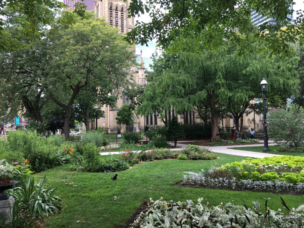
Turn west (left) on Bloor and continue to Bay Street, crossing to the west side. Turn north on Bay and walk up to Cumberland Street. Turn west (left) on Cumberland and walk through Yorkville to Avenue Road. Turn south (left) on Avenue and walk down to Bloor. Cross Avenue and then cross Bloor, to reach the south-west corner by the Royal Ontario Museum. Continue west on Bloor to the gates marking the entrance to the Philosopher’s Walk, just west of the ROM.
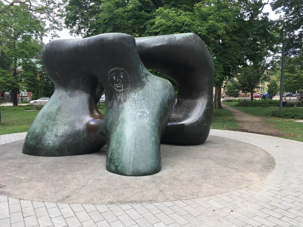
Follow Philosopher’s Walk (fun fact – Philosopher’s Walk follows the ravine of the now-buried Taddle Creek) south to Hoskin Avenue. Cross Hoskin and then turn west (right) for about 50m to Tower Road on the University of Toronto campus. Turn south on Tower road and follow it through the arch at Soldier’s Tower. South of the Tower, follow Kings College Circle south and west and then cut west through the campus to reach the corner of St. George and Russell Street. Follow Russell Street west to Spadina Circle, then turn south on Spadina to reach College Street. Cross College and then Spadina to reach the south-west corner, and then continue west on College to reach Augusta Avenue. Turn south (left) down Augusta into Kensington Market. At Baldwin Street, turn east (left) and continue a few meters to reach Kensington Street. Turn south (right) and follow Kensington to Dundas Street.
At Dundas, turn east (left) and follow it, crossing Spadina in Chinatown. Continue on Dundas to Beverley Street, crossing to the south-east corner by the Art Gallery of Ontario. Turn south on Beverly and walk down to Grange Park. Enter the Park and cut through past the Henry Moore sculpture to reach Stephanie Street. Turn east on Stephanie and then after a few meters turn south to walk through the little park at St. Patrick’s Market. Continue south to Queen Street. Turn east (left) on Queen and cross University Avenue to the north-east corner. Jog north on University a few meters to the gate into Osgoode Hall gardens, turning east and walking through the Gardens to emerge on the west side of Nathan Philips Square. Walk through the Square to take a selfie in front of the Toronto sign!
This walk was designed to tempt you with lots of sights, so I wouldn’t be surprised if you started out with the best of intentions to finish and got so distracted that you have to come back another day.
The Henry Moore sculpture at Grange Park
Also, this walk works in any season. I did it recently on a scorching July day, and being able to pop into places like the Eaton Centre for some AC cooling was really nice. Passing so many covered shopping areas like that also means that on a rainy or snowy day, you can duck out of the weather. Then again, like so many walks in Toronto, I think this would be at its best in early autumn, to catch the foliage in Queens Park and U of T, and to take advantage of the harvest foods at the markets. And finally, don’t forget that in winter, you can go skating on the outdoor rink at Nathan Philips Square. Really, any time of the year will work.
Food & Refreshment:
I set this up going anti-clockwise round the downtown core, which means you go by St. Lawrence Market near the start, a perfect place for breakfast or lunch or a snack. Going in this direction lets you pass through Kensington Market near the end, which is also a great spot for food plus it has lots of coffee joints, juice bars, and beer-and-alcoholic drink bars. In between, there are coffee shops, restaurants, ice cream parlours, bakeries, donut shops, food trucks, and more that cover the spectrum from quick takeaway to full service sit-down.
As far as restrooms and toilets are concerned, there are lots – Nathan Philips Square, St. Lawrence Market, the Eaton Centre, College Park, and Yorkville all have public facilities, and of course the many coffee shops and restaurants along the way provide lots of options.
One thing there isn’t a lot of is water fountains – there are ones in St. Lawrence Market and in the Eaton Centre, but other than that you may want to carry water with you. Of course, the many food/drink options along the way will tempt you if you’re thirsty, so staying hydrated shouldn’t be a problem.
Diversions:
This whole route offers detours, distractions, and diversions. My advice is to use the marked route as a rough guide and just let your curiosity take over.
That said, the two food markets (Kensington and St. Lawrence) are destinations in themselves for me, and so are the AGO, the ROM, and the Hockey Hall of Fame. I could spend hours at any of these places.
From the St. Lawrence Market area, heading east a bit and taking in the Distillery District is good fun. There’s a great holiday market there in December, and some tasty food and shopping options year-round.
Starting at about Carlton Street, and running north about a block east of Yonge along Church Street, the Village is a vibrant, fun, and colourful neighbourhood that’s Toronto’s spiritual home of Pride and its LGBTQ community. The annual Pride parade attracts hundreds of thousands of people of all ages and is centred along Church.
A few blocks further east of the Village, along Parliament Street between about Gerrard and Wellesley, the Cabbagetown neighbourhood showed Toronto what we could do with our beautiful Victorian homes. It’s full of good shops and quiet little streets that are perfect for a stroll, and nearby Riverdale Park and the Riverdale Farm offer lots of things for kids to do.
Yorkville covers several square blocks between Yonge Street and Avenue Road, and between Bloor and Scollard Streets. A hippie hangout in the 1960’s, today it’s full of high-end shops, art galleries, bars, restaurants, and some of the best people-watching in the city.
Part of a series on my favourite places to go for a walk in Toronto
Blog posts are a labour of love for me, and yet there is a cost to running this site and organizing my walks.If you’d like to help with that, I’d really appreciate something for my tip jar.The Buy Me a Coffee service allows patrons like you to fund writers like me. If that sounds like a worthy idea to you, then go ahead – keep buying me coffees.Thank You Very Much to everyone who has contributed already!
*****
And now on to the regular post …..
One of the oldest neighbourhoods in Toronto is the area along Queen Street East, and east of the Don River. It has several names. The City calls it South Riverdale, on Google Maps it’s Riverside and Leslieville, and to Torontonians it’s now mostly thought of as just Leslieville. Whatever you call it, it’s a great area to wander and explore.
Location: For me, what I’ll call Leslieville is a bit more compact than what the City calls South Riverdale. I think of it as extending a few blocks north and south of Queen between Broadview and Greenwood Avenue to the east, and Eastern Avenue and Dundas Street to the south and north. Most Torontonians think of Riverdale as being a bit on the east and west sides of the Don along queen, from River St in the west to Broadview (or a bit past that to the train tracks) in the east. If that’s Riverdale to you, then Leslieville is the area east of Riverdale along Queen to Greenwood.
Public Transit: Take the Line 1 subway to Queen Station, then catch the 501 Streetcar east to about Broadview if you want to wander east through Leslieville. Or stay on the streetcar to about Greenwood and then you can wander back west. It’s only about 4.5 km along Queen back to the subway.
Why I like it:
I like it for several reasons. First of all, there are a ton of little shops, bars, restaurants, and funky dives. OK, it did go through an overly-hipster stretch a few years ago, but now it’s matured into a gentler post-hipster family neighbourhood that still tries to show a little edge here and there, yet not enough to actually be dark and edgy – the equivalent of parents in their early 30’s. For me as a parent pushing 60, it’s great walking around and seeing young families starting out.
Another reason to like it is that it’s a foodie place and I do like to eat. There are plenty of places and they create some competition for each other – you have to be good to stand out. And that foodie scene is then echoed in some of the food shops – cheesemongers, butchers, fishmongers, organic greengrocers, bakers, and more. You could dine very well for breakfast, lunch, and dinner, and finish in a cool bar, anywhere in a 2 km stretch of Queen between Broadview and Leslie. That competition also means that places turn over, so if you go back every few months there will be something new to try.
One other fun fact – back in the 1980’s, Canada’s national broadcaster the CBC ran a show for teens called the Kids of Degrassi Street, about inner-city kids living on what is a real street that’s smack in the middle of the area. In the 2000’s, a revived and updated version of Degrassi Street starred a little known young actor named Aubrey Graham, who today is better known as Drake. Today, you can wander along the real Degrassi street looking at the renovated homes that are now everywhere – a far cry from the working class world of the original Degrassi Street TV series.
Sights:
The most obvious sights are along Queen, and just walking up and down here you’ll find something to catch your eye, whether it’s a cool design/clothing place, a retro bar, or a thrift shop full of bargains. The streets will be a mixture of locals and tourists, young and old, new parents, grandparents, kids, dogs, bikes, strollers, and little wagons. It’s a real neighbourhood, not a manufactured one, where people live and work and play. Walking around you see Toronto in its diversity, though it’s also true that the gentrification and ensuing increase in housing costs means that it’s losing some of its funky edge.
Besides the shops, you see that gentrification when you wander the side streets, increasingly full of older homes renovated and updated. The time to buy here was 5-10 years ago – a $500k fixer-upper then will probably be worth well north of $1m now. If you are into houses and home reno’s, wandering about will give you lots of ideas to try.
There are also some nods to history throughout the neighbourhood. Just north of Queen, on Broadview, there is the former Don Jail, built in the 1860’s and only closed in the 2000’s.
Today, the building has been restored and incorporated as the admin wing of BridgePoint Hospital, and you can tour the grounds to admire the architecture.
There’s also nods to local history at places like the Leslieville Pumps. This gas station is now known more for it’s takeout or eat-in BBQ than it is for petrol.
Food & Refreshment:
Too many to list, there’s everything from fine dining to bistros to diners along Queen. Toronto’s diversity is reflected as well – pizza, sushi, BBQ, Indian, Thai, Caribbean, you name it.
There are lots of coffee places and bars too, many with outdoor tables which are perfect for people watching. Summer is the best time for that, and sun-starved winter warriors are often sitting out in March or April whenever they can.
There are some public washrooms at the community centre at Jimmy Simpson Park. Other than that, a coffee place is your best bet for quick pit stop.
Diversions:
It’s not massively far to start out at St. Lawrence Market for breakfast and then walk north and east through Corktown to Queen and then on over the Don River into Leslieville. You can of course go the other way, starting in Leslieville and ending perhaps at the Distillery District or at St. Lawrence. Either way, you tie together 2 great foodie areas with a nice 4-5 km walk.
To the north of Leslieville along Gerrard Street, is one of Toronto’s several Chinatowns, centred around Broadview. A loop up Broadview from Queen to Gerrard and then east to about Carlaw will take you through that vibrant scene.
If you keep going east on Gerrard, past about Leslie, you come to Little India, the downtown’s place for authentic south Asian foods, fashion, and charm.
At the east end of Leslieville at about Greenwood, a short walk south and east takes you to Ashbridges Bay, which is basically the entry into the Beaches neighbourhood.
Blog posts are a labour of love for me, and yet there is a cost to running this site and organizing my walks.If you’d like to help with that, I’d really appreciate something for my tip jar.The Buy Me a Coffee service allows patrons like you to fund writers like me. If that sounds like a worthy idea to you, then go ahead – keep buying me coffees.Thank You Very Much to everyone who has contributed already!
*****
And now on to the regular post …..
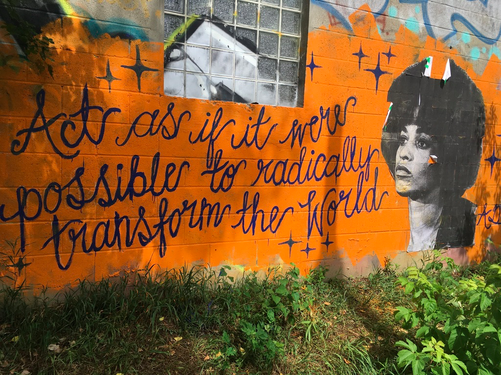
Graffiti art on the Lower Don
I was thinking about how to make an all-day walk that tied together some of my favourite parks and trails in mid-Toronto, and looking at a map I realized that I could put together something that stared and ended in mid-town and took in the Don Valley, the lakefront, and the parks and trails to the west around Roncesvalles. Here’s what I came up with:
Length: Depending on your exact route and any detours, it will be about 30-32 km. Allow yourself about 7-8 hours to give time for breaks, picnics, and perhaps some shopping.
Surface: Mostly paved, with some gravel paths along the Kay Gardner Beltline.
Public Transit: Take subway Line 1 to Davisville Station and walk south 2 blocks along Yonge Street to Merton Street. Cross at the lights, walk about 50m east and turn into the laneway behind condo to reach the Beltline Trail opposite the gate into Mount Pleasant Cemetery. The finish is the same spot, so just reverse your steps to get back to Davisville Station.
Route:
Starting in mid-town on the Kay Gardner Beltline Trail on the north side of Mount Pleasant Cemetery, it follows that Trail through the Cemetery and then out on the south-east end, to continue down the Moore Ravine past the Don Valley Brickworks. Here, divert to the Brickworks for a pitstop, and then cross Bayview to join the Lower Don Trail.
Continue south on the Don Valley Trail to Rosedale Valley Drive. Since the Don Trail stops here, it climbs the hill beside St. James Cemetery and then enters Riverdale Park, following the trails there back down into the Don Valley to pick up the Lower Don Trail again. Continuing south, it reaches Corktown Common and then bends around to the west as it joins the Martin Goodman Trail along the lake.
Continuing west on the Martin Goodman Trail, you go all the way across to Sunnyside Park, and then take the footbridge over the roads and rail lines to reach Roncesvalles Avenue. Walking north up Roncy, you reach Grenadier Road, turn east for a bit, and then jog north up Sorauren Avenue to reach Dundas St W. Turning east, you follow Dundas for about 100m to reach the start of the West Toronto Rail Trail. This takes you north for several km past Bloor Street, and deposits you on Osler St, where you jog north and west to reach Davenport Road, just west of Earlscourt Park.
Cutting through the park, you emerge onto St. Clair Avenue at the bottom of Prospect Cemetery. The roads through here wind north and exit onto Eglinton Avenue. Turning west for a bit, you find Caledonia Road, go north to Bowie Avenue, and then turn west to pick up the start of the York Beltline Trail. This then curves north and then east, taking you eventually to Marlee Avenue. Exiting this trail, you cross Marlee at the lights, follow Elmridge Drive over the Allen Expressway, and then turn into the lane to join the Kay Gardner Beltline again at its western end. Following this all the way back to Mount Pleasant Cemetery completes the loop.
Sights:
What I like about this route is that it shows off so many of the best parts of Toronto – the parks, the ravines, the trails, the lake, and diverse neighbourhoods full of shops, restaurants, and bars. You get some natural fun along with some urban colour.
At the start, Mount Pleasant Cemetery is worth a visit all by itself. I love wondering its cool shaded roads and exploring the history of Toronto expressed in the headstones and monuments. The Kay Gardner Beltline Trail is incorporated into the Cemetery, so you can just follow the purple line painted on the road, or you can detour and explore a bit.
As you exit the Cemetery, you enter one of the best walking trails in Toronto, the Moore Ravine Trail. The trees, the quiet, the burbling of Mud Creek, and the people watching are all fantastic. It’s a short walk, but it then takes you past the Don Valley Brickworks, again a worthy destination on its own.
Cool Moore Ravine shade on a hot summer day
From the Brickworks, following the Lower Don Trail takes you under the Prince Edward Viaduct that carries Bloor Street and the subway over the Don Valley. Climbing the hill at Rosedale Valley Road takes you into Riverdale and east Cabbagetown. The zoo and park here are great fun for kids, and in summer the hot dog and ice cream vendors are worth a treat.
And of course, then there’s Corktown. The Common is one of my favourite recent additions to the City. I remember this area in the 1980’s as a post-industrial grey wasteland, and to see it now, transformed, is to be reminded that even if we badly bugger up the world, we can, if we put our minds to it, help nature reclaim and renew it.
The wavedeck at the foot of Spadina
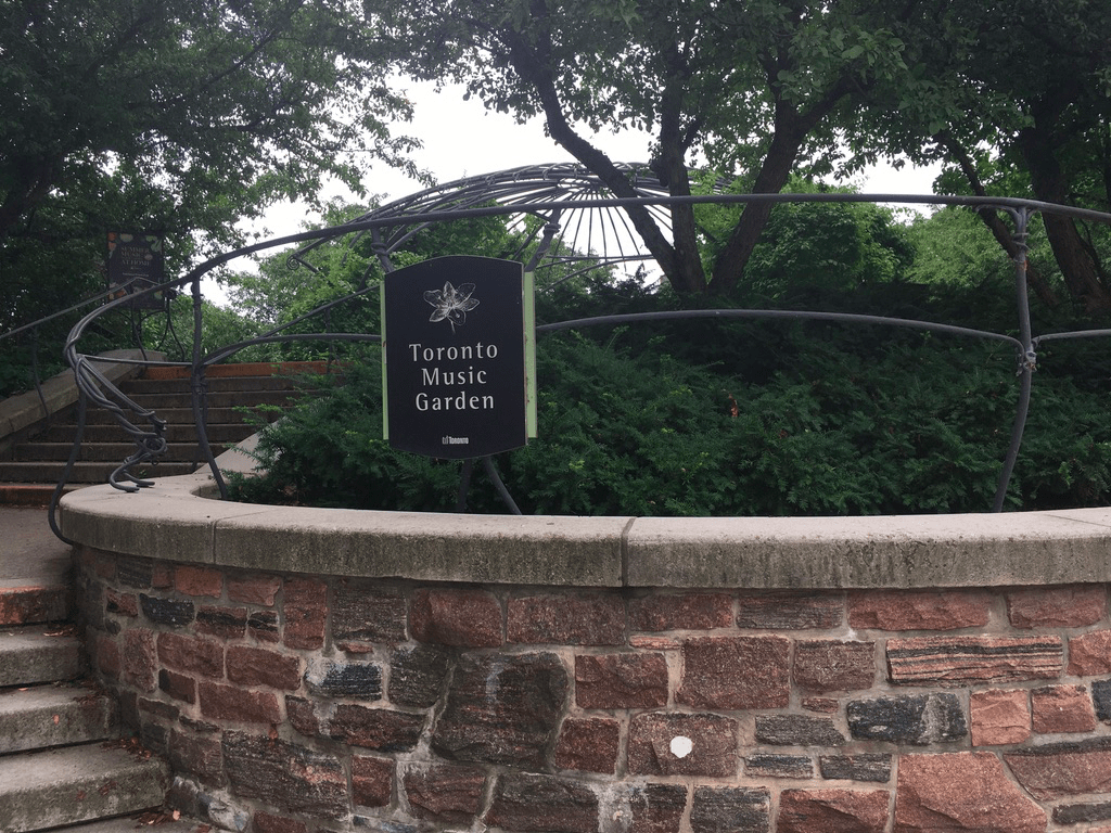
The Martin Goodman Trail takes you through the Queen’s Quay neighbourhood, another area that’s seen huge changes over the past 20 years. The shops at Queens Quay itself have been joined in the area by many condo’s, and while I can’t say I’m a fan of tall glass towers, it does mean that there’s a much more residential feel in the area now. Combine that with reminders of industry like the Redpath Sugar Mills along with the marinas, the Harbourfront Centre’s art galleries, and little parks like the Toronto Music Garden and you get a diverse area with many things worth a detour and exploration.
Past Queens Quay, the lakeshore all the way west is mostly one big big green space divided into several parks – Coronation, Marilynn Bell, and Sunnyside. Each is chockfull of picnic areas, benches, Adirondack chairs, and cool shade. I could do without the roar of traffic from the busy nearby roads, but when you get a little quiet lull, the honk of geese and splash of waves reminds you that you’re next to Toronto’s greatest feature – Lake Ontario.
Little Norway Park along Queens Quay
Then you jump back into urban life, along Roncesvalles, where shops, restaurants, and bars abound. There’s a lot of life here and it’s changed so much over the past 20 years that I hardly recognize it. The recent addition of the Museum of Contemporary Art to the area just continues to boost an already-booming area.
The West Toronto Rail Path leads you into an area that hasn’t yet been gentrified (yes there are still some of those in mid-Toronto). This area still has a lot of older untrendy shops that remind you that actual working-class people still live in actual working-class houses.
Graffiti art along the West Toronto Rail Path
And then Earlscourt Park, leading to the Corso Italia area along St. Clair Avenue West brings you into a slice of Toronto that has seen waves of newcomers bring life along with their culture and foods. It’s changing still as it always has – come back in 20 years and the Corso Italia may become Little Mexico.
Prospect Cemetery is a cool oasis about 3/4s of the way through this walk, and like Mount Pleasant, it’s a reminder of so many things about Toronto’s past. Whereas Mount Pleasant’s early headstones show the Anglo-Scots surnames of the “Toronto the Good” era, in Prospect Cemetery the names are Irish, Ukrainian, Polish, and Portuguese – west Toronto has been working class for more than one hundred years.
Prospect Cemetery
You see that working class vibe as you leave Prospect and cross Eglinton. The houses and shops here are smaller but no less well tended than the bigger places near, for example, Rosedale or Forest Hill. And then joining the York Beltline, you are joining a path that follows one of the key transportation links that made this area an industrial powerhouse for decades. It’s slowly becoming more residential, and as you walk east back towards the finish, you move back in time from the newer redevelopments into the older, greener mid-town neighbourhoods.
greenery along the Beltline
In walking this, in many ways you do loops in time and in demographics as well as geographically. Along the way, the route takes you from the old City of York which dates back to 1780’s, neighbourhoods that grew up between the mid-nineteenth though to the mid-twentieth centuries, and up into the latest waves of downtown urbanization. It covers inner-city rent-controlled public housing, the latest young-homeowner condo forests, older working-class, and upscale old-money. And, it shows off the natural features of Toronto that I like the most – the ravines, creeks, rivers, and the lake.
Finally, I’d be remiss if I didn’t mention that the time of year will offer a lot of variety to this walk. You can do this in any season, though some of the trails can get icy in January and February. It’s, shall we say, bracing to walk along the lake in the winter, but when it’s cold and the waves are high the natural ice sculptures can be dramatic. Of course, autumn would always be lovely given the many treed paths and parks so a crisp October day might be perfect. And spring and summer offer their own joys. I did this walk recently, in July 2020, and picked a day that was in the mid-20’s. There are some stretches, especially near Ontario Place and on the York Beltline, where there is little shade, so if it’s bright and sunny you’ll definitely need sun protection.
Food & Refreshment:
There are many, many options along this route. If you like picnics, this route offers some excellent locations in the parks you pass. If you like quick bites, then there’s that too – food trucks, ice cream, coffee, and little cafes. And of course, there are restaurants galore, in parks like the Brickworks, or in neighbourhoods like Queens Quay, Roncevalles, or the Corso Italia.
Washrooms are located in most of the parks along the way, though many are closed in the cold months (November-April). There are year-round washrooms at the Brickworks, along Queens Quay, and in the community centres at Earlscourt Park and Memorial Park. There are also many coffee shops along the way where you can use the facilities for the price of a coffee.
In terms of water fountains, it’s best to carry at least some water. There are places in many of the parks but these are turned off in the cold months. Other liquid refreshment options abound along Queens Quay and in Roncesvalles.
Diversions:
This is a route that is easy to break up over several days. The parks make good jumping on/off points – Corktown Common, Coronation Park, and Earlscourt Park are all near streetcar stops and can work well this way.
If you are coming in from outside Toronto, you might want to stop/start at Union Station instead of Davisville. You can take the GO Train to Union and walk down Bay Street to Queens Quay, and join the loop that way.
I’ve described this going clockwise around Toronto, but of course you could do it counter-clockwise. Either way, you have to descend from mid-town to the lake and climb back again, though I find the climb through Earlscourt and Prospect Cemetery to be a bit less steep than up the Don Valley and the Moore Ravine.
In walking this, you’ll pass some great shopping/dining areas, especially around Corktown – the Distillery District and St. Lawrence Market are an easy detour away, and you can avoid the industrial grunge around the bottom of the Lower Don Trail where it joins the Martin Goodman Trail.
If you really want to extend your loop, you can also incorporate the Toronto Islands. Just take the ferry at the bottom of Yonge over to Wards Island, walk the path west to Hanlon’s Point and ferry back to the docks to rejoin the path I’ve outlined. I’d allow at least 1.5 hours for this, including ferry waiting times.