Favourite Toronto Walks -East Toronto Loop

Part of a series on my favourite walking trails in Toronto.

Blog posts are a labour of love for me, and yet there is a cost to running this site and organizing my walks.If you’d like to help with that, I’d really appreciate something for my tip jar.The Buy Me a Coffee service allows patrons like you to fund writers like me.  If that sounds like a worthy idea to you, then go ahead – keep buying me coffees.Thank You Very Much to everyone who has contributed already!

*****

And now on to the regular post …..

Several years ago, I was training to do the Toronto Waterfront Marathon. I had never done a walk (and I walked it more than I ran it) of more than about 20 km, and since a marathon is 42 km, I planned out a walk that would be about 30 km in length and incorporate some ups and downs to get my legs built up.

This walk starts and ends in mid-town Toronto at Yonge and Eglinton, and takes in parts of the Beltline, the Don Valley Brickworks, the Lower Don Trail, Riverdale Park, Corktown Common, the Martin Goodman Trail, the Beaches Boardwalk, the Glen Stewart Ravine, the Taylor-Massey Creek Trail, E.T. Seton Park, Wilket Creek Park, Sunnybrook Park, the Burkes Brook Ravine, and Sherwood Park – whew!

Length: About 32 km, including about 200m of vertical ups and downs

Surface: Mostly paved, with gravel path on some of the ravine trails, plus the wooden boardwalk in the Beaches.

Public Transit: Start and end at Eglinton Station on the Line 1 subway

Route:

Starting from Eglinton Station, head south on east side of Yonge St and turn east (left) at Manor Road. Cross the street and turn right (south) down Tullis Drive. Follow Tulis south to Belsize Avenue, crossing the street to the south side. You’ll see a fence laneway in front of you – take that as it’s a public right of way and follow it to Millwood.
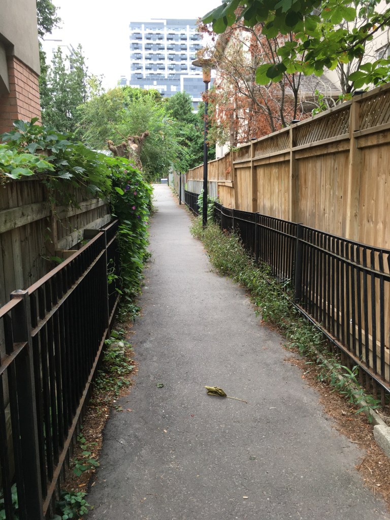
Laneway between Belsize and Millwood

Turn left (east) on Millwood and proceed down the hill. At Acacia, turn south (right) and follow that to Davisville Avenue. Cross Davisville and turn west (right) for a few meters to Pailton Crescent. Turn left (south) and follow Pailton to Merton Street. As you cross Merton at the crosswalk, there is a path directly in front of you beside a condominium building and that takes you to the Beltline Trail.

At the Beltline, turn left (east) and follow it for about 100m to the entrance into Mount Pleasant Cemetery. Inside the Cemetery follow the purple painted lines on the road, following it east under Mount Pleasant Road and around towards the memorial gardens. The marked path takes you east and south and exits the cemetery at Moore Avenue, opposite the entrance to the Moore Ravine Trail – careful, there are always many impatient drivers as you try to cross.

Descend on the trail into the ravine and follow it for about 1km. When you reach the entrance to the Don Valley Brickworks, you can detour left over the bridge and follow the trails in the Brickworks, or else continue on the Beltline south until you enter the Brickworks opposite the main buildings near the car park. Exit the Brickworks complex here, crossing Bayview Ave at the lights to join the Lower Don Trail (turn right, south). Follow the Don Trail south parallel to Bayview for about 1.5 km to the traffic lights at Rosedale Valley Drive. Cross here and directly in front of you will be the stairs up the hill beside St. James Cemetery. Climb up to reach Wellesley Park.

Walk through the park and onto Wellesley Street, and keep going about 100m to Sumach Street. Turn left (south) and follow Sumach to the entrance to Riverdale Park. Turn left into the Park and follow the path diagonally across past Riverdale Farm, in a south-east direction, to reach the stairs leading down into the Don Valley. Follow the path down to reach the bridge over Bayview Avenue – climb up, cross the road, and then take the stairs down onto the Lower Don Trail. Follow the Trail south about 1.5 km to Corktown Common.

If you go past the Common, the Trail bends a bit west and then east under the Don Valley Parkway overpass, to come to a trail junction. Turn left (east) here to cross the Don River and then join the Martin Goodman Trail parallel to Lakeshore Blvd. If you detoured into the Common, follow the paths in the park back out through the junction tunnel that passes under the train tracks to rejoin the Lower Don Trail.

Once on the Martin Goodman Trail, follow it east for 2-3 km to reach the entrance to Woodbine Beach park. It’s better to walk on the north side of Lakeshore, as the cycle path and foot path are separated here so you’re not constantly being dinged by cyclist’s bells.

Martin Goodman Trail between Carlaw and Leslie

When you reach Woodbine Beach park, cross Lakeshore at the traffic lights and turn into the park, follow the Martin Goodman trail pathway connect to the west end of the Beaches Boardwalk. Keep going east following the boardwalk for 2 km to reach Balmy Beach Park.

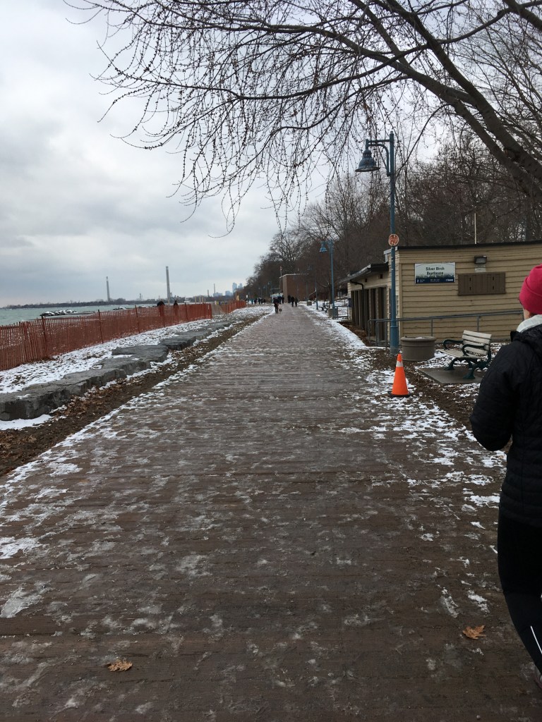
the Boardwalk at Beaches park.

At Balmy Beach, at the end of the Boardwalk, turn north (left) onto Silver Birch Drive and follow it north to Queen Street. At Queen, turn left (west) and follow it for about 500 m to the entrance to Ivan Forest Gardens park, on the north side of the street. Turn into the park and follow the trail north through the park, which will turn into Glen Stewart Park, and exit at Glen Manor Road East. Cross that street and descend into the Glen Stewart Ravine, following the trail north and east.

Exit the Glen Stewart Ravine trail at Kingston Road and turn right (east). Walk along Kingston Road east – you can either go all the way to Victoria Park Ave and then turn left (north) or else turn north up one of the side streets such as Scarborough Road and follow that to Gerrard – if you do that, turn right (east) on Gerrard and walk east to Victoria Park, then turn left (north). Once on Victoria Park, follow it north under the train tracks and on past Danforth Avenue. Keep going north past the Victoria Park subway station, and about 500m north of the station the road descends into a gulley. On the west side of the road opposite the Dentonia Park Golf Course you will find a set of stairs descending into the Taylor-Massey Creek Park trail system.

Once on the trail here, follow it west for about 4 km to reach the lower Don parklands. At the Lower Don off-leash dog park, turn right (north) and follow the trail north and then west crossing under the Don Valley Parkway to reach the junction with the Don Valley Trail system. Turn right (north) crossing the Don River over the old Don Mills Road bridge,

the old Don Mills Road bridge

and follow the trail through the parking lot to reach a bridge over the train tracks. Turn left (west) at the top of the bridge and follow the trail to reach the entrance to E. T. Seton Park.

In Seton Park, cut across the car park and turn right (north) along the roadway. Follow the road north till you pick up the West Don Trail inside the park, and then take that trail north through E. T. Seton park all the way to the car park on the south side of Eglinton Ave near Leslie Street. Turn left (west) at that car park and follow the roadway west and then north to cross under Eglinton and enter Wilket Creek Park.

hints of autumn on a September day

Keep going north through Wilket Creek till you reach the junction of the roadway/trail that turns west (left) heading towards Sunnybrook Park. Follow that roadway/trail west into and through Sunnybrook Park, towards the Riding Stables. Just before you reach the Stables, there is a path on the west side of the road that leads to a bridge which crosses the West Don River. Take that path west and on the other side of the river, turn left (south) on the trail beside the off-leash dog park. Follow the trail heading south and then bending west. On the west side of the dog park, turn right (north) onto the Burkes Brook trail. Follow this north and bend to the west to keep going parallel to the water. The trail officially ends after about 500-600m, but you can exit the official trail and keep going west on the unofficial trail. This continues for another 500 m to reach a steep hill climbing up out of the ravine to reach Bayview Avenue.

Cross Bayview (either directly here or else a bit to the north at the traffic lights by Sunnybrook Hospital). On the opposite side of Bayview, reenter the Burkes Brook trail and descend into the ravine again. Follow this trail west for about 1km, climbing the stairs passing through the off-leash dog area, to descend into Sherwood Park. At Sherwood Park, turn north and then west at the bridge over Burkes Brook (next to the City of Toronto maintenance buildings) and climb the hill along the roadway to exit the ravine/park onto Sherwood Avenue.
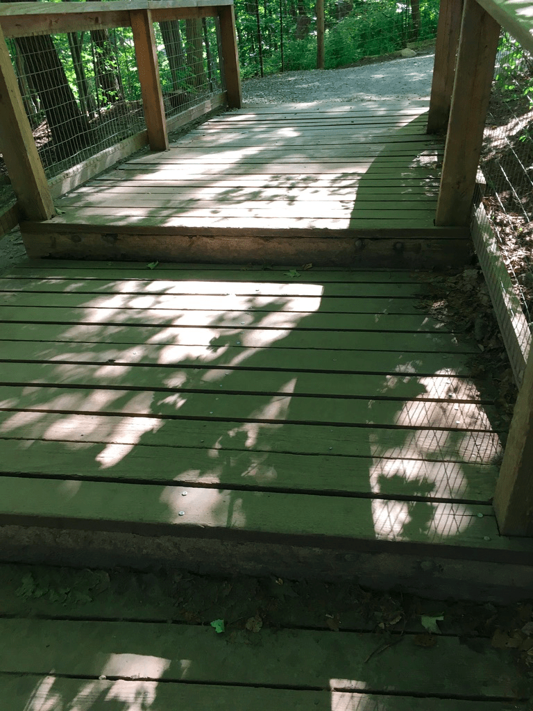
Up the stairs in Burkes Brook

Follow Sherwood west for about 500m to Mount Pleasant Road. Cross at the traffic lights and continue west along Sherwood for about another km or so to reach Yonge Street. Turn left (south) on Yonge and follow it for about 1km to reach the finish back at Eglinton Station.

Sights:

I like this walk because of the variety of scenery – the forests and wildness of the ravines, the garden settings in the parks, the sand and the lake along the Boardwalk, and the urban stretches through the upper beaches. That variety keeps it interesting over the whole length of the walk, and it also means that in any season there will something different. The ravines and shaded streets also mean you have some shelter from summer sun, though note that in winter most of the trails are not cleared or salted so they can get icy.

The Beltline down Moore Ravine

Another cool thing about this walk is that it actually follows a number of the various creeks and brooks that have been buried over time. For example, at the start of the walk, Tullis Drive follows the course of Mud Creek. If you listen carefully at the manhole cover at the corner of Tullis and Glebe Road, you can usually hear the stream following under your feet. The same happens on Millwood in the little gully that you descend into – that gully is there because of the creek. Check out the Lost Rivers project to learn more about this fascinating part of Toronto’s history.

down the hill on Millwood into the Mud Creek gulley

I also like this route for the many angles it gives you on the Toronto skyline. From the Don Valley near the Brickworks, you see it from the north and east. From beaches, you see it directly along the lake and you get the tall chimneys of industry poking up as well. You always see the CN Tower poking through and that landmark is usefully to navigate by. These landmarks are reminders that while you’re walking through many beautiful natural settings, the industrial and commercial aspects of the city are always around you.
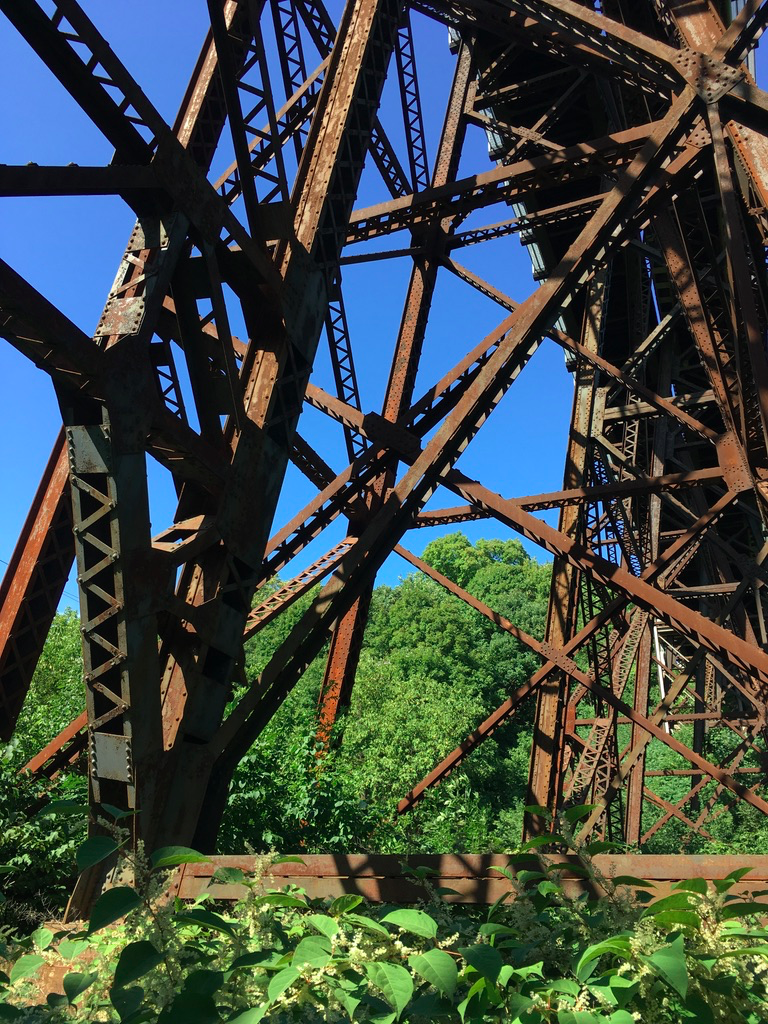
Industrial Toronto reclaimed – the old railway bridge at the north end of E.T. Seton Park

The many parks that this route takes in are also little time capsules. Corktown Common and the Brickworks, for example, are relatively new additions to the City’s park system, having been created in the 2010’s as part of the revitalization of what had been industrial areas. A generation earlier, in the 1970’s, parks such as E.T. Seton were added, and to offer the growing middle classes not just trails but also recreational amenities like a disk golf course and an archery range. A generation before that, in the 1940s after WW2, Sunnybrook Park was laid out after a private estate was taken over during the war to create a health facility for returning veterans. And finally, another generation back in the 1920s, the parks in the Beaches are 100 years old and reflect the formal gardens, picnic areas, and baseball diamonds that were popular then.

Taylor Creek

Finally, this route, especially around the Beaches, is great for people watching, I’ve seen everything from multi-generational families out for a stroll to movie shoots to outdoor aerobics classes. It can get crowded in high summer, especially on a weekend, but for people watching that just adds to the fun.

Food & Refreshment:

There are several spots where clusters of restaurants and coffee shops will set you up for the journey. That starts with Yonge & Eglinton, which is packed with places to grab some food as you set out or as you finish.

In the Brickworks there are washrooms, water fountains, and a great cafe, plus on weekends there are often farmers markets or festivals on (note that COVID-19 may crimp these a lot so check ahead).

At Corktown, there are washrooms and water fountains, and there are several coffee shops nearby. Near the Common, the shops/restaurants at the Distillery District, or the St. Lawrence Market, offer lots of choice.

In the Beaches, there are washrooms and water fountains in several of the parks. There are also cafes near the Boardwalk, and of course along Queen Street itself there are many places to chose from. If you are paying attention to the route, you’ll see that Queen between Silver Birch Drive and Ivan Forest Gardens is about half-way, so it makes a natural spot to stop for a break.

North of the Beaches, your last chance for coffee or food is near Victoria Park and Danforth. After that, if you are following the route as described, there are no coffee shops until you get back to Yonge Street. There are some washrooms and water fountains in Taylor-Massey Creek, E. T. Seton, Wilket Creek, and Sunnybrook Parks.

Note that all of the public washrooms and water fountains in any of the city parks are seasonal, so they close around October and don’t reopen till May. Note also that COVID-19 is causing restrictions on some of these facilities. In winter, you may need to use coffee shops along the route.

Diversions:

  1. I’ve described the route in a counter-clockwise direction. You can of course reverse that and go clockwise round. The hills are the same I think – you are still climbing in and out of various ravines, but it might be a bit easier going clockwise as the climbs are less steep.
  2. It’s easy to break this up if you want and tackle it over different days. Jump on/off points include the Brickworks, Corktown Common, Queen Street, or Victoria Park Station.
  3. The Distillery District and Corktown St. Lawrence are worth exploring in their own rights, as is the Beaches neighbourhood. If you break up the route, you could spend a few hours in either area and that would be a great way to explore the eastern part of the city.
  4. As noted, seasons matter quite a bit on this route. Summer near the lake is awesome, the trees in the ravines are stunning in autumn, the wildflowers in spring are gorgeous, and the quiet of a fresh snowfall is peaceful. You could walk this route multiple times and see different things every time.

TO Places – The Beaches

Part of a series on my favourite places to go for a walk in Toronto

Blog posts are a labour of love for me, and yet there is a cost to running this site and organizing my walks.If you’d like to help with that, I’d really appreciate something for my tip jar.The Buy Me a Coffee service allows patrons like you to fund writers like me.  If that sounds like a worthy idea to you, then go ahead – keep buying me coffees.Thank You Very Much to everyone who has contributed already!

*****

And now on to the regular post …..

Any time of the year is a good time for the beach

If you live in Toronto, just saying “the Beaches” probably brings up several images – the shops, restaurants and bars, ice cream, the parks, the sand, the boardwalk, and probably more besides. Whether you are a lifelong resident or a weekend visitor, strolling the boardwalk and staring at the waves is magical.

Location: There’s the “beach” part of the Beaches and then there’s the neighbourhood. The sandy lakefront starts at Woodbine Beach and continues along the lake to Balmy Beach Park. The neighbourhood stretches along Queen eastward from around Woodbine Avenue to the end of Queen Street near Victoria Park Avenue, and then south to the lake and north to Kingston Road.

Public Transit: Take the Queen 501 Streetcar east from Queen Station on Line 1 and get off at Coxwell Avenue for Woodbine Park, or a bit further east past Woodbine Ave for the shops.

Why I like it:

For me the Beaches bring up several other images. One is of Canada Day in 1999 – we had just arrived back in Toronto that day, having returned from London, so we thought we’d go for a walk to get reacquainted with the City. The Beaches seemed like the perfect spot to do that. There was a big celebration and party going on in Kew Gardens, and we nearly cried thinking about what we had left behind in London and what was welcoming us back to Toronto.

And then when we were expecting our son and my wife was well along in her pregnancy, in fact a day or 2 past her due date, we decided to go for a walk along the boardwalk. We’d heard that exercise was a good way to get things going, along with eating spicy food, so on our stroll we also grabbed a slice of hot pepperoni pizza.

With no signs of impending labour, we wandered the neighbourhood and came across a home for sale with an open house in progress. We popped in, and must have fit the estate agent’s profile, because she was all over us. We were living in a downtown condo at the time and knew that eventually we’d want a home with a garden and some space for a toddler, and this was a nice family house that backed onto the local school – you could send your child off through the backyard gate into the school grounds – and for a few moments we had serious thoughts of “what if we lived in the Beaches”.

And then we realized that the timing wasn’t great – she was only days from delivery and we didn’t fancy moving with a 1 or 2 month old – so we kept on strolling. Soon enough, within a few days our son was born, and we had more important things to do.

And as he got older, every few months we’d drive out to the Beaches, this time with a stroller, and walk along the boardwalk. Later our strolls took in the parks and playgrounds and ice creams and chasing him along the sand and tossing pebbles into the waves. Once he even won a prize by guessing the # of jelly beans in a jar at a local antique called The Seagull – it was a framed picture of well-known Beaches shops and restaurants. We kept that for years afterwards.

And then there’s the Toronto Waterfront Marathon. I did that in 2017, and the last quarter of the route took in Queen Street right through the heart of the neighbourhood. The eastern end of the route was at Maclean Avenue, where you turned and headed back down Queen, and from that turn there were about 8-9 km to the finish. I was exhausted when I came up Woodbine Ave onto Queen and as I plowed along I kept thinking “where is Maclean, when do I get there”. I was one of the stragglers at the end of the race but there were still lots of locals cheering on us slowpokes as we dragged ourselves through. I still think of that whenever I pass Maclean.

So all of those memories colour how I see the Beaches. I’m sure I’m not the only Torontonian who has a range of memories of the neighbourhood, and I’m sure that as long as we live here we’ll continue to visit to soak up the spirit of the place.

Sights:

The lakefront and the sand are why this area is popular, and the sightseeing starts there.

Woodbine Beach

There’s much more to the area than the actual beaches, of course. The parks are great for picnics and playgrounds. There’s also the pool at Woodbine Park, the outdoor skating rink at Kew Gardens, and many great spots to run around as a kid, an adult, or a dog (there are several off-leash dog run areas along the beach). Plus there are dozens of benches and Adirondack chairs along the boardwalk, perfect for people-watching or just staring at the lake.

The people-watching and window-shopping are also fun along Queen. The area is constantly changing, and old favourites like Seagull Antiques or Lick’s Burgers have sadly closed up, but new places open constantly and there are still some familiar spots like the Sunset Grill and the Beacher Cafe. COVID-19 has put a dent into the retail character of the area, but it will bounce back over time and in the meantime there’s plenty to see and do.

That’s true any time of the year, by the way. The changing seasons are reflected in the parks and the lake. On a hot summer day, the water is blue and enticing, while on a cold January day it can be grey-green and forbidding, but it’s always fascinating. The autumn colours are wonderful, and the spring flowers too. And the many places to pop into along Queen mean that you can always warm up or cool down no matter what the weather.

New Year’s Day at Balmy Beach

Food & Refreshment:

There are dozens of ice cream, coffee, burger, pizza, and other takeaway places in the area, including a Pizza Pizza outlet in Kew Gardens at the Boardwalk. There are also usually food trucks around on weekends. And of course, there are many local bars and restaurants to choose from, offering casual to formal options.

Another great idea is to visit some of the many food shops along Queen and grab the ingredients for a picnic – fresh fruit, bakeries, cheeses, snacks, coffee, tea, soft drinks, and more are all available, and there are many picnic tables scattered around the parks along with shady spots and sunny sand where you can enjoy your feast.

There are public washrooms in the parks, along with public water fountains. These are seasonal, open from about May 1 to about Oct 1 depending on the weather. Outside those months, the many coffee shops on Queen are good places for a pit stop.

Diversions:

  1. The Leslieville neighbourhood lies just to the west of the Beaches, along Queen between about Broadview to about Leslie. It’s only about a 2 km walk or so between the neighbourhoods, and there are lots of shops and sights in between, so breakfasting in Leslieville and lunching in the Beaches makes for a great day out.
  2. If the weather is kind, walking from Queen Station on Line 1 along Queen out to the Beaches will take you about an hour and a half, and then you can take the Streetcar back. You can also do that in reverse, and walk back to Queen Station.
  3. The Martin Goodman Trail follows the lakefront all the way across Toronto. Walking or cycling that trail to and from the Beaches is a great way to get some exercise.
  4. The Glen Stewart Ravine runs north from Queen at about Glen Manor Drive, and takes you along a wonderful trail up to Kingston Road. The autumn colours here are spectacular.
The RC Harris Water Treatment Plant at the east end of Queen

Favourite Toronto Walks

Blog posts are a labour of love for me, and yet there is a cost to running this site and organizing my walks.If you’d like to help with that, I’d really appreciate something for my tip jar.The Buy Me a Coffee service allows patrons like you to fund writers like me.  If that sounds like a worthy idea to you, then go ahead – keep buying me coffees.Thank You Very Much to everyone who has contributed already!

*****

After looking back, I realized that I’ve written a number of posts about favourite Toronto walks, and I wanted to collect them together in one place so that you could find them.

Favourite Toronto Walks -Martin Goodman Trail

Part of a series on my favourite walking trails in Toronto.

Blog posts are a labour of love for me, and yet there is a cost to running this site and organizing my walks.If you’d like to help with that, I’d really appreciate something for my tip jar.The Buy Me a Coffee service allows patrons like you to fund writers like me.  If that sounds like a worthy idea to you, then go ahead – keep buying me coffees.Thank You Very Much to everyone who has contributed already!

*****

And now on to the regular post …..

The Martin Goodman Trail winds along the shore of Lake Ontario, from the Humber River in the West, past Sunnyside Beach, Ontario Place, and Queen’s Quay, crosses the Don River and loops down around Cherry Beach, and then follows Lakeshore Road through Woodbine Park onto the Beaches Boardwalk to end at Balmy Beach. If you want summer, follow this path.

And if you’re not in summer, walk it anyway – the autumn colours, the spring flowers, and the natural ice sculptures of winter all offer sights to keep you interested.

And for people watching, this is Toronto hanging out in its backyard – the whole city makes an appearance at some point. It’s endlessly entertaining and changing to fit the seasons and your mood. Go walk it, and take the time to hang out and chill.

Length: roughly 18-19 km end to end, so 4-5 hours depending on stops. The Martin Goodman Trail is also part of the much longer Waterfront Trail, which within the City of Toronto itself runs from Mimico Creek in the west all the way to the Rouge River in the east. It’s around 50 km across the city, and I’ve walked that as part of my Crossing Toronto Big Walk.

Surface: paved the whole way, though you can walk on boardwalks too at Sunnyside and in the Beaches

Public Transit: to start (assuming you’re going west to east) take the subway Line 1 to either Queen Station or Osgoode Station. Catch the 501 Streetcar heading west to either the South Kingsway (east bank of the Humber River) or the Humber loop stop (west bank). From the streetcar, walk south to pick up the trail on the east side of the Humber Arch bridge At the finish, walk from Balmy Beach north up to Queen Street to catch the 501 Streetcar at Neville Park to head back west to Queen Station on subway Line 1.

Route: The Trail is strait-forward and well marked. It officially starts on the east side of the Humber River just past the Humber Arch Bridge, though there are also several km of waterfront trail on the west side of the river, between Mimico Creek and the Humber.

The Humber Arch Bridge

Strictly speaking, there are actually 2 parallel trails, one for bikes and one for walkers. On weekends especially, the bike trail can be busy with speeding spandex, so keep to the walking trail.

There are lots of park benches along the way, and in Sunnyside Park and in the Beaches, there are also lots of comfy Adirondack-style chairs. On a weekday morning, they’re heaven for resting tired feet.

The path follows the lake pretty closely with many little diversions through side gardens. There are a couple of street crossings to negotiate, near Bathurst Street, at Cherry Street, and near the Beaches. Otherwise you really can’t get lost – just head towards the CN Tower from the west end, and towards the Ashbridge’s Bay chimneys once you’re past the CN Tower.

Sights: There are lots of little joys along the trail. You might see a mother goose and her goslings trailing obediently. Or stop to take in the flowers and the visitors at one of the little butterfly gardens that dot the parks. Or there’s the site of planes taking off from Billy Bishop Airport on the islands (even more spectacular during the Toronto Airshow).

The view from the Humber Arch Bridge looking east

As you walk along the trail, there’s also many spots to take in the Toronto skyline. You may not realize it, but you are starting a bit south of the city when you are over by the Humber. As you walk towards Queens Quay, you’re walking north and east, and the many condo and office towers compete with the CN Tower and Rogers Center to dominate the view.

At Sunnyside Beach looking back west towards Mimico

Then as you move past all the shops along Queens Quay itself, and cross the Don River channel at the docklands to head to Cherry Beach, you enter a more relaxed area with sand and trees. It’s a great spot to stop for a picnic.

Cherry Beach
The trail heading east from Cherry Beach

Continuing on, the beach vibe takes over completely past Ashbridges Bay. The sand will tempt you in any weather, and in summer it’s our own version of Venice Beach. I once came across a movie shoot in progress, across the path from a step aerobics class, and alongside grandparents walking with grandkids slurping ice cream who were staring at muscle-shirted beach volleyball players.

The Beaches Boardwalk at Woodbine Beach
Balmy Beach on a not so balmy day …

Food & Refreshment: The Trail has several places for food and drinks, though most are open only during the Canadian summer – Victoria Day to Labour Day. Outside those months, the Trail has dozens of spots that are perfect for a picnic with may picnic tables, benches, chairs, shady spots under trees and sunny spots on sand.

The Sunnyside Pavilion Cafe is a lovely spot for coffee or something stronger.

There are many options around Queens Quay, especially on a summer weekend when there’s usually a festival or market of some kind.

And of course, when you get to the Beaches, a short walk north from the trail takes you to Queen Street with its many shops, restaurants, and bars, not to mention Beaches institutions like Ed’s Real Scoop Ice Cream.

There are a number of public toilets along the trail, at Sunnyside Park, at Queens Quay, Cherry Beach, Woodbine Beach, and Balmy Beach. These are only open between May – October, however. Outside those months, your best bets more or less on the trail are the shops at Queens Quay. Otherwise you’ll need to leave the trail and head towards the shops on one of the parallel shopping streets. Or just walk fast and drink lightly.

Diversions: Because the Trail runs though and nearby to many fun neighbourhoods, like Queens Quay, and especially the Beaches, there are many ways to change the route around.

  1. Shorten it and just walk from the Humber to Queen’s Quay, or from Queen’s Quay to the Beaches.
  2. West to east is fun for me because I like to end at the Beaches, but going east to west is also good. In that case, starting off with a great breakfast at a Beaches joint like the Sunset Grill sets you up to hike away.
  3. As mentioned, the walk changes character dramatically when you go off season. For a number of years, we liked to walk the Beaches Boardwalk on New Year’s Day, and often the wind off the lake is particularly icy. It’s still fun though, and when he was small our son liked to throw snowballs into the lake.

Walk Journal – Dec. 30, 2018

Location: Toronto – Corktown to the Beaches and back

Weather: 1C, grey skies, snow on the ground

Duration: about 2:45 hours, 14.5k

Today my wife and I decided to walk through the Beaches neighbourhood, so to make it longer we drove to Corktown Common and parked there. Then we walked along Eastern Ave to Broadview and then up to Queen and from there walked east through Riverside and Leslieville to the Beaches. After a nice brunch pitstop at the Sunset Grill, we kept going east on Queen to Silver Birch Ave to get down to Balmy Beach. From there, turned back west and walked along the boardwalk and the Waterfront Trail to Ashbridge’s Bay, then back up to Queen to keep going west all the way back to the Lower Don River Trail, and so back to Corktown.

If you know Toronto, you’ll recognize those neighbourhoods. For those out of town, this combined revitalized ex-industrial lands (Corktown Common), gentrified, already-past-hipster-and-on-to-Starbucks blocks (Riverside and Leslieville) and 1-kid-2-dogs ex-hippy Beaches. We’ve been going for walks in the Beaches for years – in fact the day before she went into labour, my wife and I went for a walk there after eating some spicy food in order to get things going.

It’s changed and yet it’s the same – the houses, the vibe, the people. The sound of the day for me was the rattle of sticks and pucks from the outdoor ice rink at Beaches Park, closely followed by the crunch of wet snow underfoot and the churn of small waves on gravelly shores. It was grey but it was lovely, calm, and a reminder of one of the things I love about Toronto, it’s park and trail system.

For a few years in a row when our son was younger, we’d go out to the Beaches and walk the boardwalk on New Year’s Day. This year we went a bit earlier, and now that he’s older he didn’t come with us. But watching the other young parents with kids brought back memories. Walks are often contemplative, and that was today.