The other day, I was looking at the stats for this blog and checked to see what my most popular posts were. The answer was kind of interesting – of the top 20 posts on this blog, 19 of them are about different walks around Toronto. Collectively, those have generated more than 12,000 views.
That’s cool to think I’ve helped thousands of people enjoy walking around Toronto. Go TO!
The humbling part is that the majority of my posts have been about some particular scene or thought that’s occurred to me while walking. Those posts have been, how shall I put this, somewhat less widely viewed. Most of those have a handful of views (thanks Mom!) at best.
me contemplating the futility of my writing career ….
So this blog is helpful to people when I write about things that people want to look for – duh! – like gear reviews and walking routes and suggestions for places to try. Since we’ve moved out to the east coast, I’ve stayed away from those kinds of posts, because as a newcomer I didn’t want to claim any in-depth knowledge as yet.
Still, I do want to be helpful, so going forward I’ll try to include more like that featuring walks around the South Shore and Halifax, and other places in the Maritimes, and maybe some more back in TO whenever we are back to visit family.
To that end, check out my series called TO Walks and Maritime Walks, or my Gear Reviews, and see what those other readers have been browsing.
Blog posts are a labour of love for me, and yet there is a cost to running this site and organizing my walks.If you’d like to help with that, I’d really appreciate something for my tip jar.The Buy Me a Coffee service allows patrons like you to fund writers like me. If that sounds like a worthy idea to you, then go ahead – keep buying me coffees.Thank You Very Much to everyone who has contributed already!
*****
And now on to the regular post …..
Samual Johnson once said, “when a man is tired of London he is tired of life”. With a nod to Dr. Johnson, I’d say that also applies to Yonge Street in Toronto.
The foot of Yonge looking north from the Lake
Many cities have a well-known street – Broadway in New York, Oxford Street in London, George Street in Sydney – but Yonge is a different from those thoroughfares in that, in a sense, there isn’t one “Yonge Street”. While it may be a single road, because it’s such a long street it takes on many moods, so that multiple stretches of Yonge form distinct little neighbourhoods, referred to usually by the cross streets – Yonge & Dundas, Yonge & Bloor, Summerhill, Yonge & St. Clair, Yonge & Eg, and so on as it goes north. Walking any 3-4 km stretch of Yonge between Steeles and the Lake will take you through at least a couple of these neighbourhoods, each with its own atmosphere and vibe. That, and Toronto’s famous mix of cultures from round the world, means that walking Yonge is like a mini tour of the United Nations dipped in maple syrup. I love it.
Length: Yonge is a little more than 20 km from the lake to Steeles, so allow about 5 hours if you want to walk the whole thing. That said, an hour’s stretch at picked at random is lots of fun and lets you explore the surrounding neighbourhoods too.
Surface: It’s a public road so concrete, concrete, concrete, and in winter add large dollops of salt. Wear comfy shoes.
Public Transit: Subway Line 1 runs most of the length of Yonge, from King up to Finch, and bus route 97 covers most of Yonge as well so it’s very easy to pick start and stopping points based on one of the subway or bus stops.
Route:
If it were me, I’d pick a stretch partly based on the weather and partly on the kind of food I like to eat. Starting down at the Lake on a sunny late spring day can be fantastic, and so can exploring mid-town or uptown. Downtown, mid-town, and uptown there are too many restaurants and shops to count, and there are parks like Ramsden or Alexander Muir Gardens or York Mills along the way too.
One way to decide is to simply pick a subway stop at random and then tell yourself you’re going to walk at least 3 subway stops either north or south along Yonge – keeping in mind that north of St. Clair, the stops are quite a bit farther apart than they are downtown.
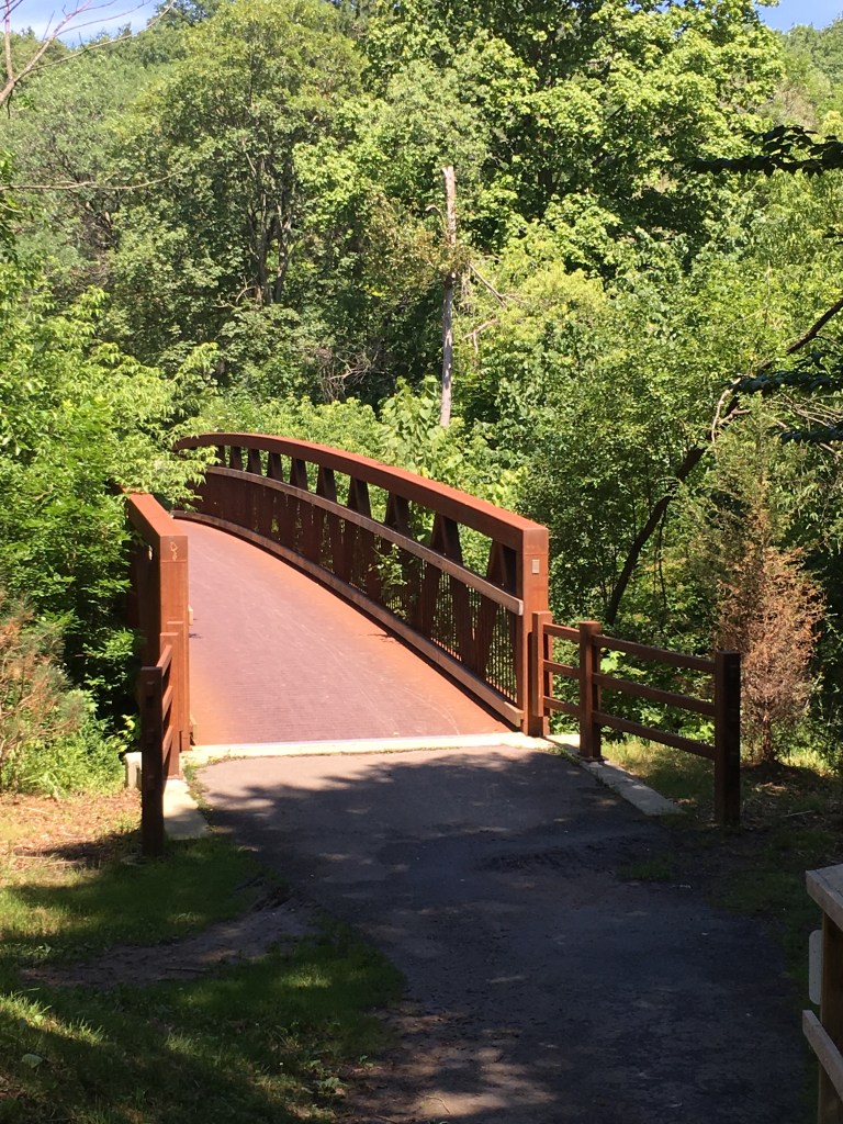
The Beltline Bridge over Yonge, just south of Davisville
However you do it, try walking not just Yonge but also the surrounding streets that parallel it. Often a block east or west of Yonge takes you into residential streets and that’s a great way to explore too, and also get away a bit from the traffic and hustle.
A favourite stretch of Yonge for me is in mid-town, between Bloor and north past Eglinton. This stretch goes past Ramsden Park (a mid-town jewel) as well as Mount Pleasant Cemetery, and it’s lovely to detour into those treed oases for cooling greenness on a hot summer day.
The entrance to Alexander Muir Park on the east side of Yonge, about 2 blocks south of Lawrence Ave
Sights:
Sights on Yonge are as much or more about the people than about the buildings or shops. People watching on Yonge is a year-round sport, and endless fun. Part of that is being people-watched yourself – the way you walk down Yonge, what you wear and what you carry, will provide gossip for others just as much as you can gossip about them. In summer, that includes sitting at one of the sidewalk cafes and patios and people-watching the street scene, sipping a cold glass of something while the passers-by judge you by the food you’re eating. Oh the joys.
Of course, there is history along Yonge as well, if you want to explore. Yonge-Dundas Square, which has become a celebration point when something big happens, like the Raptors NBA Championship win in 2019. Or little bits of history like the plaque that marks the Montgomery Tavern at Yonge and Montgomery, where William Lyon Mackenzie set off with a group of like-minded followers in 1837 during the so-called Upper Canada Rebellion to protest against the government of the day. And landmarks like the clock tower of the old CN rail station at Summerhill that’s now become an iconic location of the LCBO.
The Hockey Hall of Fame at Yonge and Front Street
Of course, for many people Yonge is really about the shopping. For most of it’s length, it’s lined by shops of all descriptions – antiques, clothing, shoes, foods, guitars, bikes, tea, electronics, and so much more. We lived for many years just off Yonge in mid-town and did all of our daily shopping within a 2-block stretch of Yonge that included a fishmonger, a greengrocer, a cheese shop & deli, a bakery, and a butcher, all great little shops where we knew the shopkeepers and they greeted us by name. Sure, Yonge has its share of the big chain stores, but why would you bother when you find some little neighbourhood gem for a unique experience? Between the shops and the many unique little restaurants and bars, you can shop local and follow your 100-km diet. Who needs more?
Food & Refreshment:
It’s Yonge, so expect at least a coffee shop if not an actual restaurant or takeaway every few hundred meters pretty much the whole length of the street. You’ll find virtually every type of cuisine the city offers, and every type of establishment from bars to bistros. There are also countless food shops, butchers, cheese shops, fishmongers, grocery stores, and greengrocers, so you can do all your shopping along Yonge – bring a knapsack and some shopping bags.
Keep in mind that Yonge is an urban streetscape for most of its length, so a hot summer’s day can feel even hotter, just a cold winter’s blast of wind can freeze to the bone. The many shops and refreshments along the way will give you breaks from the weather.
Finally, while there are no public toilets or water fountains available on Yonge Street itself, there are many options available. Downtown, there are washrooms & water fountains in the malls off Yonge at the Eaton Centre, College Park, and Yonge-Bloor. At mid-town, there are washrooms in the mall on the north-east corner at Yonge & St. Clair, and on the north-west corner at Yonge & Eglinton. Uptown, there are malls on the north-east corner at Yonge & Sheppard and the south-west corner at Yonge & Steeles. Of course, there are tons of coffee shops along the way so you can always pop into one of those.
Diversions:
Make a game of it – how many coffee shops can you find along Yonge? How many couples walking dogs will you spot? How many BMWs per block?
You can also use Yonge as a corridor between wider neighbourhoods that are well worth exploring, like Yorkville, Rosedale, Deer Park, or Lawrence Park. In that case, pick a couple of neighbourhoods that are separated by a few km of Yonge, and use the street to walk between them.
There’s much debate about what counts as “downtown”, “mid-town”, and “uptown”. If you want to break down Yonge by those labels, then I’d say downtown is Yonge from Bloor south to the Lake; midtown is Yonge between Bloor and Eg; and uptown is north of Eglinton. Of course, ask 10 people and you’ll get 10 different definitions so try exploring what your friends suggest is downtown or midtown or whatever.
Yonge is ever-changing and flows with the seasons, so exploring any part of it will be very different in December versus June.
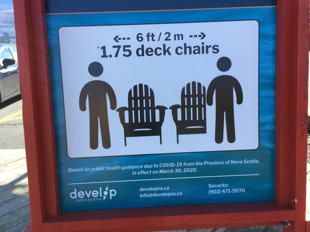
Recently I was in Halifax, and down around the harbour there are various reminder signs that get the point across with some humour.
The rising case counts over the past few weeks are a clear sign that we need to be reminded once again as we move into the autumn.
Since no one wants to go stir crazy, I’ve collected together a number of posts about places to go for a walk in Toronto so that you can get some exercise while walking responsibly.
Blog posts are a labour of love for me, and yet there is a cost to running this site and organizing my walks.If you’d like to help with that, I’d really appreciate something for my tip jar.The Buy Me a Coffee service allows patrons like you to fund writers like me. If that sounds like a worthy idea to you, then go ahead – keep buying me coffees.Thank You Very Much to everyone who has contributed already!
*****
And now on to the regular post …..
Over the past several months, I’ve written about a number of my favourite walks in Toronto. This time, I wanted to highlight something a bit different.
One of the many great things about living in Toronto is the work that the City has put into exploring its past and making it accessible to a new generation of residents and visitors. One of they ways of doing that is a fantastic program called Discovery Walks.
Each of these walking routes explores some of City’s many natural features like the lakefront or the ravine trail system, and along the way points out the history of the City.
For example, the Garrison Creek walk takes you through downtown Toronto following the route of the now-buried creek that, back in the 1790’s, emptied into Lake Ontario near what today is about Bathurst Street. Following this route takes you through some interesting inner-city neighbourhoods that are full of history, as well as fantastic shopping, bars, and restaurants.
If you visit the City’s website, the list of walks shown includes a map for each route. There are currently 11 of them, and they’re all great. Whether you’re a lifelong resident of Toronto or a visitor with an afternoon to fill, check them out! Toronto is a great walking city (ahem, it’s what I’ve been blogging about for months now!) and these walks prove it.
Length: Each trail is different. They are usually in the 1-3 hour range for a typical walker, and you can jump on/off any of these walks in many places.
Surface: A mixture – mostly they are paved and suitable for strollers and mobility devices, though there can be some gravel portions. Check each route map for details.
Public Transit: Each walk is accessible at start and finish by public transit, usually a combination of streetcar and subway, with some bus travel too. Each route map has details.
Route: See the City website for details. Each route has a detailed map that you can download.
Sights: Each of the walks has many sights to take in. Some are more nature-oriented, like the Humber Marshes, and some are more urban, like the Downtown or Uptown walks.
Any of these walks works well in any season. That said, I’ve always liked Toronto best in about mid-October on a crisp early autumn blue-sky day when the leaves have started to turn but it’s still warm enough for light clothes.
Food & Refreshment:
Most of the routes take you past at least some type of refreshments, either along the route or near the start or finish. Each route map will have some details.
Also, most of the routes take you at least partially through various City parks and trails, and there are public washrooms in most of them. There are also water fountains in most parks. Be aware, however, that these are usually seasonal so they are closed between roughly late October through early May.
Besides the public facilities, Toronto is well-endowed with coffee shops, bars, restaurants, and numerous other places where you can make a pit stop of one kind or another.
Diversions:
Can I suggest blending some of my Favourite Walks with the Discovery Walks? Check out my list and you’ll see that portions of my favourite walks cover the same trails (the Beltline for example) as one of the Discovery Walks. You can walk my route but use the Discovery Walk for more historical info. Or you can walk the Discovery Walk and use my walk for pictures and maps. Mix and match.
As the late great Ernie Banks used to say, let’s play two – why stop at one Discovery Walk when you can link them together and make a great outdoor day. For example, the Lambton House walk route is adjacent to the Humber River route.
Blog posts are a labour of love for me, and yet there is a cost to running this site and organizing my walks.If you’d like to help with that, I’d really appreciate something for my tip jar.The Buy Me a Coffee service allows patrons like you to fund writers like me. If that sounds like a worthy idea to you, then go ahead – keep buying me coffees.Thank You Very Much to everyone who has contributed already!
*****
After looking back, I realized that I’ve written a number of posts about favourite Toronto walks, and I wanted to collect them together in one place so that you could find them.
Blog posts are a labour of love for me, and yet there is a cost to running this site and organizing my walks.If you’d like to help with that, I’d really appreciate something for my tip jar.The Buy Me a Coffee service allows patrons like you to fund writers like me. If that sounds like a worthy idea to you, then go ahead – keep buying me coffees.Thank You Very Much to everyone who has contributed already!
*****
A great walk in any season, following the Don River north from the lake takes you through some of the best parks in Toronto.
Length: about 13.5 km
Surface: 90% paved with a bit of packed gravel
Public Transit options to get to Corktown include the street car from King Station on subway Line 1, along King to Cherry Street and then a short walk to Corktown. I like to subway to King Station and walk from there to Corktown, about 2 km. At the other end, there’s the Leslie 51 or the Lawrence East 54 bus from Edwards Gardens, which both take you back to Eglinton Station on subway Line 1.
From the south end at Corktown Common, the Lower Don Trail takes you up past several points where you can jump on or off – at Queen Street, Riverdale Park, Pottery Road, Crothers Woods, Don Mills, Thorncliffe, or Eglinton. You can take public transit to or from all of these, or you can find parking in many of the parks. Also the Toronto cycle path network intersects with the Trail at multiple points, so you can jump on/off that way as well.
In addition to starting at a Park at Corktown and ending in one at the Toronto Botanical Gardens, you’ll also travel through or past multiple parks along the way, including Riverdale Park, Riverdale Farm, the Evergreen Brickworks, Crother’s Woods, E.T. Seton Park, Serena Gundy Park, and Wilket Creek Park. Any of these offer shade, benches, and picnic tables, and water fountains and toilets are available from May through October. If you’re walking November through April, there are washrooms and water fountains at the Brickworks and at Riverdale Farm, as well as Edwards Gardens.
I like to start at Corktown Common and go north. Years ago, this area was industrial, rundown, and polluted – I can remember travelling through here at the bottom of the Bayview Extension. Starting in the early 2000’s, the City of Toronto has led a transformation, so that today the new residential buildings are anchored by the green space of the park.
I’ve walked these trails in both directions multiple times, in all seasons. There’s always wildlife – ducks and geese, salmon spawning in the autumn, chipmunks and squirrels, coyotes, deer, raccoons, robins, redwing blackbirds, jays, crows, hawks, and falcons. There’s also the wildflowers, the autumn colours, the spring blooms, and the cool shaded groves, the willowy grasses and the whispering reeds. And of course the burble of the river, especially north of the Bloor Viaduct, is a constant.
There is a downside in the traffic on the Don Valley Expressway, which the trail abuts along the lower stretch, but you leave that behind once you get to E.T. Seton Park. When you walk north, you’re walking from the urban to the suburban, from the industrial to the pastoral.
Also, when you walk north you realize that there is a significant elevation gradient to Toronto. The Lake is at roughly 90 m above mean sea level, so at Corktown you’re just above that. Travelling north you are climbing, and by the time you get to the Botanical Gardens, you’ll have gained almost 100m to about 180m or so above MSL. That, plus the humps over the bridges, will easily get your stair count up.
That said, since the trail is mostly paved and you are climbing gently over a 13 km length, it’s an easy walk. You can stroll it or jog it, and it’s suitable for mobility devices like walkers and wheel chairs, as well as for baby carriages, strollers, and wagons. Just keep in mind that it is a shared path for bikes, so you have to keep an eye out for them.
Finally, there are lots of options for food and refreshment along the way. Near Corktown is the Distillery District, where there are several restaurants and bars. A bit further west from there is St. Lawrence Market, with even more choice. As you head north, there is a good restaurant at the Don Valley Brickworks, and there’s a cafe at the Botanical Gardens at the end of your hike. Or you can do what I like to do, and take a picnic lunch with you and find a spot to enjoy it – a favourite is the fish ladder about 1 km north of Pottery Road where you can sit by the river in the shade.