After looking back, I realized that I’ve written a number of posts about favourite places in Toronto, so I wanted to collect them together onto one page so that you could find them. I’ll keep updating this page as I add more posts.
Part of a series on my favourite places to go for a walk in Toronto
Blog posts are a labour of love for me, and yet there is a cost to running this site and organizing my walks.If you’d like to help with that, I’d really appreciate something for my tip jar.The Buy Me a Coffee service allows patrons like you to fund writers like me. If that sounds like a worthy idea to you, then go ahead – keep buying me coffees.Thank You Very Much to everyone who has contributed already!
*****
And now on to the regular post …..
Any time of the year is a good time for the beach
If you live in Toronto, just saying “the Beaches” probably brings up several images – the shops, restaurants and bars, ice cream, the parks, the sand, the boardwalk, and probably more besides. Whether you are a lifelong resident or a weekend visitor, strolling the boardwalk and staring at the waves is magical.
Location: There’s the “beach” part of the Beaches and then there’s the neighbourhood. The sandy lakefront starts at Woodbine Beach and continues along the lake to Balmy Beach Park. The neighbourhood stretches along Queen eastward from around Woodbine Avenue to the end of Queen Street near Victoria Park Avenue, and then south to the lake and north to Kingston Road.
Public Transit: Take the Queen 501 Streetcar east from Queen Station on Line 1 and get off at Coxwell Avenue for Woodbine Park, or a bit further east past Woodbine Ave for the shops.
Why I like it:
For me the Beaches bring up several other images. One is of Canada Day in 1999 – we had just arrived back in Toronto that day, having returned from London, so we thought we’d go for a walk to get reacquainted with the City. The Beaches seemed like the perfect spot to do that. There was a big celebration and party going on in Kew Gardens, and we nearly cried thinking about what we had left behind in London and what was welcoming us back to Toronto.
And then when we were expecting our son and my wife was well along in her pregnancy, in fact a day or 2 past her due date, we decided to go for a walk along the boardwalk. We’d heard that exercise was a good way to get things going, along with eating spicy food, so on our stroll we also grabbed a slice of hot pepperoni pizza.
With no signs of impending labour, we wandered the neighbourhood and came across a home for sale with an open house in progress. We popped in, and must have fit the estate agent’s profile, because she was all over us. We were living in a downtown condo at the time and knew that eventually we’d want a home with a garden and some space for a toddler, and this was a nice family house that backed onto the local school – you could send your child off through the backyard gate into the school grounds – and for a few moments we had serious thoughts of “what if we lived in the Beaches”.
And then we realized that the timing wasn’t great – she was only days from delivery and we didn’t fancy moving with a 1 or 2 month old – so we kept on strolling. Soon enough, within a few days our son was born, and we had more important things to do.
And as he got older, every few months we’d drive out to the Beaches, this time with a stroller, and walk along the boardwalk. Later our strolls took in the parks and playgrounds and ice creams and chasing him along the sand and tossing pebbles into the waves. Once he even won a prize by guessing the # of jelly beans in a jar at a local antique called The Seagull – it was a framed picture of well-known Beaches shops and restaurants. We kept that for years afterwards.
And then there’s the Toronto Waterfront Marathon. I did that in 2017, and the last quarter of the route took in Queen Street right through the heart of the neighbourhood. The eastern end of the route was at Maclean Avenue, where you turned and headed back down Queen, and from that turn there were about 8-9 km to the finish. I was exhausted when I came up Woodbine Ave onto Queen and as I plowed along I kept thinking “where is Maclean, when do I get there”. I was one of the stragglers at the end of the race but there were still lots of locals cheering on us slowpokes as we dragged ourselves through. I still think of that whenever I pass Maclean.
So all of those memories colour how I see the Beaches. I’m sure I’m not the only Torontonian who has a range of memories of the neighbourhood, and I’m sure that as long as we live here we’ll continue to visit to soak up the spirit of the place.
Sights:
The lakefront and the sand are why this area is popular, and the sightseeing starts there.
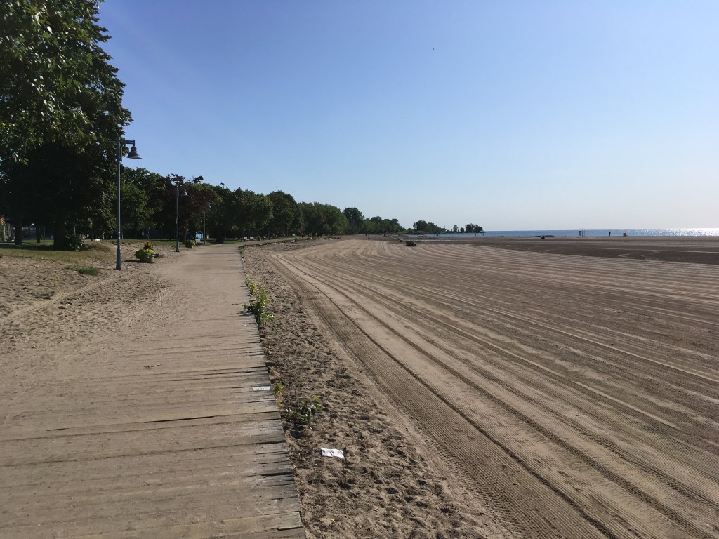
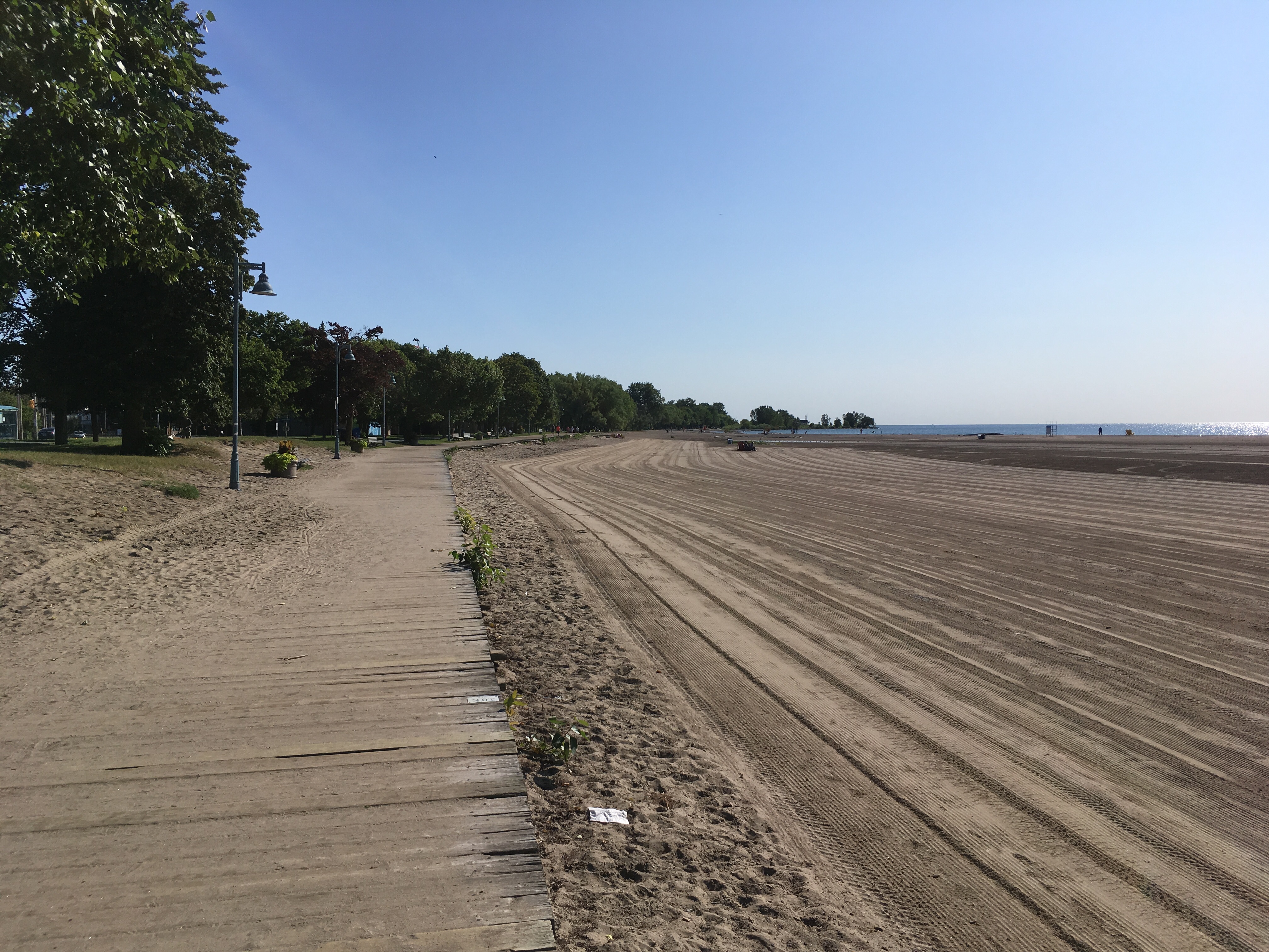
Woodbine Beach
There’s much more to the area than the actual beaches, of course. The parks are great for picnics and playgrounds. There’s also the pool at Woodbine Park, the outdoor skating rink at Kew Gardens, and many great spots to run around as a kid, an adult, or a dog (there are several off-leash dog run areas along the beach). Plus there are dozens of benches and Adirondack chairs along the boardwalk, perfect for people-watching or just staring at the lake.
The people-watching and window-shopping are also fun along Queen. The area is constantly changing, and old favourites like Seagull Antiques or Lick’s Burgers have sadly closed up, but new places open constantly and there are still some familiar spots like the Sunset Grill and the Beacher Cafe. COVID-19 has put a dent into the retail character of the area, but it will bounce back over time and in the meantime there’s plenty to see and do.
That’s true any time of the year, by the way. The changing seasons are reflected in the parks and the lake. On a hot summer day, the water is blue and enticing, while on a cold January day it can be grey-green and forbidding, but it’s always fascinating. The autumn colours are wonderful, and the spring flowers too. And the many places to pop into along Queen mean that you can always warm up or cool down no matter what the weather.
New Year’s Day at Balmy Beach
Food & Refreshment:
There are dozens of ice cream, coffee, burger, pizza, and other takeaway places in the area, including a Pizza Pizza outlet in Kew Gardens at the Boardwalk. There are also usually food trucks around on weekends. And of course, there are many local bars and restaurants to choose from, offering casual to formal options.
Another great idea is to visit some of the many food shops along Queen and grab the ingredients for a picnic – fresh fruit, bakeries, cheeses, snacks, coffee, tea, soft drinks, and more are all available, and there are many picnic tables scattered around the parks along with shady spots and sunny sand where you can enjoy your feast.
There are public washrooms in the parks, along with public water fountains. These are seasonal, open from about May 1 to about Oct 1 depending on the weather. Outside those months, the many coffee shops on Queen are good places for a pit stop.
Diversions:
The Leslieville neighbourhood lies just to the west of the Beaches, along Queen between about Broadview to about Leslie. It’s only about a 2 km walk or so between the neighbourhoods, and there are lots of shops and sights in between, so breakfasting in Leslieville and lunching in the Beaches makes for a great day out.
If the weather is kind, walking from Queen Station on Line 1 along Queen out to the Beaches will take you about an hour and a half, and then you can take the Streetcar back. You can also do that in reverse, and walk back to Queen Station.
The Martin Goodman Trail follows the lakefront all the way across Toronto. Walking or cycling that trail to and from the Beaches is a great way to get some exercise.
The Glen Stewart Ravine runs north from Queen at about Glen Manor Drive, and takes you along a wonderful trail up to Kingston Road. The autumn colours here are spectacular.
The RC Harris Water Treatment Plant at the east end of Queen
Blog posts are a labour of love for me, and yet there is a cost to running this site and organizing my walks.If you’d like to help with that, I’d really appreciate something for my tip jar.The Buy Me a Coffee service allows patrons like you to fund writers like me. If that sounds like a worthy idea to you, then go ahead – keep buying me coffees.Thank You Very Much to everyone who has contributed already!
*****
And now on to the regular post …..
Over the past several months, I’ve written about a number of my favourite walks in Toronto. This time, I wanted to highlight something a bit different.
One of the many great things about living in Toronto is the work that the City has put into exploring its past and making it accessible to a new generation of residents and visitors. One of they ways of doing that is a fantastic program called Discovery Walks.
Each of these walking routes explores some of City’s many natural features like the lakefront or the ravine trail system, and along the way points out the history of the City.
For example, the Garrison Creek walk takes you through downtown Toronto following the route of the now-buried creek that, back in the 1790’s, emptied into Lake Ontario near what today is about Bathurst Street. Following this route takes you through some interesting inner-city neighbourhoods that are full of history, as well as fantastic shopping, bars, and restaurants.
If you visit the City’s website, the list of walks shown includes a map for each route. There are currently 11 of them, and they’re all great. Whether you’re a lifelong resident of Toronto or a visitor with an afternoon to fill, check them out! Toronto is a great walking city (ahem, it’s what I’ve been blogging about for months now!) and these walks prove it.
Length: Each trail is different. They are usually in the 1-3 hour range for a typical walker, and you can jump on/off any of these walks in many places.
Surface: A mixture – mostly they are paved and suitable for strollers and mobility devices, though there can be some gravel portions. Check each route map for details.
Public Transit: Each walk is accessible at start and finish by public transit, usually a combination of streetcar and subway, with some bus travel too. Each route map has details.
Route: See the City website for details. Each route has a detailed map that you can download.
Sights: Each of the walks has many sights to take in. Some are more nature-oriented, like the Humber Marshes, and some are more urban, like the Downtown or Uptown walks.
Any of these walks works well in any season. That said, I’ve always liked Toronto best in about mid-October on a crisp early autumn blue-sky day when the leaves have started to turn but it’s still warm enough for light clothes.
Food & Refreshment:
Most of the routes take you past at least some type of refreshments, either along the route or near the start or finish. Each route map will have some details.
Also, most of the routes take you at least partially through various City parks and trails, and there are public washrooms in most of them. There are also water fountains in most parks. Be aware, however, that these are usually seasonal so they are closed between roughly late October through early May.
Besides the public facilities, Toronto is well-endowed with coffee shops, bars, restaurants, and numerous other places where you can make a pit stop of one kind or another.
Diversions:
Can I suggest blending some of my Favourite Walks with the Discovery Walks? Check out my list and you’ll see that portions of my favourite walks cover the same trails (the Beltline for example) as one of the Discovery Walks. You can walk my route but use the Discovery Walk for more historical info. Or you can walk the Discovery Walk and use my walk for pictures and maps. Mix and match.
As the late great Ernie Banks used to say, let’s play two – why stop at one Discovery Walk when you can link them together and make a great outdoor day. For example, the Lambton House walk route is adjacent to the Humber River route.
Blog posts are a labour of love for me, and yet there is a cost to running this site and organizing my walks.If you’d like to help with that, I’d really appreciate something for my tip jar.The Buy Me a Coffee service allows patrons like you to fund writers like me. If that sounds like a worthy idea to you, then go ahead – keep buying me coffees.Thank You Very Much to everyone who has contributed already!
*****
And now on to the regular post …..
The Martin Goodman Trail winds along the shore of Lake Ontario, from the Humber River in the West, past Sunnyside Beach, Ontario Place, and Queen’s Quay, crosses the Don River and loops down around Cherry Beach, and then follows Lakeshore Road through Woodbine Park onto the Beaches Boardwalk to end at Balmy Beach. If you want summer, follow this path.
And if you’re not in summer, walk it anyway – the autumn colours, the spring flowers, and the natural ice sculptures of winter all offer sights to keep you interested.
And for people watching, this is Toronto hanging out in its backyard – the whole city makes an appearance at some point. It’s endlessly entertaining and changing to fit the seasons and your mood. Go walk it, and take the time to hang out and chill.
Length: roughly 18-19 km end to end, so 4-5 hours depending on stops. The Martin Goodman Trail is also part of the much longer Waterfront Trail, which within the City of Toronto itself runs from Mimico Creek in the west all the way to the Rouge River in the east. It’s around 50 km across the city, and I’ve walked that as part of my Crossing Toronto Big Walk.
Surface: paved the whole way, though you can walk on boardwalks too at Sunnyside and in the Beaches
Public Transit: to start (assuming you’re going west to east) take the subway Line 1 to either Queen Station or Osgoode Station. Catch the 501 Streetcar heading west to either the South Kingsway (east bank of the Humber River) or the Humber loop stop (west bank). From the streetcar, walk south to pick up the trail on the east side of the Humber Arch bridge At the finish, walk from Balmy Beach north up to Queen Street to catch the 501 Streetcar at Neville Park to head back west to Queen Station on subway Line 1.
Route: The Trail is strait-forward and well marked. It officially starts on the east side of the Humber River just past the Humber Arch Bridge, though there are also several km of waterfront trail on the west side of the river, between Mimico Creek and the Humber.
The Humber Arch Bridge
Strictly speaking, there are actually 2 parallel trails, one for bikes and one for walkers. On weekends especially, the bike trail can be busy with speeding spandex, so keep to the walking trail.
There are lots of park benches along the way, and in Sunnyside Park and in the Beaches, there are also lots of comfy Adirondack-style chairs. On a weekday morning, they’re heaven for resting tired feet.
The path follows the lake pretty closely with many little diversions through side gardens. There are a couple of street crossings to negotiate, near Bathurst Street, at Cherry Street, and near the Beaches. Otherwise you really can’t get lost – just head towards the CN Tower from the west end, and towards the Ashbridge’s Bay chimneys once you’re past the CN Tower.
Sights: There are lots of little joys along the trail. You might see a mother goose and her goslings trailing obediently. Or stop to take in the flowers and the visitors at one of the little butterfly gardens that dot the parks. Or there’s the site of planes taking off from Billy Bishop Airport on the islands (even more spectacular during the Toronto Airshow).
The view from the Humber Arch Bridge looking east
As you walk along the trail, there’s also many spots to take in the Toronto skyline. You may not realize it, but you are starting a bit south of the city when you are over by the Humber. As you walk towards Queens Quay, you’re walking north and east, and the many condo and office towers compete with the CN Tower and Rogers Center to dominate the view.
At Sunnyside Beach looking back west towards Mimico
Then as you move past all the shops along Queens Quay itself, and cross the Don River channel at the docklands to head to Cherry Beach, you enter a more relaxed area with sand and trees. It’s a great spot to stop for a picnic.
Cherry BeachThe trail heading east from Cherry Beach
Continuing on, the beach vibe takes over completely past Ashbridges Bay. The sand will tempt you in any weather, and in summer it’s our own version of Venice Beach. I once came across a movie shoot in progress, across the path from a step aerobics class, and alongside grandparents walking with grandkids slurping ice cream who were staring at muscle-shirted beach volleyball players.
The Beaches Boardwalk at Woodbine BeachBalmy Beach on a not so balmy day …
Food & Refreshment: The Trail has several places for food and drinks, though most are open only during the Canadian summer – Victoria Day to Labour Day. Outside those months, the Trail has dozens of spots that are perfect for a picnic with may picnic tables, benches, chairs, shady spots under trees and sunny spots on sand.
There are many options around Queens Quay, especially on a summer weekend when there’s usually a festival or market of some kind.
And of course, when you get to the Beaches, a short walk north from the trail takes you to Queen Street with its many shops, restaurants, and bars, not to mention Beaches institutions like Ed’s Real Scoop Ice Cream.
There are a number of public toilets along the trail, at Sunnyside Park, at Queens Quay, Cherry Beach, Woodbine Beach, and Balmy Beach. These are only open between May – October, however. Outside those months, your best bets more or less on the trail are the shops at Queens Quay. Otherwise you’ll need to leave the trail and head towards the shops on one of the parallel shopping streets. Or just walk fast and drink lightly.
Diversions: Because the Trail runs though and nearby to many fun neighbourhoods, like Queens Quay, and especially the Beaches, there are many ways to change the route around.
Shorten it and just walk from the Humber to Queen’s Quay, or from Queen’s Quay to the Beaches.
West to east is fun for me because I like to end at the Beaches, but going east to west is also good. In that case, starting off with a great breakfast at a Beaches joint like the Sunset Grill sets you up to hike away.
As mentioned, the walk changes character dramatically when you go off season. For a number of years, we liked to walk the Beaches Boardwalk on New Year’s Day, and often the wind off the lake is particularly icy. It’s still fun though, and when he was small our son liked to throw snowballs into the lake.
Blog posts are a labour of love for me, and yet there is a cost to running this site and organizing my walks.If you’d like to help with that, I’d really appreciate something for my tip jar.The Buy Me a Coffee service allows patrons like you to fund writers like me. If that sounds like a worthy idea to you, then go ahead – keep buying me coffees.Thank You Very Much to everyone who has contributed already!
*****
On a chilly, rainy, grey, November day that felt more like December, I was trying to cheer myself up with recollections of warmer days. Strolling in the Beaches came to mind. The neighbourhood is perfect for Little Walks on a summer’s day (and any time of the year for that matter).
On mid-week summer’s day, there are parents and little kids, camp groups, seniors, tourists, ice-cream eaters, sunbathers, paddlers, cyclists, roller-bladers, and more. There’s usually a breeze off the lake, even on the hottest days, and there are lots of shaded benches, not to mention the lake itself for cooling your toes. The city has put lots of Adirondack-style chairs along the route, perfect for people watching.
There’s a hot dog stand and a pizza outlet. There are sometimes food trucks, and often ice-cream vendors. Nearby Queen Street has many restaurants, grills, pubs, bars, and food shops. Your options are many and tempting.
Come on a weekend and it’s busier, and there are different events going on in the parks – concerts, ball games, markets, and more.
Come in other seasons and it’s much the same but with autumn’s blazing colours or winter’s natural ice sculptures or spring’s new growth. You can walk over and over, and still smile at something amusing each time.
It’s one my favourite Little Walks. When my wife and I returned to Canada in 1999, after living in London for a few years, the first place we came was to the Beaches on July 1, Canada Day. That stroll along the boardwalk was our welcome home. A few years later, we walked it again, this time a few days past my wife’s due date awaiting our son’s arrival, in hopes that the stroll and slice of spicy pizza would spur things along. And then recently we’ve made a semi-habit of walking it each New Year’s Day, for a blast of chilly fresh air.
If someone said to me, what should I do as a tourist in Toronto, strolling the boardwalk would be at the top of my list. You learn a lot about a place in observing how the locals relax and this is Toronto with its hair down wearing its weekend clothes. Come see.
After a good first stage on my Crossing Toronto Big Walk, I was looking forward to Stage 2, covering the section east of the Don River. This would follow the Waterfront Trail as much as possible, taking me from Corktown Common on the Don River eastwards all the way to the Rouge River.
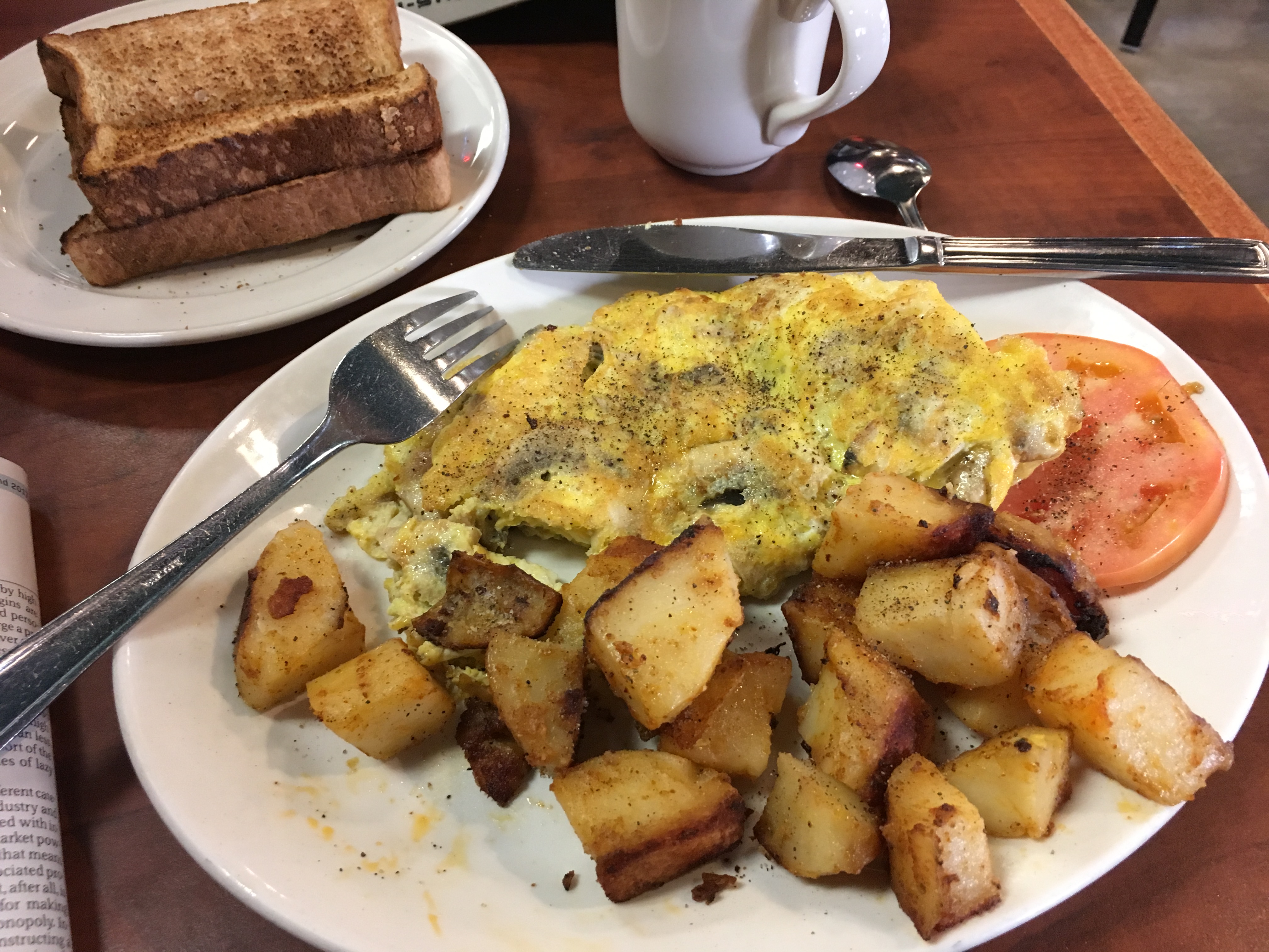
Since this stage meant that I could take the subway to King Station and walk to Corktown, along the way I knew I would pass by St. Lawrence Market. I didn’t want to repeat my coffeeless start of the day before, so I stopped at an old favourite, Paddington’s Pump, for a right proper diner breakfast.
The mushroom omelette with home fries and toast (and don’t forget the token tomato!) – yummm!
From the Market, it’s about 2 km to Corktown Common, so I added that to my journey. It was a gorgeous summer morning, and walking along the Esplanade, I passed the apartment block that was our first home when my wife and I married. There are basketball courts out front, and gardens, and kids, and joyful play – it was perfect. It put a spring into my steps, and I felt pretty good considering the 20+ km I’d covered the previous day.
Arriving at Corktown from the west, you have to climb a few steps to the crown of a small hill. The warm, wet summer we’ve been having meant that the steps were lined with greenery that burst its bounds and crowded the path like the waving throngs that cheer on a parade. Welcome brave hiker!
On the east side of the park, the path takes you down onto the Lower Don Trail, and turning south you come to a bridge over the Don. On a Friday morning, it was a stream of cyclists heading into the city – I actually had to wait for the traffic to pass. Build a bike infrastructure, and lo and behold, it will be used!
Martin Goodman Trail along Lakeshore Blvd East
Once you cross the Don, the Lower Don Trail turns into the Martin Goodman Trail, which is part of the Waterfront Trail. I followed it eastwards parallel to Lakeshore Blvd East, towards Ashbridge’s Bay Park where I could pick up the Boardwalk.
Toronto is sometimes referred to as Hollywood North, given the number of movies and TV shows that have been produced here. Walking east from the Don, you see that writ large. The Lakeshore and Leslie area is known as Studio City, home to several large production companies, and you pass their sound stage facilities as you go, along with prop rental companies, location scouts, and parking lots full of movie shoot vehicles (including various NYC taxis, police cars, and buses – amazing how often Toronto doubles for New York).
Further east, in the Beaches, you see our own version of Venice Beach North. There is a gorgeous beach of course, and the boardwalk. And there are bodybuilders and joggers, spandexed cyclists and beach yogaists. We have soy lattes and organic cold pressed juice, très cute dogs, and Bugaboo baby carriages. I even passed an aerobics class complete with enthusiastic trainers, energy pop music, and the requisite Lululemon outfits, and I had to repress a smile – “Keep it Going! Count it Down! Seven!, Six!, Five!, Four! …..”.
the Boardwalk @ Woodbine Beach, freshly groomed on a summer morning
Continuing along the Boardwalk beside Woodbine Beach and then Kew Beach, I kept passing little scenes that amused. There was an independent video shoot featuring a young actor who ran fetchingly towards the water and then stopped, to stare pensively off into the distance. There was a charming older couple strolling hand in hand wearing impressively large sun hats. There were sun worshippers stretched out reading books, kids making sand castles, newby paddle boarders trying to stay upright. It was perfect.
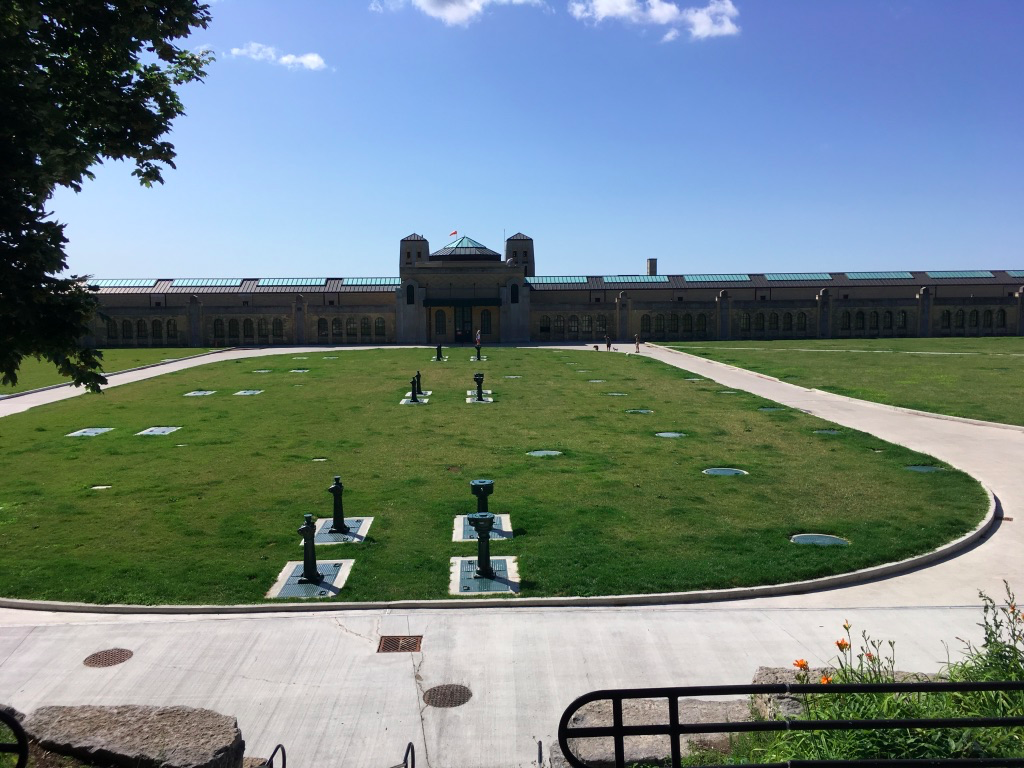
But time presses, and eventually I came to the end of the Boardwalk at Balmy Beach. I took a short break there, and then followed the Waterfront Trail signs up to Queen Street East. Near the eastern end of Queen, I passed a citadel-like structure that reminded me of the fortifications of Citadel Hill in Halifax, but this is actually a fortress of sanitation called the RC Harris Water Treatment Plant.
Past that, Queen Street ends and the road turns north to become Fallingbrook Drive. The Waterfront Trail climbs here and takes you north to just south of Kingston Road. When I was planning the walk, I had been afraid that I’d have to walk long stretches along the busy Kingston Road, but the route planners of the Waterfront Trail must have had an equal aversion to traffic, so instead they’ve chosen streets that get you as close to the water as private property allows, and along the actual lakeshore whenever public parks permit.
(I have to apologize here for my alliterative aspirations. I positively promise to pare back this predilection.)
Following the Trail, I realized that I had also forgotten some basic geography. The Beaches Boardwalk is essentially at lake elevation. As you go east from there, however, the land behind the water’s edge rises steeply to become the Scarborough Bluffs, in places 90 meters above the lake. Obviously I had to climb, and climb, and climb, and then descend, descend, descend. I ended up doing the equivalent of 75 flights of stairs as a result – oh my aching quads.
Continuing east along the Trail, I passed a familiar landmark – the Toronto Hunt golf course. As it happens, we live in the Hunt’s original 1919 building, now refurbished into condos. When this building was requisitioned by the Canadian government during WW2 and subsequently retained by the Ministry of Defence, the club needed to relocate and so they bought land to the east of the city in Scarborough. That became the Toronto Hunt property, and it was also eventually surrounded as the city expanded eastwards, so the club turned their land into a golf course and it was the familiar club crest that greeted me on the wall outside the golf course. I pondered wandering in claiming membership by proxy, but decided they’d probably throw out a sweaty hiker.
Entrance to the Toronto Hunt golf course
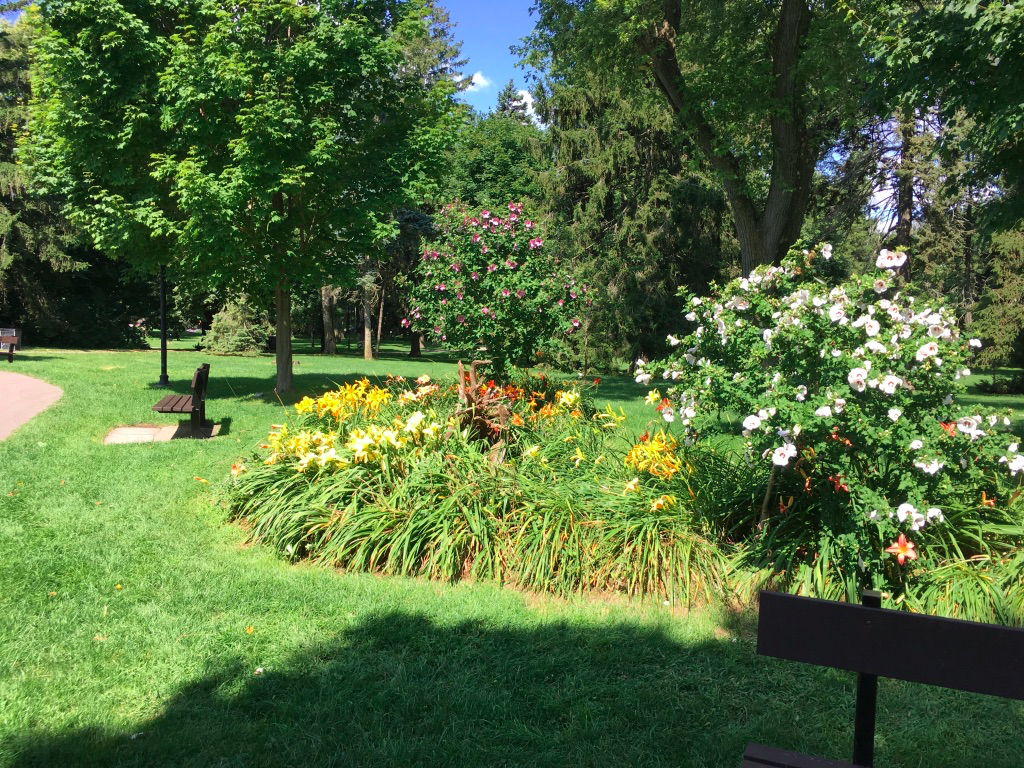
East of the Toronto Hunt, the Trail took me through the Rosetta McClain Gardens. I was stunned at the beauty of the grounds. It’s a gem of a park, and yet having lived 35+ years in Toronto I’d never heard of it. You have to go there – this park deserves to be better known.
Rosetta McClain Gardens
As well as the flowers, the park offers fantastic views over the lake – you’re near the maximum height of the Bluffs at this point, 90 meters above the lake, and on a clear summer’s day it’s easy to convince yourself that you’re staring over oceans and dreaming of fragrant shores.
The views, the views …..
As I left the Gardens, I realized that I was not yet half way on my journey, and despite the big breakfast I was getting hungry. I probably should have stopped in the Gardens, but it had only been about 11:30 or so at that point. I kept following the Trail east for several km, about an hour of walking and winding through the backstreets of the Cliffside and Cliffcrest neighbourhoods, and since there was nowhere to picnic I just kept plowing along.
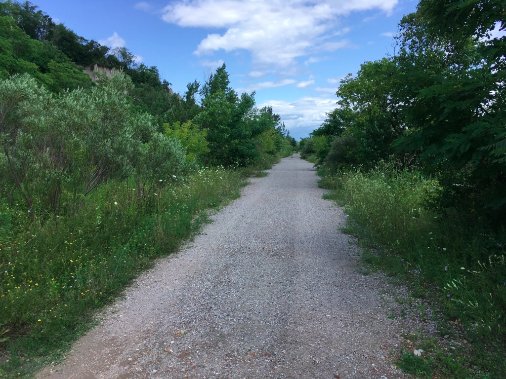
Eventually I came to the Doris McCarthy Trail which plunges down Gates Gully next to Sylvan Park. The Waterfront Trail signs by the road indicated that I should continue to follow the trail along the Hill Crescent roadway rather than descend, but I decided to go off piste and follow the alternative trail. I trusted that Google Maps, which showed an unnamed trail along the beach, would not leave me stranded and it was a gamble that paid off in spades.
The McCarthy Trail takes you about 70 or 80 meters down a steep gravel path, and after a few minutes of slithering I thought to myself that this better work out because I DO NOT want to climb back up. But after continuing on, when I reached the bottom along the lake shore, I found myself on a waterside trail that stretched east along the base of the bluffs for as far as I could see. And there was no one around – I had the trail to myself.
By this time I was starving so I found a little point where a tree provided shelter overlooking the lake, and stretched out on a rock to eat my lunch. The only sound was the surge of a gentle swell. It was heaven.
After that much needed break, I followed the beach trail east. It’s not private property, but it’s not a city park either. It looks like the City has built the trail in order to construct a breakwater along the base of the bluffs, to prevent erosion. If that’s the case, then it’s public property but I was amazed at seeing no other hikers. I guess since there are no washrooms, no actual beach, and – god forbid – no parking, there’s no attraction for most people. I didn’t care, I was just amazed to be able to walk for several km just listening to the birds and the waves.
Still, after 45 minutes walking, I was starting to wonder when I’d come to a way off the beach. The bluffs were still at least 50-60 meters high at this point so there was no way to climb vertically, and I didn’t want to have to turn back and climb up the gully, but eventually I found a trail up and off the beach. It turned out to be a maintenance road climbing into the Guild Park and that led me (after scrambling over a fence) back to the Waterfront Trail on the Guildwood Parkway.
Despite the best intentions of the Waterfront Trail designers, there’s no option here but to include several km of rather boring road-walk stretches between Guildwood Parkway and the start of the Port Union Waterfront Park, by Beechgrove Drive.
By this time, I was 20+ km in, and wondering how much longer I had to go. I’d drunk most of my water but there no parks at which to refill (though ironically I passed a water treatment plant and wondered if I could just pop in and borrow a cup).
Following the Waterfront Trail signs, I saw that I was in an industrial part of Scarborough – a chemical plant, train lines, and the olfactory delights of the Highland Creek Waste Treatment Plant, where sewage is biologically digested. The prevailing winds from the west meant that the aromas followed me for a km or so.
The Trail here runs, in part, parallel to the Lakeshore east rail line, and with the industries in the area, the soundscape is dominated by trucks, trains, and transport. And yet, along Copperfield Road, the track is lined with marsh grasses, and in quiet stretches the breeze rustling the reeds made me appreciate the difference between the higher-pitched “HISSSSSSS” of wind through grasses compared to the lower-timbred “Shushhhhh” of leaves in trees.
After that road stretch, I was glad to reach the Port Union Waterfront Park where I could descend again down to water level. I was just nicely onto this trail, about 4 km from my destination, when the clouds that had been gathering unloaded and I had to scramble into rain gear. I kept walking through the rain, and soon enough it stopped. I was footsore and thirsty, still looking for a place to fill a water bottle, and was just chugging for the finish by this time.
There are many species of insects along the waterfront, and one of the more annoying ones is a small type of fly that congregates in wavering columns along the open stretches near the water, often at about head-height. When you are walking, you have to keep your mouth closed to avoid digesting them. I was pleased to pass a flock of swallows, and then a swarm of dragonflies, both doing their best to reduce the population.
The Port Union Waterfront Park is exactly that – it offers a well maintained trail that runs along the shore for several km. There are little lookouts with benches, and trees have been planted to anchor the shore against erosion. There were people about here, families on bikes, strolling lovers, a few fishermen, and even 3 guys who were apparently shooting a music video. It was all interesting, but I was tired and just wanted to get to the finish.
And then, the rain came back one more time, just a few hundred meters from the Rouge River. It only lasted about 5 minutes and I needed 2 of that to get back into rain gear, so I was wet, sweating, and grumpy when I arrived at the Rouge National Urban Park, to find the washrooms closed due to high water and crowd of kids blocking access to the water fountain. But I’d made it – Corktown to the Rouge.
The Rouge River
The Park is interesting. It represents an understanding that natural marshlands are the best way to absorb rain water, while providing a diverse mix of flora and fauna. We’ve paved over, constrained, and covered the mouth of the Don, which used to look like the Rouge. We’ve tried to rebuild a watershed with landfill and parks at the mouth of the Humber. But the natural state that the Rouge park preserves is the way that nature has evolved to handle rivers and creeks. If we can just get out of the way, we can let the elements rearrange themselves into a sustainable ecosystem.
Location: Toronto – Corktown to the Beaches and back
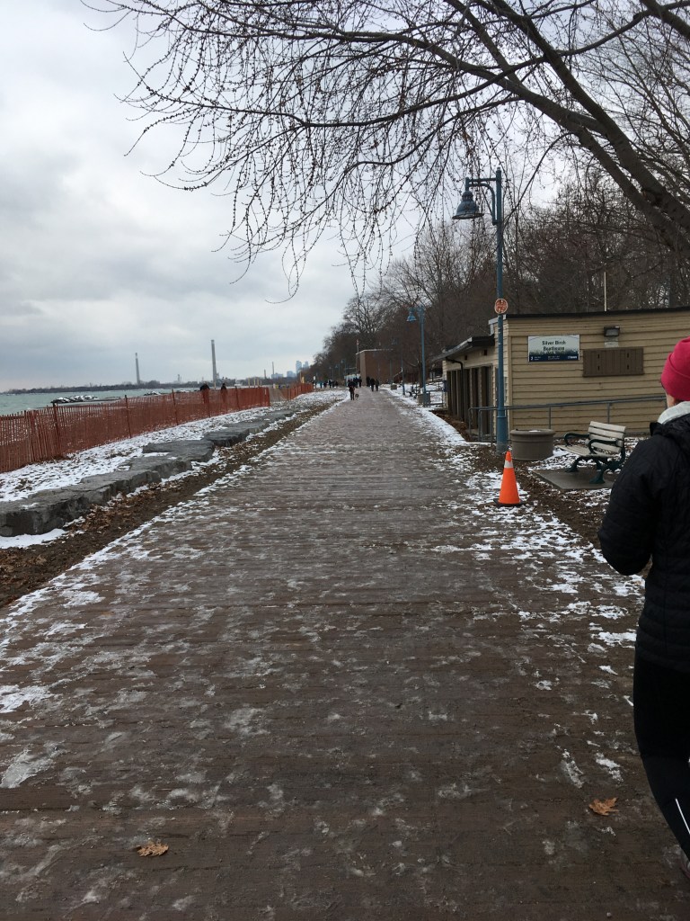
Weather: 1C, grey skies, snow on the ground
Duration: about 2:45 hours, 14.5k
Today my wife and I decided to walk through the Beaches neighbourhood, so to make it longer we drove to Corktown Common and parked there. Then we walked along Eastern Ave to Broadview and then up to Queen and from there walked east through Riverside and Leslieville to the Beaches. After a nice brunch pitstop at the Sunset Grill, we kept going east on Queen to Silver Birch Ave to get down to Balmy Beach. From there, turned back west and walked along the boardwalk and the Waterfront Trail to Ashbridge’s Bay, then back up to Queen to keep going west all the way back to the Lower Don River Trail, and so back to Corktown.
If you know Toronto, you’ll recognize those neighbourhoods. For those out of town, this combined revitalized ex-industrial lands (Corktown Common), gentrified, already-past-hipster-and-on-to-Starbucks blocks (Riverside and Leslieville) and 1-kid-2-dogs ex-hippy Beaches. We’ve been going for walks in the Beaches for years – in fact the day before she went into labour, my wife and I went for a walk there after eating some spicy food in order to get things going.
It’s changed and yet it’s the same – the houses, the vibe, the people. The sound of the day for me was the rattle of sticks and pucks from the outdoor ice rink at Beaches Park, closely followed by the crunch of wet snow underfoot and the churn of small waves on gravelly shores. It was grey but it was lovely, calm, and a reminder of one of the things I love about Toronto, it’s park and trail system.
For a few years in a row when our son was younger, we’d go out to the Beaches and walk the boardwalk on New Year’s Day. This year we went a bit earlier, and now that he’s older he didn’t come with us. But watching the other young parents with kids brought back memories. Walks are often contemplative, and that was today.